Download Agreement, Release, and Acknowledgement of Risk:
You (the person requesting this file download) fully understand mountain climbing ("Activity") involves risks and dangers of serious bodily injury, including permanent disability, paralysis, and death ("Risks") and you fully accept and assume all such risks and all responsibility for losses, costs, and damages you incur as a result of your participation in this Activity.
You acknowledge that information in the file you have chosen to download may not be accurate and may contain errors. You agree to assume all risks when using this information and agree to release and discharge 14ers.com, 14ers Inc. and the author(s) of such information (collectively, the "Released Parties").
You hereby discharge the Released Parties from all damages, actions, claims and liabilities of any nature, specifically including, but not limited to, damages, actions, claims and liabilities arising from or related to the negligence of the Released Parties. You further agree to indemnify, hold harmless and defend 14ers.com, 14ers Inc. and each of the other Released Parties from and against any loss, damage, liability and expense, including costs and attorney fees, incurred by 14ers.com, 14ers Inc. or any of the other Released Parties as a result of you using information provided on the 14ers.com or 14ers Inc. websites.
You have read this agreement, fully understand its terms and intend it to be a complete and unconditional release of all liability to the greatest extent allowed by law and agree that if any portion of this agreement is held to be invalid the balance, notwithstanding, shall continue in full force and effect.
By clicking "OK" you agree to these terms. If you DO NOT agree, click "Cancel"...
Escape to the Lost Creek Wilderness: Bison and McCurdy from Lost Park
Day and Night in the Tarryall Mountains
McCurdy Mountain: 12,168 ft Bison Peak: 12,431 ft
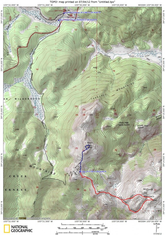
The Great Escape: Lost Park to Bison Arm
For this trip I decided on a backpack from the Lost Park Trailhead to a camp on Bison Arm. This route is about a mile longer than Bison's standard route from the Ute Creek Trailhead, but climbs about 1,000 ft less. The gentle five mile hike up to Bison Pass lends itself nicely to a hike with a large pack, and a camp on Bison Arm would allow for easy access for moonlight hiking and photography around Bison's summit area.
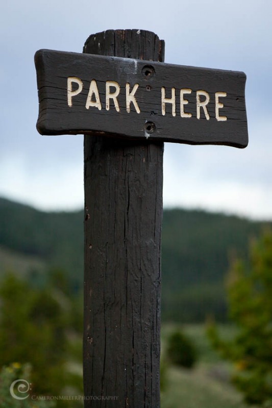
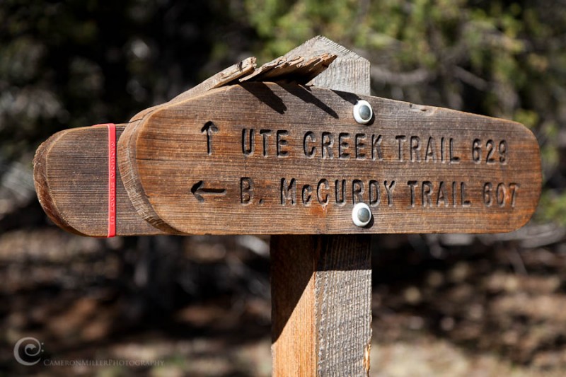
I pondered the reason for this sign at the trailhead. Lost Park found? A bit of Forest Service humor, perhaps?
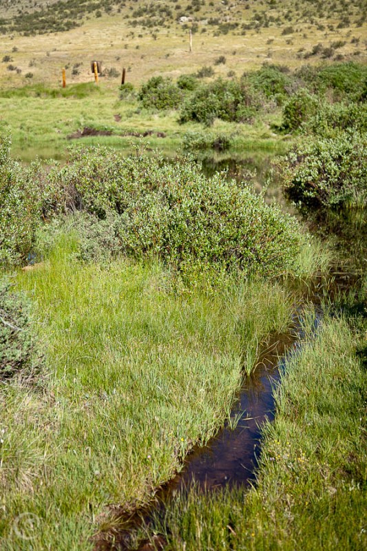
A look from the trailhead. The hike started easily enough, but I quickly encountered the Beaver Ponds of Doom...
Just a couple of minutes into the hike, the obvious trail suddenly disappeared. Beavers. I looked up and down the creek for a crossing point, and eventually found a large plank of wood spanning a section of the creek. The bridge! Oh, that wasn't so bad. I took a step onto the crossing and...PLUNGE. Booby trap. The plank was just floating there unteathered. Damn, those beavers are good. I tried crossing a beaver dam, but it wouldn't support my weight. Finally, I located a section of the creek that was barely narrow enough to jump with my heavy pack. I made my way through marshy willows back to the trail, thinking how glad I was for packing that extra pair of socks.
Looking back over the ponds.
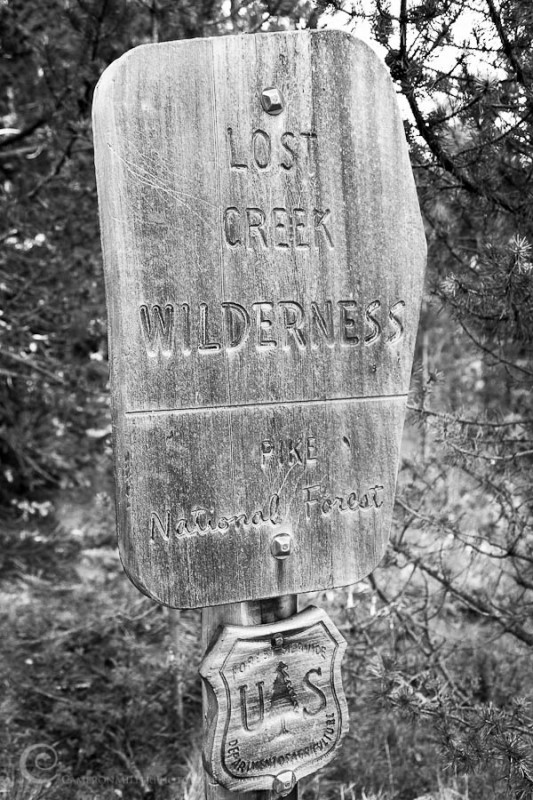
It was just a short hike to the wilderness boundary.
Along the way I noticed a piece of Pop Art created by the local residents. Eat your heart out, Andy Warhol.
Looking north at Peaks X, Y, Z and Zephyr
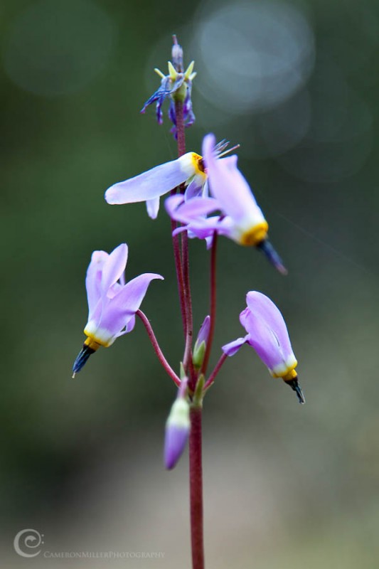
Shooting Star along the Indian Creek
Once you reach Bison Pass, the Ute Creek Trail on Bison's standard route joins up with the Brookside McCurdy Trail. The route gets a bit steeper from here. Time for me to turn on the flashers and throw it into low gear.
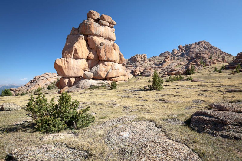
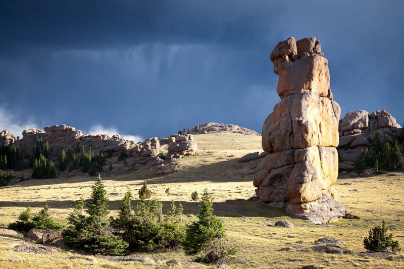
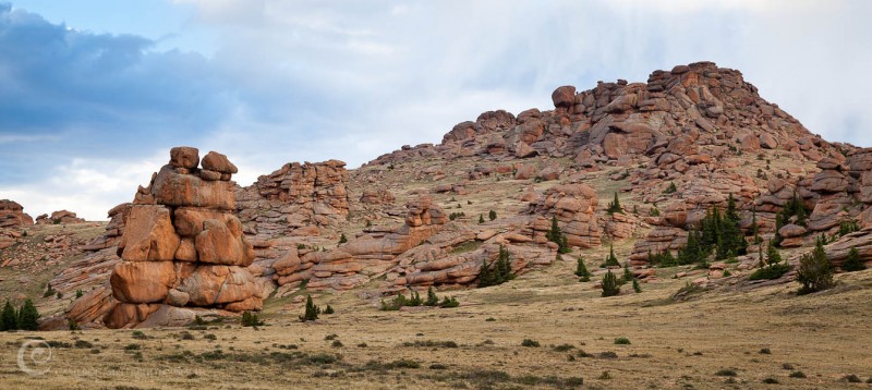
First look at Bison Monolith with Bison Amphitheater in the background.
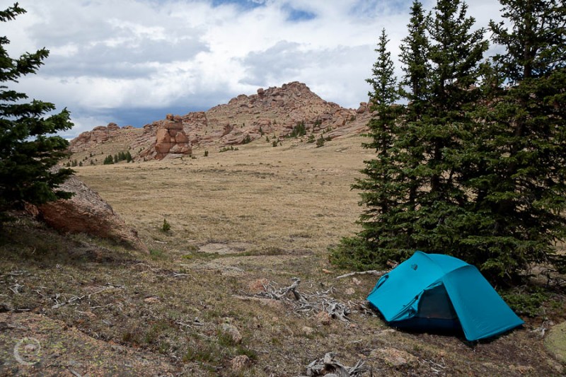
I reached Bison Arm at around 9 o'clock, set up camp, ate some oatmeal and got ready for my trip to McCurdy.
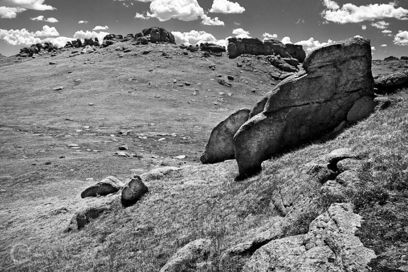
Roaming McCurdy's Broad Summit Plateau
McCurdy is huge and deserves more time for exploration than I had to offer. Clouds were quickly building around me, and I knew the summit wouldn't be an obvious one to locate. Fortunately, based on reading other trip reports and looking on the map I knew the true summit was on the southeast side of the plateau and I pointed myself in that general direction.
McCurdy's summit comes into view.
For a bit of perspective on McCurdy's size, here's a shot from the summit looking down on five deer crossing the plateau
The white thing on top of the rocks just to the right of center is a goat.
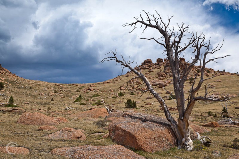
McCurdy is covered in dead trees. Impressively, many of them are still standing.
The Dreaded Chicken of Bristol
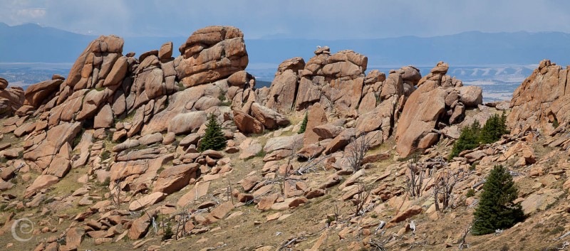
I returned to camp, took a quick nap, and made some dinner before grabbing my camera to do some wandering around Bison's beautiful rock gardens.
Looking toward Bison's Summit
Bison Monolith
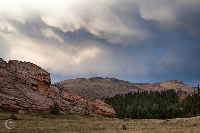
Storm Clouds Over McCurdy
The increasing cloud cover as night approached made me wonder if I was going to get the moonlight I was hoping for. I climbed into my tent and went to sleep.
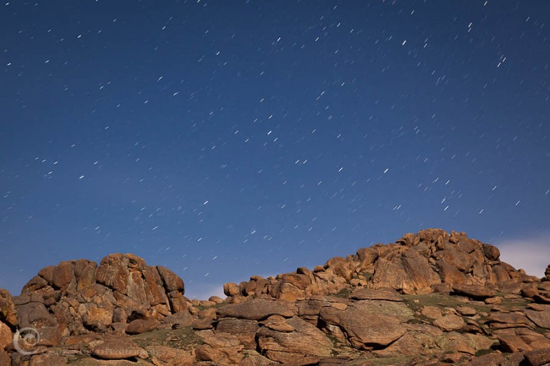
Bison by Moonlight
Around 10pm I woke up and noticed the clouds had cleared and the moon was out. I threw on my boots and headed up to the Bison Amphitheater.
Bison Amphitheater by Moonlight
Approaching Bison's Summit
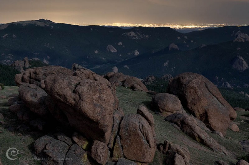
On the summit looking toward the Springs. Notice the light on the Pikes Peak Summit House 35 miles in the distance.
Front Range Light Pollution
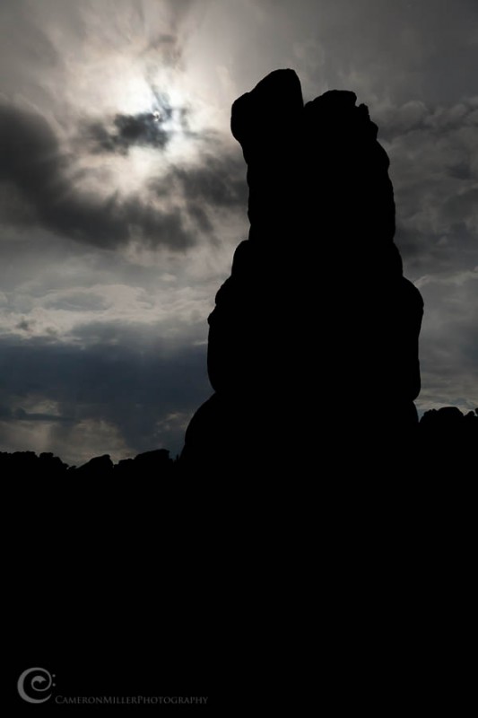
Moonlight and Monolith
I returned to my tent tired but content with another wonderful day in the mountains.
Sunday
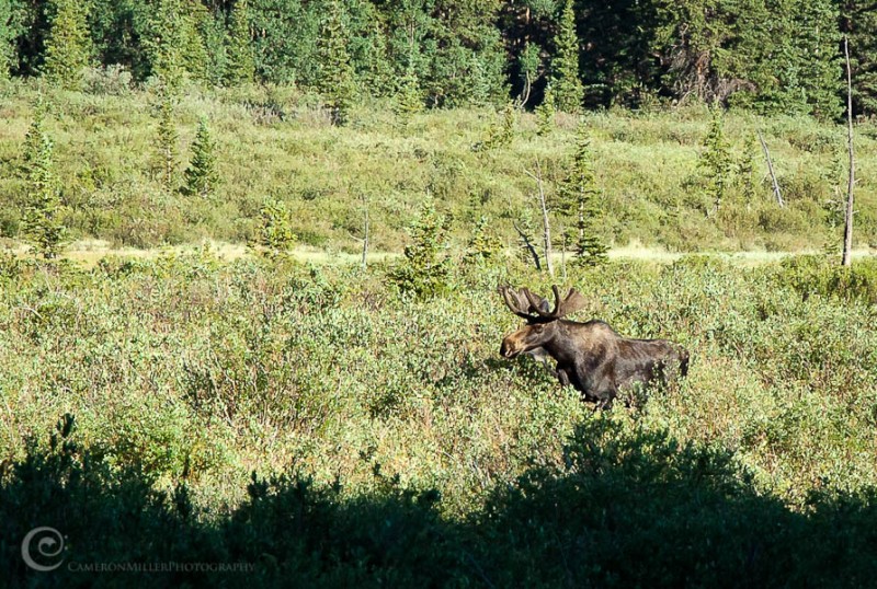
On the hike out I stumbled upon this guy. Normally I'd be quite excited to see a moose, but my excitement turned to caution after having nearly been trampled by a mama moose in the Lone Eagle Cirque the weekend before. He was acting a bit edgy and I had a feeling he could smell me but didn't know exactly where I was. I took the opportunity to hide behind a tree until he decided to head off to the other side of the meadow.
I made my way back to the Beaver Ponds of Doom happily awaiting another chance to experience the joys of soggy socks.
*If you are considering starting at this trailhead, I did notice a possible alternative on my map after the crossing on the way in. My Trails Illustrated map showed a spur connecting the Lost Creek Campground to the Wigwam Trail which meets up with the Brookside McCurdy Trail to the West. These maps aren't always accurate, and I didn't look to see if it is really passable, but it may be a drier alternative to the ponds if you are considering an approach from Lost Park.
Thumbnails for uploaded photos (click to open slideshow):
Your first photo is probably one of my favorite spots in the all of Colorado's mountains....anywhere. Amazing area. I agree with you, I need to head up to McCurdy to spend some time, lots of neat areas up there that I haven't seen yet.
Excellent TR - like the wit, love the pics!
Thanks for posting. :D
Caution: The information contained in this report may not be accurate and should not be the only resource used in preparation for your climb. Failure to have the necessary experience, physical conditioning, supplies or equipment can result in injury or death. 14ers.com and the author(s) of this report provide no warranties, either express or implied, that the information provided is accurate or reliable. By using the information provided, you agree to indemnify and hold harmless 14ers.com and the report author(s) with respect to any claims and demands against them, including any attorney fees and expenses. Please read the 14ers.com Safety and Disclaimer pages for more information.
Please respect private property: 14ers.com supports the rights of private landowners to determine how and by whom their land will be used. In Colorado, it is your responsibility to determine if land is private and to obtain the appropriate permission before entering the property.