| Report Type | Full |
| Peak(s) |
Mt. Arkansas - 13,804 feet Lenawee Mountain - 13,201 feet |
| Date Posted | 06/29/2012 |
| Date Climbed | 06/28/2012 |
| Author | AndYouSeeMe |
| Mosquito Finito and Lenawee |
|---|
|
Peaks: Mt. Arkansas(13,795ft) and Lenawee Mountain(13,204ft) Mileage: 5.25miles and 5.82miles Elevation Gain: 2,650ft and 2,740ft I had hoped to finish out the ranked and unranked peaks above 13k in the Mosquito Range by climbing the North Couloir of Arkansas this spring, but it never materialized. Knowing I wasn't going to wait until next spring, I bided my time until I could sneak out there and climb the peak by the standard route. Not having classes on Thursday this summer, and with a forecast looking decent other than some afternoon storms, I decided to go for it this week. After researching the route and seeing how short it was, the plan was hatched to add Lenawee to the day and hopefully make it back to the car before the skies opened up. In order to maximize the potential for success I left at 2:45am and pulled into the trailhead area at 4:30. The route description said to park after .3 miles but I continued for an additional half mile on an easy 4wd road to get me closer to the base of the North Ridge. Standard route gains the ridge after the first big hump following grassy slopes but I was more interested in hitting the ridge from the very beginning, getting some quality talus and boulder hopping in as a warm up. 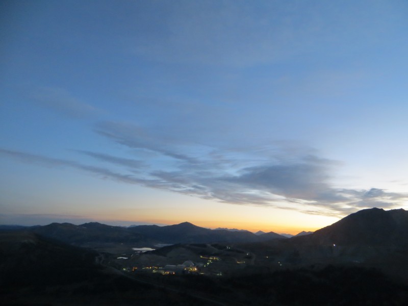 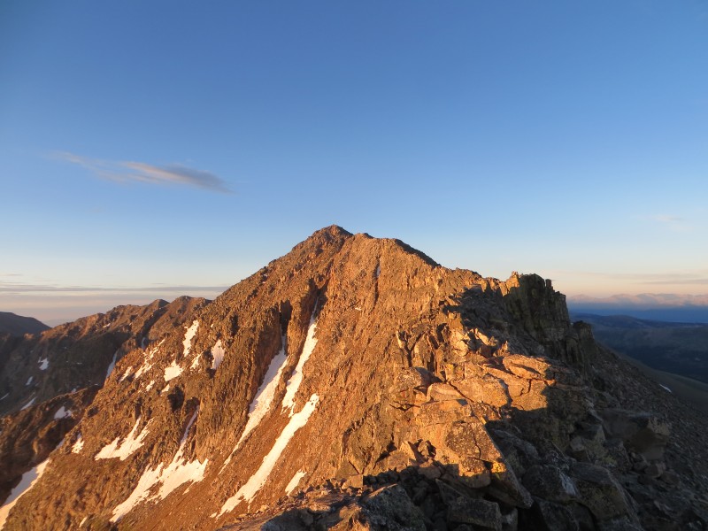 From my parking spot it was a 15 minute bushwack through the forest before the ridge came into view. The wind was howling on the ridge and made for a cold ascent, but I stayed in my t-shirt as I remembered how hot I have been lately during this recent heat wave. Once up the first grunt the ridge turns into nice grass for a while until the last third of the ridge. 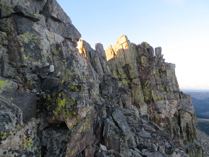 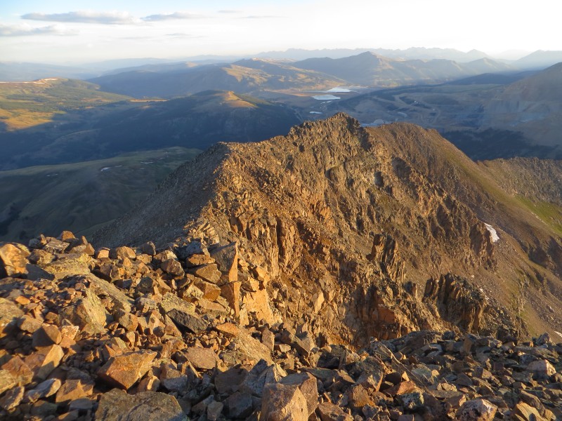 The grass turned to rock and the remained of the route to the summit is a mix of class 2 with a few class 3 moves required to stay on the top and avoid losing any elevation. After about three too many false summits I made it to the real summit at 6:10. The views were great of the rest of the Mosquito Range and it was nice to look back and remember my climbs of all those surrounding peaks, good times indeed. 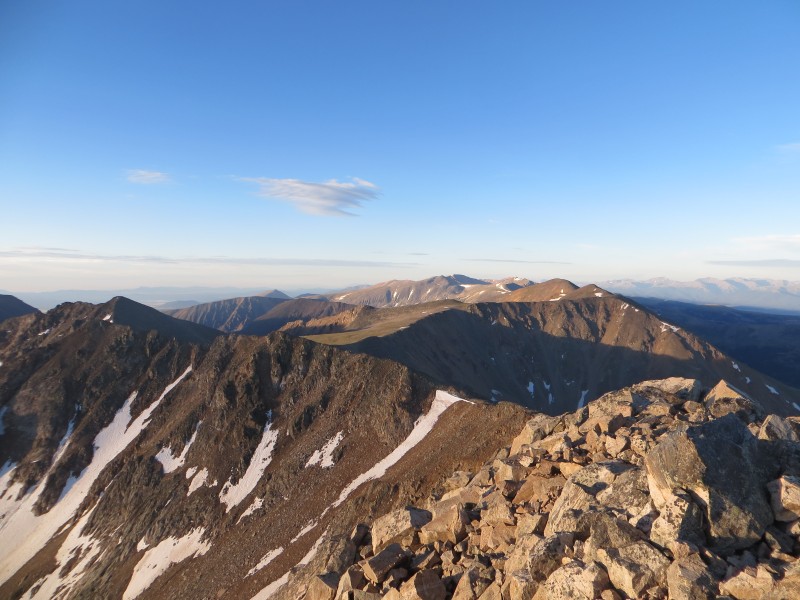  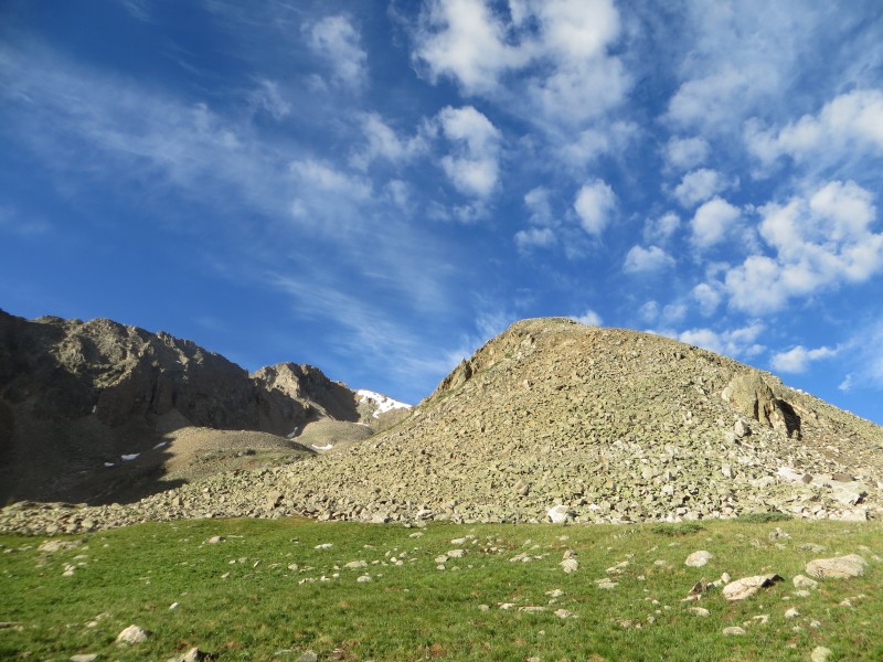 With more on the schedule for the morning my summit stay was short and I boogied down the ridge, retracing my steps back my car, arriving at 7:20. Up and over Fremont Pass, back to I-70, off at the Silverthorne exit, headed towards Montezuma. Soon I was pulling onto the Peru Creek road for the second time in 38 hours, this time only going just over 2 miles to the Chihuahua Gulch turnoff. I decided to put my new tires to the test and willed the Forester up to the first stream crossing, cutting off .6 miles each way and about 400 feet of elevation from my next climb, which I started at 8:30. The road is really rough and I would recommend not only 4wd but a short wheel base, otherwise just hike up the road. I did not find any beta on this route so I will attempt to describe the route as best as possible, as I feel that when the Peru Creek road is open this is the easiest route on Lenawee Mountain. 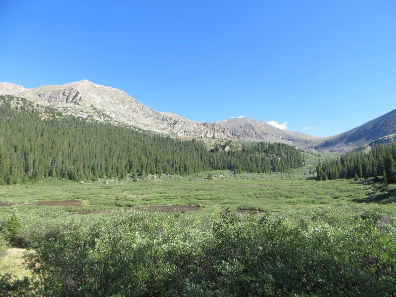 The first stream crossing, of many, is the biggest, and there is a plank across it just upstream from where the road goes across. From here it is just a matter of walking up the road as far as it goes. Whenever you get to a fork, take the left option as the right always goes up to campsites. After about an hour the road ends at the sign for the Chihuahua Trail. 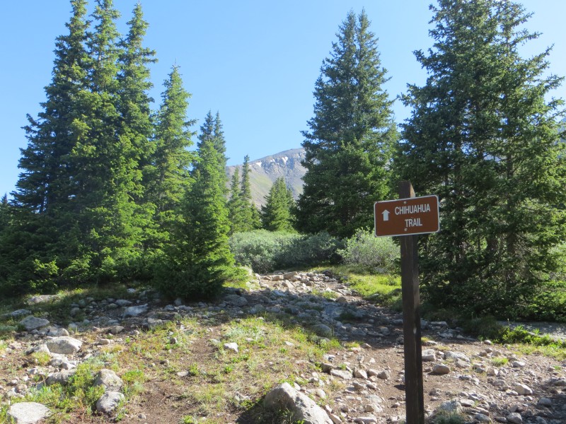 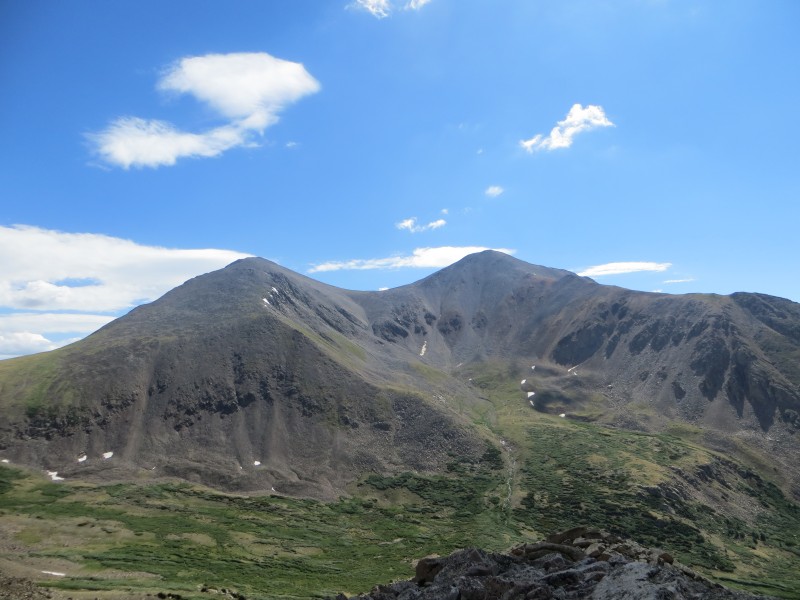 Following the Chihuahua Trail you will gain some elevation before the trail opens up into a nice flat meadow. The view of the backside of Grays and Torreys from here is awesome, and this looks like a great alternative to the throngs on the standard routes of both peaks. From this open area Lenawee dominates the view to your left. There are three obvious ridges coming down from Lenawee, and they all look like viable options. The southernmost ridge looks to be class 2 and leads directly to the summit. The northernmost ridge looks like some class 3, and it joins up towards the end of the Grizzly-Lenawee traverse, with plenty more class 3 once you join up with the traverse. I decided on the middle option, as it looked like some enjoyable class 3 with a minimal willow-bashing approach to the base. 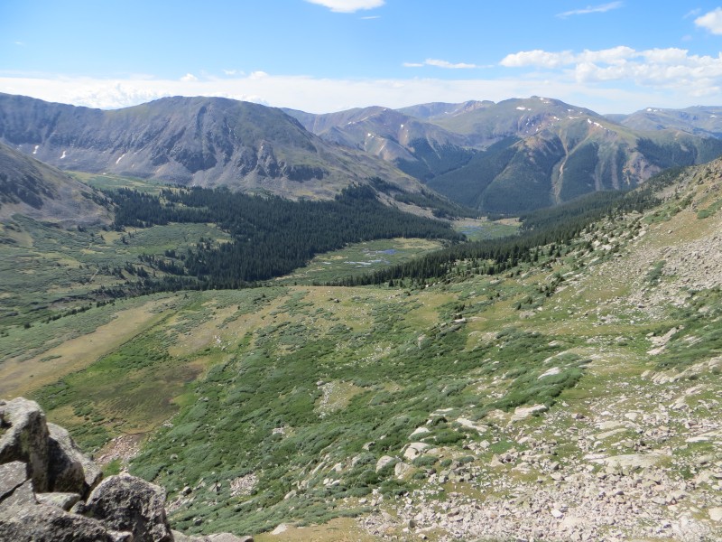 I followed the trail until it turns slightly to the right and descends a bit. A short fight with the willows put me at the base of the ridge. I can't speak for the other ridges, but this one was a blast! It alternates between nice big, solid rock to great big slabs to clamber up. The middle ridge tops out on the grassy slopes about a three minute walk from the summit. 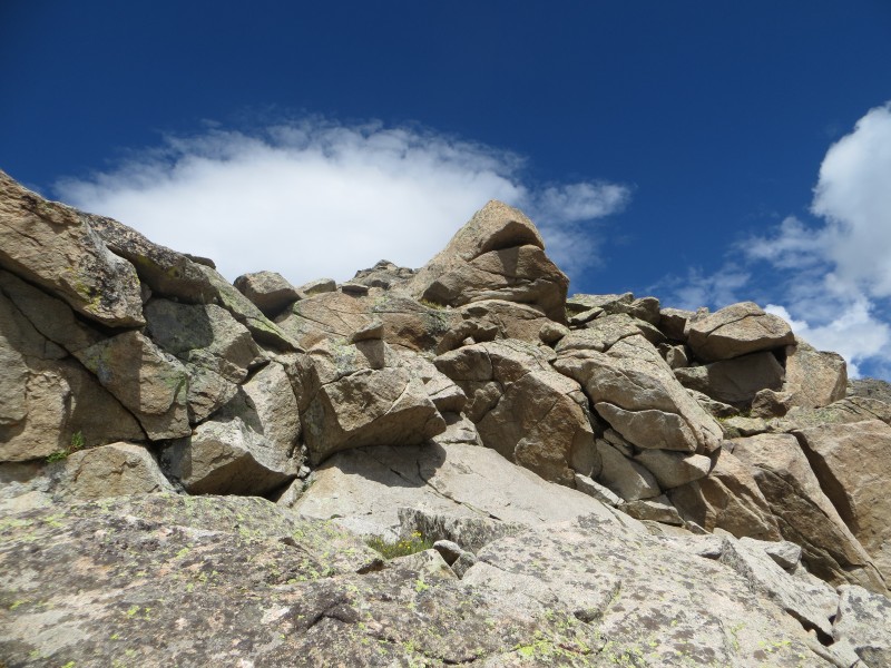 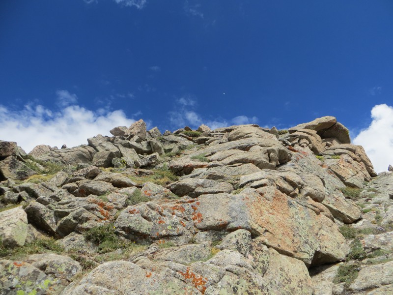 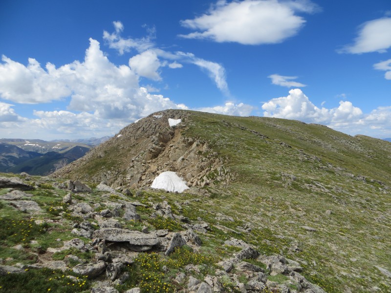 I made the summit at 10:35 and noticed that the clouds were starting to build to the west as expected. While signing the register I saw that this was Sarah's 13er finisher peak and the group she was with up there is quite the who's who in our community. Late I know, but CONGRATS Sarah! After reading her trip report about her harrowing ordeal on this mountain, it really seemed like the perfect peak to end her 13er quest. 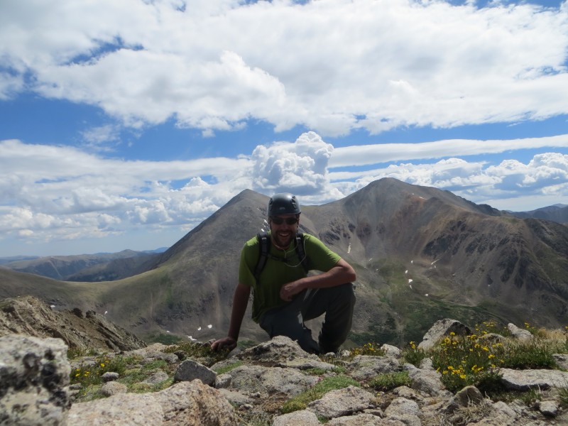 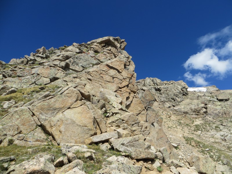 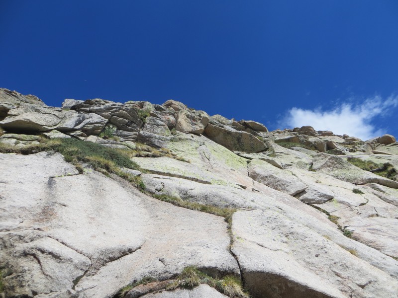 I knew I wanted to make it to my car and get down the sketchy parts of the road before they became wet and muddy, so I took some pics, ate some jerky, and started down. For my descent I just went down the slopes between the first and middle ridges. It varied between lose dirt, grassy ledges, and slabs. Due to the looseness I would not recommend this as an ascent route, but it made for a quick descent. Instead of aiming for the trail I took earlier, I avoided willows and angled towards the road. I ended up popping out right at the sign for the Chihuahua Trail and from there it was just a walk down the road back to my car, arriving at 12:00 on the dot. 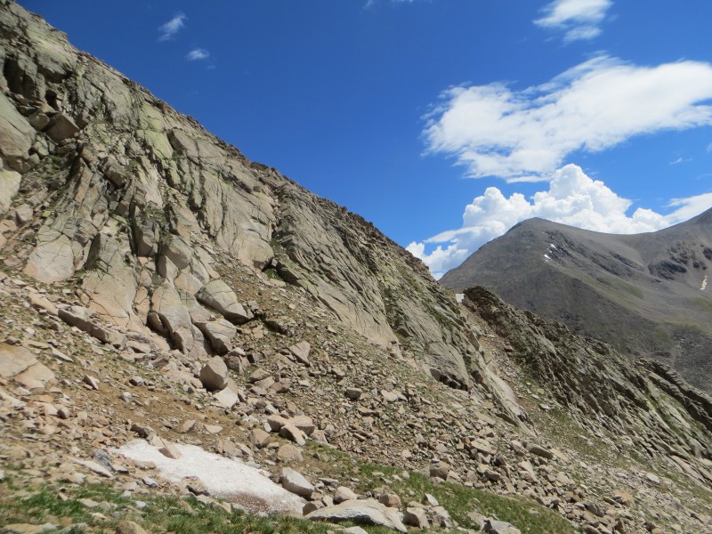 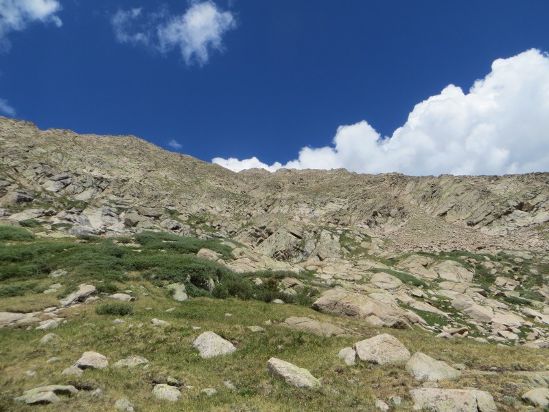 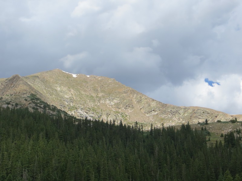 Lenawee is a great mountain and Chihuahua Gulch is a beautiful place. The highlight for me was the unique view of Grays and Torreys as well as being all alone while seeing the twenty or so people on the summits of those popular 14ers. About 5 minutes after I was off the 4wd road it started to rain and continued almost all the way home, a blessing for these dangerously dry mountains. Thanks for reading! Thumbnails for uploaded photos (click to open slideshow):
|
| Comments or Questions | ||||||
|---|---|---|---|---|---|---|
|
Caution: The information contained in this report may not be accurate and should not be the only resource used in preparation for your climb. Failure to have the necessary experience, physical conditioning, supplies or equipment can result in injury or death. 14ers.com and the author(s) of this report provide no warranties, either express or implied, that the information provided is accurate or reliable. By using the information provided, you agree to indemnify and hold harmless 14ers.com and the report author(s) with respect to any claims and demands against them, including any attorney fees and expenses. Please read the 14ers.com Safety and Disclaimer pages for more information.
Please respect private property: 14ers.com supports the rights of private landowners to determine how and by whom their land will be used. In Colorado, it is your responsibility to determine if land is private and to obtain the appropriate permission before entering the property.


