Download Agreement, Release, and Acknowledgement of Risk:
You (the person requesting this file download) fully understand mountain climbing ("Activity") involves risks and dangers of serious bodily injury, including permanent disability, paralysis, and death ("Risks") and you fully accept and assume all such risks and all responsibility for losses, costs, and damages you incur as a result of your participation in this Activity.
You acknowledge that information in the file you have chosen to download may not be accurate and may contain errors. You agree to assume all risks when using this information and agree to release and discharge 14ers.com, 14ers Inc. and the author(s) of such information (collectively, the "Released Parties").
You hereby discharge the Released Parties from all damages, actions, claims and liabilities of any nature, specifically including, but not limited to, damages, actions, claims and liabilities arising from or related to the negligence of the Released Parties. You further agree to indemnify, hold harmless and defend 14ers.com, 14ers Inc. and each of the other Released Parties from and against any loss, damage, liability and expense, including costs and attorney fees, incurred by 14ers.com, 14ers Inc. or any of the other Released Parties as a result of you using information provided on the 14ers.com or 14ers Inc. websites.
You have read this agreement, fully understand its terms and intend it to be a complete and unconditional release of all liability to the greatest extent allowed by law and agree that if any portion of this agreement is held to be invalid the balance, notwithstanding, shall continue in full force and effect.
By clicking "OK" you agree to these terms. If you DO NOT agree, click "Cancel"...
What: Pigeon Peak and Turret Peak via the North Pigeon Creek approach. Who: Nolan and me. Elevation: 7,200' gained. Miles: 11 (Roach says 8.85, but we picked nothing but the most expedient path). Time: 15.5 hours (not too fast but not too slow). Starting point: Lower campers' meadow. Mosquito bites: Boggles the mind.
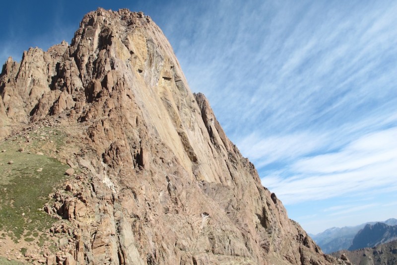
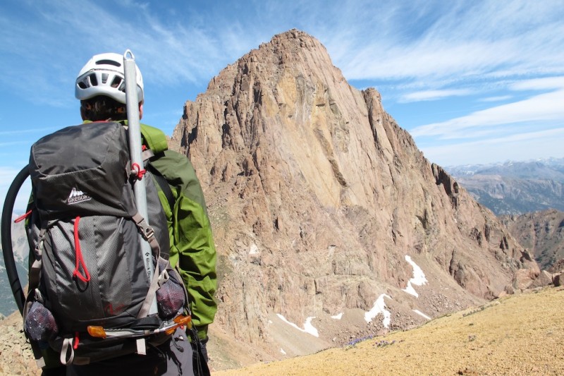
Pigeon Peak
The Story
A couple years ago, when Nolan and I were zeroing in on our "final" 14ers, we (along with 14er member rsingleton) enjoyed a mini trek through the San Juans, collecting the Chicago Basin group and the Wilson-Diente traverse over a five-day span. Since then, Nolan moved from Colorado, but we've both reminisced favorably on the area. With me having "use it or lose it" vacation time, and Nolan itching to get back to the high country, a plan formed: we'd do a parallel trip through the San Juans with a focus on 13ers. First we'd take the Durango-Silverton Narrow Gage Railway before returning to the Wilson group. Of course, the state's wildfire explosion had other ideas about such an odyssey, but we still managed a highlight: Pigeon and Turret.
We researched these peaks as best we could. Not trusting Roach fully (his descriptions have led us awry previously; e.g., driving directions for French et al.), we read everything we could get our hands on. Trip reports ranged from informative (lordhelmet's and piper14er's) to amusing (madmike's) to impressive (d_baker's winter report), to name but a few, but none gave us a good indication of the approach other than that it was arduous, unclear, and steep. This was particularly so of our planned approach, via the North Pigeon Creek bushwhack. Oh well.
The Hike
We took the train from Silverton, which departed promptly at 2:45 and dropped us at Needleton at 3:45. Immediately upon crossing the suspension bridge, we took a hard left, walked past a few private cabins along the Animas River until we got to a rocky creek crossing (which was a mere trickle). Here, Roach says there is a gate indicating the end of the private property. There is no gate. Shortly after, we passed the rusted-out rail car and found the idyllic campers' meadow.
We set up camp and enjoyed a quick jaunt up the Ruby Creek trail to find the path through the upper meadow. After passing the obvious tree sawed in half across the lowest meadow, we spotted the cairn immediately after it on the east (right) side and followed the trail to the upper meadow. There, we set up a stump so we could find the sharp turn in the dark, and then we returned to camp where a dinner of cold pizza awaited.
A note: the North Pigeon Creek approach shares the Ruby Creek trail from this campers' meadow up until shortly after the stream crossing (the stream is North Pigeon Creek), at which point they diverge rather significantly. Be sure to follow the Ruby Creek trail through and past this upper meadow; otherwise, your bushwhack will start much earlier than you'd like. And, yes, we packed in pizza; you'd be surprised how much of a 14" pizza can fit in a comically-large Ziplock. (All of it, turns out.)
With days about as long as they get, we wound up starting our hike with the sun already climbing the horizon. The route past the upper meadow is relatively straightforward: continue on the steep Ruby Creek trail until you reach the North Pigeon Creek at ~9,500'. Immediately after this crossing, an obvious trail continues to your left. Do not take this path (unless you are doing the Ruby Creek approach). Instead, look sharp to your right and find a steep, ugly path that either will remind you why you brought hiking poles or leave you cursing your bad luck in having left the poles at home. If you're already cursing, you are in for a long day. This is what Roach accurately describes as a "brutally steep" trail just after the creek crossing.
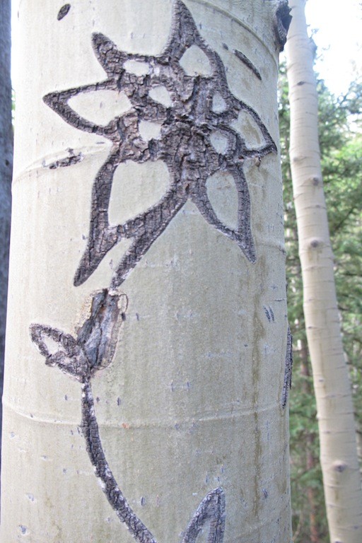
Follow this path about 300' feet up to ~9,800', to where you will turn off for a 1,200' bushwhack. In other words, the obvious trail continues, and you follow a significantly less obvious bushwhack primarily on a steep northeast trajectory. The turnoff occurs approximately 10' before you see the Columbine carved on the tree. Thus, if you see the Columbine, turn around and look up. Here is a picture of the Columbine and the turnoff.
The Columbine. If you see this, you've gone just slightly too far.
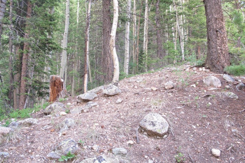
Beginning the bushwhack. This comes just before the Columbine.
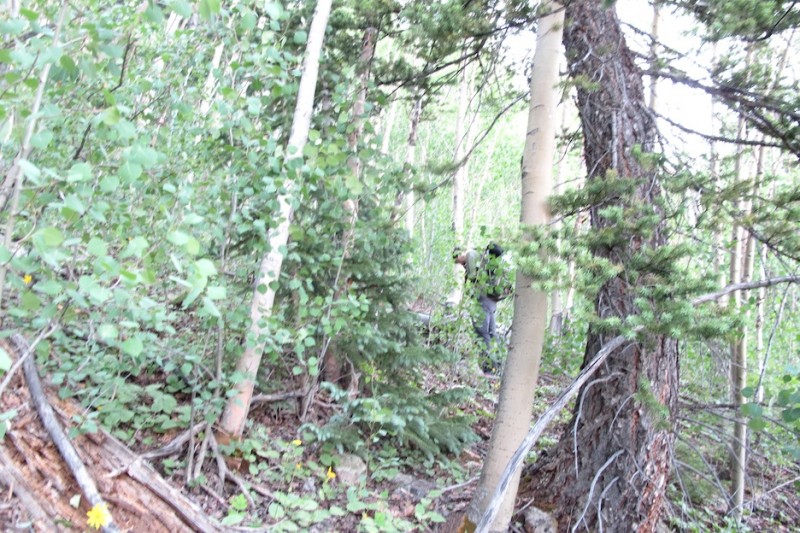
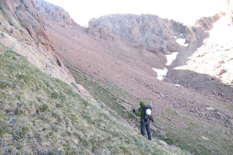
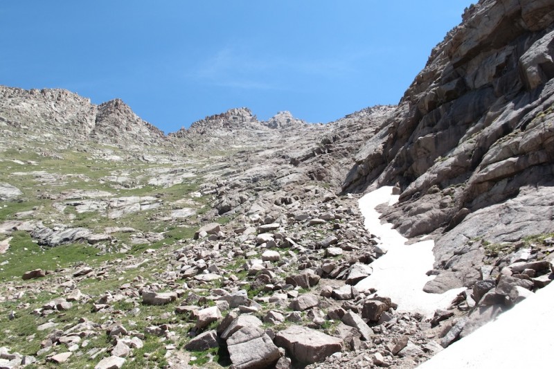
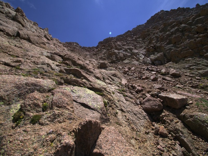
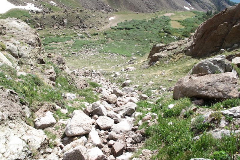
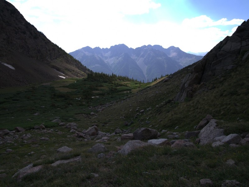
Between 9,800' and ~11,000', the route is a long, steep bushwhack. In general, stay on or near a thin ridge just below a much larger ridge to your left (climber's left ascending). This larger ridge eventually becomes the long, steep, and jagged ridge up to Pigeon itself; you do not want to take that ridge for reasons that become obvious once you reach the upper basin. Instead, the smaller ridge will lead you to a basin at ~11,740', and it does so by circling around to Pigeon's north face. Between 10,500'-10,700', there is a mini-rock glacier on your left. Be sure to keep right of it as you continue your ascent. From 9,800' to ~11,000 there is no trail and few human-made markings.
A sample.
For the next 1,200' feet enjoy the steep slope, groping trees, and imagine what climbing a mountain was like without any established trail. To pass the time, refine your sailor language.
Bushwhacking whacks backs.
A cairn or two might provide reassurance, but I would not waste your time searching them out. Likewise, up around 10,900'-11,000' a few trails appear to lead you to the upper basin at 11,700'. If you find one, great. But if you do not, I would not waste your time trying to locate one. They peter out intermittently, anyway. Once you hit 11,000' the bushwhack eases.
Be warned: the rocks in this section (9,800'-~11,000') look inviting to brace yourself on during the descent; do not trust them. They are trapdoors that release from under you without warning--sturdy one moment, a sudden tumbling void the next.
We lucked out and found a trail that more or less led us to the basin at 11,740' below Pigeon.
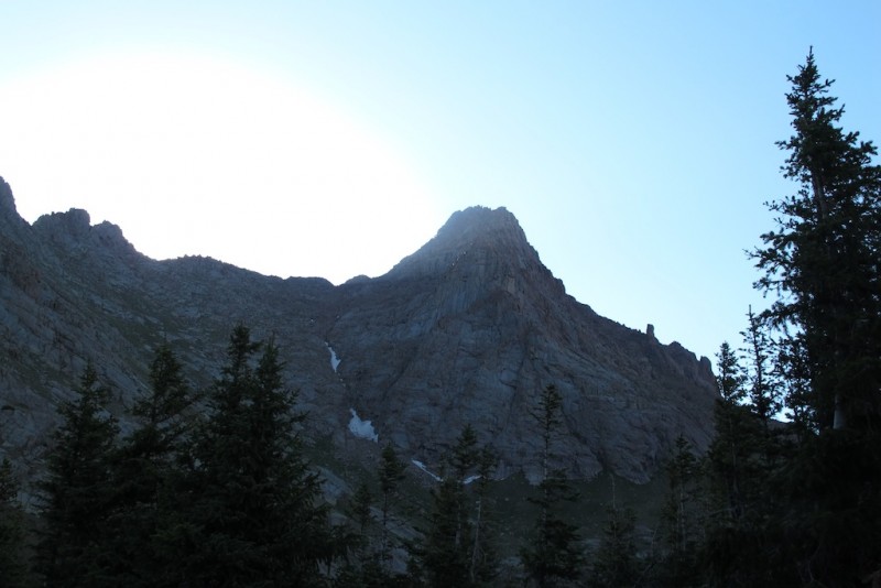
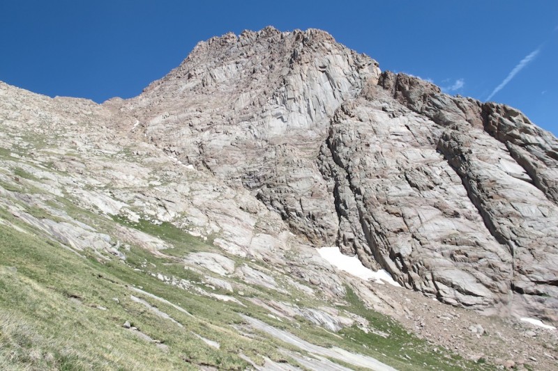
Coming into the basin, we get our first close-up of Pigeon.
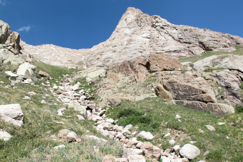
We opted to collect Turret first, since we would then be circling back towards Pigeon and, ultimately, camp. Your first goal is to ascend the grassy slopes below Pigeon to ~12,400'. Traverse around its north face until you see a long scree apron up to an obvious saddle.
Ascend the grassy slopes and traverse around Pigeon.
Nolan contemplates the scree.
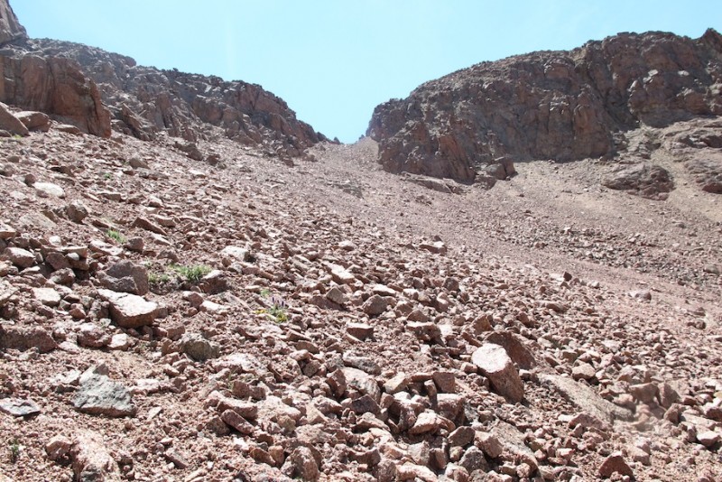
The scree scramble to the saddle will test your patience. In general, stay high and to the left. Don't walk below somebody. A superb view of Turret greets you from the saddle.
Scree to the saddle.
Turret from the saddle. You're on solid ground now.
Gain some more elevation, and you'll have an unparalleled view of Pigeon's east face.
Contemplating Pigeon.
There are many ascent options for Turret from here, and if you've come this far, I have confidence you'll find a line to your liking. Views such as this welcome you to Turret's summit.
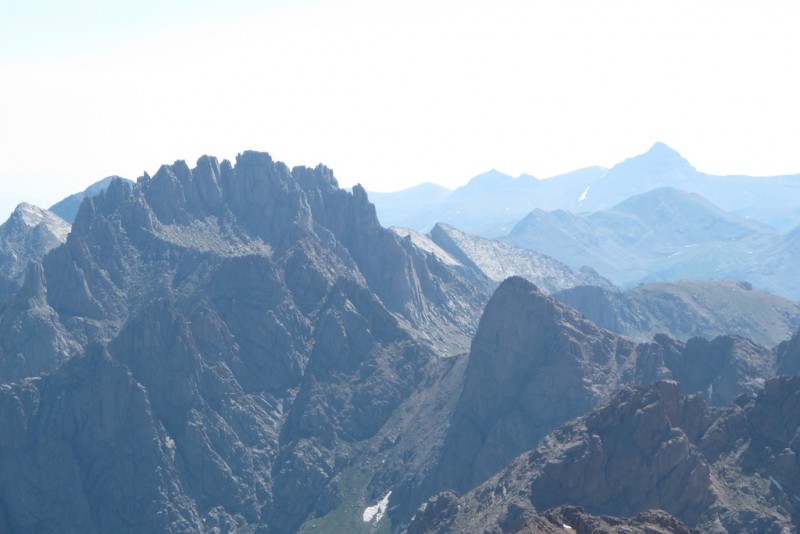
Jagged and RGP.
Trinity, Vestal, and Arrow.
Now it's time to lose all that elevation. Disheartening, I know. Retrace your steps to the first saddle. As you contemplate ways to avoid the scree, remember scree skiing isn't all bad. Be sure to drop to 12,400' before you begin circumnavigating Pigeon's base.
Circumnavigating Pigeon's lower flanks at 12,400'. (Photo credit: Nolan.)
Once you get back around to your unobstructed view of Pigeon's north face, work your way up the grassy slopes. Nolan, Mr. Lives-at-Sea-Level, turned on the afterburners here.
The grassy slopes towards Pigeon's upper reaches.
The steep grassy slopes. (Photo credit: Nolan.)
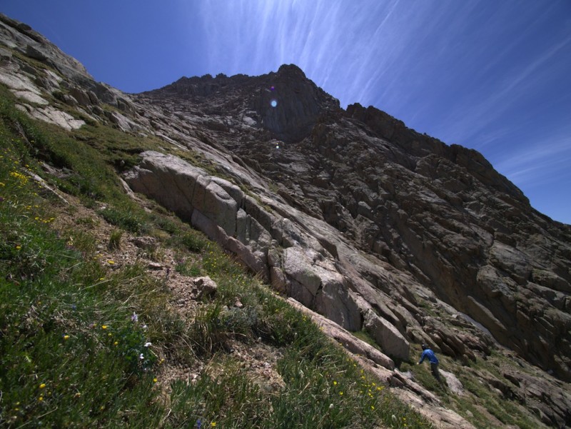
In general, aim for the "U" shape in the ridge above (shown below). There you'll head to the right up obvious class 3 ramps and blocks. You do not go all the way up to the ridge proper.
Pigeon's upper route.
Going up. (Photo credit: Nolan.)
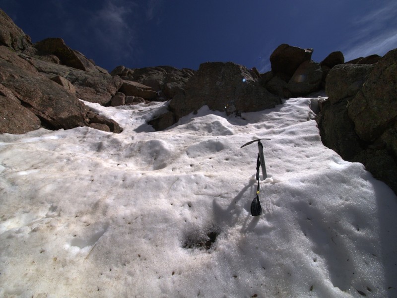
These slopes are tiring, but the scrambling light at the end of the tunnel should motivate you (it did me). There are cairns; some are honest, some are not. Generally speaking, from 13,500' onwards, there is plenty of class 3 from which to choose. Pigeon is a fun mountain that presents many options. Find one you like and go. We encountered snow, which required route adjustment.
Time to improvise. (Photo credit: Nolan.)
We left the packs for the last couple hundred feet. (Photo credit: Nolan.)
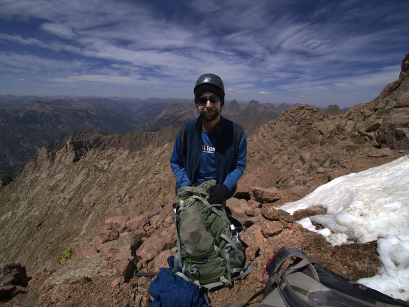
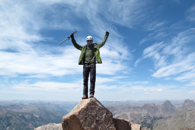
Still no summit register, but that was a mere afterthought.
Pigeon's summit.
We opted for a less-steep descent down the grassy slopes, and we cobbled together a pretty simple line of least resistance. We went to the far right of the slabs shown in the next picture and then followed a rocky stream down to the basin.
Descending the grassy slopes. We stayed right past the slabs.
After the slabs, we found this convenient rocky stream bed to descend to the basin.
Looking back. Our ascent line ran left of the snow.
As we began our descent into the trees and towards the bushwhack, we noted how stark the mountains' profiles appeared. We recognized, although did not fully process, some haze in the air as contributing to a change in the light filtering through the sky. That night, along with mosquitoes, moths, and flower spores, bits of ash landed in our camp. As noted above: the mosquitoes were biting and plentiful. We proved fantastic enablers of the mosquito obesity epidemic.
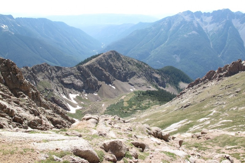
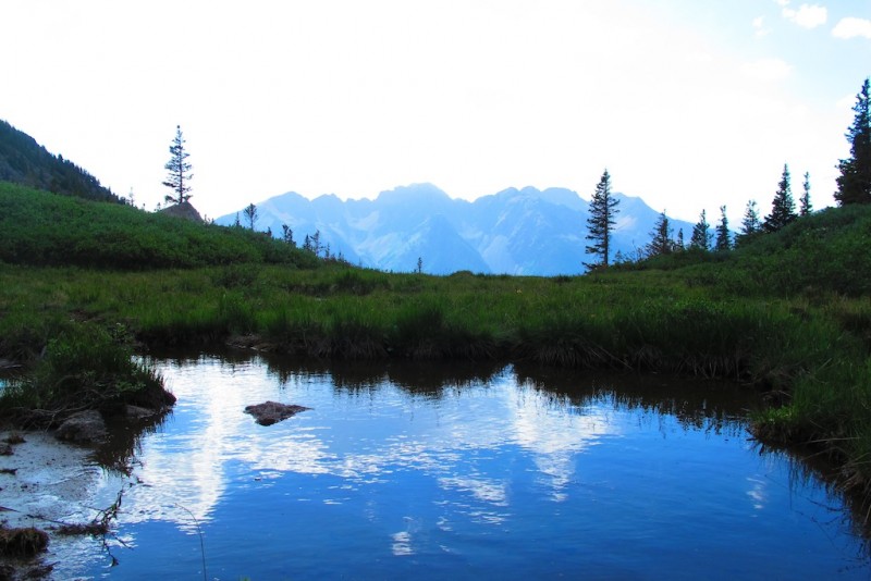
The basin at 11,740'. (Photo credit: Nolan.)
Back in the basin. The haze in the air gave prominence to the peaks' silhouettes.
After a dinner that did next to nothing to replenish the energy burned that day, we indulgently slept in to 6 a.m., at which point a friendly woodpecker decided it was time for us to pack up and get out of its meadow.
As we trained out, our goal was to head to Gladstone to bookend our trip. However, the Weber Fire essentially erupted and filled the air with smoke and ash from Silverton to Ouray and beyond to the point where we could not see across the valley or even, eventually, the mountainous skyline. Discretion being the better part of valor, we set aside our stubbornness and enjoyed having climbed Pigeon and Turret. How selfish and unimportant our goals of climbing more mountains seemed compared to those with homes near the fires and steeped in smoke and soot as well as the firefighters and volunteers who have tirelessly battled these blazes for weeks now. We could not conceive of their exhaustion and kept them at the top of our thoughts. The whole state is on fire.
The Epilogue
If you are not comfortable with map-reading, orienteering, or just plain GPS use, this isn't the route for you. My hope for this report had been to give an idea of the North Pigeon Creek approach, including effort and route-finding tips. I'm not sure I accomplished that. What I did accomplish was censoring the repeated colorful phraseology we tossed around frequently, internally, and externally. You will curse and curse plenty, but in the end, you will enjoy a fantastic day in the remote wilderness. We didn't see a soul all day.
The End!
Thumbnails for uploaded photos (click to open slideshow):
on a great climb!! i love that area!! we climbed it from ruby basin last year. we'll be in no name creek drainage this coming weekend. how were the mosquitos where you were at? were there any??
or lack there of for the approach! But to be fair, it had snow on it when we were there, so it wouldn't do you any good! :)
Congrats! Fine peaks for sure. We didn't see a register on Pigeon either, but Turret had one.
Thanks for posting! I would love to go back in there in the summer!
Edit: By any chance did you see our blue webbing on Pigeon? Somewhere probably near your snow improv route. Just curious. Your pictures bring back fond memories!
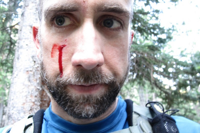
Good Gawd, Joe. :shock:
Blood letting and all!
Huge congrats to you and Nolan - great job on a tough route!
Way to go on the Cents.
You guys did a super job staying fluid and smart in less than ideal conditions last week - impressive.
Great TR #2, your writing is fantastic (not so sure about your bloody mug! That's a face only yo' momma could love :wink: )
Thanks for the 6 legged vampire warning. (skeeters)
Cheers! :D
Caution: The information contained in this report may not be accurate and should not be the only resource used in preparation for your climb. Failure to have the necessary experience, physical conditioning, supplies or equipment can result in injury or death. 14ers.com and the author(s) of this report provide no warranties, either express or implied, that the information provided is accurate or reliable. By using the information provided, you agree to indemnify and hold harmless 14ers.com and the report author(s) with respect to any claims and demands against them, including any attorney fees and expenses. Please read the 14ers.com Safety and Disclaimer pages for more information.
Please respect private property: 14ers.com supports the rights of private landowners to determine how and by whom their land will be used. In Colorado, it is your responsibility to determine if land is private and to obtain the appropriate permission before entering the property.