Download Agreement, Release, and Acknowledgement of Risk:
You (the person requesting this file download) fully understand mountain climbing ("Activity") involves risks and dangers of serious bodily injury, including permanent disability, paralysis, and death ("Risks") and you fully accept and assume all such risks and all responsibility for losses, costs, and damages you incur as a result of your participation in this Activity.
You acknowledge that information in the file you have chosen to download may not be accurate and may contain errors. You agree to assume all risks when using this information and agree to release and discharge 14ers.com, 14ers Inc. and the author(s) of such information (collectively, the "Released Parties").
You hereby discharge the Released Parties from all damages, actions, claims and liabilities of any nature, specifically including, but not limited to, damages, actions, claims and liabilities arising from or related to the negligence of the Released Parties. You further agree to indemnify, hold harmless and defend 14ers.com, 14ers Inc. and each of the other Released Parties from and against any loss, damage, liability and expense, including costs and attorney fees, incurred by 14ers.com, 14ers Inc. or any of the other Released Parties as a result of you using information provided on the 14ers.com or 14ers Inc. websites.
You have read this agreement, fully understand its terms and intend it to be a complete and unconditional release of all liability to the greatest extent allowed by law and agree that if any portion of this agreement is held to be invalid the balance, notwithstanding, shall continue in full force and effect.
By clicking "OK" you agree to these terms. If you DO NOT agree, click "Cancel"...
**Disclaimer: I have been a slacker so this beta is outdated by 3 weeks at this point**
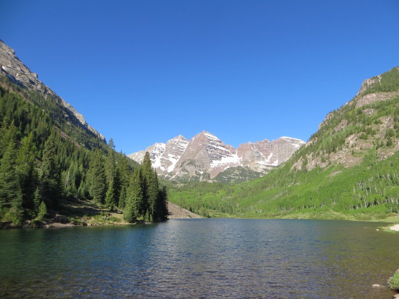
Peak: North Maroon(14,014ft)
Mileage: 9.25miles
Elevation Gained: 4,500ft
7:30am-3:30pm
'The View' at night
With a perfect forecast and three 14ers to go, I knew that I wanted to get my one remaining unranked peak out of the way to make sure I finished on a ranked peak. After class on Wednesday I hit the road to Aspen, taking my first trip up and over Independence Pass of the year. Stopping to use the bathroom at the top of the pass, I was quickly reminded how much I want to climb the Ellingwood Ridge on La Plata sometime this summer. The view of the ridge from the top of the pass is astounding!
After a quick stop at the hardware store in Aspen for some moth balls to hopefully deter any critters from feasting on my brake lines at the trailhead, I started up Maroon Creek Road. After dutifully paying my $10 I drove up to the overnight parking area and set up the Forester Motel. Being 6'5" I can make it work by laying diagonal in the back, but it is certainly only a room for one.
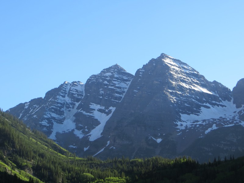
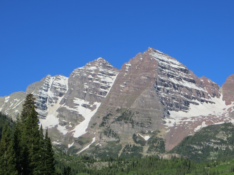
South Maroon on left, North Maroon on right
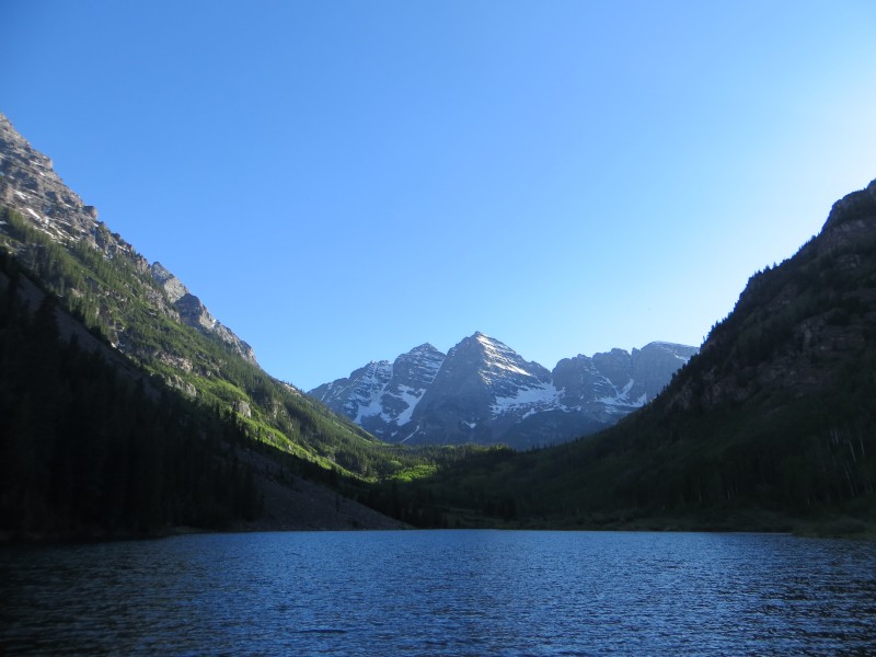
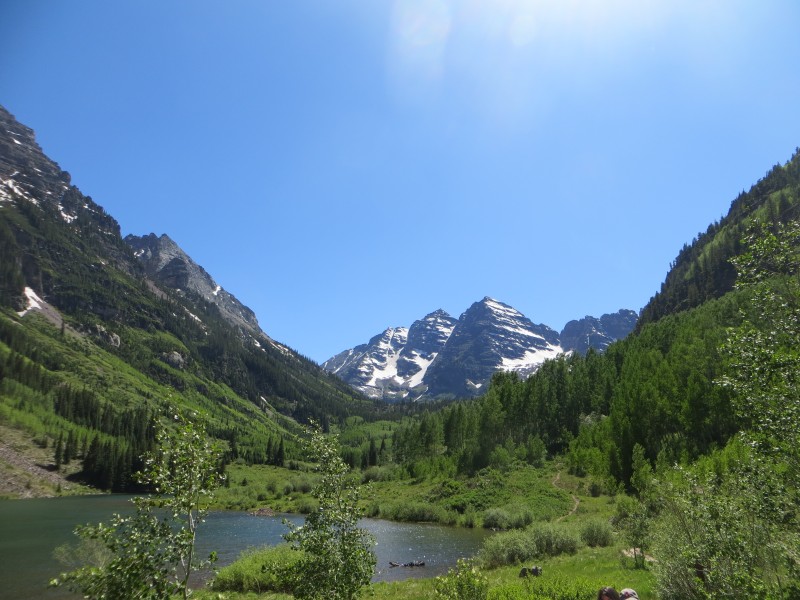
It was only around 5:30 at this time so I grabbed my dinner sandwiches, camera, and book and walked up to the lake. No matter how many times I go to Maroon Lake or how many thousands of pictures I have seen of it, it truly is a special place that I doubt could get old. In fact, if you do get sick of that view, I think it may be time to reevaluate living in Colorado and head east to (insert boring state out East here).
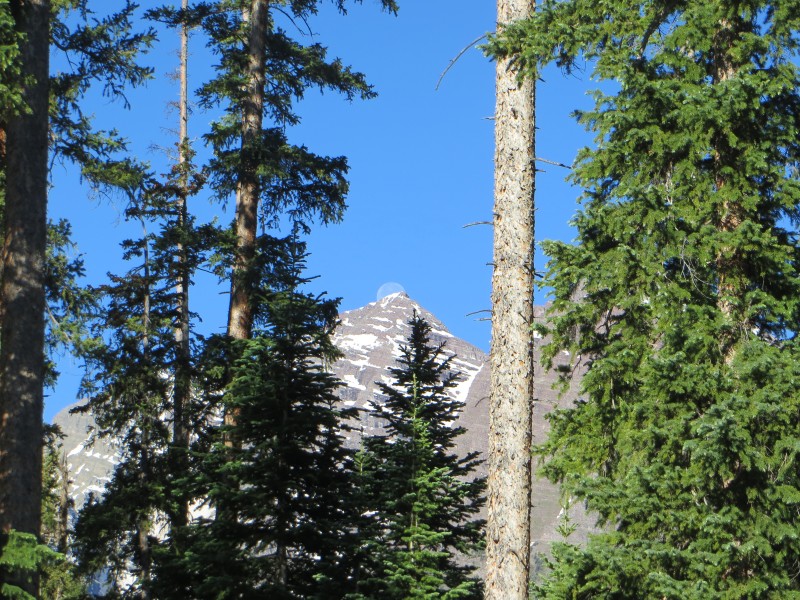
Full moon setting
With my feet in the lake I read my book after eating and also played amateur photographer for a few families that were milling around the lake. Around 6:30 my buddy Brandon(Wisco14er) and his Outward Bound cohorts made it back to the lake after a day on the Bell Cord and South Maroon. It was a very pleasant surprise as I had assumed they would have already been down and in Aspen enjoying pizza and beer by the time I got there. Luckily they started late and had great weather, so it was awesome to see them and get some beta on how North Maroon looked from their vantage point next door.
They had pizza on the brain so our visit was short, and they soon headed back to their car. I read a little longer and then walked back to my car for the night. My plan was to get to bed early and wake up around 3 to hit the trail. After surrounding my car with the moth balls I climbed in and read some of my Human Biology textbook which is the same as taking a sleeping pill. The view through my moon-roof of the full moon was great and made me feel good about my weather chances for the following day.
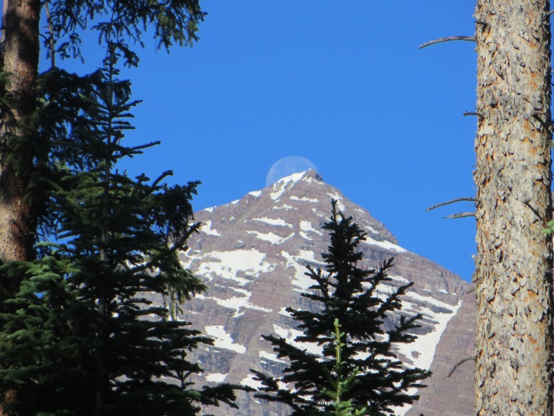
Setting over South Maroon
'The View' in the morning
Before bed I met a guy who wanted to climb with me, but after sleeping in until 7:30 he made the call that he was going to just do the four pass loop instead. Starting at 7:30 is usually unheard of for me, but with the perfect forecast I wasn't sweating it too much. The morning was beautiful and I was able to see the full moon set behind South Maroon and it was pretty cool.
Bells
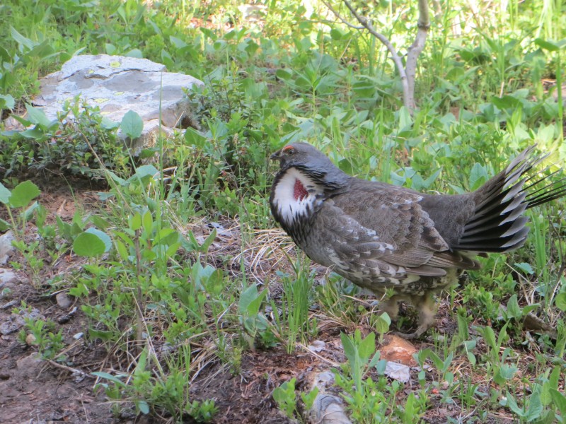
Weird bird
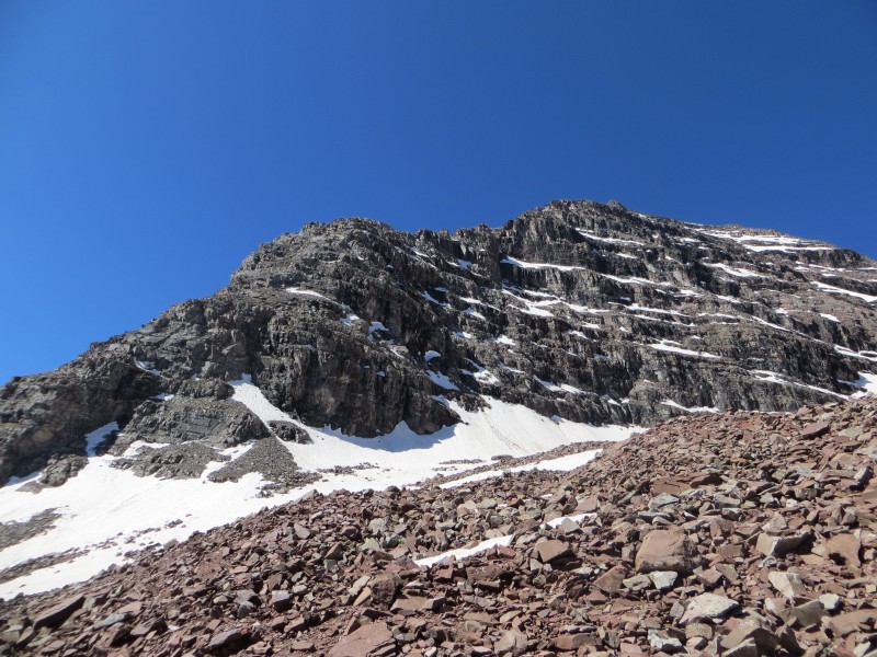
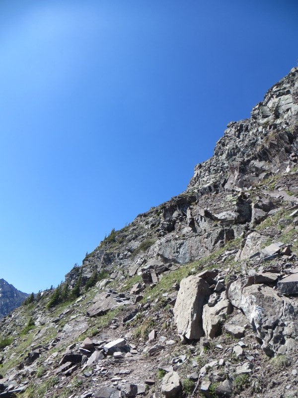
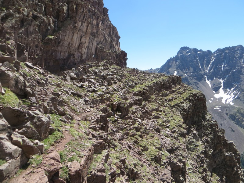
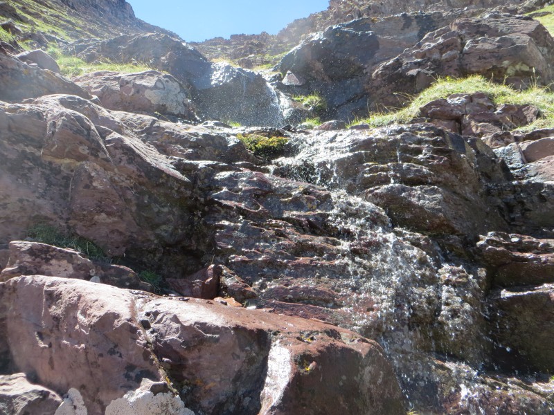
The familiar trail up to the split went fairly quickly and I was excited when I passed the big cairn marking the turnoff for Pyramid, as I hoped to be going up that trail soon and coming down it a 14er finisher. Hanging a right at the fork in the trail it was another ¾ mile to the small cairn that marked the turn off for the North Maroon trail. Finding a dry way to cross Minnehaha creek was a little troublesome, but going downstream a bit seemed to work. The trail from that point gains elevation pretty quickly and even has a short section of class 3, rare for below treeline travel. The runoff was still frozen at this point, but I knew it would be a soupy mess on the descent.
Rock glacier and NE ridge
Rock glacier
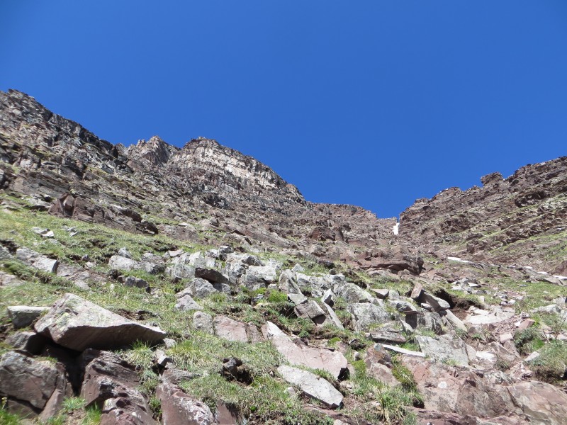
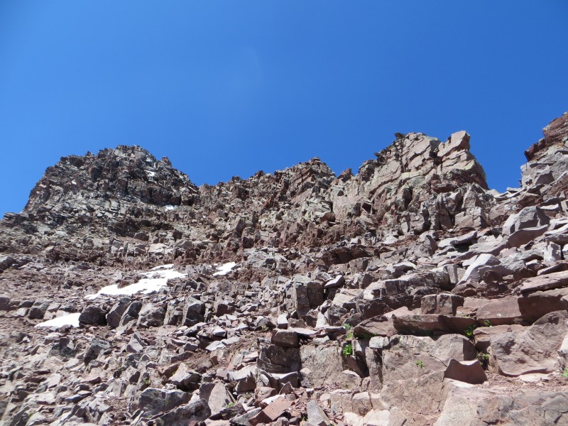
Before long I was on the rock glacier and had a few small snowfields to cross. Earlier in the morning the ice axe and maybe crampons would have been needed, but the snow had softened enough that I felt safe just kicking steps and moving carefully. After this point it was apparent the route from here on out was going to be serious, so I put my helmet on just before I rounded the corner to access the first gully. There was a decent trail to follow and I started to gain elevation in earnest in the fairly solid gully.
Almost to first gully
Looking back to Maroon Lake
First gully
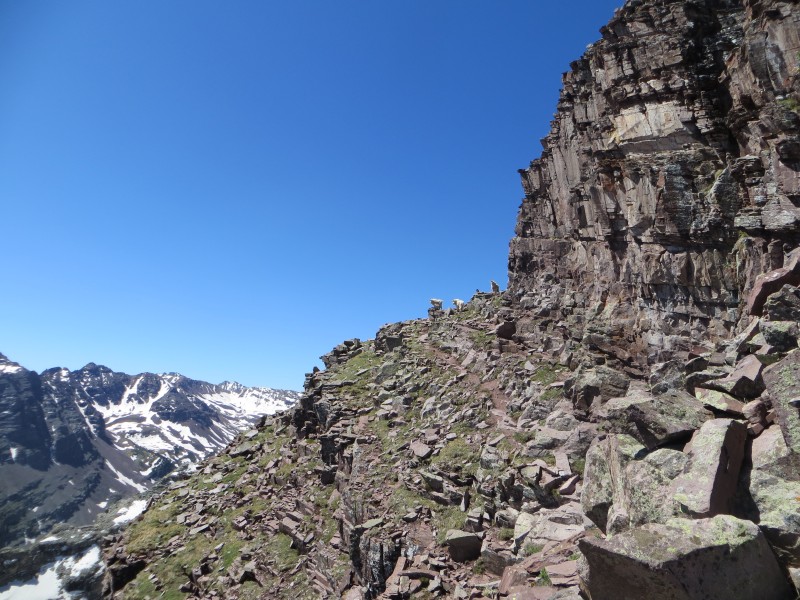
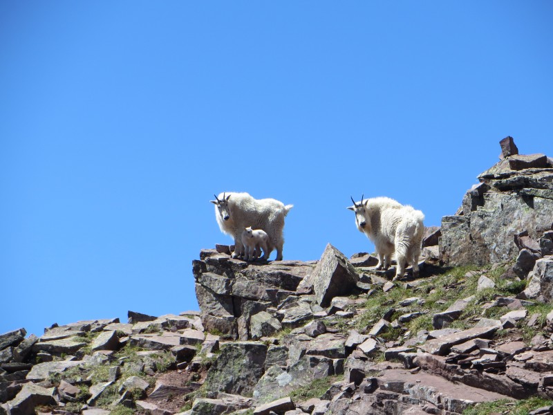
The exit to the first gully was easy to spot and traversed some ledges before rounding the bend into the second gully. Here I ran into a family of goats complete with a little baby, they were just as interested in me as I was in them. They went around the corner and I was surprised when I got around it that they were nowhere to be seen. Looking around I could not figure out where they had gone, which just proves how amazing these animals are at moving on this less than stellar rock.
Route to second gully
Happy family
Closer look
Looking back on route from first to second gully
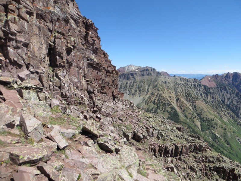
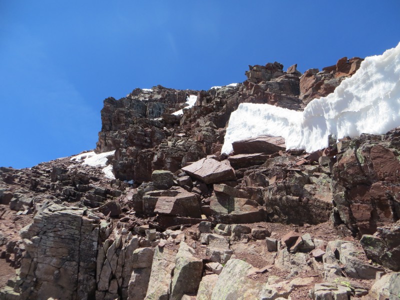
Gully number two was much steeper and much looser. Going up was not a big deal, but I was not looking forward to descending this mess. Towards the top of the gully the real climbing begins. The route is pretty intuitive and there are lots of options, your goal is just to gain the northeast ridge. After cresting the ridge the majority of the remaining route comes into view. There was still some snow present that I avoided by staying near the edge of the huge cliffs to the south.
South Maroon
Base of second gully looking back where I came
Top of second gully
Fun scrambling to gain ridge
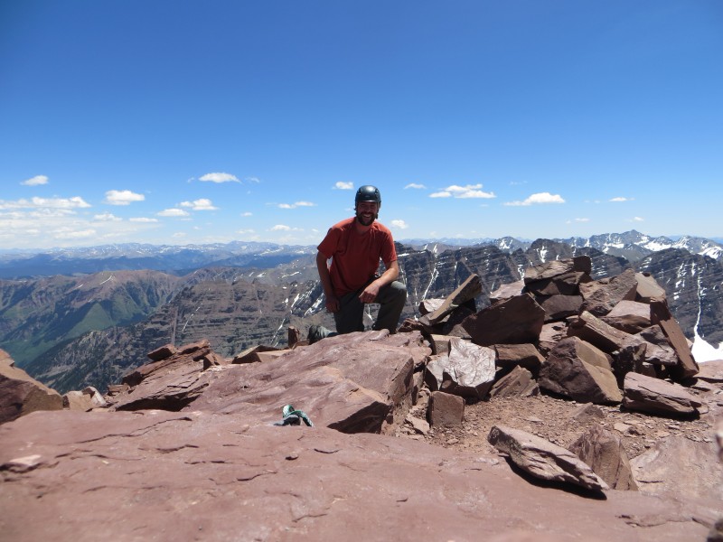
Eventually I made it to the class 4 chimney and was excited to see that other than a little snow present to get to the base, the chimney itself was in great shape. Pulling myself up I finally saw the summit in the distance and it looked doable. Another 20 minutes of scrambling and then a quick walk up the loose summit ridge and I made the summit of number 56 at 12:30!
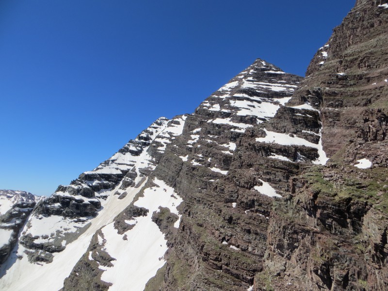
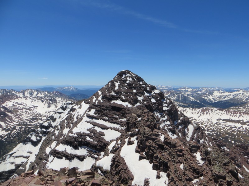
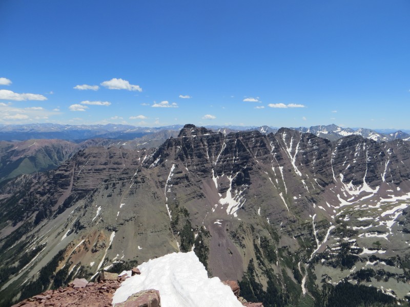
South Maroon from summit
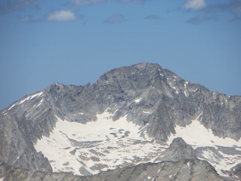
Snowmass and Capitol from summit
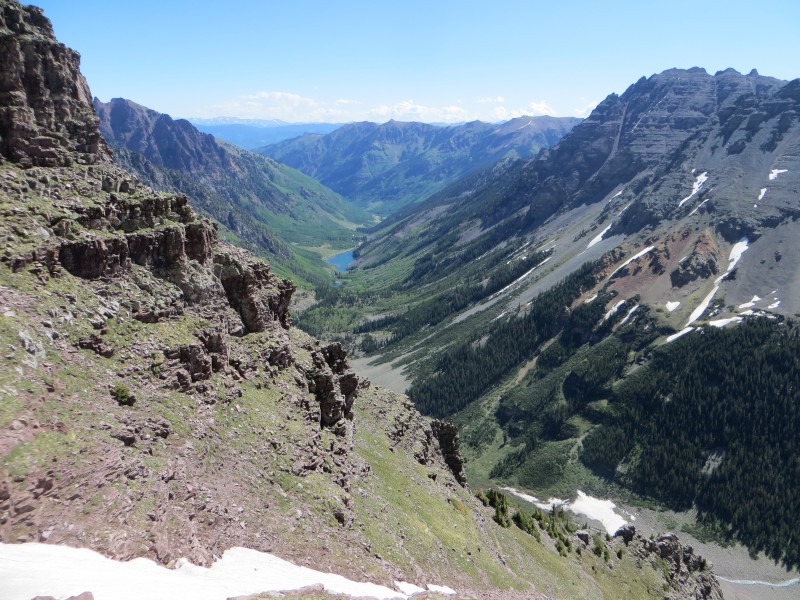
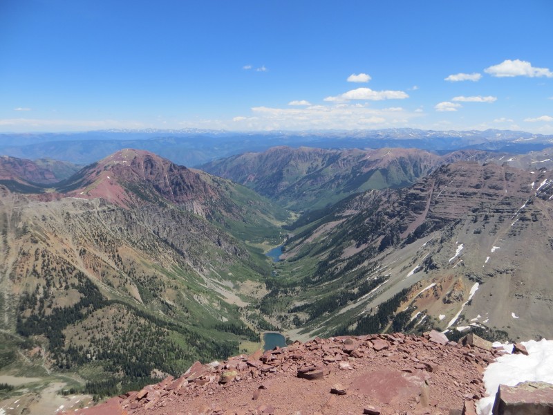
Crater and Maroon Lakes
The views were as expected, phenomenal. I ate some food, chugged a Gatorade, sent a SPOT message, and took a ton of pictures. It was really cool standing on the summit of North Maroon, because I was smack dab in the middle of Pyramid and Capitol, my two remaining fourteeners and I was stoked to tackle them both soon. Not a cloud in the sky and absolutely no wind had me spending about a half hour on the summit, alone in my thoughts and excitement.
2 to go!
Capitol, you're next
Pyramid, I'm coming for you.....
Soon I geared up again and started to head down. Reversing my route down to the top of the second gully went off without a hitch and then I began the sketchy descent down the steep, loose gully. This is not a place I would want to be with wet, muddy conditions, as it seems a slip and slide down would be hard to avoid.
Water draining down first gully
Seeing the ledges that takes you to the first gully was a welcome sight and I was anxious to get on tamer terrain. This gully went much quicker as the trail is in good shape as it switchbacks down. Quickly making it back to the snowfields I did a little obligatory postholing up to my waste, but it was short-lived and when back on the rock glacier I knew I was in the clear and out of the danger zone. Taking a quick break to refuel and take off my helmet, I then began the trip back to the car.
Being out of water at this point I put the pedal to medal and cruised down the trail, pausing to take a few more pictures at the lake and stopping at the 'Deadly Bells' sign, grateful to have won this round. Getting back to the car at 3:30 felt great and after some lukewarm chocolate mile I started to drive back to Denver, another amazing day in the hills in the books.
Sweet success
Thanks for reading!
Thumbnails for uploaded photos (click to open slideshow):
Another great TR from The Aaron man. Nice pictures and good route info. Congrats again on bagging Capitol just a few days later. 57 down...1 to go. I swear, we will share another 14er summit besides Quandary one day (maybe you'll wait for Pyramid, hint hint :lol: )
Looking forward to hiking with you this afternoon!
Great report! I just hiked N. Maroon Saturday. I was the first person up the route that morning and ran into what looks like the same family of goats at the EXACT same location. In fact, even our photos look identical. Unfortnately, instead of going away, they strolled up the second gully and kicked rocks at me for 30 minutes. Anyway, nice job and good photos.
Solid job Aaron! I just have 2 words for you: Pyrimidal Traverse.
I figure the best way to finish the 14ers is to finish on a 13er. let me know man.
Caution: The information contained in this report may not be accurate and should not be the only resource used in preparation for your climb. Failure to have the necessary experience, physical conditioning, supplies or equipment can result in injury or death. 14ers.com and the author(s) of this report provide no warranties, either express or implied, that the information provided is accurate or reliable. By using the information provided, you agree to indemnify and hold harmless 14ers.com and the report author(s) with respect to any claims and demands against them, including any attorney fees and expenses. Please read the 14ers.com Safety and Disclaimer pages for more information.
Please respect private property: 14ers.com supports the rights of private landowners to determine how and by whom their land will be used. In Colorado, it is your responsibility to determine if land is private and to obtain the appropriate permission before entering the property.