| Report Type | Full |
| Peak(s) | |
| Date Posted | 06/16/2012 |
| Date Climbed | 06/12/2012 |
| Author | B[3] |
| 4 Pass Loop Variation |
|---|
|
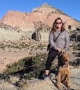
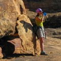
Trailhead: Maroon Snowmass Starting Trail: East Snowmass Finishing Trail: Maroon-Snowmass Trail Backpacked from 6/12/12-6/15/12 Daily mileage: ~5 miles and 2700 ft elevation gain (Day 1); ~9 miles and 2800 ft elevation gain (Day 2: unnamed and Willow Pass); ~9.5 miles and 2500 ft elevation gain (Day 3: West Maroon and Frigid Air Pass); ~14 miles and 2400 ft elevation gain (Day 4: Trail Rider Pass) *Disclaimer: We did not summit any peaks on this trip, although we had great views of Pyramid, the Bells, and Snowmass along the way.* Note: We did not take any snow gear on the trip (ice axes or crampons) and felt mostly okay with our trekking poles. I thought the sketchiest snow (soft and steep) was on Frigid Air Pass. We encountered the most snow heading down from Trail Rider Pass to Snowmass Lake. There was some soft snow and some steep harder snow on sections of the trail that could be more comfortable with an ice axe, but most of the snow was easily avoidable. We have spent the past few summers focused on our 14er summits and have done very limited backpacking (mostly packing in to a campsite so we can get an early start). This summer, we decided to do some more backpacking. While looking through the Colorado Wilderness Guide, I suggested the 4 pass loop. Ben agreed and began planning the trip. Little did I know that he had found a longer variation... On the evening prior to our trip, Ben and I sat down to look over the topo maps and elevation profiles. Our conversation went something like this: Ben: So, on the first day... Me (interupting): Why are there five passes on this elevation profile? Isn't this the four pass loop?! Ben (looking sheepish): Well, one of the "passes" is unnamed Me: That still sounds like five passes to me! Ben: The next pass only requires 600 feet of elevation gain, so it doesn't really count. Me (making shoveling motions): You're just digging a deeper hole for yourself. Ben: This conference is over. A look at the elevation profile: 4 or 5 passes? You be the judge. 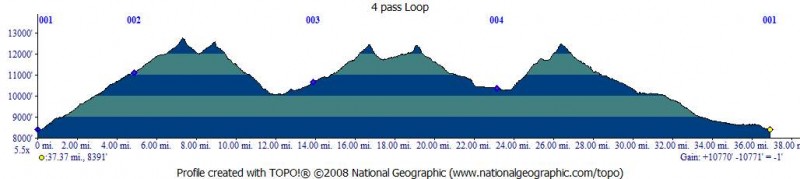 Our actual route on the loop (blue dots are our campsites):  We parked in the main Maroon Snowmass Trailhead parking area so as to end at the car (this required a short stretch of road hiking at the beginning). The East Snowmass trail was beautiful and quiet. 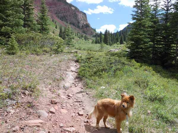 The next morning, heading up towards the unnamed pass ("East Snowmass Pass").  Getting closer to the unnamed pass (the trail can be seen faintly in the red sediments on the left and it looks steeper than it is): 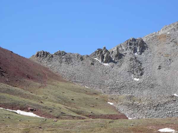 Looking back down East Snowmass basin en route to the unnamed pass: 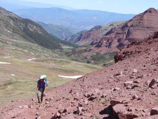 The views of Willow Lake from the top of the unnamed pass were spectacular:  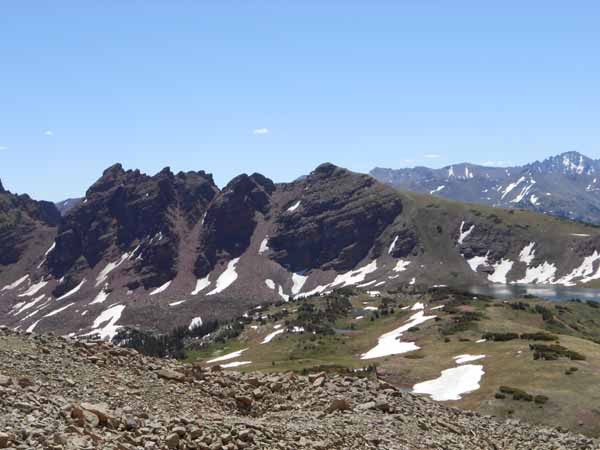 Since we still had to go over another pass this day, we did not stop at the lake but continued on to Willow Pass: 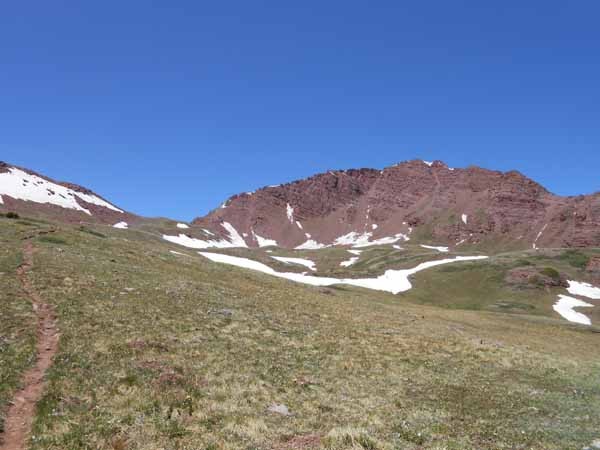 At the top of Willow Pass, we were greeted by some beautiful views of North Maroon. 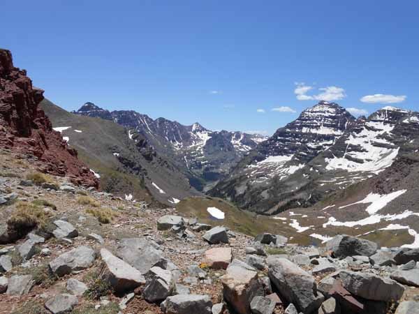 Although tired, at this point we were feeling pretty confident. We had gone over two passes and had encountered minimal snow. On the way down to Crater Lake, we spoke with two backpackers who had gone over Buckskin Pass and Trail Rider Pass. They said Buckskin Pass still had some snow but that Trail Rider Pass was alot worse (This made me apprehensive as Trail Rider would be the last pass we went over, but I hoped for the best). A look up at Buckskin Pass (which we did not go over):  After resting at Crater Lake for a while, we decided to head up the trail to a campsite at about 10,700 ft (just past the lower West Maroon Creek crossing). On our way, we had nice views of a waterfall on the flanks of North Maroon and of the Bell Cord: 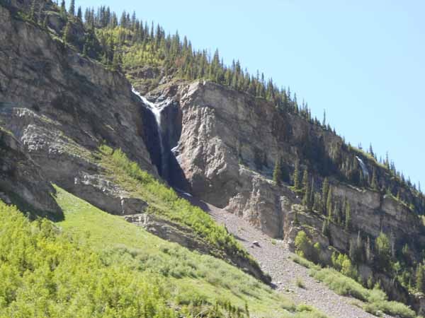 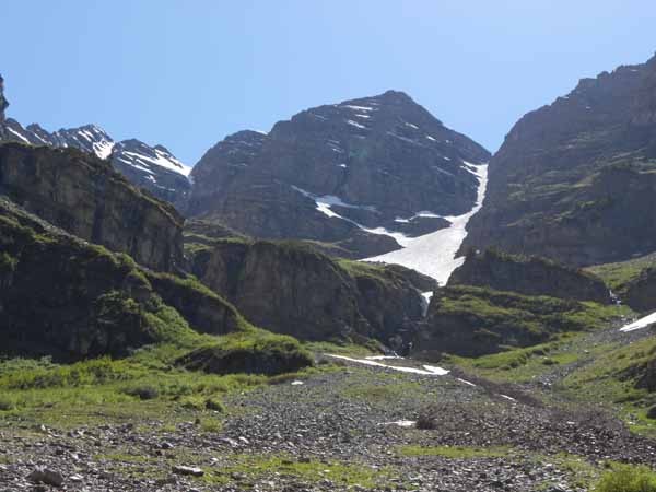 When we got to the lower West Maroon Creek crossing, the water level was too high for me to get across in my hiking boots. After scoping it out, I elected to cross the snow bridge (the snow was hard and felt solid; I went pretty high up on it and did not hear any water underneath) while Ben put on his sandals and waded across.  The forecast looked iffier for the next day, and since we had two passes to cross, we got up around 6 am. The upper crossing of West Maroon Creek did not have a convenient snow bridge, so we both waded it (sorry, no photos). It was so cold early in the morning (painfully so), leading us to speculate as to its actual temperature. On our way up to West Maroon Pass, I hit my first wall (I was exhausted and sore--maybe this wasn't the greatest choice for our first backpack of the season and our longest backpack to date). Looking up towards West Maroon Pass: 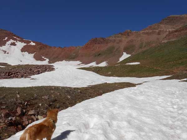 After we got over West Maroon Pass, I got my second wind (which was a good thing, as we still had to cross Frigid Air Pass that day). Photo shows looking southwest from West Maroon Pass en route to Frigid Air Pass: 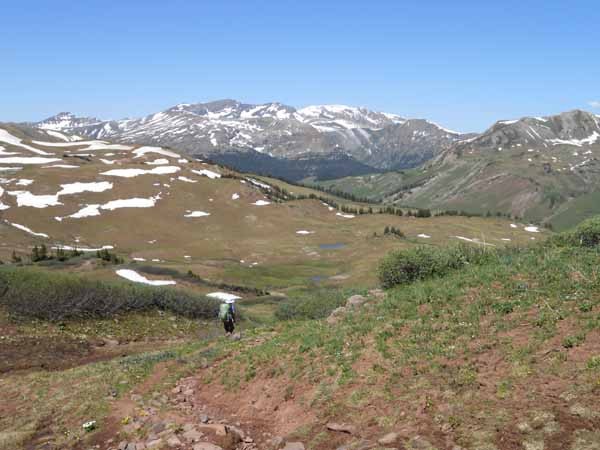 After heading down about 800 ft from West Maroon Pass, the trail contours nicely towards Frigid Air Pass. However, when we actually got closer to Frigid Air Pass, I began to feel concerned. There appears to be a cornice over the trail and I wasn't sure how we would cross it. 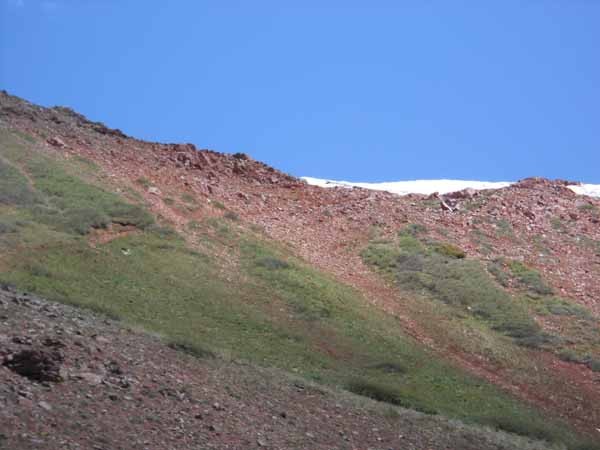 Luckily, the snow has melted enough that you can skirt the snowfield (not actually a cornice). Hard to see in the photo above, but the trail goes around the right side of the first snowfield. Going down the other side of Frigid Air Pass was not fun. The trail had alot of water running down it and some of the snowfields were steep and soft. Also, the trail kept crossing some of the same snowfields.   Given the trail conditions, we stopped alot on this segment of the trip. We had great views of South Maroon:  And were closely observed by the wildlife: 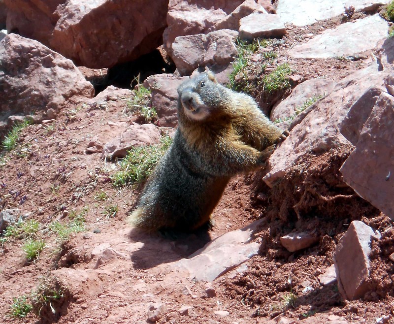 Our plan was to hike to the lowest elevation (near the trail intersection of the Hasley Basin trail and the North Fork Fravert Basin Trail) and to find a campsite in the "forest" shown on the map. The trail dropped steeply as it went past a beautiful waterfall:  We found a nice, established campsite in the valley (just before the North Fork crossing) from which we had great views: 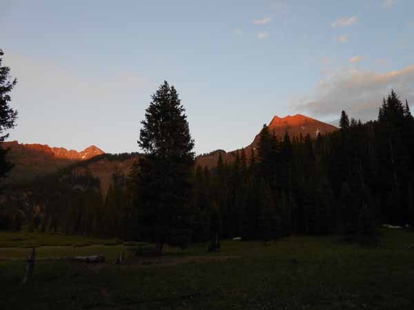  Once again, we had to start our morning with a creek crossing. The North Fork crossing wasn't that deep, but it sure was cold (Probably waded across about 6:30 am). Once on the other side, I immediately put on a spare pair of socks to warm my feet (I had learned from the West Maroon Creek crossing). We then headed up the steep North Fork cutoff trail, which was further down valley than marked on the USGS topo. There was a beautiful field of columbine (unfortunately, our feet were freezing from the creek crossing, so we couldn't stand still very long and enjoy them). 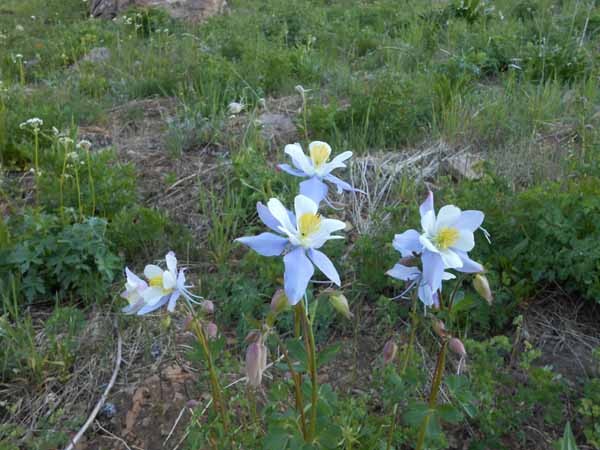 The initial part of the North Fork Cutoff Trail was quite steep, but as we got closer to Trail Rider Pass, the trail mellowed out: 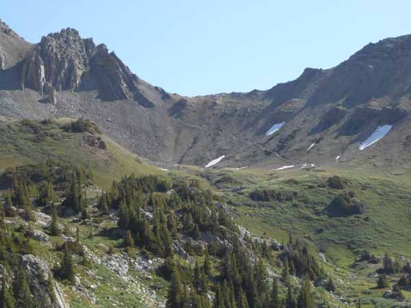 At the top of Trail Rider Pass with our first view of Snowmass Lake. The trail doesn't seem snowy yet.  However, as we hiked down the trail, we had to cross several snowfields: 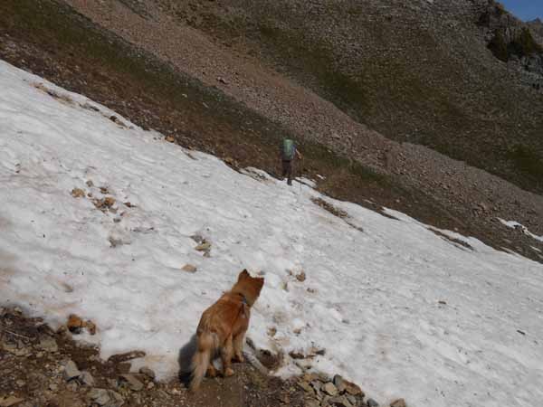 Some of the snowfields were quite steep, so it took awhile to get down to Snowmass Lake, where we stopped for lunch:  After finishing lunch, we packed up and prepared for the long hike back to the trailhead. Leo wasn't quite ready to go: 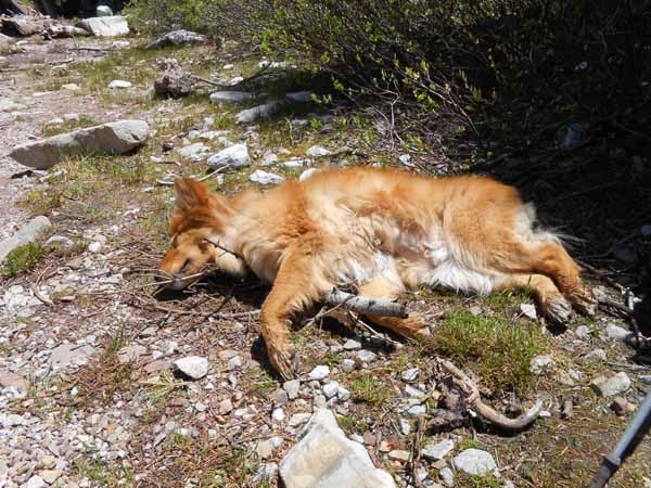 The last day was pretty rough. Although we only went over one pass (Trail Rider), we lost alot of elevation on the long hike out to the Maroon Snowmass Trailhead. The beaver dam crossing was alot easier than our prior trip to Snowmass (in late July of 2007), which was a pleasant surprise (we wore our boots across without a problem). Then, we just tried to stay focused on getting back to the trailhead... Overall, it was a great trip. The columbine were beautiful near the North Fork and also along the lower part of the Maroon Snowmass trail (near the trailhead) and will be blooming soon along other parts of the trail. The creek crossings were doable, albeit cold: I was glad to have sandals and a spare pair of socks for warming my feet afterwards. Next time, however, I plan to take a closer look at the elevation gain and loss per day prior to agreeing to a trip. Thumbnails for uploaded photos (click to open slideshow):
|
| Comments or Questions | ||||||
|---|---|---|---|---|---|---|
|
Caution: The information contained in this report may not be accurate and should not be the only resource used in preparation for your climb. Failure to have the necessary experience, physical conditioning, supplies or equipment can result in injury or death. 14ers.com and the author(s) of this report provide no warranties, either express or implied, that the information provided is accurate or reliable. By using the information provided, you agree to indemnify and hold harmless 14ers.com and the report author(s) with respect to any claims and demands against them, including any attorney fees and expenses. Please read the 14ers.com Safety and Disclaimer pages for more information.
Please respect private property: 14ers.com supports the rights of private landowners to determine how and by whom their land will be used. In Colorado, it is your responsibility to determine if land is private and to obtain the appropriate permission before entering the property.