Download Agreement, Release, and Acknowledgement of Risk:
You (the person requesting this file download) fully understand mountain climbing ("Activity") involves risks and dangers of serious bodily injury, including permanent disability, paralysis, and death ("Risks") and you fully accept and assume all such risks and all responsibility for losses, costs, and damages you incur as a result of your participation in this Activity.
You acknowledge that information in the file you have chosen to download may not be accurate and may contain errors. You agree to assume all risks when using this information and agree to release and discharge 14ers.com, 14ers Inc. and the author(s) of such information (collectively, the "Released Parties").
You hereby discharge the Released Parties from all damages, actions, claims and liabilities of any nature, specifically including, but not limited to, damages, actions, claims and liabilities arising from or related to the negligence of the Released Parties. You further agree to indemnify, hold harmless and defend 14ers.com, 14ers Inc. and each of the other Released Parties from and against any loss, damage, liability and expense, including costs and attorney fees, incurred by 14ers.com, 14ers Inc. or any of the other Released Parties as a result of you using information provided on the 14ers.com or 14ers Inc. websites.
You have read this agreement, fully understand its terms and intend it to be a complete and unconditional release of all liability to the greatest extent allowed by law and agree that if any portion of this agreement is held to be invalid the balance, notwithstanding, shall continue in full force and effect.
By clicking "OK" you agree to these terms. If you DO NOT agree, click "Cancel"...
I decided at the last minute to take Monday off in order to suffer up Lake Como Road in the dark and attempt a summit of Ellingwood Point and Blanca Peak. I left Denver at 8 p.m. on Sunday night (June 10th), drove as far up Lake Como Road as my low-clearance vehicle would take me, and started hiking up the road at 11:30 p.m. The weather was ideal, and the night views of Alamosa and the half moon in the sky kept me going.
I reached Lake Como at 3:15 a.m. The only real excitement of the hike occurred about 20 minutes later. I looked up to see a white pair of eyes about 50 yards away reflecting the light of my headlamp. The eyes were far too close together to be a deer or elk--definitely the eyes of a predator. Just as I was taking a deep breath and telling myself not to panic, the eyes awkwardly charged about 10 yards towards me for a closer look. I was quite relieved when it held up about 40 yards away and didn't keep coming. It was a bear. After a hard swallow, I watched it watch me for thirty seconds or so before it slowly circled toward my rear, watched a bit more, then walked away. I didn't bump into it again, but for the next hour I kept checking my 6 o'clock about every 5 seconds to make sure it wasn't sneaking up behind me! One thing's for sure: it definitely woke me up.
I was just below Crater Lake when it started to get light out, and I heated up some water for coffee and to prepare some dehydrated beef stew for breakfast before continuing onward.
View of Blanca from roughly 12,700 feet (just below Crater Lake).
I headed virtually straight northeast toward the low-point of the Ellingwood-Blanca connecting ridge, then veered northwest toward Ellingwood's summit. The views of Little Bear, Blanca, and the traverse between them were spectacular. The rock on Ellingwood was generally fairly solid, and it was a pretty easy Class 2+ max hike to Ellingwood's summit, which I reached at 7:30 a.m.
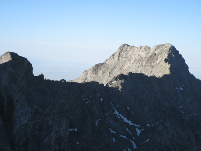
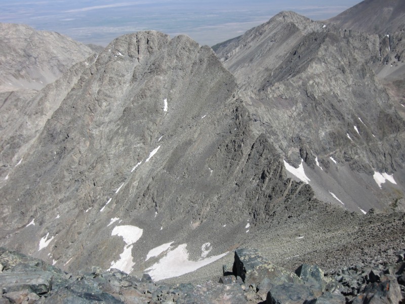
Blanca from the ridge between it and Ellingwood.
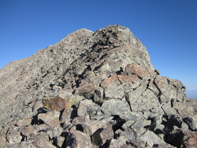
Nearing Ellingwood's summit.
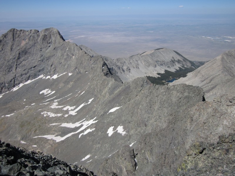
A portion of the Blanca-Little Bear traverse viewed from the north.
The summit of Little Bear from Ellingwood Point.
I spent about a half-hour on the top of Ellingwood, peering over at a group of climbers on top of Blanca. I'm not sure what route they ascended and descended, but it wasn't the standard route from Crater Lake. From Ellingwood, Blanca looked fairly intimidating, much steeper and higher than I thought it would be.
As I hiked from Ellingwood to Blanca, being awake for nearly 24 hours was starting to take its toll. I was very slow following the "High Line" route along the ridge over to Blanca, and it didn't seem that I was making any progress at all. Blanca's rock is as solid as Ellingwood's, but, either because I was tired or because it is a bit steeper, I found myself having to put my hands down for balance a lot more. I don't recall any moves that I would classify as Class 3 though, despite Gerry Roach's classification of the High Line route as such. I reached the summit of Blanca at about 10 a.m. after bumping into a couple from Taos who had reached the summit at least an hour before. I wasn't very proud of taking two hours to get from Ellingwood to Blanca, but I suppose the only one timing me was myself. Plus, I couldn't have timed my arrival any better. The couple from Taos was descending, and noone else was coming up. I could therefore enjoy some pleasant solitude and stunning views of the surrounding 14ers from my perch on Blanca.
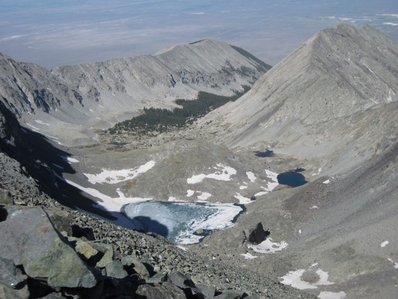
Looking into the Crater Lake basin from the Blanca-Ellingwood connecting ridge.
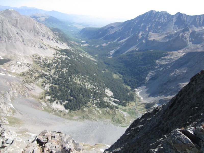
Looking northeast into the Huerfano River Valley from the ridge.
Mount Lindsey and the Iron Nipple from Blanca's summit.
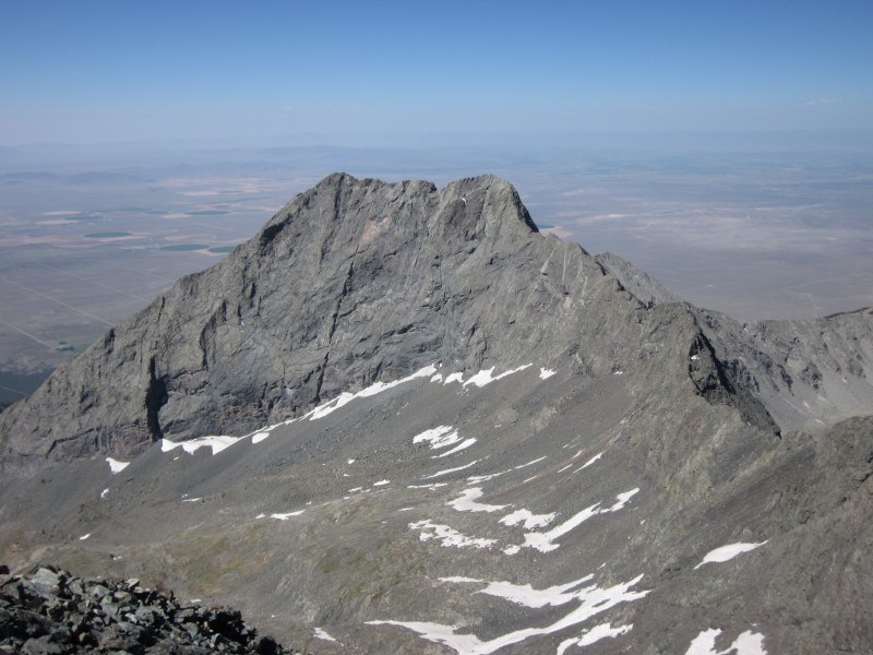
Little Bear from Blanca's summit.
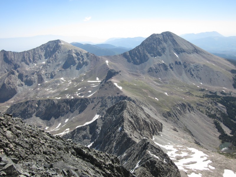
The Blanca-Little Bear traverse as seen from Blanca's summit.
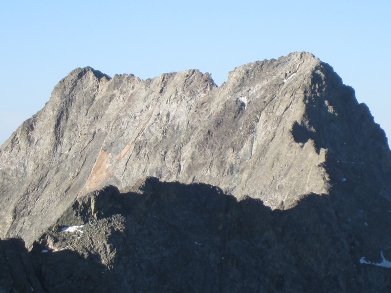
Ellingwood Point from Blanca's summit.
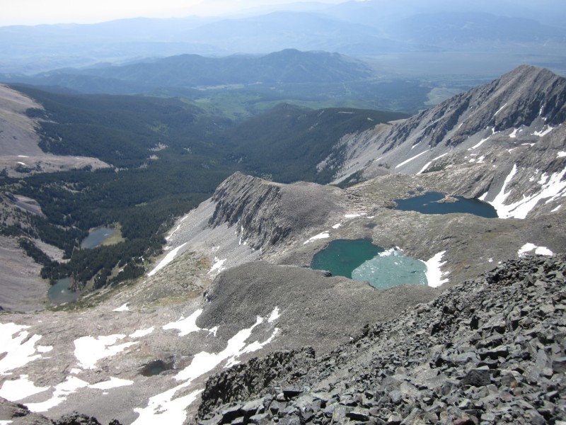
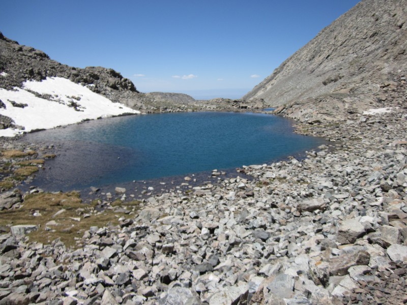
Winchell Lakes.
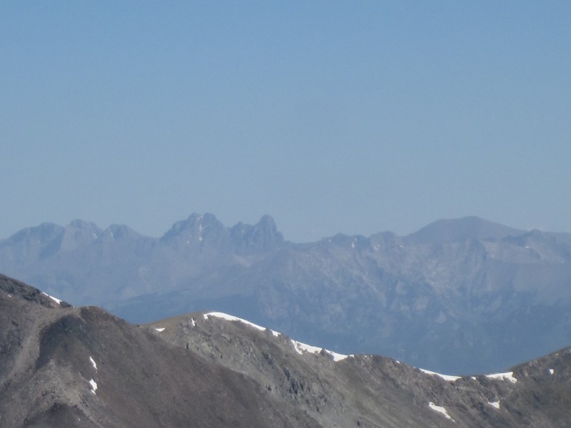
The entire Crestone Group, about 26 miles to the north of Blanca.
Other than a handful of run-ins with unstable talus, my descent from Blanca back down to Lake Como was enjoyable, particularly the views of the lakes and mountains. From Lake Como, however, the agony of Lake Como Road set in. That road just never seems to end, and it definitely seems much harder going down than going up. By the time I got back to my car at 5:30 p.m., my feet were about as sore as I think it is possible for feet to be.
All in all it was an 18 hour, 17.5 mile round trip with 6,470 feet of elevation gain. Not bad for a day's work when you are a slow hiker like me.
Upper Blue Lake.
Columbines.
Ellingwood Point from the southwest (with a little waterfall for flavor).
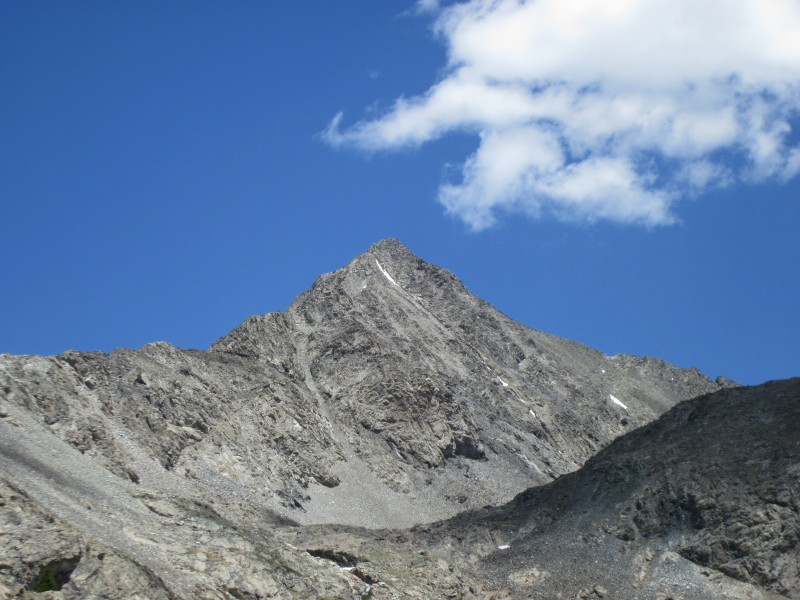
A closer view of Ellingwood.
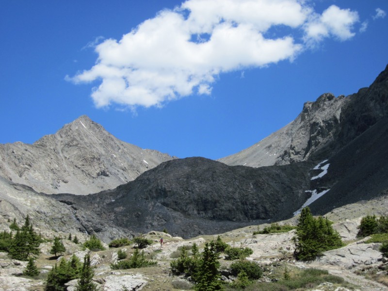
Ellingwood and Blanca.
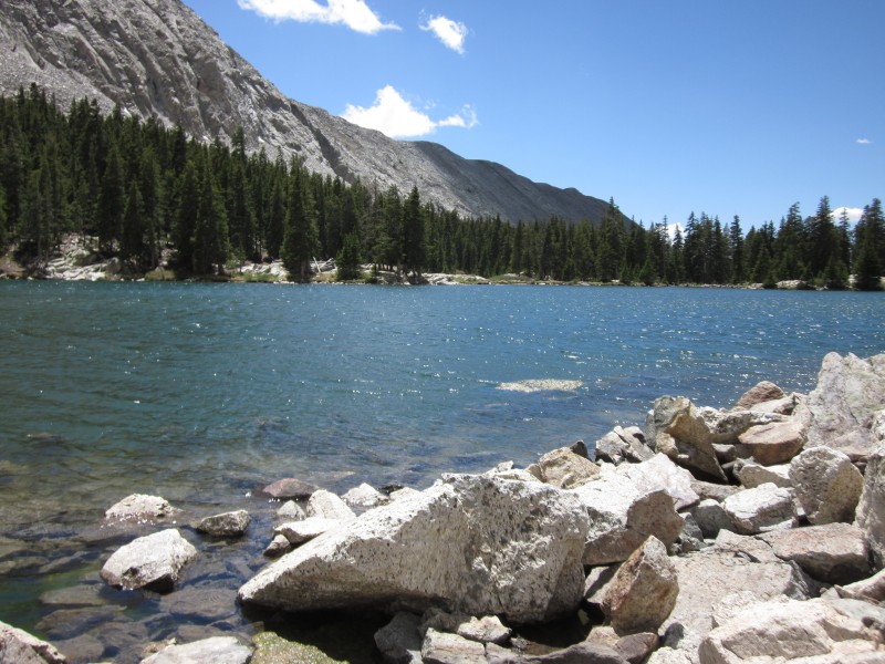
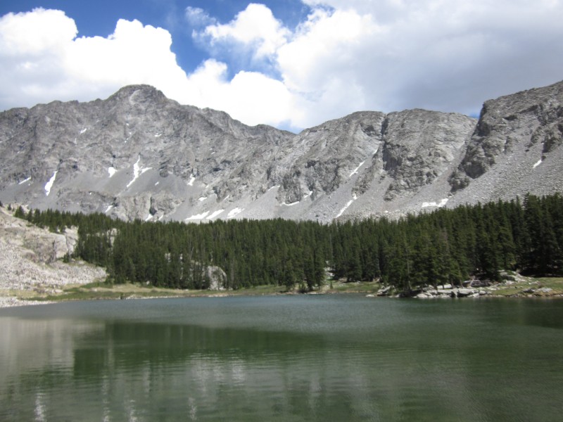
Lake Como.
Little Bear viewed from across Lake Como.
This is where descending Lake Como Road really starts to get depressing.
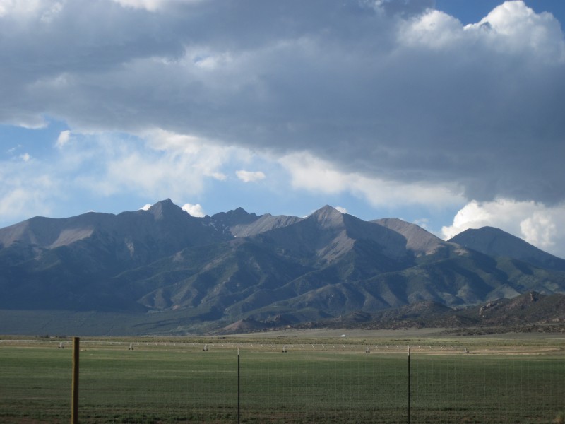
Little Bear and Blanca from Highway 160.
Thumbnails for uploaded photos (click to open slideshow):
Sounds like the bears are going to be a nuisance for campers again this year. Thanks for the update and congrats!
Caution: The information contained in this report may not be accurate and should not be the only resource used in preparation for your climb. Failure to have the necessary experience, physical conditioning, supplies or equipment can result in injury or death. 14ers.com and the author(s) of this report provide no warranties, either express or implied, that the information provided is accurate or reliable. By using the information provided, you agree to indemnify and hold harmless 14ers.com and the report author(s) with respect to any claims and demands against them, including any attorney fees and expenses. Please read the 14ers.com Safety and Disclaimer pages for more information.
Please respect private property: 14ers.com supports the rights of private landowners to determine how and by whom their land will be used. In Colorado, it is your responsibility to determine if land is private and to obtain the appropriate permission before entering the property.

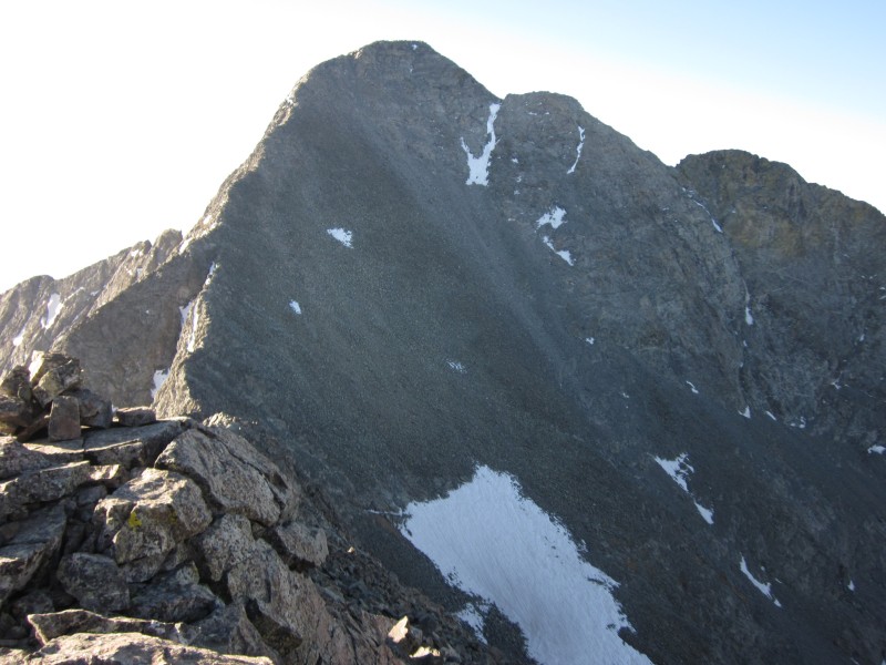


 View of Blanca from roughly 12,700 feet (just below Crater Lake).")
 A portion of the Blanca-Little Bear traverse viewed from the north.")
 The summit of Little Bear from Ellingwood Point.")
 Blanca from the ridge between it and Ellingwood.")
 Nearing Ellingwood's summit.")
 Looking into the Crater Lake basin from the Blanca-Ellingwood connecting ridge.")
 Looking northeast into the Huerfano River Valley from the ridge.")
 Mount Lindsey and the Iron Nipple from Blanca's summit.")
 Little Bear from Blanca's summit.")
 Ellingwood Point from Blanca's summit.")
 The Blanca-Little Bear traverse as seen from Blanca's summit.")
 The entire Crestone Group, about 26 miles to the north of Blanca.")
 Winchell Lakes.")
 Upper Blue Lake.")
 Columbines.")
 Ellingwood Point from the southwest (with a little waterfall for flavor).")
 A closer view of Ellingwood.")
 Ellingwood and Blanca.")
 Lake Como.")
 Little Bear viewed from across Lake Como.")
 This is where descending Lake Como Road really starts to get depressing.")
 Little Bear and Blanca from Highway 160.")


