Download Agreement, Release, and Acknowledgement of Risk:
You (the person requesting this file download) fully understand mountain climbing ("Activity") involves risks and dangers of serious bodily injury, including permanent disability, paralysis, and death ("Risks") and you fully accept and assume all such risks and all responsibility for losses, costs, and damages you incur as a result of your participation in this Activity.
You acknowledge that information in the file you have chosen to download may not be accurate and may contain errors. You agree to assume all risks when using this information and agree to release and discharge 14ers.com, 14ers Inc. and the author(s) of such information (collectively, the "Released Parties").
You hereby discharge the Released Parties from all damages, actions, claims and liabilities of any nature, specifically including, but not limited to, damages, actions, claims and liabilities arising from or related to the negligence of the Released Parties. You further agree to indemnify, hold harmless and defend 14ers.com, 14ers Inc. and each of the other Released Parties from and against any loss, damage, liability and expense, including costs and attorney fees, incurred by 14ers.com, 14ers Inc. or any of the other Released Parties as a result of you using information provided on the 14ers.com or 14ers Inc. websites.
You have read this agreement, fully understand its terms and intend it to be a complete and unconditional release of all liability to the greatest extent allowed by law and agree that if any portion of this agreement is held to be invalid the balance, notwithstanding, shall continue in full force and effect.
By clicking "OK" you agree to these terms. If you DO NOT agree, click "Cancel"...
Location: Rocky Mountain National Park Date: June 8, 2012 Hikers/Skiers: Alan (clemsonmtneer), Sarah (sstratta) Ascent Route: Flattop Mountain Trail to Hallet Peak Descent Route: Tyndall Glacier to Tyndall Gorge
I wanted to get one last spring ski descent in this year before hanging the skis up for the season and moving on to summer activities for good. My goal this spring was to make it until June, and while in a normal year that isn't hard to accomplish, I knew that this spring it would take more effort with the early June snowpack resembling more what you'd expect to find in mid July.
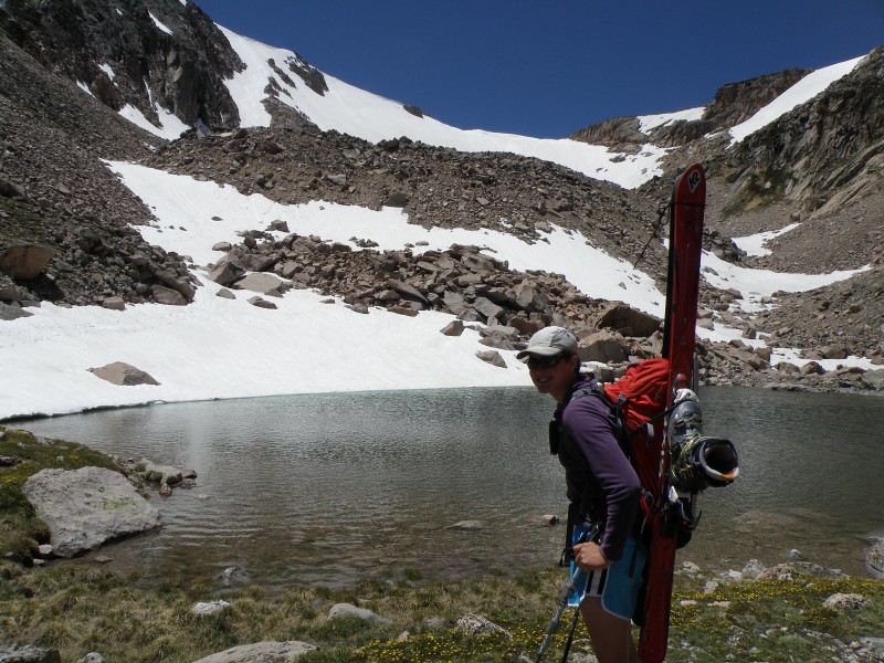
I figured Rocky Mountain National Park would be a good place to go for some summer snow, since areas of the park tend to hold snow later into the year (i.e. they have "glaciers"). The scenery isn't too bad in the park either. Sarah also wanted to ski, so she joined me and we met at the Bear Lake Trailhead on beautiful Friday morning, with no clouds in the sky and mild temps. It was shorts, t-shirt, and trail-runner conditions for the hike up, which was kind of nice.
We began hiking a little before 7 a.m., with our goal to hike to the top of Flattop Mountain (about 4 miles and 3,000 ft elevation gain on a well-used trail) and then find something to ski from there. Most of the trail was dry, so we were able to make pretty good time on the hike up considering our heavy packs. There were still several snow crossings below treeline, but the trail is heavily traveled enough that the snow was packed down well and not a problem at all to cross in trail runners. We didn't posthole a single time.
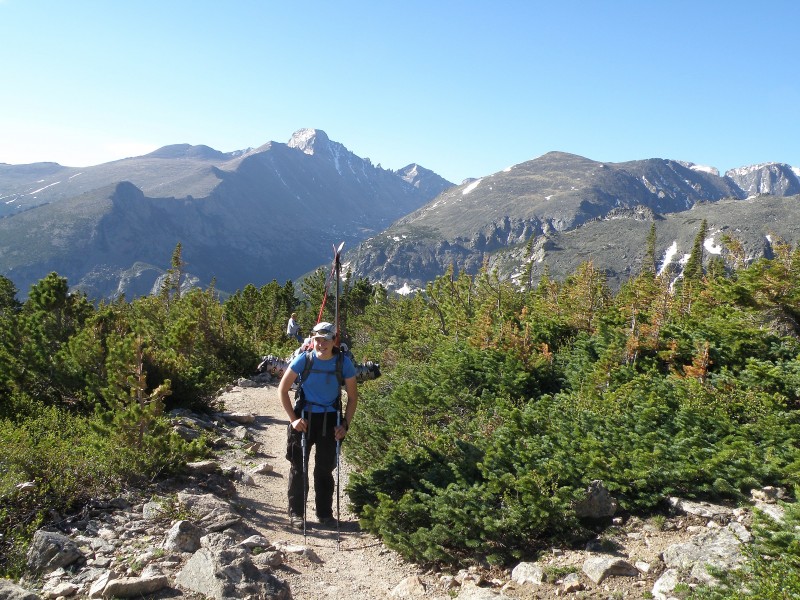
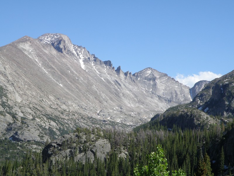
Sarah with Longs in the background
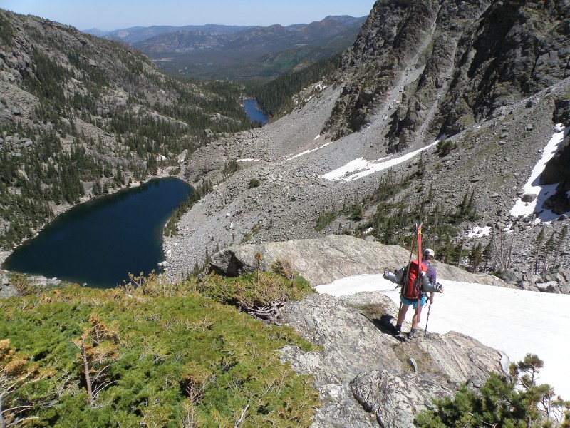
Looking into Tyndall Gorge, about halfway up the trail
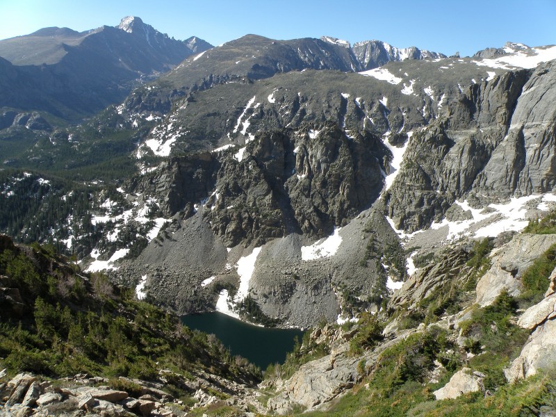
Emerald Lake and Longs Peak
Close-up of Emerald Lake
We had originally considered skiing the Ptarmigan Headwall or Ptarmigan Glacier, but once we saw the area, we changed our plans. Granted we couldn't see the whole Ptarmigan Headwall area, but what we could see didn't look good at all.
Ptarmigan Glacier/Headwall area - where's the snow??
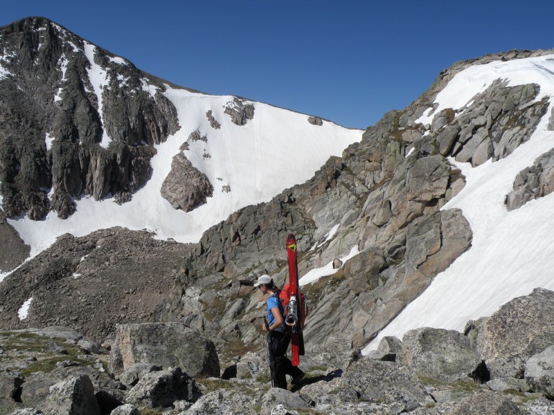
Instead, I suddenly remembered hearing that the Tyndall Glacier, between Flattop Mountain and Hallet Peak, typically offers good skiing well into the summer. We hiked farther up until we could get a view from just below the Flattop Mountain summit, and sure enough it was in and looked great! We ultimately ended up skiing the couloir on the left side of the glacier, seen in the pic below.
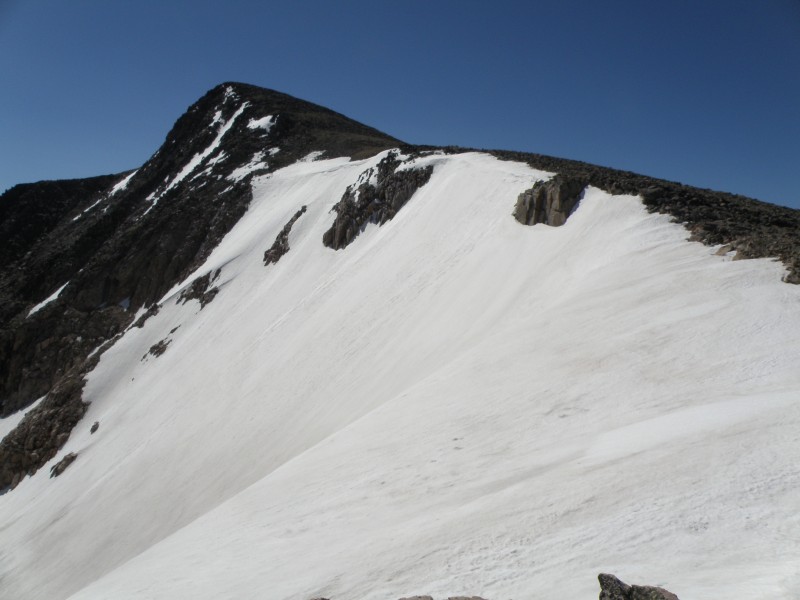
Hallet Peak and Tyndall Glacier... we skied the couloir on the left side of the glacier
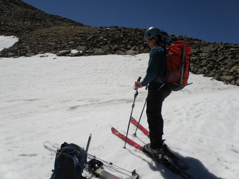
We reached the summit of Flattop around 10 am, then headed over to the glacier to check out the snow conditions. The snow was still good, softening but not too soft, so we dropped our ski equipment at the top of the far side of the glacier (the steeper side that we intended to ski), then quickly hiked up to the summit of Hallet Peak.
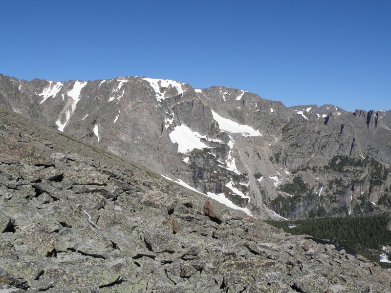
The mellower side of Tyndall Glacier
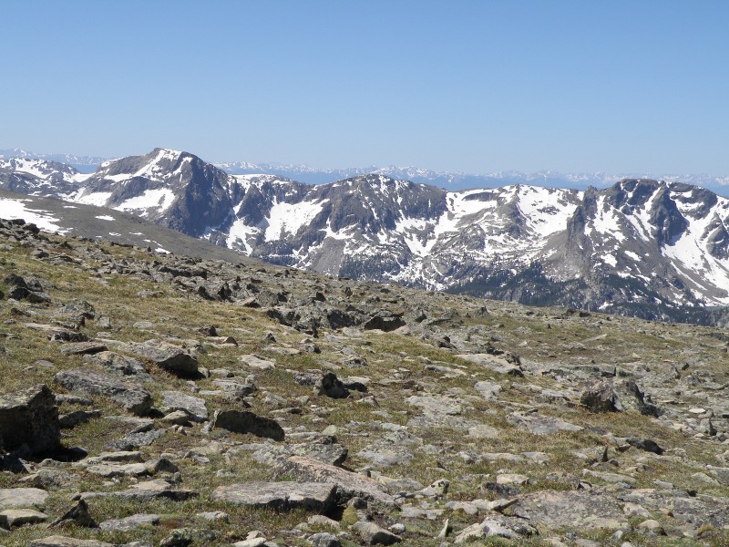
More spectacular RMNP scenery
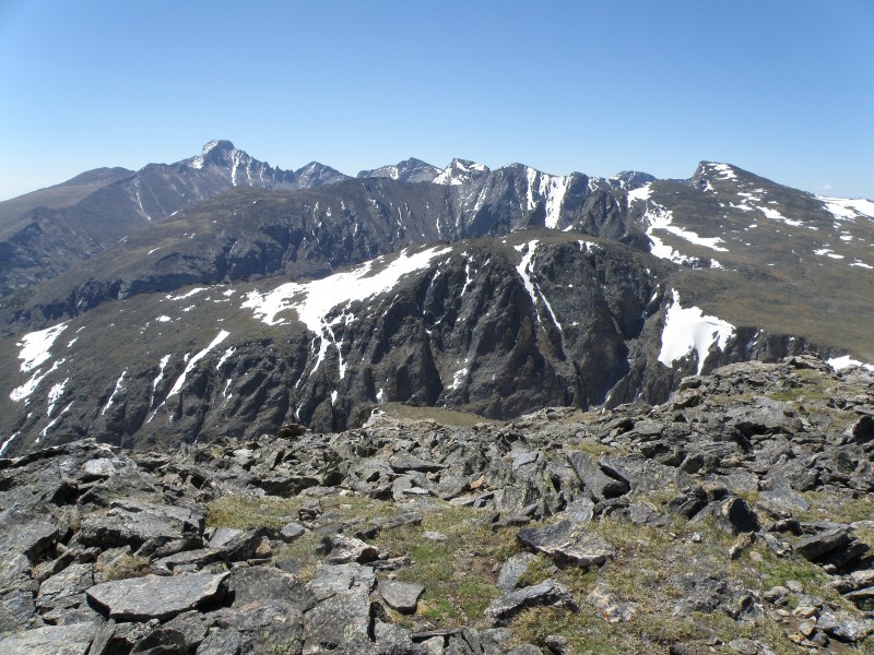
View from the summit of Hallet Peak... Taylor Glacier (right of center) looks pretty intense!
After our quick detour to Hallet Peak, we hiked back down to our ski gear, glad to see that the marmots hadn't tried to mess with our stuff, and then it was time to ski.
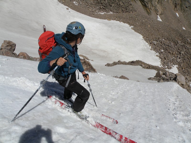
Sarah at the top of the glacier
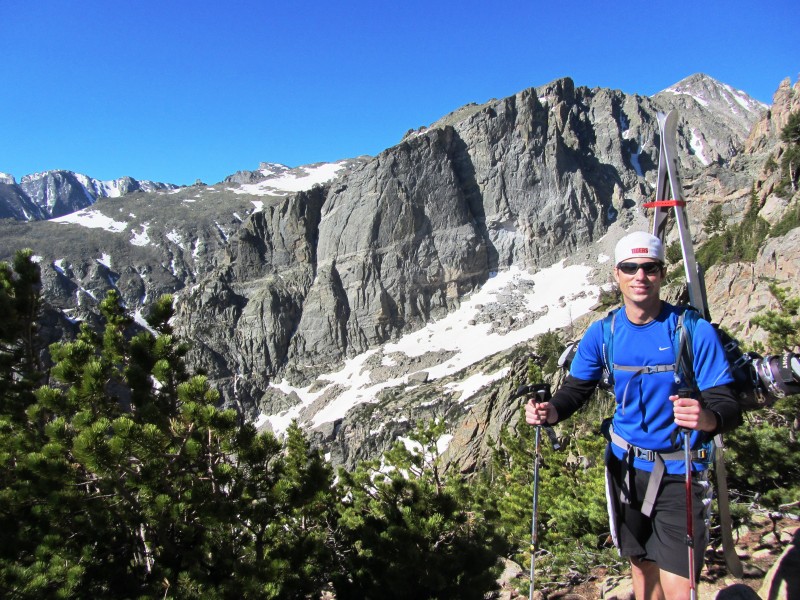
I love skiing in shorts!
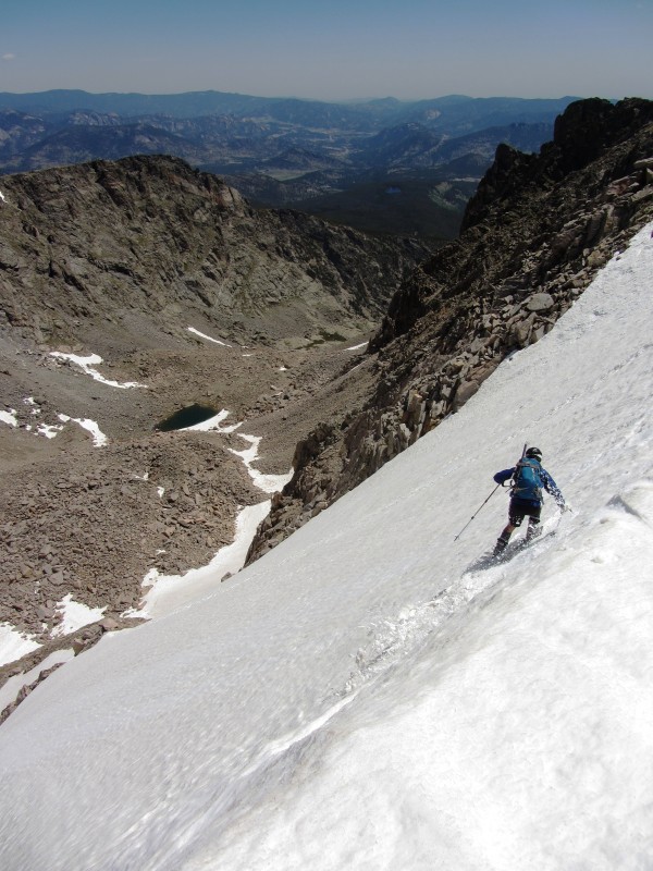
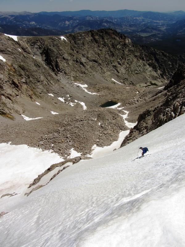
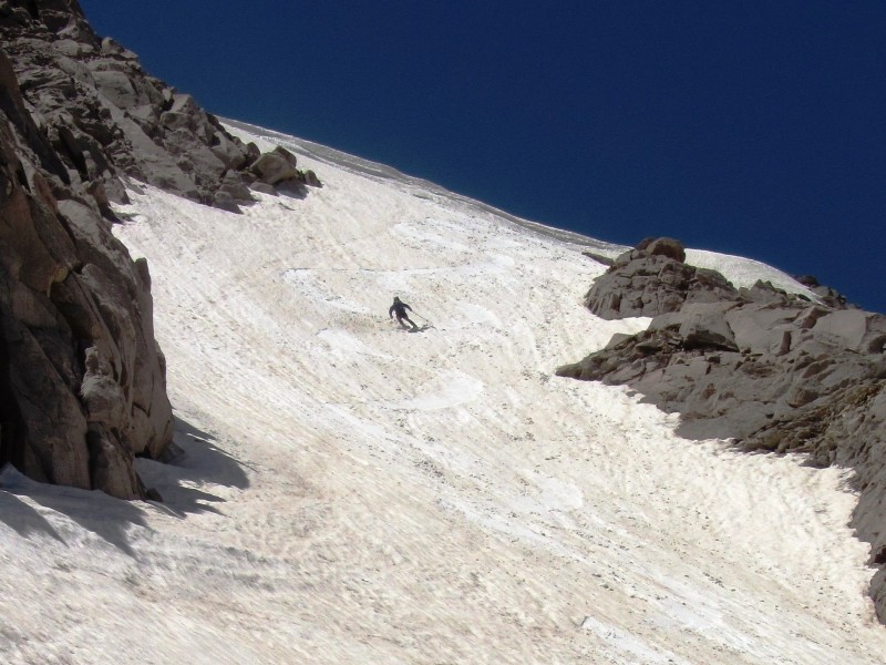
The snow ended up being in great condition (nice and soft), and the skiing was steep. According to some beta I found on summitpost, the side of the glacier we skied was 50 degrees, and the pitch seemed pretty consistent the whole way. We skied the top part of the glacier down to a rock band, from which point we entered the couloir on skier's right. This whole line was a blast to ski, one of the better spring (or in this case summer) ski descents I've had, and definitely the steepest.
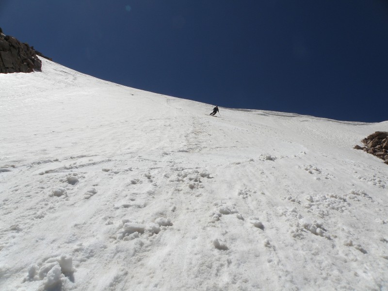
Dropping in from the top
Sarah dropping in
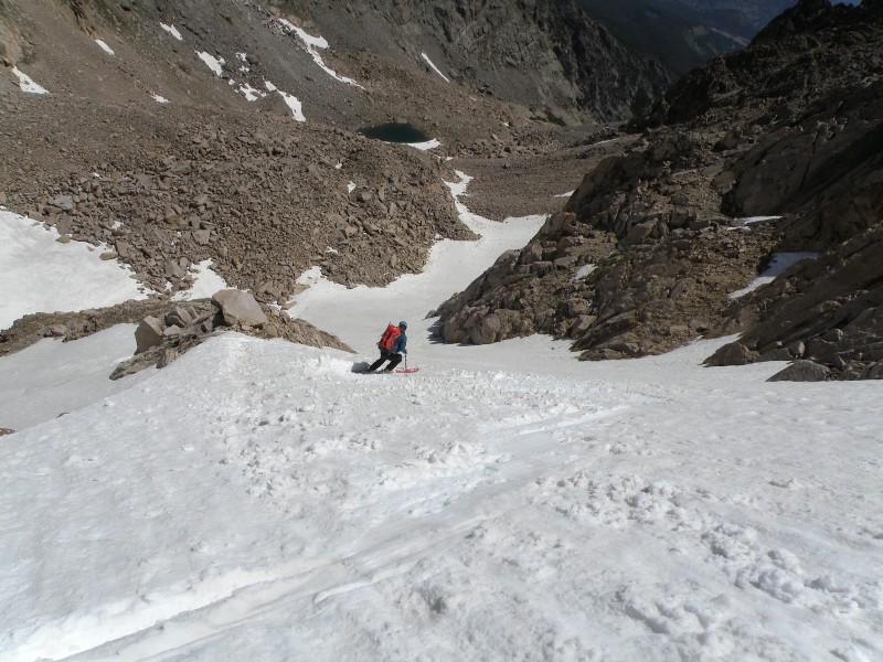
From here we dropped into the couloir on skier's right.
Looking back up at our line
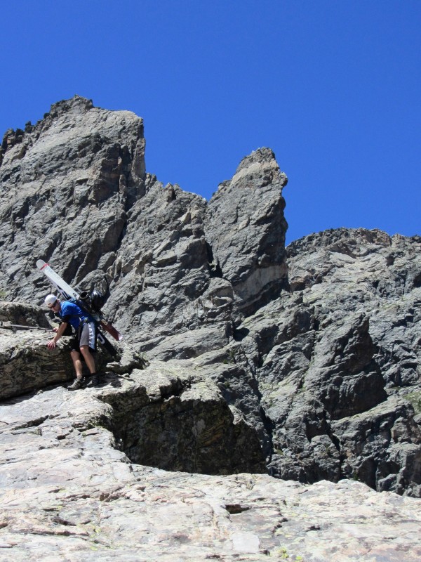
After skiing the couloir we ran out of continuous snow pretty quickly and had to switch back over to summer travel. I figured it would be a fairly short scramble down Tyndall Gorge to Emerald Lake, where we'd run into a hiking trail to take us back to Bear Lake. Boy was I wrong. The hike/scramble/whatever the hell you want to call it down to Emerald Lake was brutal, and by far the hardest part of the day. It wasn't so bad at first, just some mellow boulder hopping, but it got worse the farther down the valley we went. At least the scenery was still good, though.
Sarah in front of a small tarn below the glacier
Descending Tyndall Gorge involved downclimbing some rocky sections, which would normally be fun, but was difficult and time-consuming with ski gear on our backs. It also involved some bushwhacking, avoiding snowfields (since we were in trail runners), and loose scree toward the bottom. Eventually we came to an overlook with an awesome view of Emerald Lake below.
Emerald Lake... looks so close, but was such a pain in the ass to get to!
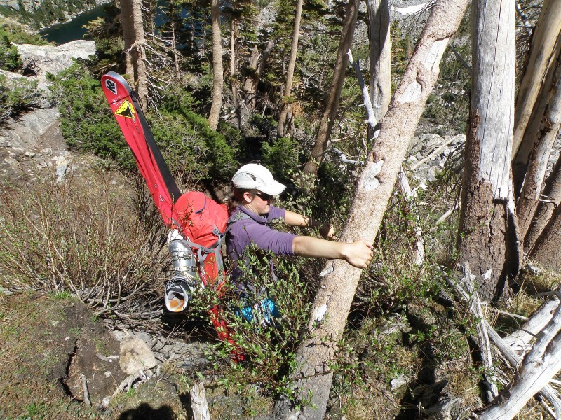
This next part was tough, we would descend to an area that looked good, only to find that snow was blocking our paths, so we had to climb back up... I actually take that back, I had to climb back up. Sarah was a badass and crossed the snow no problem in her trail shoes, but I kept slipping and busting my ass, so I got to the point where I avoided it whenever possible, even if it meant climbing back up, bushwhacking and finding a new route. It was quite the adventure!
Turns out downclimbing is more difficult with ski gear on your back... imagine that
Bushwhacking fun
We finally made it to Emerald Lake at 3:30 in the afternoon (yes it took that long), and then took a long, well-deserved break in the beautiful weather. The hike out from there was easy, and with it being a popular trail, we got plenty of funny looks/reactions from tourists for having skis on our backs.
This ended up being an awesome day in a beautiful area, even in spite of the hike down Tyndall Gorge which was hellacious at times. The ski descent was a fantastic way to cap off the season... icing on the cake if you will, to a ski season that had some good spring days, but of course will be remembered for all the wrong reasons.
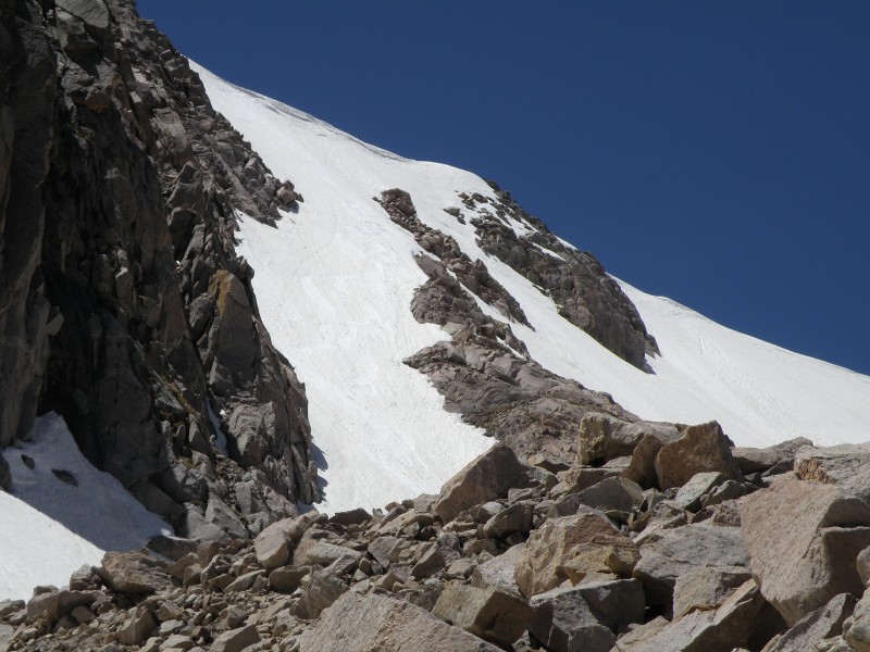
I would say to anyone looking to ski Tyndall Glacier, to either climb back up the looker's right (skier's left) side of the glacier, which is much more mellow at about 35 degrees, and hike back down the Flattop Mountain Trail... or if gear and/or snow conditions don't allow for a re-ascent of the glacier, to stay high on the right side of Emerald Lake when hiking back down. Most of the Tyndall Gorge descend is fairly straight forward, but the steep part above the lake, you need to stay on the far right side high in the boulderfield, and wait to descend until you get to the far shore of the lake.
Tyndall Gorge is still in good condition for skiing and/or climbing for those still looking for some snow, at least for a little while longer.
A couple of parting shots...
Emerald Lake
Longs Peak and Glacier Gorge
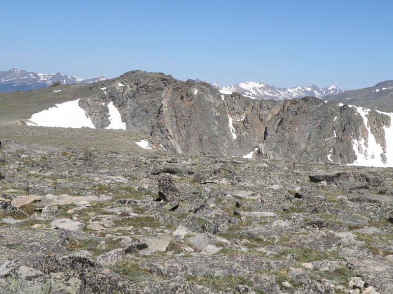
One more pic of Mt. Cumulus and the Never Summers...
Thumbnails for uploaded photos (click to open slideshow):
Thanks for the ski stoke. I was hoping that Ptarmigan would be good this year But I guess not. You didn't get a good look at Cumulus did you? I Know that sucker holds snow long time. Thanks again for the ski stoke, I think I got my last day in on Sunday on Grizzly Couloir.
davey rocket, unfortunately I didn't get any better views of the Notchtop area... we actually ventured off the trail a little ways to get a view of that areas. It did still look like there was some snow in the gullies, but definitely less than I expected. Sorry I can't give you any better info.
EatinHardtrack, if the peak I was looking at in the Never Summers is in fact Mt. Cumulus then it is still in and looks pretty good, all things considering. That's a peak that's been on my list as well, and I remember thinking it looked pretty sweet from Flattop. I added a pic of the view we had at the bottom of the report. Thanks for the comment, and awesome you skied the Grizzly Couloir... that's a fun looking line.
Congrats on the skiing this late in a lousy season. I am disappoined about Ptarmigan glacier. I was thinking about heading up there this weekend. From the road just inside RMNP, it looks like it still maybe fairly filled in.
Benners, thanks for the comment, the awesome setting definitely made the long hike with ski gear worth it!
Don, I wouldn't give up on Ptarmigan completely yet. We didn't have a good view of the entire headwall/glacier area from the Flattop Trail, and I admittedly wasn't familiar with that specific area to begin with. So it could be in much better condition than what we thought at the time, especially since you already got a good look at it.
Other than Image#5 did you happen to get any other pics of Notchtop spire, specifically the climbers descent gully just to the west of the spire? Looks like it's still holding a bit of snow?
Caution: The information contained in this report may not be accurate and should not be the only resource used in preparation for your climb. Failure to have the necessary experience, physical conditioning, supplies or equipment can result in injury or death. 14ers.com and the author(s) of this report provide no warranties, either express or implied, that the information provided is accurate or reliable. By using the information provided, you agree to indemnify and hold harmless 14ers.com and the report author(s) with respect to any claims and demands against them, including any attorney fees and expenses. Please read the 14ers.com Safety and Disclaimer pages for more information.
Please respect private property: 14ers.com supports the rights of private landowners to determine how and by whom their land will be used. In Colorado, it is your responsibility to determine if land is private and to obtain the appropriate permission before entering the property.