Download Agreement, Release, and Acknowledgement of Risk:
You (the person requesting this file download) fully understand mountain climbing ("Activity") involves risks and dangers of serious bodily injury, including permanent disability, paralysis, and death ("Risks") and you fully accept and assume all such risks and all responsibility for losses, costs, and damages you incur as a result of your participation in this Activity.
You acknowledge that information in the file you have chosen to download may not be accurate and may contain errors. You agree to assume all risks when using this information and agree to release and discharge 14ers.com, 14ers Inc. and the author(s) of such information (collectively, the "Released Parties").
You hereby discharge the Released Parties from all damages, actions, claims and liabilities of any nature, specifically including, but not limited to, damages, actions, claims and liabilities arising from or related to the negligence of the Released Parties. You further agree to indemnify, hold harmless and defend 14ers.com, 14ers Inc. and each of the other Released Parties from and against any loss, damage, liability and expense, including costs and attorney fees, incurred by 14ers.com, 14ers Inc. or any of the other Released Parties as a result of you using information provided on the 14ers.com or 14ers Inc. websites.
You have read this agreement, fully understand its terms and intend it to be a complete and unconditional release of all liability to the greatest extent allowed by law and agree that if any portion of this agreement is held to be invalid the balance, notwithstanding, shall continue in full force and effect.
By clicking "OK" you agree to these terms. If you DO NOT agree, click "Cancel"...
Trailhead: Cebolla
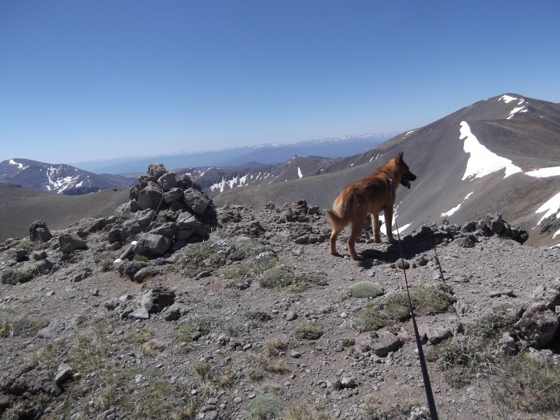
Participants: Me and Lily (canine companion)
Mileage: 11.5 mi
RT time: 8:20
Been looking at these peaks for quite awhile and with my daughter on vacation with her dad, I opted to take a couple days off work and head down there with the dog. I have only done one peak solo before...and that really didn't count. It was Mt Princeton, and there were at least 10 other people nearby at anytime. So, I wanted to try a solo trip to see how I did.
I packed up the car, loaded the dog, and headed off towards Hwy 114 on Tuesday afternoon. I had mapped out the drive to the TH on my GPS so, it all went smoothly (the road names are definitely labeled different than descriptions I read) and we arrived at the TH at 7:30p (5 hrs from my house). I must say, I am quite impressed by the road maintenance on these obscure roads...VERY smooth.
As we neared the TH and got further from any human inhabitants, I began to stress a bit...realizing that if anything happened to my dog, the car, or me that we were a long way from help. I was prepared for some emergencies had: tools, fix-a-flat, an air compressor, duct tape, extra food and water, and a first aid kit. I had left a detailed itinerary with 2 people for a 2 night, 2 day hiking trip and provided phone numbers and instructions on what to do if they didn't hear from me by a certain time; plus I had a SPOT locator. However, given certain situations, those efforts might not be enough.
My dog was anxious to stretch her legs so, we hiked around for nearly an hour. The area was beautiful, but as the sun was setting, the solitude continued to engage my imagination. Madge came up with all sorts of scenarios...everything from a dead battery, to me having an aneurysm and Lily being trapped in the car for several days before anyone found her, to (of course) encountering the (yet to be discovered) Cebolla TH Serial Killer and his sidekick.
Then I remembered some advice Otina had posted...make your first solo trip close to home and near civilization. Ah, I get it now....
Sleep eventually came and after a restful night sans coma inducing medical issues or any dismembering of the kind, the alarm went off. I did some quick cipherin' in my head and decided we could sleep in an hour later. After alarm #2 went off, I got up (much to Lily's delight) and hooked her up on a 20' lead near the creek where she enjoyed smelling all the animal scents while I got our gear together.
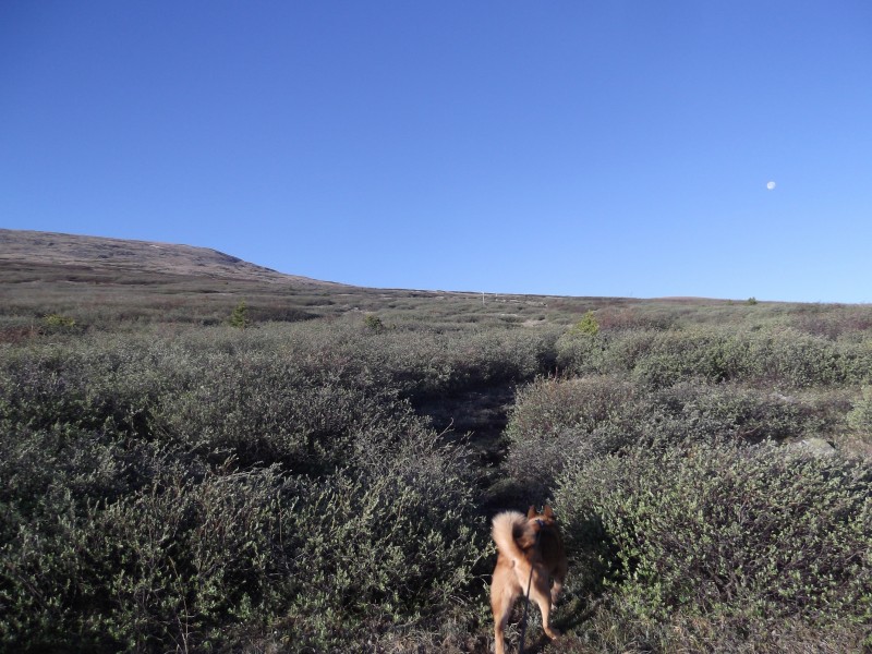
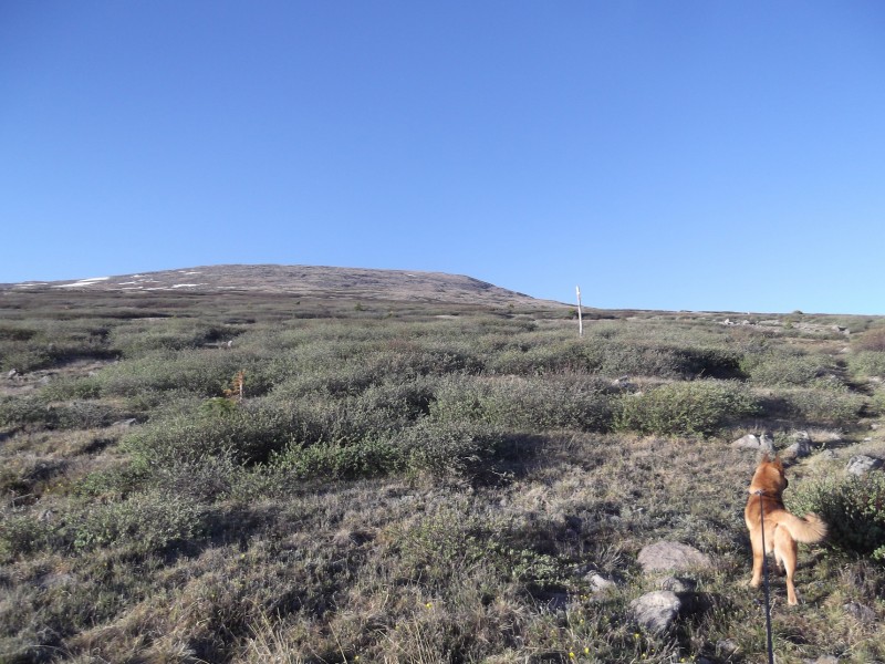
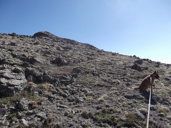
At 5:50a we were off and the "what if" game from the night before, was left behind. After what seemed like no time we were at treeline and looking at the willows. The trail is marked with poles through the willows, but sometimes they are obscured by a rebellious evergreen. Overall, the willows weren't bad. I lost the trail a couple of times, but there were paths to get through. Willow trail post
As we ascended the gentle tundra to Baldy Chato, I suddenly wasn't feeling very good and gaining the least bit of elevation was surprisingly hard. I thought, "Great, after all this effort, I'm going to have to stop after 1 short peak? What the heck?" I literally felt better ascending Thunder Pyramid 2 weeks prior and this was a gentle tundra slope. I pressed on as Lily constantly pulled on her leash, excited by all the scents in the area. Making our way to Baldy Chato's summit. Can you believe I had a hard time on this slope?
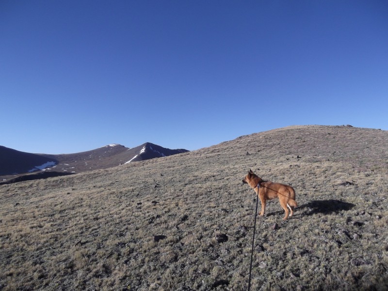
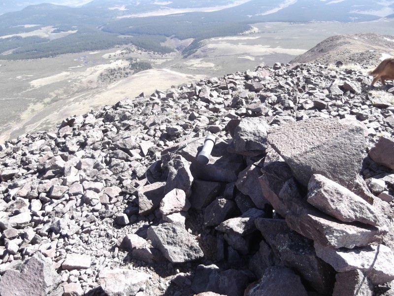
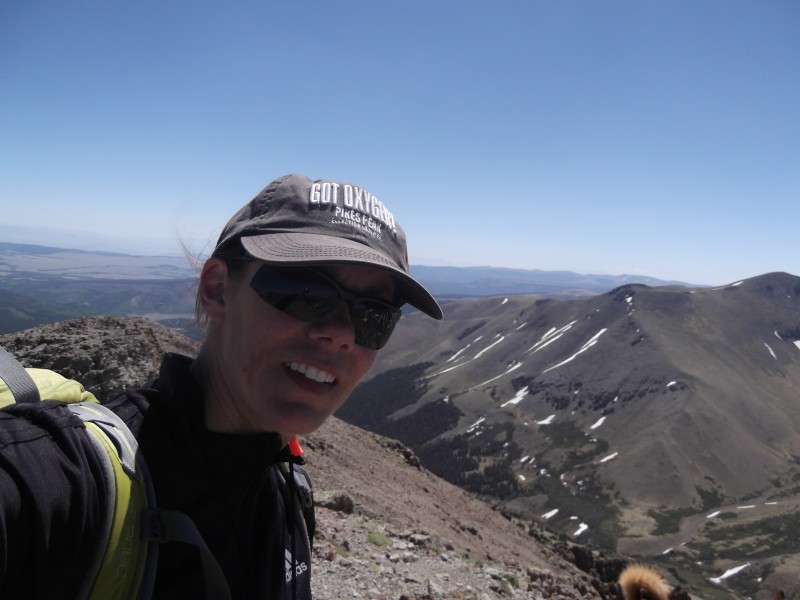
We made the summit of Baldy Chato at 7:35a. I gave Lily food and water, signed the register, took a few pictures, and ate a little something. I decided to head over to Column Ridge and see how I felt. Left the summit at 7:44a. Baldy Chato's summit cairn and register jarLooking ahead to Column Ridge (center pointy peak) and Stewart Peak to the left
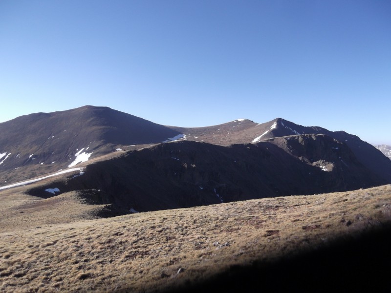
I felt MUCH better heading over to Column Ridge and was thoroughly enjoying the views and the crisp morning. Once I hit the ascent portion, I again felt terrible and struggled to gain the summit. Arrived at the summit of Column Ridge at 8:29a. Fed and watered the dog, took a few pictures, signed the register below Steve Gladbach, and departed at 8:40a. Ascending Column RidgeSummit with El Pinto register jar.
Since it seemed that I only felt bad on the ascents, I opted to try to for the remaining peaks. The trek over to Stewart Peak was pretty much the same. More pulling by Lily, but still loved the views and felt great on the hike over to the grassy saddle. Aaand, the ascent portion to the summit proved to be another struggle. Arrived on the summit of Stewart at 9:20a. Took pics, signed, ate, fed Lily, and departed at 9:30a. Ascending Stewart Peak, Lily gets impatient with my speedSummit register of Stewart Peak
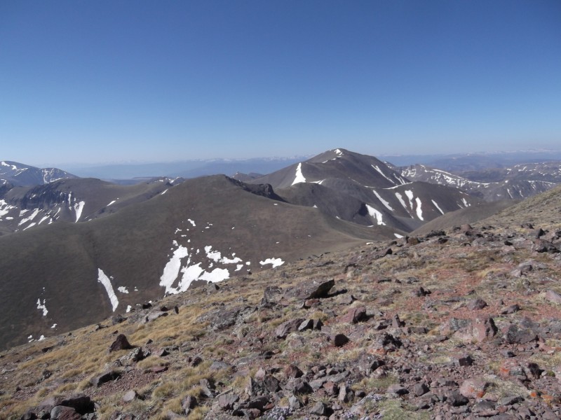
I looked at Baldy Alto and tried to decide what would be the best line over. Stay high on the ridge? Which had some ups and downs and talus...or drop into the basin and ascend the gentle grassy slopes to the saddle, but contend with side hilling and more elevation loss? Both had their merits. I opted to stay on the ridge. View towards Baldy Alto and San Luis
While descending Stewart Peak, my dog scared up a baby elk. I felt terrible, but man those guys blend well. Had I seen it, I would have taken my dog another way. He/she didn't run off until my dog was literally 1 foot from it. My dog went nuts and made a huge ruckus, I pulled her back immediately and hoped the little guy would find his mommy. He ran around a pile of rocks and I didn't see him anymore. My dog, was now even more pumped up on adrenaline and pulling with the force of a dog twice her weight. ARGH!
We headed back to the Column Ridge/Stewart saddle and ascended up to the ridge to take us towards Baldy Alto. While ascending the ridge, Lily spied another elk ~1/4 mi or so below us, booking it down Nutras Creek...despite the elk being a dot (and rapidly getting smaller), she again went nuts. Making an obnoxious amount of noise and pulling on her leash so hard, that she knocked me down.
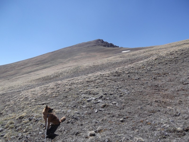
We made our way to the ridge and crossed much talus and made the descent down to the saddle, just before Baldy Alto. Again, I struggled on the ascent to the summit of Baldy Alto, but this time, I felt much worse than the others. Every step was hard. I was only 0.1 mi from the summit and I seriously considered turning around. I kept trying to convince my body that 0.1 mi was infinitely closer than coming back on another day and having 4-5 mi (one way) to this peak. All I knew was that I felt like crap and that going up was really difficult. After stopping every 5-10 steps, and annoying the heck out of Lily (who just sat down and looked at me with an, "oh please" look), I eventually made it...yay! Arrived at the summit at 11a. Nearing the summit of Baldy AltoSummit of Baldy AltoSelf portrait, with tail of dog.
I repeated the same ritual as on the other peaks and then gratefully headed down. This time I opted to skirt the ridge and its talus, trying to maintain an elevation of 13,000 and head towards the Stewart/Column Ridge saddle. There was much side hilling, but it worked out nicely. However, the 500' of elevation gain back to the saddle was (yet again) difficult for me. I really wanted to stop, but this time it wasn't an option. The car, dead battery, and serial killer were all that way. Looking down Nutras Creek basin
So, with many stops, I eventually crested the saddle and was thrilled, knowing I would have little elevation gain betwixt me and the car. I skirted the ridge line towards Baldy Chato and made my way back to the poled willows. Found the trail, made treeline, and was back at my car in no time.
As I neared the TH, I heard an ATV stop and then head on past. I got back to the TH and tied off my dog near the creek so she could cool her little feet and enjoy the water from a mountain stream while I packed up the car. While packing, a Forest Service truck drove slowly by and a little while later, I saw another ATV heading up (and this was a Wednesday). I guess this area sees more activity than I realized and my dog would have been rescued sooner than I thought.
My original plan was to next drive over to the Eddiesville Trailhead and take the Canon Hondo trail up towards Organ Mountain Thursday morning, but I decided to head home instead. With the way I felt on the ascents (still have no idea what my issue was) and my patience being tested by Lily's constant pulling for over 11 miles, I decided that heading home was probably the better way to go.
Poor Lily, she was not tired at all and did not want to be shoved back in the car for 5 hours. So, we stopped along the Arkansas river a couple of times and walked around to break up the drive for her. Don't wash your car before heading up these roads. Lily finally took a short nap on the ride home
Overall, I am glad that I took this trip solo. I enjoyed the hike and felt very well prepared for emergencies. Next trip, I probably will stay where there are people closer by, but I will also be back for Organ and a few others.
My GPS Tracks on Google Maps (made from a .GPX file upload):
Hey Valerie, way to overcome your fears of a dead battery's, aneurysms, and serial killers.! (Lily certainly didn't look to worried about those things.)
I did practically that same hike solo last summer and really enjoyed it.
I guess that's a popular trail. I did it last summer as well - except did Column Ridge and Baldy Chato on the return. AND I did the Canon Hondo route on Organ the next day, too. You really should go back for that. I thought it was great!
It is surprising (as I'm learning), just how many people have done and do this route. Hope everyone enjoyed their trips as well. Will certainly go back for Organ and 1 or 2 others on the Canon Hondo Trail. Hope everyone had a great weekend!
Congrats on your first real solo! 6/11/2012 10:49pm
I hear ya on the crazy thoughts while trying to sleep the night before. I have them from time to time, even now. At least you have a dog to warn you of the ”serial killer” :lol:
Hope the next solo goes even smoother!
Caution: The information contained in this report may not be accurate and should not be the only resource used in preparation for your climb. Failure to have the necessary experience, physical conditioning, supplies or equipment can result in injury or death. 14ers.com and the author(s) of this report provide no warranties, either express or implied, that the information provided is accurate or reliable. By using the information provided, you agree to indemnify and hold harmless 14ers.com and the report author(s) with respect to any claims and demands against them, including any attorney fees and expenses. Please read the 14ers.com Safety and Disclaimer pages for more information.
Please respect private property: 14ers.com supports the rights of private landowners to determine how and by whom their land will be used. In Colorado, it is your responsibility to determine if land is private and to obtain the appropriate permission before entering the property.