Download Agreement, Release, and Acknowledgement of Risk:
You (the person requesting this file download) fully understand mountain climbing ("Activity") involves risks and dangers of serious bodily injury, including permanent disability, paralysis, and death ("Risks") and you fully accept and assume all such risks and all responsibility for losses, costs, and damages you incur as a result of your participation in this Activity.
You acknowledge that information in the file you have chosen to download may not be accurate and may contain errors. You agree to assume all risks when using this information and agree to release and discharge 14ers.com, 14ers Inc. and the author(s) of such information (collectively, the "Released Parties").
You hereby discharge the Released Parties from all damages, actions, claims and liabilities of any nature, specifically including, but not limited to, damages, actions, claims and liabilities arising from or related to the negligence of the Released Parties. You further agree to indemnify, hold harmless and defend 14ers.com, 14ers Inc. and each of the other Released Parties from and against any loss, damage, liability and expense, including costs and attorney fees, incurred by 14ers.com, 14ers Inc. or any of the other Released Parties as a result of you using information provided on the 14ers.com or 14ers Inc. websites.
You have read this agreement, fully understand its terms and intend it to be a complete and unconditional release of all liability to the greatest extent allowed by law and agree that if any portion of this agreement is held to be invalid the balance, notwithstanding, shall continue in full force and effect.
By clicking "OK" you agree to these terms. If you DO NOT agree, click "Cancel"...
This is my first trip report but I hope I can provide some information that will help the rest of the 14ers.com community looking to make a trip to the Sangres...
Peak - Mt. Lindsey (my new favorite 14er)
Route - North Face (a wonderful route for those looking to up the ante a bit from Class 2)
Denver to Trailhead - 4 hours (including hailstorm delay)
Start time - 6:40am
Summit - 10:20am
Summit time - 20 minutes
End time - 2:00pm
Total hike time (not including summit time) - 7 hours
Interesting, perhaps trivial, data for those who, like myself, ever wondered how many calories you burned on a hike. According to a Polar Heart Rate Monitor - 4488 calories burned
After surviving a drive through hell departing Denver, the violent hail storm on Wednesday, June 6, we arrived at the Huerfano/Lily Lake trailhead around midnight and found a nice flat spot to camp. The road was easily passable for my 2000 Subaru Outback, even in the dark.
(The first video as at 10mph and the second video as after we finally pulled over under an overpass near the Castle Rock outlet stores.)
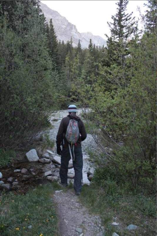
We woke up at 6:00am to a calm, cloudless morning, and hit the trail at 6:40am after breakfast. Descending into the meadow we were greeted by the massive face of Blanca. There were several small stream crossings in the valley that posed no problem whatsoever.
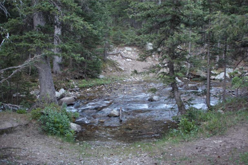
The crossing of the Huerfano River, while not sketchy by any means, required a bit more attention as there was not a continuous, well-established route with large rocks or logs. This could have been because of the water level, but I don't know how the Huerfano typically runs as this was my first time in the drainage.
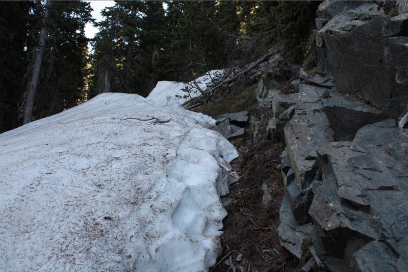
After the crossing, there were several downed trees and small patches of snow to navigate until you reach the old mine at 11,500, but none of them posed a problem as there was a clear, hiker reroute.
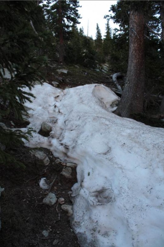
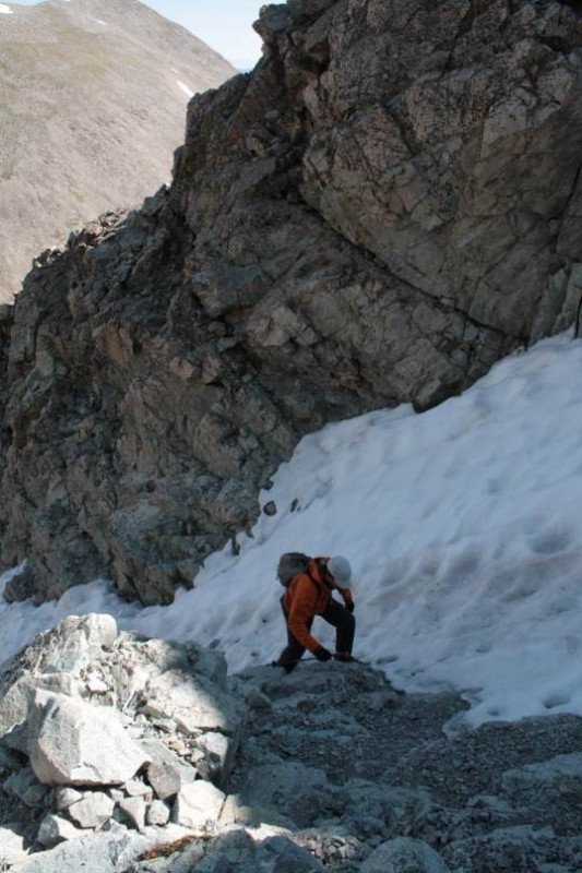
From the mine entrance to treeline, there were a few more small patches of snow but nothing serious. This image shows the largest and we hugged the rock and got through quickly.
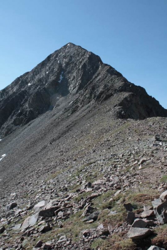
From treeline to the saddle, we made great time and enjoyed the incredible views of Blanca, Ellingwood, and Iron Nipple. Once in the saddle the full view of Lindsey emerged and we were happy to see that the snow in the gully was limited to hiker's left.
Once in the gully, the snow was frozen solid and with no spikes or axes we stuck to hiker's right which provided easy passage on solid rock all the way to the notch.
At this point, the North Face required a bit of route finding. Perhaps they are there, but we did not have much luck finding cairns to lead our way. There are two smaller gullies to cross after the notch and we found hiker's left on the 1st gully and hiker's right on the 2nd to be comfortable routes. My buddy tried hiker's right in the 1st gully, and while not as steep, it was a bit looser than hiker's left and required a crossing of the small snowfield.
There is one small snowfield between the gully crossings that requires about 8 steps through well-established, firm footsteps, but now gear is required and the crossing is very straightforward.
Once through the second gully, some small cairns are scattered about if you look hard enough. The summit ridge is easily attainable and the route from there is clear and very easy.
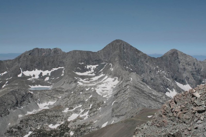
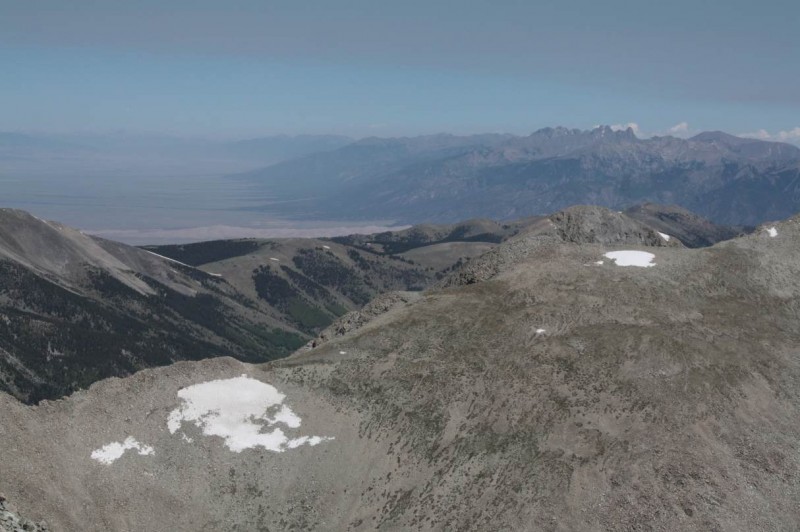
Despite having visited the San Luis Valley many times for both work and play, this was my first summit in the Sangres, and I was blown away by the view of Little Bear, Blanca and Ellingwood, Spanish Peaks, and loved the glimpse of the Sand Dunes, KC, Challenger, the Crestones and Humboldt. Little Bear, Blanca and EllingwoodSand Dunes, KC, Challenger, the Crestones and Humboldt
The descent of the gullies seem easier than the ascent, perhaps because we knew what to expect, but I also felt it was nice to see what was coming and to pick your route with the aerial view.
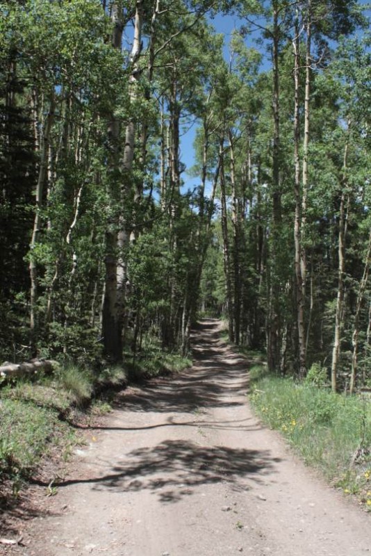
Upon arrival back at the car, we enjoyed a cold beverage and were excited to see the drive out in the daylight as it seemed thick with beautiful aspen stands when we drove in the night before. This place must be spectacular in the fall and I plan on returning...perhaps for a Lily Lake hike. Mt. Lindsey has become my new favorite 14er. The beautiful, Aspen-lined road
Thanks for reading, and if you have any recommendations for me to improve future TRs, please don't hesitate to let me know.
Thumbnails for uploaded photos (click to open slideshow):
Nothing left that measurably affects the route. There is one snowfield that requires crossing passed the notch, but as I mentioned in my conditions summary, the footing is well established and is only 6-8 footsteps across.
I have updated the TR to reflect the condition update I posted. Sorry for not including it the first go around. I do not have a photo as I was focused on the route finding from the notch to the summit ridge.
I have worn a 24 hour fitness Body Bugg on a hike and found the calorie burn from my HRM was overstated by about 3 times actual burn rate but thats my Body...Individual results may vary, Thanks for the report!
Caution: The information contained in this report may not be accurate and should not be the only resource used in preparation for your climb. Failure to have the necessary experience, physical conditioning, supplies or equipment can result in injury or death. 14ers.com and the author(s) of this report provide no warranties, either express or implied, that the information provided is accurate or reliable. By using the information provided, you agree to indemnify and hold harmless 14ers.com and the report author(s) with respect to any claims and demands against them, including any attorney fees and expenses. Please read the 14ers.com Safety and Disclaimer pages for more information.
Please respect private property: 14ers.com supports the rights of private landowners to determine how and by whom their land will be used. In Colorado, it is your responsibility to determine if land is private and to obtain the appropriate permission before entering the property.