| Report Type | Full |
| Peak(s) |
Grizzly Peak - 13,997 feet Garfield Peak - 13,778 feet |
| Date Posted | 06/05/2012 |
| Date Climbed | 06/02/2012 |
| Author | Rainier_Wolfcastle |
| Grizzly / Garfield - West Slopes |
|---|
|
Who: Shawn (Rainier_Wolfcastle) When: 6/2/2012 - Start at 11:45am - Summits at 3:30 & 4:00 - Finished at 5:45pm TH: Grizzly Reservoir TH (Elevation 10,560) Peaks: Grizzly Peak A (Ranked # 54), Garfield Peak (Ranked #116) Stats: 8.8 miles, 3,948 feet of elevation gain Route: Lincoln Creek Road to Grizzly West Slopes Route, Grizzly/Garfield Saddle to Grizzly, ridge back to Garfield, back to saddle, return via ascent route. References: Colorado Thirteeners: From Hikes to Climbs, Gerry Roach & Jennifer Roach, First Edition The Good Samaritan: My plan was to climb Cathedral early Saturday morning and then Grizzly early Sunday morning. However, as I was approaching Basalt on CO 82 friday night I noticed my Blazer's engine was making quite a racket. I pulled into a Conoco and popped the hood. Well, it was clear something was making the belt struggle and causing the noise and quite a bit of heat. Let's be clear, I'm an automotive idiot! I grab my owner manual to get a picture of the engine. Just then a dude pulls up in a white van and asks me whats wrong with my engine. "Ummm, just trying to figure that out." Within two seconds he says: "your alternator is seizing up!" I am immediately disgusted, dammit no mountains for me...now I get to try find an auto mechanic in Glenwood on a summer Saturday. The dude tells me just to drive down to the Napa Auto Parts, buy an alternator and replace it. "I have no tools, or know how!" "Get in, lets go to Napa," he tells me. Well, Napa is closed. Dude tells me he will drive me to a hotel, pick me up in the morning, go get coffee, then go to Napa, then he'll show me how to replace an alternator. He says he spent 30 years in Northern Alaska, you don't leave someone on the side of the road up there! True to his word, he picks me up, I buy a round of coffees, we go take the alternator out...yup, that thing is fried. We go to Napa, I buy a $115 alternator, 20 minutes later my car is running as smooth as ever. I fill his van with gas, shake his hand, and I'm on my way! The timing, the geniune nature, and selflessness...ridiculously lucky on my part. Thank you Richard from Alaska! The New Plan: Well anything involving snow is out at this late an hour. Hmmmm, I could try that West Slopes route up Grizzly....heck, any hiking today is gravy at this point. The TH: The turnoff for Lincoln Creek Road is South off of CO 82 between Aspen and Independence Pass. I did not track mileage, but it felt like it was about half way between Aspen Downtown and Indy Pass. Roach says the road is 2wd...well, I did not need to put my Blazer in 4wd...but I did need the clearance not offered by your average passenger car. It is not so much rocks, as it is the angled slabs covering the road. The drive in was about 6.6 miles until I reached a gate blocking further access... I guess I am not driving directly to the base of the route. The drive in passes several number campsites...some of them look pretty sweet! Each campsite had a fresh Bear Incident Warning Posted from May 21st. I parked at a camping area right next to Grizzly Reservoir with some picnic tables...damn, I wish I had a grill and some fishing gear! The Start: I had a 2.5 mile road walk to reach the West Slopes turnoff, from there it would only be a 2.4 mile roundtrip to the Grizzly summit from 10,920. Some nasty clouds were builiding to my NW. I figured I could stroll up the road and see what the weather looked like in an hour when I reached the turnoff. Not to mention this route is perfect for the weather weary: Class 2 and never more than a mile from safety! Looking South:  Looking Southeast: 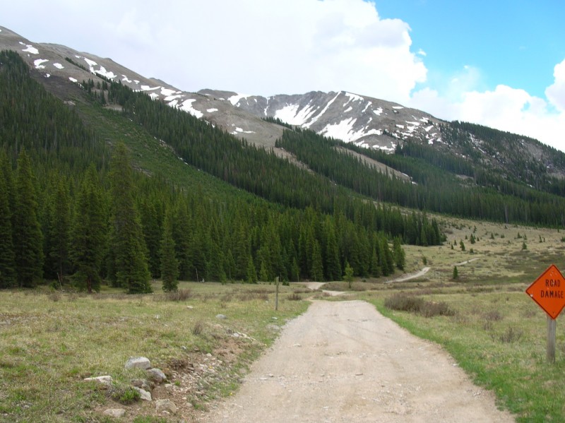 The 4wd portion of this road is much smoother than the 2wd portion...interesting. The only reason I can think for it to be closed is the 2 or 3 fairly small downed trees crossing the road. About 1.5 miles into the hike it started thundering to the North and a light sprinkle started. I decided to hangout in the lower portion of a pine grove just off the road, hoping it passes. How about I pass the time by using some of this deadfall to build a Les Stroud (Survivorman)style shelter? Please note that I did not using anything that wasn't dead and laying on the ground. My shelter building skills turned out to be even worse than my mechanical! Somehow my plan for a lean-to shelter became a half-assed teepee? 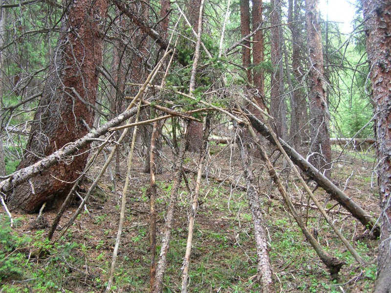 After 20 minutes, I ate some lunch in my teepee and noticed the weather was clearing. Back along the road I go. About 15 minutes later at 12:45 I noticed a gully/weakness directly to my West...this must be the route! 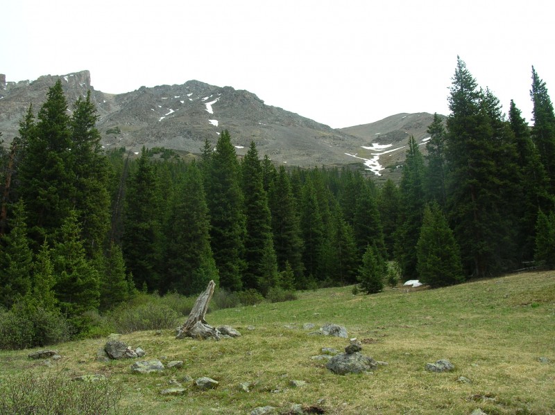 Notice the small cairn in the bottom/center/right of the photo? I did not see it on the way, even though I took that picture and walked right by it. I did notice it on the way out, took a picture...the ascent and descent pictures were identical....I must have climber's ADD. Here is a pic from the turnoff looking across the road to the West: 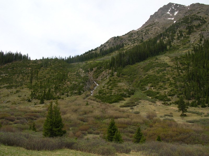 The Ascent: There is no trail to follow, but no bushwhacking or route-finding is really needed either. Just pick clear paths and stay in the general vicinity of the creek/center of the gully. Obviously with 2,600 feet of gain in 0.9 miles it is steep (the pictures don't really do it justice), but the start was actually very pleasant. Here are pics looking back and then up from about an hour into the upclimb: 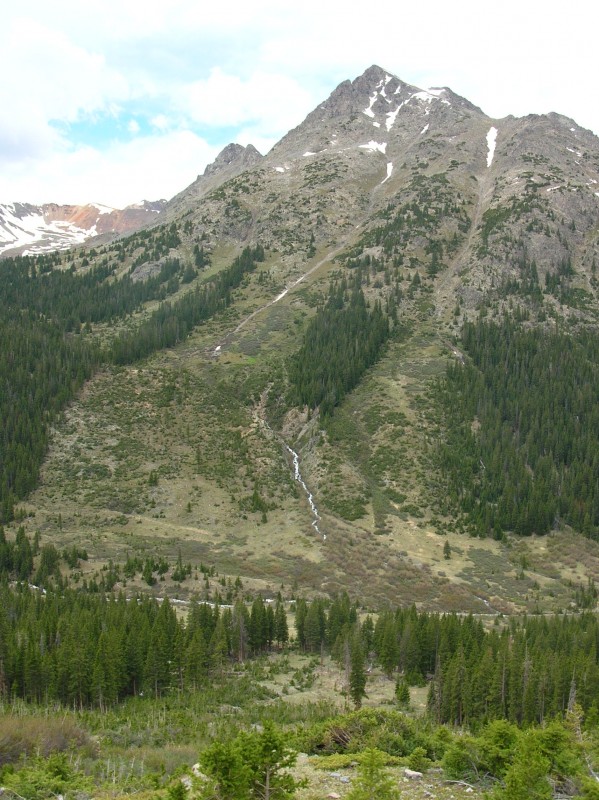 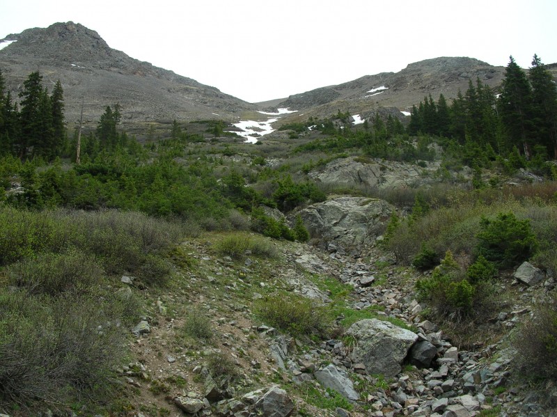 From those pics the angle did steepen, while grass and slab gave way to talus. Here are pics looking back and then up from an hour & 45 minutes into the climb:  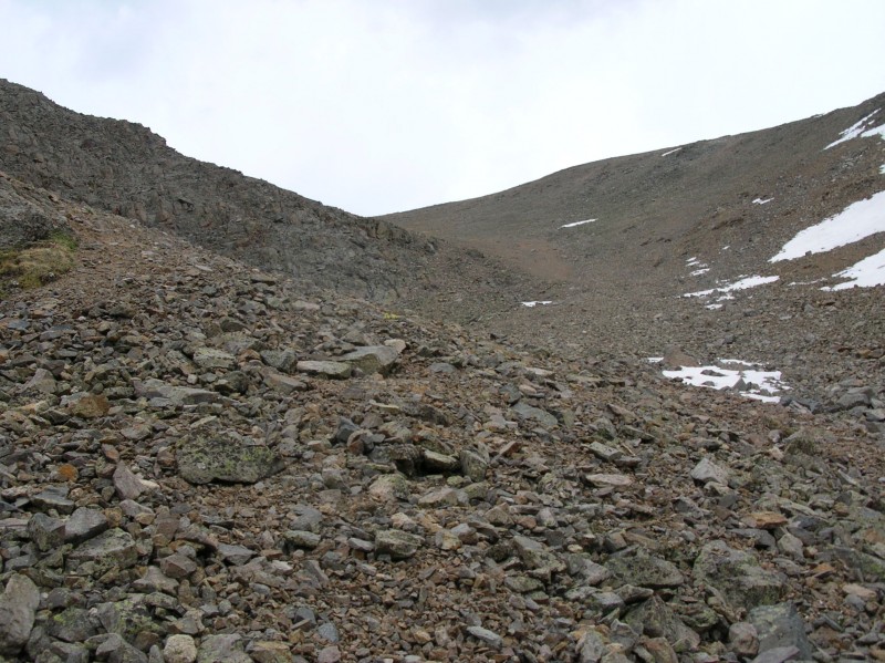 The upcoming portion in that last picture is the crux of the route...the angle is the steepest and gully center is loose scree with some loose talus mixed in. This was the first area were I could see trail and foot prints, but they were all in the scree and certainly from people's descents. I chose to for-go the 2 steps up/1 step back scree by staying left of center and scrambling up solid rock to the left. It involved a little class 3, but actually made this section kind of fun...instead of shear madness! Note that on my descent I pretty much scree skied a thousand vertical feet in about 10 minutes, right through this section. Past the scrambling, I still stayed left in the talus, instead of the scree in the middle. Now I can see the Grizzly/Garfield Saddle:  Close to the saddle looking towards Grizzly: 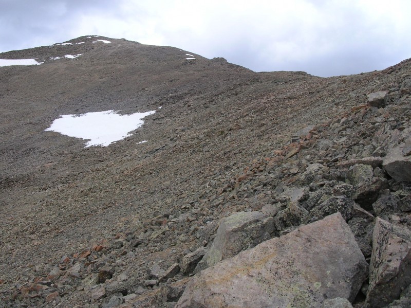 Looking back down on the ascent route, this gives a little more perspective on the 2,600 feet in 0.9 miles: 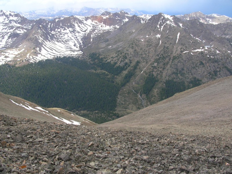 Nice view to the South: 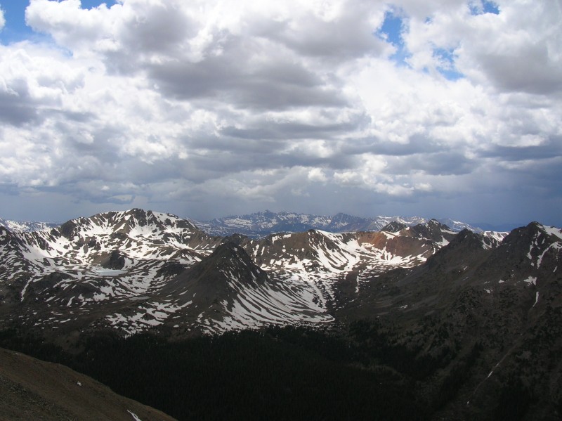 Blurry view of the ridge going South, Unranked Point 13,620 is featured in the upper right: 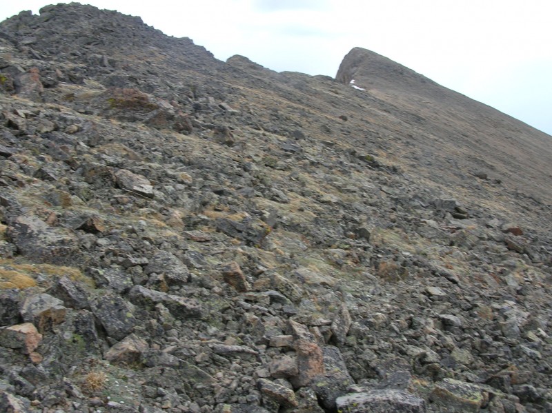 At the saddle I dropped my pack and carried just my camera up the 0.3 miles and nearly 500 feet to the Grizzly Summit. It is just an unmarked talus walk to a false summit, then passing to the left towards the true summit you get this crazy view through a crack to the East:  And here is the view to the Northwest (the TH must be down there somewhere): 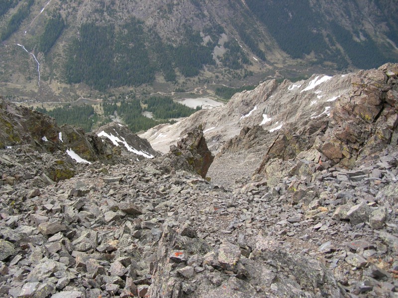 Okay, now I spot my second cairn of the day (top left), marking the easy route up to the true summit:  Woohoo! Here are the summit shots: Back South along my ascent ridge and around towards Garfield (my next goal):  Looking North, Grizzly Coulier must top out over there somewhere. Also, notice that "Prow" in the upper left of the photo....this is a good landmark to spotting the peak, it can be seen in my photo #4. 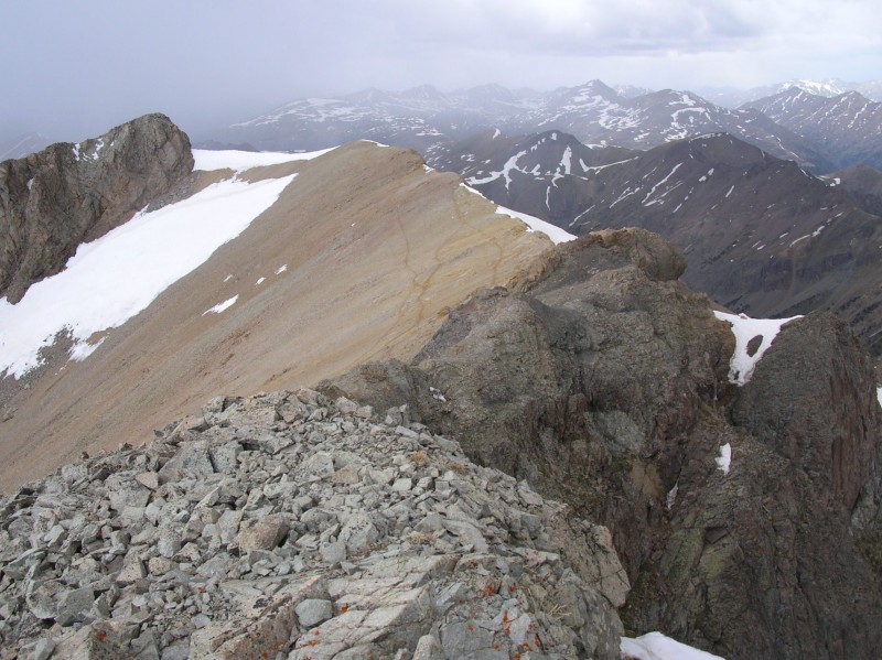 View to the East: 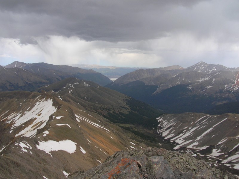 View to the Northwest (prow in upper right...along with some dark clouds)...better get moving:  When I got back to the saddle it was already clearing up and the sun was poking through...sweet, time to go climb a bi-centennial (its all coming up Shawn today The descent was very fast, including the thousand feet of scree skiing in past people's tracks. I was back at the car an hour and a half after leaving the saddle. The route was far better than I thought it would be....although the last hour and half on the West slopes ascent are certainly not the most asthetically pleasing. Thanks for reading! Shawn Thumbnails for uploaded photos (click to open slideshow):
|
| Comments or Questions | |||||||||||||||
|---|---|---|---|---|---|---|---|---|---|---|---|---|---|---|---|
|
Caution: The information contained in this report may not be accurate and should not be the only resource used in preparation for your climb. Failure to have the necessary experience, physical conditioning, supplies or equipment can result in injury or death. 14ers.com and the author(s) of this report provide no warranties, either express or implied, that the information provided is accurate or reliable. By using the information provided, you agree to indemnify and hold harmless 14ers.com and the report author(s) with respect to any claims and demands against them, including any attorney fees and expenses. Please read the 14ers.com Safety and Disclaimer pages for more information.
Please respect private property: 14ers.com supports the rights of private landowners to determine how and by whom their land will be used. In Colorado, it is your responsibility to determine if land is private and to obtain the appropriate permission before entering the property.


