Download Agreement, Release, and Acknowledgement of Risk:
You (the person requesting this file download) fully understand mountain climbing ("Activity") involves risks and dangers of serious bodily injury, including permanent disability, paralysis, and death ("Risks") and you fully accept and assume all such risks and all responsibility for losses, costs, and damages you incur as a result of your participation in this Activity.
You acknowledge that information in the file you have chosen to download may not be accurate and may contain errors. You agree to assume all risks when using this information and agree to release and discharge 14ers.com, 14ers Inc. and the author(s) of such information (collectively, the "Released Parties").
You hereby discharge the Released Parties from all damages, actions, claims and liabilities of any nature, specifically including, but not limited to, damages, actions, claims and liabilities arising from or related to the negligence of the Released Parties. You further agree to indemnify, hold harmless and defend 14ers.com, 14ers Inc. and each of the other Released Parties from and against any loss, damage, liability and expense, including costs and attorney fees, incurred by 14ers.com, 14ers Inc. or any of the other Released Parties as a result of you using information provided on the 14ers.com or 14ers Inc. websites.
You have read this agreement, fully understand its terms and intend it to be a complete and unconditional release of all liability to the greatest extent allowed by law and agree that if any portion of this agreement is held to be invalid the balance, notwithstanding, shall continue in full force and effect.
By clicking "OK" you agree to these terms. If you DO NOT agree, click "Cancel"...
Southern Slopes of Oxford to Belford from Pine Creek
The Route: Southern Slope of Oxford from Pine Creek then traverse to Belford then back across Elkhead Pass into Pine Creek.
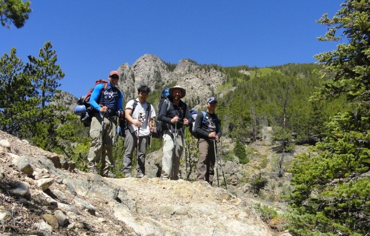
Ascent Party: Exiled Michigander, Stiffler_from_Denver, Alex "BlackJack", Up "the two-backpack Thai"
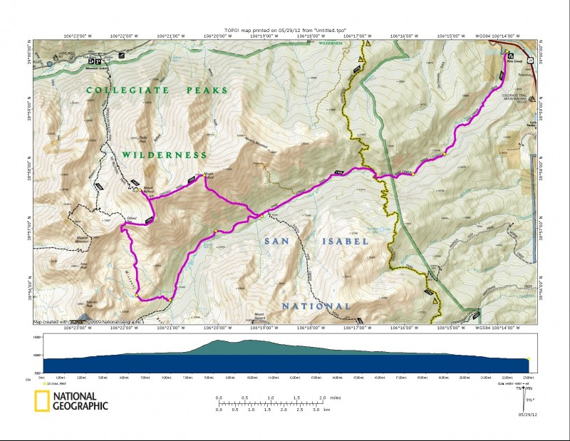
Mileage/Elevation/Time: Day 1: 6.68 miles, 2,107 ft. of elevation gain (Pine Creek TH to just past Little Johns Cabin) 4.5 hours Day 2: 9.66 miles, 4,332 ft. of elevation gain (3,400 in the first 1.3 miles to BelOx and back Elkhead pass) 10 hours Day 3: 6.68, -2,-107 elevation gain (Little John's Cabin back to TH) 3 hours Total: 23.02 miles, 6,439 feet of gain
With the weather looking good for Memorial Day weekend, 4 economics graduate students left Denver on Saturday for a trip to Little John's Cabin in route to summiting Oxford and Belford from the Pine Creek Trailhead.
This is an awesome 3-day camping/hiking/14er-bagging trip and hopefully this trip report will give some more information about an awesome, non-standard route to bag BelOx.
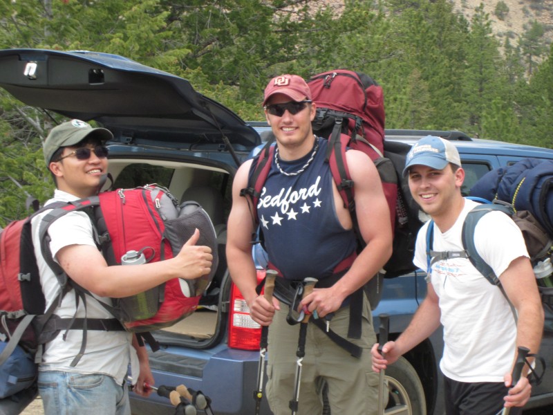
Here we are gearing-up. For a bit of comic relief, we normally hike with Up "the two-backpack Thai," who refused to rent a hiking backpack from REI claiming he would just use two regular packs. This was not an efficient method.
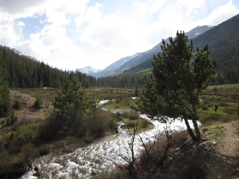
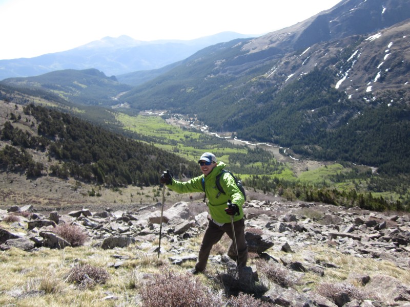
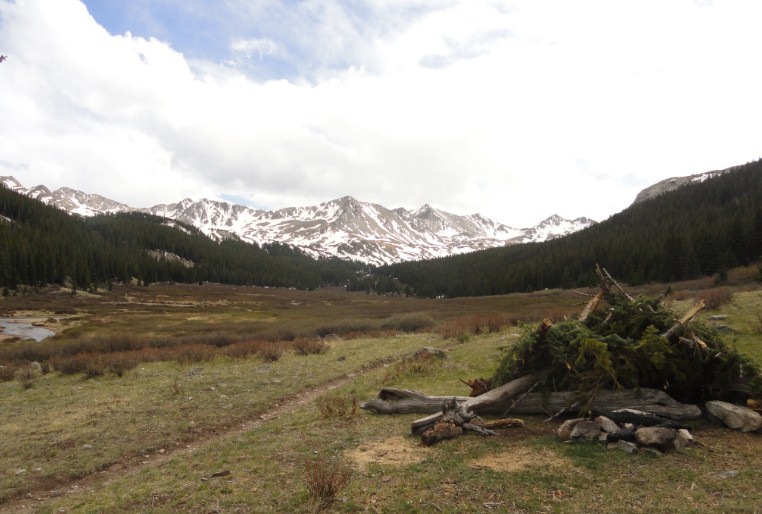
The Pine Creek trail is a fantastic route with very gradual elevation gain over 6.5 miles to Little John's Cabin. Below is a picture of the valley that opens up just as the Pine Creek Trail intersects the Colorado Trail.
It is about 2 miles from the Colorado Trail intersection to Little Johns Cabin. There are some great camping spots behind Little John's Cabin as well as directly south of Little Johns across the river on South Pine Creek Trail. Once you start seeing a lot of aspens, you know you're getting close to Little Johns.
We continued about 200 yards further into the aspens and found a great camping spot pretty much directly south of Oxford Peak. We slept only about 1.5 miles from the summit of Oxford but that 1.5 miles included 3200 feet of elevation gain the next day.
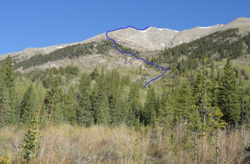
Here is the route we took up the southern face of Oxford.
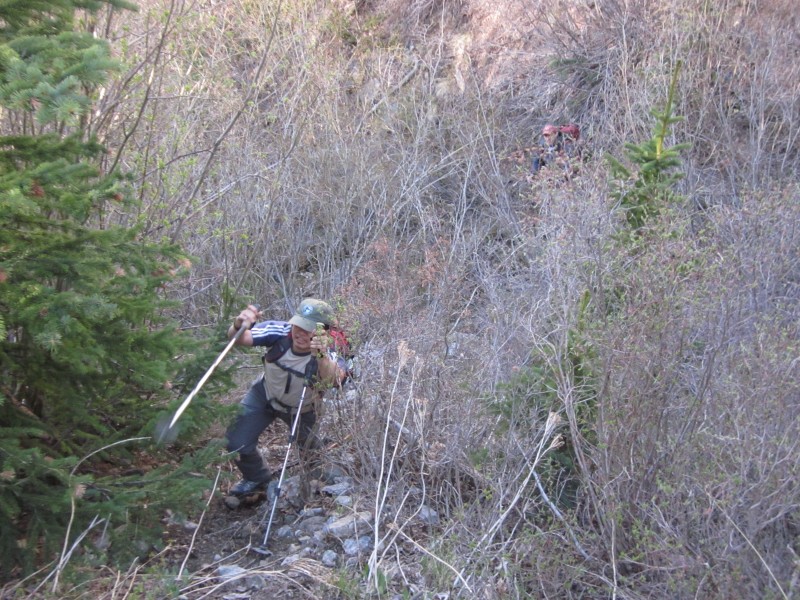
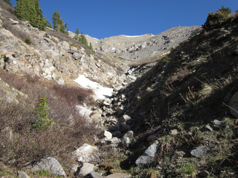
We followed the Pine Creek trail headed west the next morning about 100 yards until we crossed a north/south flowing stream. This is where we turned north and started the bushwacking steep ascent up Oxford's south slopes. We stayed pretty close to the steam through tree-line and never cliffed-out or ran into too much trouble.
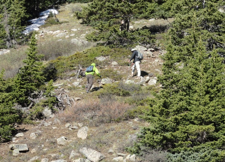
a little bushwacking but it wasn't bad
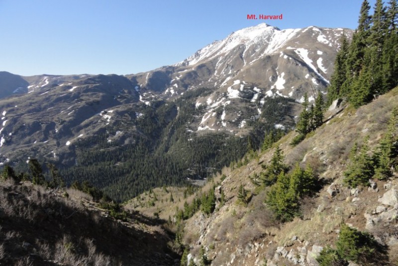
Looking south across to Harvard peak back down our route.
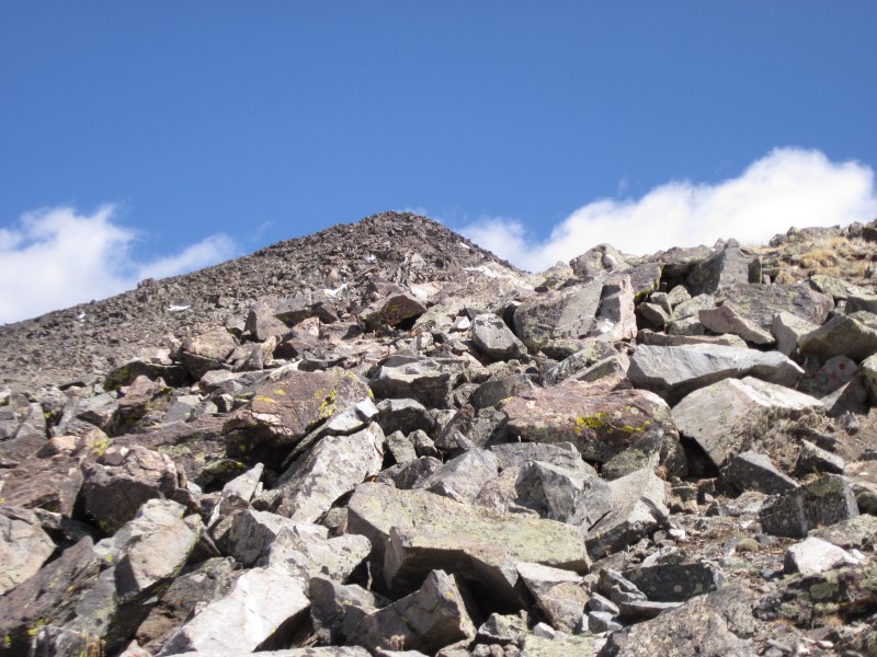
looking up to the summit of Oxford following the stream
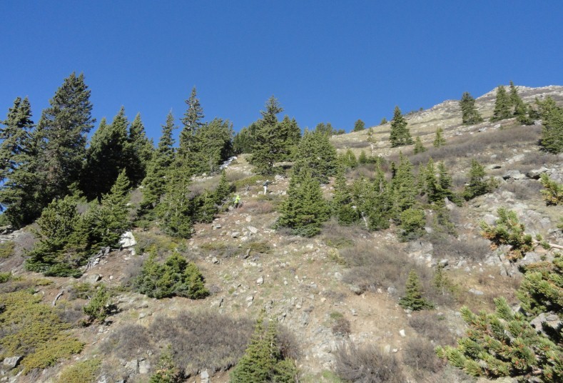
steep climb breaking through treeline
Alex "BlackJack" climbing the south side. Picture looks back down toward Pine Crek
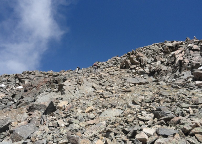
worst part of the route
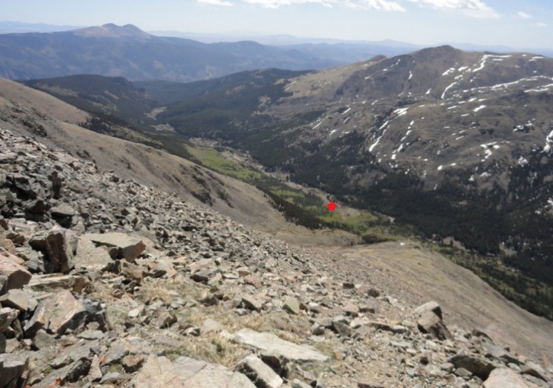
red star is Little Johns Cabin
slow steep part to summit
It took us just shy of 4 hours from near Little John's Cabin to the top of Oxford.
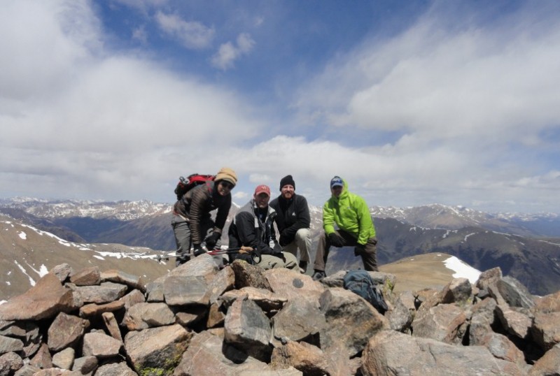
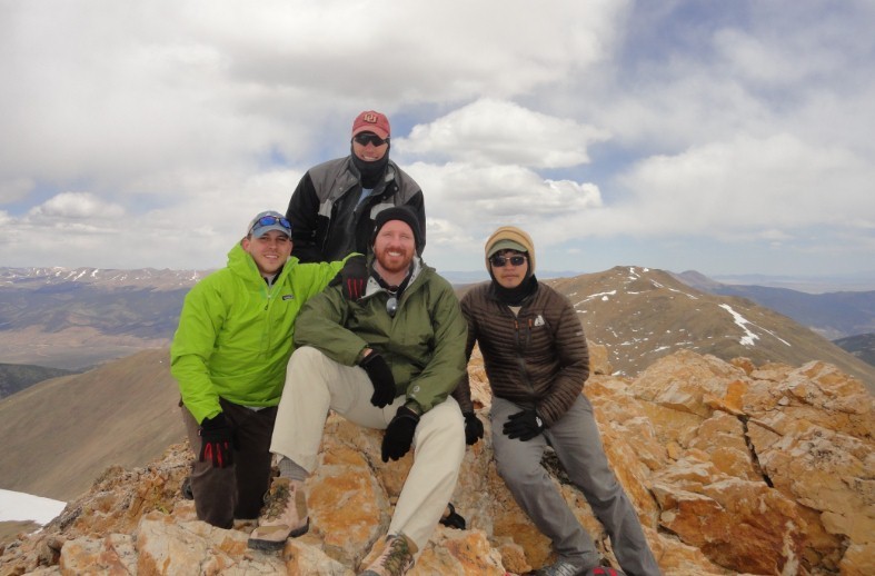
Summit of Oxford the traverse to Belford Summit of Belford
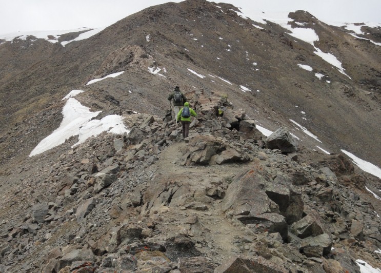
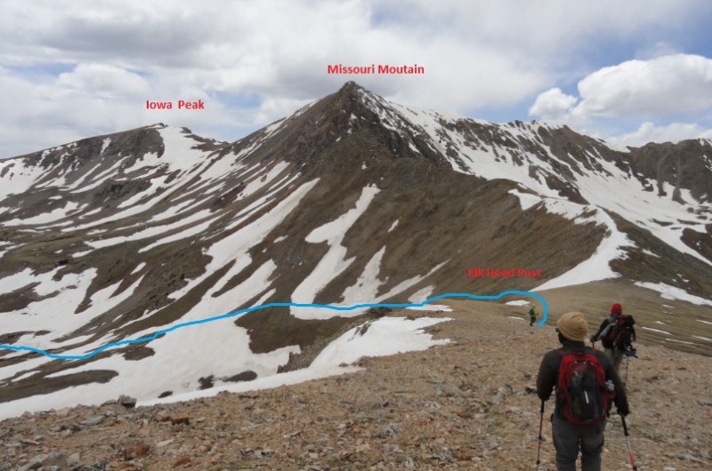
From the summit of Belford we headed to Elkhead Pass for a longer but less steep descent back to Little Johns
Elkhead Pass is a beautiful way to get back into Pine Creek with a well-defined gradual path into a beautiful basin where you are surrounded by Harvard, Emerald, Iowa, and Missouri Peaks. It's about 6 miles to get back to little Johns from Belford, but taking the gradual Elkhead route back to Pine Creek trail is much better then traversing back to Oxford then descenting the Southern Slopes which would be fairly dangerous.
someone made a nice wind-break shelter and fire pit in the upper Pine Creek Basin
all four of us hiking out on Memorial Day Tons of elevation gain between mile 7-8.5 as we climbed the steep southern face of Oxford
We got back to camp at 5 o'clock that night, made cheddar brauts and freeze dried beef-stew for dinner. The next day we hiked out and headed to the Quincey's in Buena Vista for our celebratory lunch. (this part of the trip is highly recommended)
Thumbnails for uploaded photos (click to open slideshow):
The trailhead is right off 24. I parked parallel to 24. In the first picture of the trip report, 24 is just behind my Jeep. You could drive about 60 yards further to and upper trailhead but it was alittle more rocky. 2wd will be easy to park where I parked. Take a look at topo graph in last picture of trip report, top right corner shows the .4 mile dirt roat to where I parked.
Caution: The information contained in this report may not be accurate and should not be the only resource used in preparation for your climb. Failure to have the necessary experience, physical conditioning, supplies or equipment can result in injury or death. 14ers.com and the author(s) of this report provide no warranties, either express or implied, that the information provided is accurate or reliable. By using the information provided, you agree to indemnify and hold harmless 14ers.com and the report author(s) with respect to any claims and demands against them, including any attorney fees and expenses. Please read the 14ers.com Safety and Disclaimer pages for more information.
Please respect private property: 14ers.com supports the rights of private landowners to determine how and by whom their land will be used. In Colorado, it is your responsibility to determine if land is private and to obtain the appropriate permission before entering the property.