Download Agreement, Release, and Acknowledgement of Risk:
You (the person requesting this file download) fully understand mountain climbing ("Activity") involves risks and dangers of serious bodily injury, including permanent disability, paralysis, and death ("Risks") and you fully accept and assume all such risks and all responsibility for losses, costs, and damages you incur as a result of your participation in this Activity.
You acknowledge that information in the file you have chosen to download may not be accurate and may contain errors. You agree to assume all risks when using this information and agree to release and discharge 14ers.com, 14ers Inc. and the author(s) of such information (collectively, the "Released Parties").
You hereby discharge the Released Parties from all damages, actions, claims and liabilities of any nature, specifically including, but not limited to, damages, actions, claims and liabilities arising from or related to the negligence of the Released Parties. You further agree to indemnify, hold harmless and defend 14ers.com, 14ers Inc. and each of the other Released Parties from and against any loss, damage, liability and expense, including costs and attorney fees, incurred by 14ers.com, 14ers Inc. or any of the other Released Parties as a result of you using information provided on the 14ers.com or 14ers Inc. websites.
You have read this agreement, fully understand its terms and intend it to be a complete and unconditional release of all liability to the greatest extent allowed by law and agree that if any portion of this agreement is held to be invalid the balance, notwithstanding, shall continue in full force and effect.
By clicking "OK" you agree to these terms. If you DO NOT agree, click "Cancel"...
Trailhead: Maroon Lake Route: Len Shoemaker Basin to the north face of UN13,631 Distance: Approximately 8.8 miles from Maroon Lake TH Who: Bob & Kate Special gear: Ice axe, crampons, helmet, gaiters, etc. We did not need snowshoes.
The break in the route is our camping spot.
Every TR of this mountain combines it with another. UN 13,631 seems to not get its own attention and therefore it must be lonely. That or we're not skilled/in shape enough to combine it with one of its neighbors...
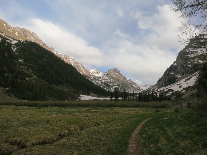
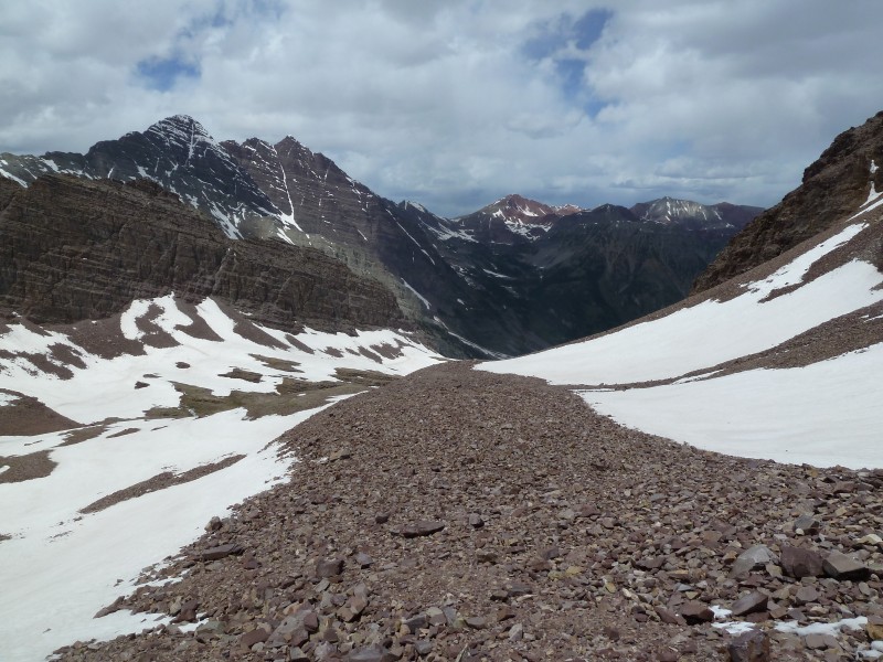
Hiking in. We didn't know it, but that's UN13,631 there in the left of center distance with the snowy face.
Kate and I really wanted to get some more experience with the Elk Range. So far we had only hiked the Elk 14ers and we wanted to get into the 13ers. We decided on a 3-night camping trip in the Maroon Bells area with plans for 13ers each day. We hiked in Friday night and found that the campsites near the "bent tree" were marked as closed with a $100 fine threatened for non-compliance...
Well, that was unfortunate. So we split up - Kate headed farther south into the basin while I headed back north, each of us tried to find a good campsite in that area so we wouldn't have to sleep on a rock field or in a bunch of deadfall. I found a pretty good spot a little north of the bent tree on the left side (as you hike south into the basin) of the trail.
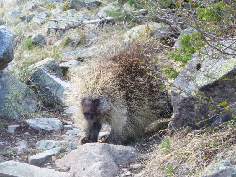
A porcupine visited us our first night. Our 2-person tent isn't (of course) big enough for both of is and all of our gear to fit inside, so we keep our packs under the fly. We saw this guy on the trail on the way in and he may have been our visitor.
This is the jerk who tried to eat my helmet...
He started eating the front padding of my helmet, I guess to get the salt. I thought better of swatting him away and instead made some noise in the tent and brought my helmet away from the opening between the fly and the ground. Later in the night, the same(?) rodent made an attempt at eating Kate's pack, but she fought him off valiantly.
After our hike, we came back to the tent to see that some of the mesh had been eaten away. The Maroon Bells area is full of pernicious critters...
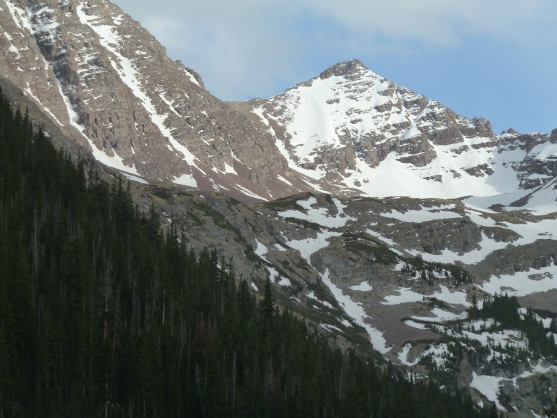
We didn't realize it at the time, but we had a pretty good view of our objective while hiking in. Here is a zoomed-in image.
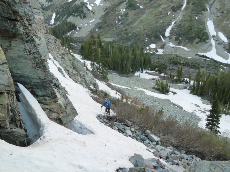
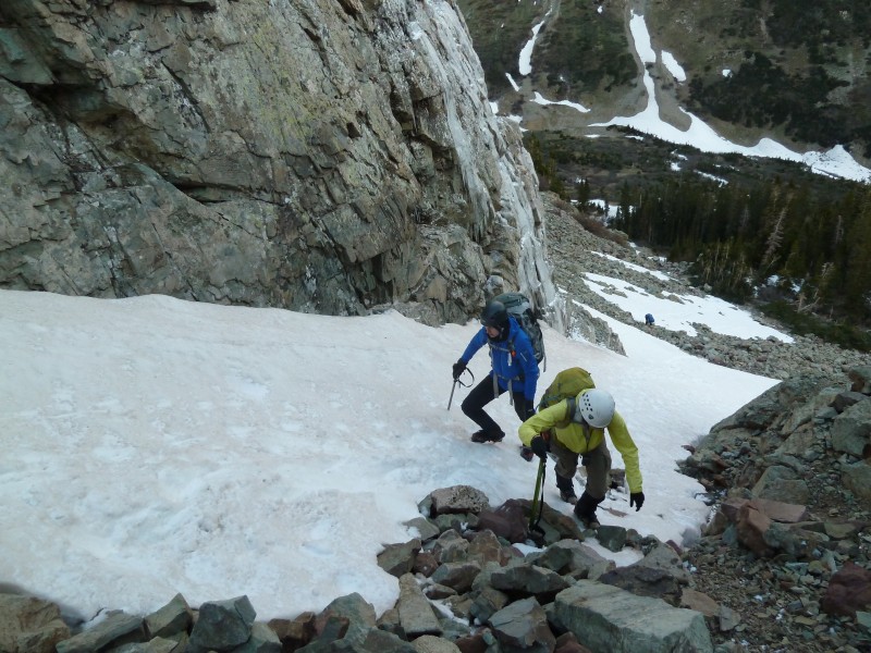
We ascended into Len Shoemaker (LS) basin by following the Maroon trail south until it crosses the creek. The snow bridge is still "in" about 100 feet south of the trail sign. A few minutes of hiking later and we got to a small opening in the willows with a mostly-horizontal cairn. There's another cairn about 20 feet further down the trail. This is the exit point for the ascent into LS basin. We walked slightly northeast following directions from USAKeller's recent Thunder Pyramid report to a series of steep gullies separated by some flatter areas. These gullies had snow in them and the snow was very hard in the morning.
Looking down from the first gully.
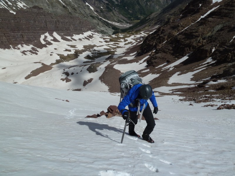
We broke out the helmets and crampons for this part since the rocks in the gullies (most of the 3 or 4 gullies had mixed conditions) were loose.
From the next day's climb of Thunder Pyramid. Hikers in one of the gullies.
This was annoying since the snowy parts were separated sometimes by 20 - 50 yards or so of rocks and we didn't feel like taking our crampons on and off for each gully/snow field. So we had crampons-on-talus, which is less than pleasant.
Snow-talus-snow-talus. Fingernails on chalkboard-crampons on talus....
In the morning the snow wasn't quite bullet proof, but we weren't getting much more than the tips of our spikes into it. Also, our ice axes were more like canes since we couldn't make more than a small dent with them in the surface.
Snowfield.
We angled to the right as we ascended, while if you were going to Thunder Pyramid you'd angle left following a few cairns. To avoid unnecessary, but minor, ups and downs in the basin you should follow the creek bed (in which case you'd want to head left toward TP until you get to the creek bed).
I see you.
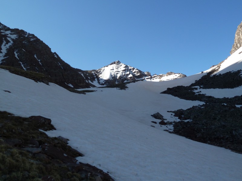
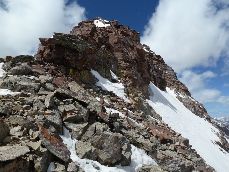
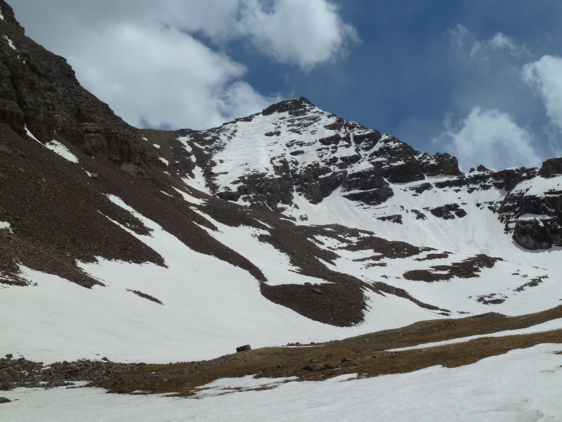
As we got closer, I started to realize how steep this hike would be. It didn't look so bad on the Topo...
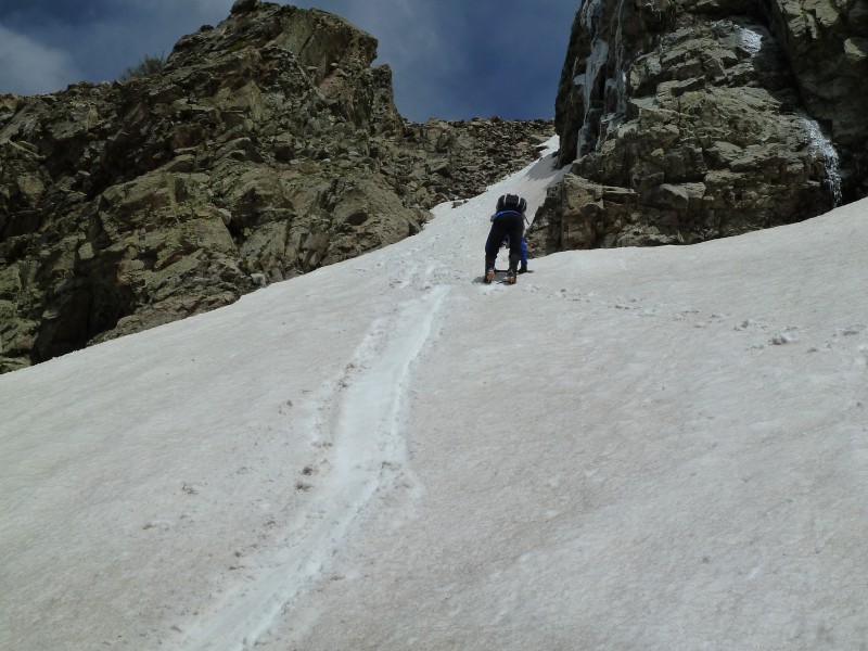
Our route went up the intermittently-snowy strip left of the face until before the first rock section, where we traversed to
To be honest, we didn't have an ascent plan for this mountain. We were just going to go out and wing it. I knew where the mountain was. I knew how we would approach it. However, the details of how we'd get to the summit were not known. I did know that I wanted to get home alive and well, so I knew that there was a chance we wouldn't summit.
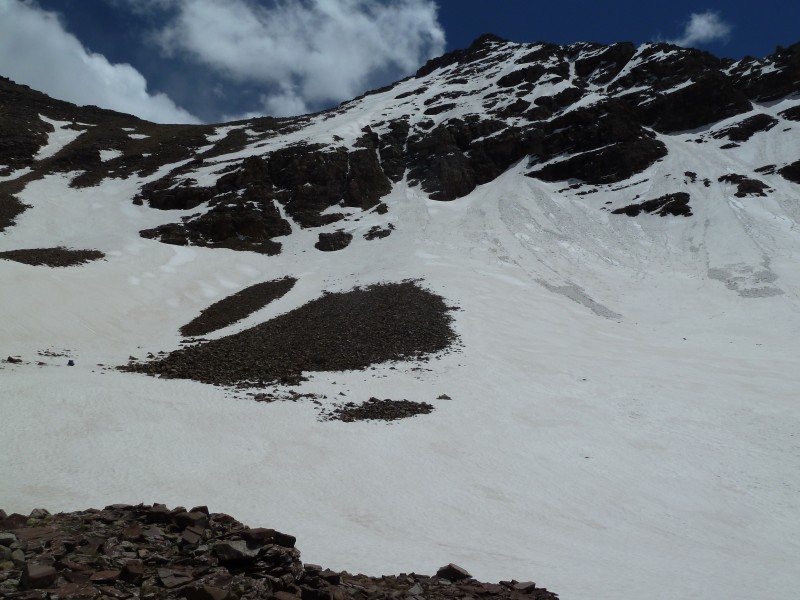
I don't know what the basin is like without snow, but it seemed to be grassy talus for at least the first 1/3 or so. Then it might have been just talus after that. Judging by the steepness of the face, I don't think I'd want to be there when there's no snow. We did see a hint of a trail, but we made no attempt to follow it and I can't guarantee that what we saw 1) was a trail that 2) went to this mountain.
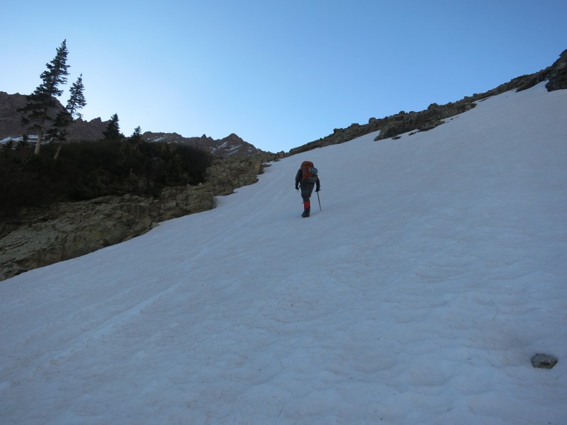
We had one last snowfield to hike up before we got to the base.
Going up a snowfield before we got the the actual base of the mountain.
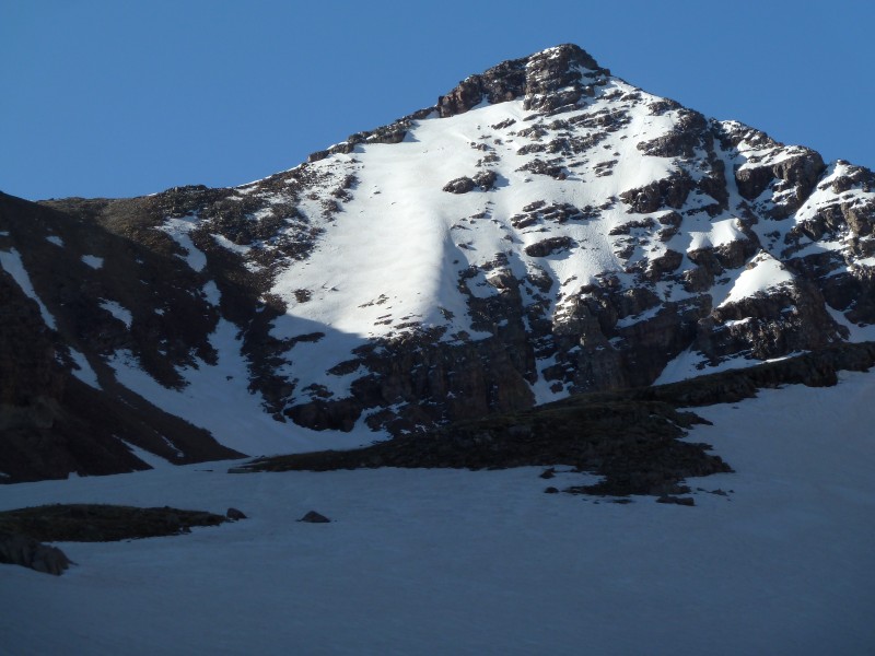
Looking at the mountain from the basin, we decided that the best looking plan would be to ascend the snow just left of the face until we got to the rocks. We then planned on heading to the face. Then we'd go up and see what those cliffy-looking things looked like up close.
The snow was pretty steep and while we got a little more purchase with our crampons here than in the lower gullies, we were not able to kick steps more than about an inch or two - in most places. In some parts we got good steps. In others, it was spike-tips only.
Looking down at Kate and LS basin as we ascended the face.
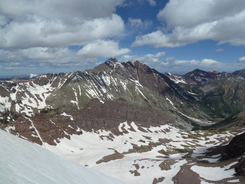
The views on the ascent were very nice.
Nice view of LS Basin. Oh, and the Maroon Bells are back there somewhere, too.
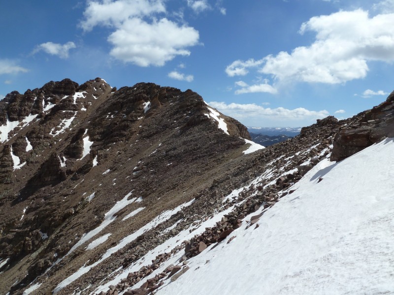
Looking toward the saddle with Lightning Pyramid.
From here on, I'll present our "solution" for this hike. I call it a solution because there are several ways to the summit and what we did is just two of them. I say two of them because we got to and left the final summit ridge by different routes. Also, I'm sure things look different without snow.
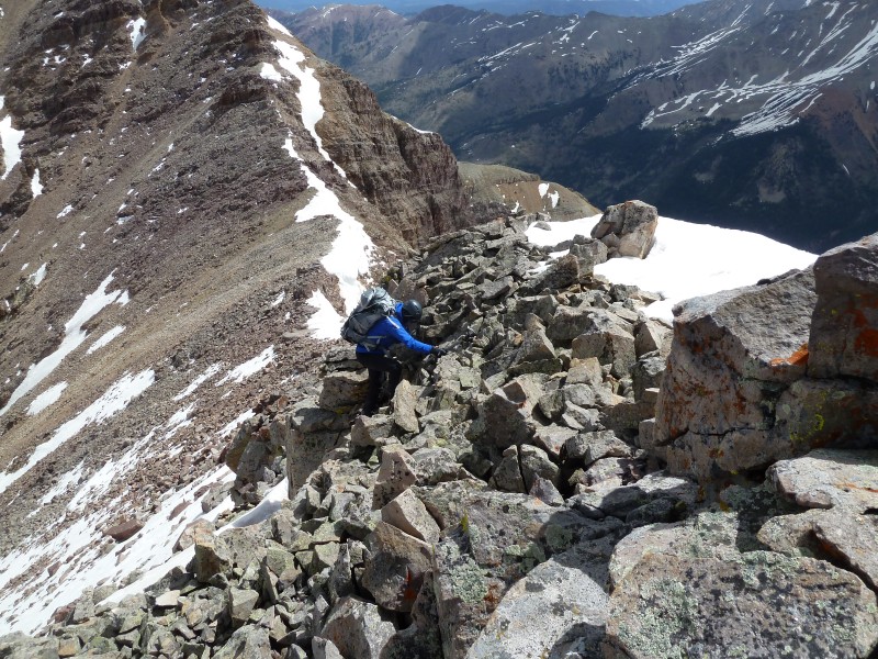
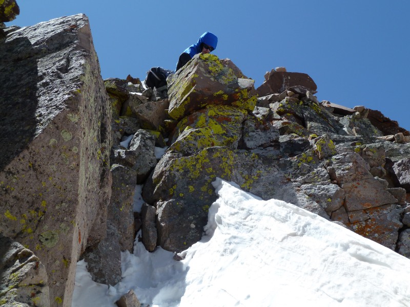
We got to those cliffy-looking things eventually and we found a weakness that would allow a quick scramble to the ridge.
Getting to the ridge.
Finishing the first scramble.
We decided to go left of the summit ridge at this point. Why did we decide to go left? I don't know. It seemed like a good idea at the time.
Ridge.
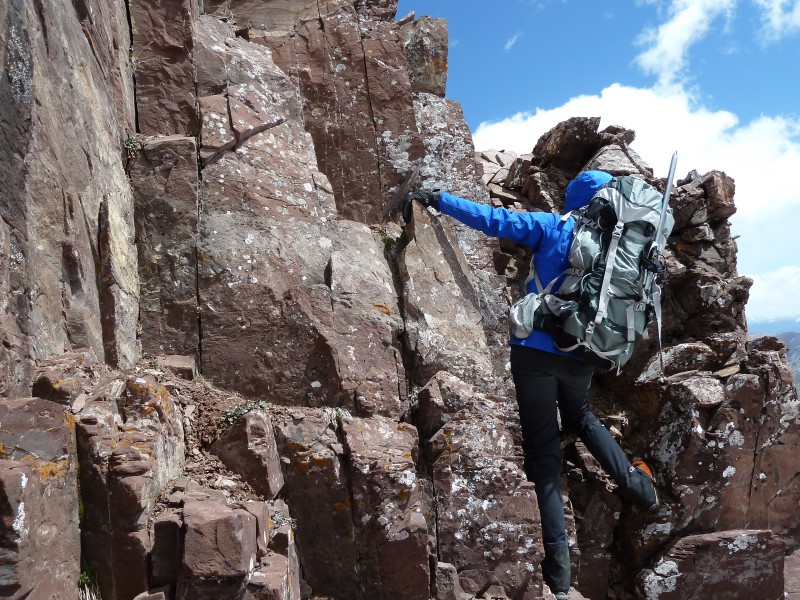
Just to the right of Kate (below), we had to make an interesting move that reminded me of a move on Pyramid where you need to get around a corner sticking out into your path by stepping over some exposure. The holds were fairly solid here and we went up this mini-chimney-thingy.
This looks like the Elks...
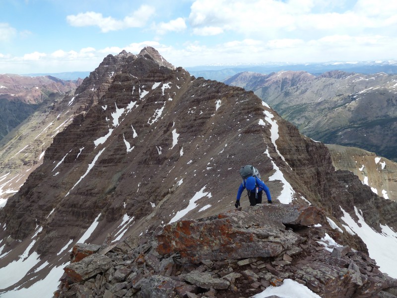
Once on top of that, we had a pretty easy walk to the summit.
Well, maybe there were a couple of steps up, but nothing significant.
Almost there.
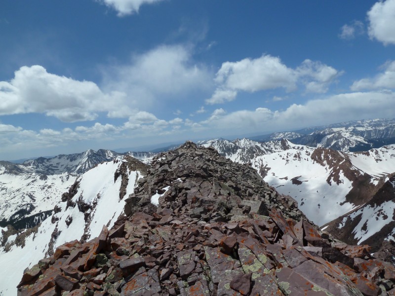
View toward Lightning Pyramid, Thunder Pyramid, and just plain-old Pyramid from the ridge.
And there it is.
Summit.
We decided to descend more directly on the ridge. We headed down from the final summit ridge via some pretty easy scrambles on the descender's left side.
Down climb.
Here is Kate about to down climb that first scramble from several pictures back.
View looking up the rock that Kate was ascending in image #14.
We walked back through the basin, sticking to the creek bed.
Heading out.
A couple of parting shots:
Looking back.
Another look back.
The snow in the gullies we used to ascend to LS Basin was starting to get slushy during our descent. That glissade path in this picture is mine - but it was unintended. I started an unplanned boot-ski in the snow - while wearing crampons... That was not real wonderful and I was waiting for the spikes to catch on something sending me head first down the snow. Fortunately, I stopped while still standing upright and I turned to tell Kate about my situation and my feet came completely out from under me. I fell into a stable, feet-first, side-glissade position with my axe in perfect arrest position, so I dug my axe into the slushy snow as I looked at the consequence of my fall - the rocks at the bottom of the snow field. The axe didn't stop me, but it did slow me enough that I didn't crash into the rocks below - it was more of a love tap.
Kate decided to down climb that part facing in and kicking steps.
Down climb.
Lessons learned:
-Scrambling while wearing a large backpacking pack is problematic when scooting down something, especially when the scooting is down loose rock.
-Walking with crampons on talus is not fun.
-Critters eat your stuff.
-Sometimes winging it can be fun.
-Unplanned glissades are stressful.
Thanks for reading this!
Bob and Kate
Thumbnails for uploaded photos (click to open slideshow):
We wondered who you guys were - saw you descending in the last picture. Seems like I've missed you guys by mere minutes on a few different peaks this year.
Wooderson - We slept in on Saturday and attempted Thunder Pyramid on Monday. We had some route issues on TP and I balked at the climbing required to get to the top (our winging it didn't work out so well) so we turned around.
Monster5 - I think Kate might have said ”hi” to you when you passed our camp. We watched you guys head up the gully and on the way down.
The unplanned glissade wasn't a huge deal, but I was curious to know how it was going to turn out when I was watching the rocks come at me while my axe was cutting through slushy snow... Just because we were almost done with the snow part of the hike didn't mean we were out of danger...
It is kinda fun just to go to a peak with a clouded version of where the route goes, and just climb what looks fun and pleasing to the eye. Nice climb and report. It was good to see you in street clothes earlier.
Caution: The information contained in this report may not be accurate and should not be the only resource used in preparation for your climb. Failure to have the necessary experience, physical conditioning, supplies or equipment can result in injury or death. 14ers.com and the author(s) of this report provide no warranties, either express or implied, that the information provided is accurate or reliable. By using the information provided, you agree to indemnify and hold harmless 14ers.com and the report author(s) with respect to any claims and demands against them, including any attorney fees and expenses. Please read the 14ers.com Safety and Disclaimer pages for more information.
Please respect private property: 14ers.com supports the rights of private landowners to determine how and by whom their land will be used. In Colorado, it is your responsibility to determine if land is private and to obtain the appropriate permission before entering the property.