Download Agreement, Release, and Acknowledgement of Risk:
You (the person requesting this file download) fully understand mountain climbing ("Activity") involves risks and dangers of serious bodily injury, including permanent disability, paralysis, and death ("Risks") and you fully accept and assume all such risks and all responsibility for losses, costs, and damages you incur as a result of your participation in this Activity.
You acknowledge that information in the file you have chosen to download may not be accurate and may contain errors. You agree to assume all risks when using this information and agree to release and discharge 14ers.com, 14ers Inc. and the author(s) of such information (collectively, the "Released Parties").
You hereby discharge the Released Parties from all damages, actions, claims and liabilities of any nature, specifically including, but not limited to, damages, actions, claims and liabilities arising from or related to the negligence of the Released Parties. You further agree to indemnify, hold harmless and defend 14ers.com, 14ers Inc. and each of the other Released Parties from and against any loss, damage, liability and expense, including costs and attorney fees, incurred by 14ers.com, 14ers Inc. or any of the other Released Parties as a result of you using information provided on the 14ers.com or 14ers Inc. websites.
You have read this agreement, fully understand its terms and intend it to be a complete and unconditional release of all liability to the greatest extent allowed by law and agree that if any portion of this agreement is held to be invalid the balance, notwithstanding, shall continue in full force and effect.
By clicking "OK" you agree to these terms. If you DO NOT agree, click "Cancel"...
May 23, 2012
~16.8 Miles, ~6,800 Gain
Trailhead: Conundrum Hot Springs TH
Being 3 ½ hours, the drive to Conundrum Hot Springs Trailhead wasn't too bad. I slept in the back of my car at the trailhead and woke up at 4:20 AM. In the dark, I was hiking up the Conundrum Creek Trail around 4:45 AM. The mileage up the trail went fairly quickly as I made my way up the valley and the trail was in good condition except for the stream crossing above Silver Dollar Pond. A bit wet but very manageable with all of the downed logs crossing the river.
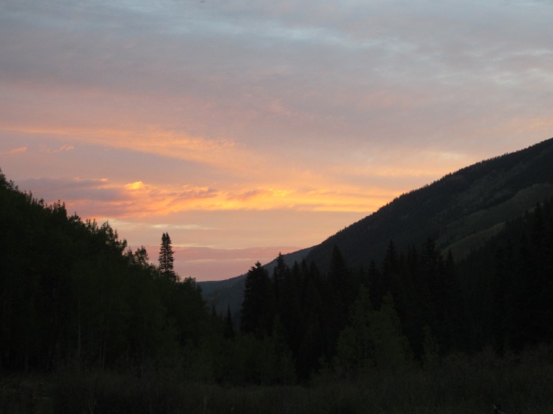
Sunrise.
For the end of May, I was expecting a lot more snow in the area and I was actually hoping to climb these peaks with some snow but that wasn't the case. There was no snow on the Conundrum trail and I left the trail ~10,600 and started my usual 13er bushwhack upwards through some aspens. I was able to minimize my bushwhacking by finding some grassy slopes that took me upward to the small basin to the east of the Hillard-Keefe saddle.
Castleabra from my ascent line.
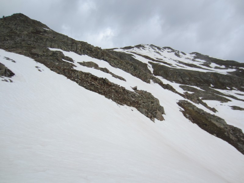
Since the slope was steep, I gained elevation quickly and encountered my first bit of snow around ~12,400. I traveled on the snow until I found a low angle grassy bench which took me to the Hillard-Keefe saddle where I took a break. The 13,200 false summit to the northeast of Hillard was a junky tower that I had to climb over. I climbed directly on the ridge until I figured out descending on the northwest side of the ridge around the tower was a better option. Some class 3 moves on typical loose Elk rock was required to gain the 13,200-Hillard Saddle and from the saddle, it was a class 2 hike to the summit of Hillard where I arrived at 9:30 AM.
Working my way up the snow to the Hillard-Keefe Saddle.
Keefe Peak.
Hillard Peak and the rotten tower at 13,200.
Looking back on Keefe from my traverse towards Hillard.
Keefe from the summit of Hillard.
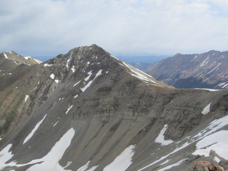
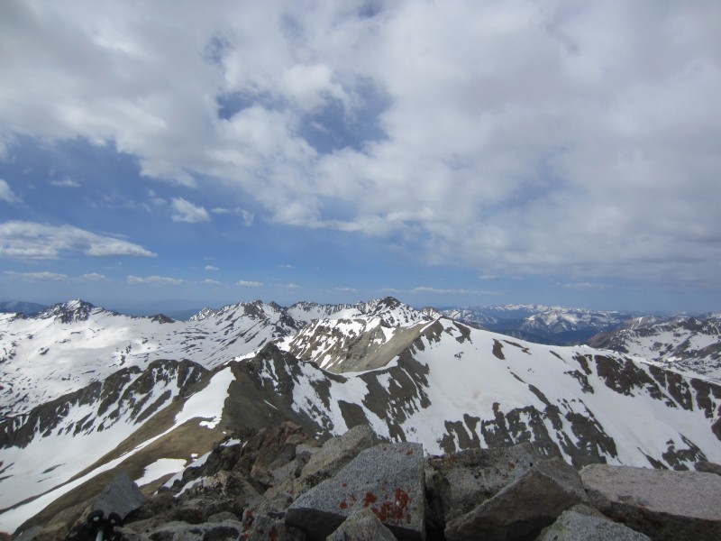
Castle Peak from the summit of Hillard.
A bit of an overcast layer and a light breeze kept things cool. The cooler temperatures were welcome since I was rock climbing in Denver the day prior with the temperature in the low 90s. I returned back to the Hillard-Keefe saddle and hiked up the talus class 2 south ridge of Keefe where I arrived on the summit at 10:20 AM. Excellent views of Cathedral and Castle Peak; however, I wasn't excited about the view of Hunter. Hunter appeared far away and from what I could tell, wasn't going to be a straight- forward grassy ridge romp.
The south ridge of Keefe.
Looking down the south ridge of Keefe.
Nearing the summit on the south ridge of Keefe.
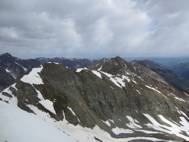
Hunter from the summit of Keefe.
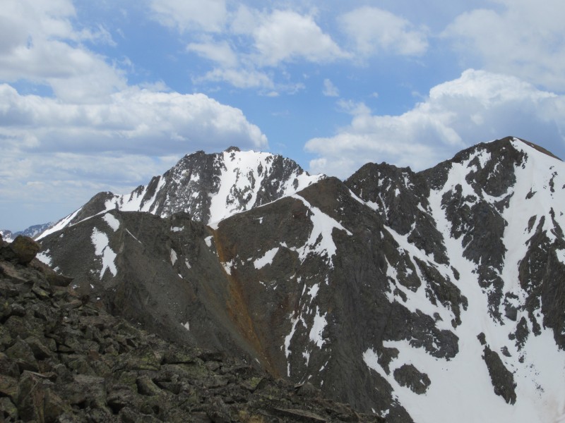
Hillard from the summit of Keefe.
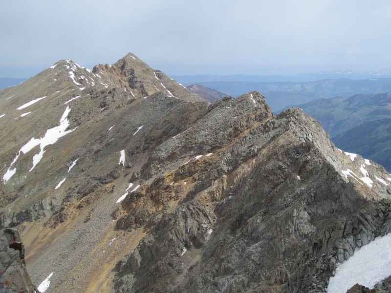
I spent close to 20 minutes on the summit of Keefe before starting my long journey towards Hunter. The immediate west ridge of Keefe required some short class 3 sections and the travel to point 13,400 northwest of Keefe was manageable. The crux of the traverse was between Point 13,400 and Point 13,418. Descending northeast off of 13,400 went well until I hit the 13,400-13,418 saddle where a very sharp ridge prevented easy access. I'm sure the ridge would make for some excellent scrambling except the rock was fairly junky.
Descending off of Keefe, looking back.
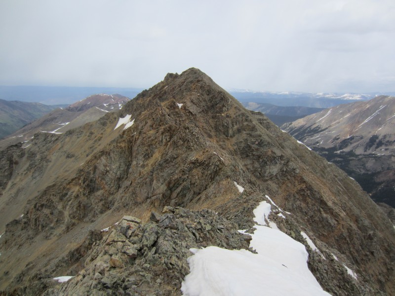
Hunter Peak from the traverse. The crux section can be seen.
North face of Keefe which might have a decent snow climb.
The crux section on the Keefe-Hunter traverse.
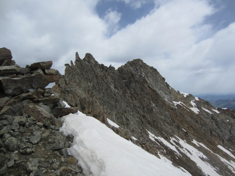
From the 13,400-13,418 saddle, I descend about ~100 feet on the east side of the ridge and followed narrow grassy ledges below the ridge proper. Plenty of class 3 scrambling was encountered and I regained the ridge proper after intercepting an east ridge spur from the main ridge. Once back on the ridge, there was plenty of short ups and downs which required some minor class 3 scrambling.
Grassy ledges bypassing the crux section.
Grassy ledges bypassing the crux section.
Typical short class 3 sections on the Keefe-Hunter traverse.
Looking back at Keefe about 2/3s of the way on the traverse.
Just before the summit of Hunter, I encountered a second crux. A short section of rotten towers. I was able to bypass them on the east side of the ridge on some exposed ledges. Finally, I arrived on the summit of Hunter at 12:40 PM. I returned back down the south ridge of Hunter and descended a steep scree/snow slope into a wide basin just northwest of Silver Dollar Pond. The descent was quick but I can't recommend the gully as an ascent line unless the snow was continuous to the ridge.
Final crux section on Hunter.
Keefe from the summit of Hunter.
Pyramid Peak from the summit of Hunter.
The gully I descended off of Hunter.
Welcoming the trail back, I made good time back to the car where I arrived at 3:30 PM. I forgot how long the trail was up the Conundrum Creek drainage.
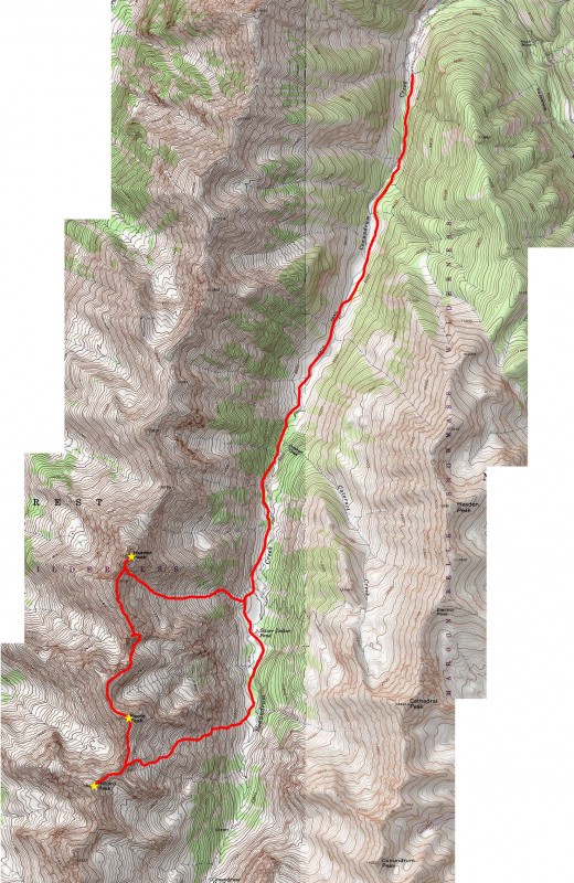
Route Map.
Thumbnails for uploaded photos (click to open slideshow):
I put together a long trip for those (on paper) as well and I'm glad to see someone finally do a report on em. Leave it to Furthermore. Good lord man, do you do anything else than climb 13ers? Jealous!!!!
We saw these from UN13,631 and I was hoping for some info on them. Thanks!
Caution: The information contained in this report may not be accurate and should not be the only resource used in preparation for your climb. Failure to have the necessary experience, physical conditioning, supplies or equipment can result in injury or death. 14ers.com and the author(s) of this report provide no warranties, either express or implied, that the information provided is accurate or reliable. By using the information provided, you agree to indemnify and hold harmless 14ers.com and the report author(s) with respect to any claims and demands against them, including any attorney fees and expenses. Please read the 14ers.com Safety and Disclaimer pages for more information.
Please respect private property: 14ers.com supports the rights of private landowners to determine how and by whom their land will be used. In Colorado, it is your responsibility to determine if land is private and to obtain the appropriate permission before entering the property.


")
")
")
")
")
")
")
")
")
")
")
")
")
")
")
")
")
")
")
")
")
")
")
")
")
")


