Download Agreement, Release, and Acknowledgement of Risk:
You (the person requesting this file download) fully understand mountain climbing ("Activity") involves risks and dangers of serious bodily injury, including permanent disability, paralysis, and death ("Risks") and you fully accept and assume all such risks and all responsibility for losses, costs, and damages you incur as a result of your participation in this Activity.
You acknowledge that information in the file you have chosen to download may not be accurate and may contain errors. You agree to assume all risks when using this information and agree to release and discharge 14ers.com, 14ers Inc. and the author(s) of such information (collectively, the "Released Parties").
You hereby discharge the Released Parties from all damages, actions, claims and liabilities of any nature, specifically including, but not limited to, damages, actions, claims and liabilities arising from or related to the negligence of the Released Parties. You further agree to indemnify, hold harmless and defend 14ers.com, 14ers Inc. and each of the other Released Parties from and against any loss, damage, liability and expense, including costs and attorney fees, incurred by 14ers.com, 14ers Inc. or any of the other Released Parties as a result of you using information provided on the 14ers.com or 14ers Inc. websites.
You have read this agreement, fully understand its terms and intend it to be a complete and unconditional release of all liability to the greatest extent allowed by law and agree that if any portion of this agreement is held to be invalid the balance, notwithstanding, shall continue in full force and effect.
By clicking "OK" you agree to these terms. If you DO NOT agree, click "Cancel"...
This is my first attempt at putting together a trip report so we'll see how it goes...
Stevens Gulch Road seemed a bit more bumpy than last summer, but was easily driven on dry road conditions. We arrived at the Grays Peak trailhead at 04:30 on 5/20/12 with calm and clear weather conditions under a still star littered sky. There were a good 20 vehicles scattered in the parking areas when we arrived.
At 04:55 we started our approach to Dead Dog Couloir which splits Torreys east face. The trail conditions consisted of dry dirt, frozen mud, ice, and snow as we started our climb. There was a considerable amount of frozen run water on the trail at spots that made for some slick spots. It was recognized that at lower elevations a dusting of snow had accumulated from the snow showers from Saturday the 19th mostly on preexisting snow.
Early morning sun hitting Grays and Torreys Sun rise Along the trail Torreys and Dead Dog Couloir
Approaching the apron of Dead Dog, we noticed the runnel on the lower half of the couloir had produced some wet slide activity and collected a considerable amount of rockfall. It is advised to staying to skiers right on your descent to avoid the runnel and rock debris, some of which are a good eight inches in size. The runnel itself is not "Grand Canyon" size as it can still be skied across, but does not make for a smooth descent.
Runnel noticeable from a distance
Near 06:30 we started our ascent up Dead Dog Couloir. It was quickly recognized that boots and trekking poles needed be complimented with crampons and an ice axe. The slope was getting moderate solar heating, but had not yet softened from the nights freeze. At numerous times rocks came whizzing by as my partner warned me from above. Another group of climbers were 50 yards back and they too were warned. This was a good system with moderately spaced climbers. It was interesting to see the various types of spring precip on the slope from the prior day (graupel and sections of unconsolidated powder that had drifted). The unconsolidated snow made for tricky footing at spots, but was easily navigated. We topped out on Torreys Peak around 09:00 with mostly sunny skies and very light winds.
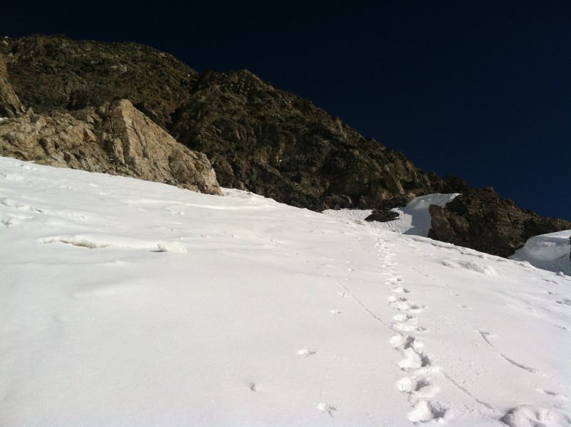
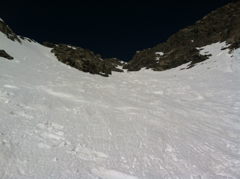
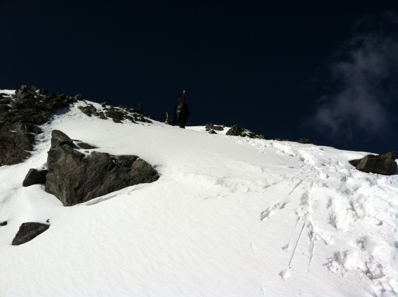
Nearing apron top In the couloir Looking down the couloir Along the ridge to Torreys peak On the summit Party at the peak Grays peak Kelso Ridge and basin
Due wind loading of snow from the prior day on the upper east face of Torreys we made our way back to the top of Dead Dog to begin our descent. The ridge between the summit and Dead Dog had between 6 to 12 inches of fresh snow and was littered with rocks. The descent down Dead Dog Couloir was very smooth as the snow had softened up nicely by 10:00 under sunny skies. As mentioned above, avoid the runnel on skiers left if desiring the smoothest run with less loose rocks to navigate.
The trail back to the parking lot had heated up considerably on the way down, as all the ice and snow was now water/mud and wet snow. We made it back to the vehicle around 12:00.
Thumbnails for uploaded photos (click to open slideshow):
Thanks for the TR. What camera were you using on this trip? Your saturation and photo quality on some of these pics looks like 35mm film but I'm assuming it was digital. Thanks again.
From what I could tell Kelso Ridge had some snow on the upper ridge area as you can see from the one photo. Below that I'm not sure, but based on conditions elsewhere it would lead me to believe it's fairly snow free. The east face of Kelso had some snow lines coming down, but a lot of bare in between.
I'm not sure of what your ground clearance is. I drive a Subaru Outback and made it up with no issues. There are a few spots that I took angled and slow with dips in the road and rocks. My only concern would be the clearance. Last summer I took a Subaru Impreza up with 4 people in the car. I had some power issues at the one steep section, but was fine clearance wise. I do think the road was a bit bumpier right now than last summer though. You can drive all the way to the TH.
That new snow above 13k sure made things smooth! Nice work!
Caution: The information contained in this report may not be accurate and should not be the only resource used in preparation for your climb. Failure to have the necessary experience, physical conditioning, supplies or equipment can result in injury or death. 14ers.com and the author(s) of this report provide no warranties, either express or implied, that the information provided is accurate or reliable. By using the information provided, you agree to indemnify and hold harmless 14ers.com and the report author(s) with respect to any claims and demands against them, including any attorney fees and expenses. Please read the 14ers.com Safety and Disclaimer pages for more information.
Please respect private property: 14ers.com supports the rights of private landowners to determine how and by whom their land will be used. In Colorado, it is your responsibility to determine if land is private and to obtain the appropriate permission before entering the property.
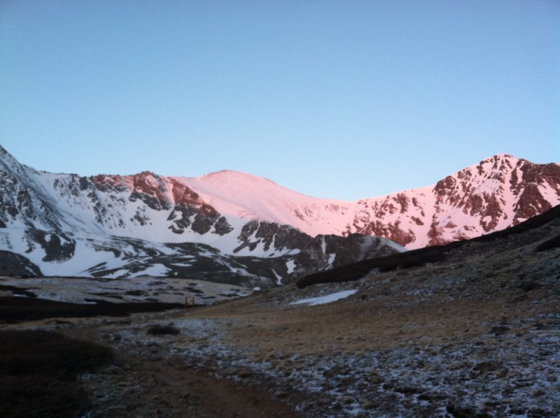


 Early morning sun hitting Grays and Torreys")
 Along the trail")
 Torreys and Dead Dog Couloir")
 Runnel noticeable from a distance")
 Nearing apron top")
 In the couloir")
 Along the ridge to Torreys peak")
 On the summit")
 Grays peak")
 Kelso Ridge and basin")
 Party at the peak")
 Looking down the couloir")
 Sun rise")


