Download Agreement, Release, and Acknowledgement of Risk:
You (the person requesting this file download) fully understand mountain climbing ("Activity") involves risks and dangers of serious bodily injury, including permanent disability, paralysis, and death ("Risks") and you fully accept and assume all such risks and all responsibility for losses, costs, and damages you incur as a result of your participation in this Activity.
You acknowledge that information in the file you have chosen to download may not be accurate and may contain errors. You agree to assume all risks when using this information and agree to release and discharge 14ers.com, 14ers Inc. and the author(s) of such information (collectively, the "Released Parties").
You hereby discharge the Released Parties from all damages, actions, claims and liabilities of any nature, specifically including, but not limited to, damages, actions, claims and liabilities arising from or related to the negligence of the Released Parties. You further agree to indemnify, hold harmless and defend 14ers.com, 14ers Inc. and each of the other Released Parties from and against any loss, damage, liability and expense, including costs and attorney fees, incurred by 14ers.com, 14ers Inc. or any of the other Released Parties as a result of you using information provided on the 14ers.com or 14ers Inc. websites.
You have read this agreement, fully understand its terms and intend it to be a complete and unconditional release of all liability to the greatest extent allowed by law and agree that if any portion of this agreement is held to be invalid the balance, notwithstanding, shall continue in full force and effect.
By clicking "OK" you agree to these terms. If you DO NOT agree, click "Cancel"...
Report Type
Full
Peak(s)
Henry Mountain - 13,272 feet
Broncho Mtn - 12834
Square Top Mtn B - 12985
Fossil Mtn - 12749
The Peaks:
Henry Mtn (13,254') - 438th highest
Broncho Mtn (12,834') - 762nd highest
Square Top Mtn B (12,985') - NR
Fossil Mtn (12,749') - NR
The Stats:
9.75 miles round trip
4530' elevation gain
Gold Creek Campground/ Trailhead (~10,085')
Participants:
Solo
Introduction
Recently our office has scaled back our hours and we only work four days a week, the bad news is I only get paid for four days a week, the good news - three day weekends! I have a couple of friends that are training to climb Mt Whitney this summer, and were looking for a fourteener to climb this weekend. We decided upon Uncompahgre, and climbed that on Saturday. My one friend lives in Crested Butte and I hadn't seen him or his family for over 2 years, so I ended up crashing their mother's day and staying in CB. So what to climb come Monday? Pouring over maps there were some cool peaks in the Elks, but my friend has had his eye on those so we decided we would get up some of those together another time. Having never been to the Fossil Ridge Wilderness before, and with Henry Mtn - a new 13er for me and a peak with over 1000' of prominence - that started looking like a pretty good idea!
The trailhead was easy to get to from Gunnison by heading east on US 50 to the town of Parlin (with the QT store), and headed east on the road to Ohio City/Pitkin. After 7 miles of pavement, you take a left in Ohio City (signed for Gold Creek) and follow 7 miles of well graded dirt to the campground and trailhead. The campground was surprisingly a no fee campground, but still has designated sites with picnic tables, fire rings and a bathroom. Nice! I of course was the only one there on a Sunday night in May and set up the trunk with my camp for a nice night's sleep.
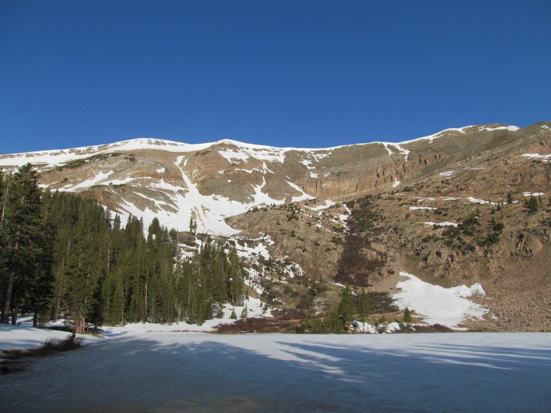
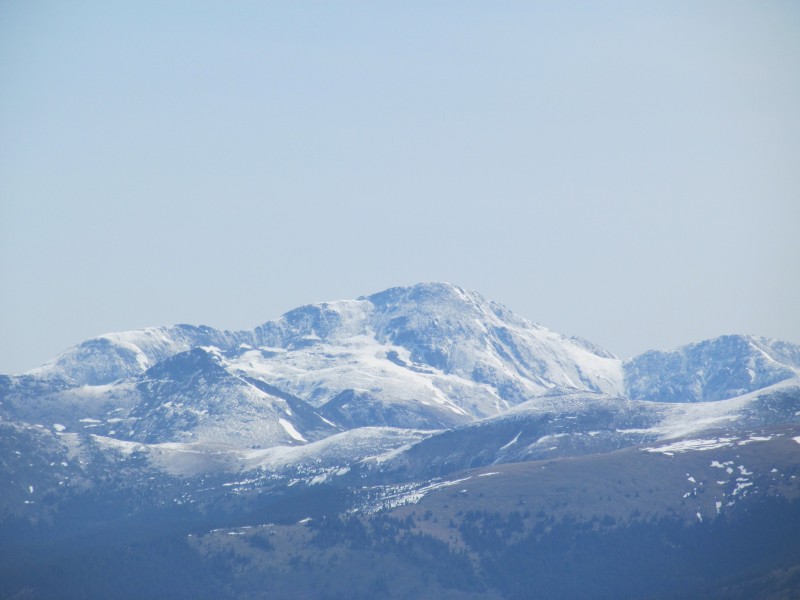
Broncho and Trailhead from Camp
The Peaks
The trail starts right at the campground entrance, and although rocky, was easy to follow. After about 1/2 mile (sign said 1/4) the trail splits and I took the Mill Lake trail which leads to the basin below Fossil Mtn. The trail is not long, maybe 2 additional miles, and ends at the lake at 11,500'. There were some patches of snow, especially above 11k, but no need for snowshoes. the lake was still frozen, making for some cool morning pictures of Fossil Mtn.
Mill Lake and Fossil
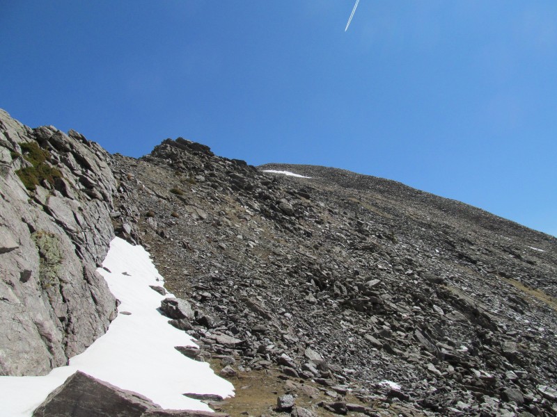
From here the slopes were mostly dry to reach the ridge, but rather steep. I tried to angle through the lower talus and hit a grassy slope to reach the ridge near a false summit. This slope gained about 900' of elevation in probably 1/4 mile, but despite being a bit of a lungbuster, wasn't too bad as the ground was pretty stable.
Ascent Slopes from Mill Lake
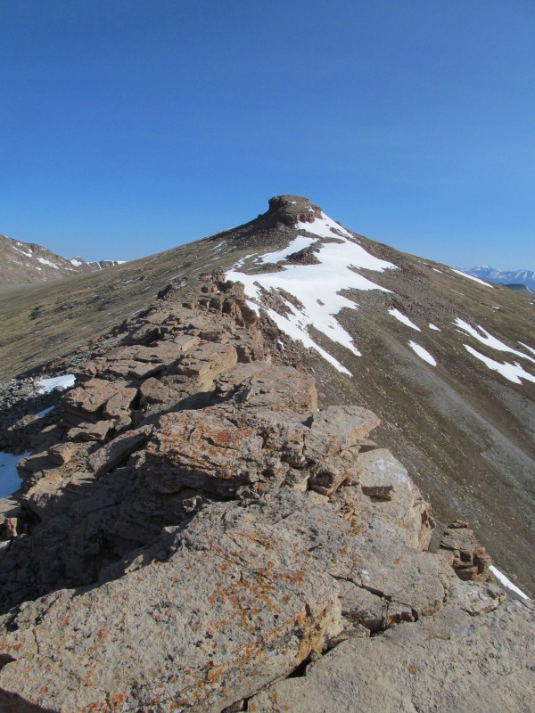
The ridge crest to the summit of Fossil is rocky, but stays at class 2 and went pretty quickly.
Ridge to Fossil
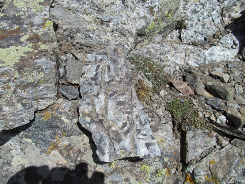
The rocks are pretty cool in this area, a dark gray slate with spots that I assume are the fossils? I am not sure, nothing I saw really looked like anything recognizable (no trilobites like they always sell in gift shops as "fossils"), but it was still pretty cool!
Fossils?
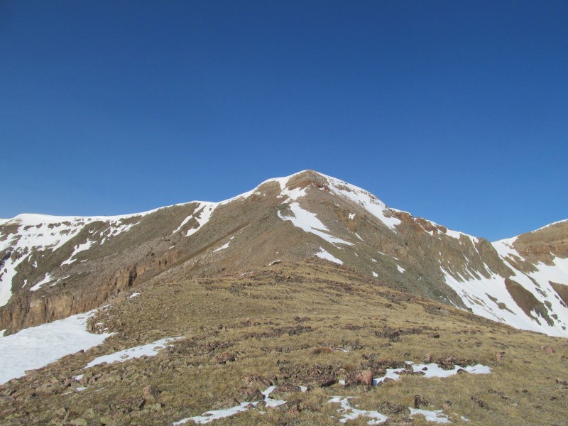
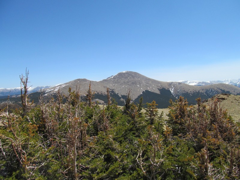
The summit of Fossil was reached, and great views were enjoyed while I snacked. I finally saw the first views of Henry and Square Top and the ridge from Square Top to Broncho. It was nice to feel like some progress was being made, but there was still another unranked 12er to pass over before reaching Henry. He likes to hide back there and make you work for his summit.
Henry and Square Top from Fossil
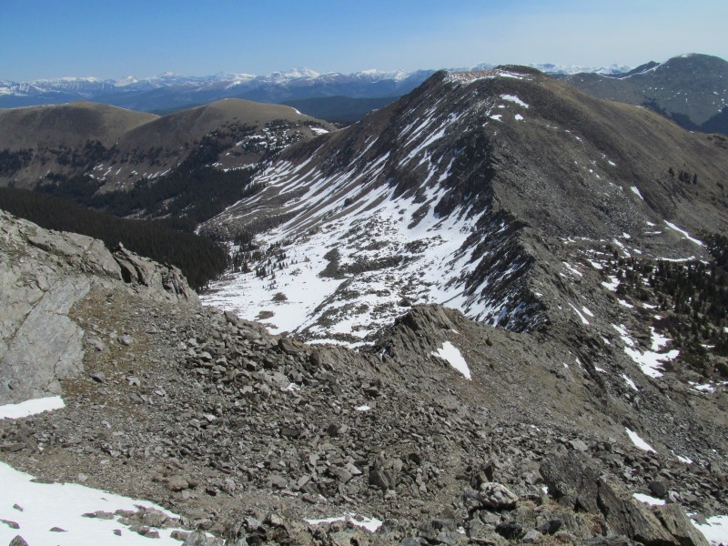
The ridge connecting Fossil and Square Top is pretty cool, a different type of rock again, bigger blocks that almost look like they will require some scrambling, but don't. It was fun hopping across the ridge crest here!
Ridge to Square Top
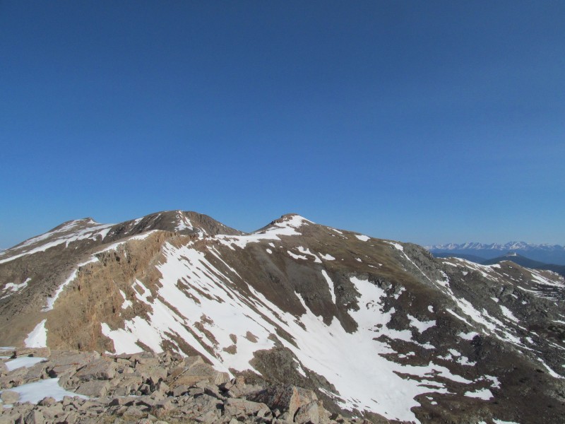
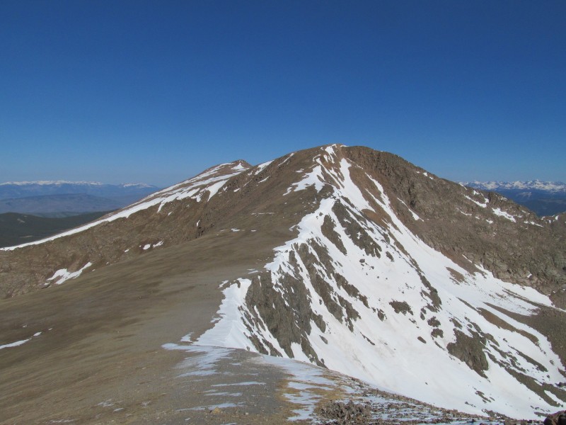
Then it was up the final ridge to the summit of Square Top and through its broken cliffy top that helps give it its name. I had a nice break here and continued on to Henry. After an initially steep descent, the terrain became pretty gentle and the slopes to Henry were fairly gentle as well. There are two summits, but the first one you get to is the true summit and is a good 20 feet higher.
Route to Henry from Square Top
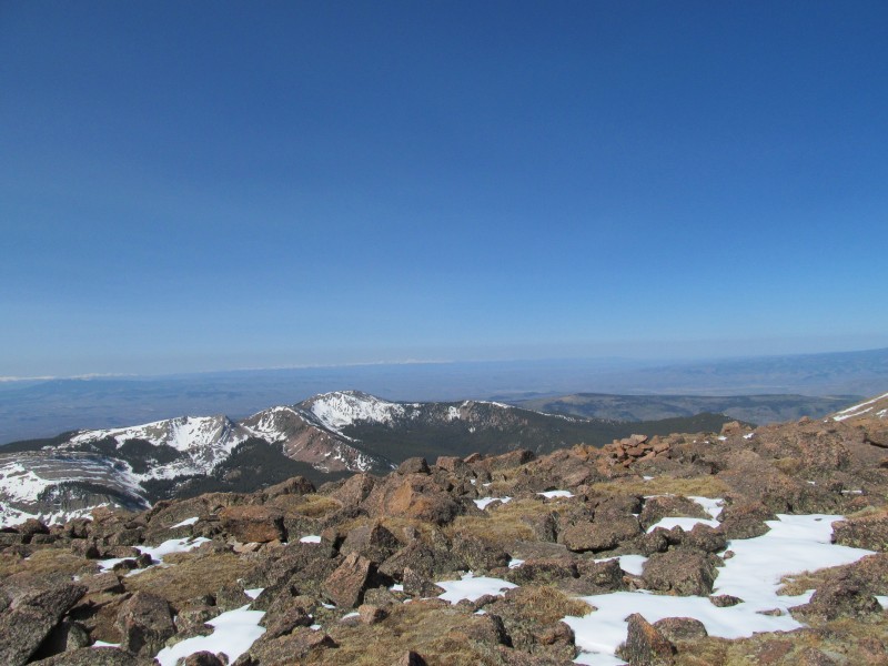
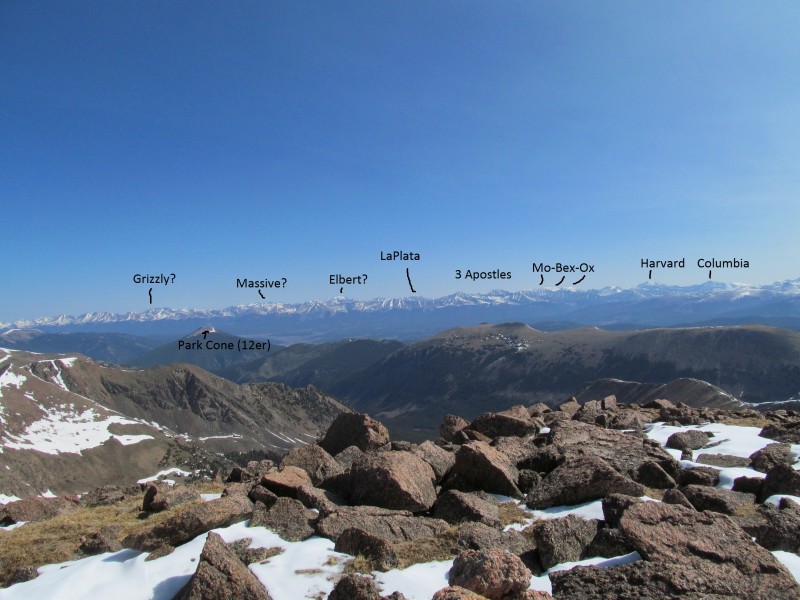
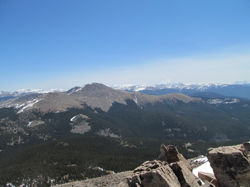
The summit was a big flat plateau with commanding views that are quite nice. This peak lays west of the main Sawatch crest, so you get a back side view of the Sawatch, and then because nothing is taller than Henry Mtn for miles in the other directions so you get long distance open and clear views of the San Juans and West Elks. A privileged position and well earned with having to climb 2 unranked 12ers to get there. Nearby 12er Park Cone (which has over 2,000' of prominence) looked like a summit I should get to if only for the views alone, but the panorama of the Sawatch was pretty darn cool from Henry Mtn too!
San Juans (the thin distant white line)
Sawatch Peaks
Yale Zoom
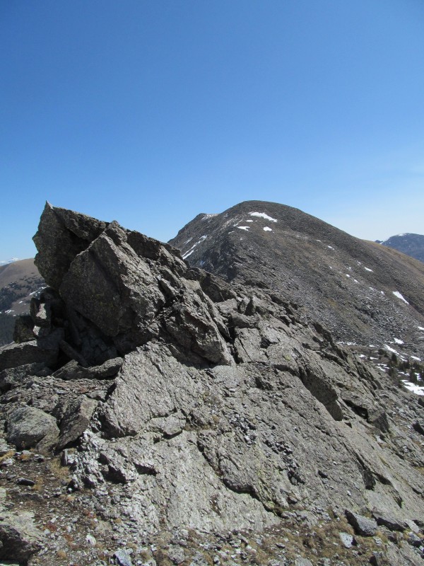
I then reclimbed Square Top and started to work my way down its rugged east ridge towards Gunsight Pass and Broncho Mtn.
Engaging East Ridge of Square Top
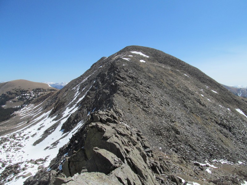
The ridge looks much worse than it is, and there are some possibilities to bypass parts on the right (south) or just drop down a steep talus gully and bypass the whole thing - especially if you are not interested in Broncho.
Looking Back
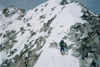
Scrambly Towers
I stayed mostly on the crest, but for a few spots that I couldn't tell what was on the backside, I occasionally took the "easy way" and dropped a bit on the right (south) to keep from having to backtrack. I hit Gunsight Pass and thought the opposite side looked a little exposed and decided to drop and extra 150' or so and go up Broncho via easier terrain.
Nearing Gunsight Pass
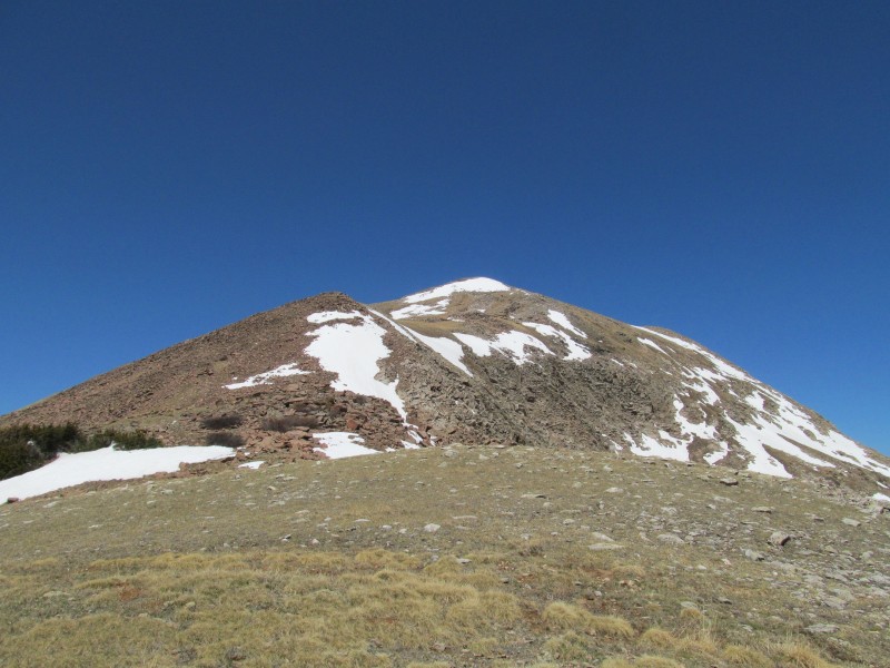
Ascending Broncho
I ascended steep talus slopes to a false summit, then traversed the flat summit plateau to its highest point where I enjoyed some more excellent views, including some better close up views of a neighboring 13er - Fairview Peak. If one is really ambitious you can climb two unnamed 12ers north of Broncho and then Fairview, but it easily adds another 8 miles and 2000' to one's day. The weather was good, and I certainly thought about it, but would rather get home earlier in the afternoon and decided to descend. Its too early in the year for 20 mile 8000' days anyway...
View from Broncho Summit
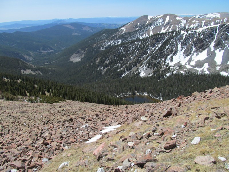
I started off down the dry south ridge of Broncho until I hit the trees, stopping for a few more pictures, and then started to angle my way down southwest facing slopes to hit the Lamphier Lake trail that would lead me back to the campground and my car.
Descending Broncho's South Ridge
Lampgier Lake and Route Back to Car
The slopes were steep, and had their share of deadfall, but they were completely dry as was the trail when I hit it. I hiked out the last mile or so back to the road and was surprised to find the parking lot only 1/4 mile away. It didn't seem to line up with the morning where I had to traverse 1/2 mile to get to a trail that was actually closer, but I guess that first trail went at a different angle deeper in the woods than I realized at the time.
Fairview from Ridge
Conclusion
I drove out the dirt road, where the road regraders were out working, and back towards the pavement. A short delay to let them bulldoze some rocks out of my way and I was on the way home. I enjoyed my first visit to the Fossil Ridge Wilderness, and look forward to returning for Fairview and to enjoy this beautiful area. Not sure about how many fossils I really saw, but I will say the rocks were really cool! Being an architect I was wondering how nice the dark gray slate would look in someones house, but of course I took only photographs and was a good leave no trace steward! I highly recommend a visit to this special and little visited area. Somehow this is the first trip report on this site for this peak, that just doesn't seem right... get out there and enjoy this wonderful little corner of the Sawatch!
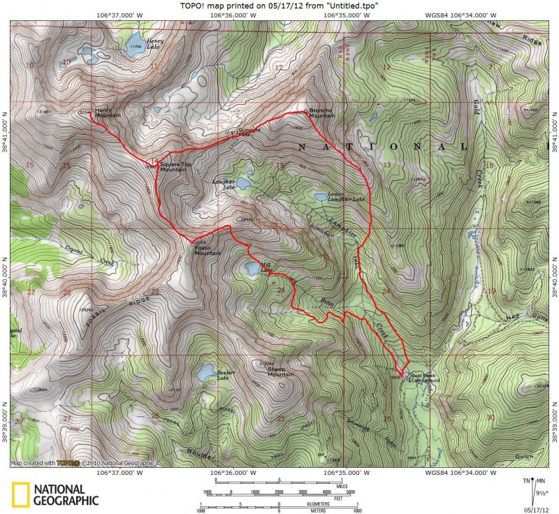
Route Topo
Thumbnails for uploaded photos (click to open slideshow):
It may be contoured and shaded but it is still so much more of a blank canvas than a finished work. Make it what you will. Your report clearly shows how great it can be.
I see two other 12ers that were basically en route. You transplants just aren't the same as bonafide Coloradans.
Can't figure out what those fossils are. I was thinking big crinoid stems and gastropods (upper right), but it doesn't quite look like those - horn corals, maybe? The Leadville is Mississippian in age. Oh well. I'm not a geologist.
I have a fond memory of that area. Fairview was my first mountain at age 4. I did all of those mountains in my childhood. Many trips up to Lamphere Lakes. I think both my parents have it in their wills to spread their ashes there still.
I learn something new from you all the time. Thanks for the great trip report of some lesser knowns. Bill's going to need a 12ers.com soon if you keep this up. See you soon.
Those ”fossils” you took a picture of are most likely not fossils at all but phenocrysts (hornblende maybe, hard to tell)that are part of an intrusive igneous body. I did this exact hike a couple years back and saw those rocks as well. The Fossils of fossil ridge are actually in the rock formation shown in your ”Ridge to Square Top” picture. Anywho, great TR and it most definitely is an under appreciated area.
Kimo - Indeed the map is my canvas, and my feet the brush
Monster5 - They were unranked and I thought I would save myself in case I got a wild hair to do Fairview too, thanks for the rock insights!
Matt- Its a cool place, a guy from Gunni was in the register like 5 times, seems those who find it, treasure it.
Brian- Yeah, the 3 day ain't bad, but I'd rather get paid! Hard to balance time off with less money to travel to peaks
Scot- These days I tend to keep my TRs on the lesser knows, glad to see they find so much interest! See you tomorrow for another one
Ryan- Saw you in the register and was hoping you'd chime in, thanks for the geologist's perspective! The rock up there is so cool, and quite unique.
Interesting report, Mike! I always wonder about fossils being that high up. Makes you think the world was upside down at one time. Thanks for posting! :D
edit: I just read SuperPolok's reply after I posted this one. If they aren't really fossils, they're still pretty cool!
... to admit that I haven't spent much time in that area at all, even though it's pretty close by. I rode my bike starting at that same trhd down to Willow Creek, but that's it. Some friends of mine skied Henry a few years back during a big winter, I might have to do the same. thanks for the TR
Caution: The information contained in this report may not be accurate and should not be the only resource used in preparation for your climb. Failure to have the necessary experience, physical conditioning, supplies or equipment can result in injury or death. 14ers.com and the author(s) of this report provide no warranties, either express or implied, that the information provided is accurate or reliable. By using the information provided, you agree to indemnify and hold harmless 14ers.com and the report author(s) with respect to any claims and demands against them, including any attorney fees and expenses. Please read the 14ers.com Safety and Disclaimer pages for more information.
Please respect private property: 14ers.com supports the rights of private landowners to determine how and by whom their land will be used. In Colorado, it is your responsibility to determine if land is private and to obtain the appropriate permission before entering the property.