Download Agreement, Release, and Acknowledgement of Risk:
You (the person requesting this file download) fully understand mountain climbing ("Activity") involves risks and dangers of serious bodily injury, including permanent disability, paralysis, and death ("Risks") and you fully accept and assume all such risks and all responsibility for losses, costs, and damages you incur as a result of your participation in this Activity.
You acknowledge that information in the file you have chosen to download may not be accurate and may contain errors. You agree to assume all risks when using this information and agree to release and discharge 14ers.com, 14ers Inc. and the author(s) of such information (collectively, the "Released Parties").
You hereby discharge the Released Parties from all damages, actions, claims and liabilities of any nature, specifically including, but not limited to, damages, actions, claims and liabilities arising from or related to the negligence of the Released Parties. You further agree to indemnify, hold harmless and defend 14ers.com, 14ers Inc. and each of the other Released Parties from and against any loss, damage, liability and expense, including costs and attorney fees, incurred by 14ers.com, 14ers Inc. or any of the other Released Parties as a result of you using information provided on the 14ers.com or 14ers Inc. websites.
You have read this agreement, fully understand its terms and intend it to be a complete and unconditional release of all liability to the greatest extent allowed by law and agree that if any portion of this agreement is held to be invalid the balance, notwithstanding, shall continue in full force and effect.
By clicking "OK" you agree to these terms. If you DO NOT agree, click "Cancel"...
Mountain and Route: Mt. Lindsey via the North Face Gully
Date: 05/06/12
RT Mileage: 10.6mi
Vertical Gain: 3850ft ascent, 4200ft descent
Party: Adam (AFDusmc) and Karthik (theotherindian)
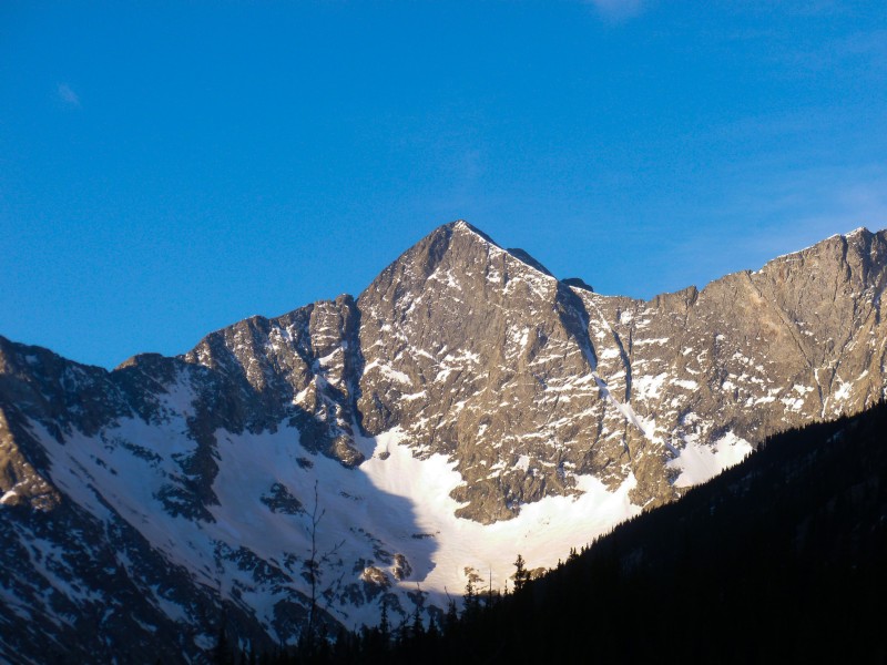
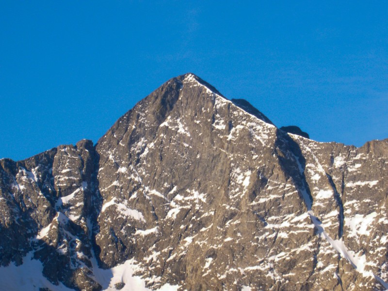
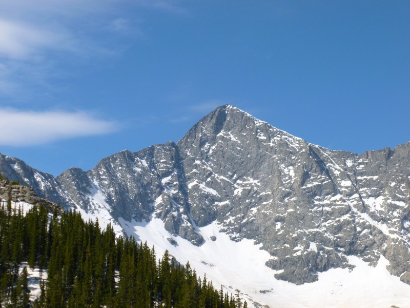
After driving close to 5 hours, with the supermoon glaring menacingly and what seemed to be an eternity through the dirt road, Adam and I found ourselves less than a quarter mile from the Lily lake TH. A short jaunt on the road to the TH and we were on our way, admiring the imposing view of Blanca and the meadow in the foreground.
Blanca from a distance This area has a lot of pointed things
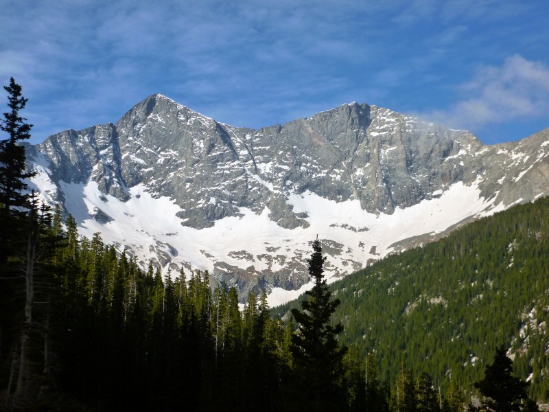
The trail wandered aimlessly below treeline gaining an impressive zero elevation in close to two miles. When we finally started heading up, we took the wrong route. We missed the trail, if there was one, that heads into the gully but instead took the slope to left of it which was a snow bump to the side of a boulder field. After some steep climbing though hard snow and boulder hopping, we caught a glimpse of the basin. We realized we were probably a couple of hundred feet above the basin we were supposed to be in. After another bout of rock hopping and minor post holing, we rejoined the actual trail and worn out snowshoe tracks. The last mile had taken forever and we were considerably energy depleted, but the view of Blanca and Ellingwood sure lifted our spirits.
Blanca, Ellingwood and a top notch sky Soak in the views
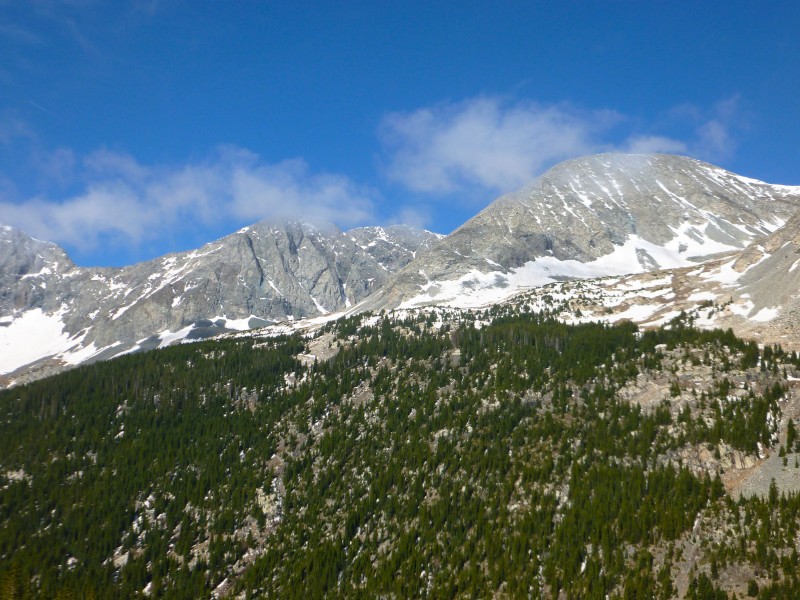
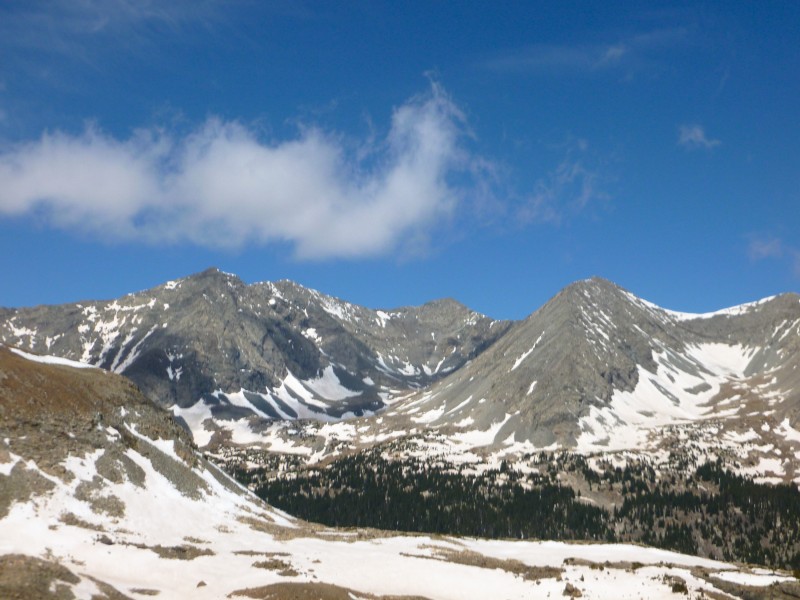
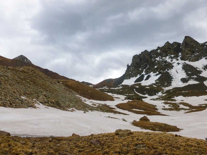
After long grinding walk through the basin admiring the views of Blanca, Ellingwood and Iron nipple and equally long hike up to the saddle, some concerns regarding the weather started popping up.
Iron Nipple? Or something next to it ... Adam heading to the saddle This area sure rocks!
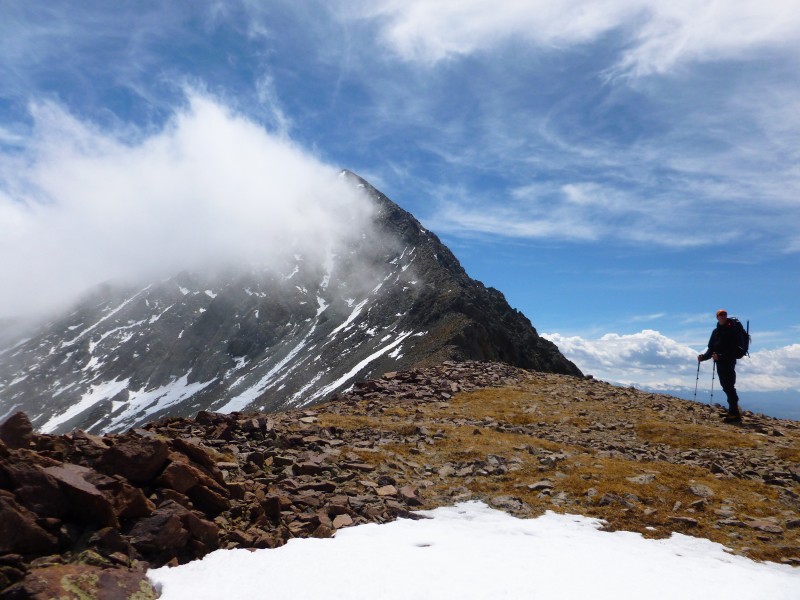
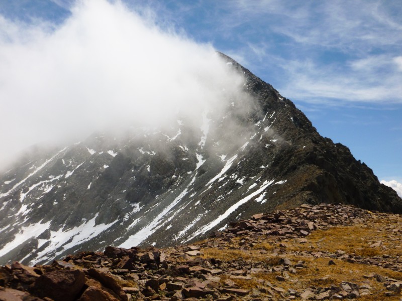
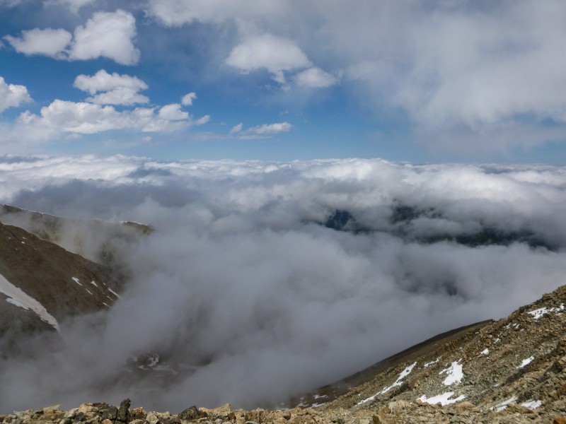
What initially seemed to be just evaporated snow rising up, seemed to get more formidable with the wind smashing and churning them together. By the time we reached the saddle, large fog clouds started covering up the basin and some darker clouds started moving in from elsewhere too. The view on the other side of the saddle didn't lift our spirits much.
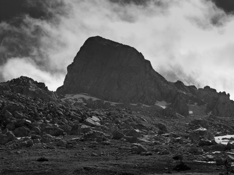
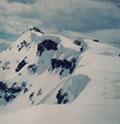
The hiker and the mountain Shy Ms. Lindsey
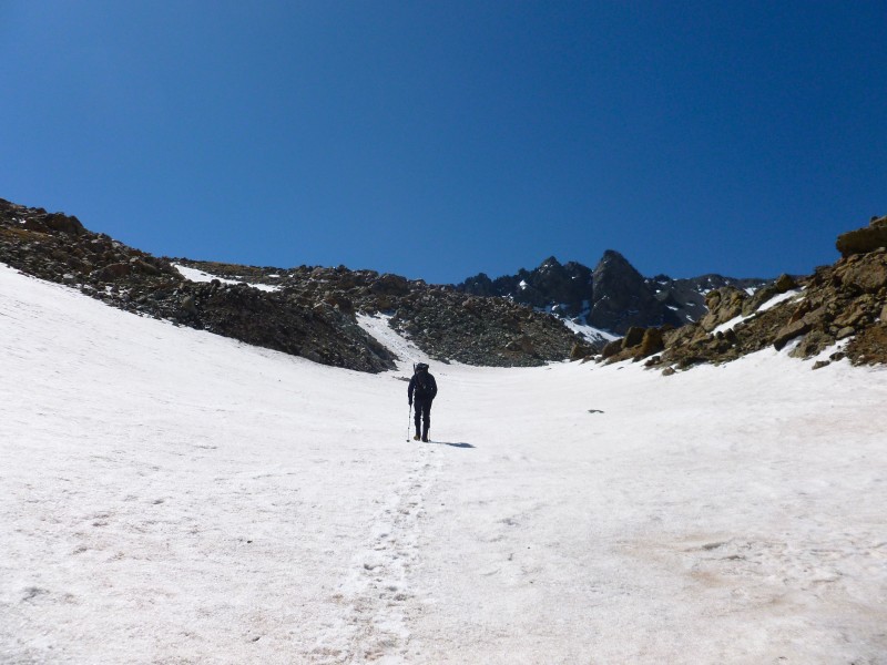
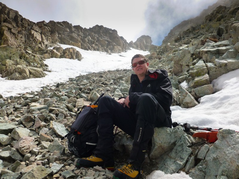
The hike up to the base of the gully was mostly non eventful. We were so exhausted by this time and with the weather moving in, the thought of north couloir was completely erased from our minds. We put on our crampons, parted with our packs and continued to head up through the boot ladder.
Rest before the test
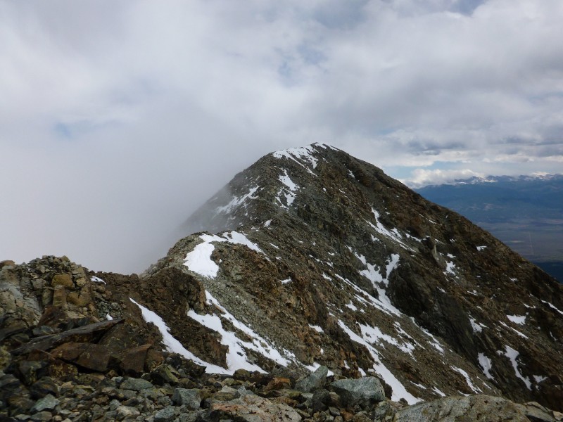
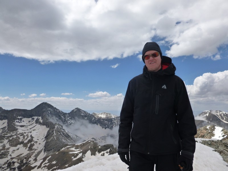
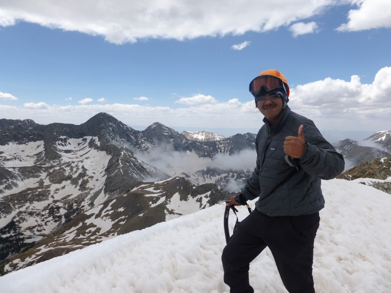
The snow was surprisingly good and traction was a non issue. While I was quite jittery about getting down on this steep snow, Adam kept assuring me the snow was perfect for heel stepping on the way down. I would later find out he was spot on. After climbing two hours on Missouri's soft C couloir two weeks ago, the Lindsey gully seemed very short. After the notch, we went to the left but I refrained from going too far to the left through the snowfields and tried scrambling up some solid rocks to the false summit. Adam, by now had reached the false summit and had a big smile plastered on his face assuming it was the summit. I was secretly wishing it was true but knew from previous reports there is another 0.2 mile to the hike. We finally made it to the summit after 7 hours from the TH. We clicked a few pictures and then started heading down, with concerns about the weather still on our mind.
The true summit Puffy ones, above and below Happy Adam Somehow made it!
The hike down was largely uneventful upto the basin. But the postholing fest started soon after. Adam started cruising down the trail and I took my own sweet time to get down. I eventually stepped into the stream underneath the snow on one of the million postholed steps of the day and wet both my shoes. I also had to cut back through downed trees and deep snow to the trail we ascended to retrieve my snowshoes. For the day, I ended up carrying snowshoes for about 6 miles but not having them when I needed the most. I still had four more miles to go (my car was parked near the national forest entrance) and I took almost 3 hours walking slowly in soggy shoes. The drive back through the dirt road took forever and the last thing I needed was rain all along I-25 for a grand 200 miles but Colorado had other plans.
Cya Lindsey ... one last look
Well, parts of the hike were miserable, but in the end I hiked on those 'pointy' peaks. Those are called mountains, right?
My GPS Tracks on Google Maps (made from a .GPX file upload):
got lost in that same wrong gully with snow. While dry, it's a pretty easy trail, but with a bit of snow, it really changes. I also walked all the way out with sopping wet shoes, gurgling with every step. I agree, it's one of the most beautiful basins and 14ers of all- a very special place. Thanks for the great pictures.
Guys looks like you put some effort in to gain the summit, nicely done. I bailed on Lindsey this weekend, hopefully next weekend will hold a better weather pattern. Thanks for the information on the post holing, you guys have had some practice lately.
Planning on Lindsey in mid-June. Thanks for the posting and a look at the conditions. Blanca's NE wall is awesome.
Caution: The information contained in this report may not be accurate and should not be the only resource used in preparation for your climb. Failure to have the necessary experience, physical conditioning, supplies or equipment can result in injury or death. 14ers.com and the author(s) of this report provide no warranties, either express or implied, that the information provided is accurate or reliable. By using the information provided, you agree to indemnify and hold harmless 14ers.com and the report author(s) with respect to any claims and demands against them, including any attorney fees and expenses. Please read the 14ers.com Safety and Disclaimer pages for more information.
Please respect private property: 14ers.com supports the rights of private landowners to determine how and by whom their land will be used. In Colorado, it is your responsibility to determine if land is private and to obtain the appropriate permission before entering the property.