| Report Type | Full |
| Peak(s) |
Kit Carson Peak - 14,167 feet Challenger Point - 14,086 feet |
| Date Posted | 04/16/2012 |
| Modified | 02/01/2015 |
| Date Climbed | 08/25/2011 |
| Author | DeTour |
| Kit Carson via the highest town in America |
|---|
|
Our Kit Carson experience consisted of two fabulous peaks gift-wrapped with the most enchanting mountain campsite I had ever experienced and a charming little village filled with quaint characters and a llama named after Jimi Hendrix. It started on a weekday afternoon in the town of Crestone, jumping-off point for Kit Carson and Challenger Point. We were seeking lodging for one night, with plans to camp at Willow Lake the next night, and seek the peaks the following day. 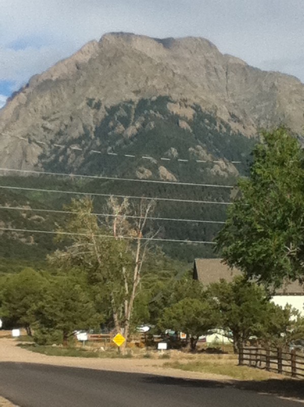 We started with a little downtown "hotel," which was allegedly open for business, but locked tight, with a handwritten sign instructing travelers to call what turned out to be someone's cell phone voicemail. Dear Daughter quickly comprehended that searching the Internet for Yelp reviews won't accomplish much in Crestone. You need to talk to real people, so she set out to find some. She - we - found plenty. The cannabis therapy shop next to the hotel was closed, but Maryjane found a lead at the next business down, some other type of spa. The folks there told her the Manitou Foundation had a conference going, which filled most of the "conventional" (by Crestone standards) lodging, but we should check with a gal named Electrum Amore, who had some cabins. We could probably reach her by asking at the Laughing Buddha, which she owned. We didn't know what exactly the Laughing Buddha was, but had noticed the building due to its combination of old West architecture and bright purple paint. It also proved to be closed, despite posted hours that said it was open - a pattern was developing there. But the door had a poster about a play which included a phone number and the name "Electrum." How many Electrums could a town of 150 people have, we reasoned, even though we were realizing that reality in Crestone could be, well, pretty much whatever you wanted it to be. The number did turn out to belong to "our" Electrum. She had no cabins available, but did have some yurts we could rent, behind a local coffee shop. "If you like them, make yourself at home," she said. We could leave payment for her at the coffee shop, or at the Laughing Buddha - "she's running a little late," Electrum said of the bartender - or maybe she'd be around later. "Whatever," she laughed, which pretty much summed up the town in every aspect. The yurts turned out to be basically round tents on wood platforms, in a run-down little garden compound that appeared to have had an exotic charm at some past point. But they were fine for a night of alternative lodging. We stashed our gear and took a drive up the mountain to scout the trailhead before the next day's hike. 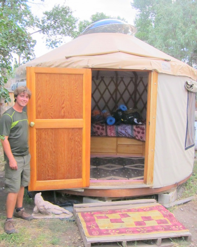 Our trip back down was halted by a strange site - a llama, lounging by the side of the road, nibbling on mountain grass. Its bored gaze and leash told us it was a domestic animal, even though it wouldn't let us close enough to take the leash, which is probably good because none of us had any idea what we would do with it if we did get ahold of it. 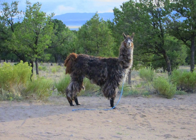 We left the llama and returned to the village in search of some food, only to find "whatever" continued to rule the day. We concluded by now that, regardless of what the elevation sign says, Crestone must be the highest little town in America. The town's two little restaurants were closed, so we tried the Laughing Buddha, which was now open. It appeared to be a pretty typical watering hole with a couple dozen locals and one slightly harried bartender. I asked her if the kitchen was open. "Microwave pizza," was her cryptic response. "There's an issue with the chef." I did not seek details, nor did we take her up on the pizza. In the course our meanderings, we came across another unique feature of Crestone: the "Free Box," a kind of community sharing center where people donate stuff for anyone who wants or needs it.  We ended up at the conference center restaurant south of town, for lack of alternatives. While there we told the waitress about the llama and asked if she might know the owner. "That sounds like Jimmy," she said. So, we thought, the owner's name is Jim ... "No, the lama's name is Jimi," said the waitress. "After Jimi Hendrix." The owner, it turned out, lived in some vague place "on the mountain" and strolled the town with a small menagerie of dogs, goat and Jimi, selling a little goat's milk or, occasionally, llama wool. She said she would pass along word that Jimi had been seen on the road up to the trailhead. With our curiosity satisfied and a hopeful sense of having helped to reunite Jimi with his owner, we retired to our yurts. Some deer had visited the grounds, presumably attracted by several apple trees.  During the night, Mark heard what sounded like a larger animal, based on the way apples popped under its weight. He decided to remain in the tent rather than investigate. That visitor's identity may have been revealed the next day, in a tree across the street from our little yurt garden. 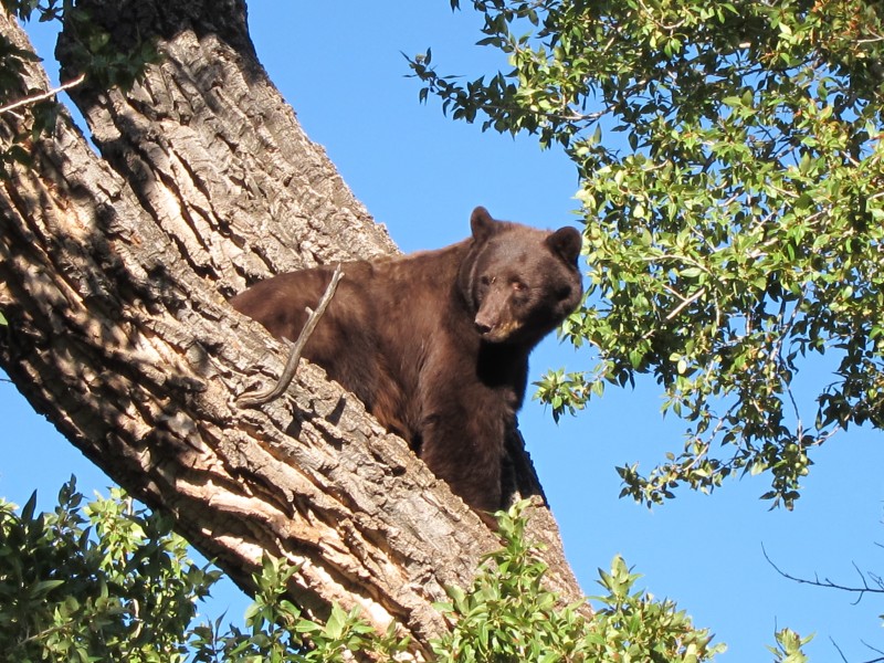 With that fitting conclusion (for the time being) to our Crestone experience, we headed up the beautiful Willow Lake Trail to our camping destination. The reputation of the trail, and the lake, being among the best Colorado has to offer, seemed well deserved based on our limited experience. The trailhead vicinity is appealing, with a stream and a view west over the valley a short way in. After about a mile of tedious switchbacking, there opens up a spectacular view of Challenger Peak, Kit Carson's summit peaking out from behind it, the Willow Lake headwall, and Willow Creek drainage.  Of course spectacular views by definition mean significant distances must be traveled, and the trail is long, but varied. Rocky outcroppings, stream crossings, beautiful forest, it has it all.   Our party was one of about five camping near the lake. We found nice sites available on the north side of the lake. Words cannot describe how enchanting the place was - start with serene, remote, beautiful, breathtaking, and try to let your imagination free from there. 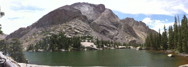 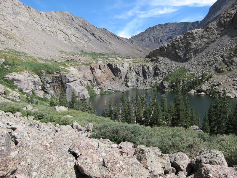 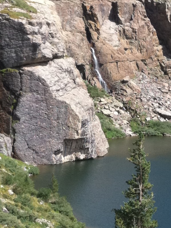 As an unexpected bonus, we learned someone had gone to the trouble some years back to lug a canoe all the way up there, available for anyone who wants to paddle the lake. We took advantage of that opportunity, enjoying a different perspective on the bluff and waterfall at the east end of the lake, and on the experience in general. 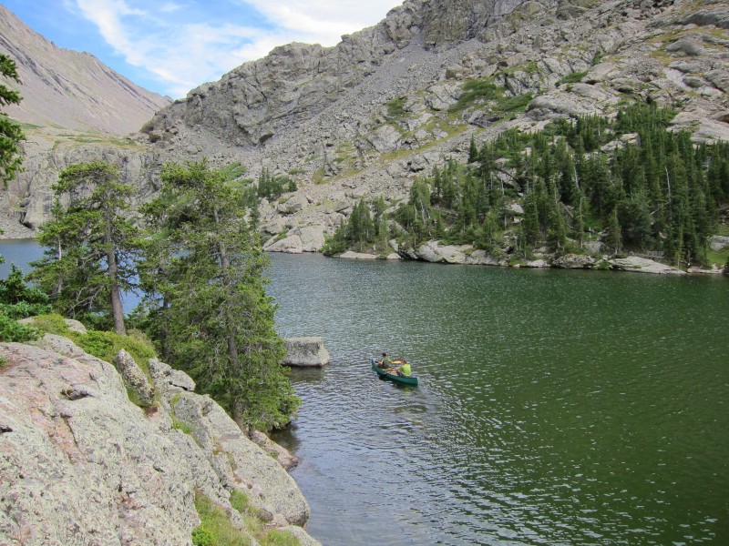   After a typically restless night's sleep, we set out around daybreak. We expected to get wet in the willows at the east end of the lake, but they were dry this late August morning. Making only a brief stop to enjoy the waterfall and view from above the lake, we soon found ourselves heading up Challenger's north slope at around 12,000 feet.  Some early clouds appeared threatening for a while. We thought getting rained on was likely, and discussed the prospect of a serious storm hitting us with minimal warning, with the mountain blocking the view to the west. But the clouds cleared, and our string of good fortune continued: no significant precipitation on any of our fifteen 14ers. The distinctive deep gully on Challenger's north slope, which the trail roughly parallels, had minimal snow. The bottom of the gully is higher than I had realized from viewing photos - it really just splits the upper half of the slope. 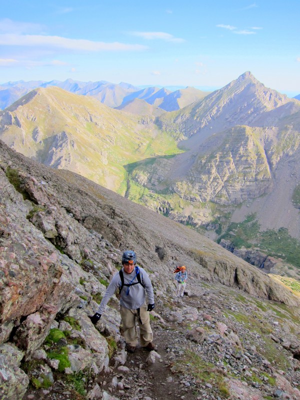 The trail was impossible to lose as it followed a rock rib along the lower slope, but when it departed the rock rib toward the gully and started winding through rubble, we managed to lose it briefly, to climber's left. We actually found our off-trail excursion enjoyable in this case, scrambling over rock generally ranging in size from basketballs to rain barrels. But between the angle of the slope and the fact that it had not been "broken in" by numerous others, I worried some about the prospect of a rockslide. I thought then, and still do, that the risk was low, but the consequences if something did move could be serious. That was probably the only real risk we encountered on this hike, in my opinion.  We regained the trail soon enough. It is loose in spots, as many have observed; but as usual, we found some of the loose sections could be avoiding by simply opting for solid rock nearby. I feel like part of the reason people talk down Challenger and talk up Kit Carson is because all the work is on Challenger. You gain almost 2,000 feet going up that slope - it's going to take its toll. The fun really starts when you reach Challenger's ridge. 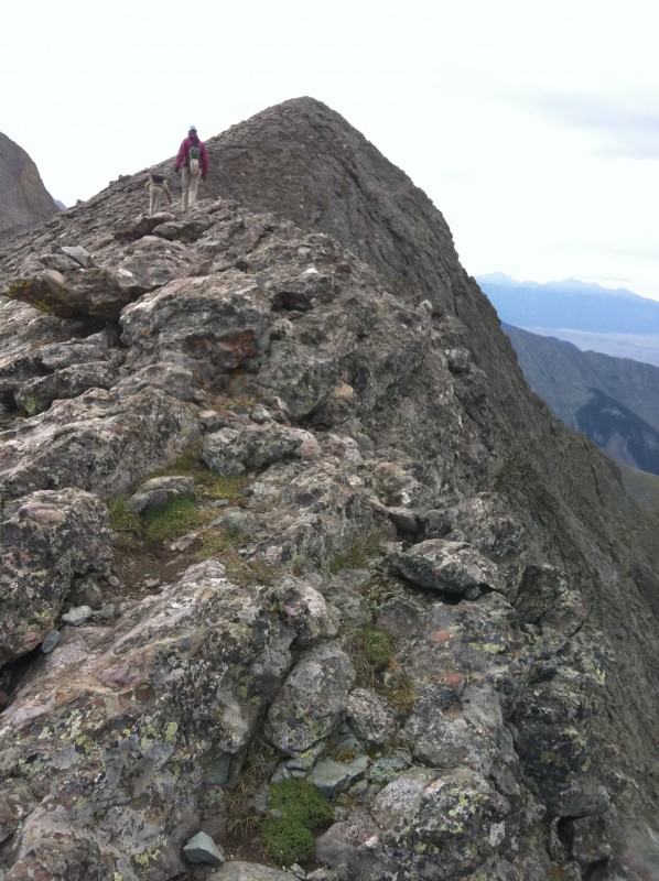 From the saddle at 13,860, we ditched the trail in favor of a short class 3 scramble directly to the ridge. Once on the ridge, we mostly stuck to it all the way to Challenger's summit. The trail follows the ridge in spots, and winds a short distance below it in many other locations. But the ridge rock was solid, the views unbeatable, the feeling exhilarating. I could see no reason to depart the ridge, other than one two-step section where the tremendous exposure of Challenger's south face crept close enough that I stepped to the left of the ridge boulders. 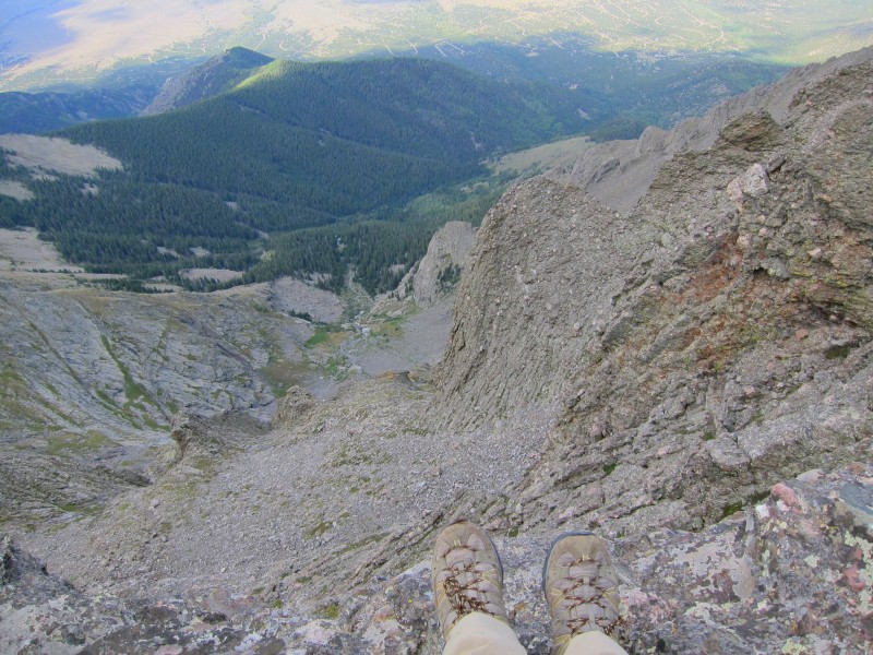 Overall, I found Challenger to be a pleasant surprise. Maybe it gets short-changed as Kit Carson's "kid sister." I had a picture of it as a pile of rubble you have to cross to get to Kit Carson, but it's far better than that. 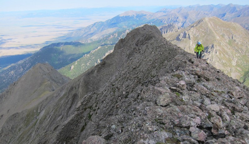 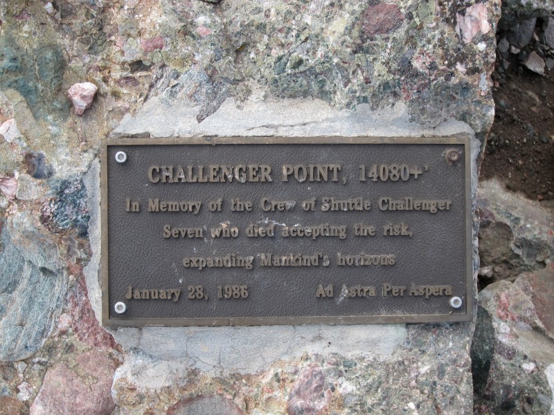 But we were on to KC soon enough. At the saddle between the two, and continuing along Kit Carson Avenue, there is more dizzying exposure on the south side. The trail doesn't come especially close to it, and KC Avenue, as many have observed, is a wide, easy walk. But the almost-sheer drops are there to admire if you wish. 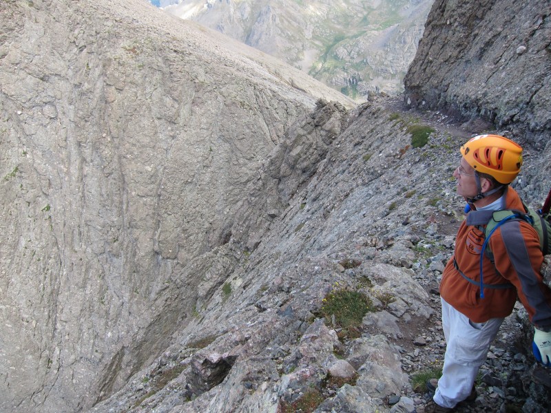 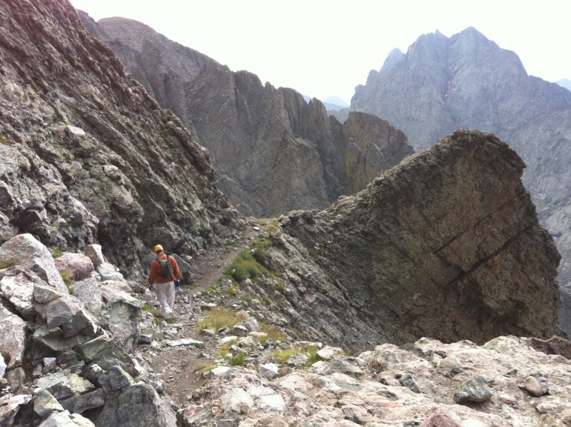 Before long we stood at the base of the gully leading toward the summit. Based on several accounts, especially Bergsteigen's trip report, we had decided beforehand to take the steeper, more westerly gully, rather than the standard trail. A solid, shorter class 3 scramble beats a loose class 2 trail any day in our book, and this gully did not disappoint. Solid Crestone conglomerate laced with countless diagonal fractures and ledges made it a fun, fast scramble. At no point in the gully did any of us feel there was anything difficult. 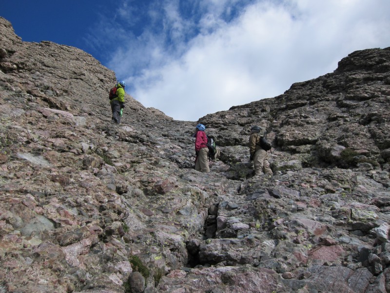 The two gullies merge a short distance below KC's east ridge, and when you reach the ridge you are rewarded with a classic view of Willow Lake, framed by a distinctive notch in the ridge. The summit is a short walk/scramble away. 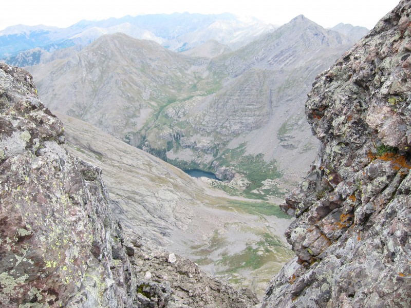 We celebrated the summit of KC with our traditional Three Musketeer bar. Great views in every direction included Crestone Peak, which we had climbed last year. 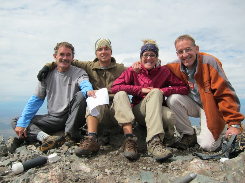 One thing nagged at me on the summit. Columbia Point loomed so close, its west face so majestic. I wanted badly to go for it, but discretion said to leave it for another time and enjoy what this day had brought. We still had to get down, break camp and hike out. The sour memory of a rash decision three years before, when we had decided late to attempt the traverse to Mt. Wilson after climbing El Diente, convinced me to let Columbia go now. We climbed down the same westerly gully that we had come up, and found it just as easy and fun. Kit Carson Avenue was easy to locate from this gully, as the two merge into a small but distinctive scree field. I count that as another advantage of this westerly gully over the standard trail. We had read several accounts of people who blew past the Avenue on the way down the standard trail, as KC Avenue seems to devolve into a less pronounced feature at that point. We had assessed that potential mistake as one of the biggest hazards of this climb. 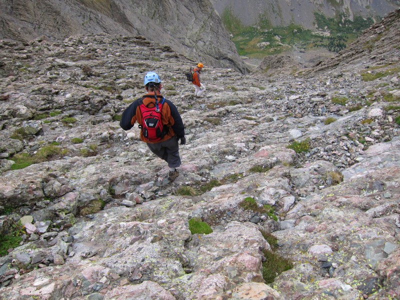 Before long we were back at the KC-Challenger saddle. There I realized one shortcoming in our pre-trip research. We knew it's possible to cut across Challenger's north face without regaining the summit, but I had no idea if there was a trail to follow there. We saw what looked like a trail segment leading down and west from the saddle. But I had read warning of how Challenger's north slope gets steeper and looser in the area above the cliffs west of Kirk Couloir. I didn't know if that trail would take us into that danger, and we didn't want to find out. We set off cross-talus at an elevation roughly even with the saddle. The talus dance was fairly quick and easy, although some of the large boulders did move under weight, so some care was required. Soon we were close enough to angle back up to the standard trail, and from there, once again, I took to that solid, beautiful ridge rock. We retraced our ascent route along the ridge down to the saddle. On our descent from the saddle we again managed to lose the trail once, at about the same elevation as we had lost it on the way up, only this time to descender's left. But again, there were no consequences and we soon regained the trail. 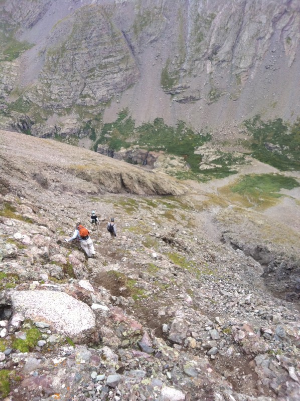 The sense of accomplishment started to really set in, tempered by the knowledge that we still had to break camp and make that long hike out. It was indeed a long march out. But the weather remained beautiful and the trail just as enchanting on the way down as it was going up. We were to have one more unplanned interaction with the people of Crestone before we left the area. Upon calling home, I learned I had foolishly lost my drivers license and a credit card along the trail. (They were loose in my pocket and must have fallen out when I pulled something else out of the same pocket.) A hiker coming down found them and kindly left them with the most "official" person he could find in town - the publisher of the local newspaper. The publisher thoughtfully realized I would need that ID to fly home. There was no phone number with the stuff, but she put her investigative skills to work. A Google search of my unusual name, a few phone calls, and the next thing you know I was meeting Kizzen Laki at the office of the Crestone Eagle to retrieve my belongings. The irony of the situation was flagrant, because the Crestone Eagle is the stomping ground of one Keno Menechino, sometimes reporter and chief publicist of the local movement to rename Kit Carson Mountain. That idea, of course, was reviled on this website, and I was among the revilers. In fact, I had suggested we respond to the petition to rename Kit Carson Mountain with a petition of our own, to rename the town of Crestone to Kit Carson City. That would clear up name confusion, I diabolically reasoned. I was so enamored with my clever idea that I had insisted our group stop and take a photo of the "Welcome to Crestone" sign, with the intent of photoshopping it to "Kit Carson City." Now Keno's employer was returning my valuables and chatting about our visit. "Did you go up in the mountains?" she asked. "Which ones did you climb?" "Umm ... Challenger and, ah .... Kit Carson," I mumbled apologetically. "Or whatever you call it." I changed the subject to Jimi. The mountain name debate highlighted the Manitou Foundation, which some say uses a spiritual facade to mask a lucrative pursuit of Almighty Dollar, including a sinister link to the United Nations oil-for-food scandal of 1995-2004. In my mind, there was no distinction between that foundation and the town of Crestone. But a couple days around the people of Crestone completely changed my view on that. Their community is an authentic small-town hippie culture, with an appealing disregard of conventions and material things. I know hippie cultures can have their dark side too. But for us, the lodging, the llama, the wallet experience, the canoe, the Free Box, and the generally clueless irreverence of the people added up to a delightful and very entertaining experience. I owe them an apology for thinking ill of their town, no matter how dopey their ideas about mountain names may be. I loved the place, and look forward to returning someday soon.  Thumbnails for uploaded photos (click to open slideshow):
|
| Comments or Questions | ||||||||||||||||||||||||
|---|---|---|---|---|---|---|---|---|---|---|---|---|---|---|---|---|---|---|---|---|---|---|---|---|
|
Caution: The information contained in this report may not be accurate and should not be the only resource used in preparation for your climb. Failure to have the necessary experience, physical conditioning, supplies or equipment can result in injury or death. 14ers.com and the author(s) of this report provide no warranties, either express or implied, that the information provided is accurate or reliable. By using the information provided, you agree to indemnify and hold harmless 14ers.com and the report author(s) with respect to any claims and demands against them, including any attorney fees and expenses. Please read the 14ers.com Safety and Disclaimer pages for more information.
Please respect private property: 14ers.com supports the rights of private landowners to determine how and by whom their land will be used. In Colorado, it is your responsibility to determine if land is private and to obtain the appropriate permission before entering the property.


