| Report Type | Full |
| Peak(s) |
Apache Peak - 13,450 feet Navajo Peak - 13,419 feet Niwot Ridge - 13,038 feet Arikaree Peak - 13,164 feet Kiowa Peak - 13,126 feet |
| Date Posted | 04/14/2012 |
| Modified | 04/21/2012 |
| Date Climbed | 04/10/2012 |
| Author | AndYouSeeMe |
| Indian Peaks Tour |
|---|
|
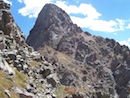
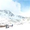
Peaks: Apache(13,441) Navajo(13,409) Niwot Ridge(13,023) Arikaree(13,150) Kiowa(13,276) Mileage: ~18miles Elevation Gain: ~6200ft While climbing Audubon and Paiute peaks on Sunday I couldn't help but stare longingly to the south towards the other 13ers in the Indian Peaks Wilderness. With the road to the 4th of July trailhead still impassable due to snow, North and South Arapahoe and Old Baldy will have to wait a little longer. However, Apache and Navajo are served by the same trailhead I used earlier that morning, so why not make a return to the Brainard Lake area for the second time in three days and see what sort of trouble I could get myself into. With a big day planned the alarm clock was wound back from a leisurely 5am on Sunday to 2am for this attempt. After a quick drive up the canyon to Ward I was on my bike once again at 3:40am heading this time to the Long Lake trailhead. On Monday I replaced my gear shifter cables on the bike and the ride up to the TH went much better than it did on Sunday. Amazing how much of a difference it makes when you have more than one gear! The road was a little more melted out this time, but still had a few short areas where I had to walk the bike over some snowdrifts, but the time saved versus walking the whole road was awesome. I set out on the Pawnee Pass trail at 4:15 under clear skies and a bright half moon. The trail to Long Lake was very easy to follow and the nights freeze made snowshoes unnecessary as I was able to walk on top without breaking through the crust. At the far side of the lake I made the decision to ditch the snowshoes and prayed it was something I did not come to regret later in the day. I made the call mainly because I did not want to do the upcoming 4th class climbing with the added weight and bulk of the snowshoes on my back throwing off my balance. The trail from Long Lake to Lake Isabelle was a little more difficult to follow, but with my GPS and hard snow, I knew what direction I needed to go and was able to blaze my own trail whenever I lost the main one. Just below Lake Isabelle there is a steep snowfield to climb before reaching the lake, and I was happy to find some steps already kicked in it so I did not feel the need to take out the axe and crampons. The lake was still frozen and I was walking across it just as the eastern horizon started to show hints of dawn. From the lake and with help from the moon I was able to start making out the impressive cirque in front of me. With Navajo on the left, Apache center, and Shoshoni to the right I was in awe and very excited to delve deeper and higher. From the far side of Lake Isabelle the route to gain the upper bowl became obvious and I used a series of snowfields and ramps to make good time higher and higher. After crossing a small tarn and taking some pictures of the impending sunrise I had one last snowfield to climb to finally reach the base of Apache Peak. 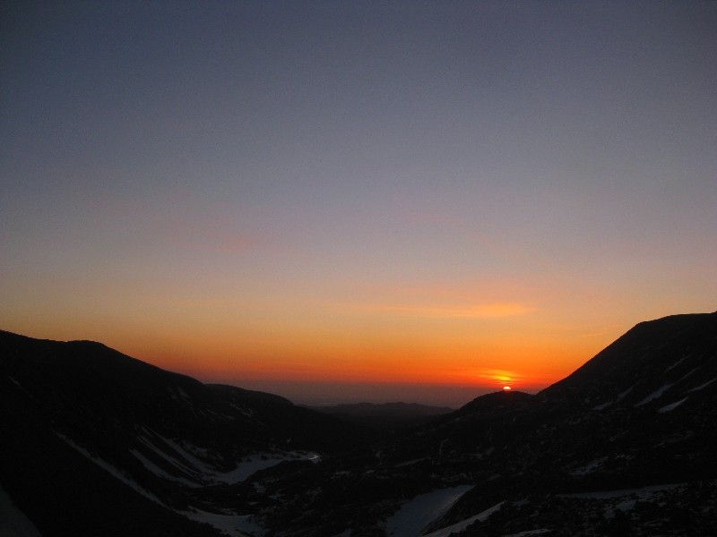 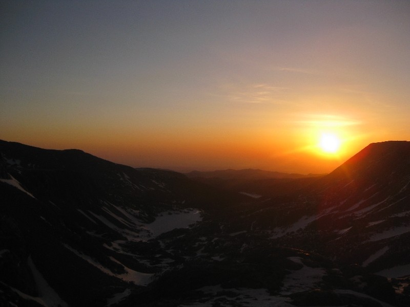 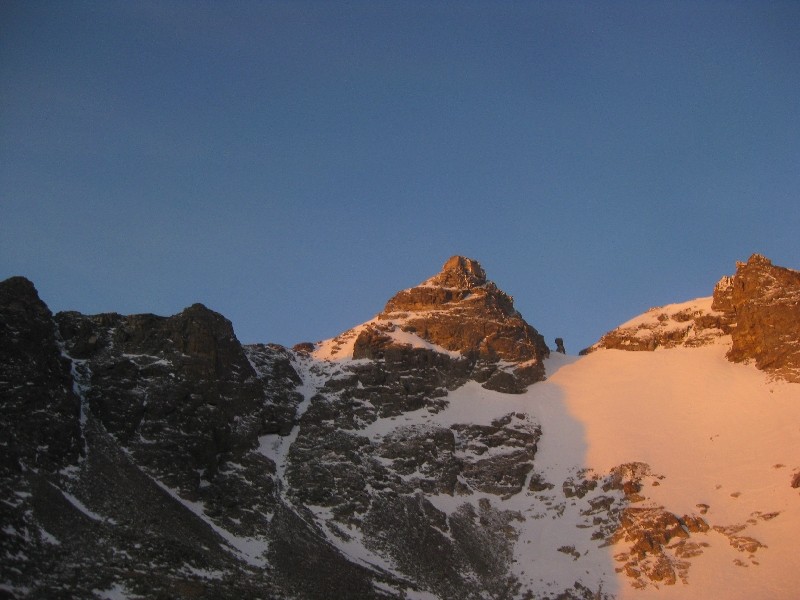 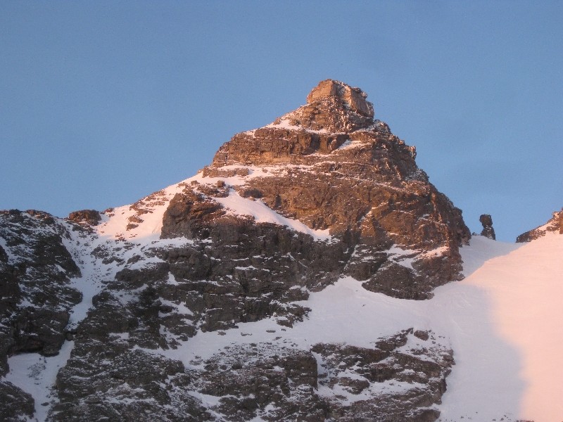 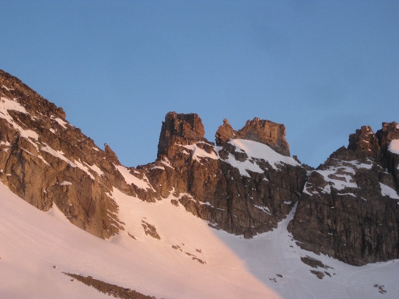 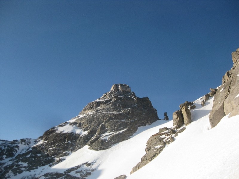 The sun had risen at this point, bathing the peaks that surrounded me in alpenglow and I felt truly lucky to be in that place at that time, all by my lonesome. My gameplan was to climb either Queen's Way or the Apache Couloir, and the decision was easy when the time came. While Queen's Way was definitely in, I could not resist the asthetic, direct line to the summit that the Apache Couloir offered. I was at the base of the couloir, putting on crampons and helmet and getting out the ice axe at 7am.  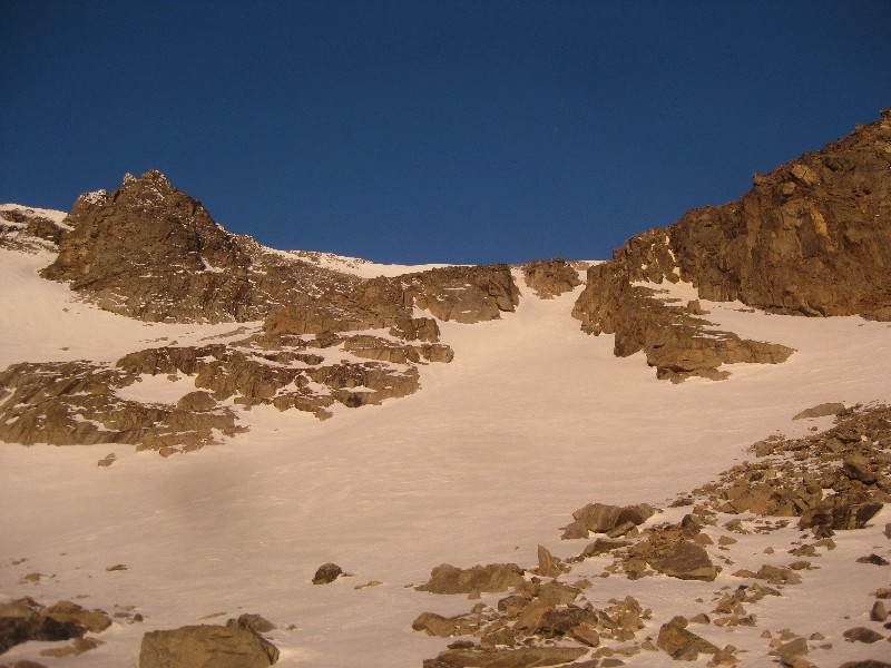  This climb is a classic according to Roach and I would have to agree. It tops out at around 45 degrees and deposits you only a few hundred feet from the summit. What makes it a classic though, in my opinion, is the beautiful surroundings, it really feels like a special place. The snow was in perfect condition for climbing and I was glad to see that it was mostly continuous all the way up. About 15 feet of it had melted out towards the top, but it was easy to navigate and get back on the snow. An hour later I pulled myself up to the south ridge of Apache and was able to take a much needed break while taking off my crampons. 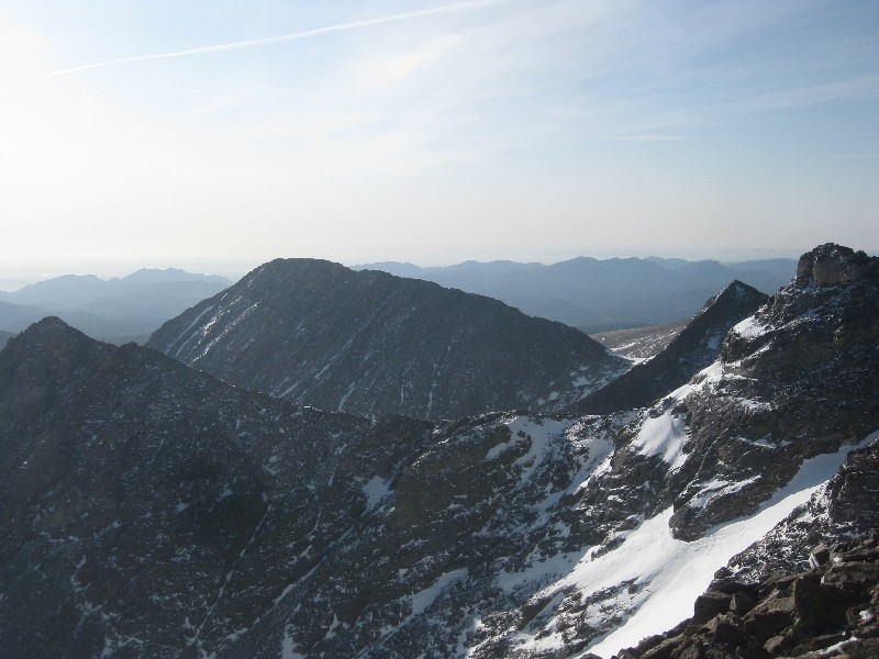 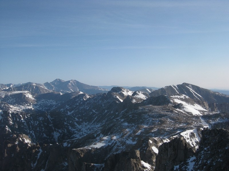 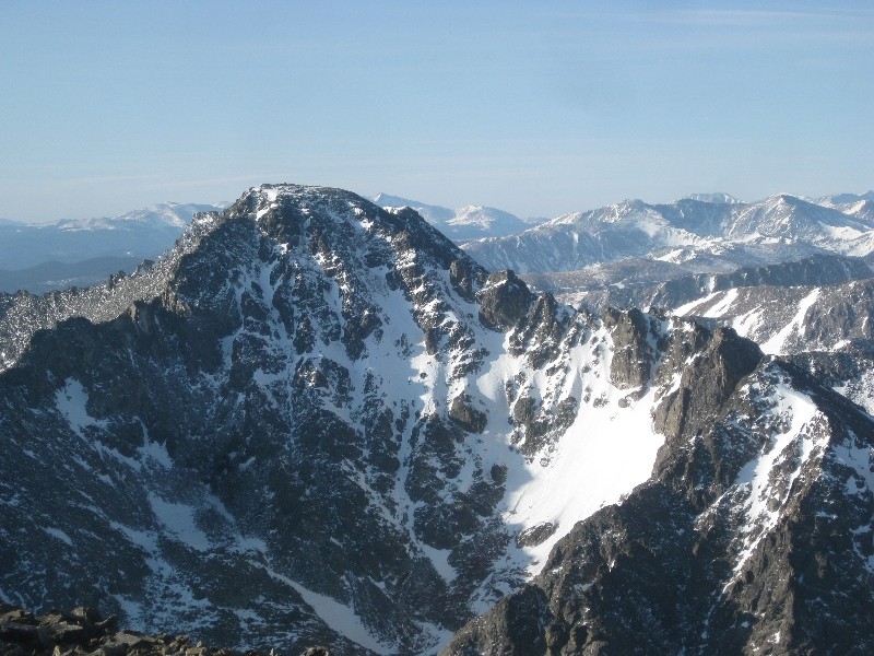 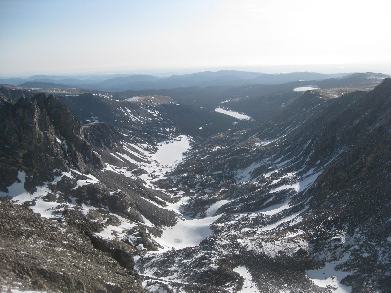 What followed was a simple hike up to the summit of Apache Peak. The views were great and it was fun to look over at the peaks I had climbed just 48 hours before, as well as Longs and Meeker in the distance, and the rest of the days objectives to the south. I spent only a few minutes on top, knowing that the day was still very young and I had a lot more on my plate. 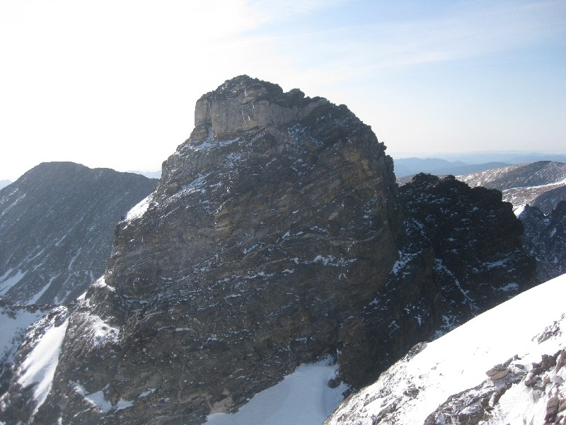 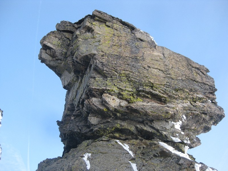 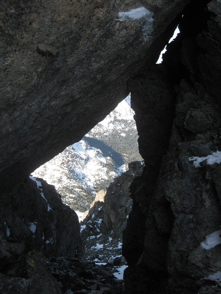 After stowing my ice axe and crampons, I decided to keep the helmet on and begin my way over to Navajo Peak. The ridge between the two gets spicy on the Navajo side and I had to get my axe out again to assist and make sure if I did slip that I would be able to arrest the fall. The last little bit until the notch between the two demanded my full attention, but it went and soon I was staring open-mouthed up at the impressive Navajo Peak. I had to skirt around to the east side of unranked 'Dickers Peck', which I knew was above my skill level, as it requires some technical class 5 climbing to get to its summit. After bypassing it I knew that the rest of the way up Navajo would not be easy. 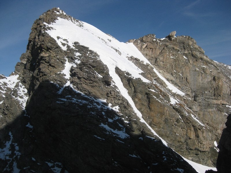 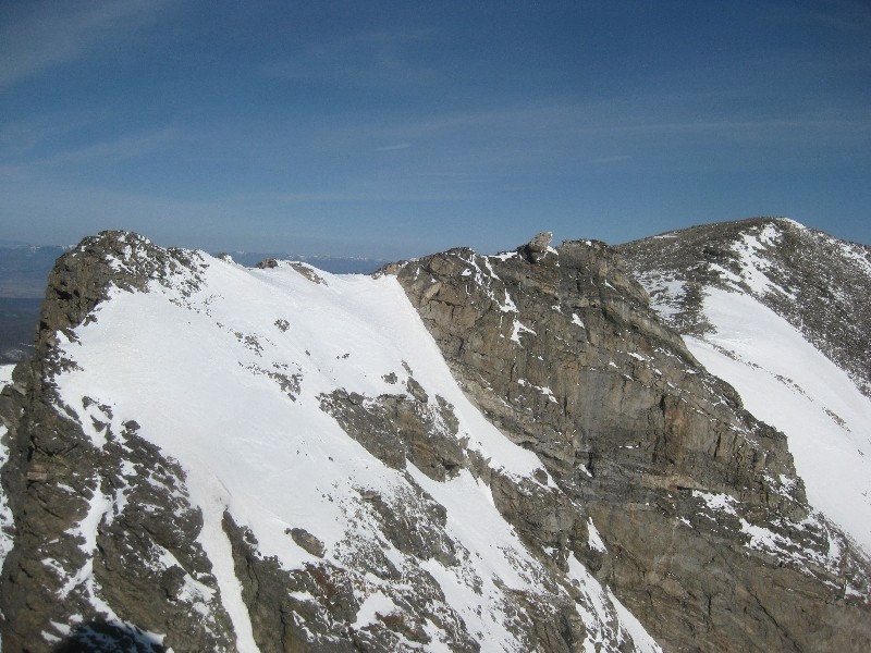 Contouring around to the west of Navajo, the route became clear and I ascended a loose ledge system around the corner. What came up next was expected due to my route research, but I didn't know for sure what to expect with snow added into the equation. The class 4 chimney is the crux of the route and it requires full attention without snow. Luckily there was less snow than I had expected, but more than I was hoping for. This was no fall zone and I was completely focused. There was plenty of loose rock in the chimney and I had to be very diligent with each move, clearing the snow and rock before committing to anything. It was tough and a little scary, but it went, and soon I was safely above it, looking down and oh so happy that I would not be descending that way. Without the invaluable information and advice from Furthermore the day before, I would have done my loop in the other direction, and I am not convinced I would have attempted to downclimb of the chimney, so THANKS DEREK!! 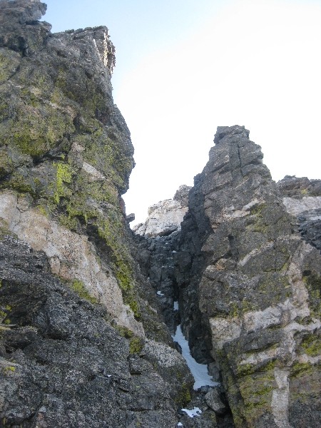 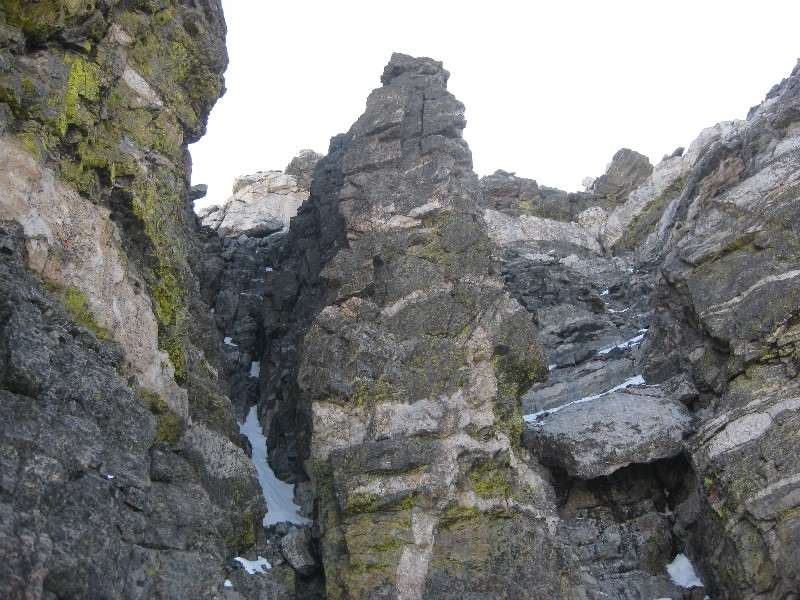  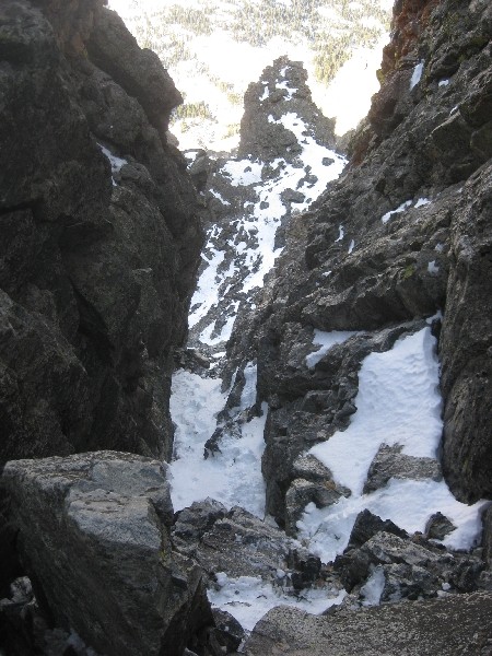 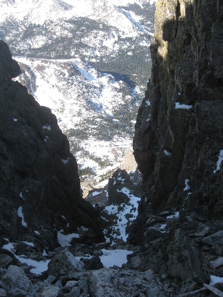 From the top of the chimney it was a loose class 3 climb to the summit Navajo. I think Navajo just took over the top spot as my favorite 13er thus far. The combination of the stiff class 4 climb, views of the surrounding peaks and the small summit made it something I will not forget anytime soon. The views over to North Arapahoe Peak were awesome, as I had never seen that mountain up close before. Now it was decision time, head back down towards Lake Isabelle and end the day at 2 peaks, or venture into the off-limits Boulder Watershed and bag another 3, 1 unranked and 2 ranked 13ers. 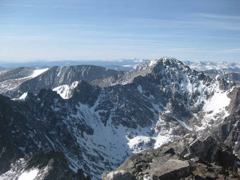 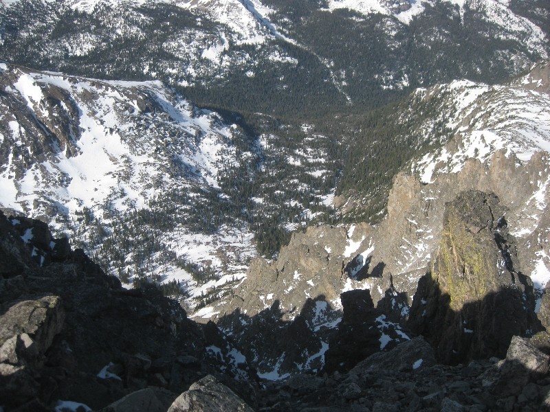 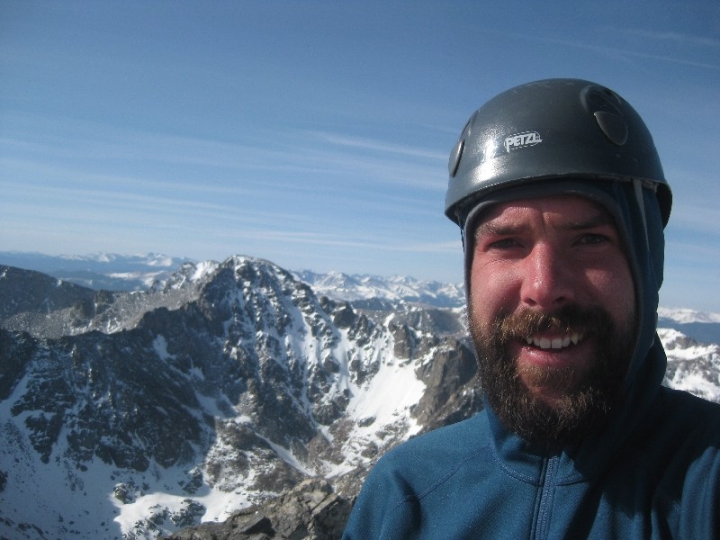 Well, I must have hit my head on my responsible descent back to Lake Isabelle, staying out of the off limits area. Next thing I knew I was heading in the opposite direction and was making my way along the ridge to the summit of Niwot Ridge. While this is an unranked 13er, it is no walk in the park, but worth it for the different perspective on the area peaks. It was at this point that my legs started to question my reasoning behind adding Niwot Ridge to an already big day. I told them this was not their decision and to just do what they do best, power on. 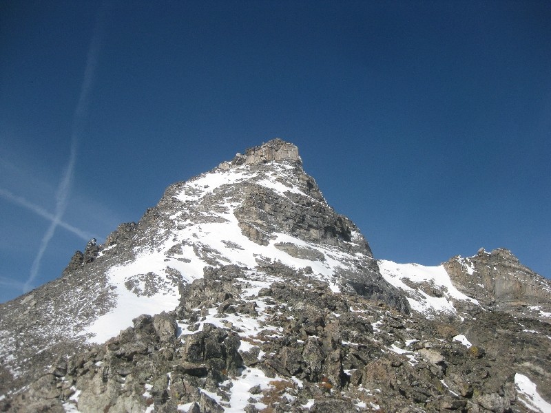  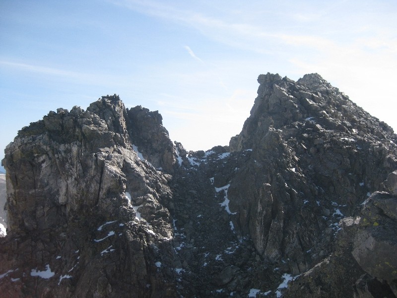 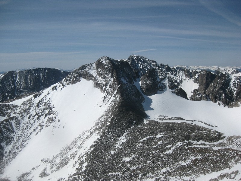 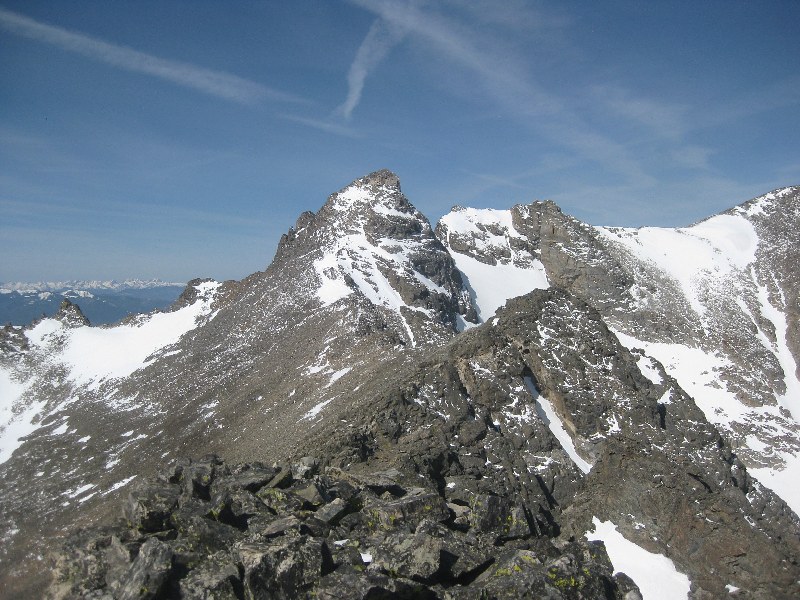 Looking back  Summit of Niwot Ridge After a few minutes resting on summit number three for the day I started to consider my options for getting over to Arikaree Peak. In the end I decided to descend all the way into the basin and ascend the north ridge. There is limited beta on Arikaree so I was not sure what to expect on the North Ridge. It started easy enough and then quickly turned to sustained class 3 on ledges and blocks. The crux of this route is the large notch that is visible from Navajo Peak. A tough downclimb into the notch had me very concerned with whether this route would go to the summit or not. Luckily, just through the notch a narrow, snowy ledge section granted access to easier terrain. The last bit up to the summit was very loose, evidence of how little this peak gets climbed. 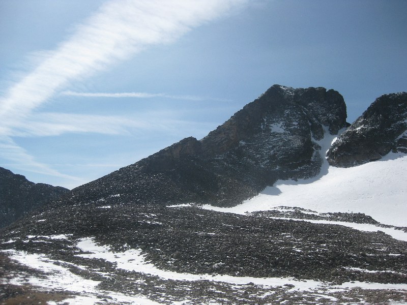 North Ridge of Arikaree  Sketchy ledges 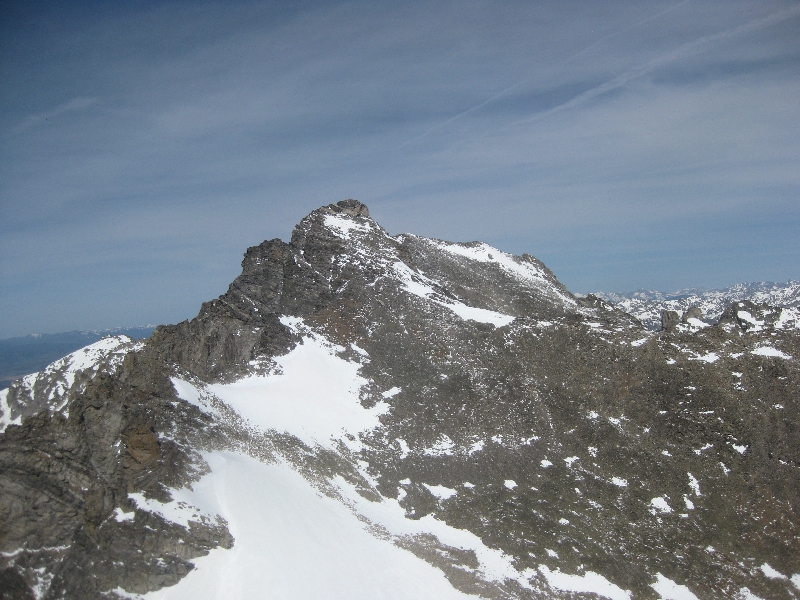 Navajo from Arikaree summit It felt great to step onto the summit of Arikaree Peak and from there I could see the relatively simple route over to the last objective of the day, Kiowa Peak. Here I took a nice long break to chug water and devour handful after handful of trail mix. The attention-demanding climbing I had been doing for the past few hours had me forgetting to eat and drink, so it was past due time for an extended break. 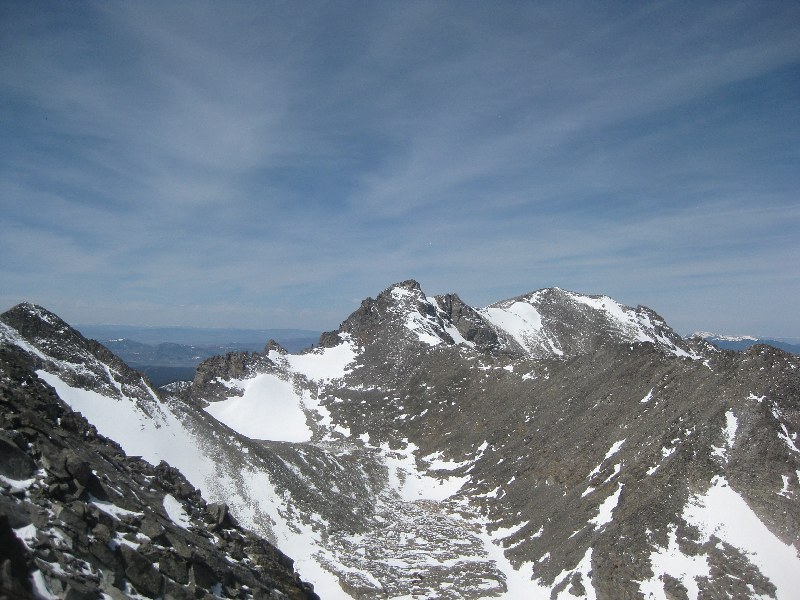 Other 4 peaks from Kiowa The descent to the saddle and then ascent of the west ridge of Kiowa was very straightforward. By now my legs were not happy and the ridge seemed to go on forever. After multiple false summits I finally could go no higher and was standing on the top of my last peak for the day! From this angle, I could almost my entire route for the day and it felt great knowing I had done it, and done it safely. The only thing left now was to safely get back to my bike, and then the car. 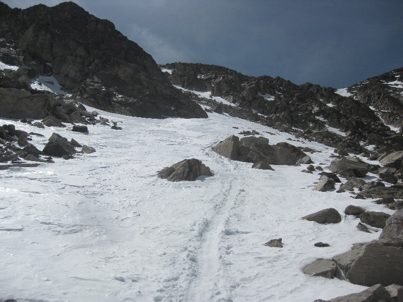 Descent to Green Lakes 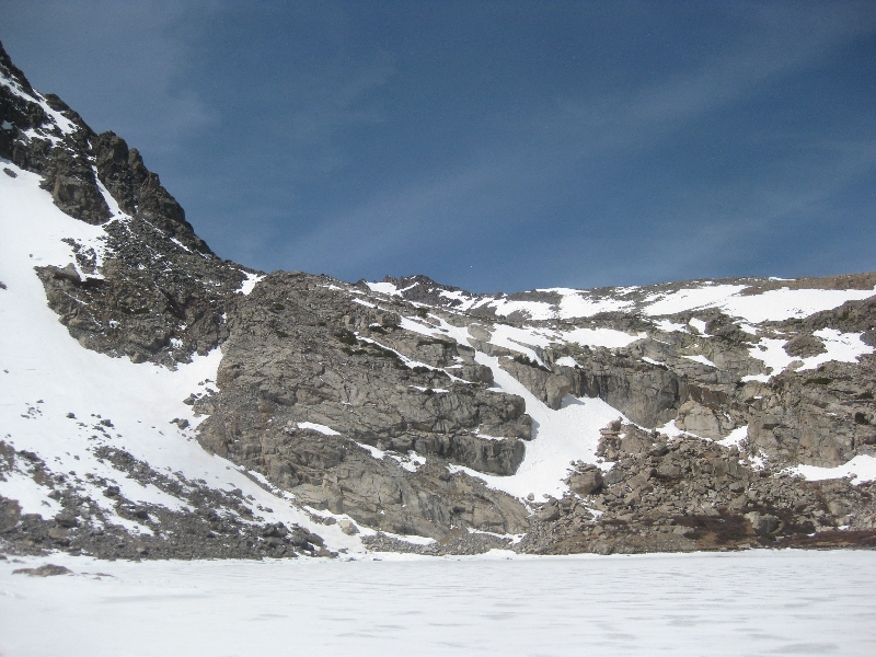 Impressive headwall This is when reality hit me, I was far from my snowshoe stash and had the eastern parts of Niwot Ridge between me and them. I was able to get some glissading in on my way down to Green Lakes, which was nice. The whole time down in that area I was very paranoid that someone would pop up and bust me for being in an area I wasn't supposed to be, but that didn't stop me from taking many pictures of a beautiful area not many people get to see up close. 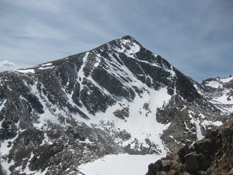 Kiowa from Green Lakes 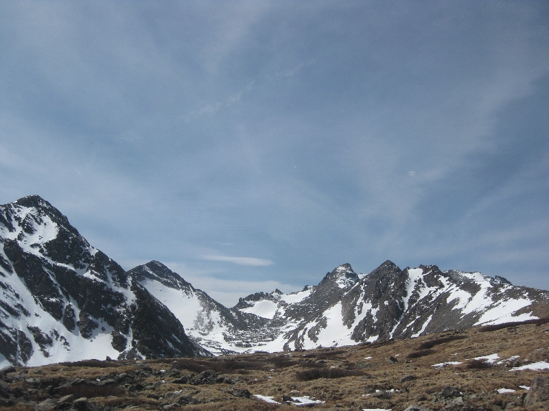 All 5 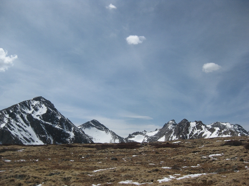 All 5 again From Green Lakes I had one last 800 foot climb up and over Niwot Ridge before being able to drop down to Long Lake, my snowshoes, and the trail out. At this point I was completely gassed and settled into a solid eight steps, then rest, routine. Ok I lied, it was more like 5 steps. After what felt like forever I crested Niwot Ridge and was glad to have all elevation gain behind me. Some nice snow slopes allowed for great glissading down to the Pawnee Pass trail and eventually my snowshoes. 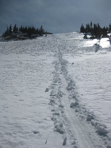 Yeehaw! At this point the snow had softened, my boots and feet were soaked, and I was in zombie mode. What had been frozen marsh in the early morning was now a swamp, and I didn't care. I gave up trying to avoid the water and ended up just walking through the ankle deep water, knowing that I was only about an hour from the car and my sandals. 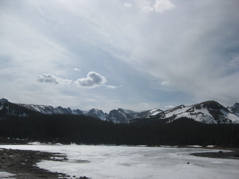 Parting shot from Brainard Lake Seeing the pavement of the Long Lake trailhead was a welcome sight and the slog in sloshy boots down the road to my bike went pretty well. After getting on my bike I knew it was a mostly downhill ride back to my car, and after some pictures from Brainard Lake, I hightailed it out of there. I arrived back at my car at 3:40 for an exactly 12 hour day. This area is someplace special and while I certainly do not condone doing what I did and venturing into the off limits area, I highly recommend it! 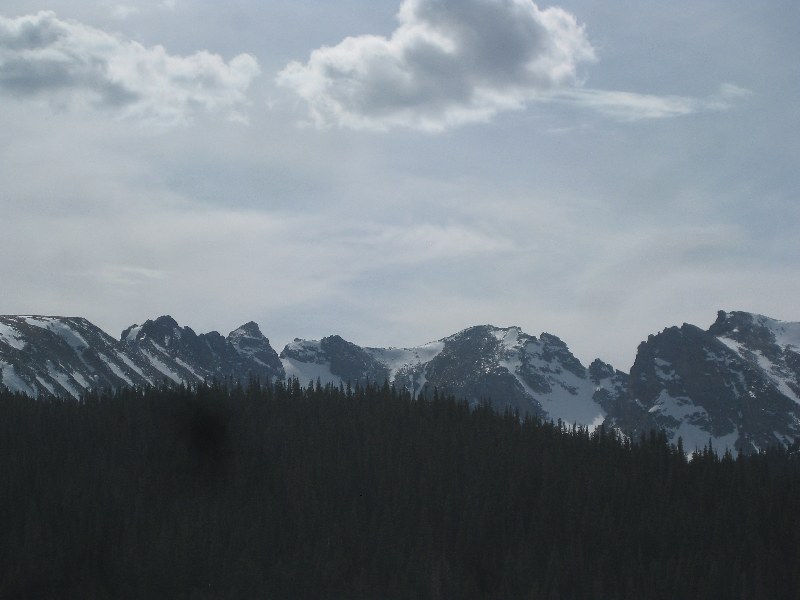
Thumbnails for uploaded photos (click to open slideshow):
|
| Comments or Questions | ||||||||||||||||||||||||||||||
|---|---|---|---|---|---|---|---|---|---|---|---|---|---|---|---|---|---|---|---|---|---|---|---|---|---|---|---|---|---|---|
|
Caution: The information contained in this report may not be accurate and should not be the only resource used in preparation for your climb. Failure to have the necessary experience, physical conditioning, supplies or equipment can result in injury or death. 14ers.com and the author(s) of this report provide no warranties, either express or implied, that the information provided is accurate or reliable. By using the information provided, you agree to indemnify and hold harmless 14ers.com and the report author(s) with respect to any claims and demands against them, including any attorney fees and expenses. Please read the 14ers.com Safety and Disclaimer pages for more information.
Please respect private property: 14ers.com supports the rights of private landowners to determine how and by whom their land will be used. In Colorado, it is your responsibility to determine if land is private and to obtain the appropriate permission before entering the property.