Download Agreement, Release, and Acknowledgement of Risk:
You (the person requesting this file download) fully understand mountain climbing ("Activity") involves risks and dangers of serious bodily injury, including permanent disability, paralysis, and death ("Risks") and you fully accept and assume all such risks and all responsibility for losses, costs, and damages you incur as a result of your participation in this Activity.
You acknowledge that information in the file you have chosen to download may not be accurate and may contain errors. You agree to assume all risks when using this information and agree to release and discharge 14ers.com, 14ers Inc. and the author(s) of such information (collectively, the "Released Parties").
You hereby discharge the Released Parties from all damages, actions, claims and liabilities of any nature, specifically including, but not limited to, damages, actions, claims and liabilities arising from or related to the negligence of the Released Parties. You further agree to indemnify, hold harmless and defend 14ers.com, 14ers Inc. and each of the other Released Parties from and against any loss, damage, liability and expense, including costs and attorney fees, incurred by 14ers.com, 14ers Inc. or any of the other Released Parties as a result of you using information provided on the 14ers.com or 14ers Inc. websites.
You have read this agreement, fully understand its terms and intend it to be a complete and unconditional release of all liability to the greatest extent allowed by law and agree that if any portion of this agreement is held to be invalid the balance, notwithstanding, shall continue in full force and effect.
By clicking "OK" you agree to these terms. If you DO NOT agree, click "Cancel"...
Citadel Ski Tour
Start at the "gate" Loveland Pass exit ~10,600 into Dry Dulch - 6 AM
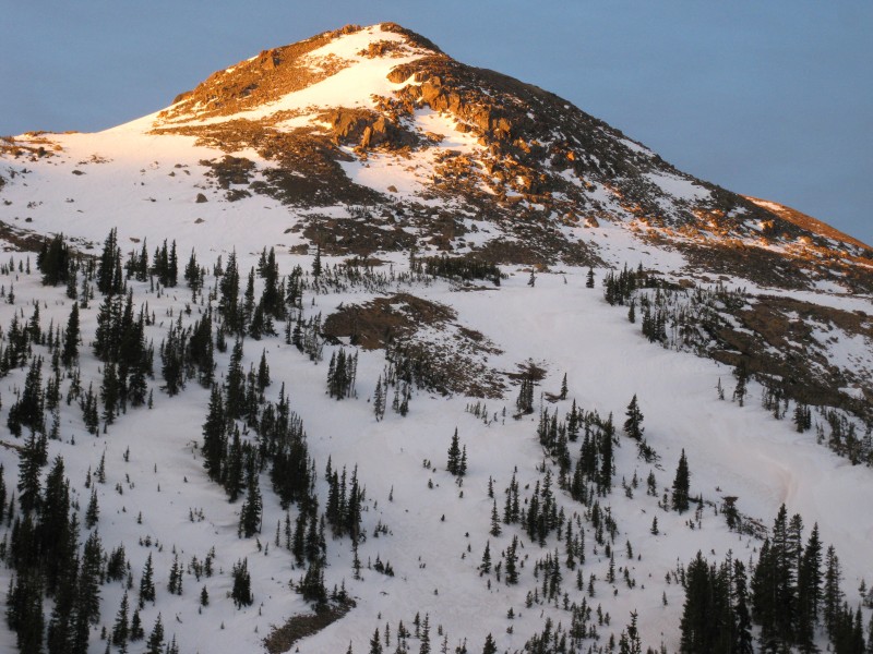
Summit Citadel 13,294
Out Herman Gulch to Herman Gulch Trailhead at ~10,300 with a Car Shuttle - 2 PM
Who - Mickeys Grenade (Jeff) and Chuck
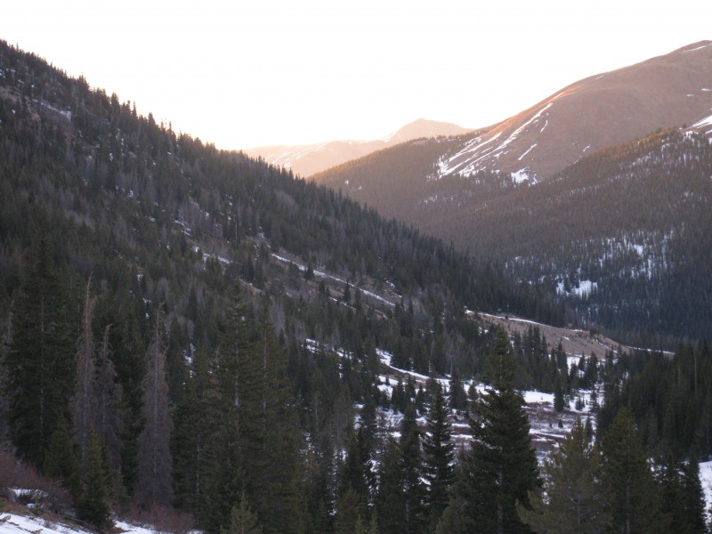
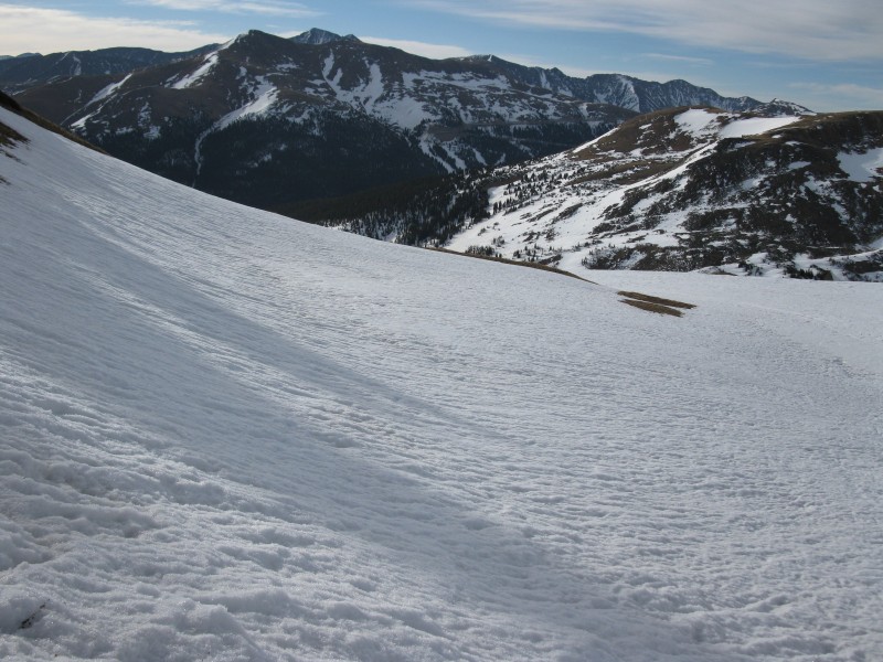
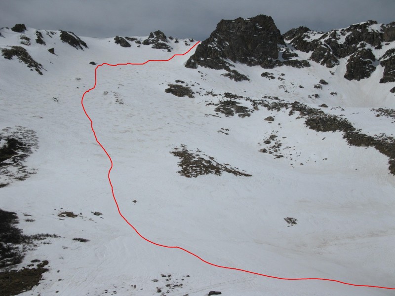
We were able to drive to the gate at ~10,600 from the Loveland Pass exit. We left the car at 6:00 AM and carried our skis in to Dry Gulch for a short time. Then we were able to skin up the valley floor with our skis on. Looking Back Out Dry Gulch
We left Dry Gulch and climbed up a steep hill to the North while carrying our skis. There was a dry ridge that we followed up to the "bench". Climbing this steep hill was difficult with ski boots on. Sun Hit Across the Valley Almost to the "Bench" Chuck Climbing up to the Bench
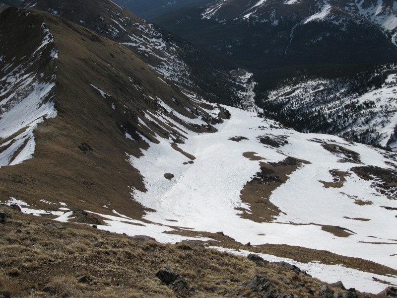
The snow covered bench was great for skis! "Bench"
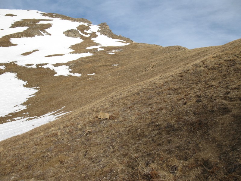
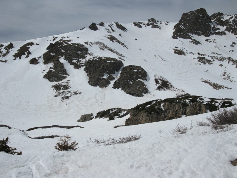
We headed West with our skis on, along the flat bench. Next we turned Northwest and carried skiis up to the dry saddle at the low point of Citadel's Southeast Ridge. Dry Saddle on the Low Point of Citadel's Southeast Ridge
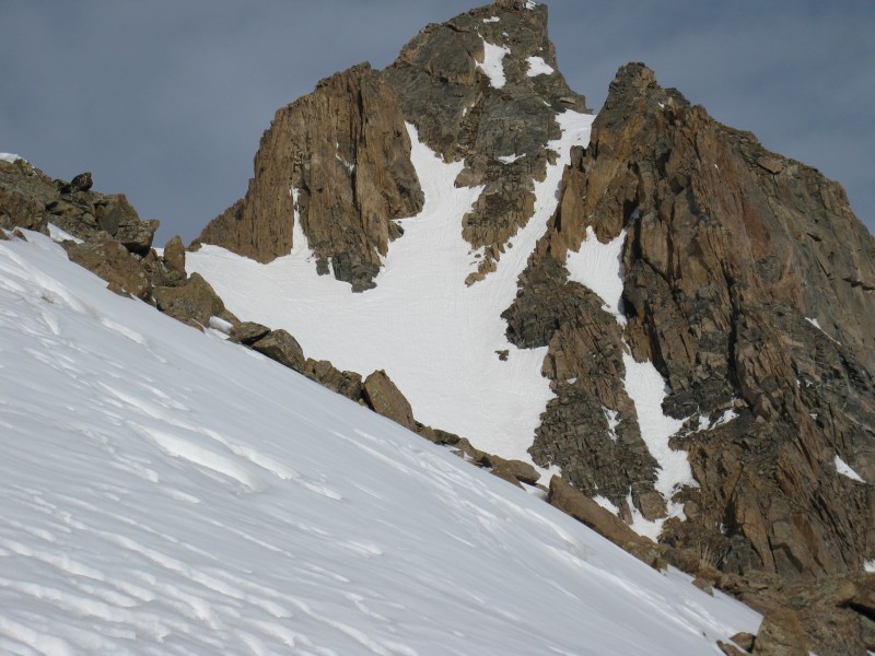
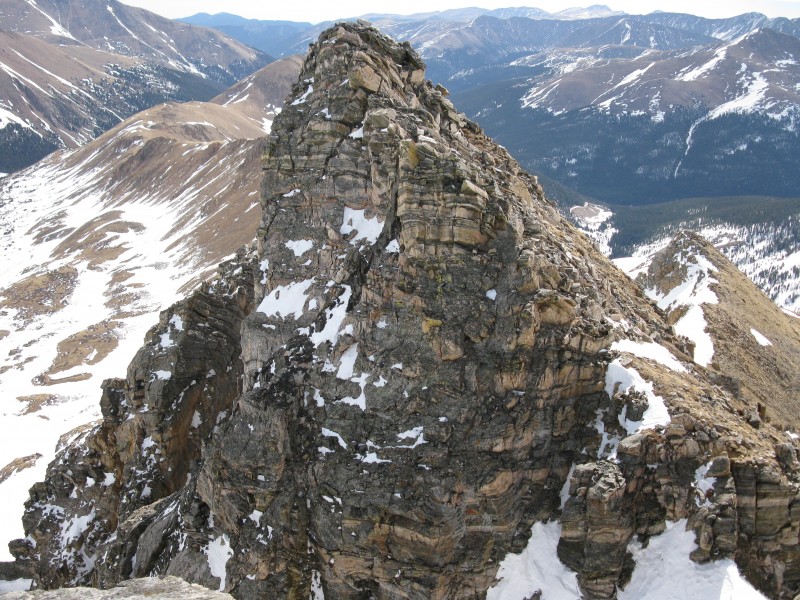
We followed the Southeast Ridge to the summit. Looking up the Southeast Ridge Chuck Climbing up the Southeast Ridge Looking Down on the "Bench"
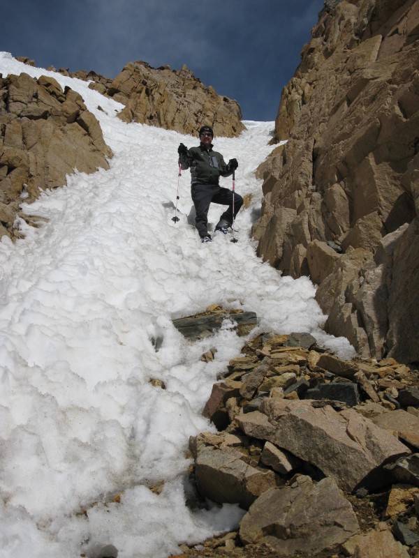
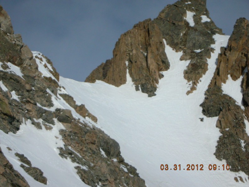
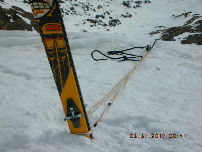
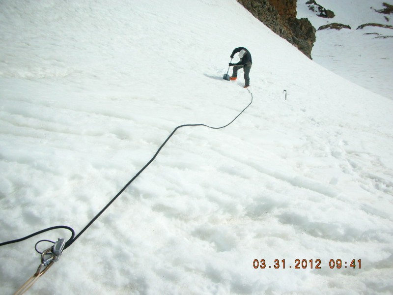
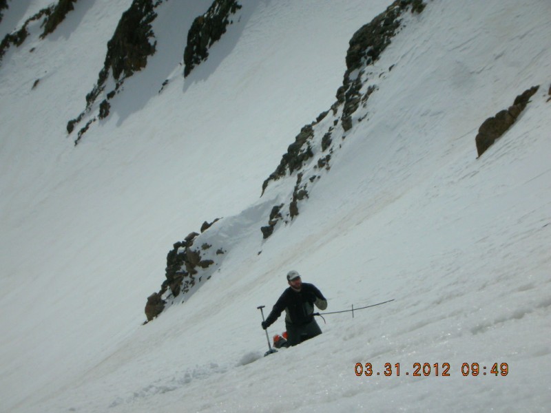
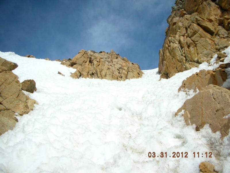
We stopped a few hundred feet below the summit on the Southeast Ridge to leave our packs and skis at the top of our descent route in to Herman Gulch. I built a snow anchor with my skis and used a short piece of rope to head down the slope while on belay to dig a snow pit. There was a lot of snow there. I dug a hole 3-4 feet deep and did not reach the ground or the depth hoar. I did a shovel compression test and the snow would not fail. There was a very hard ice layer underneath the 4-6 inches of soft snow. I pulled out the entire 3-4 foot column and it stayed intact! I came back up to the top and then sent Chuck down while on belay to check out the snowpit and then fill the hole back in with snow. We decided to leave our gear there and head to the summit. I felt comfortable with a whippet. Chuck did it without a whippet or an ice ax. He said that it would have been nice to have an ice ax. We had to traverse some cliff bands on snow and then climb up a short 40 degree snow couloir to the final summit ridge. There was some post-hole action along the traverse that was annoying! After the snow climb, there was a short rock scramble to the summit with one or two class 3 moves to the summit. This was intersting with ski boots on! From the Summit Looking at a Slightly Lower Summit Chuck Descending the Snow Couloir
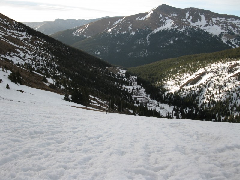
We made it back to our skis and our backpacks. Now its time for the best part. The ski descent. Ski Descent
It was a blast skiing the East Face of the Citadel.
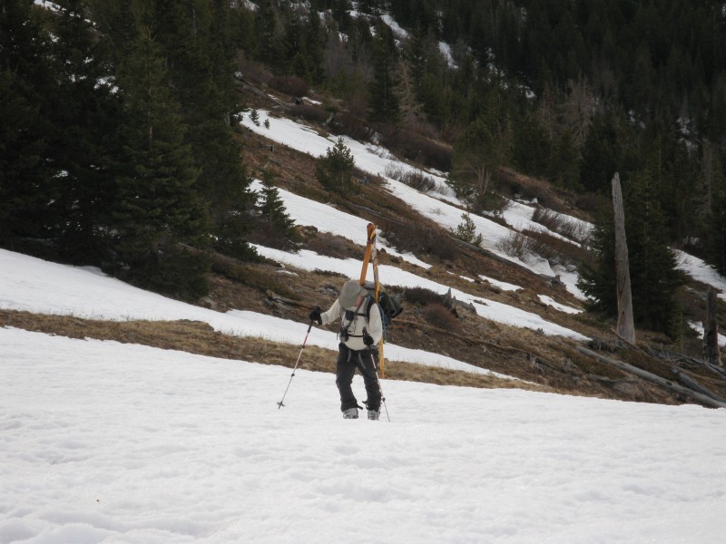
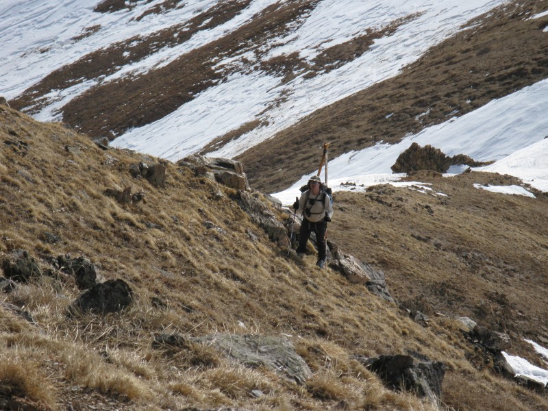
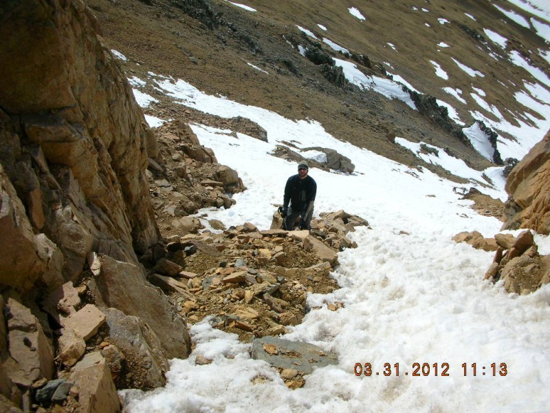
The descent out of Herman Gulch was tough There were times where you would post-hole with your skis on. Some sections were not snow covered. You had to either take your skis on and off or walk across with your skis on. I had one incident where my ski went under the snow pack and my shin smashed against some semi-hard snow. It hurt! We perservered and made it to within 20 minutes of hiking while carrying skis to the Herman Gulch Trailhead. I had a great time in the mountains today. We were back at the cars at about 2:00 PM. I don't think I will be doing anymore ski tours this year unless we get some more snow fall.
The photos below are from Chuck. I'm getting Ready to go Dig a Snow Pit Looking Up at the Start of our Ski Descent Snow Anchor I'm Digging a Snow Pit Jeff in the Snow Couloir
Thumbnails for uploaded photos (click to open slideshow):
Great TR Jeff!! I have been eying this peak for this spring. Thanks a ton for the Beta!
Caution: The information contained in this report may not be accurate and should not be the only resource used in preparation for your climb. Failure to have the necessary experience, physical conditioning, supplies or equipment can result in injury or death. 14ers.com and the author(s) of this report provide no warranties, either express or implied, that the information provided is accurate or reliable. By using the information provided, you agree to indemnify and hold harmless 14ers.com and the report author(s) with respect to any claims and demands against them, including any attorney fees and expenses. Please read the 14ers.com Safety and Disclaimer pages for more information.
Please respect private property: 14ers.com supports the rights of private landowners to determine how and by whom their land will be used. In Colorado, it is your responsibility to determine if land is private and to obtain the appropriate permission before entering the property.