Download Agreement, Release, and Acknowledgement of Risk:
You (the person requesting this file download) fully understand mountain climbing ("Activity") involves risks and dangers of serious bodily injury, including permanent disability, paralysis, and death ("Risks") and you fully accept and assume all such risks and all responsibility for losses, costs, and damages you incur as a result of your participation in this Activity.
You acknowledge that information in the file you have chosen to download may not be accurate and may contain errors. You agree to assume all risks when using this information and agree to release and discharge 14ers.com, 14ers Inc. and the author(s) of such information (collectively, the "Released Parties").
You hereby discharge the Released Parties from all damages, actions, claims and liabilities of any nature, specifically including, but not limited to, damages, actions, claims and liabilities arising from or related to the negligence of the Released Parties. You further agree to indemnify, hold harmless and defend 14ers.com, 14ers Inc. and each of the other Released Parties from and against any loss, damage, liability and expense, including costs and attorney fees, incurred by 14ers.com, 14ers Inc. or any of the other Released Parties as a result of you using information provided on the 14ers.com or 14ers Inc. websites.
You have read this agreement, fully understand its terms and intend it to be a complete and unconditional release of all liability to the greatest extent allowed by law and agree that if any portion of this agreement is held to be invalid the balance, notwithstanding, shall continue in full force and effect.
By clicking "OK" you agree to these terms. If you DO NOT agree, click "Cancel"...
Who: Shawn (Rainier_Wolfcastle) and Jolie (my ~2 yr old Black Lab on leash for all but last 2 miles back to car)
When: 3/24/2012 - Start at 5am - Summit at 9:30am - Finished at 3pm
Stats(estimates): 7.8 miles, 3,150 feet of elevation gain
TH: Mayflower Gulch 2wd
Route: with some variation to be explained, Ascent: East edge of NW Bowl to Villa Ridge, Descent: Villa Ridge
Based on some excellent recent trip reports and the Saturday Weather forecast I hatched a plan to start at the Mayflower Gulch TH and climb Atlantic's West Ridge, then continue on to Pacific, Crystal, Peak 10, & Peak 9 then descending NW to CO 91 and hiking or hitching back to the car. I tried to get 6 hours sleep in the back of the Blazer at the TH...but this time I just could not sleep.
I finally got on the hard packed 4wd road at 5am. I had not been up this area before and was armed with a Nat Geo Map and a compass...both stayed in the pack a little too long! After 10-15 minutes or so up the road I saw a clear trench to the left, I think this was my correct target. I strapped on the snowshoes and followed the trench. The trench crossed Mayflower Creek and started ascending the other side...but for some reason in my sleep walking state I veered off South (thinking I was going East). After 30 minutes I finally took my morning Espresso Love Gu and maybe 10 minutes after that realized I was a not where I should be...but where was I? Time to get a GPS for route finding in the dark...I think so!
I finally got the compass out, I was in disbelief that I had been going South for so long. I went up a little ridge right in front of me and ate breakfast waiting for some daylight.
When daylight came I could clearly recognize Pacific Peak. Then I realized that was Atlantic's West Ridge in front of it....man, that must be a mile away with 500 ft to lose and regain. With my big day planned, I knew the plan was shot. Time to climb something...how about soft-ranked Drift Peak and maybe Fletcher Mountain? I was already halfway up the mini ridge to pt 12,387 (non official). I could see a trail to my south leading to Drift's NW Bowl...lets exchange snowshoes for micro-spikes and go take a look.
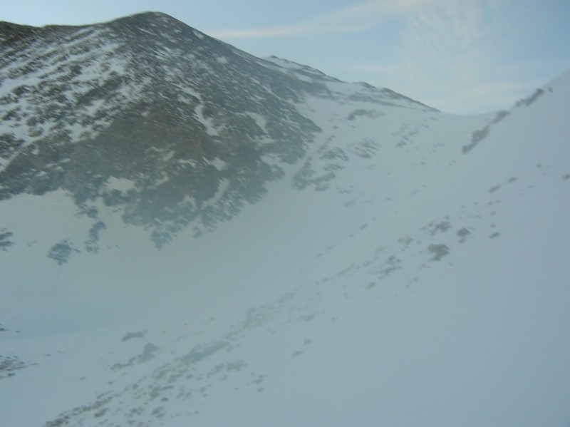
Here is a fuzzy early morning pic of that bowl with Drift Peak in the top left:
Hey, there is Pacific and Atlantic...that is where I should be:
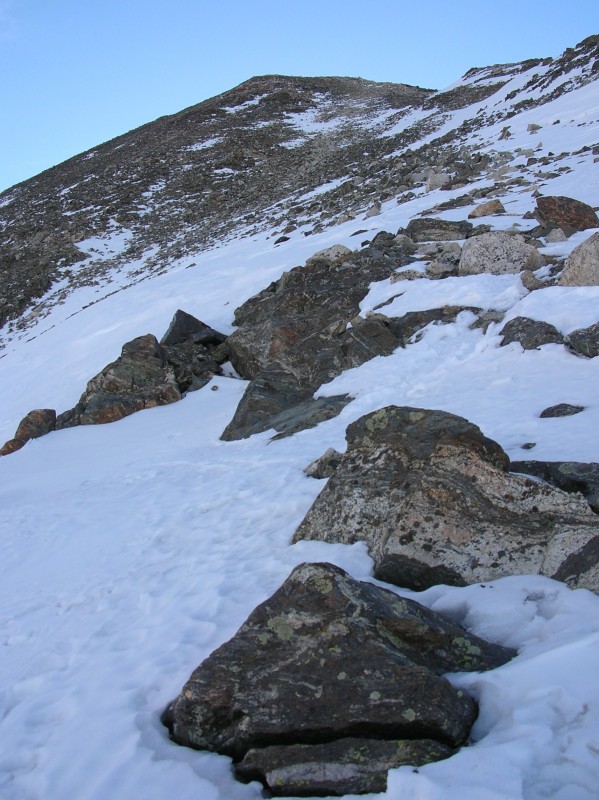
The slope angles of the bowl were right in that avalanche prone sweet spot, CAIC forecast for this aspect was right on the border of moderate and low. I called my wife to give her a heads up regarding my change in plans. I got out the ice axe and kept to the lower angle thin hard pack on the climber's right edge of the bowl and that was fine until I was maybe 50 feet below Villa Ridge. Dammit, 6 inches of hardpack and 2 feet of sugar. This snowpack is good for nothing! I cut hard to my right to some exposed boulders and pieced together the lowest angle thinnest snow I could to the ridge proper...knowing there is now way I'm coming back this way!
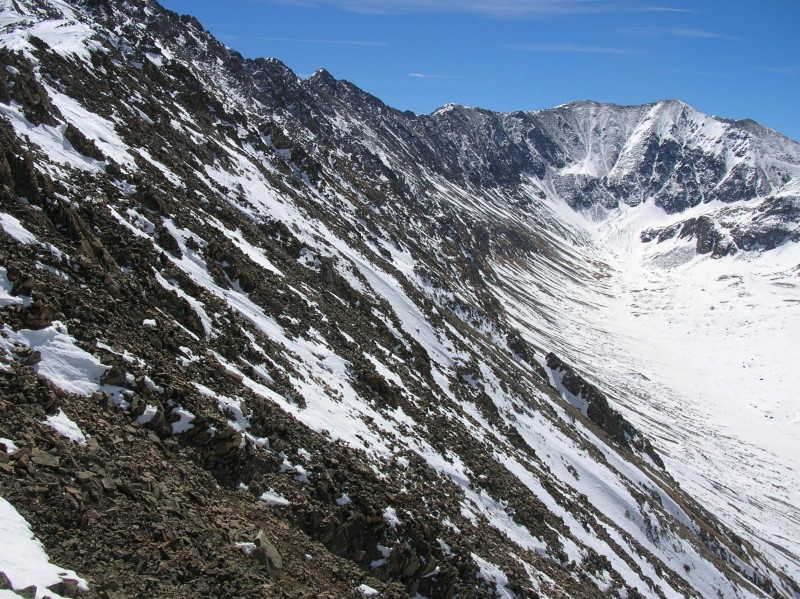
The ridge from here is heavily snow covered until the last few 300-400 ft to the summit..where it is more exposed talus then snow. There was one set of boot tracks on the ridge and tended to agree with their choices...what was ridge/what was cornice. This ridge was far spicer then I had anticipated with steep drops on either side and plenty of snow "drifted" on top!
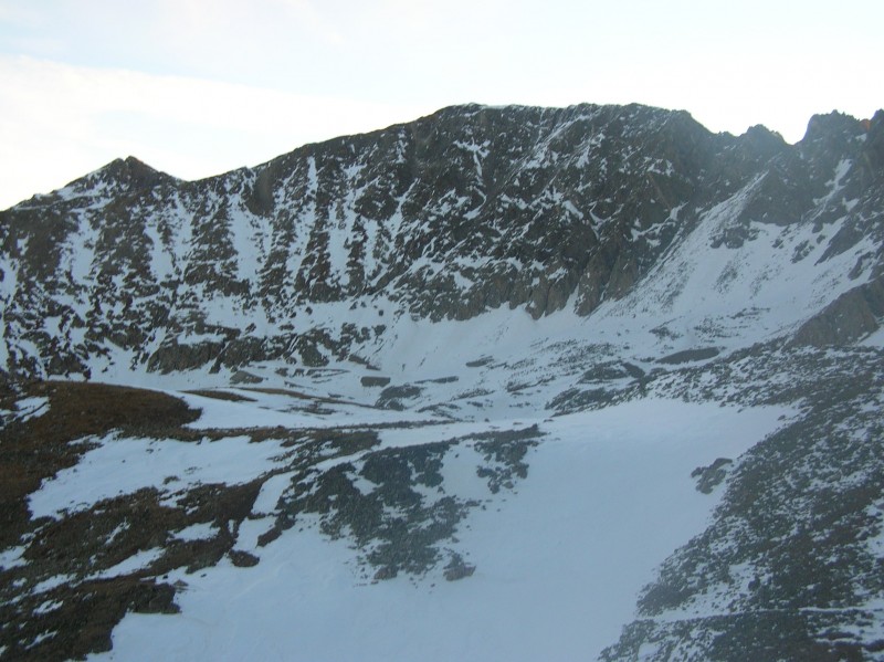
Here is a look down from the first spot I could really relax. My ascent to the ridge was at the farthest end of the snow field covering the right edge of the ridge.
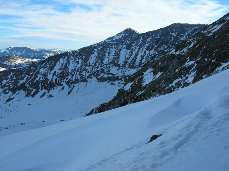
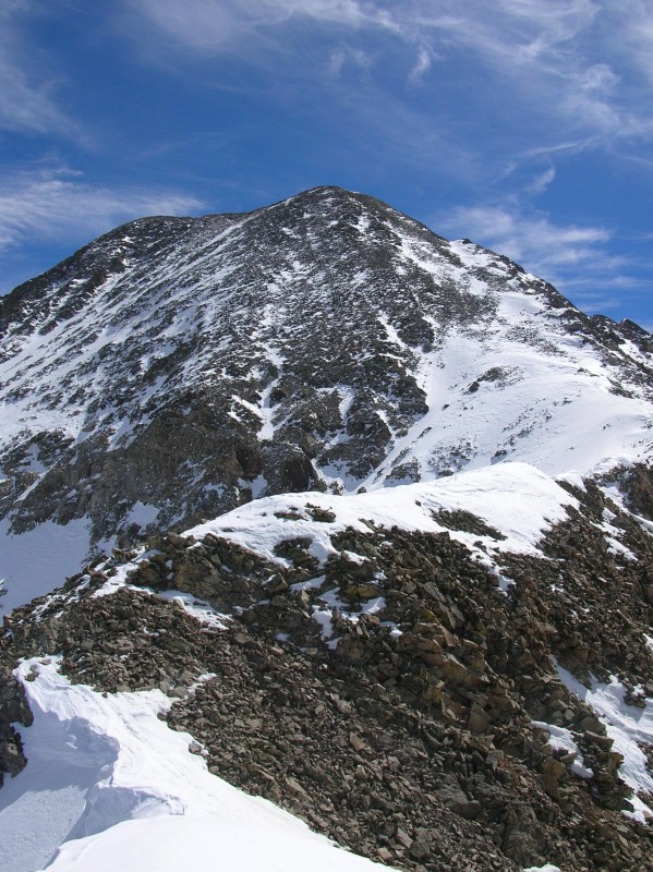
Here is a look over to my initial first two targets.
And here is what I have left to Drift Peak:
After talus hopping to the summit I took a break and got out the map...can I get to Fletcher from here? That ridge is out of the question. Hmmm...Gerry and Jennifer mention a round about way to gain those gentle South Slopes of Fletcher. I call the wife again, "If I don't call you within an hour, this is were to find us!" I find a low spot with the lowest angle snow I can...three problems:
1) same crappy snowpack
2) my dog would need to stay leashed to me
3) there is no way I could ascend the steepest last 20 ft of sugar back to the ridge..so I would be exiting to Blue Lake
So I just go exploring the first part of the ridge to Fletcher just for fun. After maybe 100 yards of pretty exposed but fairly wide and flat ridge you come to pretty much a 40 foot deep notch that is unclimbable by me...even if it were a on a gym wall. From here I took a couple of pics.
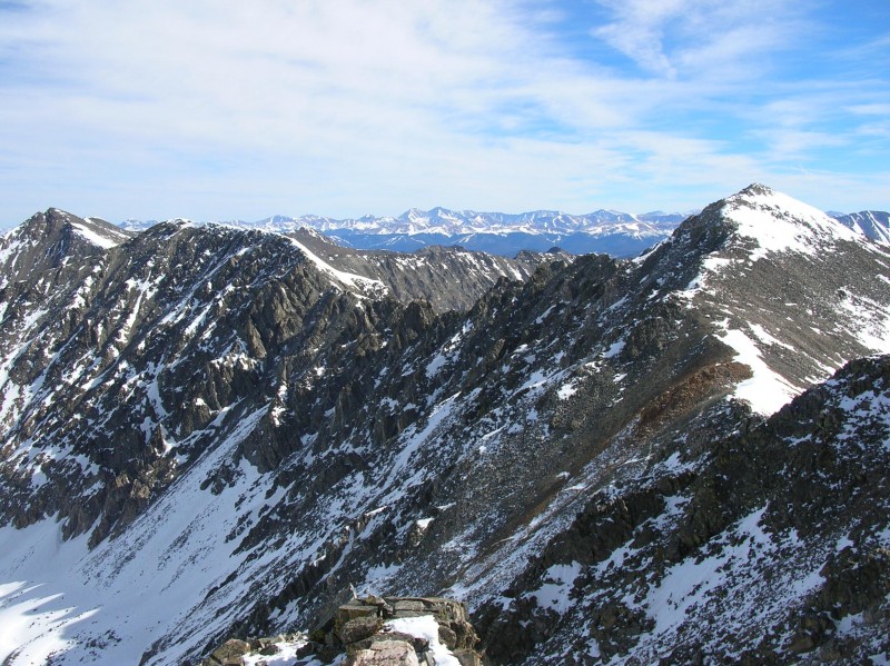
The first is of Fletcher(left) and Quandary(right). The top of the 40 ft notch is lower right:
Next is a pic of (from left to right) Pacific, Atlantic, Peak 10?, Torreys, Grays, and Fletcher:
And here is a look back to Drift Peak:
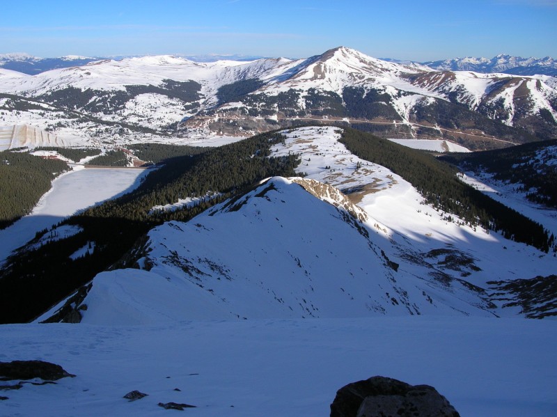
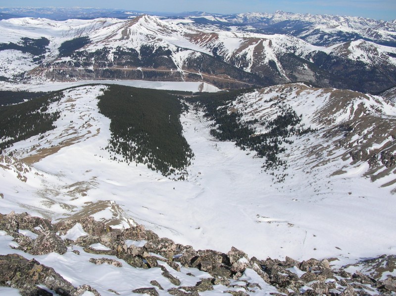
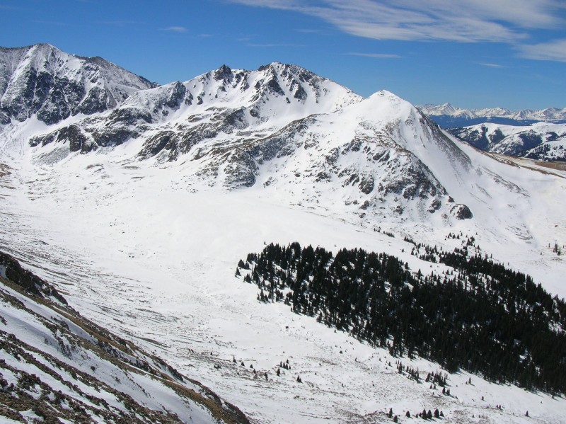
I returned to Drift Peak, called the wife, and took this pic of the entire Mayflower basin...which by now was crawling with skier, boarder and snowshoer activity:
Now I could not wait to get down past where I joined the ridge and back on some solid ground.
Here is pic looking back up from somewhere along my descent:
Here is a pic of the Clinton Amphitheatre:
Clinton top left and Bartlett in middle:
The ridge was snow covered pretty far down. The last bit was steep loose dirt/rubble. When I finally hit the soft grass bench leading to Gold Hill I took a half hour nap and then watched the many skiers and boarders in the basin. The drop into the basin is guarded by a large lengthy cornice (barely seen on the middle left of my pic #9), so be careful to drop on the north side! I had a 15 minute soft downhill snowshoe to the cabins at the end of the road. Then a nice easy 25 minute walk down the hardpacked road!
Thanks for reading!
Shawn
Thumbnails for uploaded photos (click to open slideshow):
For those interested, I did go back the next Saturday and accomplished my initial goal (Atlantic through Peak 9 traverse) :D Please note the drop from Peak 9 to CO91 was a post-hole nightmare...ending with a barefoot icey stream crossing!
Caution: The information contained in this report may not be accurate and should not be the only resource used in preparation for your climb. Failure to have the necessary experience, physical conditioning, supplies or equipment can result in injury or death. 14ers.com and the author(s) of this report provide no warranties, either express or implied, that the information provided is accurate or reliable. By using the information provided, you agree to indemnify and hold harmless 14ers.com and the report author(s) with respect to any claims and demands against them, including any attorney fees and expenses. Please read the 14ers.com Safety and Disclaimer pages for more information.
Please respect private property: 14ers.com supports the rights of private landowners to determine how and by whom their land will be used. In Colorado, it is your responsibility to determine if land is private and to obtain the appropriate permission before entering the property.