Download Agreement, Release, and Acknowledgement of Risk:
You (the person requesting this file download) fully understand mountain climbing ("Activity") involves risks and dangers of serious bodily injury, including permanent disability, paralysis, and death ("Risks") and you fully accept and assume all such risks and all responsibility for losses, costs, and damages you incur as a result of your participation in this Activity.
You acknowledge that information in the file you have chosen to download may not be accurate and may contain errors. You agree to assume all risks when using this information and agree to release and discharge 14ers.com, 14ers Inc. and the author(s) of such information (collectively, the "Released Parties").
You hereby discharge the Released Parties from all damages, actions, claims and liabilities of any nature, specifically including, but not limited to, damages, actions, claims and liabilities arising from or related to the negligence of the Released Parties. You further agree to indemnify, hold harmless and defend 14ers.com, 14ers Inc. and each of the other Released Parties from and against any loss, damage, liability and expense, including costs and attorney fees, incurred by 14ers.com, 14ers Inc. or any of the other Released Parties as a result of you using information provided on the 14ers.com or 14ers Inc. websites.
You have read this agreement, fully understand its terms and intend it to be a complete and unconditional release of all liability to the greatest extent allowed by law and agree that if any portion of this agreement is held to be invalid the balance, notwithstanding, shall continue in full force and effect.
By clicking "OK" you agree to these terms. If you DO NOT agree, click "Cancel"...
Mountain and Route: Humboldt East Ridge
Date: 03/24/12
RT Mileage: 12.53 mi
Vertical Gain: 5300ft
Party: Jason (jblyth17) and Karthik (theotherindian)
After seeing condition reports from last week for Humboldt east ridge, Jason and I decided to hit this up for the weekend. Little did we know the postholing fest that Humboldt had organised for us. Jason slept at the trailhead the previous night and I pulled up to the TH around 5:30 after recently 'normal' 150 minutes of Friday night sleep, which in retrospect was a bad idea for the drive back. Jason mentioned that he had met a group of Friday hikers who summitted Humboldt without taking the Rainbow trail (by the southeast flank route maybe?)
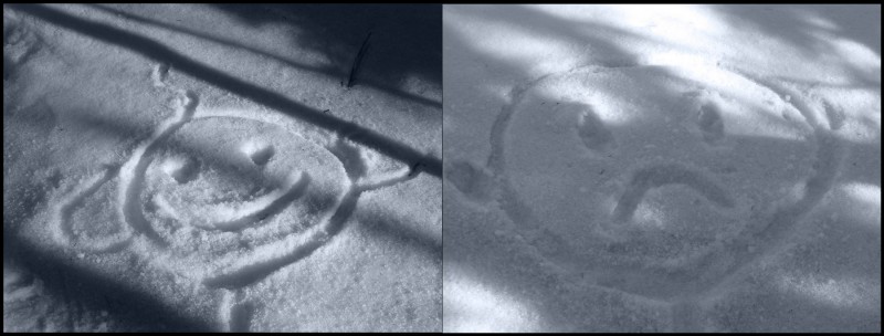
We started walking up the S. Colony road a little past 6 when the first rays were peeping out of the vast horizon and arrived at the Rainbow Trail Junction. I don't know why trees are being felled in such large numbers, but they almost made the Rainbow Trail look non existent. The fact that the road up S. Colony lakes has seen much more foot traffic didn't help us much either. After some deliberations, we decided to stick with the route from 14ers.com and navigated around, above and under the cut trees. Shortly thereafter, we crossed the creek and gained the lowest part of the ridge. At around 10,300, Jason was feeling queasy and we decided to rest for a while to see if he got better. As I had nothing better to do, I started fiddling around with twigs and stones and was happy drawing happy and sad troll faces in the snow.
Trolling around
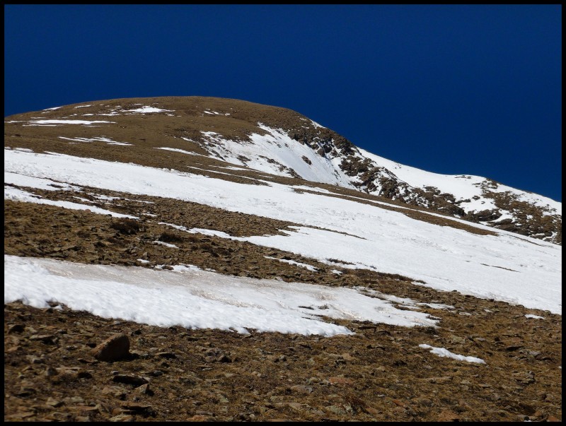
When Jason's condition didn't get better, he asked to me go ahead and get the summit, while he would either wait it out or turn back. It was here that the postholing nightmare started. Any signs of a trench if it was there, was at best faint lines on either side with the trench itself covered in sugar. I went into this hike expecting a nice trench by the party up there last weekend, but according to my theory, the temperatures were so high last weekend that snow from above the trench, melted and filled the trench completely. To add to the misery, I veered off the trail for a bit and found myself in waist deep snow. I eventually found my way back to the trench, or whatever remained of it and continued along, postholing knee deep in many places. At about 11,200, I had almost given up on the summitting, sick of the postholing when Jason showed up, re-energized after a nap. We continued up and eventually reached the treeline and stashed our snowshoes. It took us about 2.5 hours to gain 1500 feet re-establishing the trench. The mountain above treeline was a completely different world, a world of grassy slopes, firm rocks - basically everything a nice summer hike would involve including the weather. Wind was non existent and so was the snow, except for a few patches here and there.
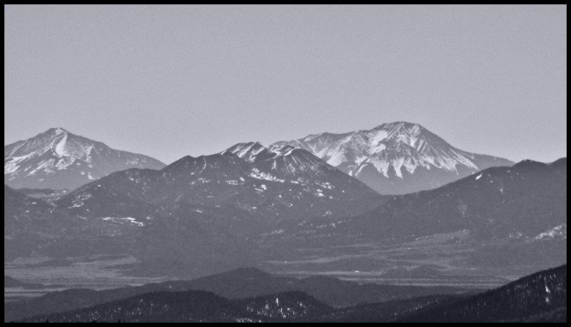
Faraway views
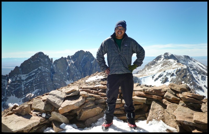
We started walking up the bump and then the long ridge walk. Jason summitted around 1:50pm and I got up around 2:15pm.
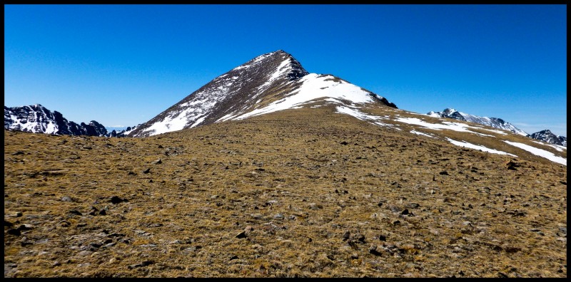
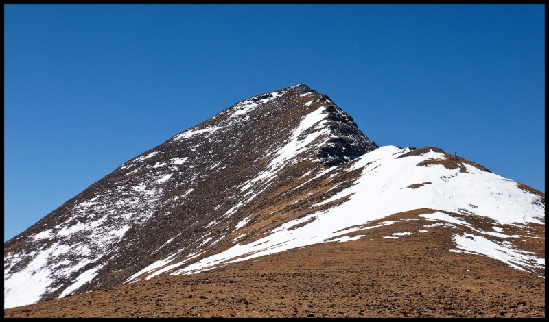
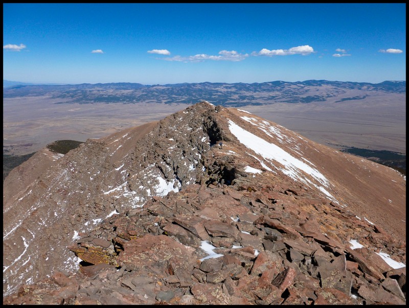
The false false summit Humboldt comes into view The summit ridge, looks 'cute', doesn't it? Jason is somewhere over there ..
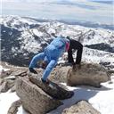
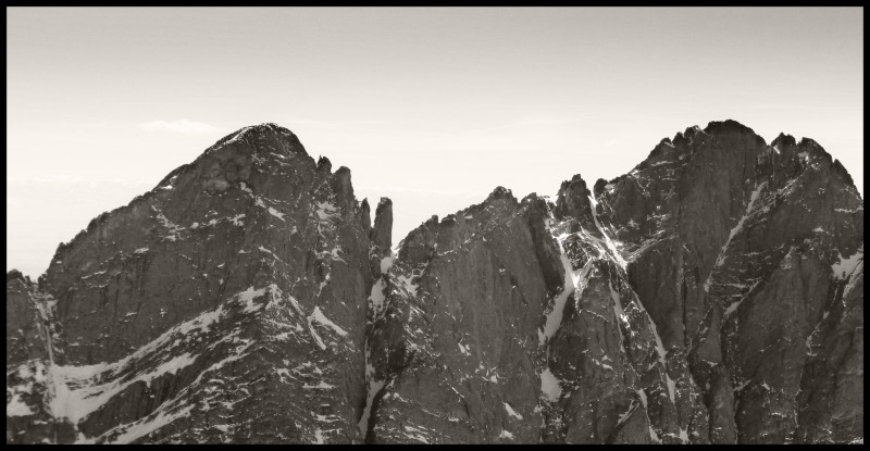
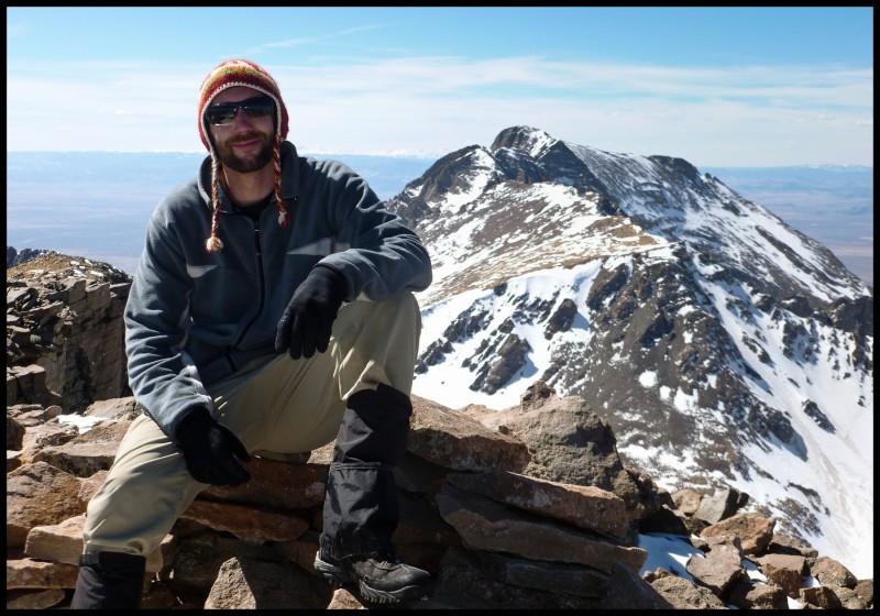
After the summit photoshoot (we had the mighty Crestones for a prop this time!), we started heading back down and saw one other guy turning back a couple of hundred feet above the treeline.
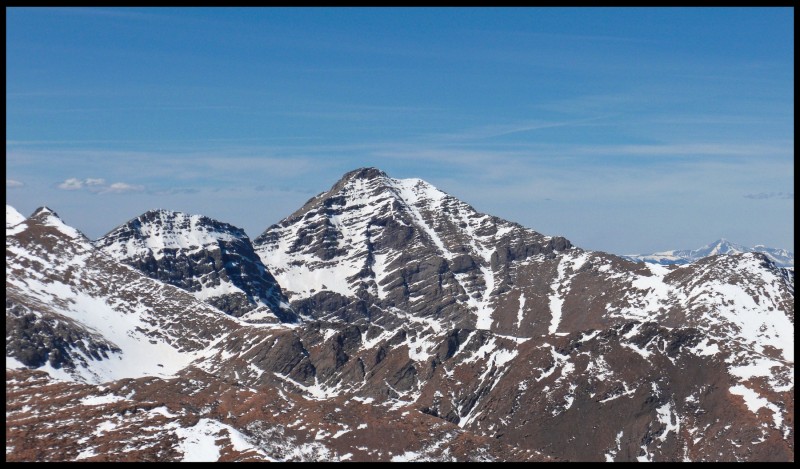
I have no clue what mountain this is, but its cool Everyone's favorite mountains - The Crestones Almost the entire Blanca massif Jason's first Sangres summit Hey Cresties, who's taller now? Looking down on the ridge
The trench was in much worse condition by this time. It turns out a couple of others had attempted the route without snowshoes and had terrible postholing experience. There was evidence of struggle all along the trail. We were no better with our snowshoes and slid, fell and post holed back our way to the creek and eventually reached the S. Colony road.
From the first rays to the last
Epilogue: The drive back was not so great. The town of Westcliffe sleeps well before 8pm, but the deer folk around it do not. I luckily missed hitting deer crossing the road by a few feet when I slowed down to check if a gas station was open. I had to wait another hour and half to get my Starbucks energy drink and drive a little safer.
My GPS Tracks on Google Maps (made from a .GPX file upload):
than when I was up there a week and a half ago! We mostly didn't have a ”trench” either, just a semi-distinct path of packed-down snow. And yep, Mt. Adams is awesome--I don't plan to finish the centennials, but it is one of them that's definitely worth climbing.
Hmmmmmmm.... Awesome report and yes Post Holing sucks... It def. takes a special kind of person to endure the torture that is hiking but also provides the most amount of peace and beauty... Weird! I think I shall try this one this weekend! 14er #4 :P [b]
Thanks for organizing, had a great time. Glad we both made the summit!
Caution: The information contained in this report may not be accurate and should not be the only resource used in preparation for your climb. Failure to have the necessary experience, physical conditioning, supplies or equipment can result in injury or death. 14ers.com and the author(s) of this report provide no warranties, either express or implied, that the information provided is accurate or reliable. By using the information provided, you agree to indemnify and hold harmless 14ers.com and the report author(s) with respect to any claims and demands against them, including any attorney fees and expenses. Please read the 14ers.com Safety and Disclaimer pages for more information.
Please respect private property: 14ers.com supports the rights of private landowners to determine how and by whom their land will be used. In Colorado, it is your responsibility to determine if land is private and to obtain the appropriate permission before entering the property.
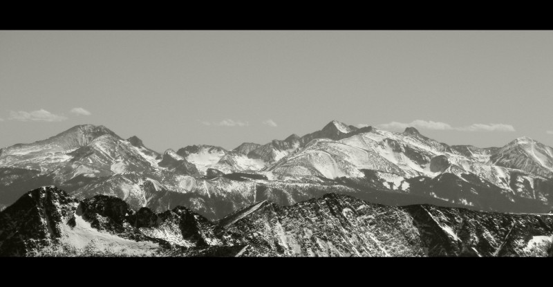
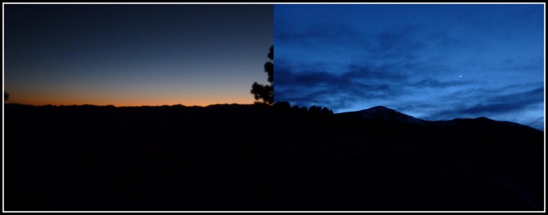
 From the first rays to the last")
 Trolling around")
 Faraway views")
 The false false summit")
 Humboldt comes into view")
 The summit ridge, looks 'cute', doesn't it? Jason is somewhere over there ..")
 I have no clue what mountain this is, but its cool")
 Everyone's favorite mountains - The Crestones")
 Almost the entire Blanca massif")
 Jason's first Sangres summit")
 Hey Cresties, who's taller now?")
 Looking down on the ridge")