Download Agreement, Release, and Acknowledgement of Risk:
You (the person requesting this file download) fully understand mountain climbing ("Activity") involves risks and dangers of serious bodily injury, including permanent disability, paralysis, and death ("Risks") and you fully accept and assume all such risks and all responsibility for losses, costs, and damages you incur as a result of your participation in this Activity.
You acknowledge that information in the file you have chosen to download may not be accurate and may contain errors. You agree to assume all risks when using this information and agree to release and discharge 14ers.com, 14ers Inc. and the author(s) of such information (collectively, the "Released Parties").
You hereby discharge the Released Parties from all damages, actions, claims and liabilities of any nature, specifically including, but not limited to, damages, actions, claims and liabilities arising from or related to the negligence of the Released Parties. You further agree to indemnify, hold harmless and defend 14ers.com, 14ers Inc. and each of the other Released Parties from and against any loss, damage, liability and expense, including costs and attorney fees, incurred by 14ers.com, 14ers Inc. or any of the other Released Parties as a result of you using information provided on the 14ers.com or 14ers Inc. websites.
You have read this agreement, fully understand its terms and intend it to be a complete and unconditional release of all liability to the greatest extent allowed by law and agree that if any portion of this agreement is held to be invalid the balance, notwithstanding, shall continue in full force and effect.
By clicking "OK" you agree to these terms. If you DO NOT agree, click "Cancel"...
Uncompahgre Winter Ascent (South Ridge) - Nellie Creek 2WD TH
Uncompahgre South Ridge Winter Ascent
Date: Saturday-Sunday, March 10-11, 2012 Crew: Kevin P., Sarah, Joe, Kevin B., Shawn, and myself Route: East Slopes > South Ridge (standard) ascent and descent from winter closure at Nellie Creek 2WD TH; I skied down from 13,400' Stats: 15 miles; 5,300' climbed; 4,100' skied; 10 hrs 10 min on summit day
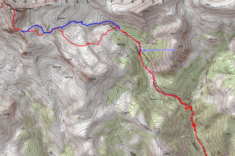
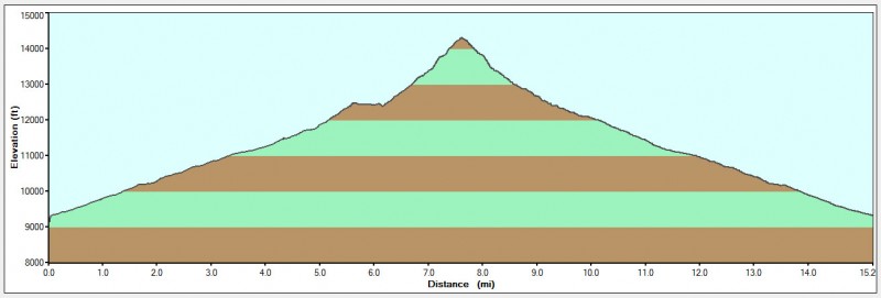
Topo and profile of the route (red=climb; blue=ski):
Saturday, March 10, 2012 - Backpack to Camp at 11,400':
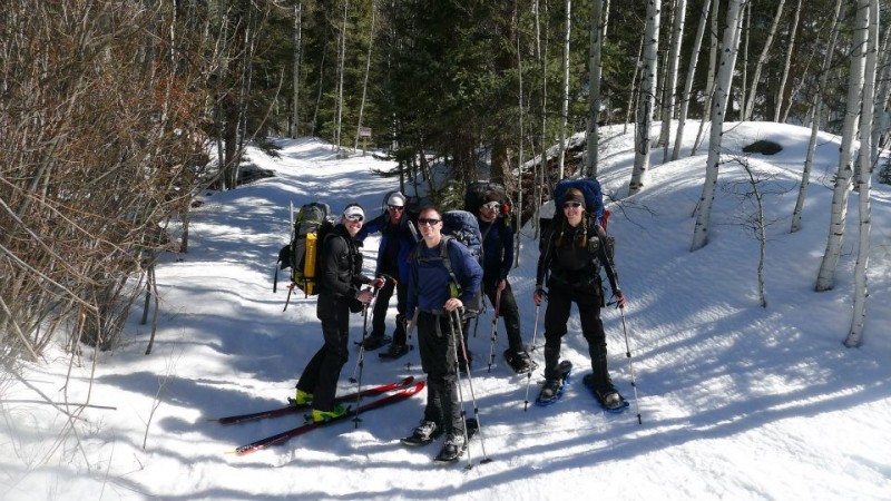
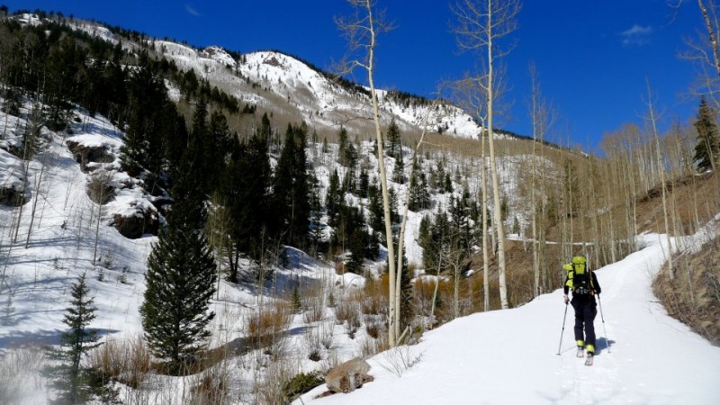
Our crew had such an awesome day on Redcloud and Sunshine a month ago that we were ready for more San Juan fun with a winter camp and ascent of Uncompahgre Peak. With a great weekend forecast and some semi-recent beta from Carl's group, plans were set. After enjoying another luxury stay at the 5-star Water Wheel Inn in Gunnison, the five of us met Joe at 10:00am at the bottom of the 2WD TH on Saturday. We geared up and set off at 10:35am; myself on skis and the rest on snowshoes. (Even though I already have a Summit Ski of Uncompahgre, I brought skis for the fact that I knew I'd be able to skin all the way up to the notch and have a mellow ski down; the ski wasn't as important to me as the winter ascent). It was very warm and sunny; felt like a perfect spring day in the heart of the San Juans.
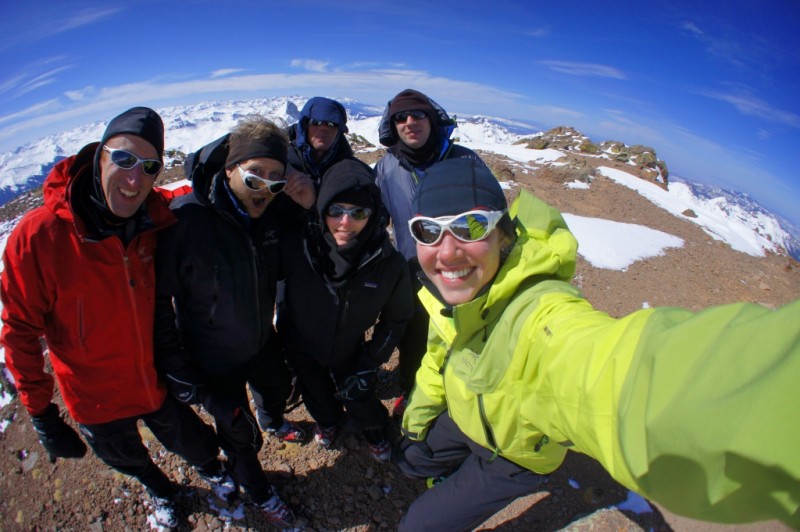
Let's get this party started! Our group at the 2WD Trailhead: Photo: Kevin
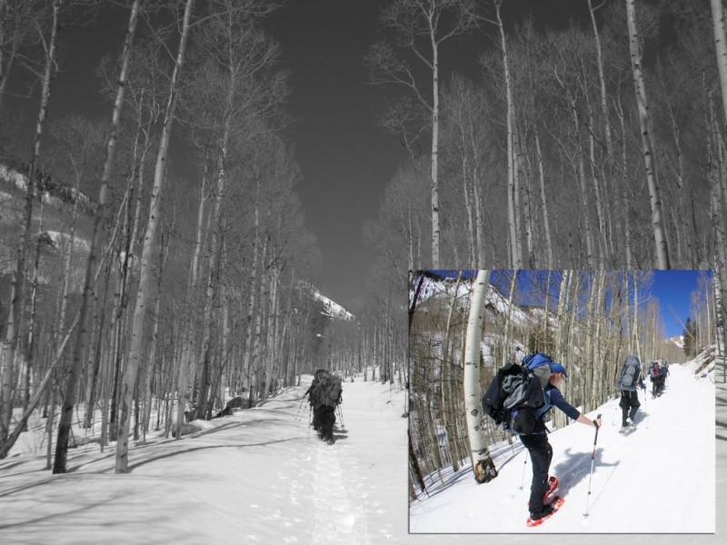
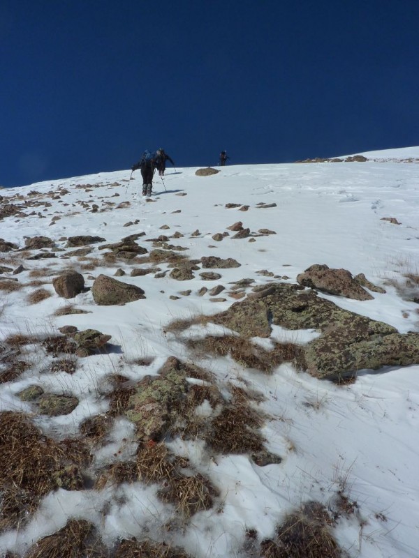
The snowshoe crew makes their way up the gentle road:
I skin the road and enjoy the weather - always in a better mood when skis are on my feet: Photo: Kevin
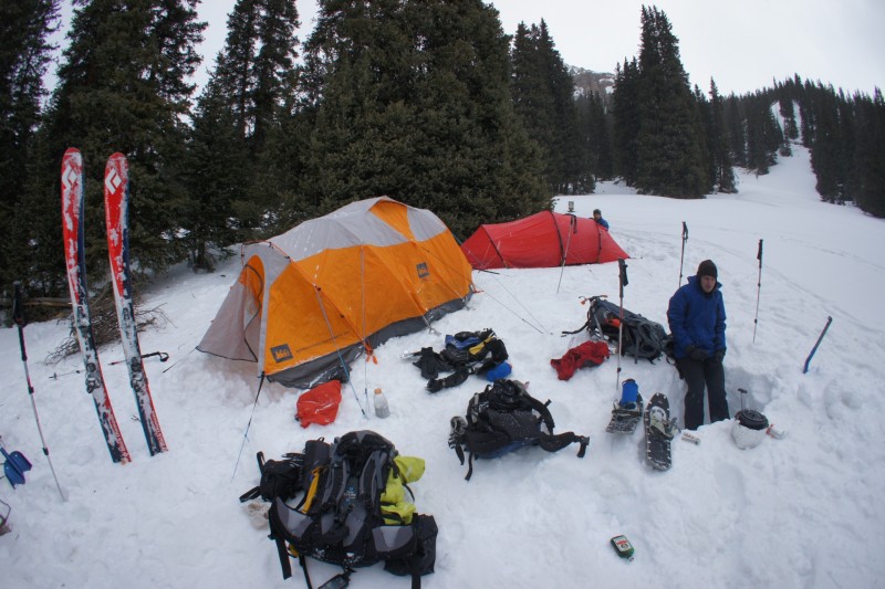
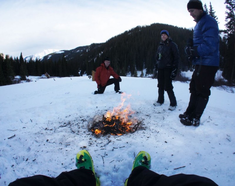
There were plenty of mud slides and minor rock falls along the road, and the stream crossings weren't a problem. After studying the map, there was one slope that could have been suspect on the east side of our track near 11,130'. But, we followed a track from earlier that morning keeping us away from that. Just past that however on our left (west) side of the track were some more potential suspect slopes - we weren't worried about anything sliding though. We made good time over the 4.25 miles to camp at the summer TH near 11,400' in 3hrs. 10min. (at 1:45pm). I'm not used to arriving at camp during daylight hours, so it was odd having so much time to hang out; I liked it. The snow was quite warm, forcing us to stay on flotation gear even after we stomped our campground. Camp was set up fairly quickly and we started getting the water boiling done for the next day. The weather was forecasted for sunny, high of 28 degrees, and wind 5-10mph - shortly after camp arrival, a brief snow/graupel storm graced us with her presence for part of the afternoon. Kevin B. got the campfire going for us. After dinner, stories, and many laughs around the fire, we all hit the sack early around 7:30pm.
Setting up camp, Shawn starts the multi-liter water boiling process in our "kitchen" during a short snow squall:
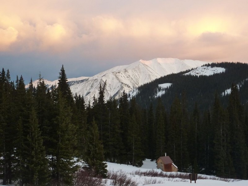
UN 13,180' shows herself after the snow squall at dusk: Photo: Shawn
Nothing beats a warm campfire and good conversation on a cold winter night - thanks Kevin Baker!
Sunday, March 11, 2012 - Summit Ascent and Pack Out:
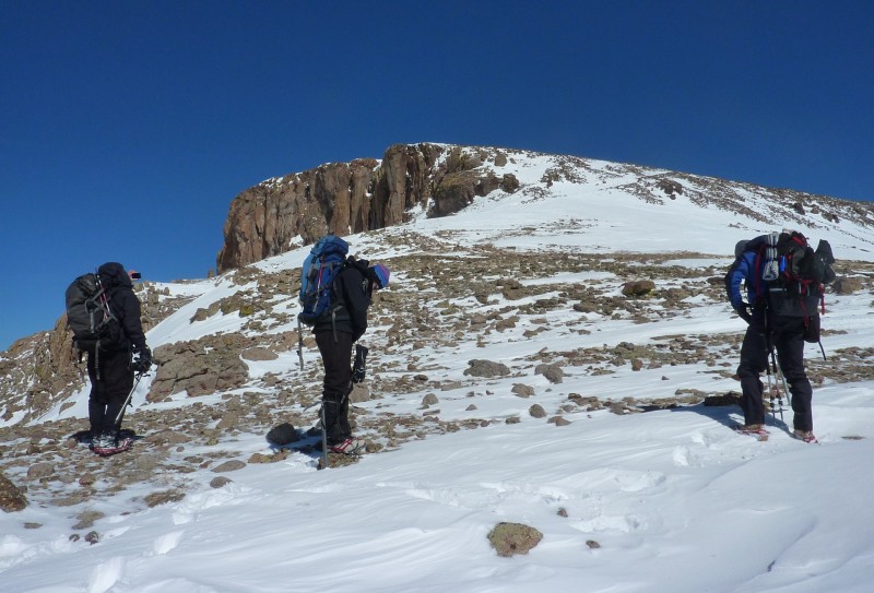
Slightly thrown off by the time change, we eventually started up trail from camp at 8:00am. Near 11,800' at the "boulders", we deviated slightly from the standard route to avoid crossing a large drainage. We virtually made a bee-line straight up from the boulders, staying on the south side of the gully and standard route on mellower terrain. The winds were a bit higher than expected, keeping things cool most of the morning.
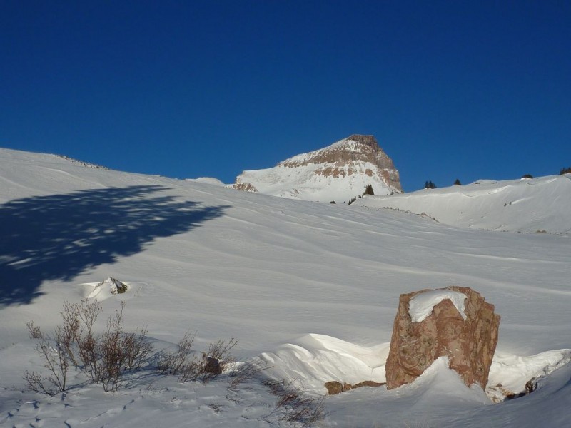
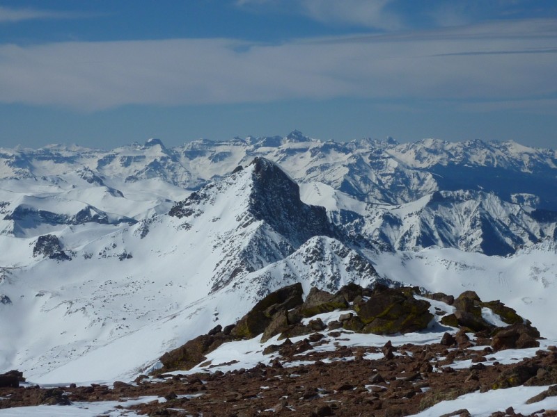
A glowing and aesthetically pleasing 14k chunk of rock (seen from 11,800'): Photo: Shawn
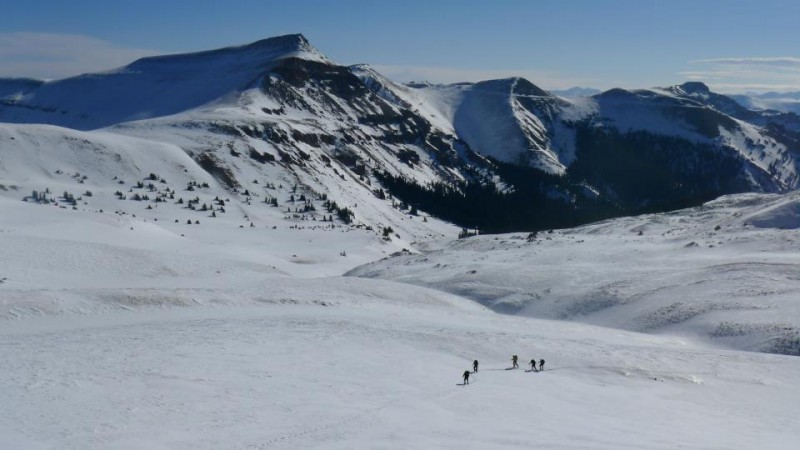
We made our way up, around, and traversing several hills throughout this remarkable alpine basin en route to the south ridge. Skin conditions were good - variations between sastrugi, pockets of powder, and a crusty layer - all giving me surprisingly good bite. Also, there was a bit more overall snow consolidation than we expected - we estimated 20-25mph winds that day.
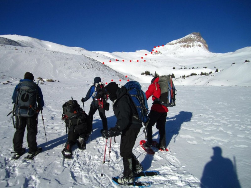
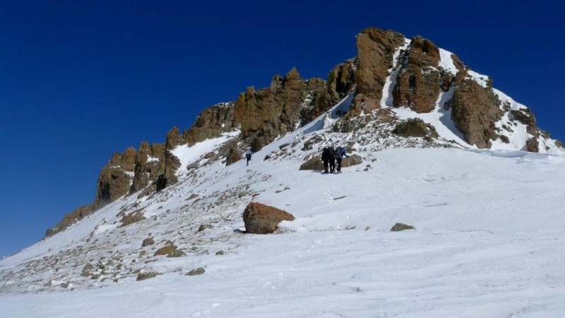
The group pauses near 12,300' to look at the route (in red):
Making our way to the South Ridge: Photo: Kevin Photo: Kevin
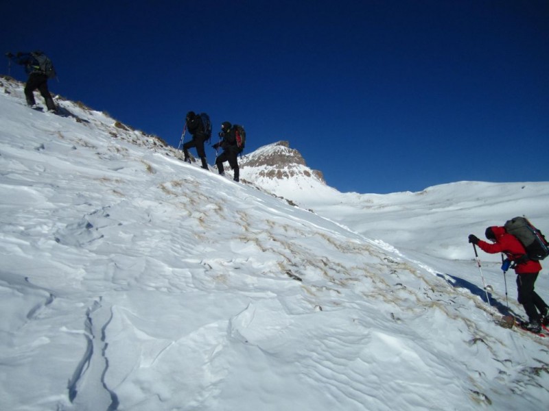
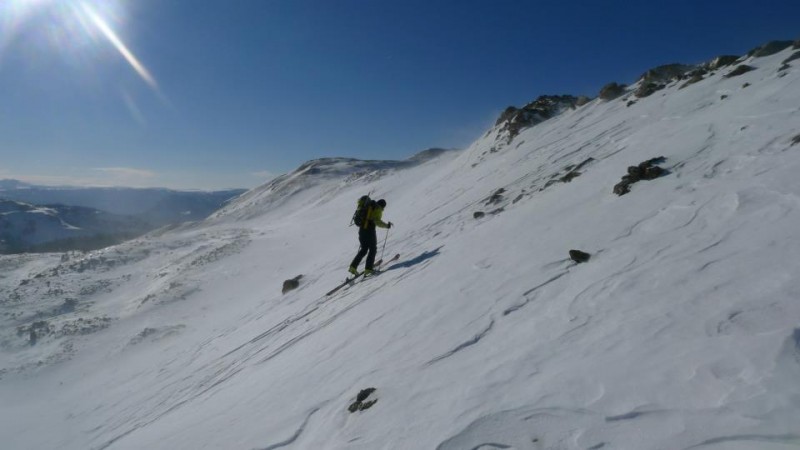
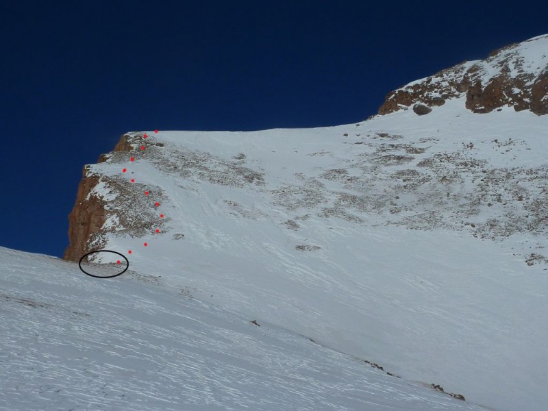
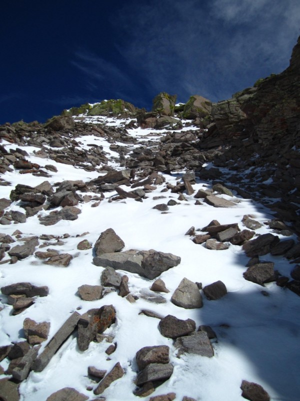
We reached the notch at 13,400', just before the steep slope below the ridge. Here, we stashed our snowshoes and skis, and everyone but Kevin B. and I put micro-spikes on. This slope was definitely more wind-blown than what Carl's group faced a month ago. Bee-lining straight up the slope staying on or near the wind-blown rocks (photo below) was the obvious and safest way we would reach the ridge. Once again, our line strays from the standard switchbacks on the SE Face.
Our route to the South Ridge taken from just below the notch at 13,400'(snowshoe/ski stash circled): Photo: Shawn
Breath-taking views looking at the western San Juans from the notch:
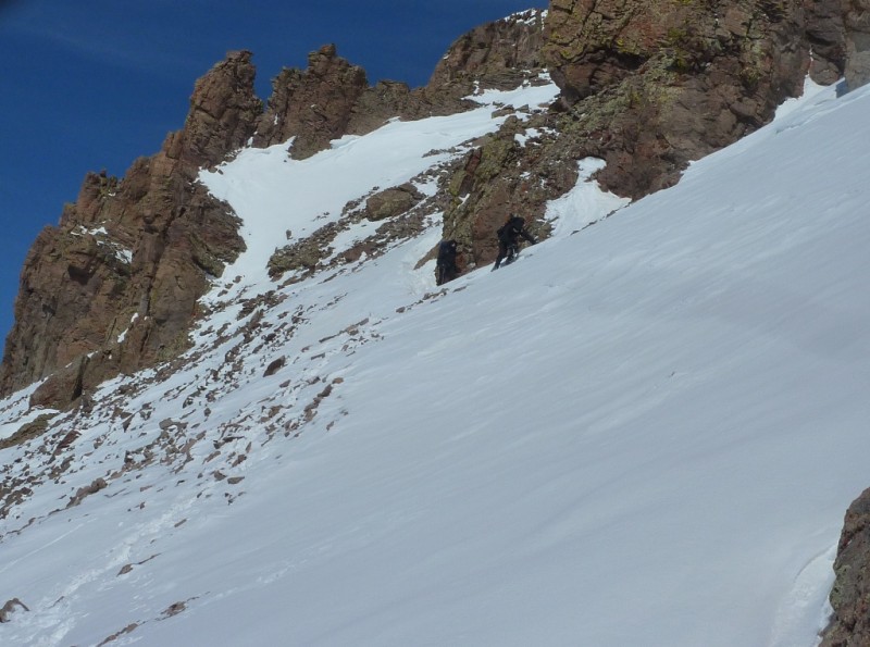
Joe, Kevin P., and Sarah climb the steep slope to the ridge: Photo: Shawn
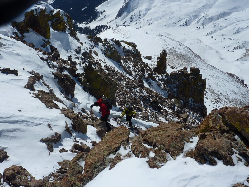
After reaching the south ridge, Kevin B. and I put on crampons at 13,800'. Heading north around to the west face, we traversed a short snow slope to the base of the steep, loose scree gully - the crux of this route. Not going to lie here, but climbing this 150' steep section in AT boots undoubtedly elevated my anxiety levels. We all stayed on climbers' right of the gully before leaving it at 13,900'. Kevin and I ditched the crampons halfway up.
Joe, Kevin P., Sarah, and Shawn head towards the west scree gully along the ridge: Photo: Kevin
Looking up the west face from the base:
Kevin and I nearing the top of the dry west-facing crux: Photo: Shawn
Kevin P., Sarah, and Joe start up the last 400' to the summit after topping out above the gully: Photo: Shawn
We topped out, headed northeast to meet the rest of the group on the summit at 12:45pm. The wind died down, we re-fueled, soaking in the sun and awesome San Juan views.
Kevin B., Kevin P., Joe, Shawn, Sarah, and I share the vast summit of Uncompahgre together; Wetterhorn peeks through just left of center:
Wetterhorn et al. from the summit: Photo: Shawn
*For skiers: Although it's very thin and bony up top above the gully, I do believe a summit ski can be linked together, minus the downclimb in the gully.
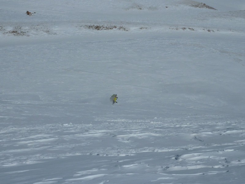
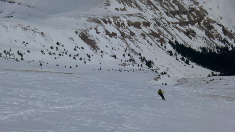
We left the summit at 1:45pm; I'm completely nervous for the climb back down the gully in ski boots. It turned out that it wasn't nearly as bad as I anticipated, thanks to Kevin B. for sticking with me! We put the crampons back on and finished the downclimb. Traversing back across the south ridge and then down the steep slope, we found ourselves back at the flotation cache at the notch. For me, the fun began here once I put the skis back on my feet! While the group followed our track down, I went to check out a section just north of the ascent route. Ski conditions were certainly less than ideal - no pretty skiing. Albeit a mellow slope, I still made a ski cut and jumped on it - solid wind-pack and sastrugi. Things were kept rather cool thanks to the winds. I wrapped skiers' right around the base of a large rocky knob and waited for my partners near 12,900'. From here, ski conditions varied from sastrugi, to a layer of breakable crust, pockets of wind-blown shallow powder, and then turned into heavier snow as I neared treeline.
Kevin P. and Sarah traverse back to the south ridge from the west face: Photo: Shawn
I get some mellow turns in: Photos: Kevin & Shawn
We chose to take a more direct route down very close to the standard route. The five of us split from Kevin B. at 12,000', and although his route was mellower than ours, both routes put us on south-facing slopes that were steep enough to slide. Thankfully nothing did and we all knew that our ascent route was by far the safest option.
I returned to camp at 3:30pm, the group shortly after. We broke down the tents, packed up and started the 4 miles down the road an hour later. We were back at the cars around 6:15pm. And thanks to Joe for the superb blister care - definitely the game changer for me. Another solid weekend in the mountains with a solid crew to mark in the books. Can't wait to do it again!
My GPS Tracks on Google Maps (made from a .GPX file upload):
What a fun trip! Good time with good friends. Thanks for the sweet writeup, C Moore! This will be a good resource for future winter hikes up the Big U.
and solid company. But thats not a winter climb. Thats a bluebird day, doesnt count. Instead of a ”Calender Winter” ascent, it should read more like ”Winter-like conditions” ascent in the future. Good work nonetheless, you guys still had to deal with the vertical and added roundtrip mileage.
Kevin/Sarah - Where are the Deviant Dales? Those look like Modus in your hands.
Brian, rest assured a couple of Deviant tallboys did in fact make the trip. I commend you for picking out the truly important details in this report.
Caroline, thanks for writing the TR! Although I'm disappointed you weren't able to incorporate some of those witticisms from the Water Wheel shindig Fri. night, it's probably for the best.
And many thanks to Kevin B. for organizing the outing. This was a great trip with a really fun group. Definitely a highlight of the winter-like conditions season. 8)
I heard from Kevin P that you all were going to be in the neighborhood, we went up PT 13832 and PT 13811 this past Sat with a group of 4. Got a good look at Uncompahgre from up there and were thinking you'd all be successful! Nice job :D
Great TR, Caroline. Maybe you should change your screen name to ”Nails” or something considering you did this peak with a torn meniscus. That's a heck of an effort, especially with an overnight.
Thanks again to Kevin B. for the invite, it was great getting out with you and smooth shawn keil again.
On a side note, which one of y'all was snoring like a mule on Saturday night? :wink:
Ummm the guilty snoring party was the female in the tent. I had to turn on my MP3 player to try and cover up the noise. I can't say I slept very well. Although in Caroline's defense it is usually me snoring, so I am sure it was just payback.
SO MUCH for your nice comments! I really appreciate it!
Caution: The information contained in this report may not be accurate and should not be the only resource used in preparation for your climb. Failure to have the necessary experience, physical conditioning, supplies or equipment can result in injury or death. 14ers.com and the author(s) of this report provide no warranties, either express or implied, that the information provided is accurate or reliable. By using the information provided, you agree to indemnify and hold harmless 14ers.com and the report author(s) with respect to any claims and demands against them, including any attorney fees and expenses. Please read the 14ers.com Safety and Disclaimer pages for more information.
Please respect private property: 14ers.com supports the rights of private landowners to determine how and by whom their land will be used. In Colorado, it is your responsibility to determine if land is private and to obtain the appropriate permission before entering the property.