Download Agreement, Release, and Acknowledgement of Risk:
You (the person requesting this file download) fully understand mountain climbing ("Activity") involves risks and dangers of serious bodily injury, including permanent disability, paralysis, and death ("Risks") and you fully accept and assume all such risks and all responsibility for losses, costs, and damages you incur as a result of your participation in this Activity.
You acknowledge that information in the file you have chosen to download may not be accurate and may contain errors. You agree to assume all risks when using this information and agree to release and discharge 14ers.com, 14ers Inc. and the author(s) of such information (collectively, the "Released Parties").
You hereby discharge the Released Parties from all damages, actions, claims and liabilities of any nature, specifically including, but not limited to, damages, actions, claims and liabilities arising from or related to the negligence of the Released Parties. You further agree to indemnify, hold harmless and defend 14ers.com, 14ers Inc. and each of the other Released Parties from and against any loss, damage, liability and expense, including costs and attorney fees, incurred by 14ers.com, 14ers Inc. or any of the other Released Parties as a result of you using information provided on the 14ers.com or 14ers Inc. websites.
You have read this agreement, fully understand its terms and intend it to be a complete and unconditional release of all liability to the greatest extent allowed by law and agree that if any portion of this agreement is held to be invalid the balance, notwithstanding, shall continue in full force and effect.
By clicking "OK" you agree to these terms. If you DO NOT agree, click "Cancel"...
Mt. Guyot - 13,370 Feet
Front Range
December 18, 2011
Trailhead:French Gulch Route: We started with the Northwest Ridge/Face route, but we deviated - see the map. Mileage: ~7.1 miles Special gear: Ice axe, snowshoes, microspikes (Kate wore them; I didn't), winter weather clothing.
Mt. Guyot. Is that "Guy-aht"? or "Gi-oh"? or "Guy-oat"? Whatever - you don't need to pronounce it, just hike it!
Route: Red up. Blue down.
With a good weather report - temps in the low 30s and tolerable winds - we decided to get out and finish this hike. We got to about 11,300 feet last weekend before turning around due to cold feet and deep snow and no snowshoes. Our bad.
This time, we brought our winter boots and snowshoes and finished the job.
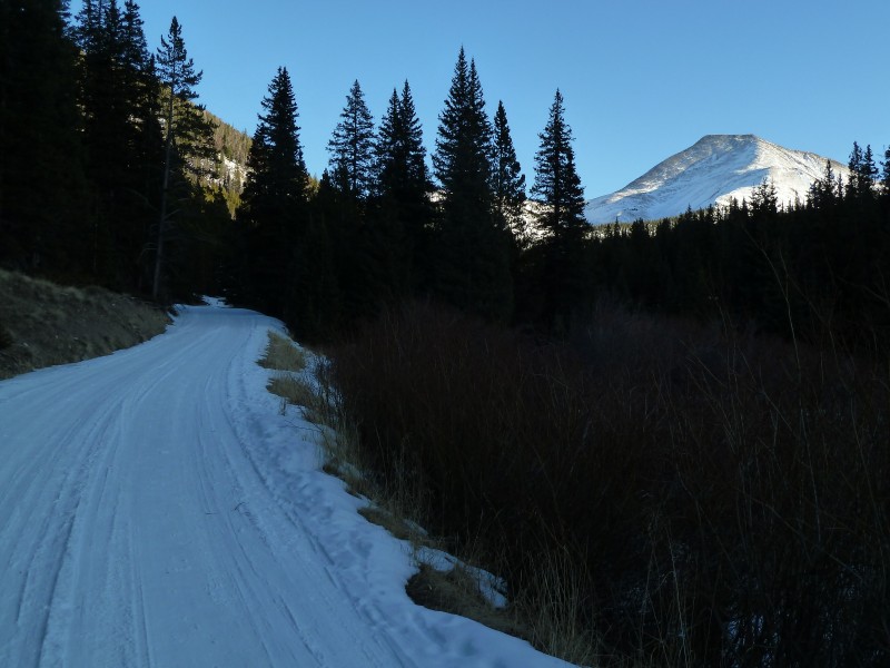
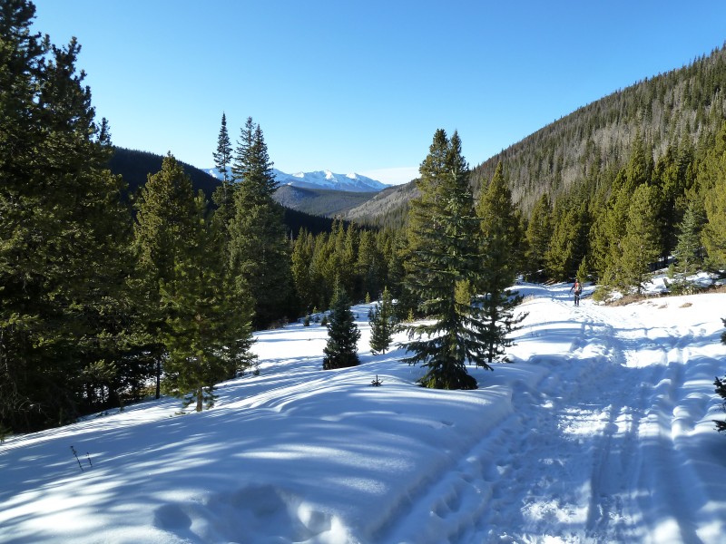
We parked at the signed TH - the French Gulch TH directions from this site are spot on. We started up the road and bypassed the first closed gate and continued up the road.
Stay left here.
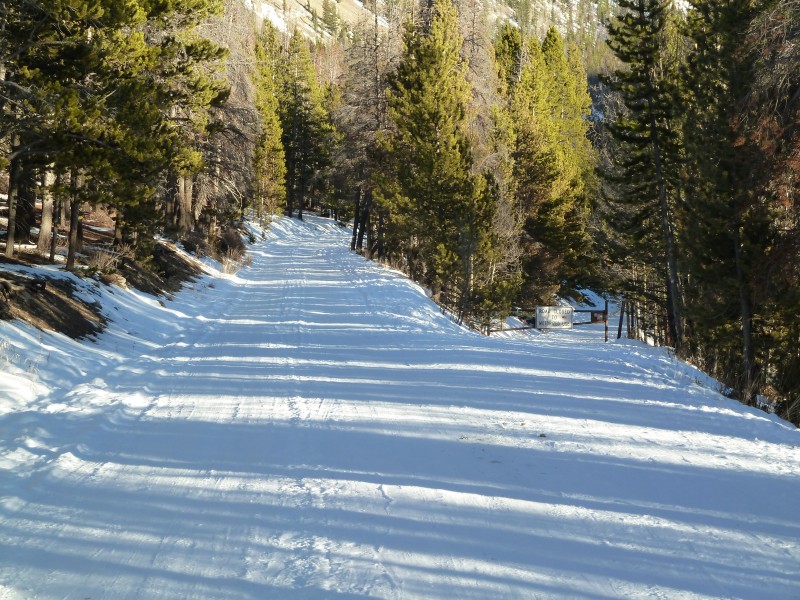
The road is very well packed from the trailhead up to and beyond the next closed gate.
View of the summit while hiking the road.
After the closed gate, we continued on the road and passed a new-ish looking cabin/barn on the right with metal on the lower 1/3 and light wood on the top. You'll turn left maybe 50 yards passed that building.
Turn left here. Note the rock on the right.
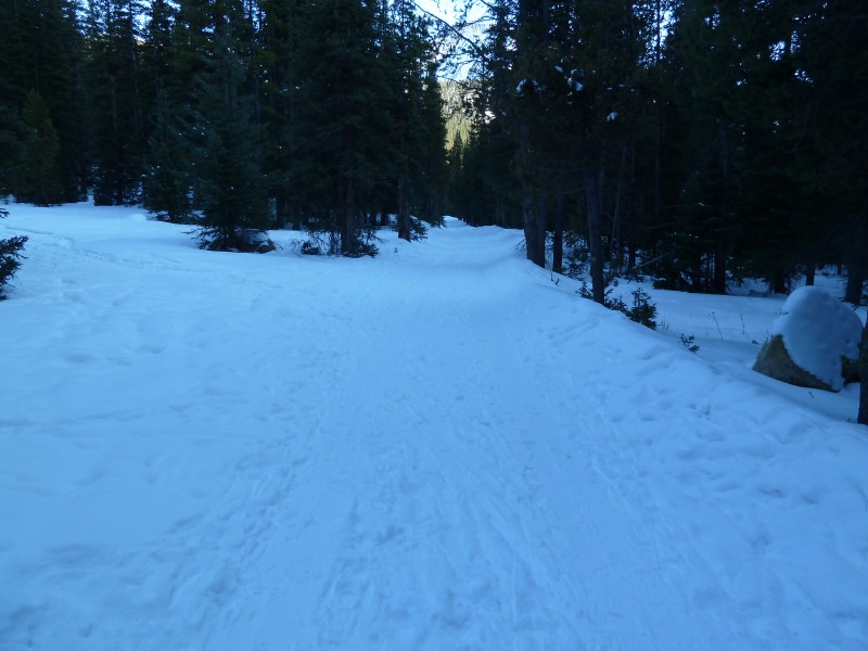
The left turn takes you onto a trail that sees much less use, but was pretty well packed down for a while. This is the entrance to Little French Gulch.
The path can mostly support a hiker's weight down low, but above maybe 11,100 ish feet you'll want snowshoes to avoid postholing.
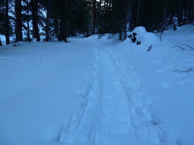
Lower on the path.
Higher up. A little farther up. Mt. Guyot shows itself along the trail.
We stayed along the creek bed to ascend into the higher part of the basin. There is an exit out of the creek bed on the right that may or may not be the summer trail. There were some tracks leading up there, but that's the way we went the prior weekend and we didn't like it... The view around 11,300 or so.
The snow along the creek bed was a mix of hard snow that supported our weight, crusty snow that dented our shins, and sugar. This would be the theme all day...
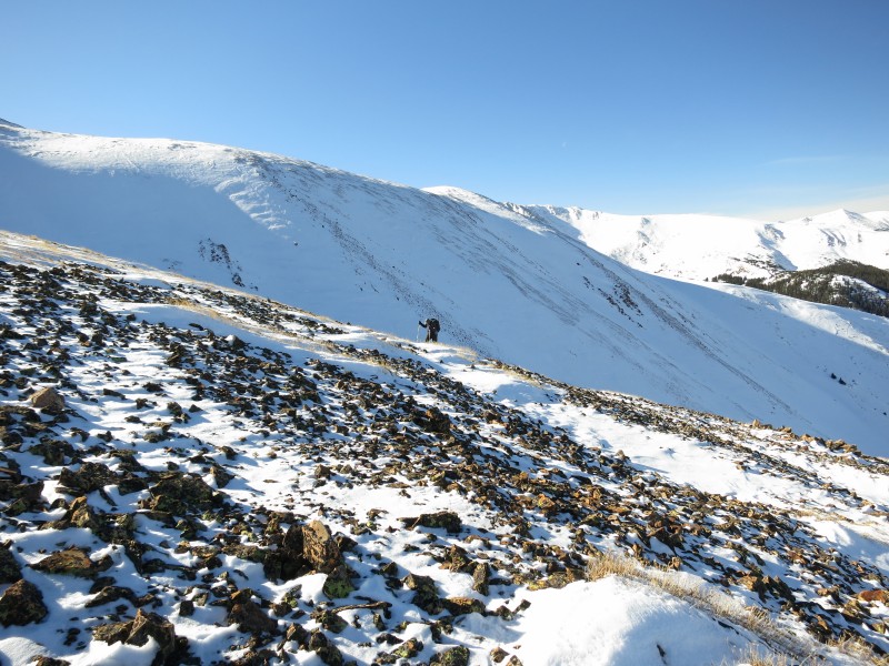
We ascended farther into the basin than what the summer route description calls for, but we also did not follow the winter route suggestion. Instead, we decided to get out of the snow and into the sun by ascending the north ridge. We headed out of the drainage just below 12,000 feet. Gaining the ridge was pretty easy and allowed us to get into the sun. We turned left and gained the ridge above where that snow-free ridge enters the drainage on the left in the above image. Bob gaining the north ridge.
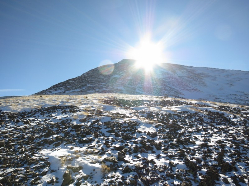
About this drainage... The weather report called for 33 degrees and low (ish) winds. The winds were, in fact, low-ish. Fine. But the temps were not 33 degrees. This drainage doesn't get a lot of sun - at least this was true this weekend and last. So the temps were not 33. Not even close. It was pretty chilly. Gaining that ridge did get us into the sun - but only for a few minutes. The summit kept hiding the sun as we got closer to it... Looking up at our goal.
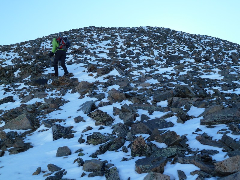
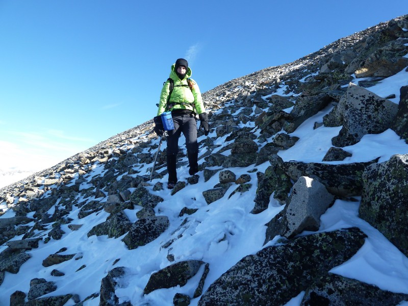
Here is Kate ascending the steep part after gaining the north ridge. The rocks were loose and the snow didn't help at all. Kate on the steep after gaining the ridge. In shadow once again.
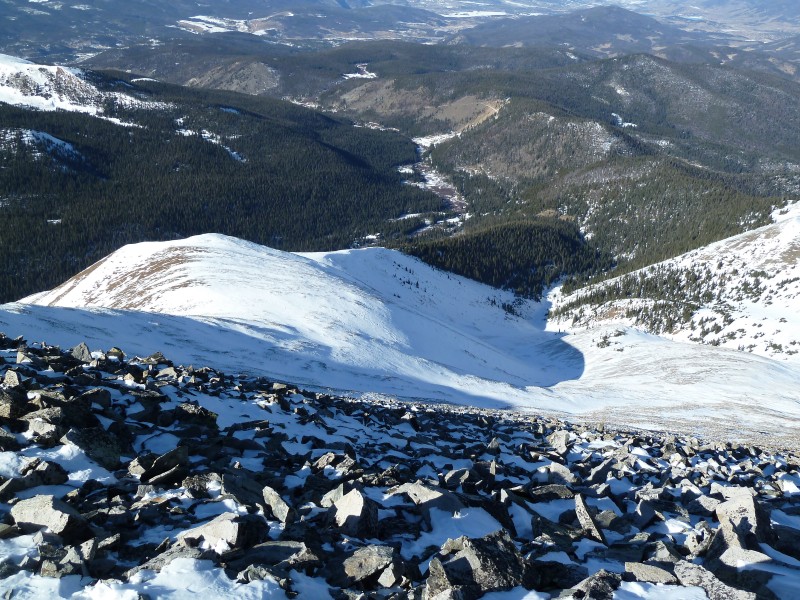
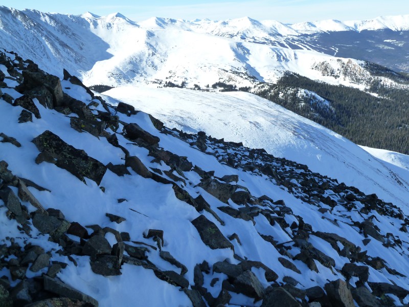
Looking back at our ascent route from the steep part leading to the summit. Looking back at our route - approx. along the red line.
Looking back at the approach.
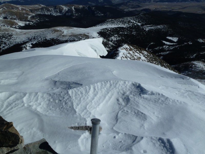
The summit is fairly small - or so it seemed. There was a nice looking cornice hanging off the top. We stayed on the exposed rock for safety. Cornice.
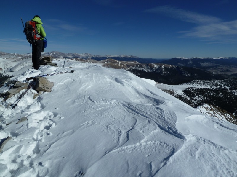
Kate checking out the view
On our ascent, we spied some snow that looked like it might contain a good glissade. This snow was on/near the winter snow route from the 13ers.com route description. We did a descending traverse over to there. Heading down.
The snow on the traverse was consistently annoying. It was mostly just loose sugary snow that made every rock very slippery. Getting closer to the Northwest slope snow route.
The snow conditions for the glissades were generally ok, but there was a thin crust in areas, powder in others, and hard slab in yet other areas. With the variable conditions, we tried to stay close to the rocks and ended up walking down a fair amount. We did get in a couple of nice glissades when the conditions allowed. Snow.
Heading down the drainage.
Walking out.
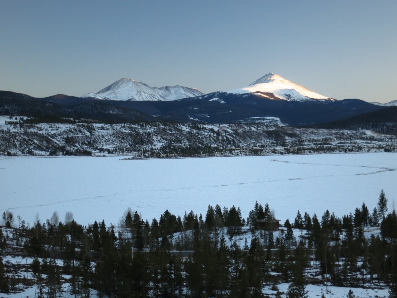
We stopped at the scenic overlook just east of the Frisco/Breck exist on I-70 to see what we hiked (the left one). Scenic overlook
We thought this would be a quick hike, but the loose rock and bad snow on the final 1,000 feet or so really slowed us down - both on the ascent and the descent. It took us about 7 hours car to car.
Bob and Kate
Thumbnails for uploaded photos (click to open slideshow):
I admire your perseverance, Bob (and Kate). Getting right back out there and making amends as soon as possible is the best strategy for dealing with failed attempts, in my opinion.
Congrats on your successful summit, and happy holidays to both of you! :)
Acoustic5679 - It would be great to ski into and out of that area. It seems to be a popular place for that - judging by the tracks.
Bob
Caution: The information contained in this report may not be accurate and should not be the only resource used in preparation for your climb. Failure to have the necessary experience, physical conditioning, supplies or equipment can result in injury or death. 14ers.com and the author(s) of this report provide no warranties, either express or implied, that the information provided is accurate or reliable. By using the information provided, you agree to indemnify and hold harmless 14ers.com and the report author(s) with respect to any claims and demands against them, including any attorney fees and expenses. Please read the 14ers.com Safety and Disclaimer pages for more information.
Please respect private property: 14ers.com supports the rights of private landowners to determine how and by whom their land will be used. In Colorado, it is your responsibility to determine if land is private and to obtain the appropriate permission before entering the property.


 Route: Red up. Blue down.")
 Stay left here.")
 View of the summit while hiking the road.")
 Turn left here. Note the rock on the right.")
 Lower on the path.")
 A little farther up. Mt. Guyot shows itself along the trail.")
 The view around 11,300 or so.")
 Kate on the steep after gaining the ridge. In shadow once again.")
 Looking back at our route - approx. along the red line.")
 Looking back at the approach.")
 Bob gaining the north ridge.")
 Looking up at our goal.")
 Cornice.")
 Kate checking out the view")
 Heading down.")
 Getting closer to the Northwest slope snow route.")
 Snow.")
 Walking out.")
 Heading down the drainage.")
 Scenic overlook")


