Download Agreement, Release, and Acknowledgement of Risk:
You (the person requesting this file download) fully understand mountain climbing ("Activity") involves risks and dangers of serious bodily injury, including permanent disability, paralysis, and death ("Risks") and you fully accept and assume all such risks and all responsibility for losses, costs, and damages you incur as a result of your participation in this Activity.
You acknowledge that information in the file you have chosen to download may not be accurate and may contain errors. You agree to assume all risks when using this information and agree to release and discharge 14ers.com, 14ers Inc. and the author(s) of such information (collectively, the "Released Parties").
You hereby discharge the Released Parties from all damages, actions, claims and liabilities of any nature, specifically including, but not limited to, damages, actions, claims and liabilities arising from or related to the negligence of the Released Parties. You further agree to indemnify, hold harmless and defend 14ers.com, 14ers Inc. and each of the other Released Parties from and against any loss, damage, liability and expense, including costs and attorney fees, incurred by 14ers.com, 14ers Inc. or any of the other Released Parties as a result of you using information provided on the 14ers.com or 14ers Inc. websites.
You have read this agreement, fully understand its terms and intend it to be a complete and unconditional release of all liability to the greatest extent allowed by law and agree that if any portion of this agreement is held to be invalid the balance, notwithstanding, shall continue in full force and effect.
By clicking "OK" you agree to these terms. If you DO NOT agree, click "Cancel"...
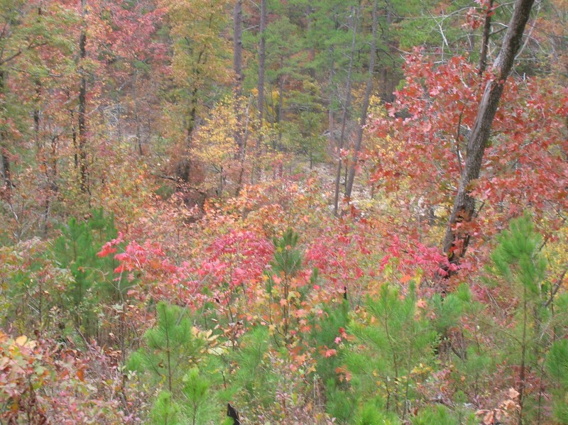
The trail is called Eagle Rock Loop. It is a 26.8 mile loop hike that we started on Friday, November 4, 2011 at 11:30 a.m. and finished on Sunday, November 6, 2011 at 9:30 a.m., so we completed the entire route in less than 48 hours. It is in the Ouachita National Forest in southwest Arkansas. Closest town is Mena if you want to try and find it on a map. We started at the Athens-Little Missouri-Big Fork trailhead in the northwest corner of the loop, but since it is a loop hike, there are several other trailheads you can start the hike from. The most well known is the Albert Pike trailhead. In June 2010, a flash flood of the Little Missouri River caused by overnight rain swept through the Albert Pike campground, killing 20 unsuspecting campers. The area is now been closed to overnight camping. When we hiked through the area around Albert Pike, you still could see evidence from that event which occurred nearly 18 months ago, i.e., debris/downed trees that had been carried along by the water flow and pushed up against other trees and is now resting in a place that is much higher than the current location of the water in the stream. Very sobering. We concluded that this was the ideal time of year to do this hike. The water flow was at a seasonal low which meant the many stream or river crossings did not present any serious challenge or danger. Instead of summer heat/humidity and the accompanying mosquito swarms, we had ideal hiking temperatures mainly in the 60's and 70's. The magnificent fall foliage was amplified by the wide diversity of tree types which threatened to put us on visual overload.
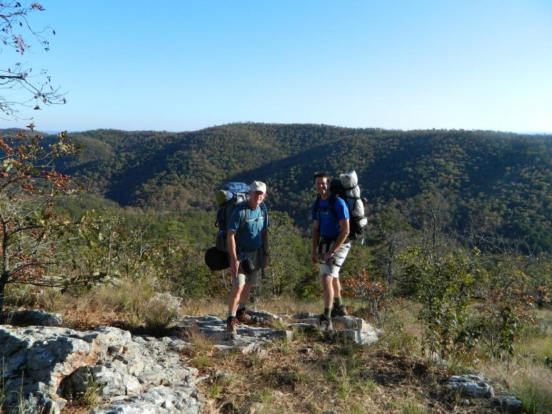
We decided to hike the loop counterclockwise because we wanted to take on the most physically demanding part of the route while we were fresh. Our start from the Athens-Big Fork trailhead meant we were committed to immediately crossing six ridges in less than eight miles with corresponding elevation gains and losses. Trailhead sign
The link below shows you the elevation profile for the entire loop and clearly illustrates our first day task.
We ended day one by making camp at Eagle Rock Vista (elevation 1,520 feet), just over 7 miles from our trailhead; 2,154 feet of elevation gain and 2,014 feet of elevation loss for day one. No worries. On the day one trail - photo credit Gary GroffGary and Rob at Eagle Rock Vista - elevation 1520 feet
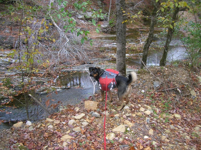
With the most strenuous portion of the route out of the way, we comfortably stretched out day two and covered 14 miles. Viles Branch Section of the Eagle Rock Loop trail - runs east and west and forms the southern leg of the loopCali on the Viles Branch trailRob, Cali, and Gary at the confluence of Viles Branch and Little Missouri River
We completed the entire southern leg of the loop, which included the only two river crossings where we had to remove our boots and cross in sandals.
Little Missouri River between Winding Stairs and FR106 East trailheadLittle Missouri RiverEarly November in the Ouachita National ForestWish You Were Here to See This Yourself?Panoramic from Albert Pike Overlook - looking north
We also moved most of the way up the eastern leg of the loop along the Little Missouri River which permitted us to see evidence of the flood from the summer before.
Rob demonstrating height of flood debris on Little Missouri River trail - photo credit Gary Groff
Day three was a fairly relaxing stroll of close to 6 miles, highlighted by the only two water crossing on the entire trail where you get to use a bridge, and a very picturesque falls on the Little Missouri River.
Little Missouri River falls
Hope the photos help capture what we experienced because the natural beauty of the area was astounding. If you're convinced that you need to indulge in this little Arkansas treasure, here is a link to a really well done Forest Service product with directions to several of the trailheads and an accurate and informative map.
November in Arkansas is much different than November in Colorado. As both of you noted, November also marks the start of KU basketball. Am going to the Davidson game at the Sprint Center on December 19. Hope everyone enjoys the Thanksgiving season. We may need to do another KC-area 14ers.com gathering. Maybe between Christmas and New Years?
One of my sons did the Eagle Rock Loop in March 2010 with a group from his Boy Scout troop. As I recall, they started at Albert Pike CG. Nice to see your photos of the area.
Caution: The information contained in this report may not be accurate and should not be the only resource used in preparation for your climb. Failure to have the necessary experience, physical conditioning, supplies or equipment can result in injury or death. 14ers.com and the author(s) of this report provide no warranties, either express or implied, that the information provided is accurate or reliable. By using the information provided, you agree to indemnify and hold harmless 14ers.com and the report author(s) with respect to any claims and demands against them, including any attorney fees and expenses. Please read the 14ers.com Safety and Disclaimer pages for more information.
Please respect private property: 14ers.com supports the rights of private landowners to determine how and by whom their land will be used. In Colorado, it is your responsibility to determine if land is private and to obtain the appropriate permission before entering the property.


 Trailhead sign")
 On the day one trail - photo credit Gary Groff")
 Gary and Rob at Eagle Rock Vista - elevation 1520 feet")
 Viles Branch Section of the Eagle Rock Loop trail - runs east and west and forms the southern leg of the loop")
 Cali on the Viles Branch trail")
 Rob, Cali, and Gary at the confluence of Viles Branch and Little Missouri River")
 Little Missouri River between Winding Stairs and FR106 East trailhead")
 Little Missouri River")
 Early November in the Ouachita National Forest")
 Wish You Were Here to See This Yourself?")
 Rob demonstrating height of flood debris on Little Missouri River trail - photo credit Gary Groff")
 Panoramic from Albert Pike Overlook - looking north")
 Little Missouri River falls")


