| Report Type | Full |
| Peak(s) |
Granite Peak - 12807 |
| Date Posted | 11/06/2011 |
| Modified | 11/07/2011 |
| Date Climbed | 09/03/2011 |
| Author | ChrisinAZ |
| Additional Members | TerryLiv |
| Reaching the top of Montana...the easy way? (part 1) |
|---|
|
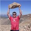
Granite Peak, a sharp fin of rugged rock thrusting its way above all else in Montana, is a peak I have long dared to dream of climbing. As a kid, it captivated me, yet seemed an impossible goal at a time when I'd never hiked more than a dozen miles, and didn't even know what class 4 climbing really was. Many years before even this, I'd gone on vacation with my parents to Yellowstone, and had marveled at the geysers, geothermal vents, and solemn woods of the area. But it was the drive over Beartooth Pass that was truly unforgettable to me--driving a road with eight feet of plowed snow on either side in July, stopping on a high plateau to throw snowballs around, and staring, slack-jawed, at a sea of dramatic and distant peaks that seemed as high as I was. Through the many ensuing years, I went about my daily life, but never entirely ceased to feel the pull of this area and this mountain. Fast forward to August of 2011, a year into my master's program at CSU. Terry, another 14ers.com member, had posted about a tentative trip to climb Granite Peak. I was naturally quite interested, contacted him, and we arranged to meet each other to talk about potential plans for the climb. Terry was older than most who attempt Granite, but I was to discover that he was as equal to the challenge as the best of them! After finishing the 14ers the year before, he'd been working away at the western states' highpoints. I'd had my eye on the Southwest Couloir route up Granite, a lesser-know, infrequently-travelled, and non-technical route to the summit. Below is what would become our route; a topo of the route can be found here (in red). 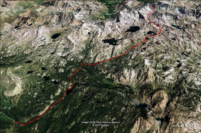 The big unknown variable was the record snowfall that had saturated the Absarokas the past spring, and the condition of the couloir because of this. We nevertheless decided it would suit our plans nicely, and soon all that remained was to pack, finalize the route, and impatiently count down the days... At last, Friday of Labor Day weekend had arrived! I left my last class of the day and met Terry, and we began the long drive up through Wyoming shortly thereafter. The miles melted away as we made our way north across the plains, reaching Casper in only 3 hours or so. We stopped for a late lunch there, then left the interstate to cross the vast expanse of desolate grassland east of the Wind Rivers. After a while (and a nap), we realized we could see the range itself in the distance, stretching dozens of miles and rising abruptly out of the featureless plains. We reached Shoshoni and headed north, soon passing through a surprisingly cool canyon and emerging in Thermopolis, a town which strangely reminded me of Arizona. Then onward to Cody, WY, our last real town before Montana. I'd passed through Cody on my vacation as a kid, and was anxious to see it again, but it was unfortunately dark by the time we reached it. One last stop for dinner, and a brief wrong turn, and we were on the winding Chief Joseph Highway, making our way to Cooke City, MT. We didn't roll into town until sometime around 11 PM, and except for a few drunken revelers staggering out of the town's saloons, we found the town dark and seemingly uninhabited. We backtracked a short bit to the Lulu Pass road, and with the help of some pre-recorded waypoints, navigated the confusing roads to the final spur road leading to the trailhead. Up to this point, the road was occasionally rugged, but passenger-car-driveable. We parked here, and both decided we were too exhausted to bother setting up a tent. We dragged our sleeping bags into the front seats instead and promptly fell asleep... Saturday morning dawned bitterly cold and stunningly beautiful. Waking sometime around dawn, I got out to stretch my legs, and was awed by the sharp pinnacles of Pilot Peak and its nearby mountains across the valley rising above the fog, bathed in early morning sunlight. The woods and meadows seemed quiet and peaceful. 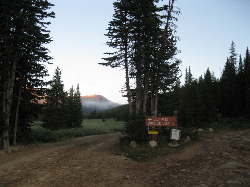 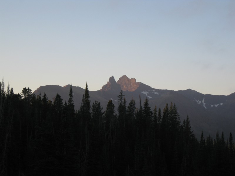 Terry and I made our final preparations, and soon we were walking the 4WD road to the trailhead. It's worth noting that the final bit of road to the true trailhead has been torn up and is now impassable to vehicles, and the road walk itself takes all of five minutes; you won't gain much by bringing a 4WD vehicle here. We found the obvious trail and were quickly on our way. After a short, steep climb, the trail flattened out and traversed a shelf below some small, exposed rocky cliffs. Sunlight penetrated the deep forest in places, and the occasional gap in the trees hinted at the views that would await us later on. In less than an hour, we'd reached Lady of the Lake. Nothing I'd read had hinted at how beautiful she really was... 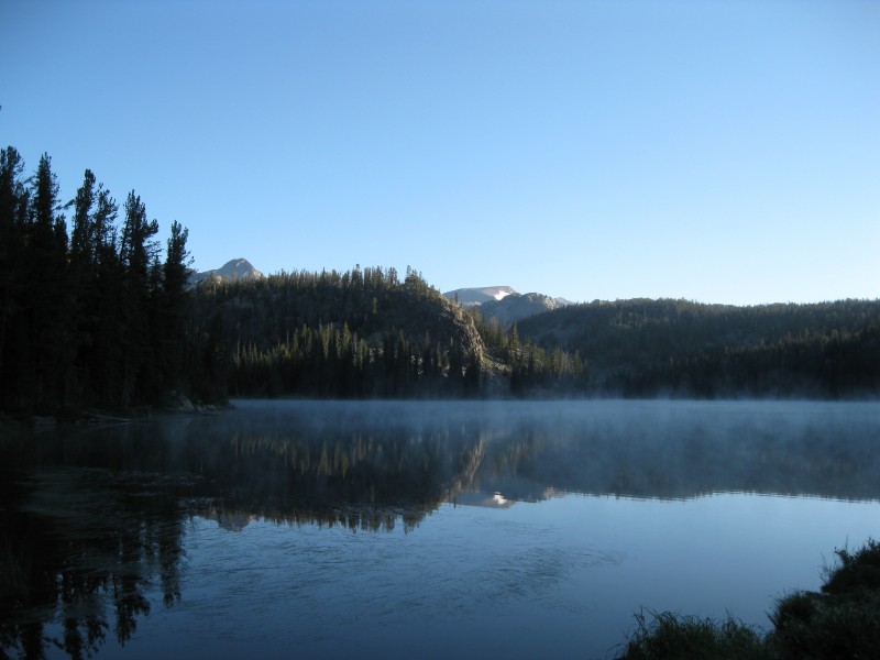 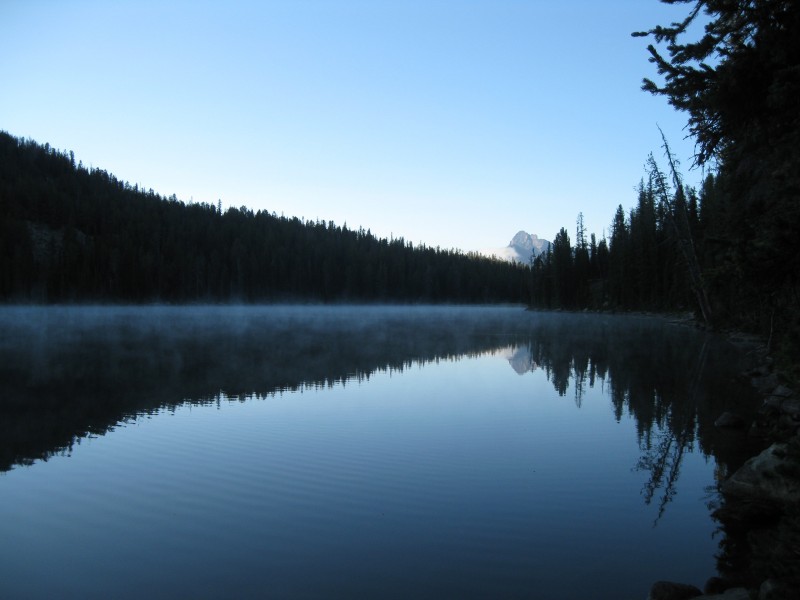 We broke to eat and de-layer, soon continuing onward up the trail. There's a junction a few minutes after leaving the lake, marked by a large cairn--you'll want to turn right. Shortly thereafter, the trail skirted the right side of a large meadow, and a few distant and rugged peaks to the north came briefly into view. 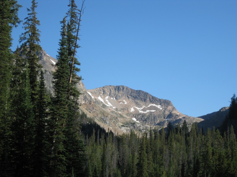 At the far end, we had to cross a small stream; after quickly consulting the map, I realized this was not Broadwater Creek, and that we needed to continue farther. We found the continuation of the trail, ascended up to a small, wooded pass, and made the gradual descent to Broadwater Creek. Turning right and going 100' or so, we found a log that made for easy crossing. At this point, one attempting Granite has two options: continue north along the trail to "Heartbreak Hill", make the tedious boulder-hop along the shores of the Aero Lakes, and drop back into Sky Top Basin. Or, follow the Sky Top drainage the whole way up. Hearing the Sky Top route was easier, we'd previously decided on the latter. While the trail junctions are not marked, we nevertheless found the trail--or rather, several trails--cutting east across this wooded area over to Sky Top Creek. We were unsure whether there'd be a trail, or what condition it might be in, but we were heartened to find a pretty obvious one heading up the drainage, at least initially. 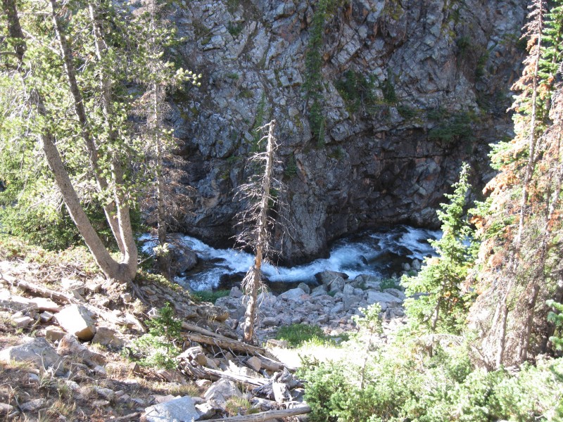 We gained a few hundred feet before suddenly cresting a small hill and emerging into a wide, grassy basin where several streams mingled together. We noticed a tent, but didn't see anybody around. The area was evocative of the backcountry of Sequoia National Park--simply amazing! A fast-flowing, swollen creek crashed its way down a rocky valley on its way from Lower Aero Lake. Unfortunately, there was no easy way to cross it. I found a few exceedingly slippery logs, and at last bit the bullet and crossed them, though losing plenty of style points in the process! Terry had gone upstream to find potentially easier crossings, but after twenty minutes, we concluded that there simply were none. This would be the first of many obstacles Montana's record snowpack would throw at us this trip... Terry at last made the crossing where I had, and we soon picked up the trail again by sticking to the left side of the valley, though it was now fainter and more rugged. Perhaps half a mile past the meadow, the valley opened up into another longer and prettier meadow, filled with verdant grass and crossed by meandering streams. In the distance, I could see a waterfall. 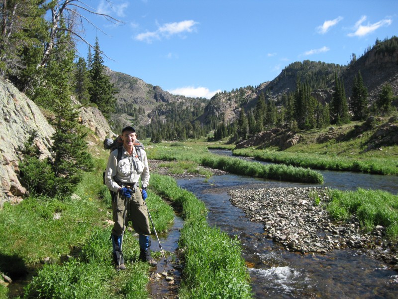 The trail here was easy going, gaining no elevation, and oftentimes dropping down onto gravel beds or small grassy patches of high ground. At the end of this meadow, we soon approached what'd be a fairly substantial climb--600' or so--up to Lone Elk Lake. The first bit was indeed steep, and I let Terry go ahead a bit. By the time I'd caught up to him, I realized he was chatting with what seemed to be a father and daughter with their German shorthair pointer, the first people we'd seen since Cooke City! They told us they'd been backpacking for a week and were on their way out, but they didn't have much information about our route. We said goodbye and continued onward. After this first steep bit, the trail became more mellow, though ever fainter. More than once, we had to stop and look for cairns in the distance, or slightly more obvious trail segments. Noon found us just 15 minutes or so below the top of the hill, and we decided to enjoy lunch here, in the increasingly open country just below treeline. 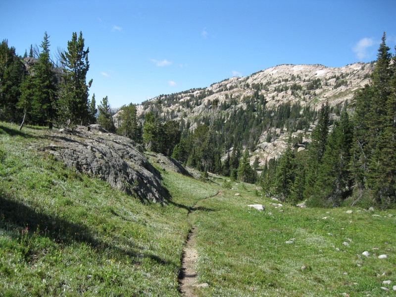 We took our time, as the weather was still spectacular, and we knew we had all day to reach camp. We made short work of the last bit of uphill, where the trail corralled us into a small pass; as we neared the top, we could at last look back and see some distant mountains far to the southwest.  We popped over it into the basin, and the views took a sudden turn for the jaw-dropping! 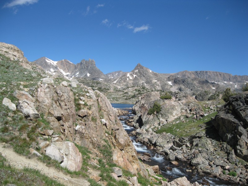 Before us stretched a majestic land of pristine alpine lakes, dramatic granite spires, and rugged rocky hills. We couldn't see Granite Peak itself yet, but there was still plenty to catch our attention... 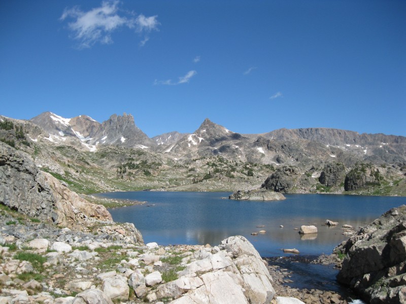 The bad news: any semblance of a defined trail had disappeared. Armed with Splattski's route info and the occasional cairn, Terry and I began traversing this occasionally difficult, but spectacular terrain. Contouring left of Lone Elk Lake, we soon encountered a large residual snowfield that dropped straight into the lake. We had to ascend and clamber away from the lake a bit to find a place where it dropped down with less hazard. We crossed and found the route free of obstacles for a while longer. I noticed a small island in the middle of the lake, and thought it might be fun to swim out to it on the return; as it turned out, I didn't get the chance. Perhaps it's for the best--it was surprisingly chill here, even in mid-day with the sun blazing overhead. 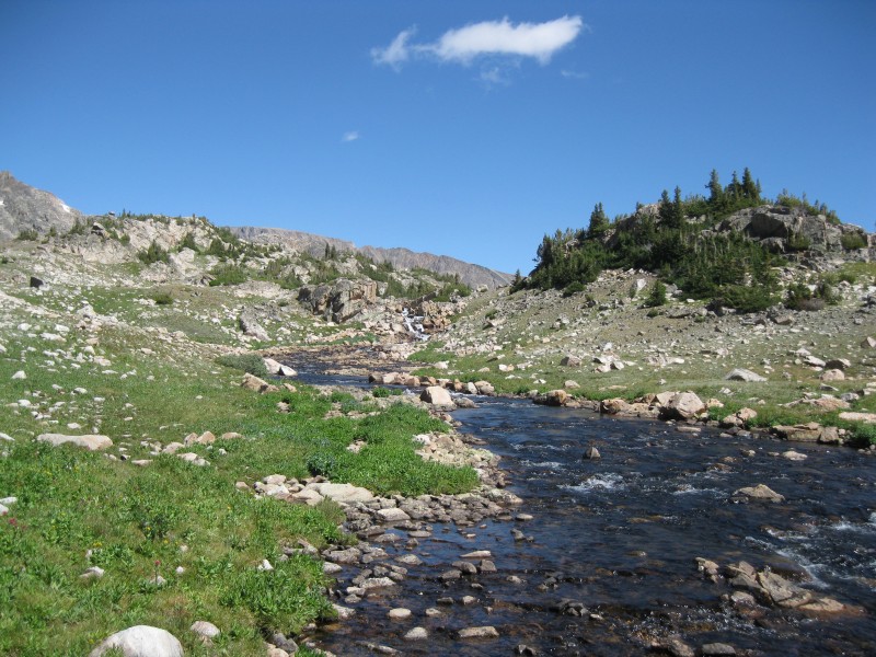 Next up were two unnamed lakes between Lone Elk and Rough Lakes. The first was trickier, and made for some confusion on our return. I discovered the easiest route entailed scrambling up the rocks left of its outlet stream and rock-hopping to the other side just above a moderately-sized waterfall, then staying to the right of the next several lakes. As we covered easy terrain along the SE shores of Rough Lake (following your map here is important so you don't end up finding yourself on some peninsula!), we spotted a few younger guys in flannel shirts who appeared to be up there fishing. We stopped to say hello, and discovered they were actually rangers! They also didn't have any solid information on the SW Couloir route, but gave us some helpful information on how to get into the upper Sky Top basin via the shortcut we had planned. We thanked them, and continued on. At the inlet stream to Rough Lake, we found the best place to cross--a series of rocks in the water in a marshy area just above the lake. We miraculously managed to cross without getting our feet wet. Onward we went, now leaving the main drainage and cutting NNE up a gradual valley (toward the "S" of Sky Top Lakes on the topo). 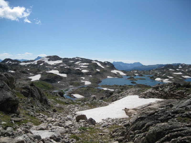 After perhaps 20 minutes of work, we crested at a small, rocky passageway, and gazed upon Granite Peak for the first time. Well, part of it at least...I realized that this spot would be tricky to find on the return, and marked a waypoint for it; I'd recommend you do the same. The first lake we encountered was the middle of the three largest in the upper Sky Top basin, and we immediately encountered another obstacle: a steep, unavoidable snowfield blocking our path and dropping straight down into the lake. For those of you who've hiked with me, it's no secret that I'm not exactly the world's biggest fan of steep snow. However, having brought my ice axe and microspikes, I figured it would be manageable. After donning both, I crossed--slowly, painstakingly--and was shocked to see Terry nonchalantly making his way across with trekking poles! Ah, well...most people seem to be more comfortable on the steep stuff than I. From here, the route continued along the left side of the lakes, occasionally requiring some route-finding, backtracking, and second-guessing. 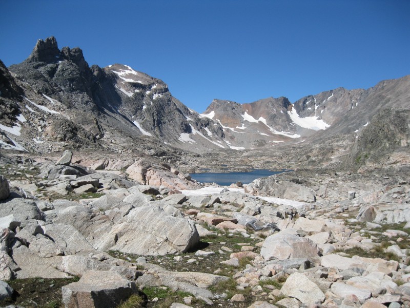 Shortly after the snowfield, one spot demanded coming down to the shoreline and traversing some interesting class 3 rock slabs. As we approached the last major lake, our route took us some 50' above the shoreline, providing a stunning vista of the lake and Granite Peak beyond... 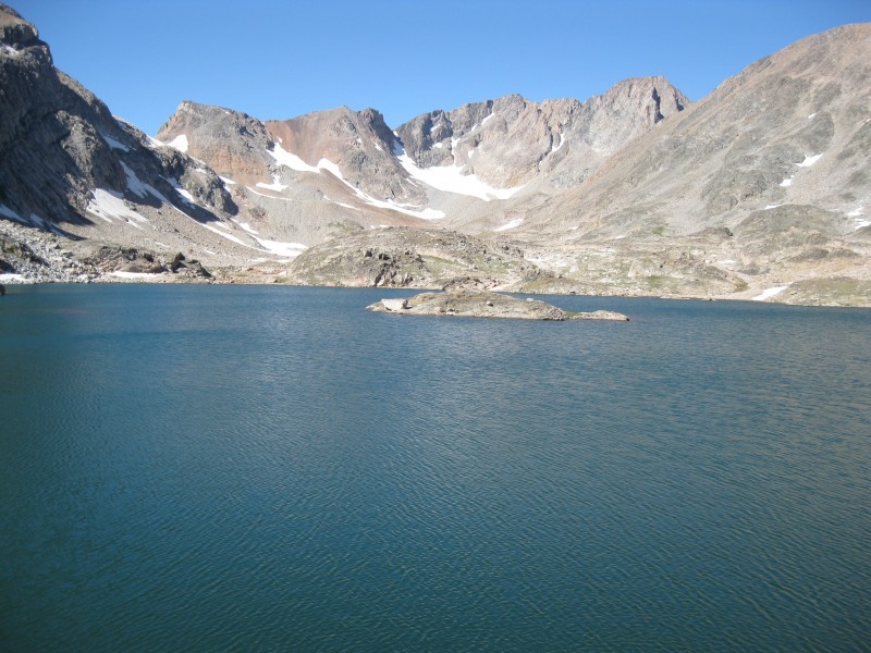 Here were a few more snowfields, a bit less steep but still requiring care. I crossed this time with just my axe, at last dropping down to dry ground along the lakeshore. As we made our way around the west shore of the lake, I noticed a massive and mostly-snow-covered slope leading down from the saddle above Upper Aero Lake. Though I later met someone who'd taken that route and claimed the snow was avoidable, it nevertheless affirmed my satisfaction in our choice of route! Just past this final lake, Terry and I crossed the main drainage once more, this time on a sort of causeway of rocks, crusted with some sort of strange residue and replete with gnats. For a few minutes, I felt less like I was in the high country of Montana, and more like I was walking along the coast in Connecticut! 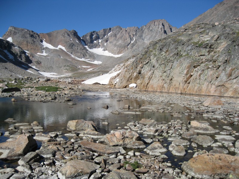 Beyond this causeway, Terry and I stayed high for a while on some rocky and grassy hills, and soon encountered another guy. He had come over the pass just south of Granite, and two of his friends had attempted the SW couloir but turned around (...great). We asked about camping higher in the valley, and he suggested that there really weren't any worthwhile options higher up. We thanked him and continued on a short distance to a flattish, relatively rock-free grassy area where I thought we might want to camp. We dropped our gear, and I decided to explore a bit farther up the valley to see if there was any kind of good camping around the second-to-last small lake. I turned around after ten minutes, having not even reached the lake, and still not seeing anything promising. Upon my return, Terry announced he had found a flat area of dried mud nearby that would make for a good campsite. I investigated, and found the spot, about 15' square, surrounded by small hills of rocky tundra, yet looking like a small patch of Death Valley. Surreal! I was skeptical we'd be able to fit my tent in between the rocks there, but upon testing it out, it barely fit. We moved camp and set up the tent.  Terry had mentioned seeing a few people coming down the valley, and I decided to explore a bit perhaps 10 minutes later just for the heck of it. As it turned out, I caught them just as they were quietly walking out of sight past our campsite! They ended up being a couple from New Jersey who were closing in on the state highpoints--having only two and three to go--and had successfully climbed Granite that day by our route! They reported the route mostly dry, with a few areas of snow and rime ice that were avoidable with a bit of work, and mentioned that Terry and I should follow some snowfields up the rest of the valley for easy travel. Excited by the news, I thanked them profusely and wished them a good hike out.  A bit later, I enjoyed an MRE for dinner; Terry simply had power bars. Even before the sun set, it was chilly, and I'd thrown on several layers; I was glad to have them on as darkness fell. Terry and I prepared our packs for the next morning, decided what time we'd wake up, and crawled into our sleeping bags. After a bit of studying for one of my classes, I at last succumbed to exhaustion and was soon out like a light. 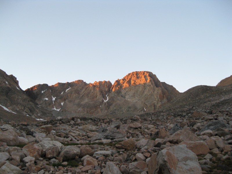 Click here for part 2... Thumbnails for uploaded photos (click to open slideshow):
|
| Comments or Questions | |||
|---|---|---|---|
|
Caution: The information contained in this report may not be accurate and should not be the only resource used in preparation for your climb. Failure to have the necessary experience, physical conditioning, supplies or equipment can result in injury or death. 14ers.com and the author(s) of this report provide no warranties, either express or implied, that the information provided is accurate or reliable. By using the information provided, you agree to indemnify and hold harmless 14ers.com and the report author(s) with respect to any claims and demands against them, including any attorney fees and expenses. Please read the 14ers.com Safety and Disclaimer pages for more information.
Please respect private property: 14ers.com supports the rights of private landowners to determine how and by whom their land will be used. In Colorado, it is your responsibility to determine if land is private and to obtain the appropriate permission before entering the property.