Download Agreement, Release, and Acknowledgement of Risk:
You (the person requesting this file download) fully understand mountain climbing ("Activity") involves risks and dangers of serious bodily injury, including permanent disability, paralysis, and death ("Risks") and you fully accept and assume all such risks and all responsibility for losses, costs, and damages you incur as a result of your participation in this Activity.
You acknowledge that information in the file you have chosen to download may not be accurate and may contain errors. You agree to assume all risks when using this information and agree to release and discharge 14ers.com, 14ers Inc. and the author(s) of such information (collectively, the "Released Parties").
You hereby discharge the Released Parties from all damages, actions, claims and liabilities of any nature, specifically including, but not limited to, damages, actions, claims and liabilities arising from or related to the negligence of the Released Parties. You further agree to indemnify, hold harmless and defend 14ers.com, 14ers Inc. and each of the other Released Parties from and against any loss, damage, liability and expense, including costs and attorney fees, incurred by 14ers.com, 14ers Inc. or any of the other Released Parties as a result of you using information provided on the 14ers.com or 14ers Inc. websites.
You have read this agreement, fully understand its terms and intend it to be a complete and unconditional release of all liability to the greatest extent allowed by law and agree that if any portion of this agreement is held to be invalid the balance, notwithstanding, shall continue in full force and effect.
By clicking "OK" you agree to these terms. If you DO NOT agree, click "Cancel"...
Mount Blaurock ranked Bi-Centennial #186
Ervin Peak ranked Tri-Centennial #233
5.3 miles roundtrip
3900 feet +/-
Forest Service Road 390 from Highway 24 north of Buena Vista to Winfield then Forest Service Road 390A past the log houses to the right and past the Winfield Cemetery to the south-southwest ridge for Ervin Peak
These rarely climbed peaks lie north of Huron, northwest of Belford and Oxford and east of LaPlata, popular 14ers. Mount Hope (Centennial) and Quail lie northeast with Rinker north and Mount Elbert even farther north
The mileage may be short but there is plenty of variety to the hike/climb as you make your way up and down starting with some easy bushwacking to faint game trails to the Ervin Ridge that has some scrambling and Class 3 on the ridge proper
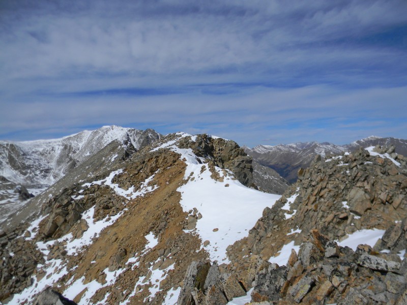
The traverse to Mount Blaurock is an easier walk up to begin with and then some more ridge scrambling along an undulating ridge that will have you taking about 6 "oh there is the summit" pictures before gaining the actual high point
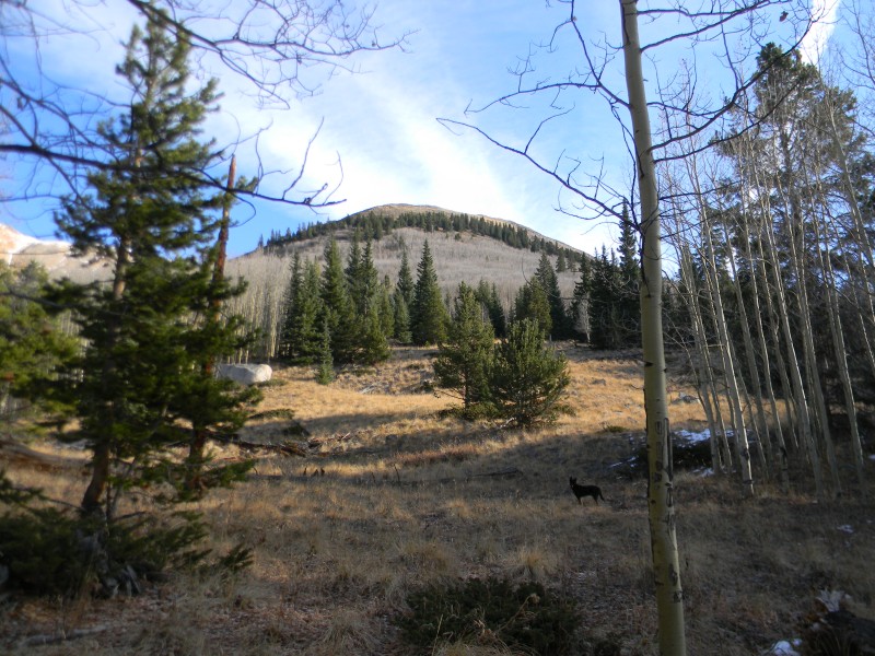
I parked and started through the trees and up through the small aspens to this grassy opening that lets you peek ahead
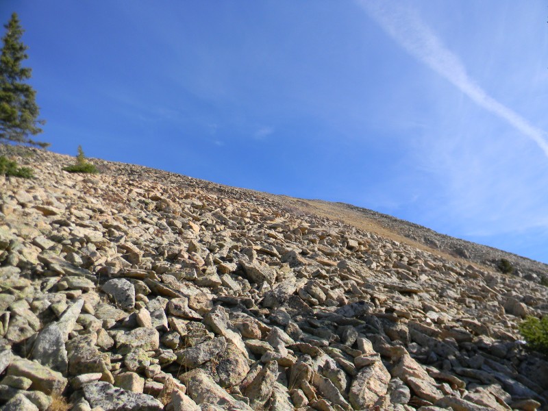
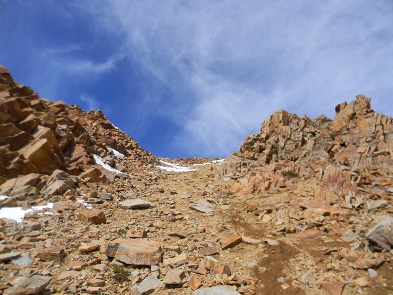
Talus and steeper slopes, you will be gaining from 10,400 feet at the road to 13,400 feet in approximately 1.7 miles
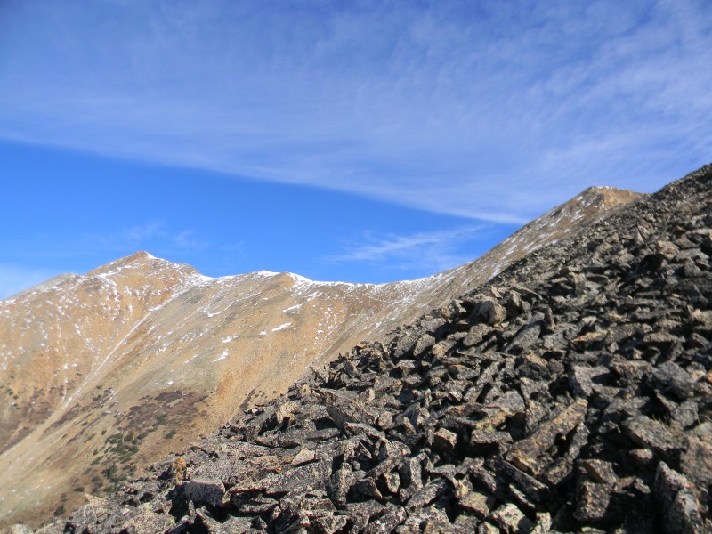
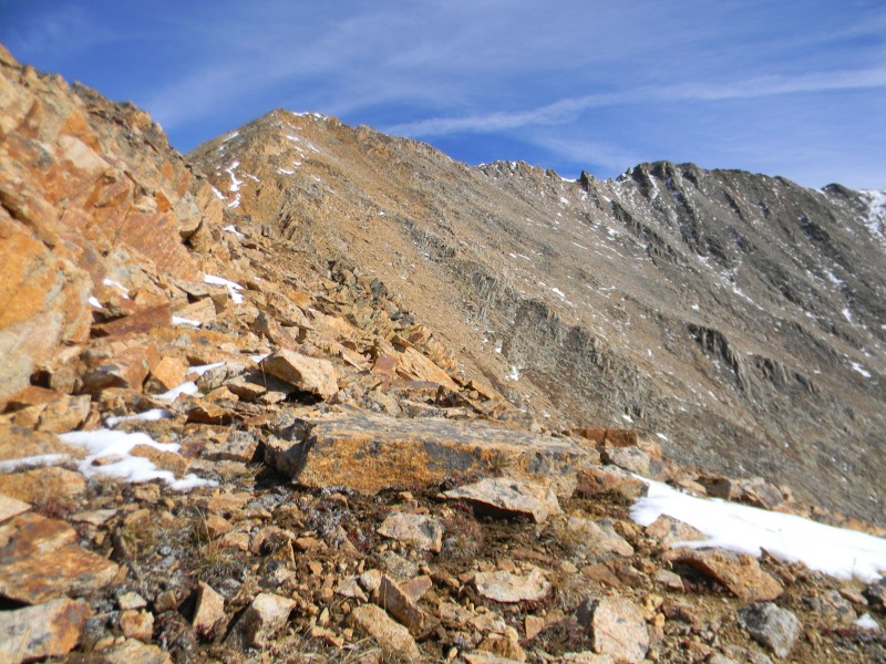
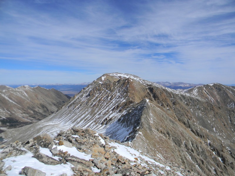
The point above the Ervin-Blaurock saddle you are heading for, the saddle and Mount Blaurock to the left
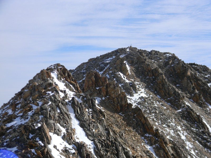
You will follow the ridge and skirt to the right as you look at the next section with Ervin Peak to the right
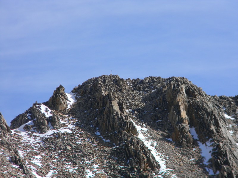
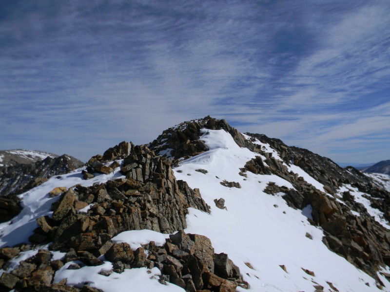
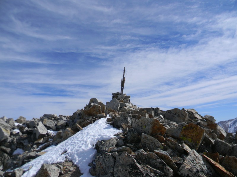
A closeup of the summit
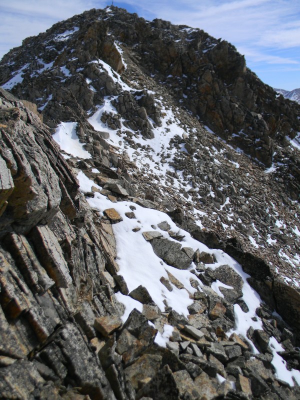
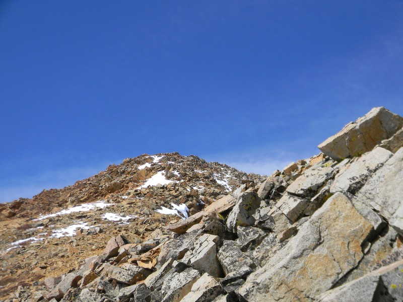
The jumbled rock looks rough but it is easily maneuvered as you head for the point above the saddle
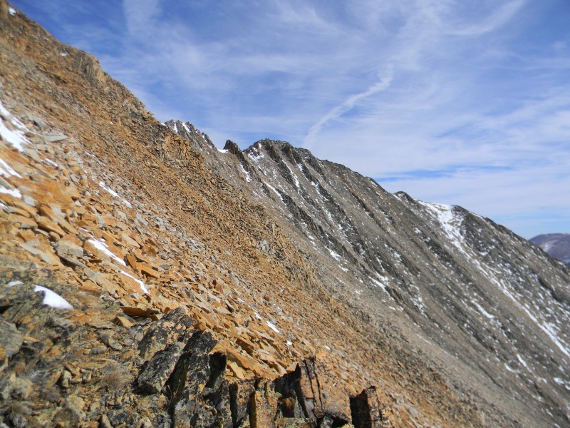
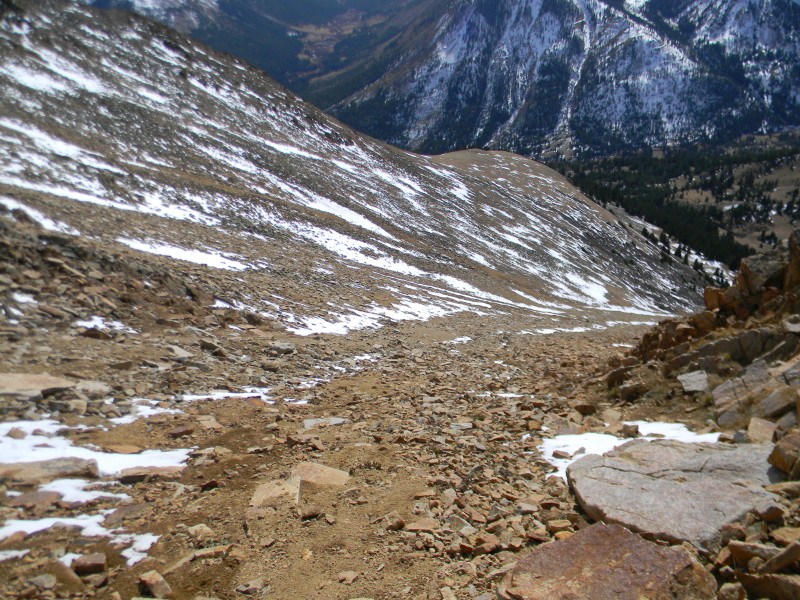
The south-southwest ridge looking back down
The start of the ridge as it heads east
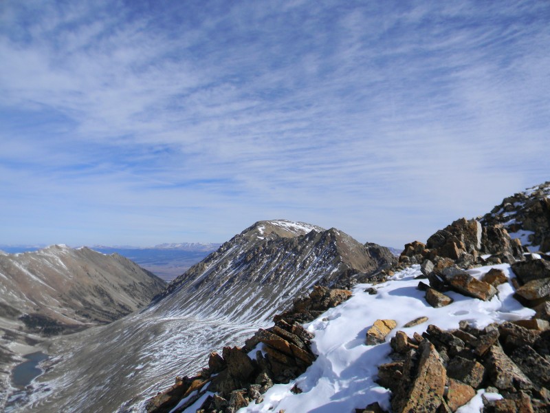
Mount Hope, I believe, further away
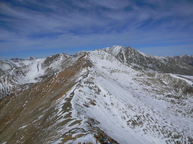
Mount Blaurock back to the west with LaPlata Peak beyond
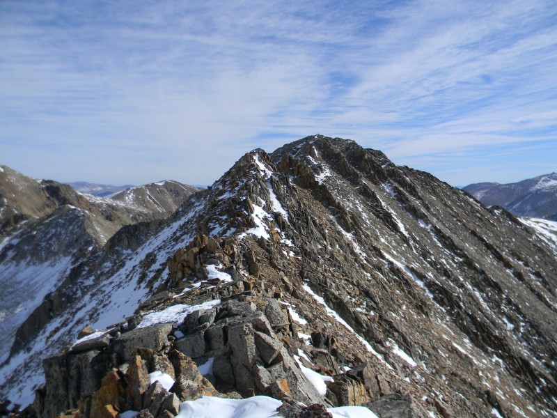
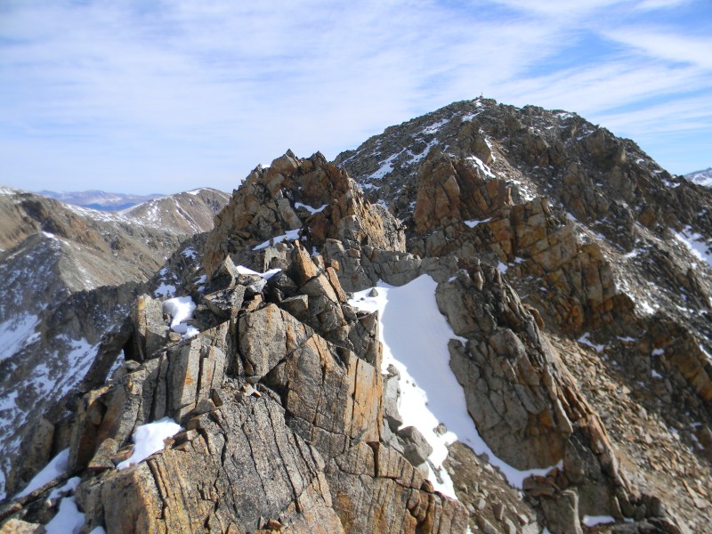
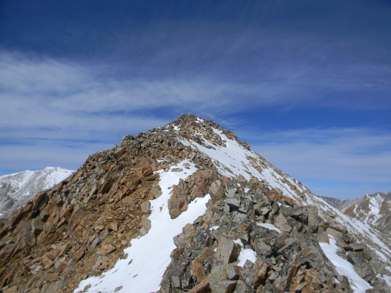
The ridge traverse is only about 0.25 miles but it is interesting should you stay on the ridge itself
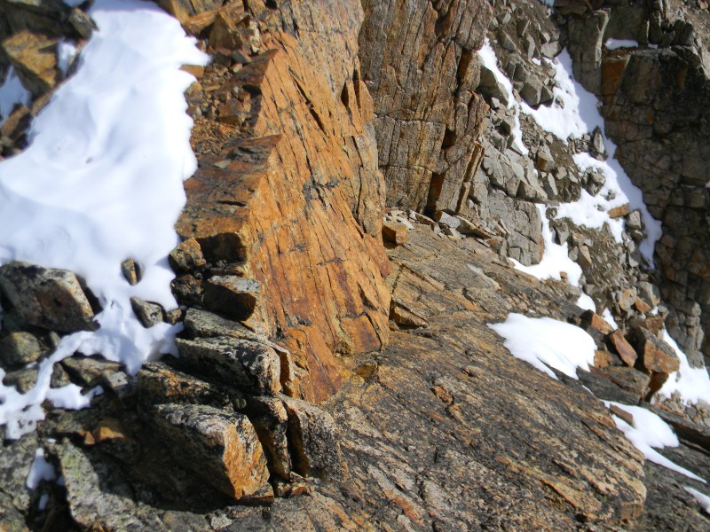
A closer look
A spot along the way
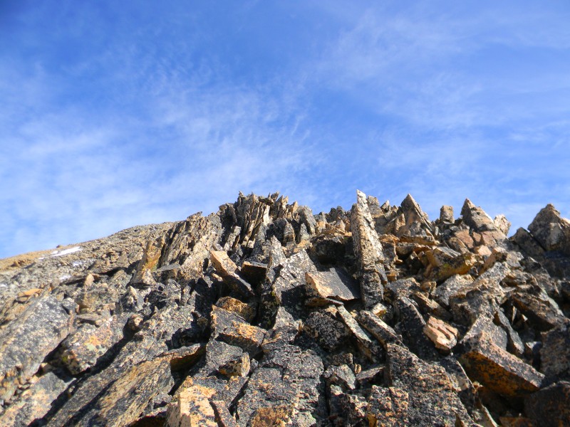
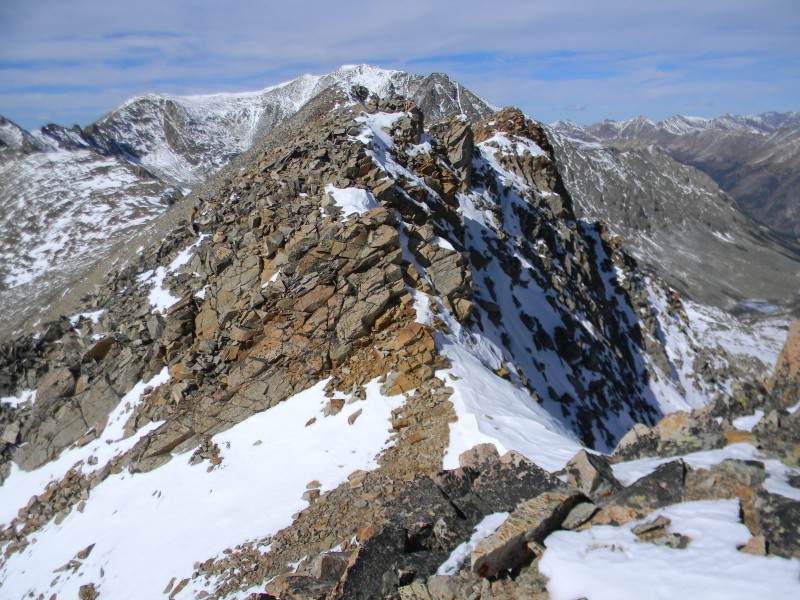
The ridge will be narrow in other spots and the rock will slope off one side or the other. The second "tower" and tallest one before the summit looks challenging...
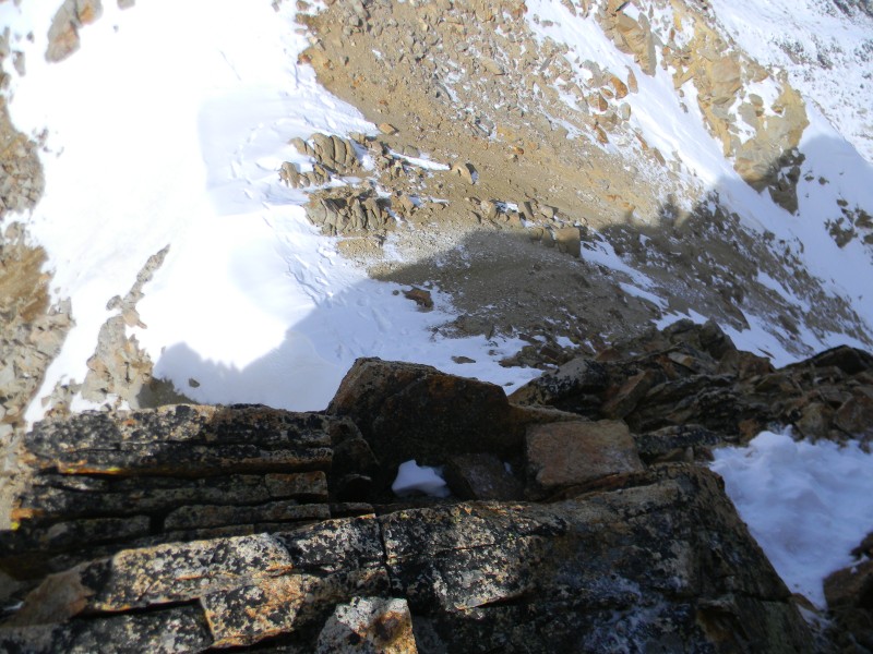
...this is looking down and back after ascending the tower
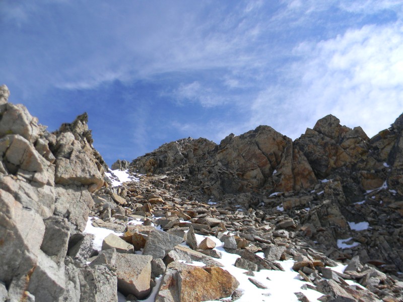
This looks ahead from the tower to the gully you may want to use, drop down 30-40 feet...
...and then up
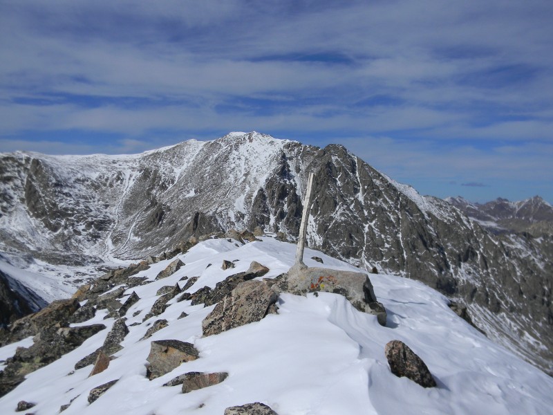
The summit with the cleanest, driest and most pristine register I can remember seeing. I was the 7th person to sign the register in 2011 and only the 21st in the 2 1/2 years since the register was placed
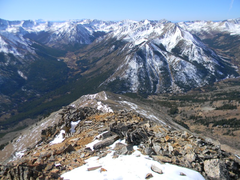
This looks back from the summit to the west
Mount Hope and Quail
This parting look is from the point above the Ervin-Blaurock saddle. I dropped down from the Ervin summit and then traversed across the side slope to see how this may have worked should you want to bypass the ridge. You could head directly towards the gully and before the first rib below the summit and past the "tower". It was loose rock and did not save any time. It is Class 2 however
The rock can be broken and loose. I was making my way back from the summit after dropping back down the little gully. I started back up the "tower" and as I was on a narrow ledge I grabbed for a hand hold and it broke off falling about 20-25 down below me. I was able to push off and forward as the 4'x4'x1' thick chunk of rock skimmed my back on its way down. Lucky I did not go with it.
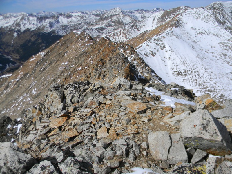
You will drop off the point and down to the saddle, the ridge to Mount Blaurock...
...continuing along the ridge
The summit "stick" while looking at LaPlata beyond. The 9th to register in 2011
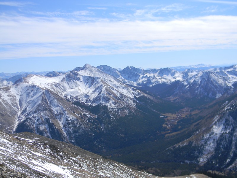
South
I backtracked toward Ervin a short distance and then dropped down this nice soft dirt filled gully...
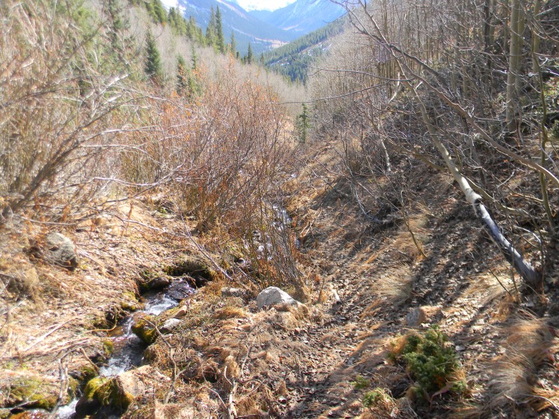
...then traversed across to this small ridge between Black Bear Creek and Grey Copper Creek making my way back...
... dropped off the small ridge to Grey Copper Creek, followed along a small game trail...
...crossed the creek on another game trail to the left, crossed a road I had crossed over on the wya up and then through the trees for a short way back to my vehicle
My GPS Tracks on Google Maps (made from a .GPX file upload):
Looks like you are having fun after completing the Centennials - and enjoying the solitude! Glad you here able to maintain control as the 4x4x1 ”handhold” gave way.
Thanks Piper14er. I just returned from a trip to Colorado and hiked Ervin with a friend of mine on Friday, 7/12. As I look back on your report now, I see that we followed your ascent route almost to a 'T'. We didn't think so at the time. We were expecting to hit the ridge at the Blaurock/Ervin saddle, but were right where you went. A bit of confusion on our part. It was a steep hard climb with no established path to follow. The way back we descended via Grey Copper Creek. I was only the 2nd to register in 2013. No pen/pencil in register tube, so I left my pen. Maybe others summitted but did not register. Great climb, great views. Not one I will do again though. Glad we had you info or we wouldn't have attempted it.
Caution: The information contained in this report may not be accurate and should not be the only resource used in preparation for your climb. Failure to have the necessary experience, physical conditioning, supplies or equipment can result in injury or death. 14ers.com and the author(s) of this report provide no warranties, either express or implied, that the information provided is accurate or reliable. By using the information provided, you agree to indemnify and hold harmless 14ers.com and the report author(s) with respect to any claims and demands against them, including any attorney fees and expenses. Please read the 14ers.com Safety and Disclaimer pages for more information.
Please respect private property: 14ers.com supports the rights of private landowners to determine how and by whom their land will be used. In Colorado, it is your responsibility to determine if land is private and to obtain the appropriate permission before entering the property.
")
")
")
")
")
")
")
")
")
")
")
")
")
")
")
")
")
")
")
")
")
")
")
")
")
")
")
")
")
")