| Report Type | Full |
| Peak(s) |
Mt. Ouray - 13,979 feet |
| Date Posted | 09/30/2011 |
| Date Climbed | 09/12/2011 |
| Author | JimR |
| Mt. Ouray from Marshall Pass |
|---|
|
Mt. Ouray from Marshall Pass Date Climbed: 9/12/11 Beginning Elevation: 10,820' Peak Elevation: 13,971' The Group: Tim, Julia, JimR Distance: 6.35 miles Total Elevation Gain: 3302' My wife and I, along with two friends (Tim and Julia), rented a house in Salida for a week in mid-September. Tim and Julia were visiting from England, and the plan was for Tim, Julia, and me to spend most days hiking"weather permitting. My wife hoped to do some golfing. As it turned out, the weather was less permissive than we had hoped, but we still got in a few good hikes. We decided to start the week with Mt. Ouray from the Marshall Pass Trailhead. We left the house in Salida a little before 7 and arrived at the trailhead at about 7:30 (?). There's a sign for the turnoff for Marshall Pass Road (200) on Rte 285 south of Poncha Springs, and the road is in good shape all the way to the pass. There's parking and restrooms at the trailhead. We got geared up and started hiking a little before 8 AM. We planned to (and did) follow the West Ridge Route in Roach's 13er book. From the trailhead, we walked a couple hundred feet back down the road to an old road (not the first, "4WD" road) and headed left/north on it.  We (almost) immediately came to the cabin on left, which seemed to be occupied, since there was a pair of rain pants drying outside the door. We proceeded on, into the trees and uphill. In principle there's a good view of Mt. Ouray and its western ridge before entering the trees, but in practice it was obscured by low clouds (which would be a recurring theme for the week). The woods are quite sparse, and we picked up intermittent trails at times, but generally we just kept going up and north until we ran out of trees. Things cleared a bit at this time, and we were able to see the Ouray summit, but it didn't last long, and soon we were hiking along the ridge in the fog. Not for the last time that week, Tim remarked that it was like hiking in Scotland.   The route follows the continental divide north along a ridge until it met the west ridge of Ouray. At that point, the route turns east, descends a little, and then climbs steadily to the summit. The intersection of the two ridges marks a local high point (12,685), so we planned to follow the ridge north until we hit the high point and then turn right (east). What in fact happened was that Tim was monitoring our direction with his compass, and at one point he noticed that we were heading east along a ridge. We had made the turn onto Ouray's west ridge without realizing it. We descended a little and then had about a ½ mile flat section before we began the 1300' ascent to the summit, which was obscured by clouds (of course). 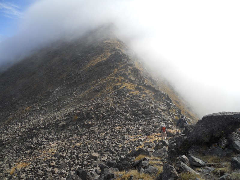 The slope up to the summit is partly grass, partly loose rock, and not too steep. Unable to see the summit, we just trudged up until there was no more up to trudge, arriving at the summit a little after 11.00. 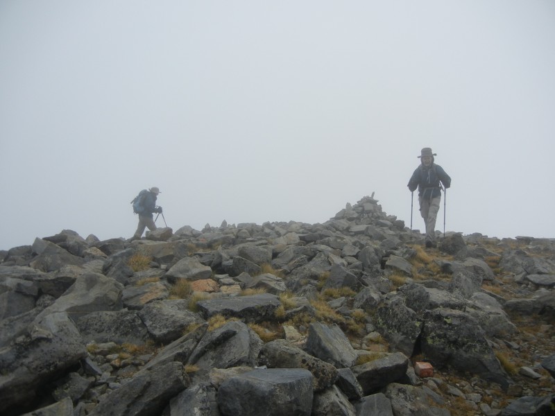 Although the visibility was poor, the weather didn't seem particularly threatening, so we had some lunch in the little rock windbreak before heading back down at about noon. 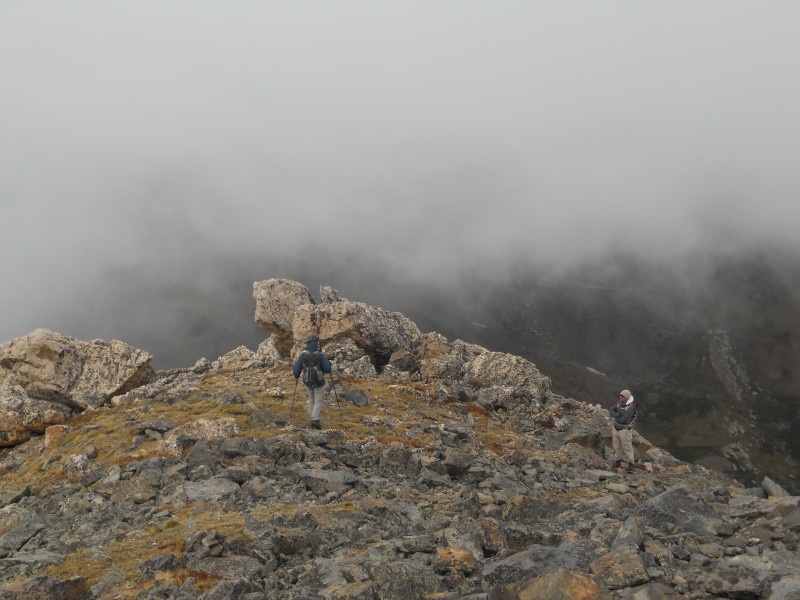 The fog began to lift as we descended, and before long, we could see the entire remaining length of Ouray's west ridge, all the way to the continental divide ridge. 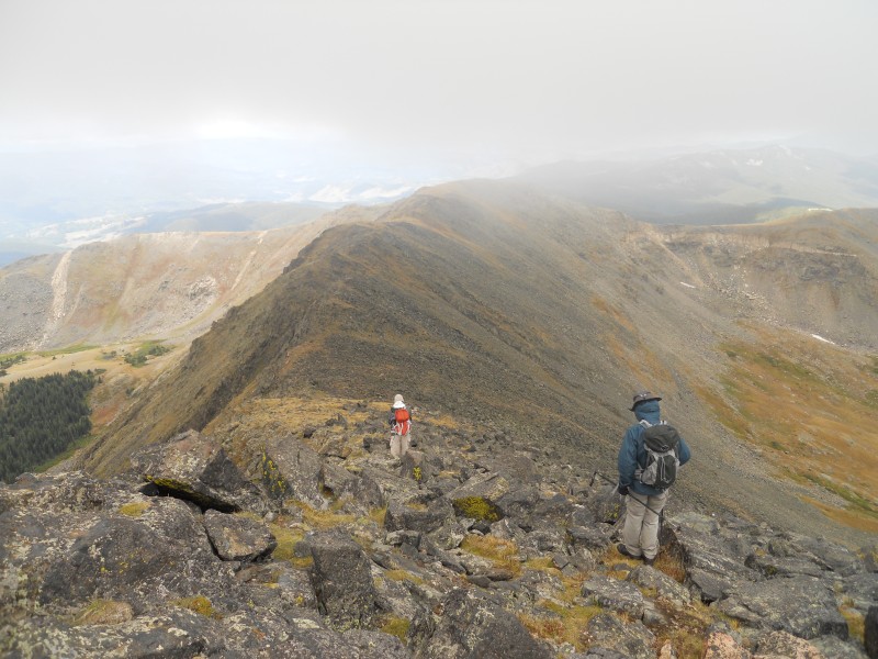 By the time we got to the CD ridge, we could even look back and get a view of Ouray's summit, as well as the entire west ridge. 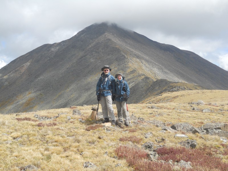 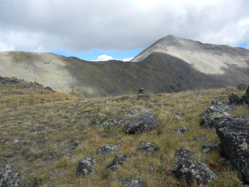 After that, we just followed the ridge south, and near the end of it we headed down for the trees. Tim's compass kept us going in the right direction, and we actually emerged from the trees at the old road/trail that we had ascended. (We also had a little navigational help at the end from the noise made by some people building something near the old cabin. No idea what it was, and we didn't ask.) We got back the car at about 2:30. All in all, it was a pleasant, low-key hike and a good way to start the week. It was also Tim & Julia's third centennial peak for the trip: they had done Mt. Evans shortly after arriving in Colorado, and they did Grizzly while in Aspen. (Fletcher the following Sunday would make it four.) 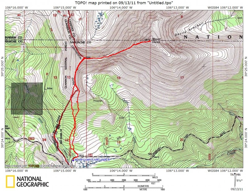 Thumbnails for uploaded photos (click to open slideshow):
|
| Comments or Questions |
|---|
|
|
Caution: The information contained in this report may not be accurate and should not be the only resource used in preparation for your climb. Failure to have the necessary experience, physical conditioning, supplies or equipment can result in injury or death. 14ers.com and the author(s) of this report provide no warranties, either express or implied, that the information provided is accurate or reliable. By using the information provided, you agree to indemnify and hold harmless 14ers.com and the report author(s) with respect to any claims and demands against them, including any attorney fees and expenses. Please read the 14ers.com Safety and Disclaimer pages for more information.
Please respect private property: 14ers.com supports the rights of private landowners to determine how and by whom their land will be used. In Colorado, it is your responsibility to determine if land is private and to obtain the appropriate permission before entering the property.

