Download Agreement, Release, and Acknowledgement of Risk:
You (the person requesting this file download) fully understand mountain climbing ("Activity") involves risks and dangers of serious bodily injury, including permanent disability, paralysis, and death ("Risks") and you fully accept and assume all such risks and all responsibility for losses, costs, and damages you incur as a result of your participation in this Activity.
You acknowledge that information in the file you have chosen to download may not be accurate and may contain errors. You agree to assume all risks when using this information and agree to release and discharge 14ers.com, 14ers Inc. and the author(s) of such information (collectively, the "Released Parties").
You hereby discharge the Released Parties from all damages, actions, claims and liabilities of any nature, specifically including, but not limited to, damages, actions, claims and liabilities arising from or related to the negligence of the Released Parties. You further agree to indemnify, hold harmless and defend 14ers.com, 14ers Inc. and each of the other Released Parties from and against any loss, damage, liability and expense, including costs and attorney fees, incurred by 14ers.com, 14ers Inc. or any of the other Released Parties as a result of you using information provided on the 14ers.com or 14ers Inc. websites.
You have read this agreement, fully understand its terms and intend it to be a complete and unconditional release of all liability to the greatest extent allowed by law and agree that if any portion of this agreement is held to be invalid the balance, notwithstanding, shall continue in full force and effect.
By clicking "OK" you agree to these terms. If you DO NOT agree, click "Cancel"...
I'm still getting to know the North Cascades. I'm finding that there's much more to this range than what I previously thought. For one, it's so much more remote, rugged and steep than I had ever imagined. Needless to say, it will surely keep me and Jen busy for a long time.
After climbing Trappers Peak on 9/2/11 and Tiffany Mountain on 9/3/11, we did the following hikes over the next two days.
Even though we've done a lot of hiking and climbing in the Cascades over the last year or so, including Mt. Rainier, Mt. Saint Helens and Mt. Baker, I feel these five hikes we did over Labor Day weekend gave us a great taste of what the North Cascades has to offer. And now I'm even hungrier for more.
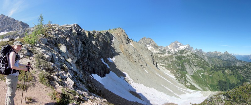
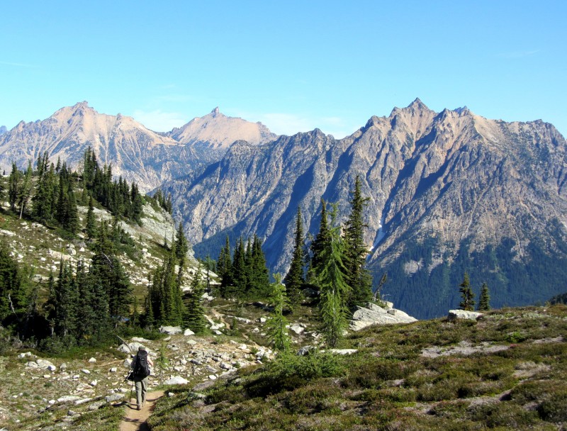
Tatie Peak, 7,386' (9/4/11) Round-trip distance and total elevation gain: 5 miles and 1,000' of gain
Some mountains have a great effort/reward ratio. That is, with just a little effort you reap big rewards. This mountain goes one step further: The rewards begin within just a few yards of the trailhead.
But before I get ahead of myself, let me share a couple images from the narrow road to the trailhead, which my guidebook describes as "harrowing." Technically speaking, it was a relatively easy 4WD road, but it was also a true shelf road with many single-vehicle-width sections and some sheer, many-hundred-foot drops. I kinda' felt like I was back in Colorado.
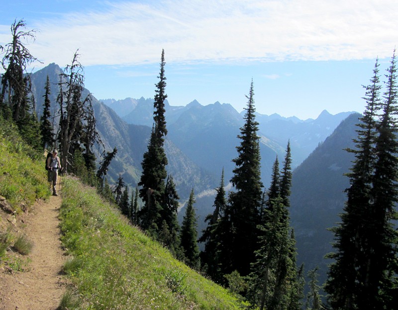
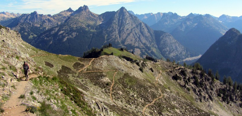
The trail to Tatie Peak, which goes on for many miles to Grasshopper Pass and beyond, was well maintained and easy to follow. And as mentioned before, the views literally started within a few yards of the trailhead, and they continued to improve as we slowly ascended higher.
Some of the surrounding mountains were humbling:
After about two miles of hiking, we left the trail and headed up Tatie Peak's ridge.
Jen on Tatie's ridge:
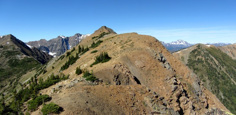
Tatie Peak:
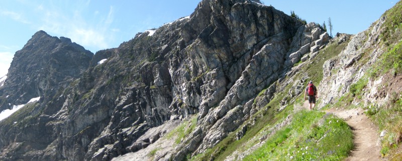
Like so many mountains in the North Cascades, Tatie's north face was nearly vertical in some places. The ridge felt a little airy in a couple spots, but it was easy to hike away from the very edge, and moves never exceeded easy class 2.
Even though we saw a few other hikers on the lower trail, we had Tatie Peak's summit all to ourselves. The 360-degree view was amazing.
Jen chillin' on Tatie's summit:
Me nearing Tatie's summit, with Ninetynine (I think it's called) behind me:
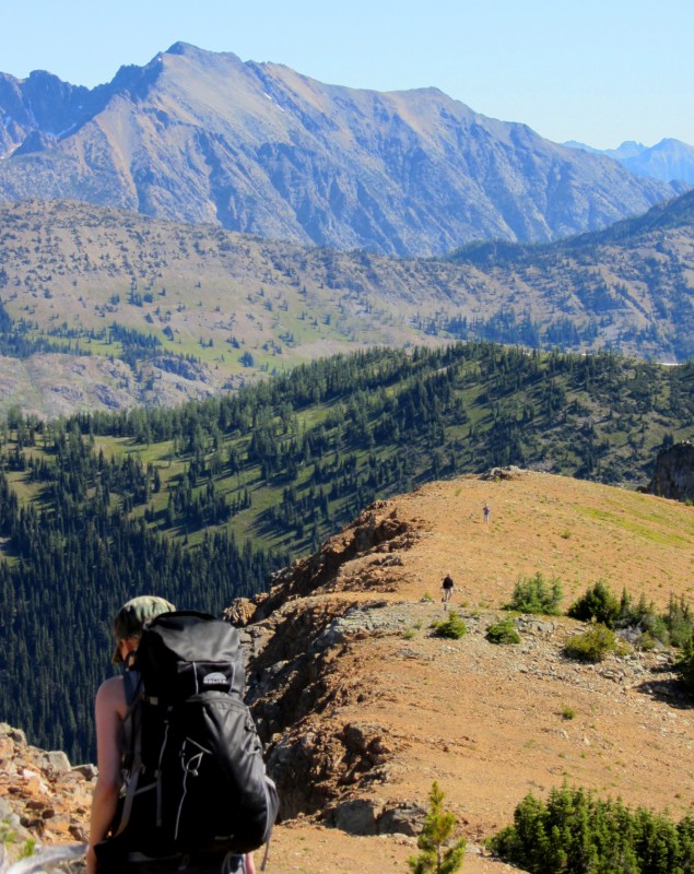
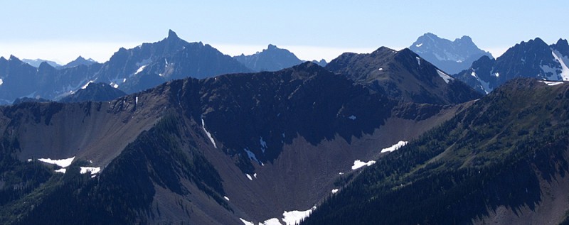
From Tatie Peak, you get a great view of Slate Peak across a deep valley:
With no plans or time commitments holding us back, we decided to head back down and then check out Slate Peak.
Jen hiking down the ridge (a couple hikers can be seen coming up) ... I love the layers of colors and textures in this photo:
Another ridge shot while on our way back:
Slate Peak, 7,440' (9/4/11) Round-trip distance and total elevation gain: Less than a mile and maybe a few hundred feet from the gate at the end of the road
Originally, we weren't going to bother with Slate Peak. But after seeing it from Tatie Peak's summit, it looked more interesting. And, back at the truck, after learning that it's the highest road in Washington, we just had to check it out.
The road got a little bumpy and exposed in some spots, but it posed no major challenges. The only problems I faced were opposing drivers - all of which were too scared to back up to pullouts. So I had to do all the backing up.
From the locked gate at the end of the road (a little over 7,000'), the hike to the top was easy and short (albeit steep), and it was well worth it.
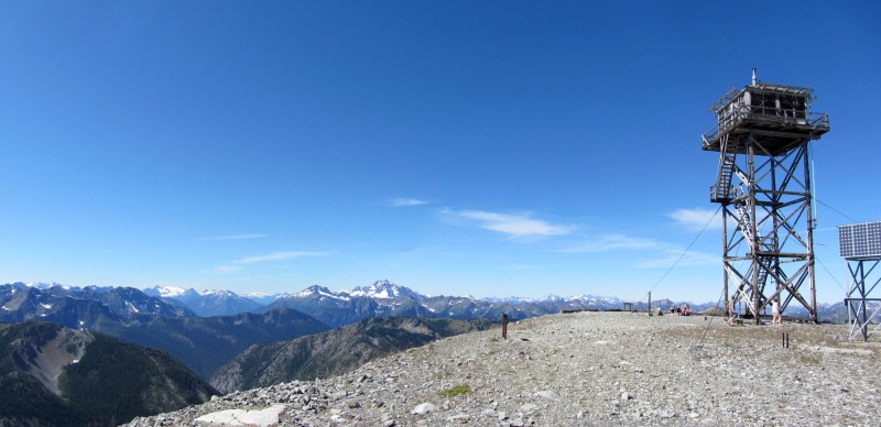
During the Cold War, Slate Peak's summit was blasted off by the military so that they could set up a radar station. Later, a fire lookout tower was erected, which still stands today (Jack Mountain in the distance):
Tatie Peak across the valley, dead center:
View to the north, with the Canadian Cascades just two or three dozen miles away:
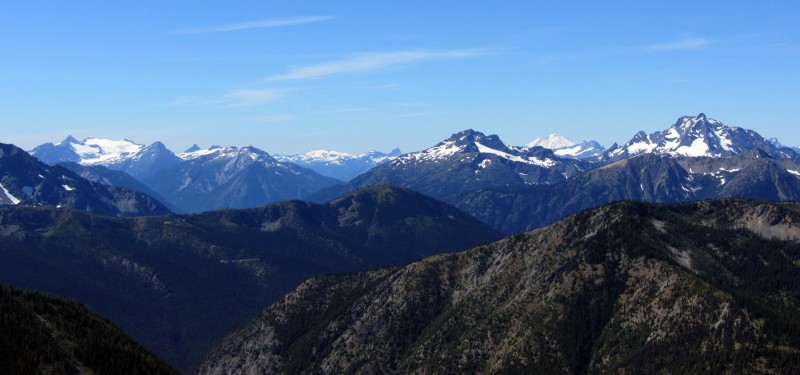
Another view from Slate Peak's summit (Snowfield Mtn., Crater Mtn., Mt. Baker and Jack Mtn.):
Crater, Baker & Jack:
As always, post-hike beers were in order. I liked the idea of going to Three Fingered Jack's in Winthrop, which is the oldest legal saloon in Washington, but the beer selection sucked. Plus we couldn't pass up $2.75 mugs of Boundary Bay IPA at the Duck Hotel.
Apparently, bald faced hornets like Boundary Bay IPA, too:
Don't worry. Jen rescued it with her fork.
Maple Pass Loop, 6,600' at pass, highpoint on loop is 6,850' on Frisco Mountain's ridge (9/5/11) Loop distance and total elevation gain: 7 miles and 2,000 feet, plus some ups and downs
Most people do this 5-star-hike counter-clockwise. We went clockwise to get over with the worst of it early on: The din of road noise behind us and the relentlessly steep trail ahead of us.
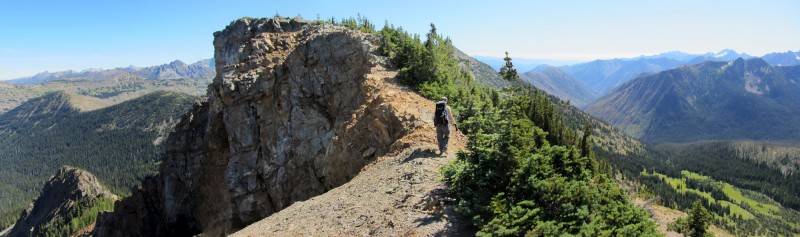
As we neared timberline, the ridge narrowed, and so did the trail. Even though it was a solid, single-track trail, you wouldn't want to trip on a shoelace here:
Zoomed-in shot of a waterfall across the valley (one of many):
The higher we climbed on the ridge, the better the views became.
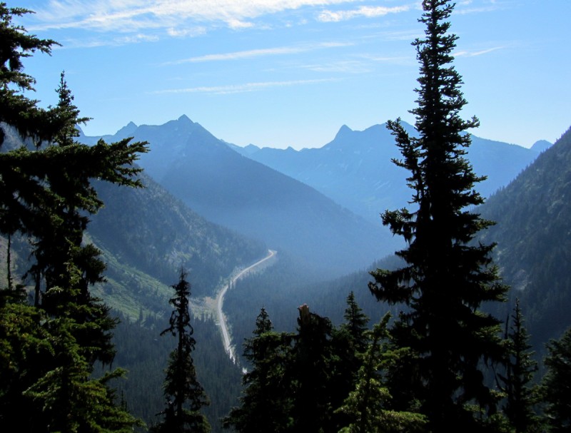
Here are a couple shots looking back toward the valley we came from, with Hwy 20 far below (because of snowfall, Hwy 20 completely shuts down in the winter):
And here's a look at the other side of the ridge we were ascending:
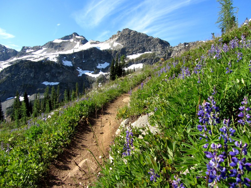
Wildflowers were in full bloom, albeit late because of the heavy snowpack.
Mountains also erupted all around us:
Looking back on the switchbacks below us:
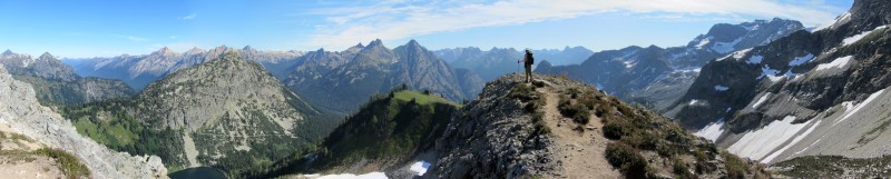
Nearing the highpoint of the loop:
One of my favorite photos from this hike, here's a pan from the Maple Pass loop's highpoint:
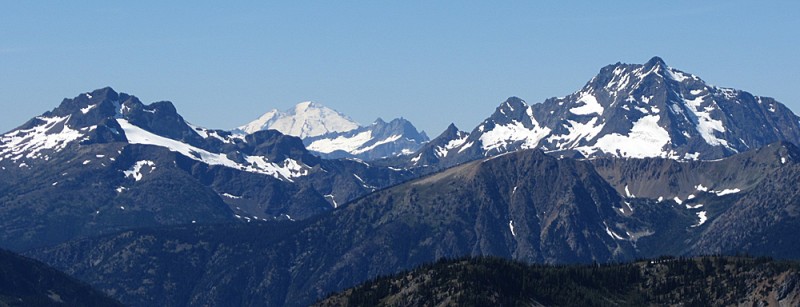
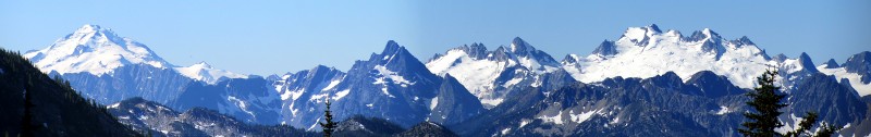
And here's a pan looking in the opposite direction, with Glacier Peak and Dome Peak to the south:
Approaching (descending to) Maple Pass:
Mountains just west of Maple Pass:
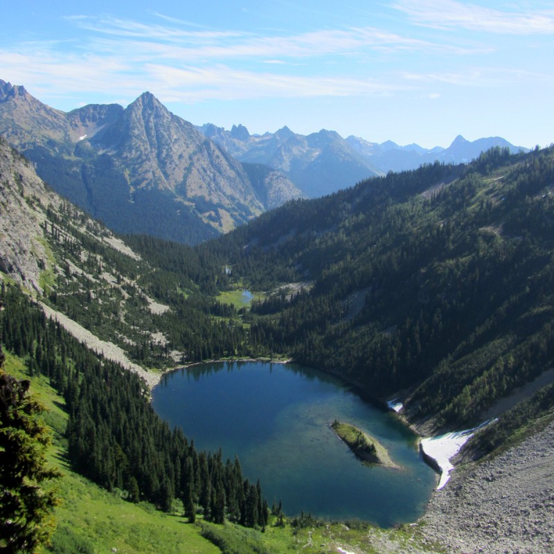
Lake Ann (our descent trail can be seen lower-left):
Spectacular views continued for most of this hike. It was pure eye candy. And because it was a loop, we saw something new every step of the way.
About three and a half hours after starting, our hike concluded back at the parking area at Rainy Pass.
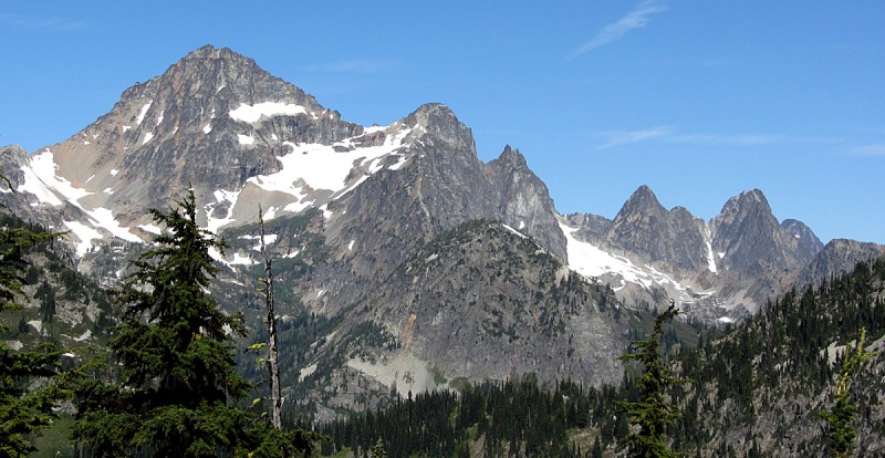
On the drive home we got another great view of Early Winters Spire / Liberty Bell near Washington Pass (my other trip report has a similar image, but the sun wasn't hitting the mountains right):
So many mountains, so little time ...
Thumbnails for uploaded photos (click to open slideshow):
Spectacular mountains and vistas, guys! Guess you don't have to miss CO when you have places like this to hike in! Your image #6 from the top looked like bear claws reaching down from the ridge. Beautiful shots! Thanks! :D
That place is something else, specially Lake Ann. Doesn't sound or look like you are missing Colorado too much. Seems like North Cascades is proof there is more to that state than just strata-volcanoes, although those panoes of Baker and Glacier Point were pretty inspiring. So much to do, so little time.
You don't even know what a can of worms you're opening with that North Cascades area (but, I think you're getting the idea)! :lol: 8) Glad you are enjoying yourselves so much ... I know that many of us here are vicariously enjoying Washington through your wonderful trip reports. Thanks for posting. Happy trails! :D
Is really maturing as an all-around hiking web site. I know Bill is primarily interested in Coloroado but maybe a California and Washington section should be added for 14ers and eventually other state 13ers and beyond.
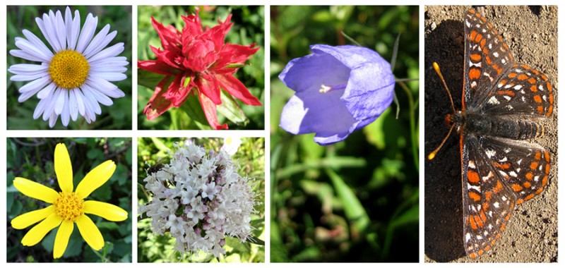
As usual, fantastic photos and report, Aubrey. That island in Lake Ann looks amazing. I love the little montage of wildflowers & butterfly, too... very artsy. :)
Thanks so much for continuing to share your PNW adventures with us. I really must get out there and experience it for myself some day...
I have an annotated panorama atop Whistler Mountain (7790') across from Lake Ann I took last month --> http://gigapan.org/gigapans/15233f9eab85d0b04efbcc107f41f76f/ - Whistler is dead center in your Image #13. Certainly one of my favorite ranges, fantastic photos thanks for posting.
Once again a great report and climb Aubrey and Jen. Keep these coming, I need to get back to the PNW at some point in the near future. I can't wait for some of your spring climbing tr's.
Theodore: A friend of mine from Seattle, who is an accomplished climber, went 0 for 3 on Baker's North Ridge a couple weeks ago. I hear it's only a late-summer route, and I think he ran into some routefinding issues. I hope your climb is 1 for 1.
Well, I think I now have a place to go for an out of state vacation. Thanks for sharing a great trip report and beautiful photos. Very motivating to make the rest of us want to climb those peaks.
Caution: The information contained in this report may not be accurate and should not be the only resource used in preparation for your climb. Failure to have the necessary experience, physical conditioning, supplies or equipment can result in injury or death. 14ers.com and the author(s) of this report provide no warranties, either express or implied, that the information provided is accurate or reliable. By using the information provided, you agree to indemnify and hold harmless 14ers.com and the report author(s) with respect to any claims and demands against them, including any attorney fees and expenses. Please read the 14ers.com Safety and Disclaimer pages for more information.
Please respect private property: 14ers.com supports the rights of private landowners to determine how and by whom their land will be used. In Colorado, it is your responsibility to determine if land is private and to obtain the appropriate permission before entering the property.