Download Agreement, Release, and Acknowledgement of Risk:
You (the person requesting this file download) fully understand mountain climbing ("Activity") involves risks and dangers of serious bodily injury, including permanent disability, paralysis, and death ("Risks") and you fully accept and assume all such risks and all responsibility for losses, costs, and damages you incur as a result of your participation in this Activity.
You acknowledge that information in the file you have chosen to download may not be accurate and may contain errors. You agree to assume all risks when using this information and agree to release and discharge 14ers.com, 14ers Inc. and the author(s) of such information (collectively, the "Released Parties").
You hereby discharge the Released Parties from all damages, actions, claims and liabilities of any nature, specifically including, but not limited to, damages, actions, claims and liabilities arising from or related to the negligence of the Released Parties. You further agree to indemnify, hold harmless and defend 14ers.com, 14ers Inc. and each of the other Released Parties from and against any loss, damage, liability and expense, including costs and attorney fees, incurred by 14ers.com, 14ers Inc. or any of the other Released Parties as a result of you using information provided on the 14ers.com or 14ers Inc. websites.
You have read this agreement, fully understand its terms and intend it to be a complete and unconditional release of all liability to the greatest extent allowed by law and agree that if any portion of this agreement is held to be invalid the balance, notwithstanding, shall continue in full force and effect.
By clicking "OK" you agree to these terms. If you DO NOT agree, click "Cancel"...
Carbonate Mountain A -- 13,663 feet
Cyclone Mountain A -- 13,596 feet
Sawatch Range
September 18, 2011
Trailhead: Cyclone Creek. Take CO-50 to 240 (at Maysville) and follow it for 8.2 ish miles. The road is rough in spots, but a well-driven 2WD can get there. Look for the TH (first pic) after passing by the ruins of an old cabin (marked "Shavano" on the Topo). The trail has a trail marker a little ways into the forest, which is visible from the road if you're looking for it. Route: We followed Roach's route for Cronin (he calls it "North Carbonate") from Cyclone Creek. In short, from the TH, follow the trail for about .9 miles, cross to the other side of the creek. Follow that trail (which fades in and out) for about 1 mile, re-cross to the original side of the creek, and hike up via the obvious gully to the ridge. Turn right for Carbonate and left for Cyclone. Mileage: ~7.4 miles Special gear: None needed. Class 1 or 2 the whole way.
One of three guys bashing through some willows heading into the drainage, maybe 1.25 miles from the TH and about 50 yards from the nice trail to us: "Hey - Did you climb Tab-ah-gua-chee peak today?"
Us: "Um, no. Are you looking for the Jennings Creek drainage?"
Them: "Yeah."
Us: "Oh. Well, you're in the wrong place. You're one drainage over from there. It's on the other side of that ridge."
Them: "Ok. That's what we needed to know."
And then they continued into the drainage... at about noon, with some significant clouds coming in. Oh well. I shouldn't really make fun since I don't know how to say "Tabeguache" either. I think there was some consensus on "The Gooch," though.
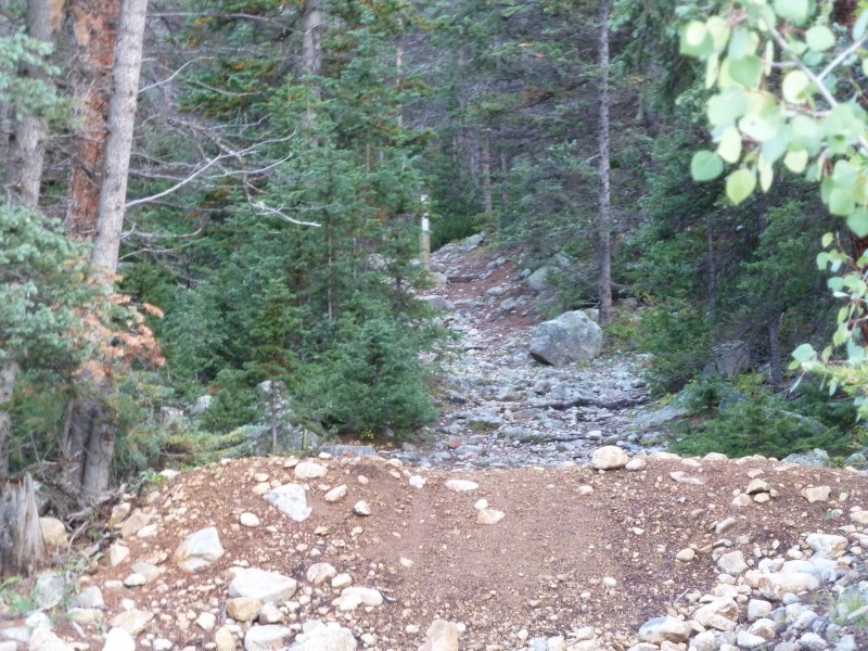
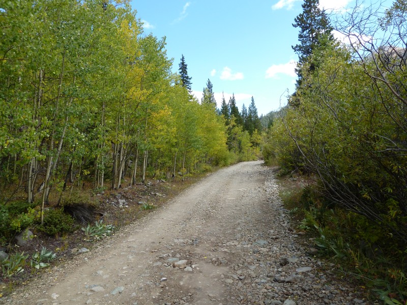
Here's the view of the unmarked trailhead from the road. It's a little ways passed the Jennings Creek "TH" - maybe .5 miles or so.
The trail follows what looks to be an old road, but the road quickly fades into a path. There's a pile of dirt on the trail blocking most vehicles from going farther up the "road." However, it would be useless to try to take a vehicle on the "road" - contrary to what the Topo says, it ends not far into the hike.
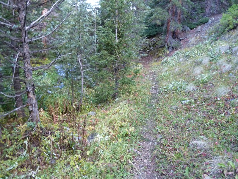
The path varies from nice and clear like this to not so nice and not so clear. If you lose the trail past the first creek crossing, the general rule of "get farther into the drainage" applies and will serve you well. If you aren't on the trail and you're willow bashing, get higher on the west side of the drainage and you'll likely cross the trail.
Looking back at the first creek crossing.
There is some deadfall on the route. But it is easy enough to get around or over.
I think this is Grizzly Peak, which is at the head of the drainage.
Our original plan was to hike to Cronin Peak via the saddle between Carbonate and Cyclone, then over Lo Carb then to Cronin, then descend back into the drainage from the Grizzly/Lo Carb saddle. My last surviving aunt on my mom's side's maiden name is "Cronin" - no relation that I know of. We ultimately didn't get there due to some weather that was coming in. Next time Aunt Peggy!
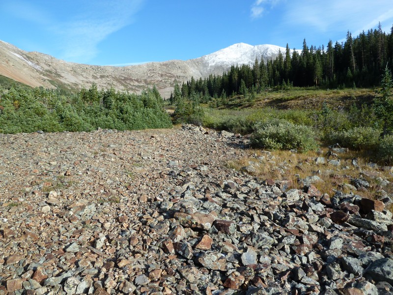
There's a talus field near the 2nd creek crossing.
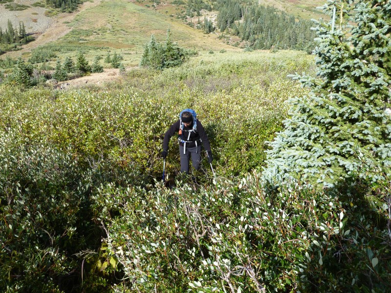
There are just a few willows at the crossing. There are game trails/paths through here. Just pick one and get through it.
There is a short section of forest that needs to be navigated until the gully appears. We dead-reckoned our way through it, but it wouldn't be stupid to take a compass heading before entering the forest. There is a lot of deadfall that can get you turned around. There are also quite a few trail segments that seem to switchback up the slope, but the elevation gain is so gradual on these trail segments that we left the trail and just headed up.
I'm not sure what to make of this. A puddle of water with a stem of ice and there was nothing that could have dripped into the puddle from higher up. Odd...
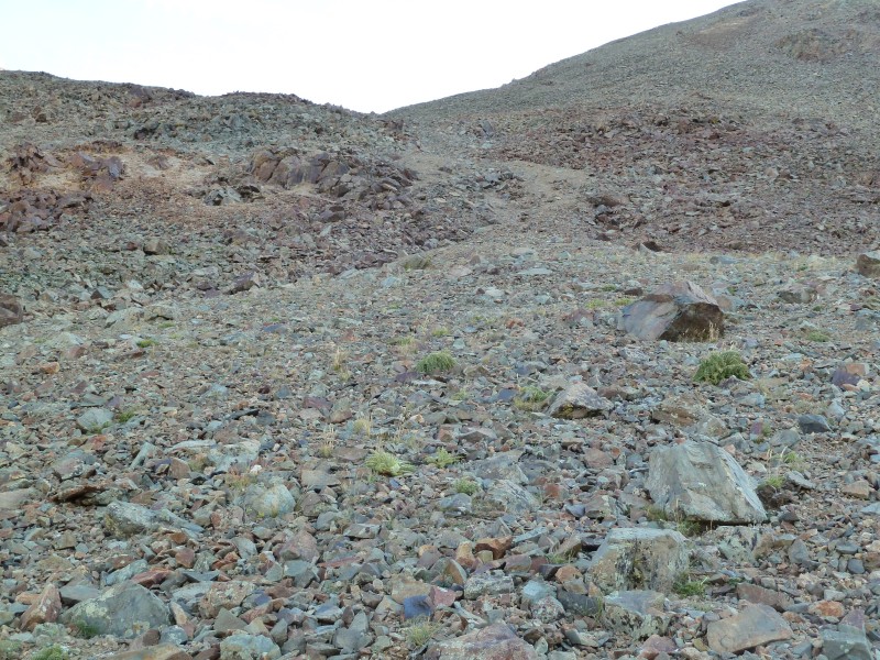
Here's the gully. Luckily the dirt was frozen on our way up so we didn't have to deal with what I'm sure is a pretty loose gully. There is larger, but still loose, talus on each side. There's also a trail on the right side a little ways up that takes you through some more stable talus. We missed that trail on the way up.
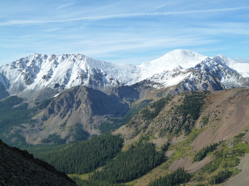
I'm pretty sure this is Taylor Mt. on the left and Mt. Aetna on the right. There's some great scenery in this area!
Here's Kate about to get to the top of the gully. Calico Mountain is on the other side of Cyclone drainage.
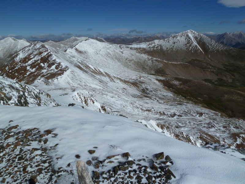
Here's the view north from the top of Carbonate. Cyclone is left of center. Grizzly is far left. Lo Carb is past Cyclone and Cronin is far right.
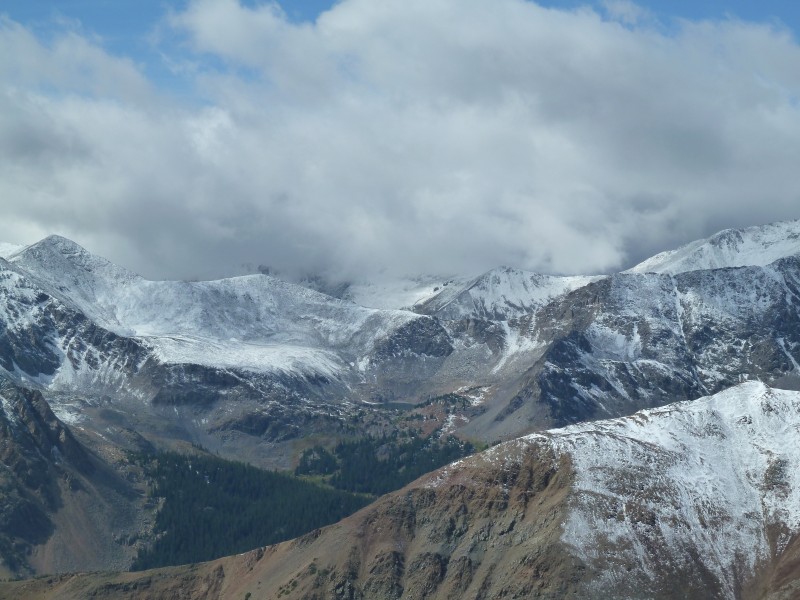
And now the weather decided to come in. Our 10% chance of bad weather just became more like 90% with these clouds across the valley from us.
The temps were colder than we were anticipating and the wind was blowing harder than the forecast called for (or so it seemed, maybe I'm just not ready for fall in the mountains yet...). We also didn't like the look of those clouds so after getting to the top of Cyclone and re-assessing the weather situation we decided not to leave ourselves with unknown or unfriendly bail-out options along the ridge to Cronin. Once we got down to the drainage floor, even more clouds came in and put us in shadow for a while. Of course, on the drive out, the mountain tops were clear...
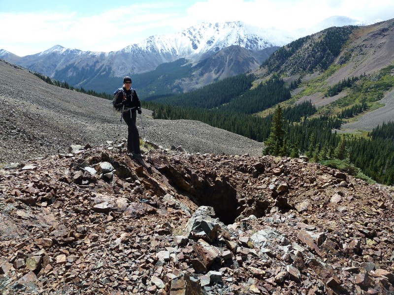
There are some mine ruins / pits in the area so you'll need to pay attention to your footing.
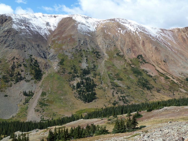
This was a nice hike in a beautiful area of the Sawatch. Here's a shot of the opposite side of the drainage from Carbonate/Cyclone - this is Calico Mountain. Colorful Colorado!
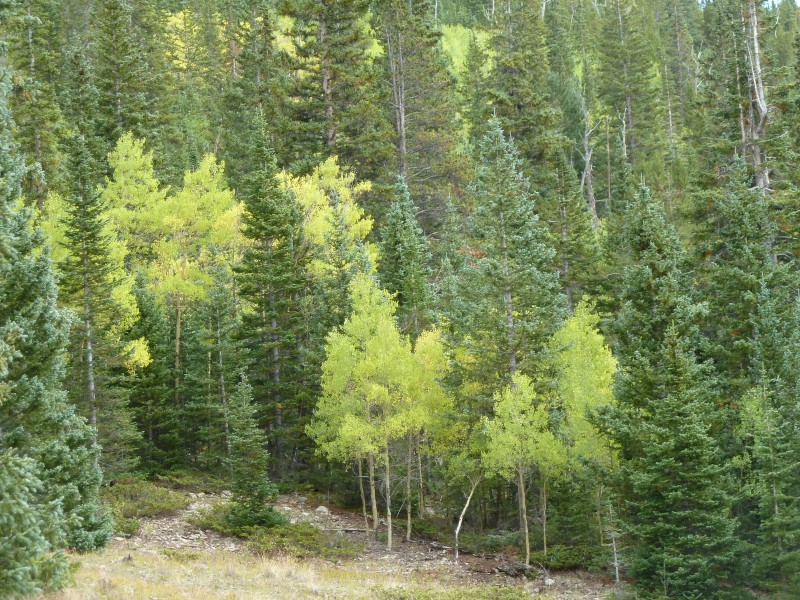
Colors on the way out. The area was on the verge of a color explosion. Maybe this coming weekend will be nice?
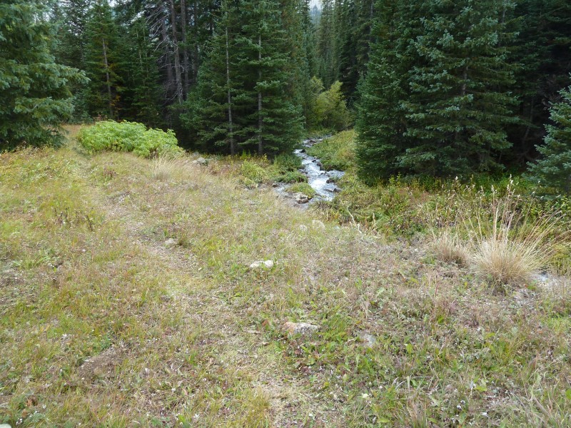
Part of the trail not far from the TH. This was on the return.
The road itself is scenic and would be worth a drive during the color season.
The road also has a good amount of camping options along it.
GPS track of our route
This hike wasn't too strenuous, but I would imagine that the gully is less pleasant if you can't find the nicer trail and you have to walk up the loose dirt.
Enjoy!
Bob and Kate
Thumbnails for uploaded photos (click to open slideshow):
Bob and Kate, if you decide to tackle this route again, I'd be interested in tagging along. I was expecting to get up Cronin via that same route at some point.
I've been planning on NC, Cyclone, Lo Carb, Cronin, Grizzly combo for quite a while now. I wondered how the trail looked headed up from the Shavano Townsite, as I had heard different things. Good stuff!
Nice report on some great peaks! My partners and I are doing Tab's West Ridge on Sunday. Did you happen to get a shot of the ridge from Carbonate's summit? We are interested in snow conditions. Thanks either way!
Did you guys happen to come across the old miners cabin that has a mini dog-house cabin behind it? I did this same hike a number of years ago and ran across that. Never seen anything like it before or after. That is a great area and a seldom visited drainage.
What to do after finishing ”the” list? 13ers, of course!
Not that you two didn't have a running start already...
Nice report, Bob, with great attention to detail.
SuperPolok - We didn't see that cabin - was it up in the drainage or near the TH?
Matt - Thank you! Now that the list is done we can have fun exploring the 13ers, which I find to be generally more enjoyable than the 14ers - for reasons we've discussed. Aside from the guys who were lost, we were the only ones on the route that day. It was a really nice hike and a good day to be out.
Nice writeup, Bob. Good to see you and Kate getting out and having fun. That area around Monarch Pass is a veritable honeypot when it comes to 13er booty. I hope you can make it to the 13er gathering. I'd like to hear about Chicago Basin and your finisher week over a brew or two or three...
As your notes mention the trail was overgrown and easy to lose so I bet two hikes into the drainage would lead the hikers to two different places. I am planning on heading back there in the near future so I'll keep an eye out. I love seeing old buildings and wondering about the people who used to live there.
I am doing this route Sunday or Monday this coming week. Thanks for the info, if any others interested PM if want to come with. Also doing Calico, Grizzly, etc on the day I dont do Cronin.
Caution: The information contained in this report may not be accurate and should not be the only resource used in preparation for your climb. Failure to have the necessary experience, physical conditioning, supplies or equipment can result in injury or death. 14ers.com and the author(s) of this report provide no warranties, either express or implied, that the information provided is accurate or reliable. By using the information provided, you agree to indemnify and hold harmless 14ers.com and the report author(s) with respect to any claims and demands against them, including any attorney fees and expenses. Please read the 14ers.com Safety and Disclaimer pages for more information.
Please respect private property: 14ers.com supports the rights of private landowners to determine how and by whom their land will be used. In Colorado, it is your responsibility to determine if land is private and to obtain the appropriate permission before entering the property.