Download Agreement, Release, and Acknowledgement of Risk:
You (the person requesting this file download) fully understand mountain climbing ("Activity") involves risks and dangers of serious bodily injury, including permanent disability, paralysis, and death ("Risks") and you fully accept and assume all such risks and all responsibility for losses, costs, and damages you incur as a result of your participation in this Activity.
You acknowledge that information in the file you have chosen to download may not be accurate and may contain errors. You agree to assume all risks when using this information and agree to release and discharge 14ers.com, 14ers Inc. and the author(s) of such information (collectively, the "Released Parties").
You hereby discharge the Released Parties from all damages, actions, claims and liabilities of any nature, specifically including, but not limited to, damages, actions, claims and liabilities arising from or related to the negligence of the Released Parties. You further agree to indemnify, hold harmless and defend 14ers.com, 14ers Inc. and each of the other Released Parties from and against any loss, damage, liability and expense, including costs and attorney fees, incurred by 14ers.com, 14ers Inc. or any of the other Released Parties as a result of you using information provided on the 14ers.com or 14ers Inc. websites.
You have read this agreement, fully understand its terms and intend it to be a complete and unconditional release of all liability to the greatest extent allowed by law and agree that if any portion of this agreement is held to be invalid the balance, notwithstanding, shall continue in full force and effect.
By clicking "OK" you agree to these terms. If you DO NOT agree, click "Cancel"...
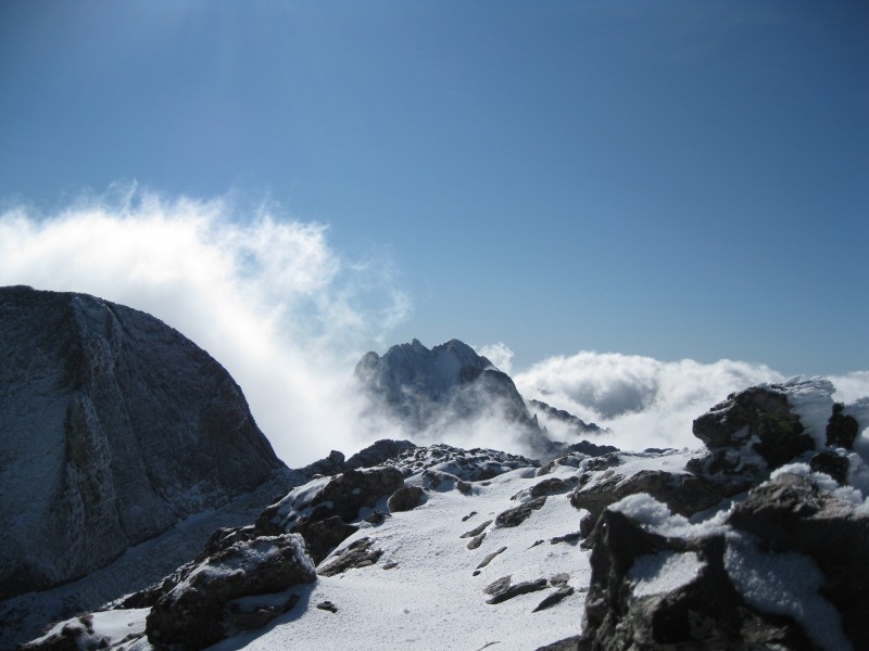
Ad Astra Per Aspera--a snowy day in the Crestone group
Brad and I had made plans for the weekend to climb Wheeler Peak, New Mexico's highest, followed by Little Bear's SW ridge. However, for the second time this season, weather thwarted our plans. Neither of us were willing to attempt an arduous 4th class route in snow, so we looked for something easier. We finally settled on Challenger and Kit Carson, though I suspected even that pair would be a demanding climb in snowy conditions, and that Challenger would live up to its name. I was right...
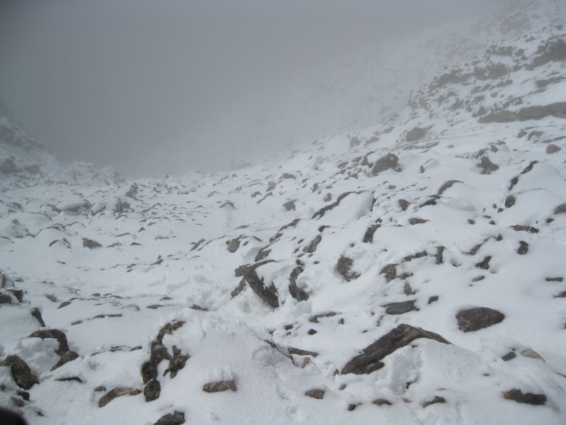
We set off from Longmont at an unholy 2 AM on Saturday, making short work of the drive to Wheeler Peak. Unfortunately, the supposedly-good weather forecast proved wrong, and the peaks were engulfed in the clouds. We proceeded, getting a few views down toward Williams Lake before passing into the clouds. Wind, cold, some light snow cover, and a nearly-complete lack of views characterized most of the climb. Naturally, the weather began to clear as we reached the trailhead and drove out.
After a stop for lunch on the outskirts of Taos--it was Brad's first time in the state, and I of course had to introduce him to New Mexican cuisine!--we headed west, then north toward the Crestone group. The drive through Conejos County brought back unfortunate memories of rural Ohio. We made good time to the town of Crestone, and short work of the road to the trailhead. As we were packing, we chatted with a few guys who'd climbed both peaks that day, and reported it difficult, but doable.
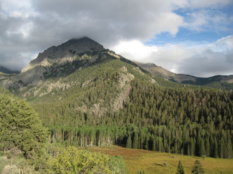
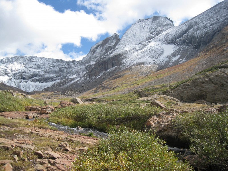
Around 5 PM, Brad and I set off. I'd been on the route before, having climbed Mt. Adams with Brian over Memorial Day, which is a worthy summit in its own right. I remembered the trail well, and we were soon heading up the main drainage below Willow Lake. Brad, whose previous Crestone experience had been the Cottonwood Creek drainage, was awed by the admittedly impressive views on the approach.
The shoulder of Challenger from the approach...this view never gets old
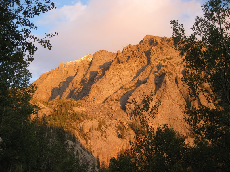
The alpenglow on the rime-ice-encrusted shoulder of Challenger was sublime.
Alpenglow on Challenger
Darkness fell as we crested the headwall, and we soon decided to forgo camping at the lake and just grab the first campsite we found, which we did. We set up camp and, too exhausted to choke down anything more than a bit of snack food, soon retired for the night.
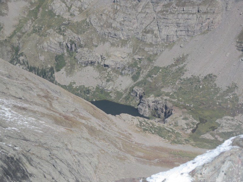
The next morning dawned cold and mostly clear. Brad and I dragged ourselves out of our warm sleeping bags around 4:30 AM and were soon on our way. Even in the dark, the way to Willow Lake felt familiar, and we'd soon reached the western shore; I stopped a few minutes to admire the falls and surrounding peaks bathed in moonlight. From here, route-finding was confusing, and we picked our way through the profusion of use trails trying to find the continuation of the main trail. After a few wrong turns, we finally got on the route and were soon passing over the rocky flats above the waterfall. We were ahead of schedule, and took a lengthy break here to mentally prepare for the climb ahead.
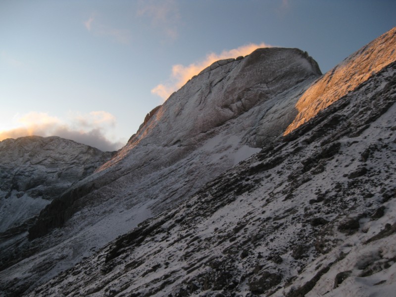
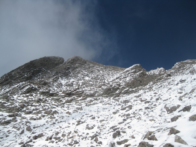
Getting onto the trail up Challenger proved a bit tricky--we just started cutting up the hill where my waypoint suggested the turn would be, in spite of an obvious trail--but quickly found the way. The trail was relentlessly steep, but otherwise pleasant enough in its frozen state. Within a few hundred feet, we started noticing tiny patches of snow. As the sky began to lighten, we were treated to an incredible vista of the surrounding peaks...Kit Carson was covered in what looked like a thin layer of frost and rime ice, with Mt. Adams poking above the clouds, snow-capped.
Kit Carson in the pre-dawn light Mt. Adams from partway up Challenger
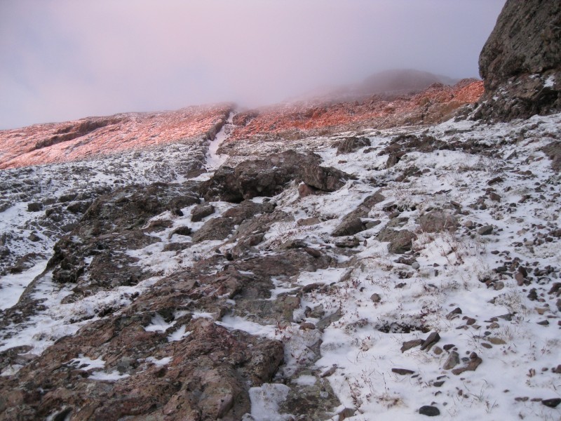
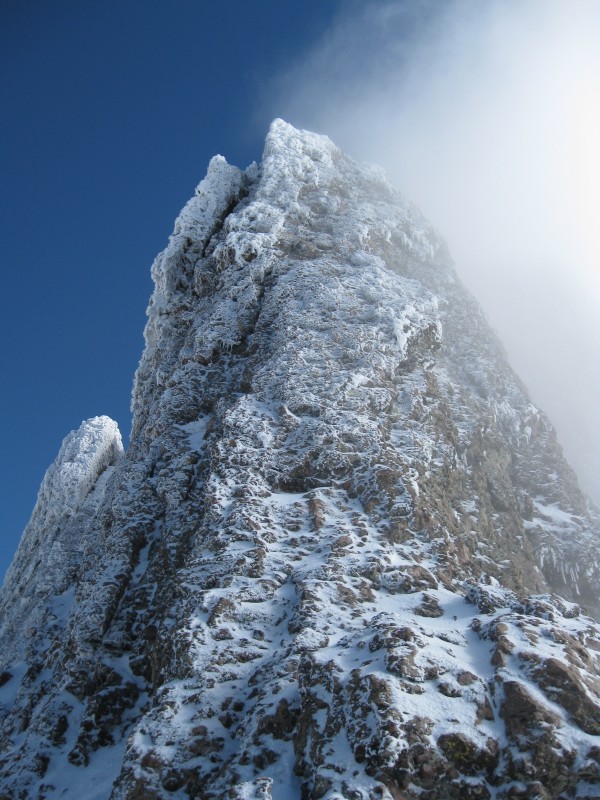
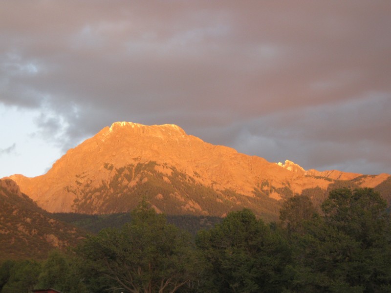
The sun peeked over the mountains shortly after, bathing the upper reaches of Challenger in orange.
Where we're headed...
As we reached roughly 13,000' up, the snow thickened to the several inches we were to encounter for the rest of the climb.
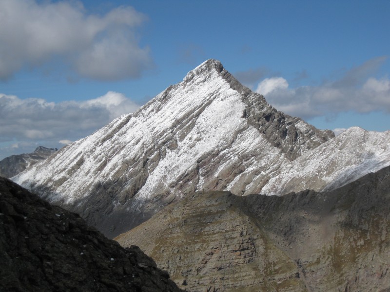
Sunlight hitting Kit Carson
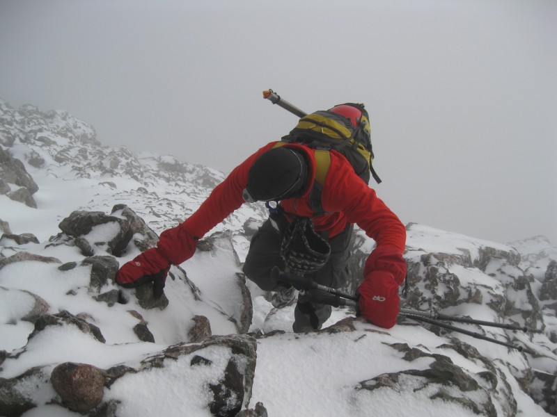
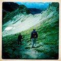
The snow made things both more and less easy...yes, we were spared some of the loose scree, but the snow also made for a bit of excitement in some mildly exposed areas. Brad and I slowly and carefully found a workable route up the rocky bulges and gullies of Challenger's slopes through a combination of route-finding and luck.
Brad making his way up Challenger's snowy slopes
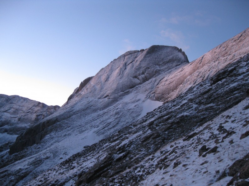
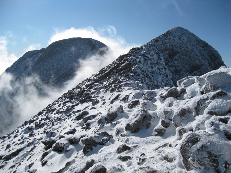
At long last, we drew near the notch on the ridge and the slope abated.
Nearing the notch
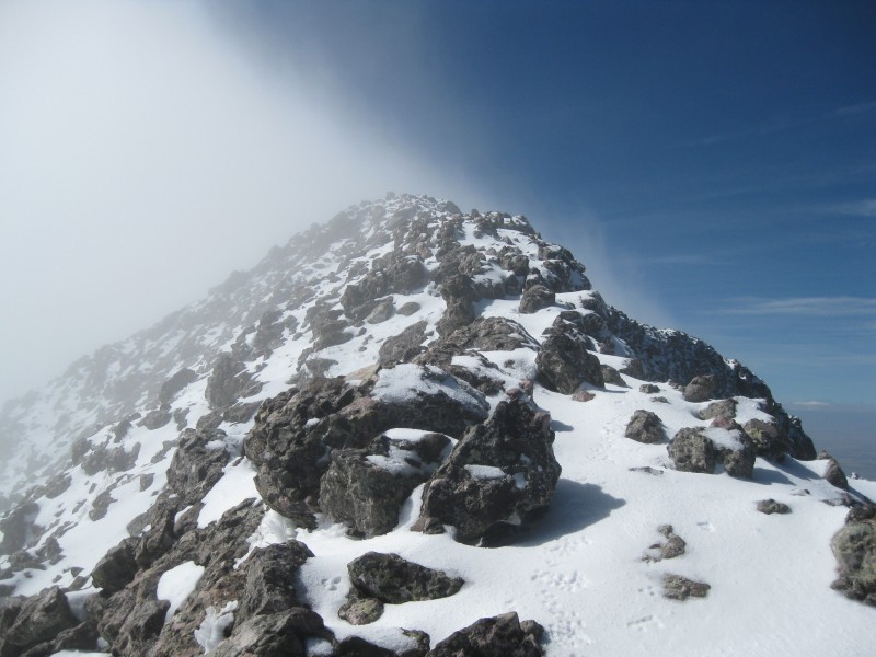
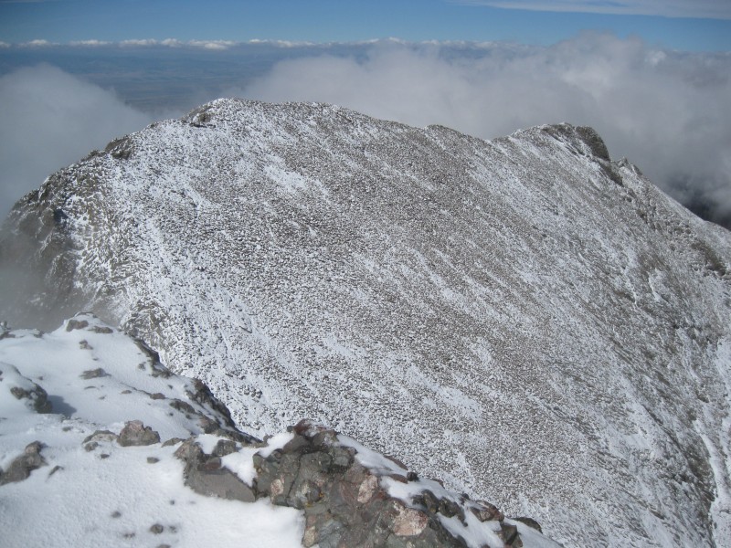
I popped over the ridge to see...nothing at first, just a sea of clouds. But then, the clouds gradually pulled away to reveal a far-reaching vista of the San Luis Valley. Brad topped out a few minutes later. We both crossed over and traversed along the west side of the ridge until that became too challenging and exposed, then scrambled up to the ridge crest.
The last quarter mile to the summit, following the ridge, was wonderful.
Approaching Challenger's summit
I felt like I was floating on air, the going was easy, and the slopes off to the left were not at all worrisome. The sun was high and the breezes, gentle.
Brad on the final few feet up Challenger...
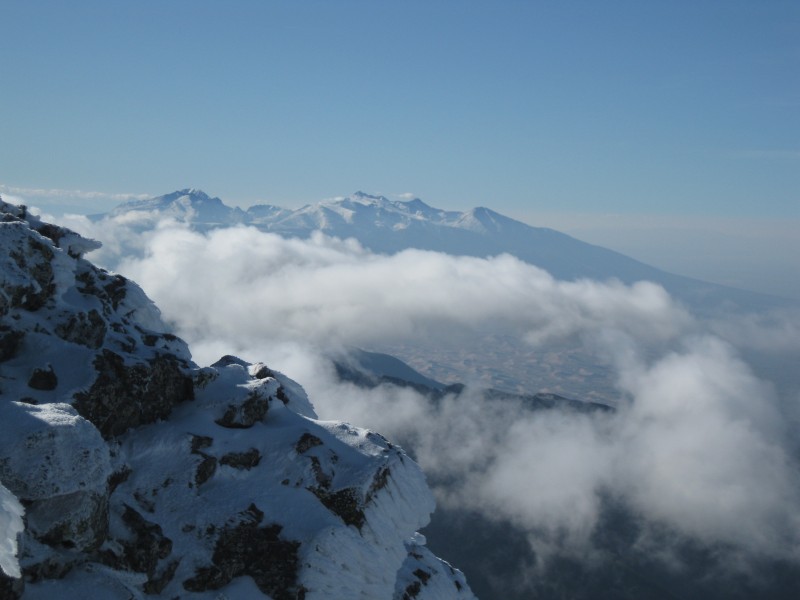
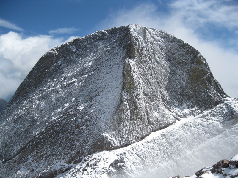
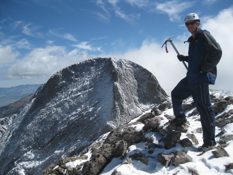
In almost no time at all, we topped out on Challenger to incredible views in virtually every direction. Clouds played over the surrounding peaks, but everywhere else, blue skies prevailed. We could see distant snowcapped Pikes Peak and the Blanca massif, which reinforced our satisfaction at having canceled plans for Little Bear. Crestone Peak even made a brief, ice-coated appearance. But it was of course Kit Carson that dominated the views, waiting patiently for us to traverse her slopes. We were soon on our way.
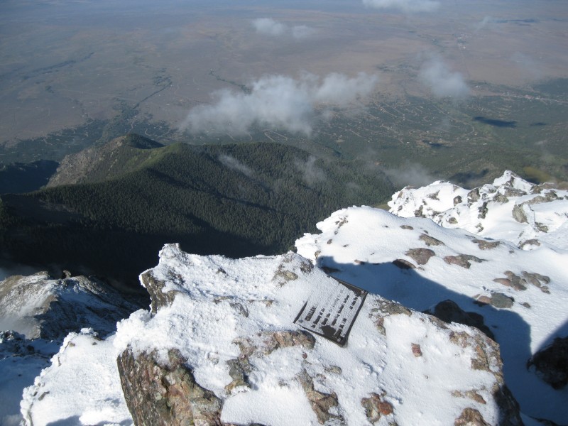
The distant Blanca group The summit plaque, the town of Crestone far below Crestone Peak making an appearance. Sadly, the best view of it we'd have all day...
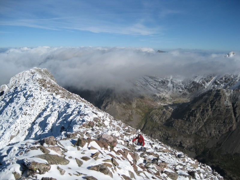
The descent from Challenger was straightforward, and we were soon at the saddle between the peaks. I took an unnecessarily hard route up a short couloir, then began making my way up the Avenue, Brad shortly behind.
Ascending the Avenue
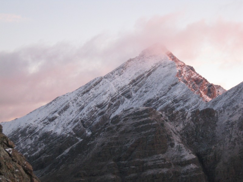
Upon reaching the highest point of the Avenue, however, things drastically changed--within literally a few feet, we went from crystal-clear blue skies to a murky, unpleasantly warm cloud.
at the highpoint of the Avenue, where Kit Carson was doing its Jekyll and Hyde thing
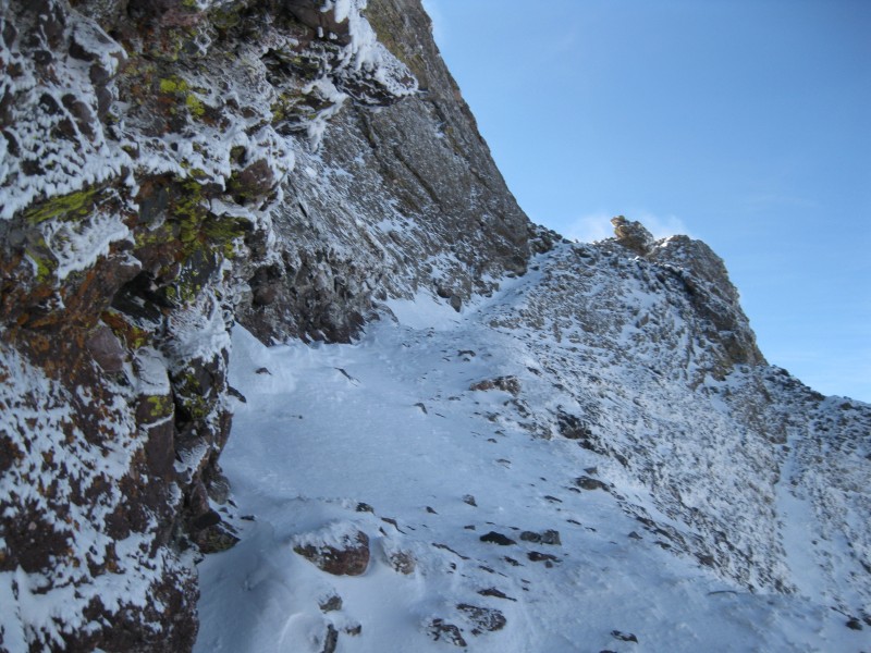
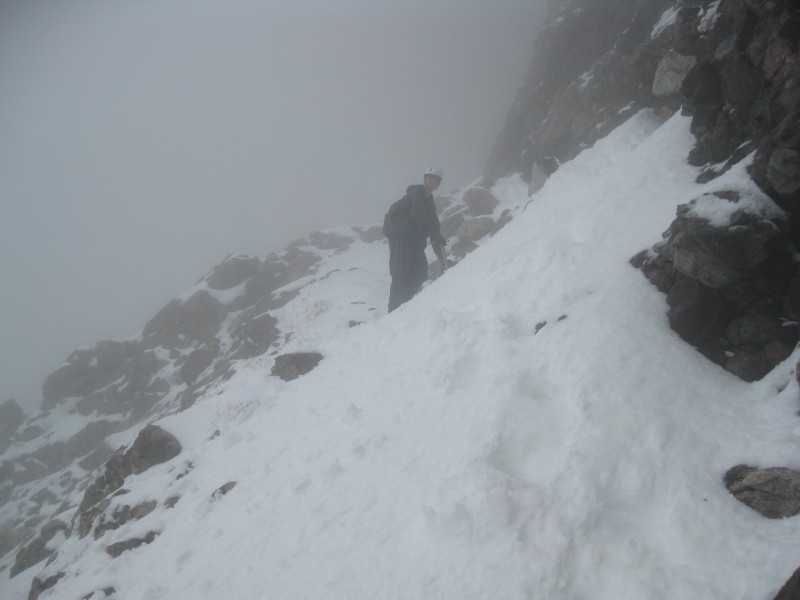
The Avenue looked much sketchier from here, at least what we could see of it. I asked Brad to lead for a while, and we cautiously began making our way downward. The day had warmed enough that bits of snow were sloughing off the upper reaches of the mountain and collecting on the Avenue--and our heads! We were both glad to have helmets...
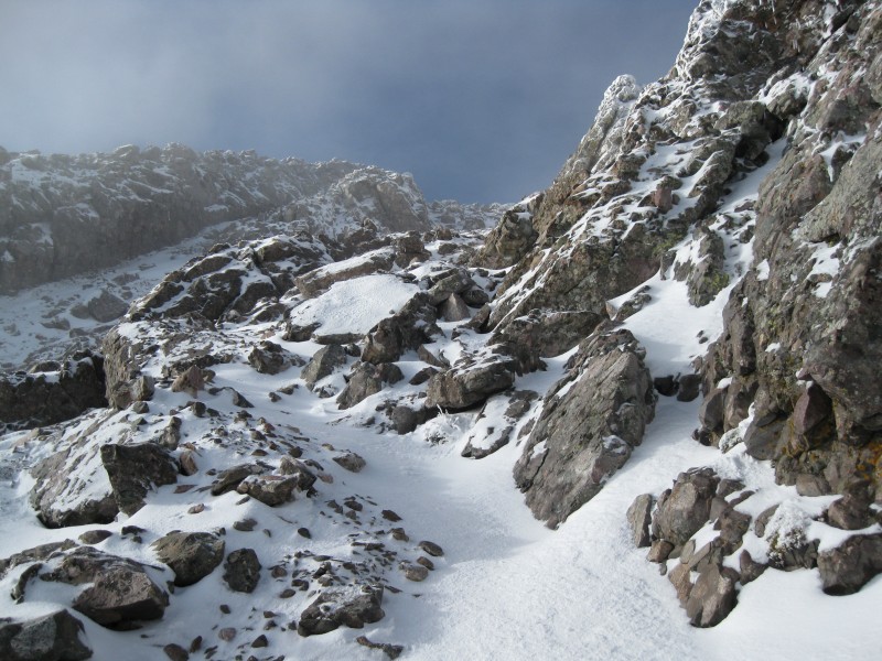
At last, we drew near the standard route's gully, which was predictably snowy, and steep but not impossibly so. The clouds very briefly cleared as we started up, providing a brief view of Columbia Point.
A brief view of Columbia Point Our ascent route up Kit Carson
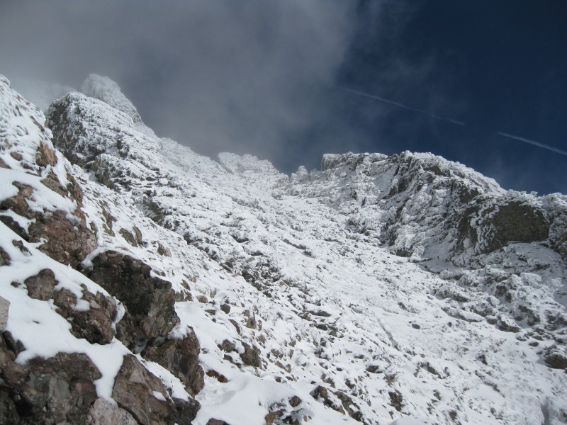
We first made an ascending traverse of the gully, then went up through some small boulders. Past here, the slope eased a bit, and I was more comfortable making a roughly direct assault up the gully, with some switchbacks thrown in on the snowier parts.
Looking back down... Nearing the crest of the ridge, and clearer skies, on Kit Carson
I discovered that most of the rime ice coating the rocks was now coming loose at the slightest touch. Excellent--more handholds for us! We were ascending (I believe) a bit to the right of where we should've been, so I found a good opportunity to cross over a rock rib several dozen feet below the ridge crest. Finally, I topped out and could see most of the remaining ridge to the top. It was narrow and, on the right side, fairly exposed. But it wasn't that difficult.
The final bit of scrambling to the summit
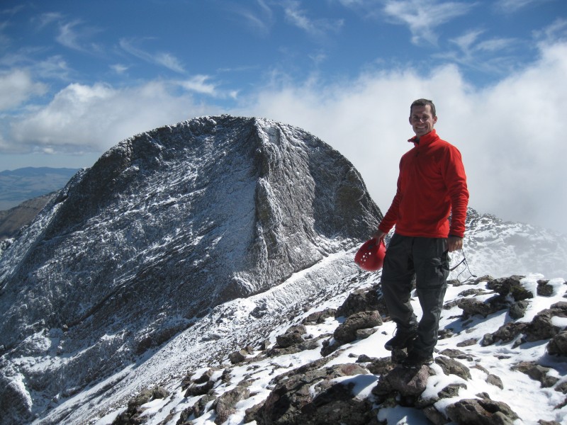
A few minutes later, and the summit of Kit Carson was ours.
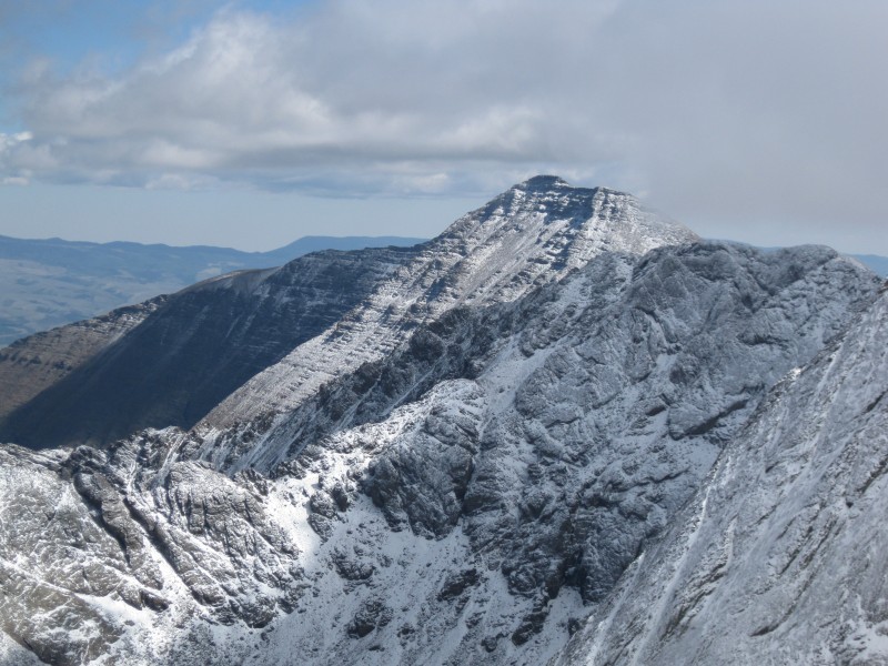
Willow Lake from the summit, far below Looking back at Challenger
We didn't spend very long on top; the ascent from camp had claimed seven hours, and we were worried about potentially unstable snow on the descent. Not to mention, the cloud of presumably sublimating snow was still blocking any views to the south. After a few pictures and a quick snack, we began descending. Our footprints made for easy route-finding, and we almost entirely followed them except for where brief easier stretches existed. So focused was I on descending that I found myself taken by surprise by the cairn marking our exit from the gully. We'd just surmounted perhaps the part I'd worried about the most, and I hadn't been spooked at all! After half a minute, we found our way back onto the Avenue.
Me, on the returning ascent of the Avenue
Even going uphill, we made good time. I was amazed to see how much wet snow and ice had accumulated on the Avenue since we'd last traveled it; in many places, our footprints had vanished. We topped out at the Prow, descended back to the saddle (this time taking an easier route), and made short work of the last climb up to Challenger. At last, the day's uphill climbing was finished. We stuck around for a bit again, grabbing some food, then made our way back to the notch.
Kit Carson. We were up THERE!? Obligatory summit shot And now, Brad
This was the other part I'd really worried about, but the substantial snow melting that had occurred in just a few hours had made the route easier, if muddier. The descent was nowhere near as bad as I'd feared, excepting one or two places where a tricky traverse using rocky handholds was necessary. I breathed a mental sigh of relief as we reached the end of the snow; only mud remained now. Carefully at first, then more quickly, we descended. At one point, we spotted a pika wandering about the tundra. Brad yelled at it to spook it--and promptly slipped and fell on his ass! Frankly, I think he deserved that one.
Humboldt Peak A last view of Mt. Adams
Back at the lake, we spent a bit of time getting photos of Kit Carson and the picturesque waterfall at the lake's east end.
Looking back at Kit Carson from near the waterfall
I could see a few tents, and yet nobody seemed to be around. I realized that we hadn't seen a single soul since the previous afternoon, and reflected on how desolate the lake had been back in May. Now, the lake held a more cheery demeanor, but I still found the lack of any sign of life a bit unsettling. We continued on, making it back to camp perhaps 15 minutes later.
All we now had to do was pack up and pack out. When doing so, it hit me that I'd forgotten to eat my summit avocado--so I did that now. Delicious! We were soon on our way, hoping to make it down before sunset. As it turned out, we made excellent time, arriving back at the car in only a bit over an hour and a half. The trip was uneventful, save for spotting a few deer near the trailhead. We rolled through Crestone (spotting the first other humans we'd seen in over a full day) and caught a stunning view of Challenger bathed in alpenglow from the setting sun.
Challenger (hiding its true snow cover) and a bit of the Peak, from Crestone, at sunset
Off we drove toward home, leaving the Sangres for the most recent, but certainly not the last time. What an incredible weekend.
Thumbnails for uploaded photos (click to open slideshow):
that the aesthetics of these mountains is immensely increased with the presence of snow, even a dusting. Nice work getting those 2 in less than favorable conditions. Willow Lake is such an amazing region.
Thanks for one of the best TRs of this combo I've seen.
You take some beautiful photos for someone with a busted view screen on his camera (or did you get a new one?)
You're having quite a year--any new hair on your chest? It looks like it's aged you at least a decade in that summit shot.
8) Now, that's what I'm talking about! :wink: I'll tell you what, the dusting of snow and icy rime made these photos so beautiful (as did the lighting and clouds; and, of course, your photographic eye). Congrats on getting them both both done in ”challenging” conditions. Sorry you didn't have those kind of views from Wheeler (but, at least there wasn't any lightning :shock: which can be so much fun on that summit). Thanks for posting. Happy trails! :D
Great report and Photos!! We just did this combo over Labor Day and it amazes me how snow makes these mountains look so much more incredible. Great accomplishment. Glad you made it back safely.
Thanks all--I can't take all the credit for the photos, though! It was just that legitimately fantastic a day...
Brad--thanks for being an awesome climbing partner, yet again. It was a blast...
49ers--sorry to hear Clark didn't work out. If you're interested, you might be able to twist my arm into doing a spring climb of it in good weather... :wink:
Matt--actually got another camera from my mom who had it lying around--huge improvement. Its inaugural trip was up Capitol (has it really been longer than that since we've hiked together?). And I've been damned lucky to have such an incredible climbing year...though it's hopefully not over quite yet! Thanks again for your input, which helped convince me this duo was doable.
Presto--the avocado is a new tradition, but one I rather like. I had one atop Wheeler too, unfortunately, the only enjoyable part of the summit. Oh well...
Brian--LB is definitely getting to be a thorn in my side (literally, by the SW ridge!). I'm hoping to nab it early next summer...know you're planning for other routes, but if you change your mind, it'd be great to have you along.
Harkness--snow can definitely add a lot to a summit's beauty. It certainly made Quandary, Sherman, and Kelso Ridge prettier and more interesting of climbs! Congrats on your Labor Day climb too :)
Wheeler and a snowy Challenger/KC. Impressive. Looks like you had quite a day on Challenger/KC.
BTW, didn't make the summit of Clark on Saturday. Couldn't see anything past Ruby Jewel Lake. From what I've heard/read, Clark is one of the more scenic places out there, so I wasn't going to bust my a*s for no view.
Caution: The information contained in this report may not be accurate and should not be the only resource used in preparation for your climb. Failure to have the necessary experience, physical conditioning, supplies or equipment can result in injury or death. 14ers.com and the author(s) of this report provide no warranties, either express or implied, that the information provided is accurate or reliable. By using the information provided, you agree to indemnify and hold harmless 14ers.com and the report author(s) with respect to any claims and demands against them, including any attorney fees and expenses. Please read the 14ers.com Safety and Disclaimer pages for more information.
Please respect private property: 14ers.com supports the rights of private landowners to determine how and by whom their land will be used. In Colorado, it is your responsibility to determine if land is private and to obtain the appropriate permission before entering the property.