Download Agreement, Release, and Acknowledgement of Risk:
You (the person requesting this file download) fully understand mountain climbing ("Activity") involves risks and dangers of serious bodily injury, including permanent disability, paralysis, and death ("Risks") and you fully accept and assume all such risks and all responsibility for losses, costs, and damages you incur as a result of your participation in this Activity.
You acknowledge that information in the file you have chosen to download may not be accurate and may contain errors. You agree to assume all risks when using this information and agree to release and discharge 14ers.com, 14ers Inc. and the author(s) of such information (collectively, the "Released Parties").
You hereby discharge the Released Parties from all damages, actions, claims and liabilities of any nature, specifically including, but not limited to, damages, actions, claims and liabilities arising from or related to the negligence of the Released Parties. You further agree to indemnify, hold harmless and defend 14ers.com, 14ers Inc. and each of the other Released Parties from and against any loss, damage, liability and expense, including costs and attorney fees, incurred by 14ers.com, 14ers Inc. or any of the other Released Parties as a result of you using information provided on the 14ers.com or 14ers Inc. websites.
You have read this agreement, fully understand its terms and intend it to be a complete and unconditional release of all liability to the greatest extent allowed by law and agree that if any portion of this agreement is held to be invalid the balance, notwithstanding, shall continue in full force and effect.
By clicking "OK" you agree to these terms. If you DO NOT agree, click "Cancel"...
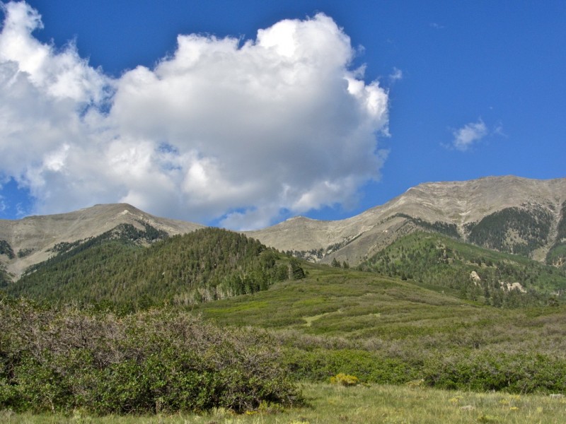
(L-R) Twin Sisters N, Twin Sisters S, and Bushnell Peak
Every year, I make a list of peaks I'd like to summit, based on several lists I'm chasing, aesthetics, or other random factors. Bushnell Peak has been on the list for three years, owing to its place on three lists (13er, county HP, 2000' prominence) and the simple fact that I find the Sangres mesmerizing when driving either north or south on US 285. Sometimes, it's hard to keep my eyes on the road because my mind's imagining what it must be like to walk around on that airy Sangre ridgeline in the sky.
I picked up Kevin and we hit the road later than we'd have liked, so it was dark by the time we crossed Poncha Pass and found our turnoff, CR 57, which is 0.7 miles north of Villa Grove. This road is big, wide, and smooth, not unlike NN-14, which leads to San Luis Peak. After hikes of Bushnell and of Hunts Peak earlier this year, it seems one of the biggest challenges in hiking northern Sangre 13ers from the west is simply finding the TH. The fun begins at a T-intersection 4.4 miles from US 285. In the dark, this was tougher than I'd have liked, given the maze of faint "range roads," inconsistent signage, and unlocked, but fussy wire gates. The full moon did help, and we arrived at the TH/Sangre de Cristo Wilderness boundary (9300') in time for a short fire, some Stone IPAs, and campfire chat focused on highlights of the past week's stellar Phish shows in Commerce City, especially the mind-blowing cover of "Sabotage" by the Beasties. Under the full moon, a thick fog rolled in from the east, slowly engulfing our view, making for a surreal end to the night.
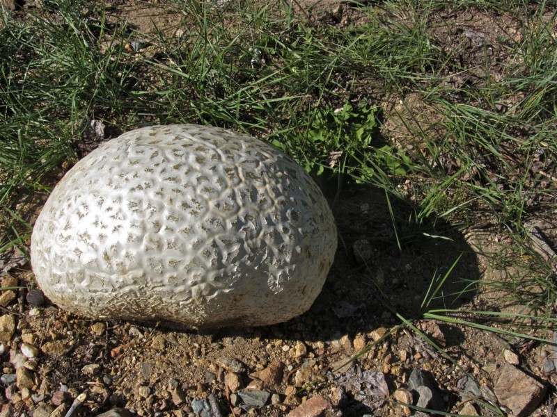
We awoke to a temperature of 31 degrees--the fall chill is here, folks--and found that the TH is marked by the biggest puffball I've ever seen. Epcot?
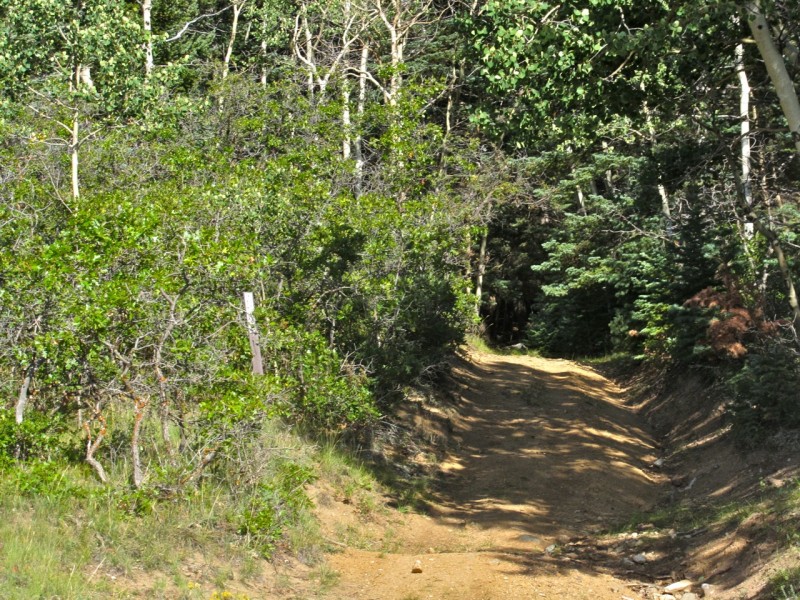
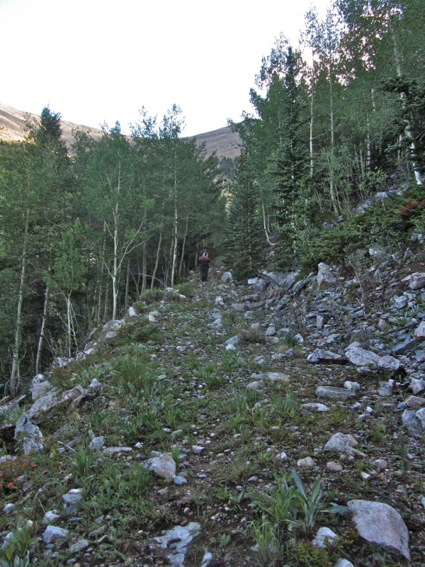
Here's the beginning of the trail, which follows an old road to treeline and beyond. No Wilderness sign here
I don't think that there was too much mining activity in the Sangres, so the presence of a vast network of roads is a bit puzzling, but it helps me out. The road provides a nice, mellow warm-up for the steepness that's to come. We:
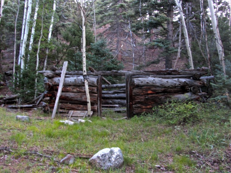
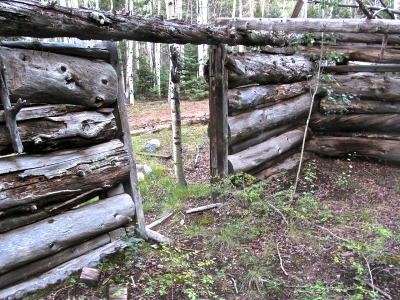
Passed some old cabin ruins along the way: Cabin exterior Cabin interior
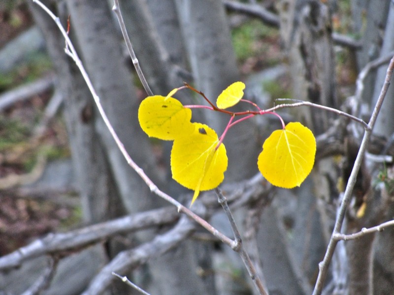
Saw a harbinger of fall colors to come Is it treeline yet?
Kept chugging up the road
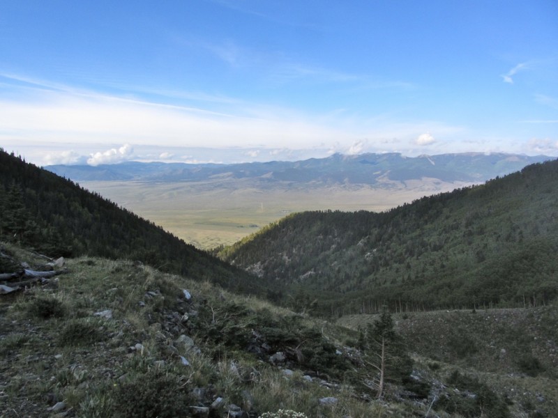
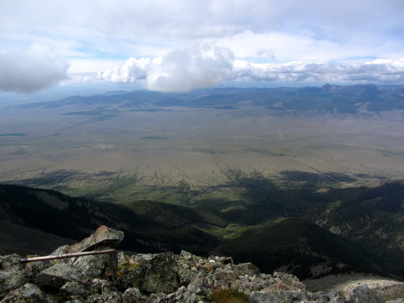
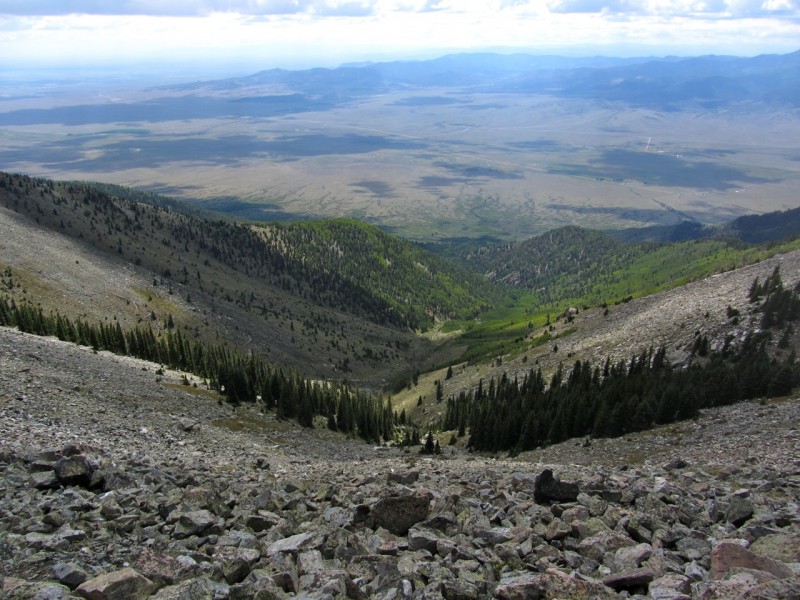
Looked back at the San Luis Valley
And, 1.75 miles in, found a great spot to rest, snack, and sunscreen up at about 10,800ft. Seating for 20 hikers
Kevin pointed out these rose hips almost glowing with vitamin C goodness:
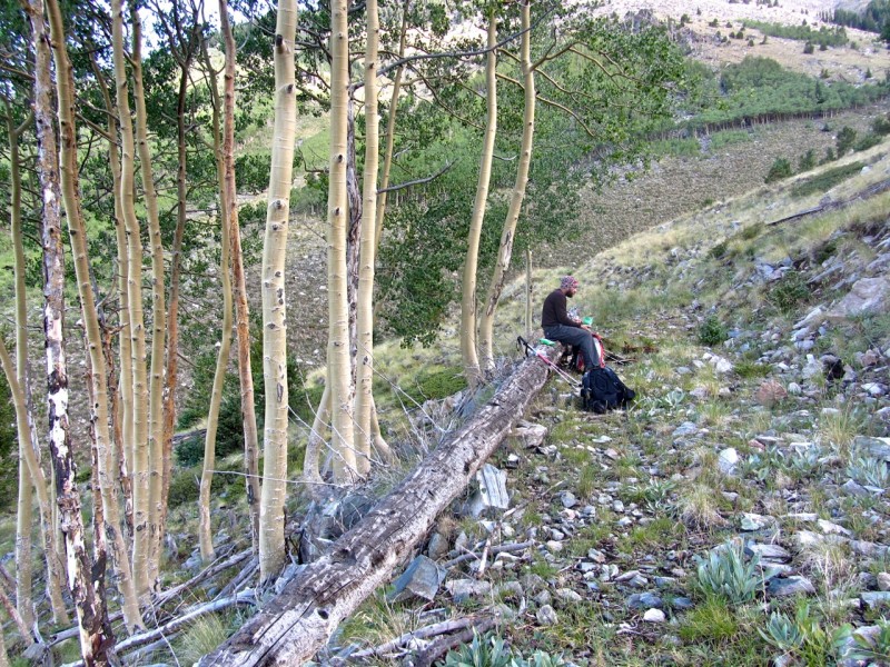
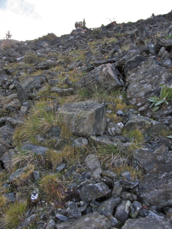
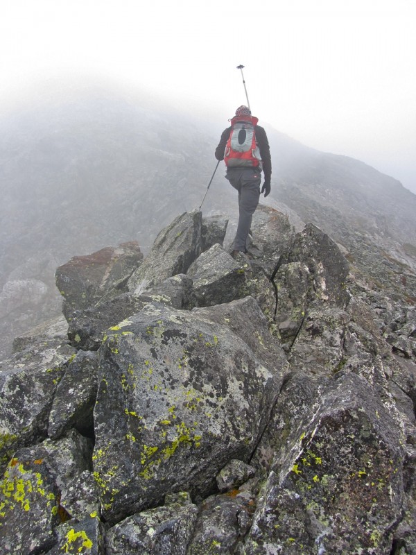
After the break, we decided to ditch the road and begin an arduous ascent to the ridgeline. From here, we had only 0.8 miles, but 2300' left to the summit of Bushnell. South Maroon all over again! (not really) While the footing looked good from below--lots of grass and chunky talus--we soon found an almost invisible layer of verglass hidden by the fact that the sun hadn't yet spilled over into the western flanks of the Sangres. Every spot I'd usually rely on for traction was slicker than snot, making going slow, but steady.
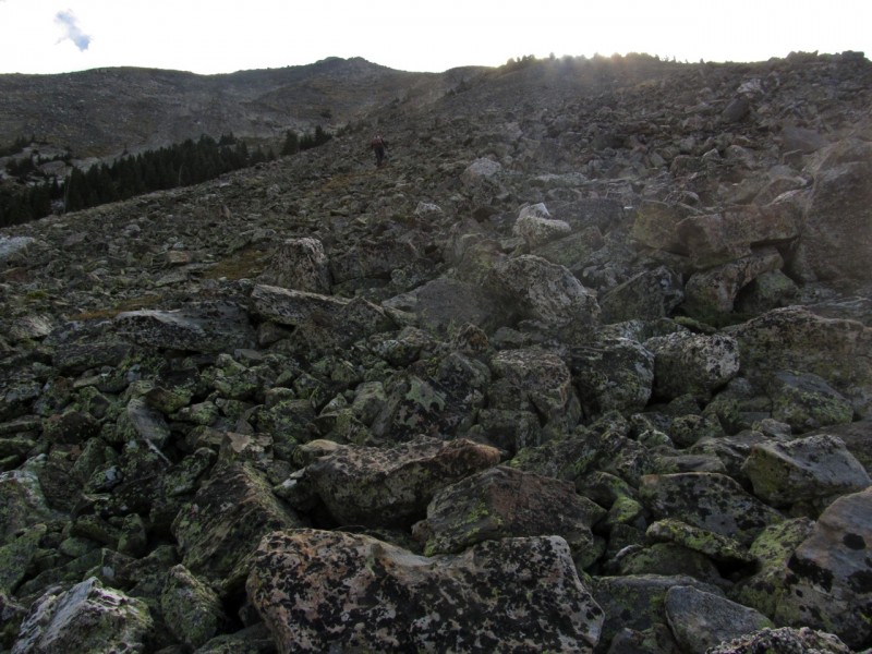
Here's how it looked: Trippy rock ice Looking over at the Twin Sisters Almost there
Reaching the ridge, I felt exuberant. Despite the fog's complicating things, we had intermittent views of Bushnell's nearby summit and the rest of our path.
We reached the summit and lounged for a while, hoping the fog would clear a bit and allow us some views. It hung around most of the time, limiting photo ops, but not taking away the majesty of occasional peeks down to the San Luis and Wet Mountain valleys. 12er Mt. Otto (12865') looks higher than us Looking north
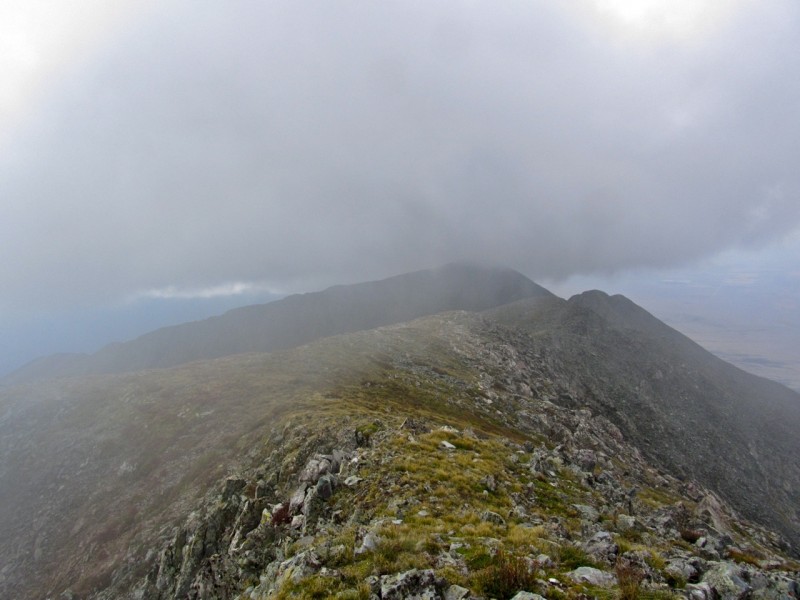
We decided to head over to Twin Sisters North, and I took one last look at Bushnell's summit.
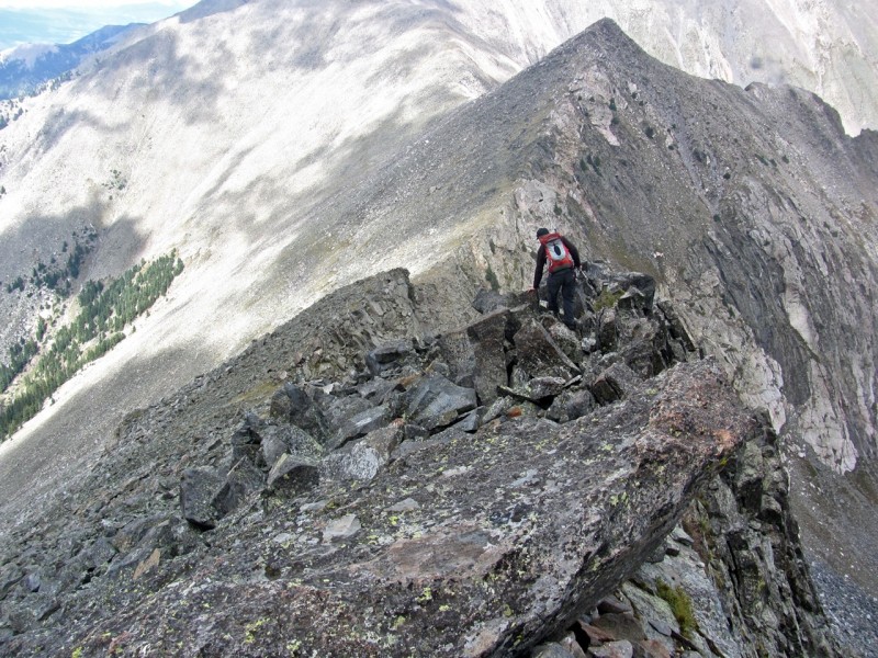
The ridge looked like it might get spicy, but Kevin assured me it wasn't going to be a problem. Thankfully, the ridge had received more sun than our ascent route, and the verglass had mostly disappeared, so we made our way without issue. There was plenty of exposure to the east, but there was no need to get too close.
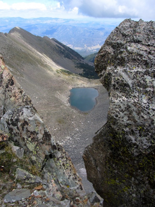
The eastern side of the range features some cool lakes. Here's one:
Since Twin Sisters South is an unranked 12er, we skipped its summit and sidehilled across some colorful rocks. In hindsight, this really didn't save us much effort.
Below us, the Bushnell lakes were blue as can be. The eastern approach to Bushnell features a backpack to them, and I hear it's worth the trip.
The fog lifted and I took a look back at our route from Bushnell, then a look ahead to our next destination, the summit of Twin Sisters North.
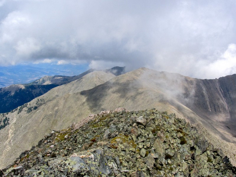
From the summit, we could finally see Hunts Peak hiding in shadow.
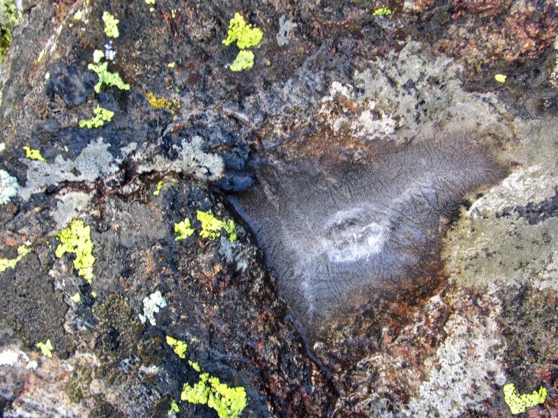
People always rave about the conglomerate rock found around the Crestones, and with good reason. Apparently, it's not the only species of cool, knobby rock in the Sangres. This looks like boba tea conglomerate to me.
Our descent route was no less steep than the ascent. However, there was far less grass to steady us. Since the verglass had melted, I was ok with this, but it was tedious. Here's how the surface looked for much of the way.
We dropped down into the grassy gully that begins near treeline at the bottom of this shot. Most of our descent route pictured here
We followed the rocky/grassy gully until it intersected with the road, and hit the accelerator back to my truck and the IPAs waiting for us. What a great day!!!!
There are several trip reports here and elsewhere for Bushnell, but these are all done in wintry conditions. I hope this gives some useful info to people like me who prefer to hike when it's warmer out. Thanks for reading.
Thumbnails for uploaded photos (click to open slideshow):
I've completely neglected the Sangres this year and this report makes me feel my regret about that, but in a good admiring way for how great it can be on those summits.
Nice report! And, those Bushnell lakes are indeed worth the backpack in from that side (big fish). 8) Epcot! :lol: You crack me up. Looks like it was a beautiful day ... glad the slick rocks didn't garner any victims. Thanks for posting. Happy trails, my friend! :D
When looking down to the valley below. Crazy rock, cabins and flora down there. I agree with everything in this TR minus the ”hike when its warmer out” comment, but to each their own. Nice outing.
I'm with traderaaron on the neglect... 9/13/2011 9:31pm
I'm hoping to get down to the sangres this fall a few times and TRs like this give me good options.
I'd also like to say that KevinK is one of the great "route scouts" on this site. I haven't seen him since late July but he looks like he's got the neck beard thing going on. Slick!
...not quite peaking yet but the colors are getting there. Colors, clouds, and cold...it's rather clear that summer is leaving us and a more honest guest will take its place.
Reading about your full moon in thick fog at altitude brings back some good memories of some time I spent in Haleakala crater. Impalpables ride in on the fog - smells, sounds, and sometimes spirits, it seems. Enjoyed the TR.
Jay, you can easily FJ all the way to the TH. Enjoy!
Presto-we need another group outing soon. Next week?
Aaron--At least the Sangres are your backyard.
Kevin and Bob-we've got plenty of Sangre left, and fall should be gorgeous down around Cuatro et al.
Wooderson--it does look like a brain, I agree. It was too cool to smash, as much fun as it would have been.
Kimo--you're talking about Fall, right?
I love the relief down to the San Luis Valley in some of those photos. Nice job on a unique day out. And I think I would have probably smashed the brain, just sayin' :P.
Caution: The information contained in this report may not be accurate and should not be the only resource used in preparation for your climb. Failure to have the necessary experience, physical conditioning, supplies or equipment can result in injury or death. 14ers.com and the author(s) of this report provide no warranties, either express or implied, that the information provided is accurate or reliable. By using the information provided, you agree to indemnify and hold harmless 14ers.com and the report author(s) with respect to any claims and demands against them, including any attorney fees and expenses. Please read the 14ers.com Safety and Disclaimer pages for more information.
Please respect private property: 14ers.com supports the rights of private landowners to determine how and by whom their land will be used. In Colorado, it is your responsibility to determine if land is private and to obtain the appropriate permission before entering the property.