Download Agreement, Release, and Acknowledgement of Risk:
You (the person requesting this file download) fully understand mountain climbing ("Activity") involves risks and dangers of serious bodily injury, including permanent disability, paralysis, and death ("Risks") and you fully accept and assume all such risks and all responsibility for losses, costs, and damages you incur as a result of your participation in this Activity.
You acknowledge that information in the file you have chosen to download may not be accurate and may contain errors. You agree to assume all risks when using this information and agree to release and discharge 14ers.com, 14ers Inc. and the author(s) of such information (collectively, the "Released Parties").
You hereby discharge the Released Parties from all damages, actions, claims and liabilities of any nature, specifically including, but not limited to, damages, actions, claims and liabilities arising from or related to the negligence of the Released Parties. You further agree to indemnify, hold harmless and defend 14ers.com, 14ers Inc. and each of the other Released Parties from and against any loss, damage, liability and expense, including costs and attorney fees, incurred by 14ers.com, 14ers Inc. or any of the other Released Parties as a result of you using information provided on the 14ers.com or 14ers Inc. websites.
You have read this agreement, fully understand its terms and intend it to be a complete and unconditional release of all liability to the greatest extent allowed by law and agree that if any portion of this agreement is held to be invalid the balance, notwithstanding, shall continue in full force and effect.
By clicking "OK" you agree to these terms. If you DO NOT agree, click "Cancel"...
After a successful ascent of Capital 2 days prior, our sites were then set on Massive. Not "just" Massive, but rather the whole dang ridge from top to bottom: the "Massive Mania" which Roach describes. Our plan was to drop a car at the Mt. Massive trailhead and camp near the Windsor Lake trailhead, for an early start the next day. We located a nice site set back in the woods near the stream off the Native Lake trailhead, which is adjacent to Windsor TH.
After an early start the next morning, JD, Cody, Steve, Keller and I started the steep climb to Windsor Lake on a good trail. On the steep trail to Windsor Lake.
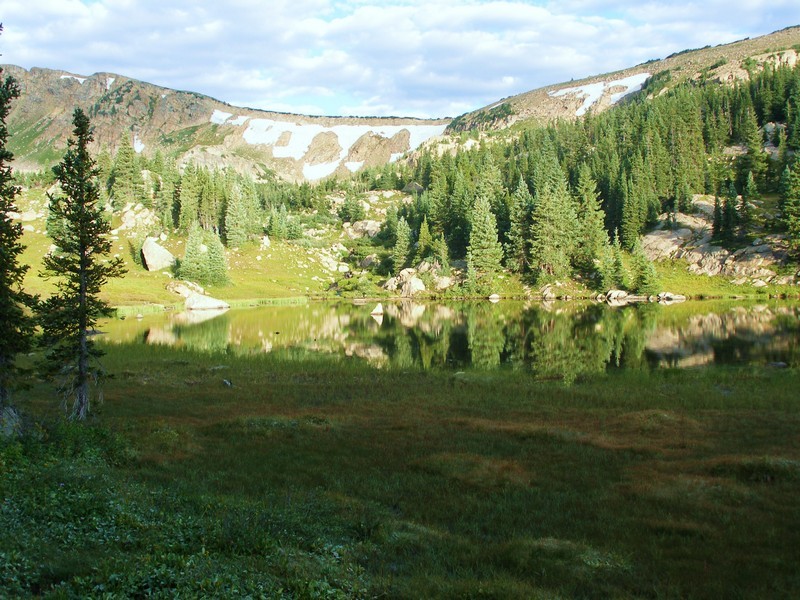
This is a beautiful area and a great way to start the hike. We had to decide where to ascend the ridge facing us (leaving the trail), narrowing our decision to 2 obvious saddles. We picked the northern most point, which was the apparent low spot in the ridge. Looking back toward Windsor Lake on top of the ridge: A very pretty place.
It turned out this was probably not the correct access point, however, as the ridge quickly turned into a big boulder scramble, requiring Class 4 moves in places. Havin' fun in the rocks!
We should have gone up the more southernly (toward Massive) saddle to avoid the scramble, but we actually had a lot of fun in this area. It just slowed our progress somewhat.
Finally, we see our task before us: the Mt. Massive and it's approach. A peek at what awaits us.
Our first "14er" is Point 14,169, which isn't that much to behold, but affords a nice view toward N. Massive.
Coming down N. Massive was an interesting scramble, allowing some variation to a long ridge walk. A little route finding here, but not bad...
Unfortunately, it was here I had a bit of a mishap. Cody, ahead of me, started across a snow/ice slope which had some old footsteps from a previous hiker. Normally, I carry an ice ax for just such occasions, but didn't bring one on this climb thinking we wouldn't encounter any snow. After Cody successfully made it almost all the way across, I picked up a triangle-shaped rock for a makeshift self-arrest tool, took 2 careful steps onto what turned out to be very hard refrozen snow, and slipped. My rock helped slow me at first, but either I lost the rock or the slope steepened, I started gaining speed and realized I was about to hit large rocks below. So, I dug in my heels and fingertips (which are now slightly shorter), bent my knees to prepare for impact, and hit a big rock on my right hip, flipping me into the air and tumbled to a stop. After checking myself for any bones sticking out (none) or bleeding (some), I took this photo of my slide: Big rock on the left had my name on it.
I'd say it was about an 80' drop to where I landed. The rest of our group rightfully decided this was not the best way, and found a way around the snow field. Now I just had to somewhat painfully return to the ridge and continue to Mt. Massive's actual summit. Almost there...
Finally, we make the true summit Sweet summit. My hip sure hurts.
We continued on to S. Massive S. Massive on the way!, but after this summit Cody contemplating the view off S. Massive, we were getting pretty tired and the blisters were talking, Happy but getting a bit tired now. so instead of continuing on to Point 13,630 and Point 12,381, we descended a drainage due east between S. Massive and Pt. 13,630 to intercept the Colorado Trail and our return to the car We went down on the left side of this slope.. Total time on the mountain was about 13 hours. SO, not quite all of Massive Mania, but with all 5 summits over 14,000' in hand, not a bad day either, in spite of the near-SAR moment. On that note: I will no longer attempt to cross hardened snow/ice without a proper ice ax. Either I'll have one or I'll find a way around next time.
Thumbnails for uploaded photos (click to open slideshow):
Comments or Questions
Caution: The information contained in this report may not be accurate and should not be the only resource used in preparation for your climb. Failure to have the necessary experience, physical conditioning, supplies or equipment can result in injury or death. 14ers.com and the author(s) of this report provide no warranties, either express or implied, that the information provided is accurate or reliable. By using the information provided, you agree to indemnify and hold harmless 14ers.com and the report author(s) with respect to any claims and demands against them, including any attorney fees and expenses. Please read the 14ers.com Safety and Disclaimer pages for more information.
Copyright: Route information, text, risk factors, maps, GPX files, charts, photos, 14ers.com-created map imagery, flythroughs, and other content provided in this route description are copyrighted by 14ers.com and may not be copied, reproduced, republished, distributed, modified, or used to create derivative works without prior written permission.
Please respect private property: 14ers.com supports the rights of private landowners to determine how and by whom their land will be used. In Colorado, it is your responsibility to determine if land is private and to obtain the appropriate permission before entering the property.