| Report Type | Full |
| Peak(s) |
Mt. Columbia - 14,075 feet |
| Date Posted | 09/08/2011 |
| Modified | 09/15/2011 |
| Date Climbed | 09/03/2011 |
| Author | Gene913 |
| Redemption and More in the Sawatch |
|---|
The Third Time Is The CharmTrailhead: Three Elk Creek (elevation 9,260 feet) Ascent Route: East Ridge Descent Route: Southeast Ridge Departure Time: 6:00 a.m. Return Time: 7:00 p.m. Climbing Time: 13 hours Elevation Gain: approx. 5,000 feet Roundtrip mileage: approx. 11 miles Climbers: Gene913, Subway, TallBob, and TunnelVision Tried the traverse to Columbia from Harvard last summer with Chopper and AHorn but I made some serious route-finding mistakes that ultimately forced us to descend back into Horn Fork Basin without summiting Columbia. Then a second failed attempt over Memorial Day weekend this year when I tried a solo ascent but was not prepared for the deep snow and extreme wind conditions in the Three Elk Creek basin and only made it to around 11,800 feet. So here I was, back on Labor Day weekend, for a third attempt at Columbia that yielded redemption and more. Try viewing this with the large photo option if you can; some of the photos turned out pretty well Our climbing group of four got a later start than planned, not departing Kansas City until 1:30 p.m. on Friday, September 2, 2011. Stopping only for gas, we arrived at the Three Elk Creek trailhead at 11:00 p.m. We quickly put up the tent and were off to sleep for a planned wake up at 5:00 a.m. By the time we hit the well-defined trail at 6:00 a.m., there was no need for headlamps. Making great time, we covered the first 1.5 miles to the junction with the Colorado Trail in just over an hour. Our good pace continued as we followed well-defined trail to the headwall at 11,500 feet. There are no real difficulties through this part of the route, especially when it is snow-free. But, here is what it looked like on Memorial Day weekend this year. 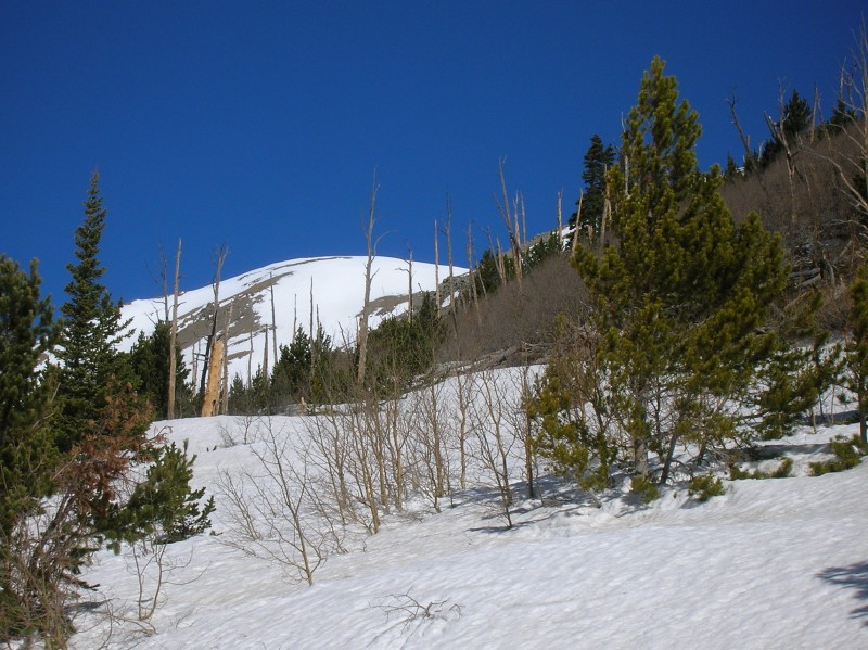 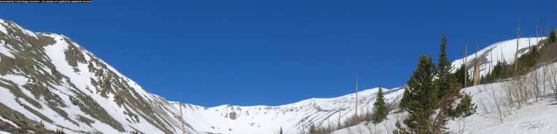  By Labor Day weekend, the scene had changed considerably. This shot was taken during the Labor Day weekend ascent. The top of the headwall is in the left center of the photo and is much different without snow cover.  After gaining the headwall, Dawson says to simply swing north and follow any likely looking route to the crest of Columbia's east ridge. Easier said then done. As the next photos show, it is a least a 35 degree slope.   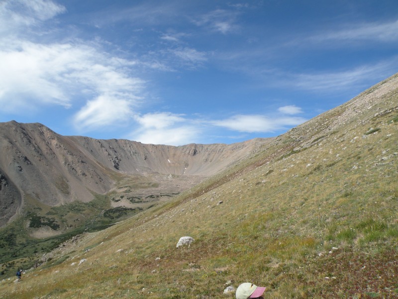 There is much work to do as you climb a mile plus from the headwall to the crest of the east ridge. This is probably the crux of the route.  Upon reaching the ridge crest at 12,600 feet, the summit is still two miles away and your next objective is the first of three false summits. Once you get the first false summit out of the way, another one looms ahead. 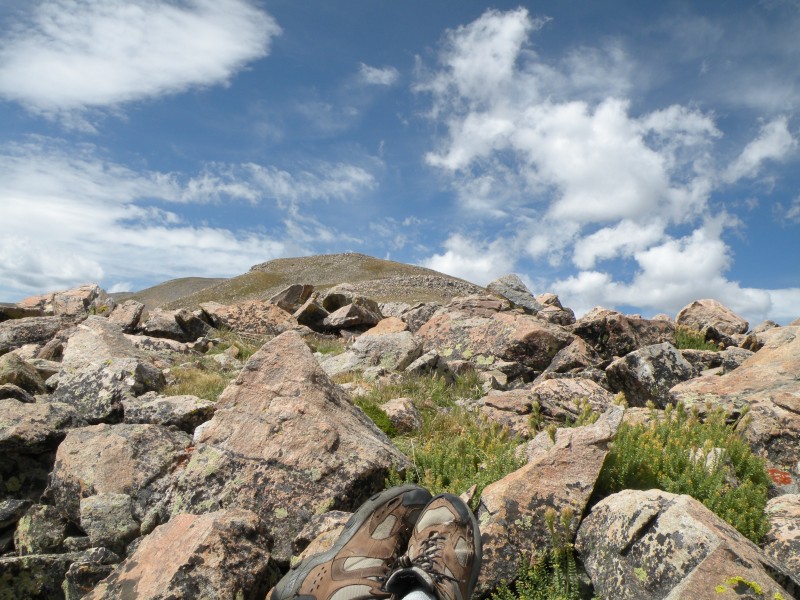 But the views only keep improving.   At this point, the composition of our four man climbing party changed. A couple from Breckenridge was charging up the slope at a faster pace than us, and TunnelVision hooked up with them. Subway was feeling the effects of no acclimation and made the decision to call it a day. We would not see him again until we got back to the car. Roach's description of "a gentle ridge" with "three false summits along the way" fails to adequately describe the task ahead.  With TunnelVision out of sight and moving at a brisk clip, TallBob and I take on the second false summit. 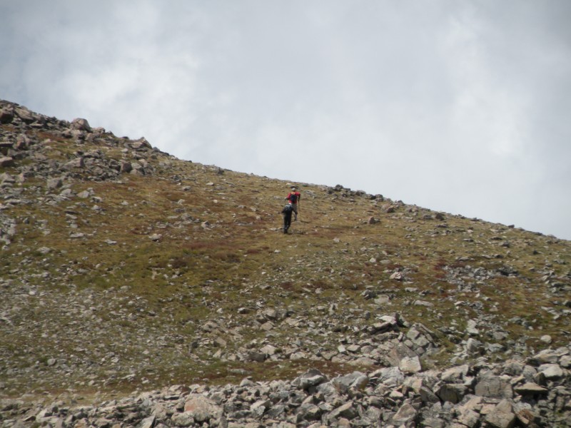 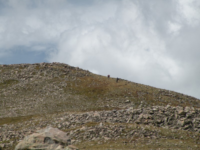 After we cleared the third and final false summit and were ready to push up to the summit, TunnelVision met us on his descent. He and the couple from Breckenridge had summited and were headed back over the three false summits, intent on going down the same way they came up. We wished them well and headed up to the summit. Your hard work is rewarded once you make the summit and look back into Three Elk Creek basin. 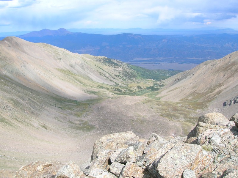  TallBob and I were not feeling particularly excited about going back over the three false summits again. We surveyed the southeast ridge from the summit and decided to give it a go on the descent.  The descent down the southeast ridge was easier than the ascent up the east ridge. For most of the first mile or so, there was a well-defined path to follow. Nothing of the kind had existed on the east ridge. Once the defined trail ceased to exist, we found easy terrain to negotiate by staying either on the ridge crest or on the descending climber's right. The one time we veered left of the crest and ran into some small, loose talus on a steep slope, we slowly traversed across it and got back on track without incident or difficulty. We stayed on the ridge crest until there was a grass covered slope to descend, which put us back into the basin just above the headwall at 11,500 feet. Once we got to the headwall, it was just an easy hike down on the same well-defined trail we had used on the ascent. It was just barely daylight when TallBob and I got back to the car at 7:00 p.m. to find that TunnelVision and Subway had already broken down the tent and were ready to go. Everyone was tired but satisfied. Three days later, the four of us climbed Yale. I have to tell you, my favorite view of Columbia is not from either the east ridge or the southeast ridge, but from the summit of Yale.  Thumbnails for uploaded photos (click to open slideshow):  Looking up Columbia's east ridge from around 11,800 feet (Memorial Day 2011)")
 Panorama of the Three Elk Creek basin from the headwall at around 11,500 feet (Memorial Day 2011)")
 Looking down on the headwall from around 11,800 feet (Memorial Day 2011)")
")
 Subway on the ascent to the crest of the east ridge (with 14ers.com baseball cap)")
 TallBob taking a break on the ascent to the ridge crest; Gene913 catching up.")
")
 TallBob and Subway on the ascent")
 Subway reclines at the first false summit and looks ahead to the next one (photo: Subway)")
 Columbia's southeast ridge as viewed from the first false summit on the east ridge; Princeton (left) and Yale (right) lur")
 Buena Vista and Arkansas River valley as viewed from first false summit on Columbia's east ridge (photo: Subway)")
 Three false summits on the east ridge as viewed from the southeast ridge")
 TallBob and Gene913 moving toward second false summit (photo: Subway)")
 TallBob and Gene913 contouring around second false summit (photo: Subway)")
 View of Three Elk Basin from the summit of Columbia")
 Panorama of Three Elk Basin with east ridge on left and southeast ridge on right")
 Southeast ridge descent route from summit of Columbia")
 My favorite view of Columbia - from the summit of Yale")
|
| Comments or Questions | |||
|---|---|---|---|
|
Caution: The information contained in this report may not be accurate and should not be the only resource used in preparation for your climb. Failure to have the necessary experience, physical conditioning, supplies or equipment can result in injury or death. 14ers.com and the author(s) of this report provide no warranties, either express or implied, that the information provided is accurate or reliable. By using the information provided, you agree to indemnify and hold harmless 14ers.com and the report author(s) with respect to any claims and demands against them, including any attorney fees and expenses. Please read the 14ers.com Safety and Disclaimer pages for more information.
Please respect private property: 14ers.com supports the rights of private landowners to determine how and by whom their land will be used. In Colorado, it is your responsibility to determine if land is private and to obtain the appropriate permission before entering the property.