Download Agreement, Release, and Acknowledgement of Risk:
You (the person requesting this file download) fully understand mountain climbing ("Activity") involves risks and dangers of serious bodily injury, including permanent disability, paralysis, and death ("Risks") and you fully accept and assume all such risks and all responsibility for losses, costs, and damages you incur as a result of your participation in this Activity.
You acknowledge that information in the file you have chosen to download may not be accurate and may contain errors. You agree to assume all risks when using this information and agree to release and discharge 14ers.com, 14ers Inc. and the author(s) of such information (collectively, the "Released Parties").
You hereby discharge the Released Parties from all damages, actions, claims and liabilities of any nature, specifically including, but not limited to, damages, actions, claims and liabilities arising from or related to the negligence of the Released Parties. You further agree to indemnify, hold harmless and defend 14ers.com, 14ers Inc. and each of the other Released Parties from and against any loss, damage, liability and expense, including costs and attorney fees, incurred by 14ers.com, 14ers Inc. or any of the other Released Parties as a result of you using information provided on the 14ers.com or 14ers Inc. websites.
You have read this agreement, fully understand its terms and intend it to be a complete and unconditional release of all liability to the greatest extent allowed by law and agree that if any portion of this agreement is held to be invalid the balance, notwithstanding, shall continue in full force and effect.
By clicking "OK" you agree to these terms. If you DO NOT agree, click "Cancel"...
With 20 14ers down but only one Sawatch peak checked (Elbert) I figured it was time to get cracking on this range. My schedule this weekend only allowed for one day of climbing, and I figured Belford - Oxford - Missouri would be a great way to knock off a few peaks while getting some fun trail running and elevation in. I met Dave (awesome guy and great climbing partner!) after posting in the forum, and we left the Morrison / 470 Park n Ride at 8pm on Saturday evening for the Missouri Gulch trailhead.
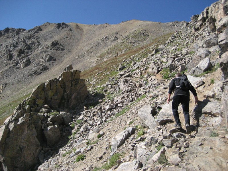
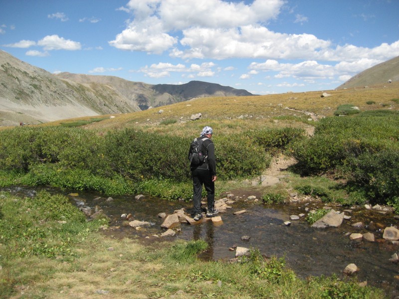
Dave slept in his Subaru while I bedded down just outside the parking lot (not knowing that there is no overnight camping allowed here, the sign was hidden in the darkness but be aware of this in the future). We woke up at around 4:15am and rolled up the trail around 4:45am. It switchbacks steeply up into Missouri Gulch before breaking treeline and leveling out. There is a nice creek running through here and many people were camped along the trail. The NW shoulder of Belford was in front of us and it looked steep; the amount of elevation gain remaining was significant, (sorry, still too dark for photos).
We started up the good switchbacks out of the gulch and gained elevation quickly.
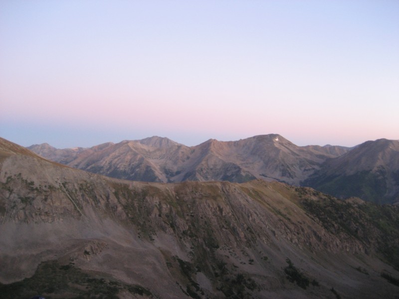
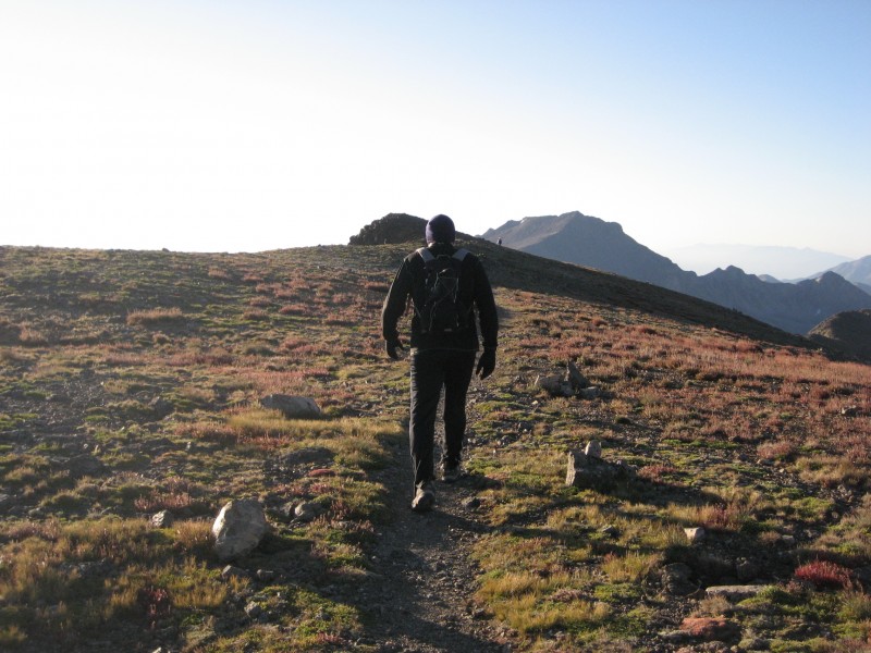
A pretty morning in the Sawatch
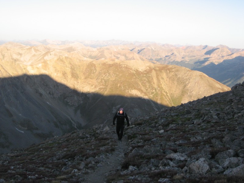
Dave coming up the switchbacks
While the terrain is somewhat steep, the trail is good and the switchbacks minimize the challenge. We approached the Belford summit block quickly and the day was off to a great start.
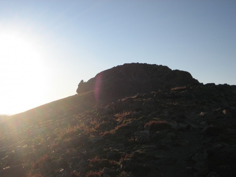
Belford summit block
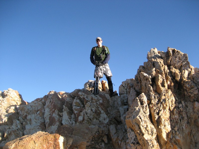
We reached the top of Belford at 7:15am, 2 hours 30 minutes after leaving the parking lot.
Summit of Belford
Dave heading toward Oxford
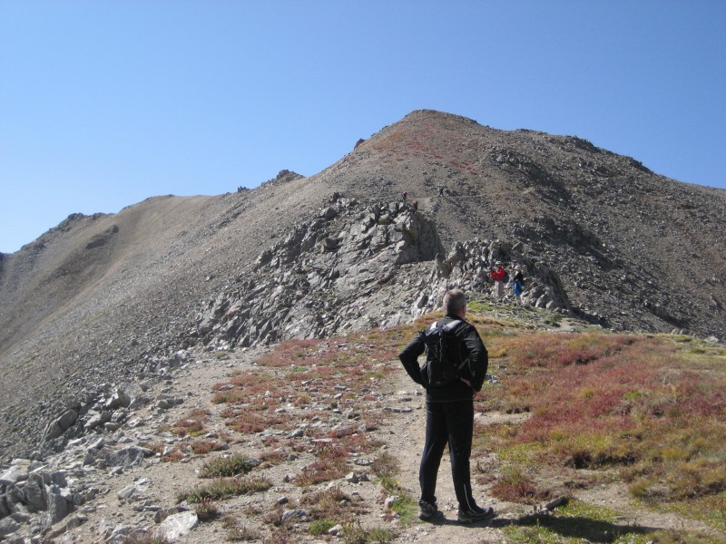
We took a 10 minute break on top of Belford and then started down to Oxford. The trail was somewhat loose and steep in places but nothing challenging, and it quickly mellowed out for an easy hike up to the Oxford summit. It took us 45 minutes to get from Belford to Oxford
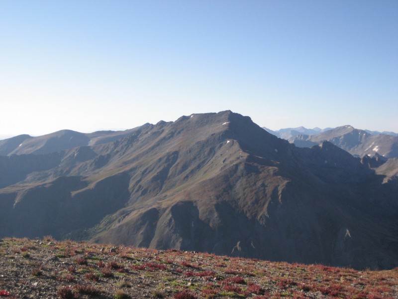
Harvard from the route over to Belford
Easy hiking up to Oxford
Looking back to Belford from the Oxford summit
Dave on top of Oxford
Oxford summit
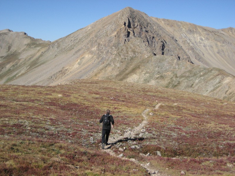
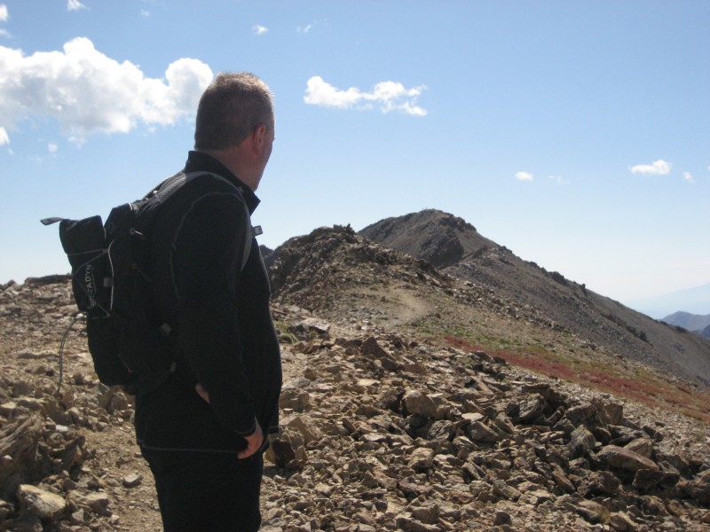
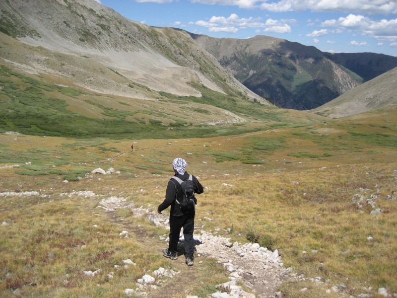
We left Oxford after a short break as we wanted to grab Missouri as well. Climbing back to Belford, we decided to skirt the summit and take the trail toward Elkhead Pass before dropping into the basin and climbing the other side on Missouri's standard route. This proved to be a great decision as it minimized our elevation loss all while allowing for fun trail running in the high alpine. I had read reports of people descending toward Elkhead Pass and then continuing up the ridge or South Slopes of Missouri, and the rock in these areas is known to be very loose so we were both against going in this general direction.
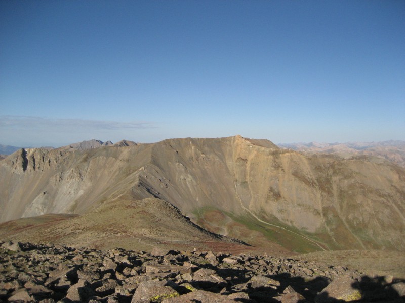
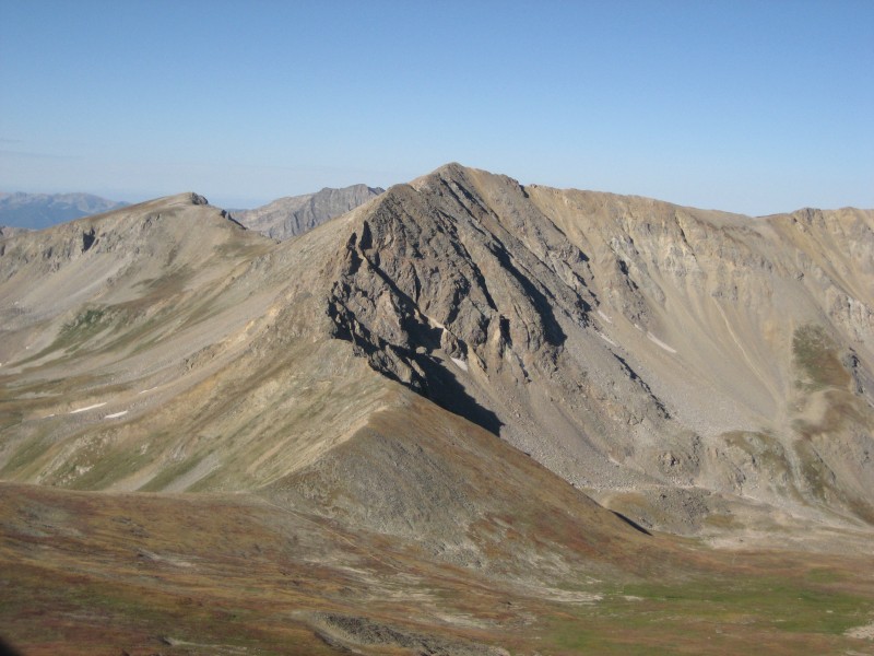
Looking at Missouri from below Belford
We ran from near the Belford summit all the way into the basin, where we filtered water before ascending Missouri.
Dave running toward Elkhead Pass
Nearing the trail junction
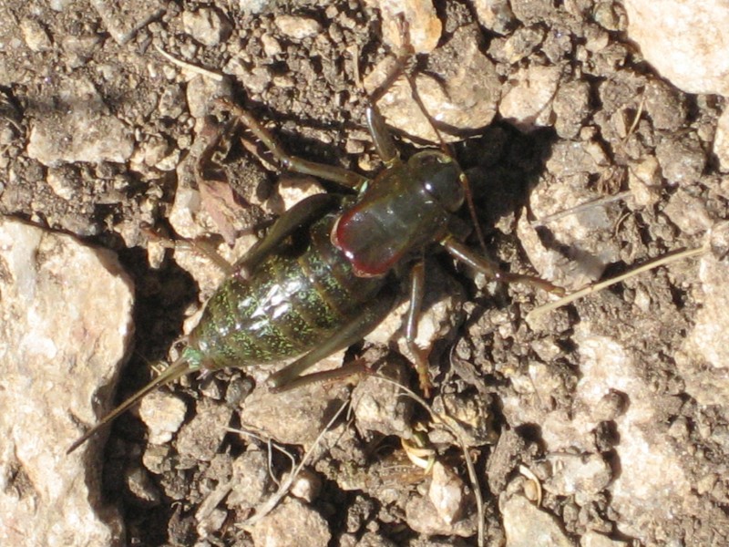
There were a TON of crickets along Missouri's standard route, some of them were pretty loud and big!
Cricket!!!
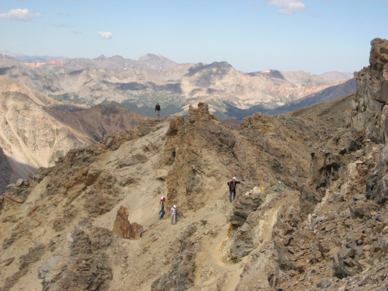
The standard route of Missouri uses easy, rocky switchbacks to gain the ridge just north of the peak.
Typical hiking below the ridge
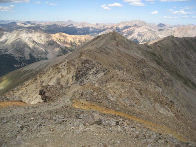
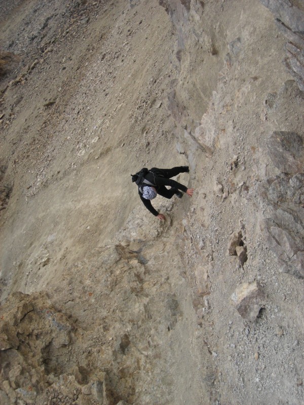
Once reaching the ridge on Missouri, the standard route is easy to follow and pretty straightforward. There are a few spots where the terrain is loose, small scree (my trekking poles were helpful), but nothing too challenging. One section that must be downclimbed on the ascent and then climbed up on the ascent (hopefully that makes sense), featured 15 feet of relatively steep scree, but I was able to find good foot holds. If you have experience walking on scree it's not a big deal (see photo #22). Looking up Missouri's standard ridge
Dave looking up the ridge
Looking down the ridge from near the summit
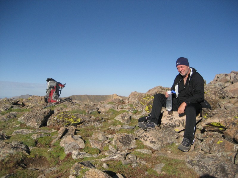
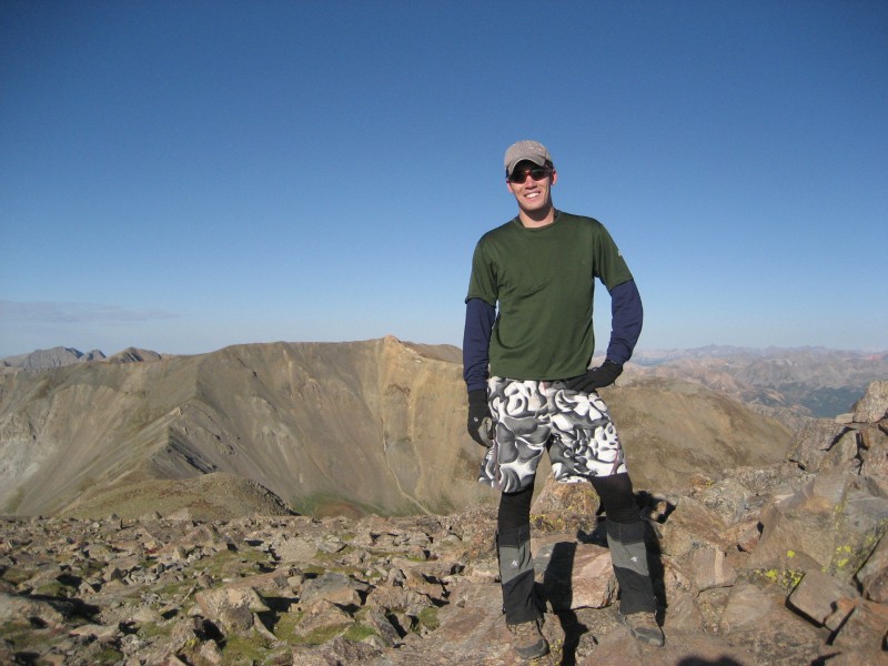
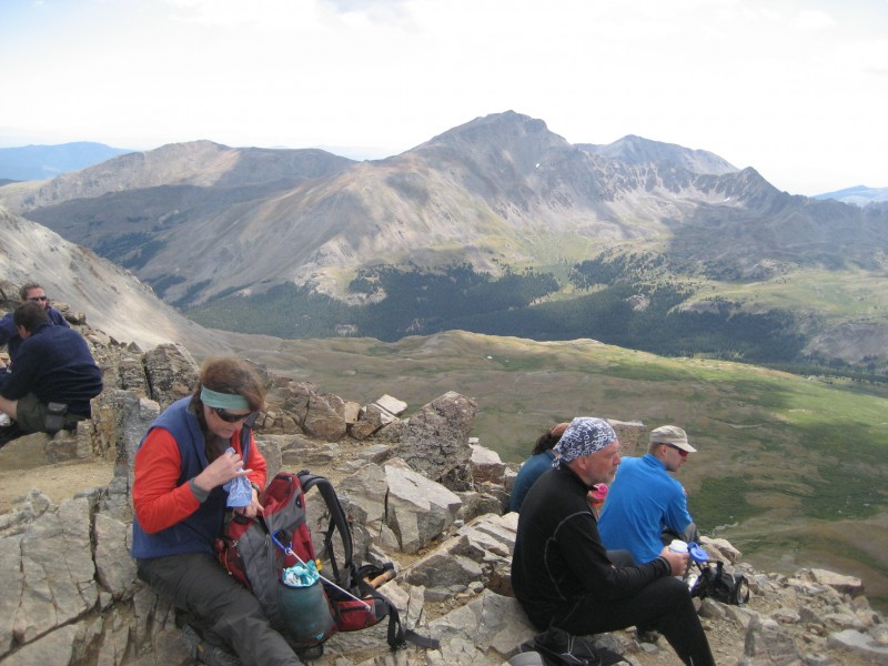
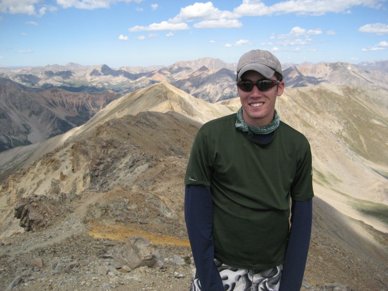
Summit crew
Summit shot
We took a few minutes on top of Missouri before descending. The route back was easy to follow and many folks were coming up with the good weather forecast.
Looking along the ridge with the loose sections
Dave coming up the loose section (for some reason I can't get the photo to rotate, but hopefully you can get an idea of t
Cruising out through the basin
Thoughts of food and beer...
All in all this was an awesome dayhike with a great partner. I'll go ahead and agree with what others have said though, it's not for everyone as the elevation gain is pretty good, (looks like about 7300' of gain in ~14 miles round trip). Despite this, the entire route was on good trails and strong legs and lungs are the best tools for knocking these three peaks off in a single loop.
We stopped at Quincy's Steakhouse in Buena Vista for some filets before heading back to Denver and Boulder respectively. Dave, it was great meeting and climbing with you!
If anyone has any questions about this route or these peaks as a dayhike, feel free to PM me.
Thumbnails for uploaded photos (click to open slideshow):
Nice work. I hiked Missouri Mtn that same morning. When we got to the top, someone was raving about a couple of guys who had run up Belford, Oxford and Missouri in 8 hrs. He was quite impressed. We must have just missed you.
When I heard the guy telling the story I was jealous. Reading your recap, makes me even more envious. A problematic achilles killed my running in the summer, so Imogene this weekend is out. Hearing and reading about your run, makes me itching to get out do a serious trail run.
...this past weekend and thanks for this excellent report: gonna try to tackle this trifecta at speed in a couple weeks, though there's no chance I'll be as quick on the downhill as you and Dave!
--Glenn
Caution: The information contained in this report may not be accurate and should not be the only resource used in preparation for your climb. Failure to have the necessary experience, physical conditioning, supplies or equipment can result in injury or death. 14ers.com and the author(s) of this report provide no warranties, either express or implied, that the information provided is accurate or reliable. By using the information provided, you agree to indemnify and hold harmless 14ers.com and the report author(s) with respect to any claims and demands against them, including any attorney fees and expenses. Please read the 14ers.com Safety and Disclaimer pages for more information.
Please respect private property: 14ers.com supports the rights of private landowners to determine how and by whom their land will be used. In Colorado, it is your responsibility to determine if land is private and to obtain the appropriate permission before entering the property.