| Report Type | Full |
| Peak(s) |
Quandary Peak - 14,272 feet |
| Date Posted | 08/28/2011 |
| Date Climbed | 08/27/2011 |
| Author | shadez |
| Quandary via the west ridge |
|---|
I have been crazy busy between work and school this year and haven't had the opportunity to get high until this weekend. I had planned the west ridge of Quandary last summer, but didn't get it in before there was snow on the route. So I decided that this was the opportunity I had been looking for and capitalized on it. I arrived at the dam at about 0800 thinking this was a 4 mile hike that I could knock out by noon and be back in the truck... one word describes that assumption - FAIL. Be it lack of conditioning since I haven't gotten any hiking in this year, difficulty with route finding on the ridge itself, old age LOL whatever... I didn't see the truck again for quite sometime. Once you cross over the dam you get a look at the beginning of the trail, I had read that people had trouble finding the main trail, but had no problems with it myself, although there are a few places where it "disappears" into willows. The wildflowers are in full bloom, and for me getting out on the trail is as much about appreciating the beauty as it is gaining the summit. 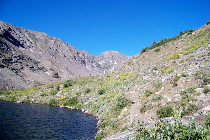 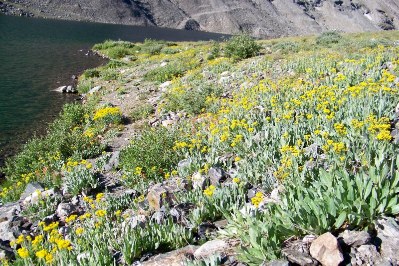  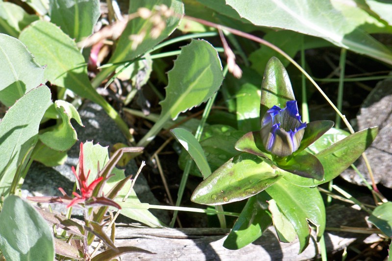 A couple hundred yards up the trail is a new (?) sign warning that this isn't the standard walk up trail on Quandary.  A look back towards the parking area... I was very taken with just how beautiful the area was. 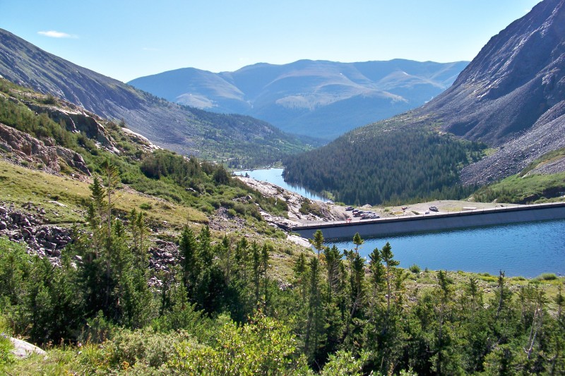 A little ways up the trail you come to the first of two basin areas.  Above the first basin there is still a bit of snow in places and waterfalls galore. I was surprised that it was still so wet up there. The above normal snow pack this winter and the monsoon season have really made "spring" last A LOT longer in the basin then I would have expected.  Once you reach the second basin the climb up to the saddle you are looking for becomes very obvious. I could see storms brewing to the west, something I would have to stay very aware of, 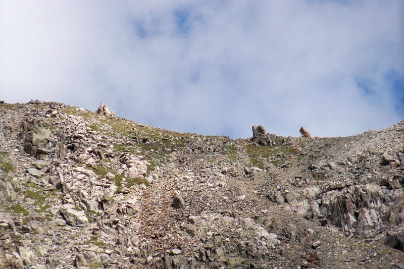 I think this ridge goes to Fletcher but I'm not sure... either way it is an AWESOME looking climb. 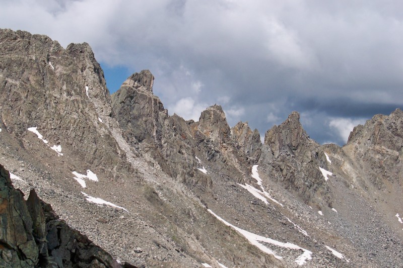 From the top of the saddle you get your first look at the false summit and the ridge, most of this section of the ridge is easy hiking/scrambling.  False summit from further up the ridge  About the time I reached the false summit the clouds started to roll in and I knew it would be a race for the summit... decision time finish the trip up or start back down. I opted to press on and promised myself if the looming clouds even hinted at lightening I would reconsider. I pressed onward watching the clouds off to the west over my shoulder for the rest of the trip.  About the time I got to the more technical section of the trip it started to rain... still no sign of lightening although there were a few rumbles of thunder. The storm looked small and fast moving and I hadn't seen a single flash while watching it approach. I weighed my options and decided to press on. Then came the hail... and the graupple... I donned my rain jacket and considered the prospect of the cracked wall and the crux section being slick from the rain and I continued. The rain/hail/graupple was in fact short lived maybe 20 minutes or so and by the time I reached the cracked wall I was dry again. 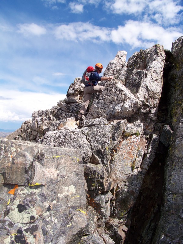 For me the down climb off the back side of the cracked wall was the sketchiest part of the trip... the lines up the cracked wall seemed obvious to me and were fairly easy class three climbing, but the down climb on the back side was a little harder to decide as you couldn't really tell what was below you until you made a move down and re-evaluated your line each time. The exposure in this area is pretty significant as well, and on slick rock... well lets just say the pucker factor was up there a bit. After down climbing the back side of the cracked wall, the final crux section was obvious, there are "steps" to the left that make the first half of wall fairly easy, a few moves later and I found myself on top. There had been a few other hikers I met on the trail that had planned on attempting the west ridge route, but they decided to bail at this point, the final crux section was more than they were prepared for. I wished them well and a safe trip down and continued. 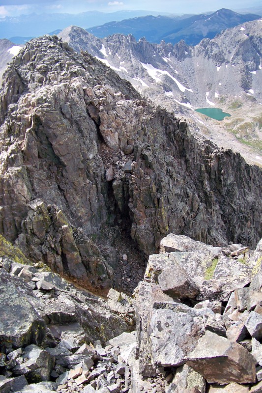 From the top of the crux section the summit is a hop, skip and jump. 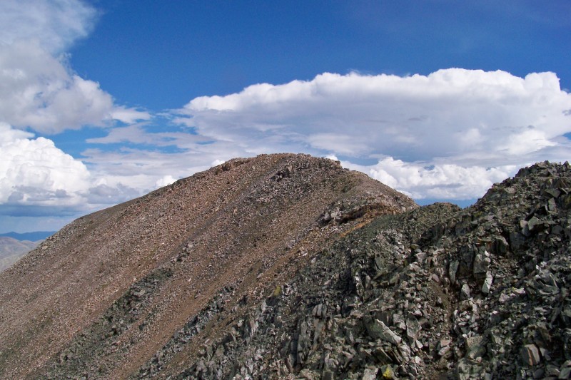 The view from the summit didn't disappoint at all... but I was STUNNED to find the summit completely empty. Not a single person was up there, I could see people up on top during the rain storm, so I was sure that there would still be some folks enjoying the view. NOPE - Quandary with no one on the summit, surely that was one for the record books. 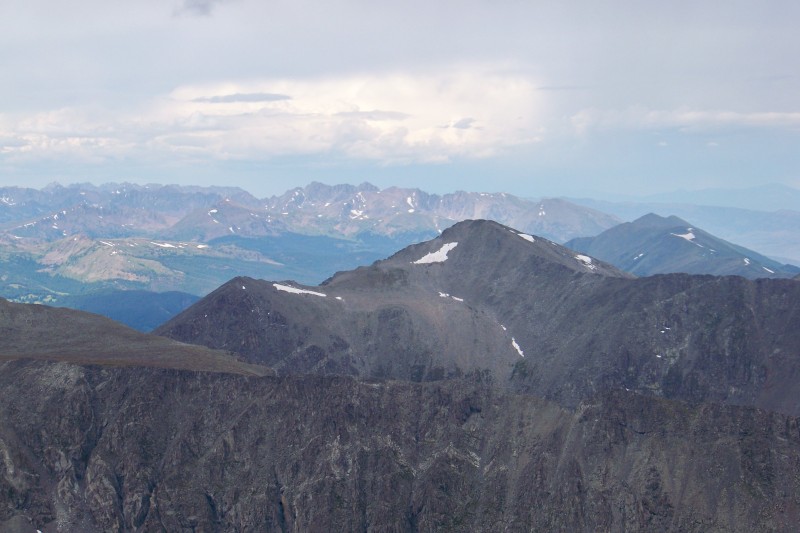    The isolation didn't last long though it wasn't long before I had some company on the summit 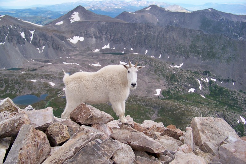 After about 30 minutes I headed back to the truck, I descended down Cristo colouir, and will say it was as challenging if not more challenging then the climb up. VERY steep and very loose rock found me on my butt more than once. It took me almost as long to get down as it did to get up which for me is unheard of... I can usually go down in 1/2 to 1/3 the time it takes me to get up. Before the Monday morning quarterbacks chime in on my decisions - I realize I may have taken a chance with the weather, and it could have turned out worse then it did, but I was up there and made the decisions based on what I saw and my comfort level. Something we all do everytime we get on trail. All told it was a great trip, and I'm excited I got to make a trip to the top of another 14er before school gets crazy again in a couple weeks. * disclaimer: for anyone reading this researching their trip up this route... While I found most of the climbing fairly easy and say that most of the route is hiking/scrambling, the two sections in the route description are serious obstacles, PLEASE don't let my description of them lull you into a false sense of security Thumbnails for uploaded photos (click to open slideshow):  Trailhead sign and Quandary in the distance")
 beginning of the trail behind the dam")
 Wildflowers in all their glory at the start of the hike")
")
")
 New (?) warning sign")
 Looking back on the trailhead from a little way up the trail")
 walking up through the first basin")
 Still VERY wet up on Quandary")
 the saddle that marks the beginning of the ridge")
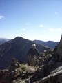
 AWESOME looking ridge... May have to tackle this bad boy someday")
 First look at the ridge and flase summit")
 Closer look at the false summit")
 False summit still offers gorgeous views")
 Tackling the first of the challenging obsticles")
 Looking back down from the top of the crux section")
 Actual summit after tackling the crux")
 Summit views")
 looking back down to the dam and parking area from the summit")
 Empty summit to the west and yet more rain")
 Empty summit to the east")
 it was bound to happen... you dont get to enjoy isolated summits for long LOL")
|
| Comments or Questions | ||||||
|---|---|---|---|---|---|---|
|
Caution: The information contained in this report may not be accurate and should not be the only resource used in preparation for your climb. Failure to have the necessary experience, physical conditioning, supplies or equipment can result in injury or death. 14ers.com and the author(s) of this report provide no warranties, either express or implied, that the information provided is accurate or reliable. By using the information provided, you agree to indemnify and hold harmless 14ers.com and the report author(s) with respect to any claims and demands against them, including any attorney fees and expenses. Please read the 14ers.com Safety and Disclaimer pages for more information.
Please respect private property: 14ers.com supports the rights of private landowners to determine how and by whom their land will be used. In Colorado, it is your responsibility to determine if land is private and to obtain the appropriate permission before entering the property.