Download Agreement, Release, and Acknowledgement of Risk:
You (the person requesting this file download) fully understand mountain climbing ("Activity") involves risks and dangers of serious bodily injury, including permanent disability, paralysis, and death ("Risks") and you fully accept and assume all such risks and all responsibility for losses, costs, and damages you incur as a result of your participation in this Activity.
You acknowledge that information in the file you have chosen to download may not be accurate and may contain errors. You agree to assume all risks when using this information and agree to release and discharge 14ers.com, 14ers Inc. and the author(s) of such information (collectively, the "Released Parties").
You hereby discharge the Released Parties from all damages, actions, claims and liabilities of any nature, specifically including, but not limited to, damages, actions, claims and liabilities arising from or related to the negligence of the Released Parties. You further agree to indemnify, hold harmless and defend 14ers.com, 14ers Inc. and each of the other Released Parties from and against any loss, damage, liability and expense, including costs and attorney fees, incurred by 14ers.com, 14ers Inc. or any of the other Released Parties as a result of you using information provided on the 14ers.com or 14ers Inc. websites.
You have read this agreement, fully understand its terms and intend it to be a complete and unconditional release of all liability to the greatest extent allowed by law and agree that if any portion of this agreement is held to be invalid the balance, notwithstanding, shall continue in full force and effect.
By clicking "OK" you agree to these terms. If you DO NOT agree, click "Cancel"...
Lenawee Mtn. (Southwest Ridge) - Arapahoe Basin Ski Area
Lenawee Mtn. Southwest Ridge Ladies Climb
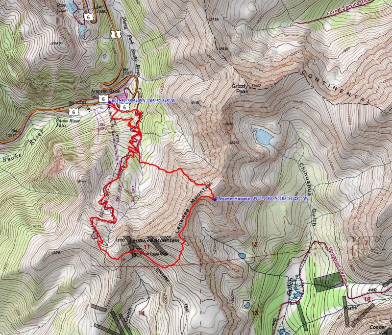
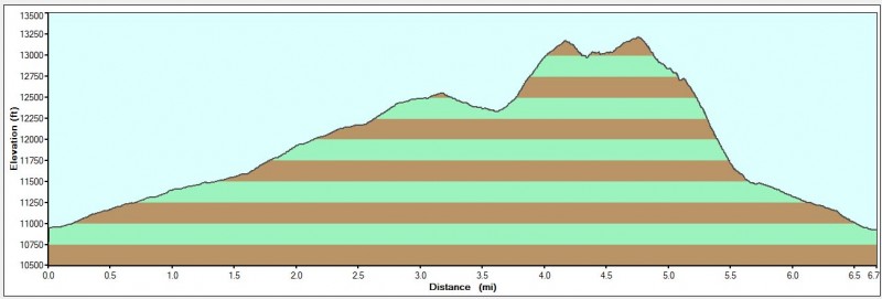
Date: Thursday, August 25, 2011 Route: Southwest Ridge from Arapahoe Basin Ski Area at 10,780'; class 2+/low 3 Stats: ~6.8 miles; 2,800' climbed; 6 hrs 30 min RT
Topo and profile of the route:
I typically don't write trip reports unless A) it is a ski/snow conditions trip report, B) it is an un-popular route, and/or C) there isn't much detailed beta out there on the route. I write this with option C in mind. Otina and I played hooky from work again Thursday and wanted something close by and relatively short. We chose Lenawee Mtn. thinking it would fit the bill. With the little time we had to research route info, we found most beta of Lenawee to be in winter, from Peru Creek, or nothing with details in summer. So we thought that it would be just a short "hike." Little did we know! I at least wanted to get the report out there for people who might have the same questions we did.
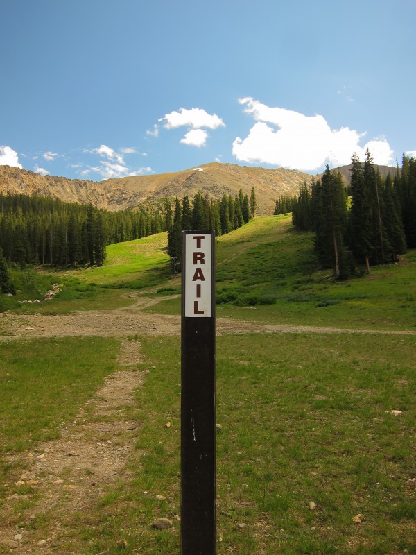
We left Boulder at 5:15am and arrived at the Arapahoe Basin parking lot for a 7:20am start. From the base area/Black Mountain Express Lift, we hiked up the well-marked trail. For some arbitrary reason, we couldn't stop talking about how cool it was to be hiking in a ski area during its off-season months. We zig-zagged through the trees and continued talking non-stop about which ski runs we've hit on this mountain (sure, hiking straight up a run would have chopped off some mileage). The funny thing was that we both felt we took more pictures at A-Basin this day that we ever did on any ski day!
Starting up the well-marked Argentine North Fork Trail from Arapahoe Basin: Photo: Otina
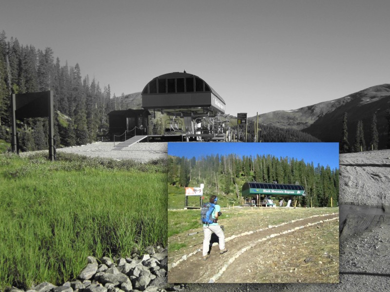
Clearly we are stoked for ski season!
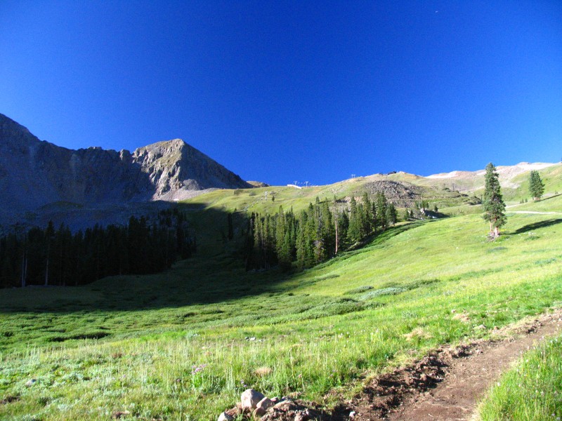
We arrive at the top of the Black Mountain Express Lift:
Looking towards the saddle where the Lenawee Mountain and Zuma Lifts meet at 12,470'. The east wall of Lenawee
starts to show (great skiing!):
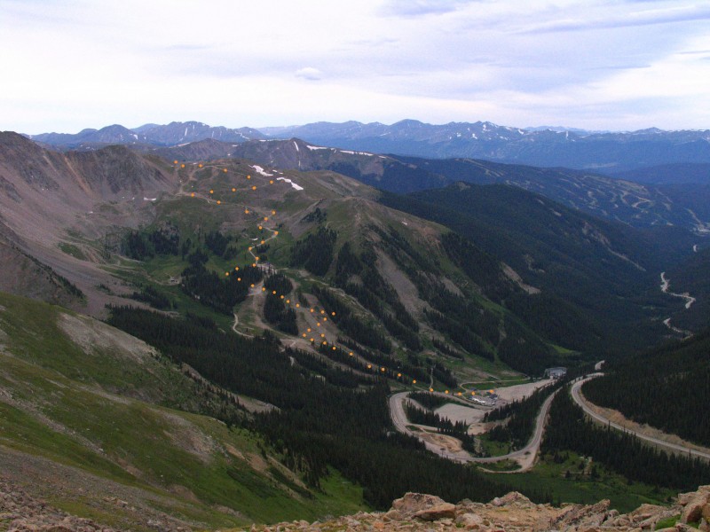
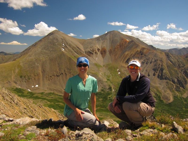
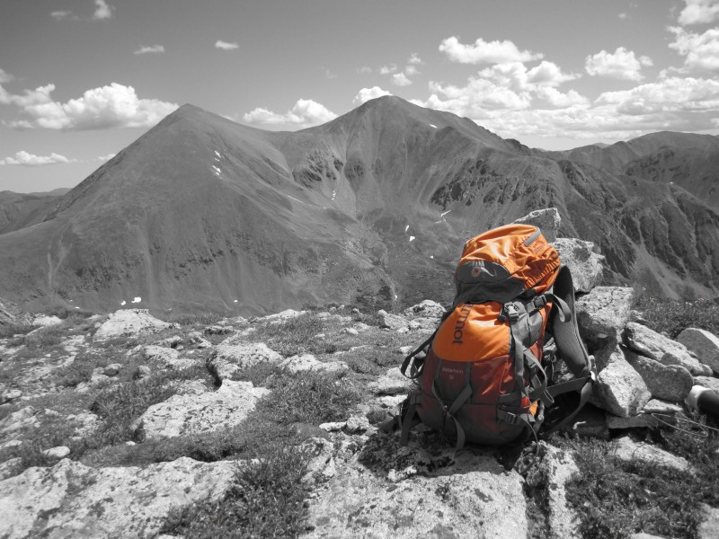
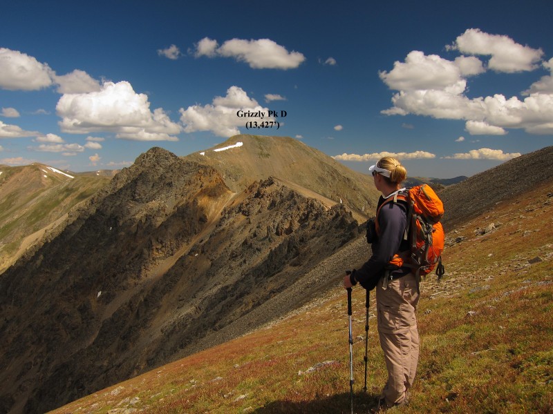
An 'aerial' view of our route leading to the top of Zuma Bowl, taken a week earlier during a hike to Grizzly Pk D:
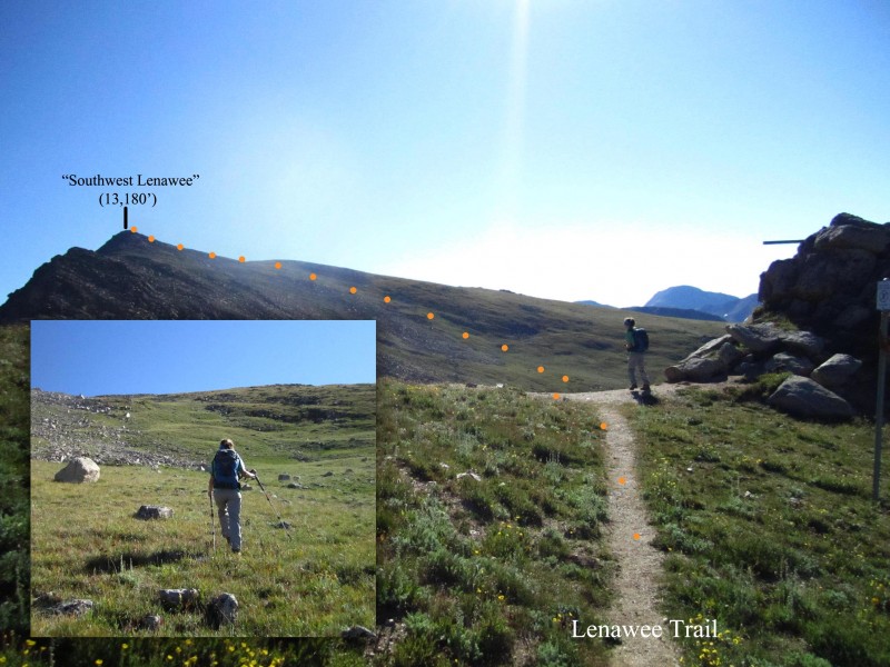
At the top of Black Mountain Express Lift, we joined with the access road and continued up that until we reached the saddle at the top of Montezuma Bowl at 12,470'. From here, we quickly joined the Lenawee Trail, heading E-SE and losing a little elevation. Near 12,300', we left the Lenawee Trail and hiked NE up a "green ramp" we saw from the saddle and then reached the top of soft-ranked "Southwest Lenawee" (13,180').
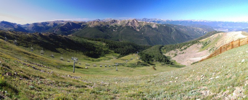
A panoramic shot looking down into Montezuma Bowl (which also offers some great skiing):
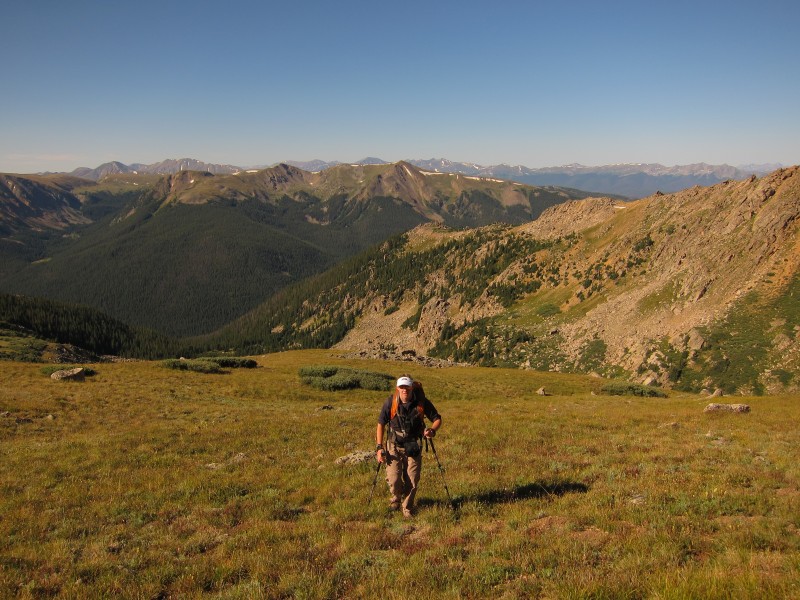
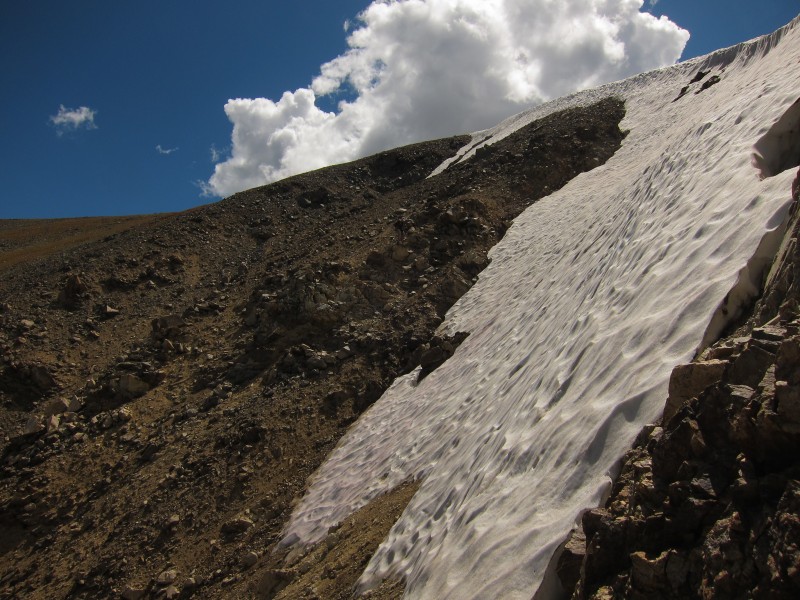
From Lenawee Trail, we slightly descended then headed Northeast at 12,300' up a "green ramp", as seen in the photo:
I climb up the "ramp": Photo: Otina
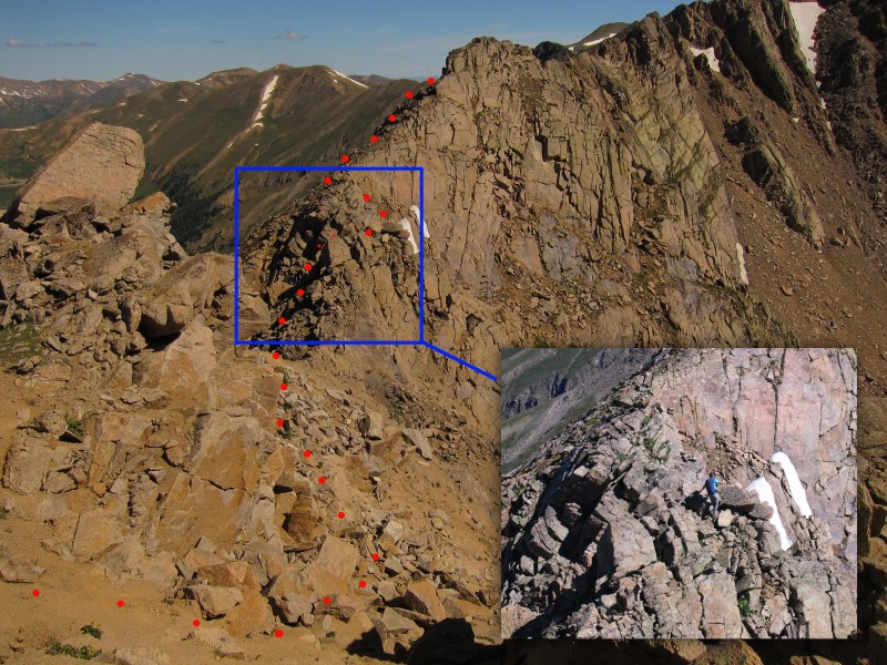
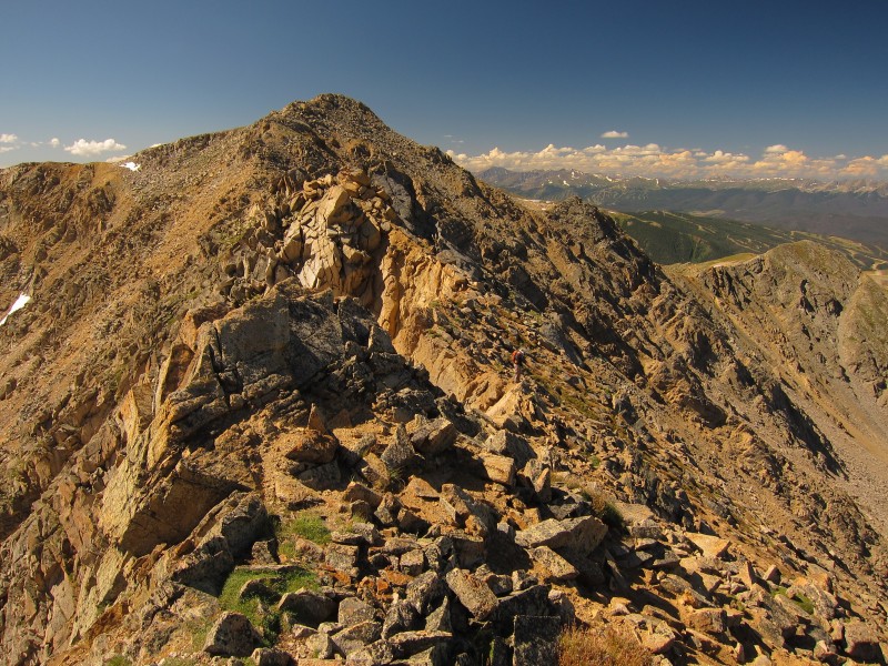
Our mindset quickly changed once we saw the remaining route from "Southwest Lenawee". The connecting ridge looked a bit dicey and somewhat exposed. Honestly, we thought we were in for a hike and when I saw this ridge, my anxiety level elevated. We decided that we wouldn't know if we didn't at least try. The descent from "Southwest Lenawee" started with a steep, loose dirt pitch. Otina went ahead to scope our route from here. So far, it went. I took my time and caught up to her. There were several rock pillars that appeared to have drop-offs. The first one we came to, we found a way around on climbers' right (east), photo below.
This ridge looks easier than it is. The first "obstacle" was the shadowed rock pillar just left of center: Photo: Otina
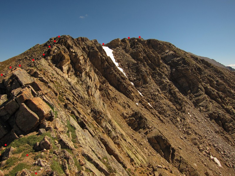
We continued on, negotiating several knobs and pillars and mostly flirting with the ridge proper. Overall, we found that staying slightly on climbers' left of the ridge offered the safest options. About half way through, exposure and terrain mellowed out a little bit. There were only a few short low class 3 sections to navigate.
Coming down a short low class 3 pitch: Photo: Otina
Looking back at the last of the rock pillar/knob sections before terrain eases: Photo: Otina
Most of the route behind us; can you spot me? Photo: Otina
The remaining (mellower) route from halfway through the ridge: Photo: Otina
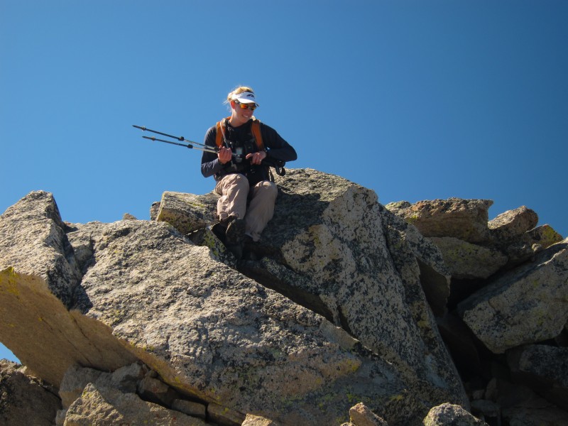
Otina gains the gentle slope to the summit:
We were on the summit at 11:20am, 4 hours after we had started (happy to be up there, but not so thrilled with the time we reached it). Although we stopped to take photos, we were surprised how long it took. We wondered why it may be easier in winter and also discussed our descent route. While there were no immediate threatening clouds, there were clouds just starting in the area and we didn't want to climb back over the ridge. We looked at contours on the GPS and decided to give a gully and ridge just N-NW of the Lenawee-Grizzly D ridge a shot. It would let us drop elevation quicker than staying on the ridge we just had climbed. A snack, several text messages and photos later, we started down a grassy slope, immediately north of Lenawee.
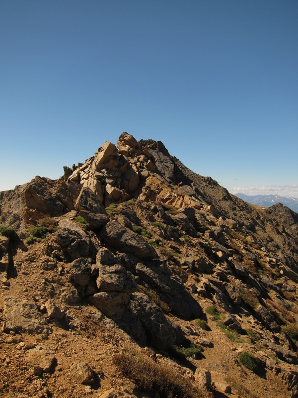
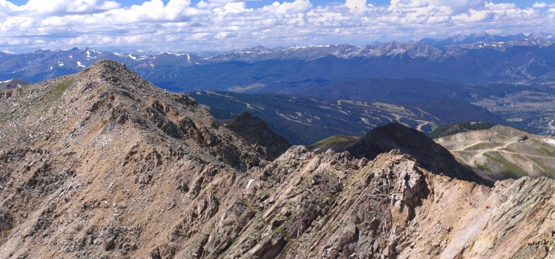
Looking back at the ridge traverse from "Southwest Lenawee". It definitely is harder than it looks:
Happy with the work done thus far; on the summit of Lenawee Mtn.:
Despite the popularity of Torreys and Grays, viewing them from different directions doesn't get old:
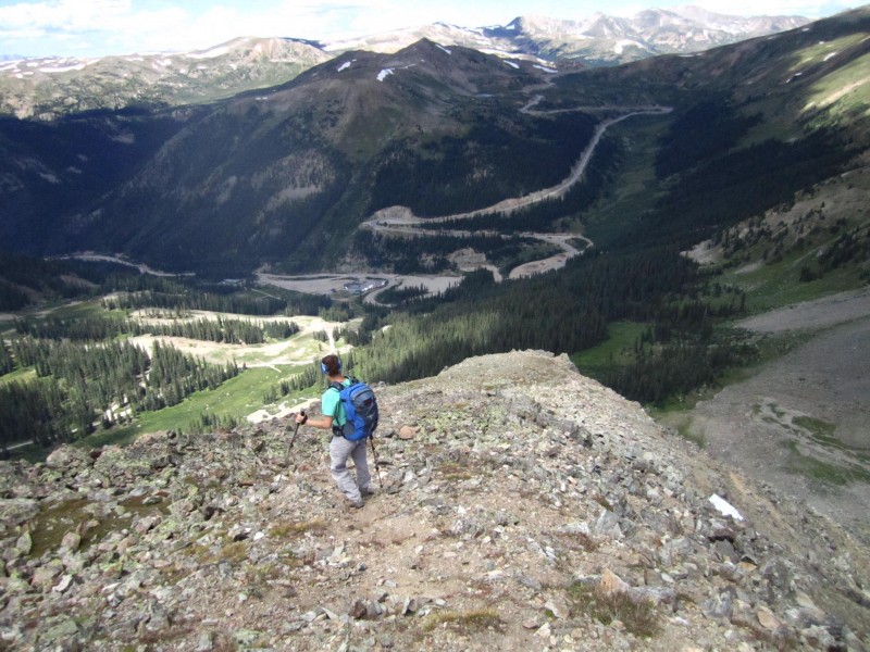
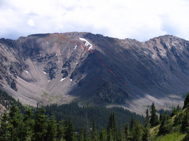
Otina and I wanted to get down as quickly as we could, so we packed up and left the summit at 11:50am. We started down the grassy slope and soon hit the first of a few unforgiving steep, loose gullies and ridges. A fall down one wouldn't be ideal. Carefully we negotiated each contour and finally reached our last ridge, looked back up at the downward progress so far, and realized it would have been much easier and faster to follow a gentle slope down just slightly more NW of the gullies we were in (I show this marked in blue on the last photo of this report). Oh well. We came to a point along the ridge where we could turn left (west) or right (east); each option had decent looking, lower-angle scree gullies we could take to get us down to flat ground. We chose the left gully at 12,330' (west), simply because it would save some mileage (it would save about 2.7 miles).
Starting the descent from Lenawee: Photo: Otina
Looking back at some of the shallow gullies we contoured (this photo doesn't do the steepness and looseness justice!): Photo: Otina
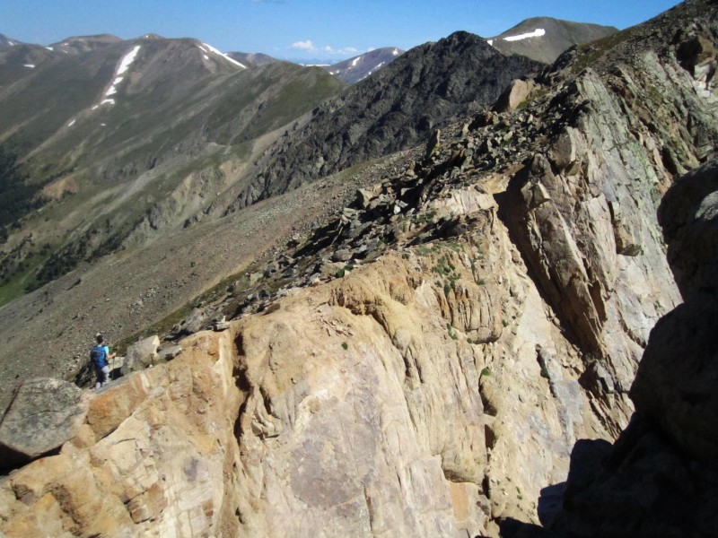
Otina makes her way down the final ridge before dropping into the gully:
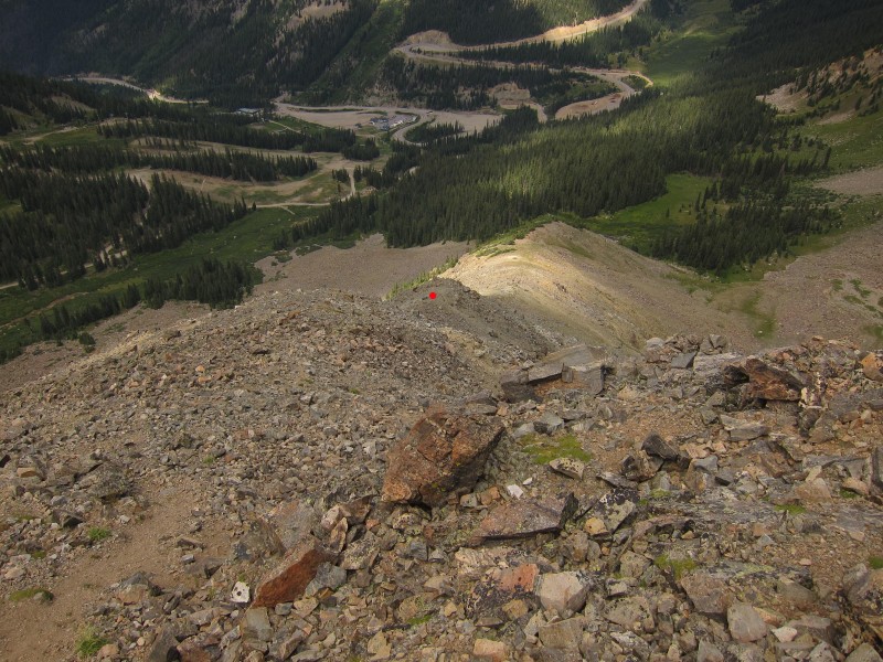
A view down the ridge before taking the west-side gully. The red dot (12,330') shows where we headed left.
You could also take the gully to the right and contour around the base of the ridge: Photo: Otina
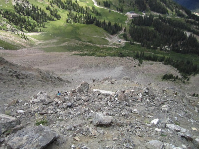
More scree and talus-surfing down the gully (also the far northern end of A-Basin's East Wall) lead us to the apron (Lower East Wall); we found quite a bit of lost ski poles and baskets! We then reached a small boulder field, crossed some willows and a shallow stream, and rejoined the access road (which I believe is part of the "Wrangler" ski run) and followed that back to the base area. It felt so good to be back on normal ground and would have been much more enjoyable to ski.
Otina descends the East Wall (west gully):
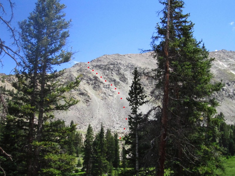
Taken from the access road, this photo shows our route down the East Wall from 12,330' along the ridge:
Our descent route (red) flirts with several small, steep gullies. Taking the route in blue would have been much easier and faster (image taken from Loveland Pass):
We returned to the car 2 hours after we left the summit at 1:50pm, and certainly happy with that descent route choice as clouds were moving in. Although Lenawee was more than we expected and bargained for, we were happy with the work done and want to get a more detailed route description out there. In short, the ridge does go, and doesn't exceed anything more than low class 3. Thanks for reading!
My GPS Tracks on Google Maps (made from a .GPX file upload):
I climbed Lenawee last weekend from Peru Creek.
I also was surprised to find C2+ to 3 on the ridge between SW Lenawee and Lenawee. It was a great hike! Lots of solitude (complete solitude)on a Saturday, and as you point out, fun to view popular 14ers (Grays/Torreys) in the area from another angle.
There is a good trail up to just above treeline on the Peru Creek side, then a gentle tundra hike to SW Lenawee.
Enjoyed the TR, pics and description from A Basin! Well done! :D Cheers!
Next time you two play hooky from work and go climb, give me a call. I'm always up for calling in sick ! :) Missed you on Friday. Friday Morning Club (FMC) just wasn't the same solo !
Great TR! Love all the draw on photos 8/29/2011 1:24am
Thanks for putting this up. That ridge was a lot of fun to route find, but I would have added another hour or so on if I would have known the difficulty.
Next time let's either add time or choose one with more beta ;) Fun either way!
Jim: when you start on 13ers, you now have a route map for it. :D
sunny1: we saw the trail, I believe it's part of the Lenawee Trail?
Vicki: I know!! Playing hooky- we'll definitely call you! Girls day out. :D
Otina: you did great route-finding, and it was a good 'boost' day for both of us!
Dad: thank you! I wish I could go to Rainier with you, but somebody (ie, you) didn't want to wait!
Caution: The information contained in this report may not be accurate and should not be the only resource used in preparation for your climb. Failure to have the necessary experience, physical conditioning, supplies or equipment can result in injury or death. 14ers.com and the author(s) of this report provide no warranties, either express or implied, that the information provided is accurate or reliable. By using the information provided, you agree to indemnify and hold harmless 14ers.com and the report author(s) with respect to any claims and demands against them, including any attorney fees and expenses. Please read the 14ers.com Safety and Disclaimer pages for more information.
Please respect private property: 14ers.com supports the rights of private landowners to determine how and by whom their land will be used. In Colorado, it is your responsibility to determine if land is private and to obtain the appropriate permission before entering the property.