Download Agreement, Release, and Acknowledgement of Risk:
You (the person requesting this file download) fully understand mountain climbing ("Activity") involves risks and dangers of serious bodily injury, including permanent disability, paralysis, and death ("Risks") and you fully accept and assume all such risks and all responsibility for losses, costs, and damages you incur as a result of your participation in this Activity.
You acknowledge that information in the file you have chosen to download may not be accurate and may contain errors. You agree to assume all risks when using this information and agree to release and discharge 14ers.com, 14ers Inc. and the author(s) of such information (collectively, the "Released Parties").
You hereby discharge the Released Parties from all damages, actions, claims and liabilities of any nature, specifically including, but not limited to, damages, actions, claims and liabilities arising from or related to the negligence of the Released Parties. You further agree to indemnify, hold harmless and defend 14ers.com, 14ers Inc. and each of the other Released Parties from and against any loss, damage, liability and expense, including costs and attorney fees, incurred by 14ers.com, 14ers Inc. or any of the other Released Parties as a result of you using information provided on the 14ers.com or 14ers Inc. websites.
You have read this agreement, fully understand its terms and intend it to be a complete and unconditional release of all liability to the greatest extent allowed by law and agree that if any portion of this agreement is held to be invalid the balance, notwithstanding, shall continue in full force and effect.
By clicking "OK" you agree to these terms. If you DO NOT agree, click "Cancel"...
Clark Peak, 12951' (CO rank 670)
2771' prominence (CO rank 26)
Jackson County Highpoint
Rahwah Wilderness Highpoint
"Lewis Peak," 12634' (CO rank 891)
5.02 miles r/t
2985' gain
Ascent party: No
Descent party: Yes
One-click photo enhancement provided by iPhoto's "enhance" button as needed
I've been putting a lot of emphasis on hiking/climbing 13ers in 2011, and, so far, it's been a good year. However, it's easy to forget that there are many other peaks of interest in this fine state that don't rise above 13 or 14k. Say what you want about keeping lists, but I've got plenty, and attention to them keeps me motivated to get out and see new things. I like exploring, seeking novelty, and I dig uncrowded hikes. After taking some flatlander friends up Kelso Mountain earlier this week and being reminded of how much I like not seeing full TH parking lots, gapers swilling New Belgium, and folks starting up a 14er at 2:30 p.m. (ignoring the clouds amassing over their target), I was ready for some solitude in an unspoiled area.
I've only lived north of Telluride for a short while and have not spent much time in the Ft. Collins area. I've been missing out, it seems. The theme for this trip focused on seeing and trying new things and I had a whole town and mountain range to try out. I left Denver and made straight for the Odell's Tap Room, which has always been a place I wished to check out. A glass of Myrcenary went down slowly and smoothly as I talked to some locals and savored the live bluegrass that lasted until 6:00 p.m. Next, I needed dinner, and I spied a Cheba Hut on my way through town. Perfect! I've always wanted to try this place, and two "pinners" added up to a fat dinner and tasty summit snack. Now, I can see what the buzz is about. I was also looking forward to the Poudre River canyon, but darkness put the kibosh on any sightseeing on the drive out toward Cameron Pass.
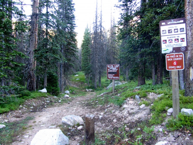
The TH for Clark Peak lies within the Colorado State Forest, just north of Gould. From CO 14, turn on to County road 41, next to a KOA.
After paying the day pass fee, I drove past Michigan Reservoir toward the turnoff for Ruby Jewel Lake.
The road to Ruby Jewel TH is a bumpy 2wd for the first 1.5 miles, where a parking area precedes a register for those wishing to take their vehicles further. From here, a hike of Clark would be a manageable eight miles r/t with 3351' gain. I chose to drive to the 4wd TH, and found the road to be rocky, but nothing challenging, save one spot which required my getting out to find a line on both the ascent and descent, but did not cause me to scrape bottom.
The road ends at a spacious parking area, with the signed Ruby Jewel Lake TH being the only obvious exit.
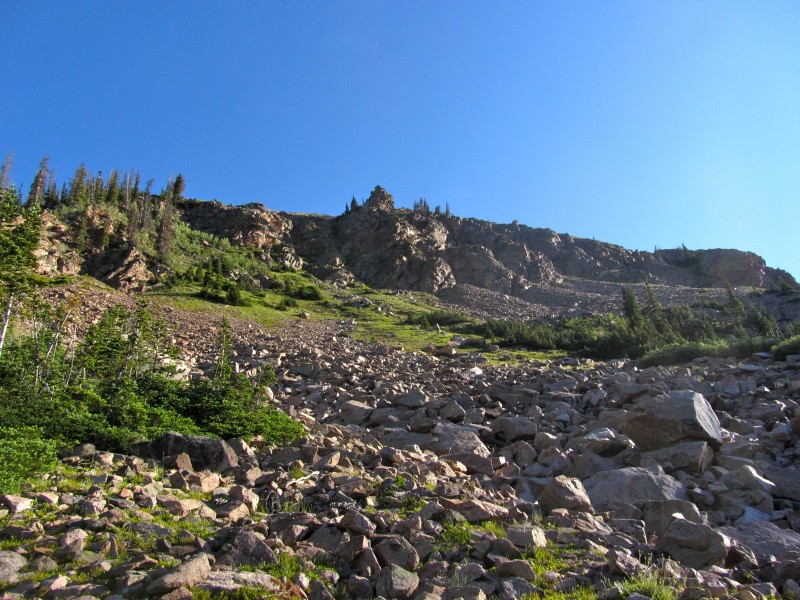
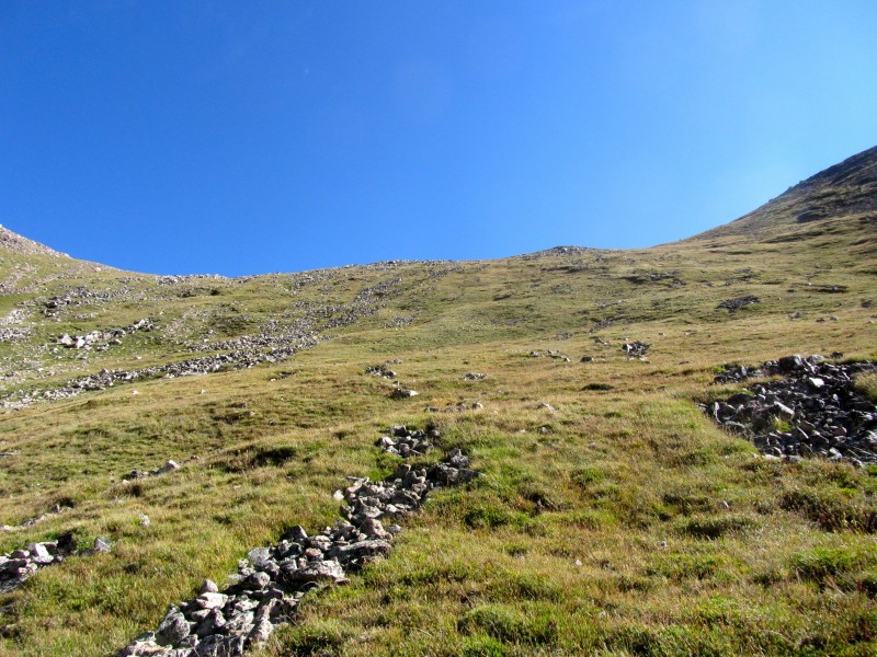
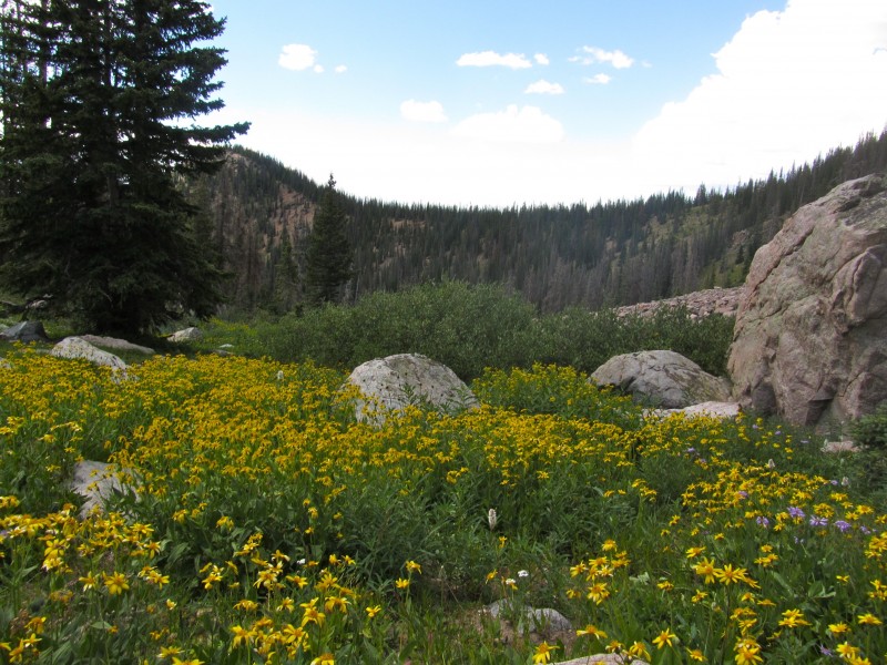
This is a nice class 1 trail that crosses the Canadian River, leads through some marshy areas into a forest, across some talus to a low treeline, and up to Ruby Jewel Lake.
It's prime moose habitat, so I was half hoping to see one, half hoping to make it out in one piece.
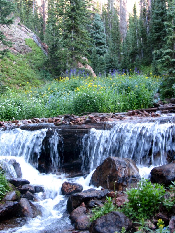
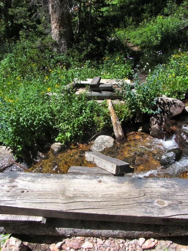
Just before the second water crossing, the trail forks: horse traffic or foot traffic. The foot trail features a nice makeshift bridge that looks at this little waterfall.
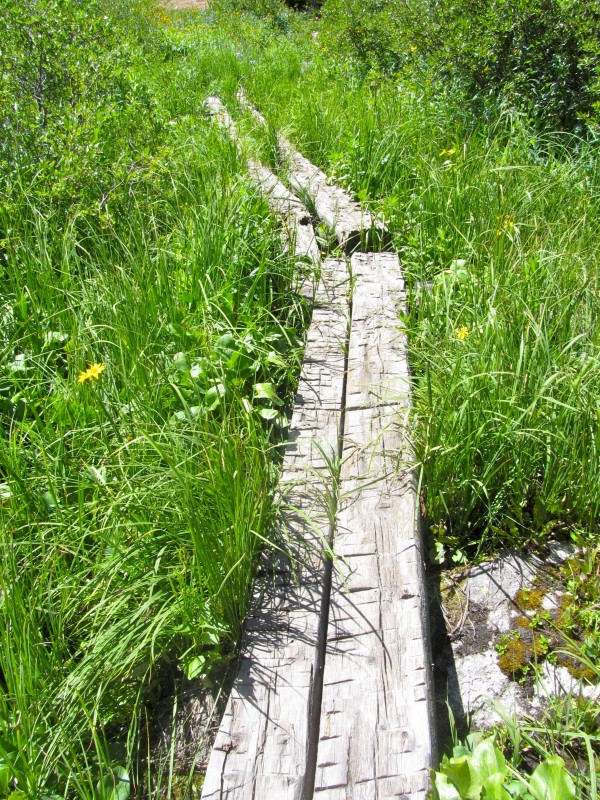
While crossing the marshy areas, I was grateful for these, which kept my feet dry:
Even though the hike had just started, it was obvious that I was in new territory.
Here are some shots from the hike up to the lake.
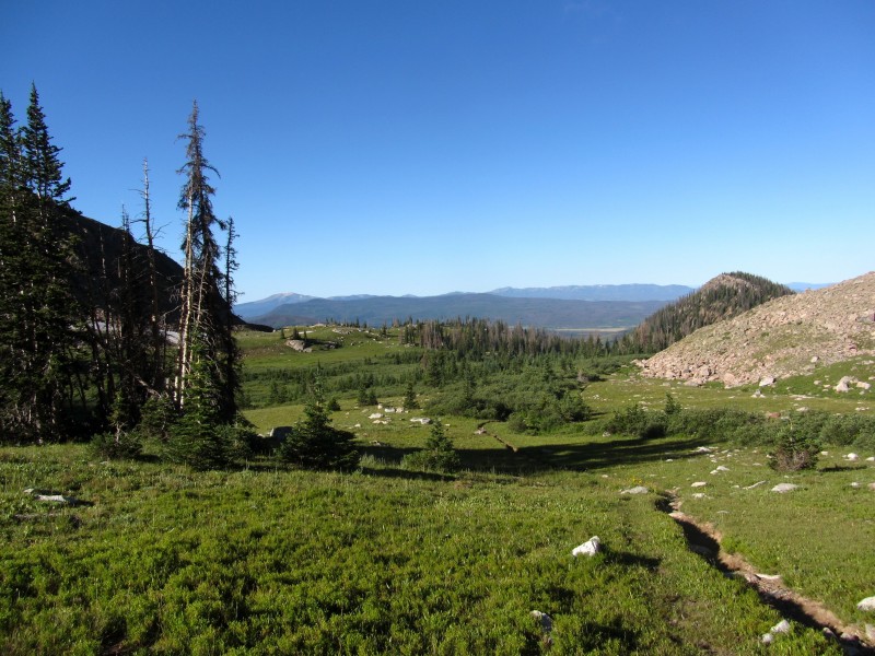
Looking back down the trail
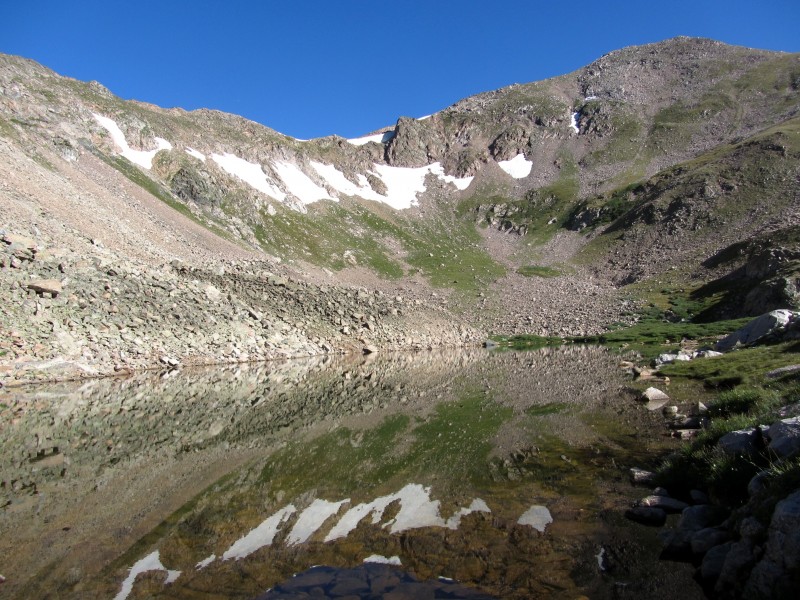
After reaching the lake, I lingered for a while, taking photos, eating some dark chocolate M&Ms, and applying sunscreen.
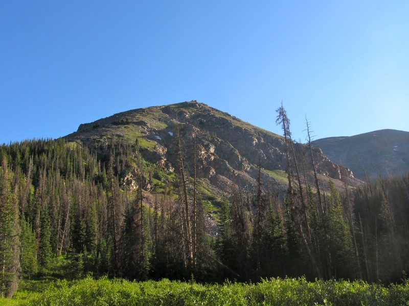
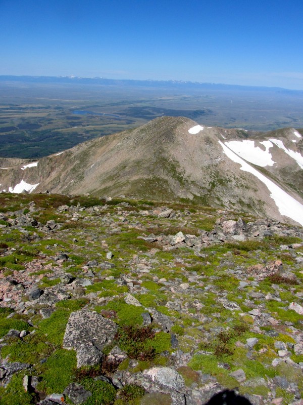
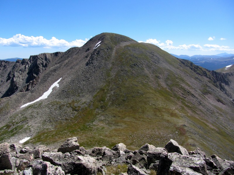
Ruby Jewel Lake with "Lewis Peak" above
Clark Peak is just out of sight, off to the right.
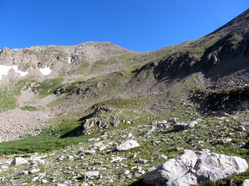
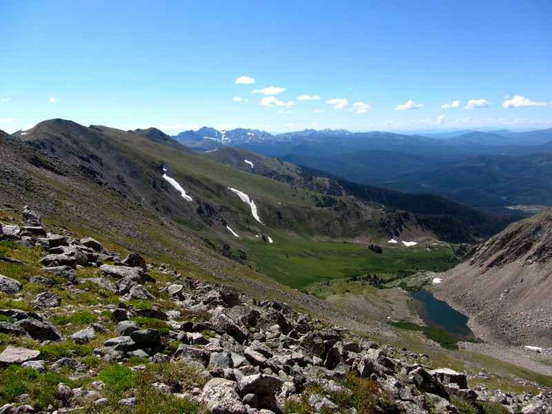
Both Colvill/Mitchler's guidebook and the SP route description offer two ascent options. The first is to head straight up Clark's steep southwest slope to just below the summit. This would be good if enough snow remained to climb, then glissade. Lacking snow, I chose to head up to the Lewis/Clark saddle via grassy slopes. It's steep, but straightforward.
About 1/2 way to the saddle
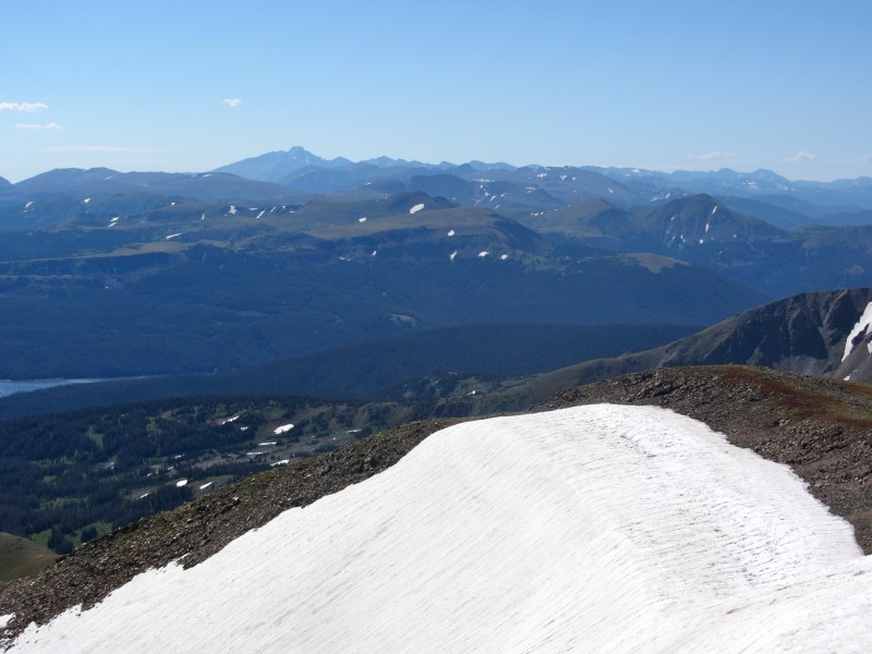
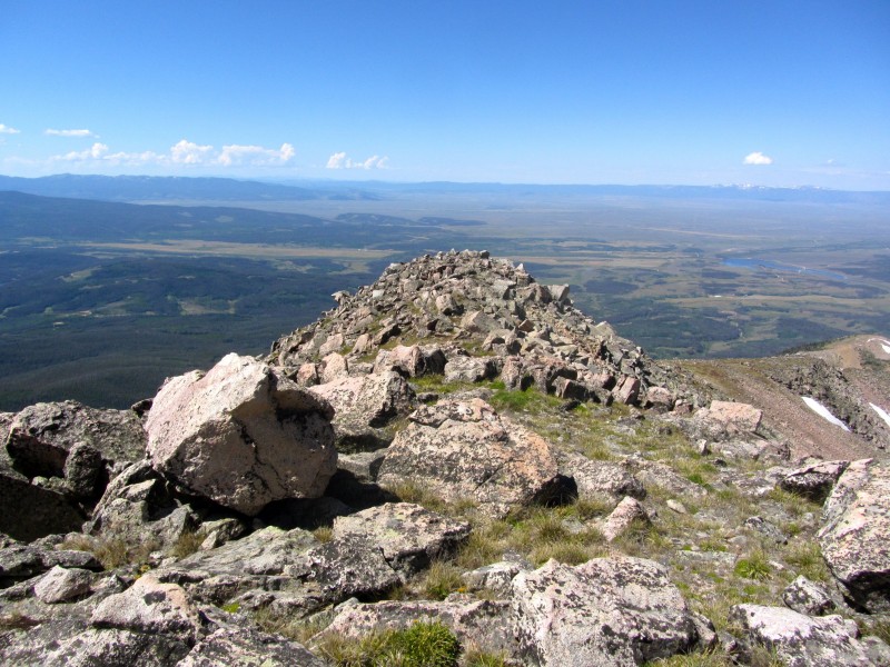
From the 12,300' saddle, it's a quick, steep grunt to Clark's summit, where the views are spectacular. I spent a long time up there in the huge summit wind shelter, ate some lunch, and took more photos.
Looking south toward RMNP
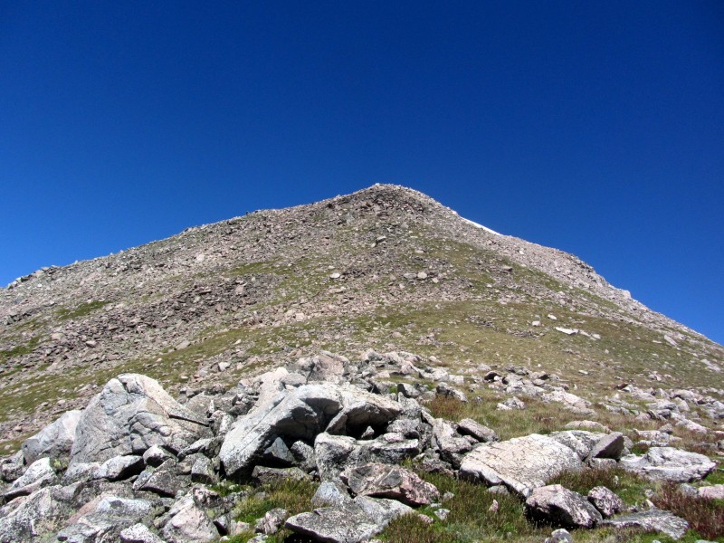
After locating the benchmark, I decided to head over to "Lewis Peak."
Looking down at "Lewis Peak" Ruby Jewel Lake from above Looking up at "Lewis Peak" from the saddle
This ascent offered more loose footing than that of Clark Peak, but I was on top in no time.
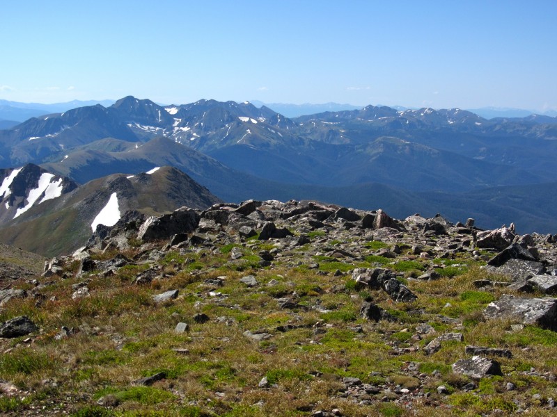
Summit View Summit View Looking back at Clark Peak
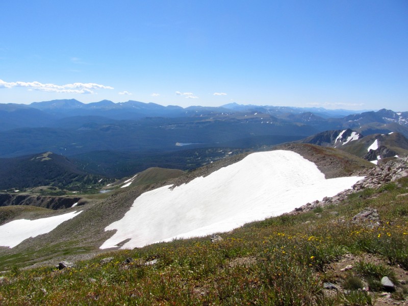
The trip down to Ruby Jewel Lake, then to the truck, was gorgeous, but uneventful.
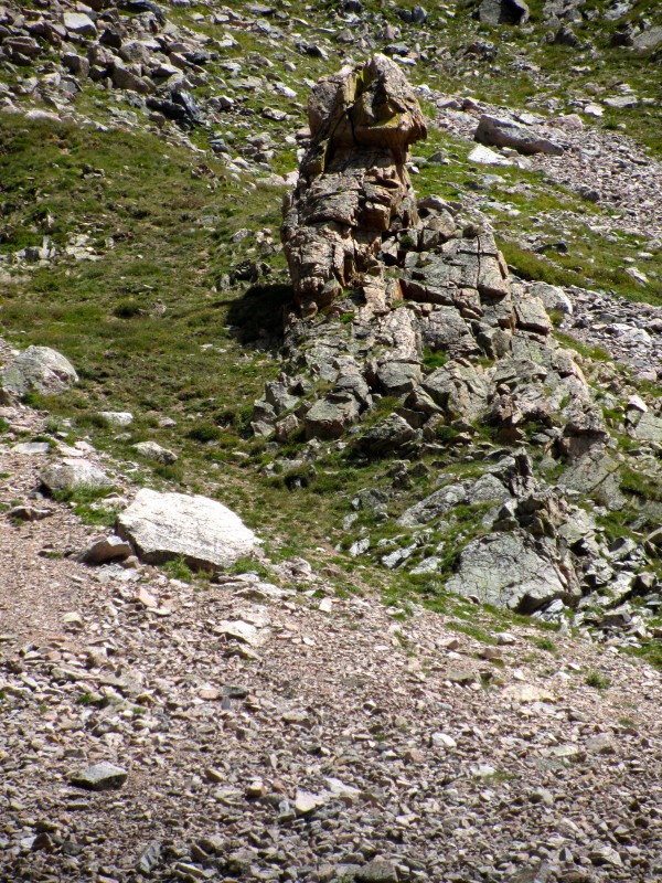
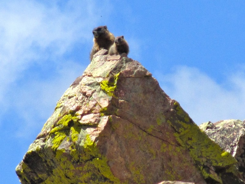
I did see that these peaks have their own version of "Dicker's Peck." Marmots watching over me Upended Amanita muscaria
When I approached the fork for horse vs. human traffic, I remembered that the horse route was more direct than that for foot traffic, so I took it. Oops. Bridge out!
Back at my truck, I was grateful for such a short, sweet day in a beautiful area, but could hear my considerable stomach rumbling, so I hit the road for home.
Along the way, I stopped twice. The first time was to go for a little swim in the Poudre.
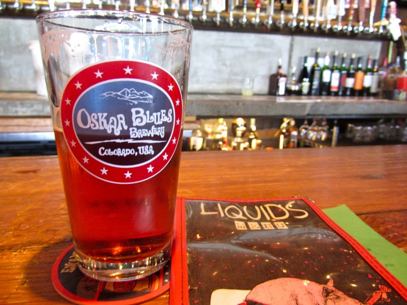
The second? A detour to Longmont for the nectar of the gods, some live music, and ribs at Oskar Blues.
Gordon, straight from the source
I took the easiest way to these summits. There are several longer approaches (backpacks) from the east, through the Rahwah Wilderness. Anyone looking for some solitude in a gorgeous area might consider those.
Thanks for reading.
8) ... we love Odell's tap room. They have the greatest selection of flights. We have never been to the northern part of Colorado for hiking ... it appears we have been missing out on some gems. Those high lakes that are seen from Lewis Peak look just perfect for a private campsite. Beautiful photos, Matt. Thanks so much for posting. Happy trails! :D
Spent a number of nights out near there back in 2007. Loved the area, but have yet to get back. May have to it soon. Beautiful area. Might make for some nice winter trips....hmm...
Awesome, I haven't read many reports on this peak. That's a nice looking peak. Not only is it the Jackson county HP, it's my highest unclimbed peak in Larimer county (it's on the county line). Thanks for the report, need to get up there someday.
OK, is it wrong that my initial reaction to this was ”I need to check out Odell's tap room and Oscan Blues” rather than ”I need to check out those peaks”? :?
But seriously, looks like a beautiful area. That first photo of the steam rising from the lake almost looks like a Yellowstone hot spring.
Nice report, Matt... both from a mountaineering and beer advocacy standpoint. :)
I'll have a trip report up tonight or tomorrow. You should have come along. We needed someone to catch the car sized boulders Brian was kicking through our ascent gully into the glacier below.
This is what climbing is about. The journey and not that other thing so many seek. Someday I'll have to check out that tap room at Odells. And check out these peaks. I especially enjoy that first photo of the lake. Water always sets the mood. Thanks for the telling the story.
We turned around at R.J. Lake but I'm feeling fully motivated to got the rest of the way to Clark Peak now after seeing your pictures (#12 and 13 especially).
I've been wanting to check this area out for a while. Looks great! Thanks for the write-up.
Caution: The information contained in this report may not be accurate and should not be the only resource used in preparation for your climb. Failure to have the necessary experience, physical conditioning, supplies or equipment can result in injury or death. 14ers.com and the author(s) of this report provide no warranties, either express or implied, that the information provided is accurate or reliable. By using the information provided, you agree to indemnify and hold harmless 14ers.com and the report author(s) with respect to any claims and demands against them, including any attorney fees and expenses. Please read the 14ers.com Safety and Disclaimer pages for more information.
Please respect private property: 14ers.com supports the rights of private landowners to determine how and by whom their land will be used. In Colorado, it is your responsibility to determine if land is private and to obtain the appropriate permission before entering the property.