
| Report Type | Full |
| Peak(s) |
El Diente Peak - 14,175 feet Wilson Peak - 14,021 feet |
| Date Posted | 08/20/2011 |
| Date Climbed | 08/11/2011 |
| Author | The Android |
| El Diente and Wilson Peak from Navajo Basin |
|---|
|
El Diente & Wilson Peak Trip Report
August 11-13, 2011 August 11: Woke up around 6 and put my stuff in my car and headed for Grand Junction at 7:15 to meet Dad and Ben. Traffic on I-15 wasn't too bad, but I ran into an unexpected amount of construction on HWY 6 on the way to Price, UT. I was stopped in the car for 15 minutes or so and I thought I was going to be pretty late as I had agreed to meet the others in GJ at noon. However, once I got through the stop it was smooth sailing all the way through the desert to GJ and made it there around 11:30. I filled up on gas and found the City Market that I thought we had planned to meet at. 30 minutes later I found out there was another City Market on HWY 50 and so I drove on down there and met them. We ate a bit of food and started driving south, but just as we turned into the small town of Ridgway, my cars engine started cutting out so we found a nearby automotive place called Sunset Automotive. After talking to their mechanics and a call to our mechanic back in Longmont, we decided to replace the fuel filter and hope it solved the problem. Fortunately it did, but unfortunately it also seems as if the fuel pump is on its way out. We made it the rest of the way past Telluride and to the trailhead. We packed a few miles in under the late evening sun and watched a beautiful pink and red sunset. 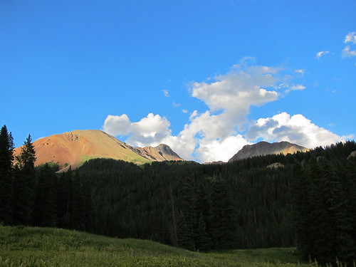 IMG_0021 by AChrysler, on Flickr El Diente on the way in 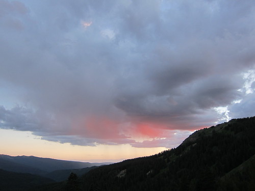 IMG_0031 by AChrysler, on Flickr Nice sunset We made it to the Navajo basin and set up shop and made a couple freeze dried meals under a very light sprinkle. The night was already late and we headed to bed after eating. August 12: Woke up around 5 with plans to climb El Diente first and then to climb Wilson Peak next. Hiked up the basin and got a good look at the north side of El Diente. We briefly considered climbing the N Buttress but we couldn't identify the route from our vantage and we couldn't seem to find our route description. We decided to go with the North Slopes route because it is well traveled and because it was easy to identify most of the route from our vantage. 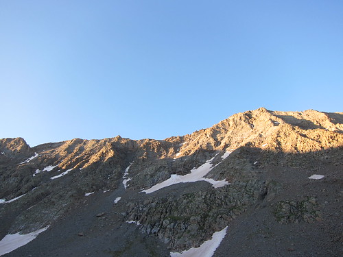 North Face of El Diente by AChrysler, on Flickr El Diente's North Face - North Slopes route follows the snow fill couloir on the left We started hiking up the slopes and got the entrance of the couloir when we started to see and hear very large rocks pouring down the large couloir we were about to climb. From here on it was pretty tense. I gave the climbers above us a good shout and let them know that we were below them. It slowed the rock fall a bit but we were still worried. 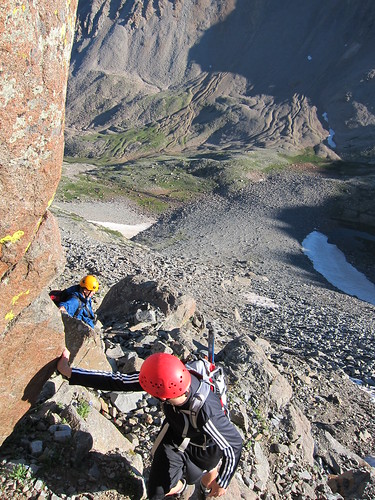 Climbing the N Slope of El Diente by AChrysler, on Flickr Early Climbing to avoid rockfall Because of the rocks we stuck to the right side of the couloirs, after making it almost halfway up we realized what a predicament that put us in; we had avoided the rockfall, but it put us on the wrong side of a nasty snowfield that was extremely steep and as much ice as it was snow. Fortunately Ben and I had crampons, but dad had just brought some microspikes. It was a tense crossing, especially for dad but we made it and were thankful to have brought the ice axes even in mid-August. The second half of the couloir was just as steep, but horrendously loose and even with careful footsteps we knocked a few rocks hundreds of feet down the side of the mountain. It came as a great relief when we made it to the saddle where the Kilpacker route joined in. 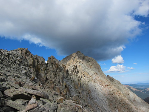 El Diente from near the saddle by AChrysler, on Flickr Near the saddle where the Killpacker route joins in At this point we ran into a few other groups and joined a party of two to the summit of El Diente. The climbing from the saddle had a good amount of class 3 moves with some moderate exposure on somewhat loose rock - although not as loose as the couloir. The summit is small and jagged, but has a rewarding view of the West. 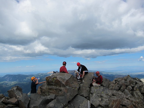 On top of El Diente by AChrysler, on Flickr On the summit with another party Although the forecast was good, some clouds had been rolling around and looked like they could turn threatening. Combined with the unfortunate experience we just had on the North Slopes and these clouds we decided to scrap the Wilson Peak plans and return to the Navajo Basin from the Kilpacker side. This added a lot miles and elevation, but it certainly was the safer choice. 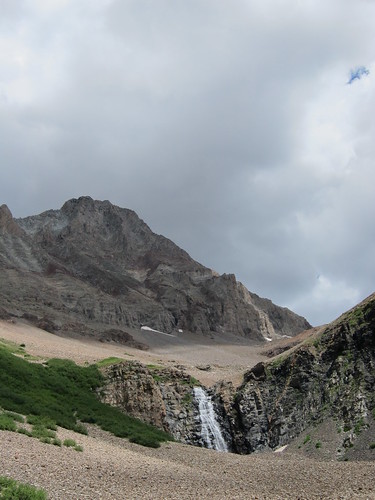 El Diente from Killpacker by AChrysler, on Flickr Plus we got to see El Diente's south face! The weather ended up holding and we got back to camp and had some good naps and woke up around 6 for dinner. We decided to get up around 3:30 on Saturday to climb Wilson Peak, so we took to bed early around 8:30. Saturday, August 13: We got up at 3:30 and were hiking by 4. There was a good moon, nearly full, and the hiking was pretty easy up to the Rock of Ages saddle. At the Rock of Ages saddle it was still pretty dark, we decided to move over to the saddle between Wilson Peak and Gladstone and wait for the sun to rise so that we would have good light for the hardest sections. At the second saddle the firsts lights of dawn were begging to expose the rugged San Juan Mountains with a beautiful sunrise.  San Juan sunrise by AChrysler, on Flickr Awesome Sunrise! 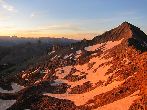 Gladstone Peak at dawn by AChrysler, on Flickr First light on Gladstone, and Lizard Head We had a snack and started on our way. We decided to make a class 3 traverse above a snowfield which was fairly solid, with only sparse amounts of loose rocks. After a few hundred feet of traversing, the route is mostly nice class 2 up to the false summit. At the false summit, the real difficulties begin. From here, the rest of the route looks quite intimidating; however by climbing up an obvious crack on the right the moves are quite manageable although loose rock must be avoided. 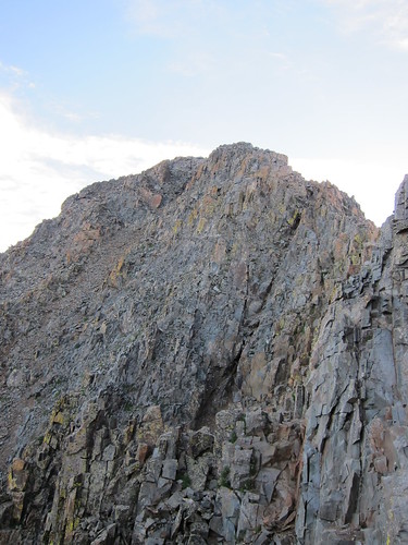 The final section to Wilson Peaks summit by AChrysler, on Flickr A fairly obvious crack on the right to climb At the top of the crack the summit appears abruptly. The Mt. Wilson - El Diente connecting ridge is prominent and beautiful from here. 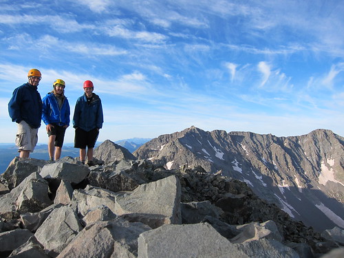 On top of Wilson Peak by AChrysler, on Flickr Us with Gladstone, Mt Wilson, and El Diente in the background We didn't stay long, as we all had a long drive ahead. The coming down was faster than coming up and we were back at camp by 10:30 - about 6:30 round trip. 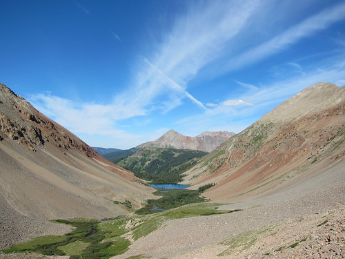 Navajo Basin at midday by AChrysler, on Flickr Navajo Basin on the way out |
| Comments or Questions | ||||||
|---|---|---|---|---|---|---|
|
Caution: The information contained in this report may not be accurate and should not be the only resource used in preparation for your climb. Failure to have the necessary experience, physical conditioning, supplies or equipment can result in injury or death. 14ers.com and the author(s) of this report provide no warranties, either express or implied, that the information provided is accurate or reliable. By using the information provided, you agree to indemnify and hold harmless 14ers.com and the report author(s) with respect to any claims and demands against them, including any attorney fees and expenses. Please read the 14ers.com Safety and Disclaimer pages for more information.
Please respect private property: 14ers.com supports the rights of private landowners to determine how and by whom their land will be used. In Colorado, it is your responsibility to determine if land is private and to obtain the appropriate permission before entering the property.



