Download Agreement, Release, and Acknowledgement of Risk:
You (the person requesting this file download) fully understand mountain climbing ("Activity") involves risks and dangers of serious bodily injury, including permanent disability, paralysis, and death ("Risks") and you fully accept and assume all such risks and all responsibility for losses, costs, and damages you incur as a result of your participation in this Activity.
You acknowledge that information in the file you have chosen to download may not be accurate and may contain errors. You agree to assume all risks when using this information and agree to release and discharge 14ers.com, 14ers Inc. and the author(s) of such information (collectively, the "Released Parties").
You hereby discharge the Released Parties from all damages, actions, claims and liabilities of any nature, specifically including, but not limited to, damages, actions, claims and liabilities arising from or related to the negligence of the Released Parties. You further agree to indemnify, hold harmless and defend 14ers.com, 14ers Inc. and each of the other Released Parties from and against any loss, damage, liability and expense, including costs and attorney fees, incurred by 14ers.com, 14ers Inc. or any of the other Released Parties as a result of you using information provided on the 14ers.com or 14ers Inc. websites.
You have read this agreement, fully understand its terms and intend it to be a complete and unconditional release of all liability to the greatest extent allowed by law and agree that if any portion of this agreement is held to be invalid the balance, notwithstanding, shall continue in full force and effect.
By clicking "OK" you agree to these terms. If you DO NOT agree, click "Cancel"...
"For me there is only the traveling on paths that have heart, on any path that may have heart, and the only worthwhile challenge is to traverse its full length--and there I travel looking, looking breathlessly." --Don Juan Matus
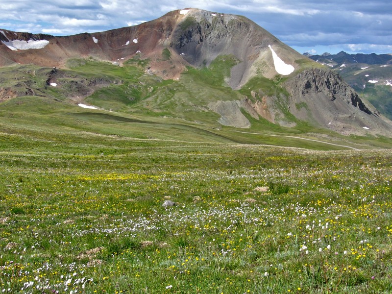
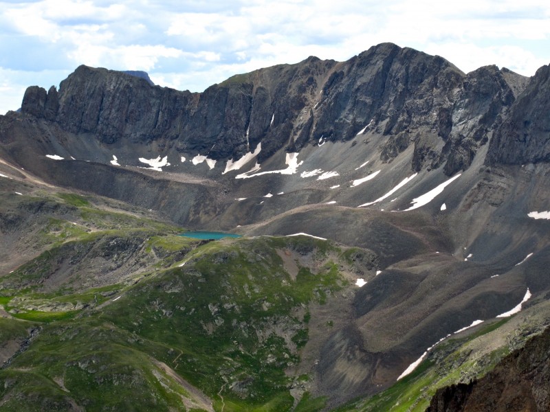
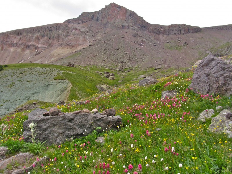
Sometimes, things don't turn out the way we expect. Life's full of surprises, not all of them bad. Last week, I left for a long-planned three-day jaunt to the San Juans, looking forward not only to the summits we expected to hit and the time shared with friends, but also the amazing scenery that never gets old. Each day featured an unexpected turn of events that left me lacking something or someone, but none of these could outweigh the sheer bliss I get looking out across this range from up high. I may have loudly and repeatedly cursed a certain guidebook author's name on Saturday, but I agree that this is "Colorado's finest range." What struck me most this time out were the new perspectives on peaks and places I've seen many times from other viewpoints. While these hikes were pretty straightforward, even easy, looking at peaks like Uncompahgre, Wetterhorn, the Ice Lakes group, and places like American Basin from new and varied vantage points made this trip special, at least to me.
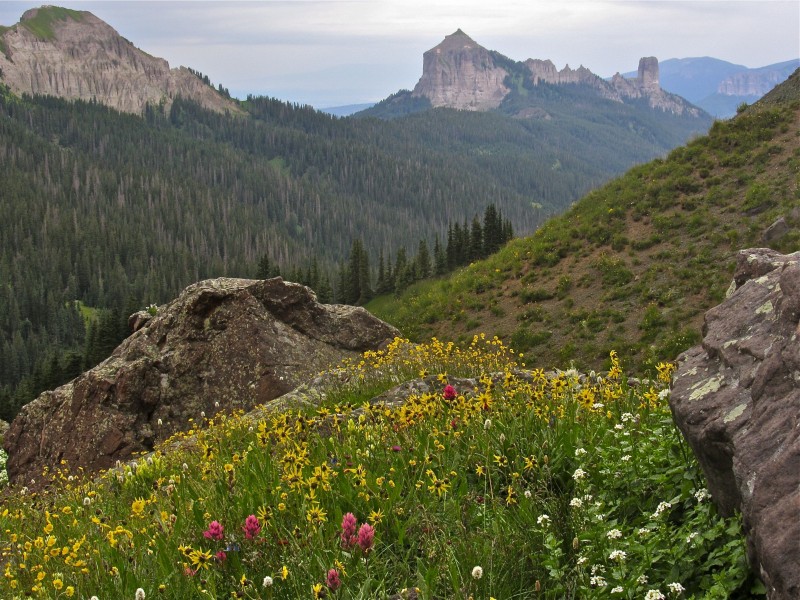
While waiting for the others to arrive at our campsite, I decided to drive up to American Basin to see if any flowers were still around. It was getting dark, but I managed to snag some shots from the classic vantage point, approaching the TH.
Here's one. American Basin, take 1
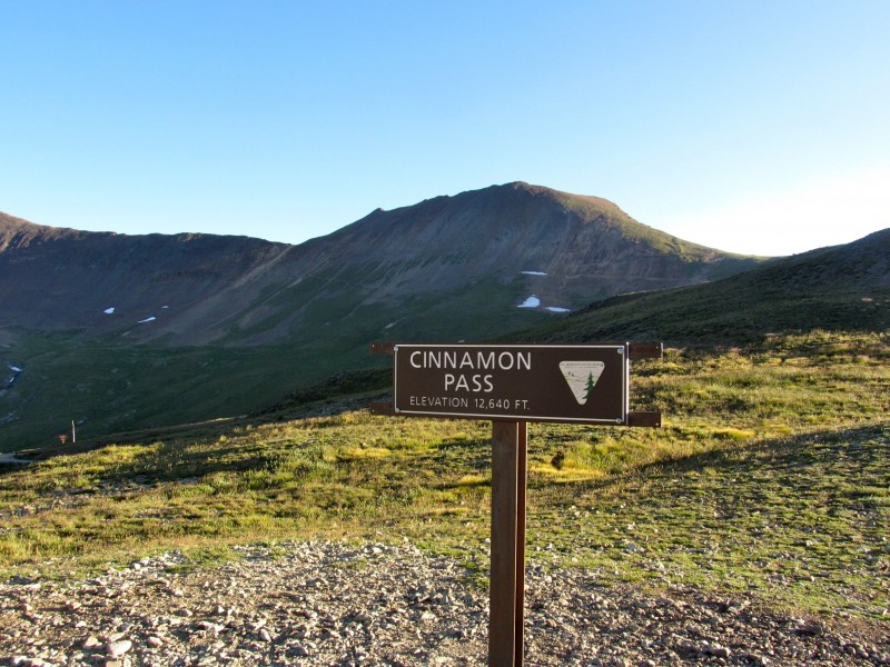
Day 1: Cinnamon Pass Peaks
Our plan was for me to drive the group up to Cinnamon Pass from the Grizzly Gulch TH. From there, we'd make a ridge run across five 13ers back toward Cooper Creek a la Furthermore, and utilize a vehicle left back at the Cooper Creek TH to retrieve my truck. When the day's agenda suddenly changed, I chose to simply start the hike as planned and was to meet the group atop Wood Mountain, but we were separated and circumstances left me alone on Wood's summit, wondering what to do with the rest of my day.
Hike around and enjoy myself, that's what!
I've driven over Cinnamon Pass many times, but only thought about checking out the two peaks on either side of the road. While this may not have been what I was hoping for, I found plenty to be happy about.
The hike up Wood Mountain is trivial, gaining about 1100' over 1.3 miles from the pass. Simply head along the rolling ridge at right in the photo below to the shoulder of Wood and catch an old mining road that ends a few hundred feet below the top. Then chug up to the summit on the steep, loose dirt and scree typical of this range (makes for a fine scree ski on the descent).
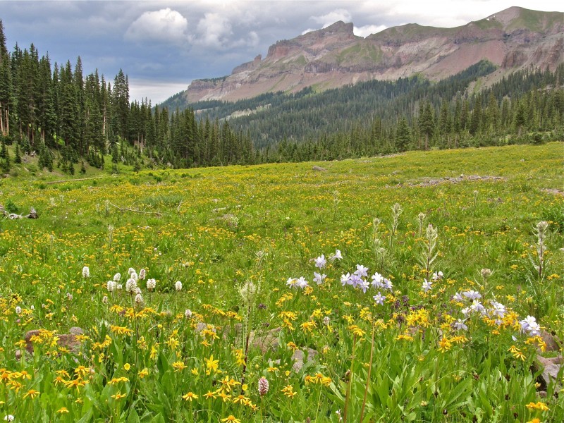
With the whole day ahead of me, I spent 90 minutes or so soaking up the scenery, which was replete with newfound views of familiar spots. Ice Lake peaks Coxcomb and Wetterhorn Lake, take 1 American Basin, take 2 Lake, take 2 Cinnamon Mountain
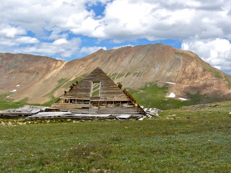
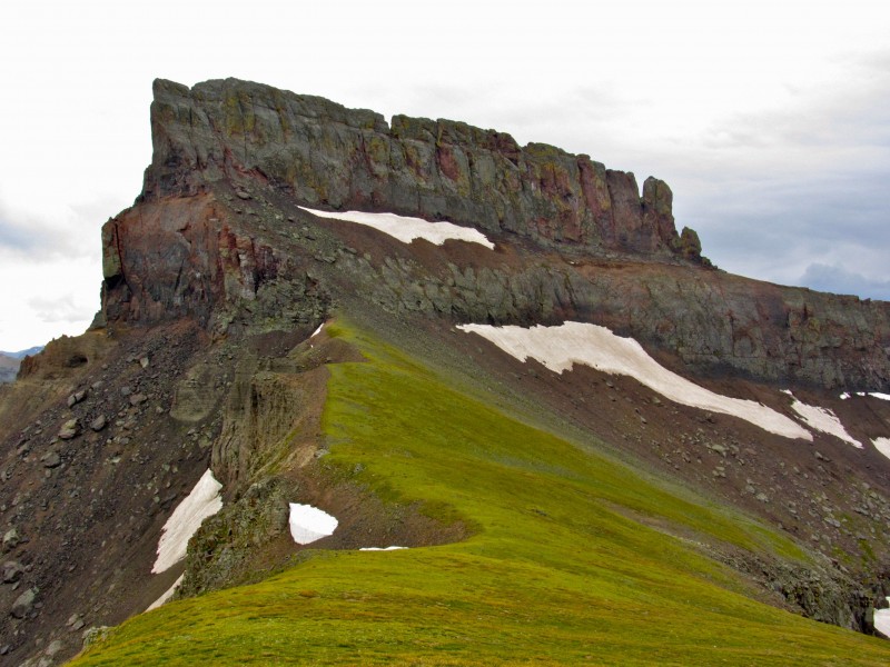
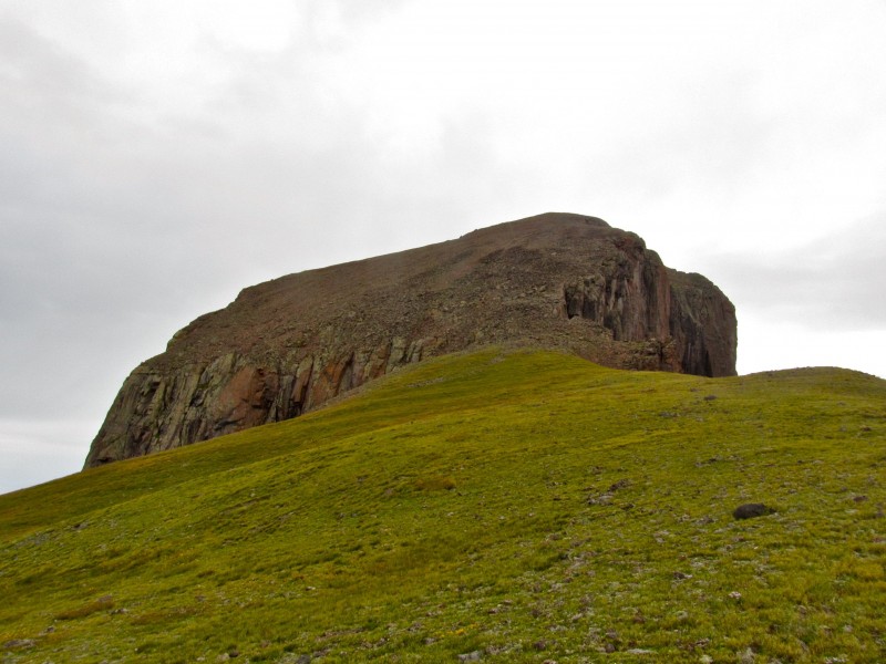
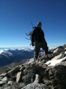
I hiked back down to the pass, which was now crawling with folks on ATVs and in Jeeps. A lady approached me and said, "I'm from Corpus Christi, Texas. Could I please take your picture with those... those hiking poles?" I said, "sure," posed, then got out of there before any further distractions could take shape. This time, I headed the other direction, toward Cinnamon Mountain. An old road leaves the pass and heads up past "tourist line" in to the tundra and toward the remains of an old cabin that's now home to marmots and other sundry creatures. Old cabin and Wood Mt, take 1 Old cabin and Wood Mt, take 2
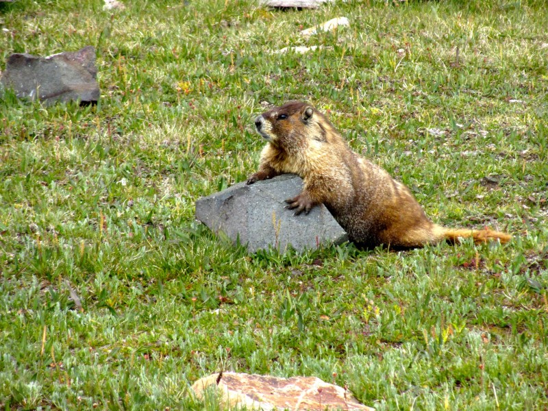
This guy followed me for a few hundred yards, probably hoping for a handout.
I left him a puddle of salty goodness, then headed toward a use trail that leads to about 13,020' on the summit ridge.
This trail is visible from the parking area, and heads up some moderately steep, mildly loose talus. No biggie.
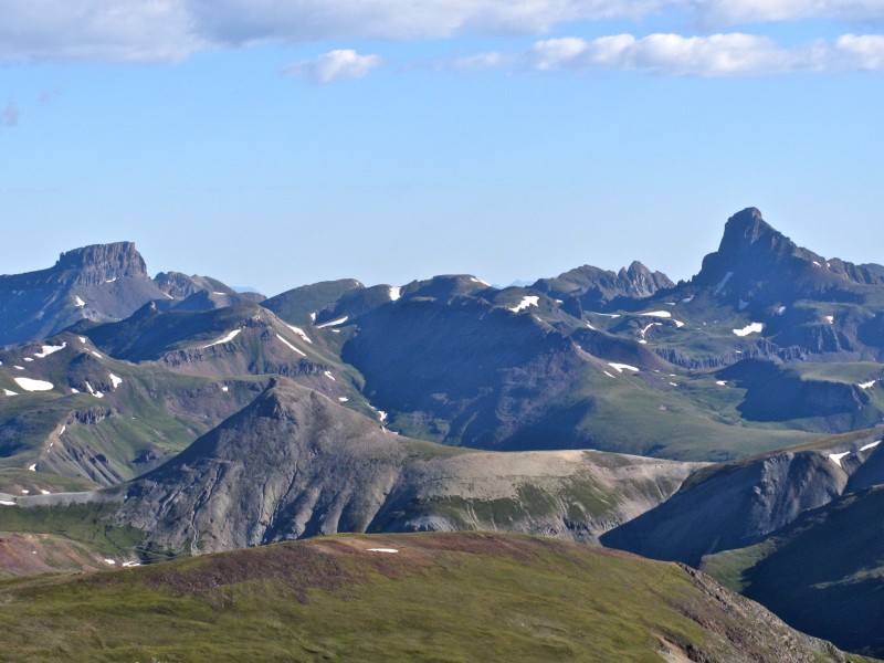
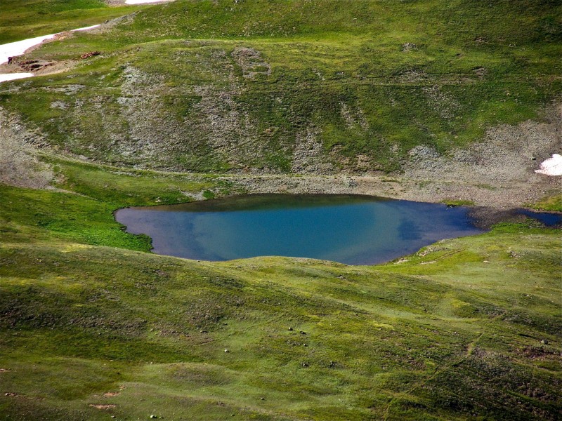
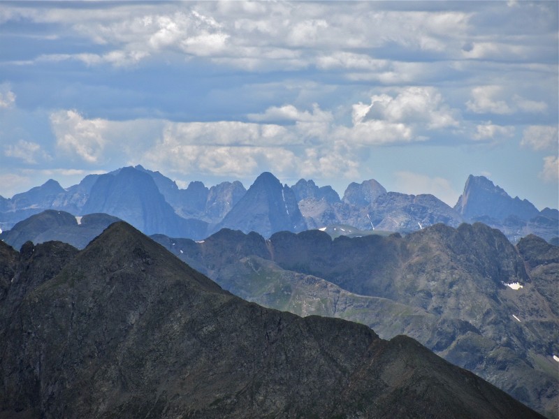
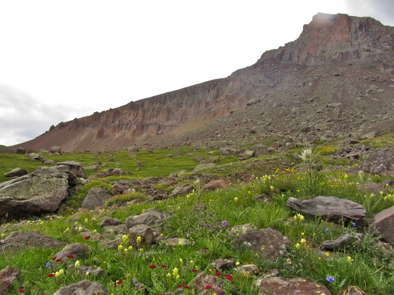
From there, Cinnamon's summit is only a few minutes away. From here, you can see so much... Sneffels and Teakettle Grenadiers American Basin, take 3 (note Sloan Lake in the center) Wetterhorn, take 2 Looking toward Silverton
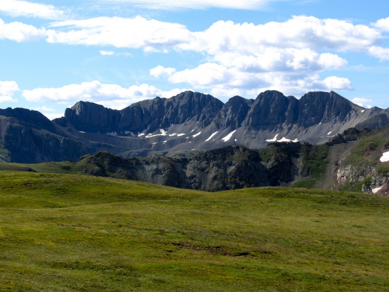
I wandered around in the basin between Cinnamon Mt and UN 13535, and started up toward the latter peak, before turning back at about 13,500' and 1/2 mile below its summit due to an amassing of black clouds heading my way. Fortunately for everyone in the area that day, no storms came about, and I headed down to the pass to look for my lost buddies, eventually finding them on the road near Cooper Creek.
After dinner at the Cannibal Grill, we enjoyed a campfire and some Modus under a brilliant full moon, and hit the sack at little later than I'd have liked. Friday was not at all what I expected, but it turned out pretty well. Stats: 5.3 miles, 2188' gain, 73 photos, one great day. Refs: LoJ Handies Peak quad
Day 2: Half Peak and 13164 from Cuba Gulch
My late bedtime, focus on hanging out at the campfire, and the 1/2 hour drive to Cuba Gulch left me scrambling in the morning to get ready for a planned solo day. While I remembered all the "essentials" for a successful summit, I managed to leave my camera--essential to a detailed TR--in the car. The guide most people use for centennial 13ers offers several routes to Half Peak. The standard route goes up Cataract Gulch, gaining 4100' or so on mostly class 1 terrain over >12 miles r/t. However, I wanted to hit the summit of PT 13164, the detour to which adds some distance to an already long day. With a somewhat shaky forecast and a late start, I chose the Cuba Gulch route, which is shorter and goes much closer to PT 13164. This was a longer day than I expected, with a lot of bushwhacking through willows up to eight feet tall, a nonexistent side trail that I searched for in vain for 30 minutes, but the reward of a short, airy-as-you-want-it-to-be traverse to Half's summit plateau, two splendid summits either on or straddling the Continental Divide with nothing but peaks, lakes, wide open skies, and more peaks in my view. I couldn't have asked for more.
Some notes on this hike and approach:
1. The Cuba Gulch road (starting after the Cataract Gulch TH) is rougher than that to American Basin, Cinnamon Pass, or Nellie Creek. It features some big-time water bars that are more like whoop-de-dos than anything else. Lower clearance AWDs might have issues, but anyone with truck clearance will be fine. The road has one creek crossing that could be a pain in June or early July.
2. Guidebook advice to be wary of, exhibit A: "You want to leave the Cuba Gulch trail between the third and fourth side streams and follow another, unsigned trail that climbs southeast. This trail is more prominent than the Cuba Gulch Trail." (bolding mine). All I can say is, "Balderdash." I'm not above mistakes on the trail, but the bolded part seems to be nonsense, and I never found this trail on either the ascent or descent. Talking afterward with a friend who also did this route, he mentioned that this putative trail eluded them on the ascent, as well.
3. Guidebook advice to be wary of, exhibit B: "When the trail becomes obscure (what trail?) at 11,800 feet, you have a challenge and a choice. You can follow the trail as it enters the willows in the lower basin. The trail is faint, but you can find passable alleys through the bushes..." Again, I may not be the best route finder out there, but I call BS on the bolded portion (bolding mine, again). I certainly could not find passable alleys of useful length, and wasted about an hour getting out of the basin and up above the willows. Caveat emptor. I have to say that this guidebook has been central in my centennial hikes, I'm grateful to the authors, but that sometimes, it's a little vague. That's part of the fun.
Back at my truck, I found my camera in its hiding place and managed to get one picture for the day as I drove out from Cuba Gulch. Stats: 11.9 miles, 3925' gain, another great day! Refs: Guidebook
Summitpost Half Peak Page 13ers.com Half Peak page with TRs from members
LoJ Pole Creek Mountain quad.
Day 3: Redcliff
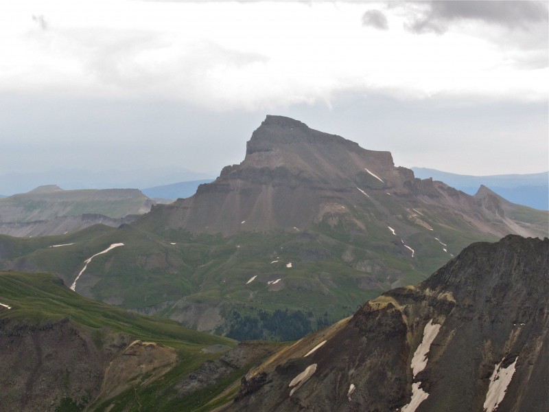
Last year, Lordhelmut introduced me to the peaks above the west fork of the Cimarron River. Thanks, man. While these peaks are actually in Wetterhorn's namesake quad, aside from the Coxcomb, they don't get much attention. Perhaps this is because of the long drive from everywhere but Ridgway. Maybe it's because there aren't any 14ers or centennial 13ers. Regardless, anyone who doesn't check out these peaks is really missing out, IMO. With a crappy forecast--50% chance of T-storms after noon--I decided earlier in the week to head to this area for a short hike. I hoped to join up with a buddy from Ouray for the spectacular looking, but rarely climbed 13er Precipice Peak. When I got back down to Lake City on Saturday and checked my messages, I discovered that he'd not be joining me. After the first two days of this trip, I was no longer surprised by this turn of events. Neither was I discouraged. Precipice looks a bit sketchy with exposure, loose stuff, and route finding challenges, so my backup plan was to hike nearby bicentennial Redcliff, which offers a straightforward six mile r/t hike, much of which is on a well-established trail.
As I made the drive down Big Cimarron road, I found myself more and more pumped.
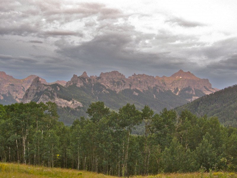
Since our ascent of Courthouse Mountain last fall, I've been hyped about getting back to this area, which offers a new perspective on the San Juans, and seldom-seen views of familiar peaks across the way.
I passed the Silver Jack Reservoir just after 8:00 p.m., and got a preview of the jagged ridgelines found in the Cimarrons.
While this area is isolated, it sure was crowded, and it took until after dark to find a place to camp. Another night, another campfire, some more Modus, and I was off to dreamland, not before taking a moment to be grateful that I get to experience this kind of stuff.
I woke up and drove the remaining few miles to the Wetterhorn Basin TH. Up the the TH for Courthouse, the road is passable for a 2wd. After that, it quickly changes its tune and demands some clearance, with a river crossing that's easy this time of year...
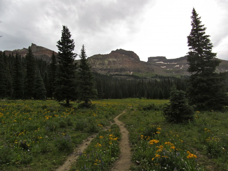
Clouds had obscured the full moon all night, and remained overhead all day. In fact, light rain fell for about two hours of this hike, but I heard not a single peal of thunder. This made for poor lighting, but with terrain and wildflowers like this, I snapped pics left and right.
As noted in luckyzsquirrel's TR, routefinding is not an issue: "Redcliff was a very straight forward hike, just head up the West Fork trail (TR 226) a little past Redcliff then cut up to the Redcliff Coxcomb saddle, then up Redcliff's only sloped side." With that in mind, here are some shots from a rewarding day on a peak that proved worth far more than just another check mark on the bicentennial list. "Fortress," Redcliff, and Coxcomb from the TH Looking up at Redcliff Head steeply toward the Coxcomb-Redcliff saddle Coxcomb from the saddle A grassy ramp and easy talus hopping lead to Redcliff's summit Wetterhorn, take 3 Another face of Uncompahgre
With nasty-looking clouds approaching and a sudden burst of stronger rainfall, I spent precious little time on the summit, and headed down without signing the wet register. The first 200' of terrain below the Coxcomb-Redcliff saddle is really steep, but at worst, tedious when dry. As the rain picked up, time was of the essence on my descent. Once wet, the grassy sections and the short slabby part I'd used on my way up did their best to remind me of my childhood slip-and-slide days, and I found myself on my butt several times.
After descending to about 12,400ft, the rain let up and I relaxed, taking time to admire the still-vibrant wildflowers and impressive peaks around me.
Courthouse Mountain Precipice Redcliff (note hoodoos on left flank)
I arrived back at my truck, ravenous from not eating more than a few handfuls of trail mix on the hike. I set up my chair with a view of all these gorgeous peaks, cracked a can of Oskar Blues, made a sandwich, and just sat there in the rain for a half hour, wishing I had another day to explore this magnificent spot. Places like this are tough to leave, but the long drive home has some positives... Always a solid finish to a day in the mountains!
Photo number 4 is sweet - you could sell it ! Sounds like we share an interest in wandering around on ridges in awe of the beauty in front of us. Looks like one of those weekends when you're thanking your lucky stars for living in an awesome section of the country. Life is grand......
Great peaks Matt. 13,164 is still one of my favorite peaks. Gorgeous place. I loved Coxcomb peak and love the view of it from Redcliff. I need to make it back that way one of these days. Thanks for sharing.
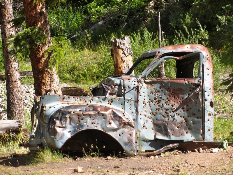
Beautiful, Matt. Makes me feel as if I were there (as I was at some time in my past). 8) The abundant flowers, unique views of the peaks, Bonnie and Clyde's bullet-riddled remains of a vehicle, and your wonderful written delivery. What more could you want!??!!? Well, may that +10% rye at Amica's ... :wink: ... hmmm?
See you next week ... it's been too long ... I need a hug! Hoppy trails! :D
No offense to anyone else, these are the best photos I have seen all summer. Make me jealous I wasn't there. That just looks like an incredible, head clearing journey. Thanks for the ride.
....... I said, ”sure,” posed, then got out of there before any further distractions could take shape.
Mtgirl, my lucky stars were thanked over and over again!
Presto, see you soon.
SP, I agree on 13164. Great peak.
Rick, I appreciate your kind words.
Scot, thanks.
Matt, thanks for the pics and info. I particularly appreciate the link to the 13ers book - which has a link to some updates/corrections (alas, not the ones you pointed out). I also appreciate the attention to info about the roads. I was recently thinking that, although my low-clearance 2wd might be sufficient for the 14ers, it might be inadequate for the 13ers.
Also, you must've seemed as exotic as a Martian to the lady from Corpus Cristi. HaHa!
Jason, I'm grateful you like my simple photos.
Cutter, I use a Canon SX230HS point and shoot with 14x optical zoom and manual controls.
Dave, I try and write these primarily for beta and to get people out to see stuff not on the usual menu. You can still do 13ers for years without running out of 2wd options. Climb on!
Bob, I fully expect to go back for Precipice. You and Kate should come along.
I was just doing some research on a few Centennials, came across this TR, and had to leave you a comment. The photos are AWESOME! Can't wait to get down to hit Dallas and others with you this summer.
Thanks, Matt for trekking to the field and capturing quite a few images I would be delighted to show in an informal geology/geomorphology class.
Caution: The information contained in this report may not be accurate and should not be the only resource used in preparation for your climb. Failure to have the necessary experience, physical conditioning, supplies or equipment can result in injury or death. 14ers.com and the author(s) of this report provide no warranties, either express or implied, that the information provided is accurate or reliable. By using the information provided, you agree to indemnify and hold harmless 14ers.com and the report author(s) with respect to any claims and demands against them, including any attorney fees and expenses. Please read the 14ers.com Safety and Disclaimer pages for more information.
Please respect private property: 14ers.com supports the rights of private landowners to determine how and by whom their land will be used. In Colorado, it is your responsibility to determine if land is private and to obtain the appropriate permission before entering the property.