Download Agreement, Release, and Acknowledgement of Risk:
You (the person requesting this file download) fully understand mountain climbing ("Activity") involves risks and dangers of serious bodily injury, including permanent disability, paralysis, and death ("Risks") and you fully accept and assume all such risks and all responsibility for losses, costs, and damages you incur as a result of your participation in this Activity.
You acknowledge that information in the file you have chosen to download may not be accurate and may contain errors. You agree to assume all risks when using this information and agree to release and discharge 14ers.com, 14ers Inc. and the author(s) of such information (collectively, the "Released Parties").
You hereby discharge the Released Parties from all damages, actions, claims and liabilities of any nature, specifically including, but not limited to, damages, actions, claims and liabilities arising from or related to the negligence of the Released Parties. You further agree to indemnify, hold harmless and defend 14ers.com, 14ers Inc. and each of the other Released Parties from and against any loss, damage, liability and expense, including costs and attorney fees, incurred by 14ers.com, 14ers Inc. or any of the other Released Parties as a result of you using information provided on the 14ers.com or 14ers Inc. websites.
You have read this agreement, fully understand its terms and intend it to be a complete and unconditional release of all liability to the greatest extent allowed by law and agree that if any portion of this agreement is held to be invalid the balance, notwithstanding, shall continue in full force and effect.
By clicking "OK" you agree to these terms. If you DO NOT agree, click "Cancel"...
Peak: Pyramid Peak
Route: Standard (NE Ridge)
Vert: Approx. 4,500
Mileage: Approx. 8 miles
Start time: 4:00 AM
Summit: 8:00 AM
Back at car: 11:45 PM
Total trip time: 7 hrs 45 min (45 min on summit)
I have wanted to climb Pyramid for a long time. After getting married and being out of the country for most of the summer, I didn't think I would have the chance to get out and hike much. Luckily, a weekend with an excellent weather forecast and clear schedules allowed my friend Jono and I to plan the trip.
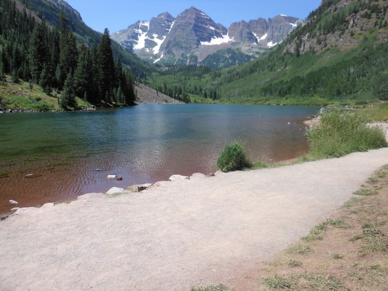
Jono and I arrived at the Maroon Bells trailhead around 10:30 PM Friday night and set up a place to sleep. We placed our pads and sleeping bags near the lake to settle in for a few hours of sleep before our 3:30 AM wake up call. Below is where we placed our bags (photo taken on the decent).
There was a meteor shower scheduled for the night, so we were excited (despite the fullish moon) to see a little show. Little did we know, many other people had the idea to watch the shower from Maroon Lake. Needless to say, we got about an hour of sleep due to people coming and going to the lake at all hours of the night. We did get to see some great shooting stars, and you couldn't pick a better place to sleep for the night, so the no sleep was really a non-issue.
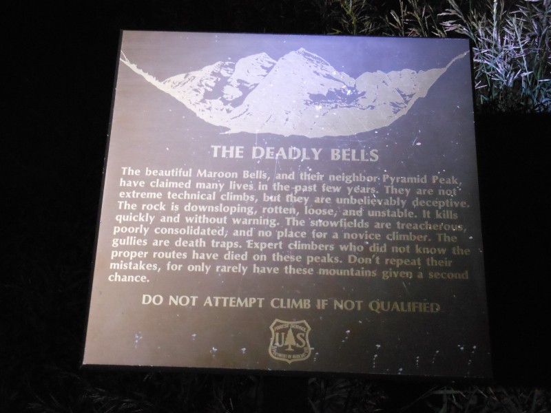
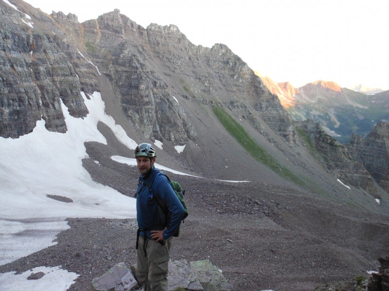
The alarm didn't go off in the morning, but I woke up at 3:40 AM anyway. We packed up our gear, ate a little breakfast, and were on the trail by 4:00 AM. Had to take a brief pause to check out the warning sign, I love this thing.
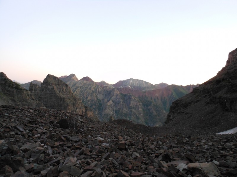
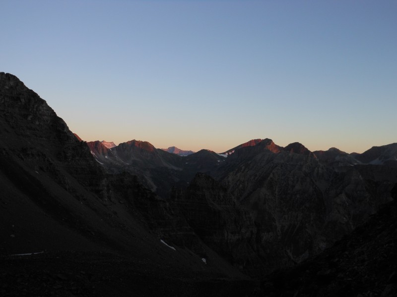
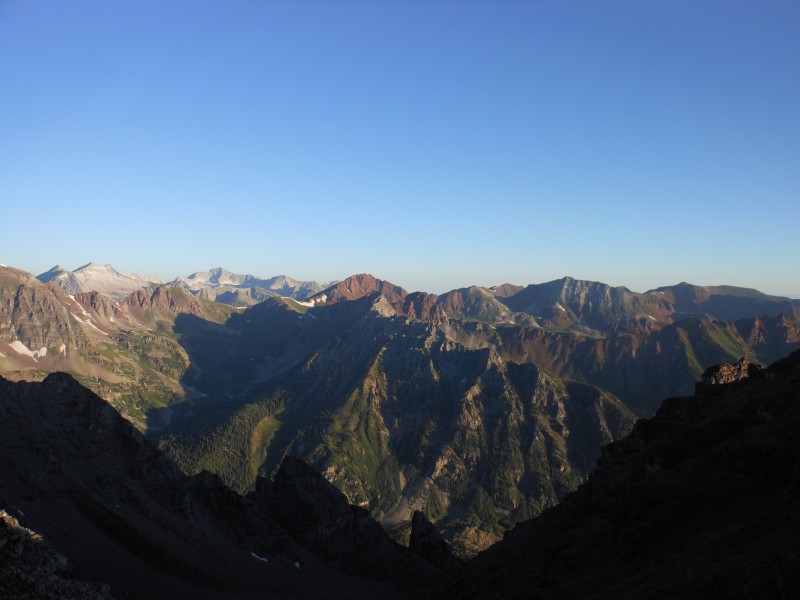
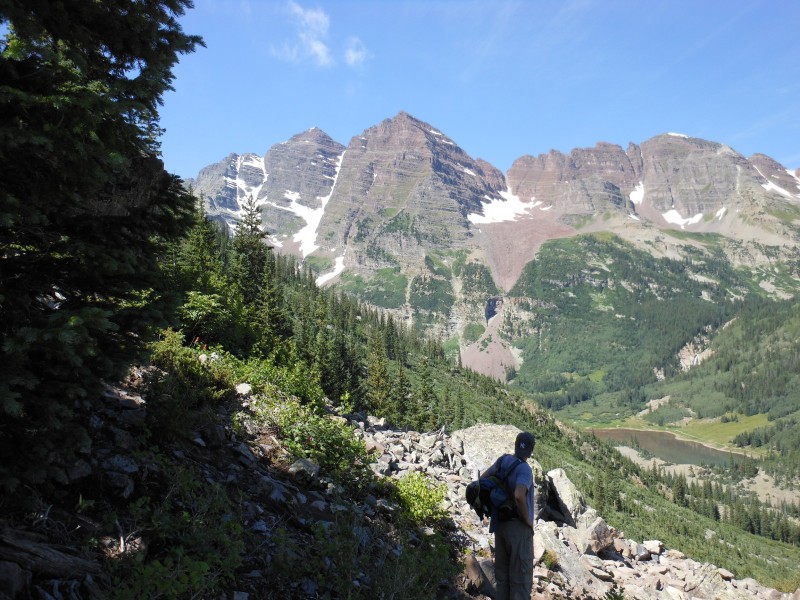
About 35 minutes after we left, we reached the trail junction for the Pyramid trail. From there, it is straight up without a break to the summit. Below are some pictures from the Amphitheater with first morning light.
Looking back after entering the Amphitheater
Pyramid from the Amphitheater
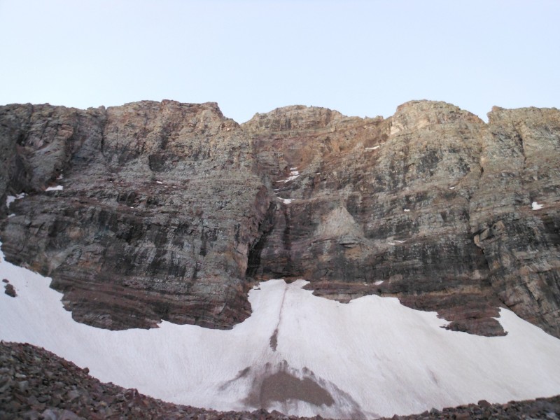
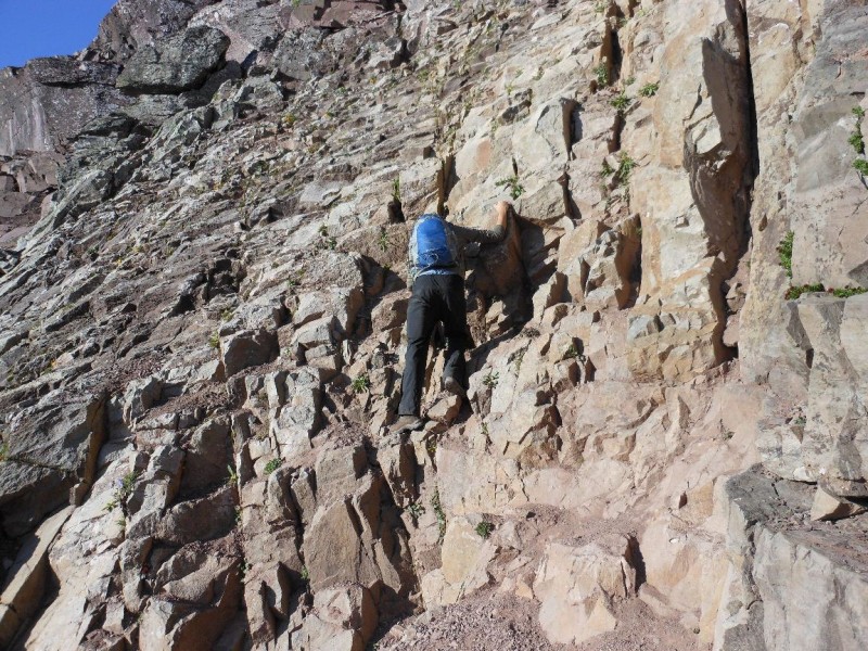
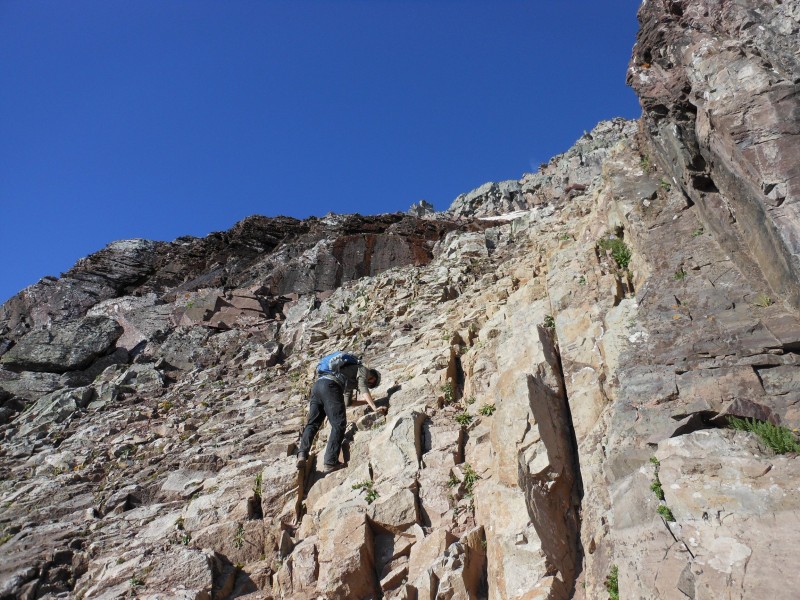
The next obstacle was the gully leading out of the Amphitheater. This is an absolute nightmare, and for me was the crux of the climb. It is steep, loose, and never ending. Below are some photos taken during the climb.
looking up the gully of death
Just before entering the gulley
Looking backwards from the gulley of death
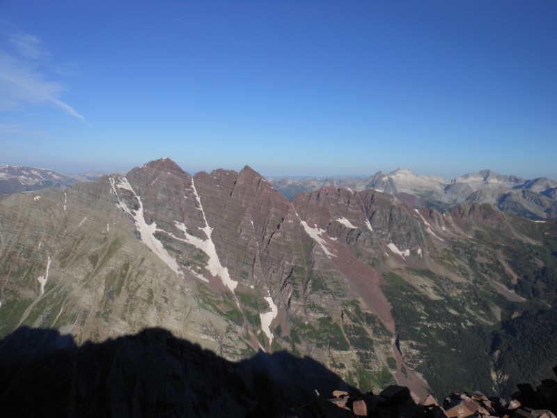
The bells coming view for the first time of the day
Looking back from the gulley
About ¾ of the way up the gulley, we looked to the right and saw what appeared to be a shorter route to the saddle, just to the right of the tower at the top. We decided to take it and regretted it almost immediately. It was very loose, and had much larger rocks in it than the main gulley. Care had to be taken, but it afforded some good scrambling, so not all was lost.
Once we reached the top, we took a 10 minute break before continuing to the top.
OH! That's why they call it Pyramid!
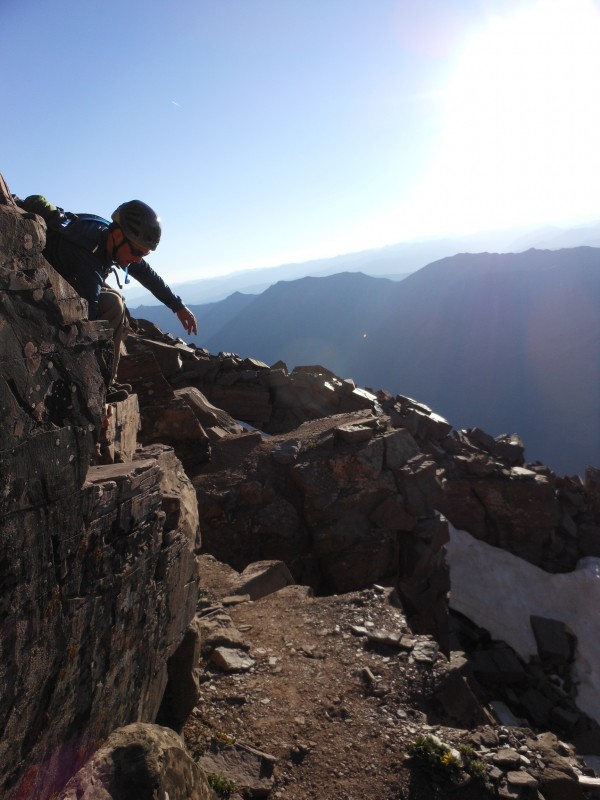
We had both been nervous about the remaining route from looking through reports and hearing about the "1,000 ft drops" from Roach. We actually found the route very enjoyable, inside our comfort level, and not extremely exposed.
We ended up missing the "leap of faith" on the ascent. Here is a picture of Jono crossing right in front of it (we didn't realize this until the decent). We kept saying, "where is this leap thing?" We did find it on the way down and did some jumping, but you don't need to cross it if you don't want to. You can easily scramble around it.
Missing the ledge
Jono and I negotiating the ledges on the way to the green wall.
We were excited for the start of the green wall and the first real scrambling of the day. This is me negotiating the first moves of the wall.
Some scrambling on the green wall.
We followed the green wall for longer than the standard route dictates. This made for some great climbing and fun class 4 moves. We stuck mostly to the true NE ridge until we neared the summit and then traversed back around to regain the standard route.
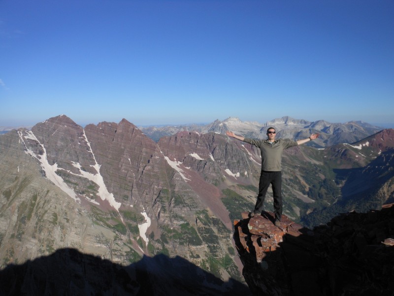
Reaching the summit was one of the most rewarding hiking experiences I have ever had. It is a non-stop, steep route from the Pyramid trail to the summit, and it felt good to be on flat ground again. Not to mention the views were AMAZING.
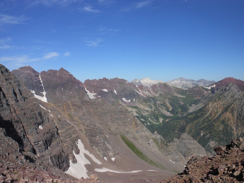
Bells, Snowmass and Capitol from the top.
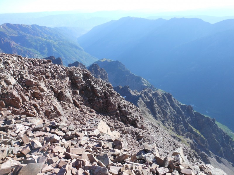
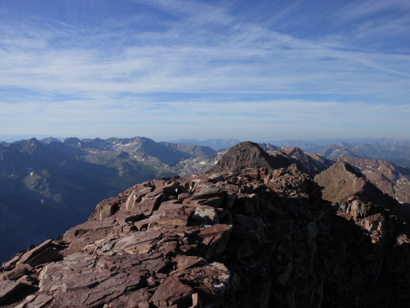
Looking back down the summit ridge
Venturing out on the diving board was exhilarating. Hard to not feel amazing and accomplished on top of this mountain. A little summit glory...
After spending about 45 minutes on the summit we decided to head down. We had passed a few people on the way to the gulley of death, but other than that we were the only people on the entire route in the morning. We did pass about 5 people on our way down, being very mindful of rockfall.
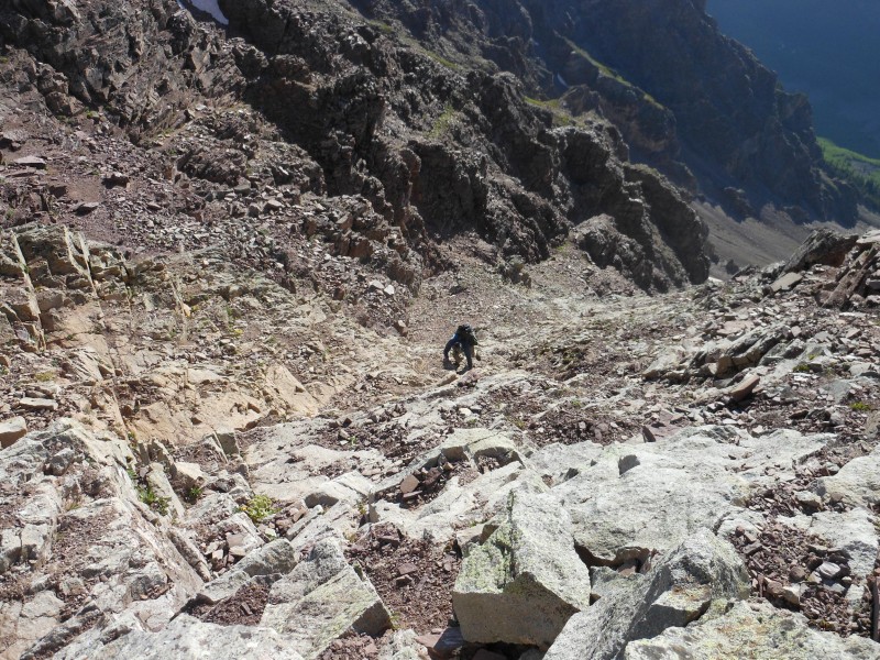
We thought the decent would take a little time from the top, based on the moves we had taken coming up. We figured some face in down climbing was in our future. However, the standard route cairns are way easier to follow on the way down and we found the climbing to be much easier than what we climbed on the way up.
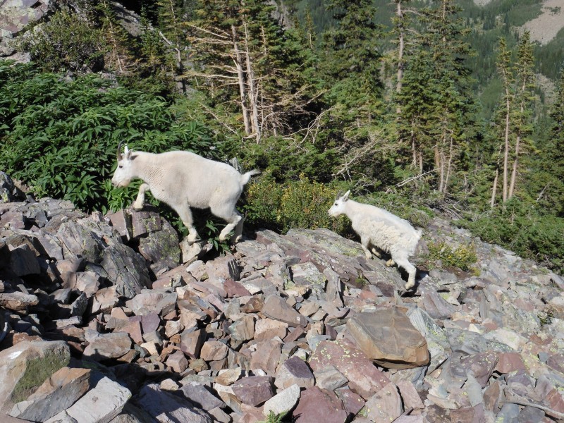
We made great time coming off the summit ridge and with perfect weather, we took our time on the remaining route, chatting with mountain goats and taking in the views.
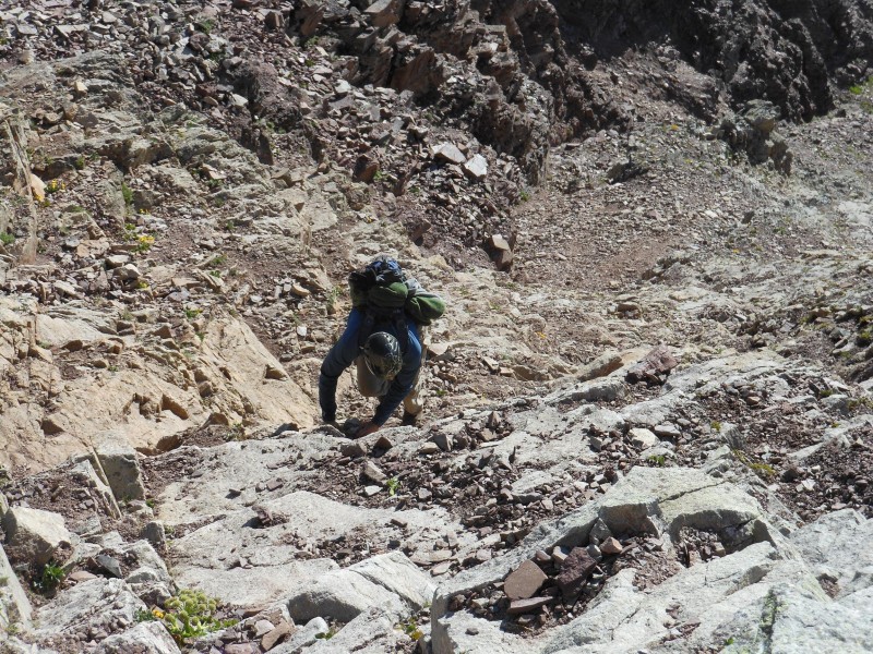
The walk down was killer on the knees and the tops of my toes. I ended up with some blisters on my feet in places I have never had them before. This had to do with the route being so steep that I was pointing on my toes most of the way down. But who's complaning
Had to enjoy some final views of the bells and soak in what an amazing place this is.
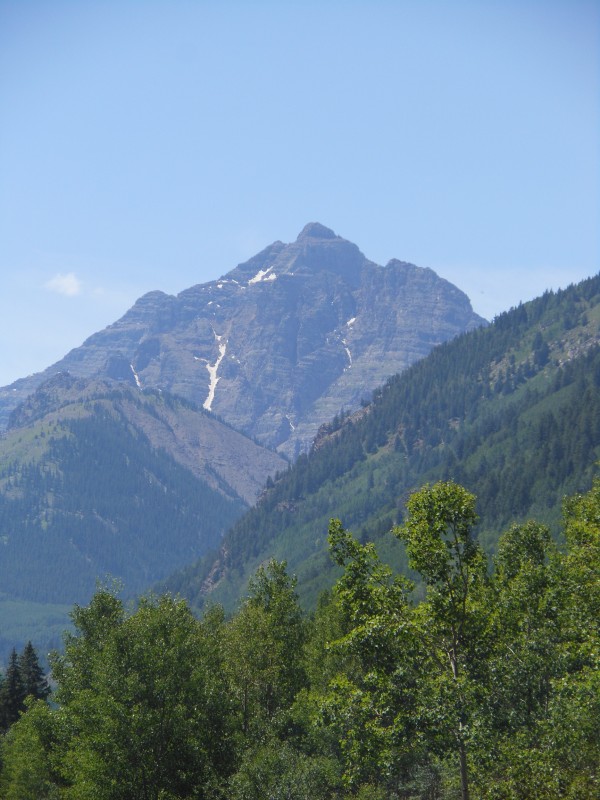
We pulled over on the way out to grab this final picture of Pyramid.
We stopped into the Woody Creek Tavern outside of Aspen for a little Hunter S. Thompson history and well deserved food before the long drive back to Denver.
Jono and I were both a little nervous about this hike prior to going, but it turned out to be amazing and well within our comfort level. The loose rock is an issue on this route (I got hit in the head with a golf ball sized rock knocked down from above, thanks helmet!), but I found most of it to be very manageable if you move slow and take care.
All in all, an absolutely amazing day and one I won't soon forget. Thanks for reading!
Thumbnails for uploaded photos (click to open slideshow):
It reminded me of our hike last year, this peak is awesome and the views are indredible. Hey, how could you miss the leap-of-faith? it is a huuuge gap, or that is at least what I remember... :wink:
Not sure how we missed it the first time around, when we down climbed a section, we were already on the other side of it. Coming back it became pretty obvious where it was. :D
Caution: The information contained in this report may not be accurate and should not be the only resource used in preparation for your climb. Failure to have the necessary experience, physical conditioning, supplies or equipment can result in injury or death. 14ers.com and the author(s) of this report provide no warranties, either express or implied, that the information provided is accurate or reliable. By using the information provided, you agree to indemnify and hold harmless 14ers.com and the report author(s) with respect to any claims and demands against them, including any attorney fees and expenses. Please read the 14ers.com Safety and Disclaimer pages for more information.
Please respect private property: 14ers.com supports the rights of private landowners to determine how and by whom their land will be used. In Colorado, it is your responsibility to determine if land is private and to obtain the appropriate permission before entering the property.


")


