Download Agreement, Release, and Acknowledgement of Risk:
You (the person requesting this file download) fully understand mountain climbing ("Activity") involves risks and dangers of serious bodily injury, including permanent disability, paralysis, and death ("Risks") and you fully accept and assume all such risks and all responsibility for losses, costs, and damages you incur as a result of your participation in this Activity.
You acknowledge that information in the file you have chosen to download may not be accurate and may contain errors. You agree to assume all risks when using this information and agree to release and discharge 14ers.com, 14ers Inc. and the author(s) of such information (collectively, the "Released Parties").
You hereby discharge the Released Parties from all damages, actions, claims and liabilities of any nature, specifically including, but not limited to, damages, actions, claims and liabilities arising from or related to the negligence of the Released Parties. You further agree to indemnify, hold harmless and defend 14ers.com, 14ers Inc. and each of the other Released Parties from and against any loss, damage, liability and expense, including costs and attorney fees, incurred by 14ers.com, 14ers Inc. or any of the other Released Parties as a result of you using information provided on the 14ers.com or 14ers Inc. websites.
You have read this agreement, fully understand its terms and intend it to be a complete and unconditional release of all liability to the greatest extent allowed by law and agree that if any portion of this agreement is held to be invalid the balance, notwithstanding, shall continue in full force and effect.
By clicking "OK" you agree to these terms. If you DO NOT agree, click "Cancel"...
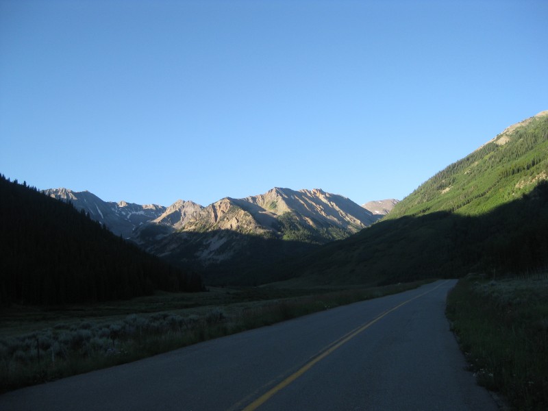
I had originally planned to climb Harvard and Columbia but had a last minute change of plans and instead chose Castle and Conundrum. I left Copper Mountain on my motorcycle at 4:50 am and had a very chilly ride over Independence Pass, arriving at the FR102 intersection around 7:10 and proceeded up the jeep road.
Nearing FR102 intersection
The going was fine, although my KTM 990 Adventure at 500 pounds is a little heavy for this sort of work. After 30 minutes of riding, I was at 12,300' or one mile from the end of the road where I decided the going was getting too rocky for the big bike (or at least its operator). The bike took a nap and I continued on foot.
Ssh - the bike is sleeping.
The river crossing was not too bad and the stream running down the road above the Pearl Pass intersection was only a couple of inches deep.
I had read the route info on 14ers.com and saved it to my telephone to use on the way up. BUT, I didn't realize until I reached the trailhead that I had only saved the Conundrum portion of the directions. Oops! Since my change of peaks occurred so late in the game, I didn't have a map either. Strike one.
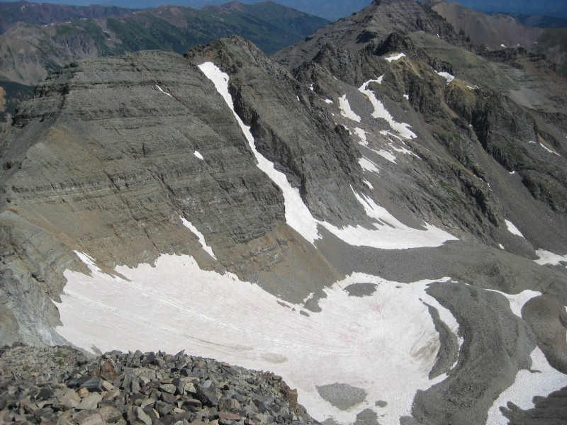
My foggy memory recalled something about going left and then taking a trail that climbs onto a ridge that leads to the summit, so after crossing the little stream at the road's end I took a left and deliberately ignored the tracks in the snow going to the right. There was a faint trail and a couple of cairns so at first I thought I was okay. Strike two. I went straight up the north east face scree field for a couple hundred feet and searched for any sign of a trail and thought (imagined?) I could see one higher up and to my left.
I went up the left side of the ridge above the grassy hill on the far left. Oops.
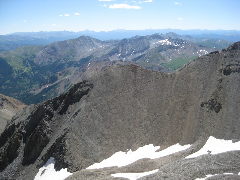
At this point I decided to just go up and a little to my left in the scree field and eventually intersect it. As I climbed higher I saw that my guess on the trail was wrong, but things were going well and the weather couldn't have been any better so I just soldiered on up through the scree.
My alternate route was rocky but quite stable.
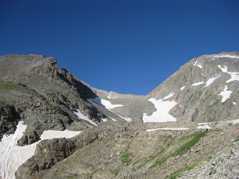
I eventually reached the top and as I looked to my right I saw the correct trail a little below me.
I regained the correct trail at the saddle towards the right side of this picture.
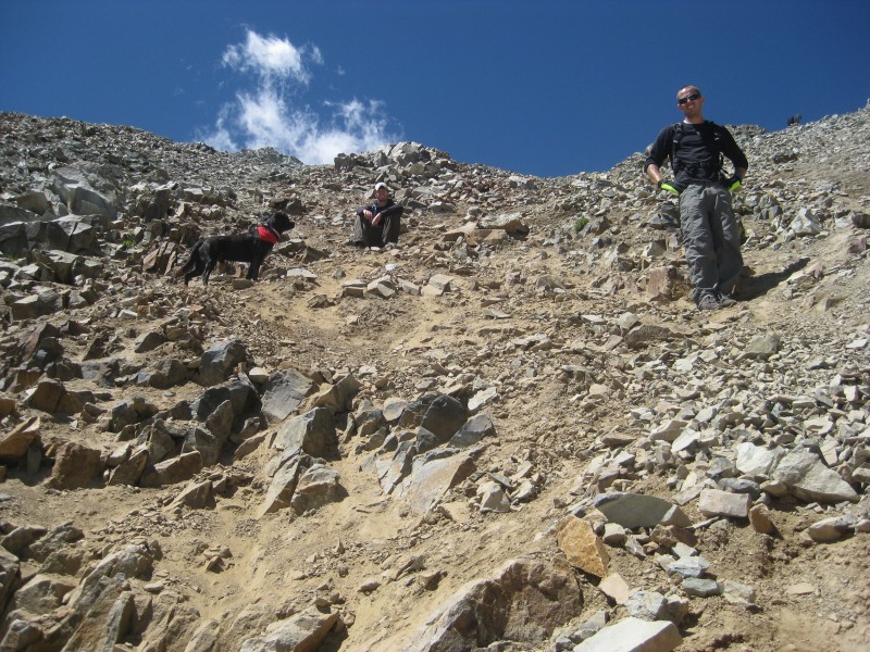
Once back on the proper route things started going much faster. I met up with two guys (Patrick and Justin) from Denver/Golden and their amazing dog Jack. We climbed as a small group and quickly gained the summit around 10:30. Jack is nearly fearless, very agile and energetic as he covered most of the trail two or three times running back and forth.
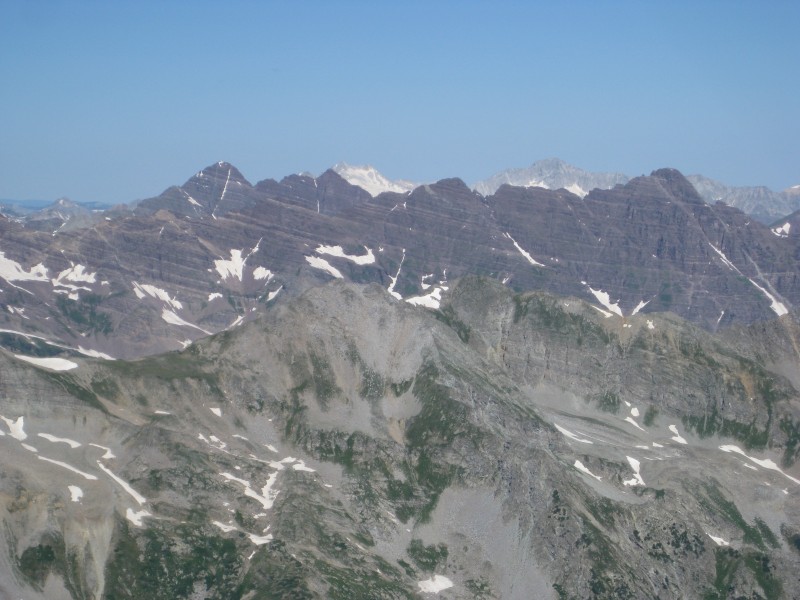
Maroons and Pyramid from the summit. Looking over to Conundrum from Castle's summit.
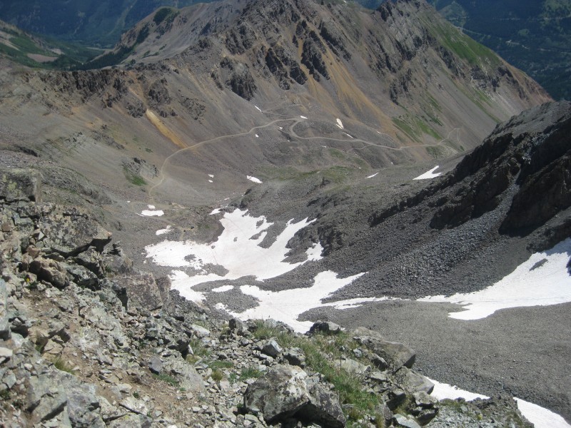
Our summit time was perfect - cloudless, windless and very warm. Home run! After a bite to eat, some pictures and conversation, we headed over to Conundrum which took a little over 30 minutes. The view from Conundrum was just as amazing as Castle's and the weather was still perfect. We enjoyed the beauty for quite a while and then headed back down to the saddle between the two peaks and downclimbed the rust colored loose rocks and gravel to the snow.
Looking down to the snow glissade route. Jack and company getting psyched for the glissade.
Since it was so warm, the snow was very soft and we had three fun glissades leading us almost to the bottom and the trail head. A quick walk back down to my motorcycle and less than three hours later I was back in Copper Mountain with my family.
Thanks to Patrick, Justin and Jack for the fun company.
Thumbnails for uploaded photos (click to open slideshow):
Your buddy there wasn't exactly smart glissading with no axe! Glad the snow was soft enough to keep the speed down.
Caution: The information contained in this report may not be accurate and should not be the only resource used in preparation for your climb. Failure to have the necessary experience, physical conditioning, supplies or equipment can result in injury or death. 14ers.com and the author(s) of this report provide no warranties, either express or implied, that the information provided is accurate or reliable. By using the information provided, you agree to indemnify and hold harmless 14ers.com and the report author(s) with respect to any claims and demands against them, including any attorney fees and expenses. Please read the 14ers.com Safety and Disclaimer pages for more information.
Please respect private property: 14ers.com supports the rights of private landowners to determine how and by whom their land will be used. In Colorado, it is your responsibility to determine if land is private and to obtain the appropriate permission before entering the property.