Download Agreement, Release, and Acknowledgement of Risk:
You (the person requesting this file download) fully understand mountain climbing ("Activity") involves risks and dangers of serious bodily injury, including permanent disability, paralysis, and death ("Risks") and you fully accept and assume all such risks and all responsibility for losses, costs, and damages you incur as a result of your participation in this Activity.
You acknowledge that information in the file you have chosen to download may not be accurate and may contain errors. You agree to assume all risks when using this information and agree to release and discharge 14ers.com, 14ers Inc. and the author(s) of such information (collectively, the "Released Parties").
You hereby discharge the Released Parties from all damages, actions, claims and liabilities of any nature, specifically including, but not limited to, damages, actions, claims and liabilities arising from or related to the negligence of the Released Parties. You further agree to indemnify, hold harmless and defend 14ers.com, 14ers Inc. and each of the other Released Parties from and against any loss, damage, liability and expense, including costs and attorney fees, incurred by 14ers.com, 14ers Inc. or any of the other Released Parties as a result of you using information provided on the 14ers.com or 14ers Inc. websites.
You have read this agreement, fully understand its terms and intend it to be a complete and unconditional release of all liability to the greatest extent allowed by law and agree that if any portion of this agreement is held to be invalid the balance, notwithstanding, shall continue in full force and effect.
By clicking "OK" you agree to these terms. If you DO NOT agree, click "Cancel"...
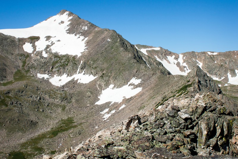
Looking up the Northeast Ridge
Don't get me wrong...I love hiking the fourteeners, but I often long for the peace and solitude found on the lower summits. I'm just as happy hiking the lesser travelled yet slightly more oxygenated peaks. The Indian Peaks have a lot to offer in this department, but somehow I've neglected these peaks over the past couple years. Weary of the thought being stuck in another weekend mountain traffic jam, I decided it was time to make a second attempt at a beautiful mountain tucked away in the Indian Peaks. It is known as Jasper Peak by some, Mount Jasper by others, and it appears only as the elevation 12,923 on maps. Despite lacking an official name, this peak has plenty to offer. Jasper's Northeast Ridge Route has a little off-trail route finding, an excellent ridge with some fun light scrambling, visits the amazing 'Lake Xanadu Basin', and like Navajo Peak, it passes by an historical plane wreck.
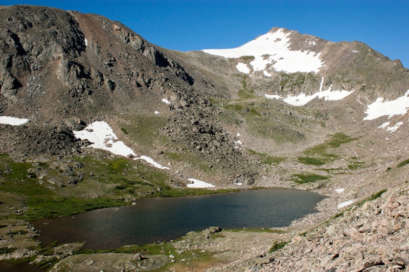
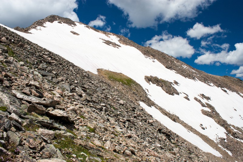
This photo taken from the Arapaho Pass Trail shows the approximate off-trail portion of the route. Route Overview
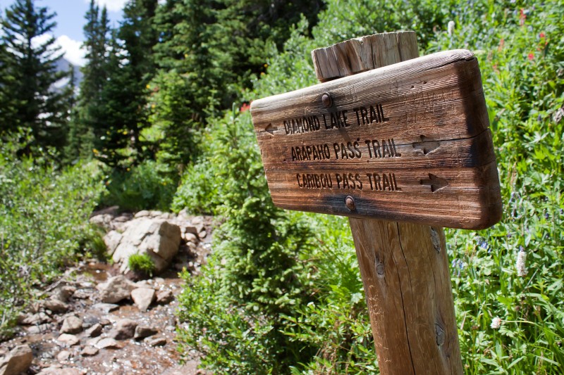
The hike begins at the popular Fouth of July Trailhead. Parking shouldn't be too much of an issue if you are getting an early start. Follow the trail to a signed switchback. The Diamond Lake trail continues straight in front of you. Take this trail. Follow the Diamond Lake Trail
After descending on the Diamond Lake Trail back to the valley floor, the trail crosses a bridge to the south side of Middle Boulder Creek. There is a nice waterfall just to the west of this crossing. After crossing the creek, immediately turn right and find a good trail that parallels the creek. Hang a right after this bridge
Follow this trail for a hundred yards or so and find a small meadow on the left. Cross to the other side of this marshy meadow, take a sharp right and look for a game trail leading into the forrest. Cross this meadow and go right
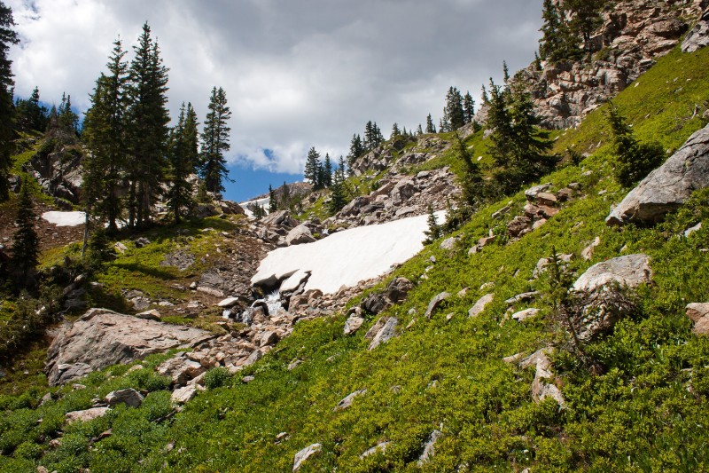
Continue a short distance until you cross a smaller side creek. This creek will help guide you through the forrest up to treeline. Stay on the North and West side of this creek, and be sure to keep it within earshot. Sometimes one of several game trails will assist your ascent, but find another if it starts leading you too far from the creek. The first time my wife and I tried hiking Jasper several years ago, I went too far west before starting the ascent. This led to a very steep and exhausting bushwhack which was likely the major factor in our failed summit attempt. keep following the creek
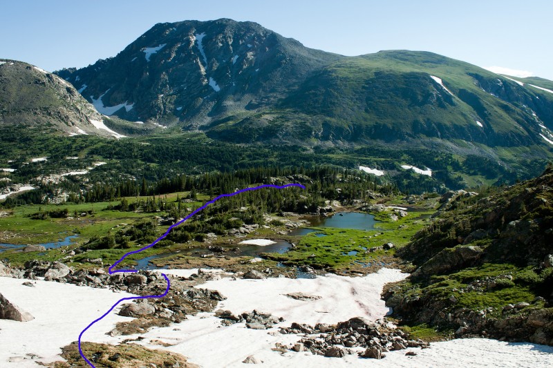
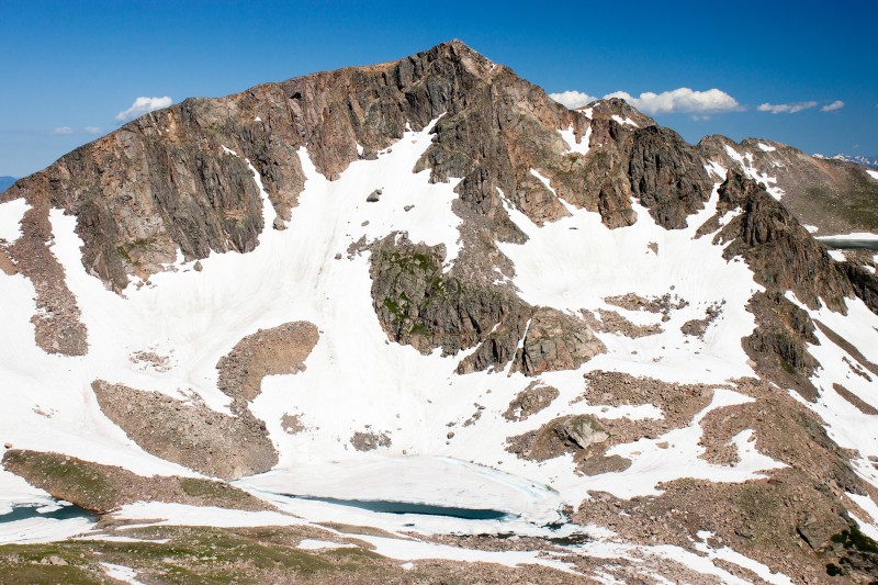
Eventually the creek will lead you up to a flat marshy area near treeline with several small ponds. From here, a direct route up to the basin (steep snow on the right side of the following photo and shown in red on the route overview photo earlier in the report) would require an ice axe and crampons. To avoid this, head to the left and ascend to the low point on the south side of the large rock bulge.
View from the ponds Looking back on the ponds
Welcome to 'Lake Xanadu Basin'. This is an unofficial name that unfortunately brings to mind a horrible movie with Olivia Newton John and roller skates (please don't ask me why I actually watched that turd of a movie). From the basin you can pretty much climb up to the ridge anywhere you please. This will involve some steep scree regardless of where you ascend. I chose to go up at the eastern most end of the ridge because it looked like there were some grassy patches among the scree. View of Jasper and 'Lake Xanadu' while heading up to the ridge
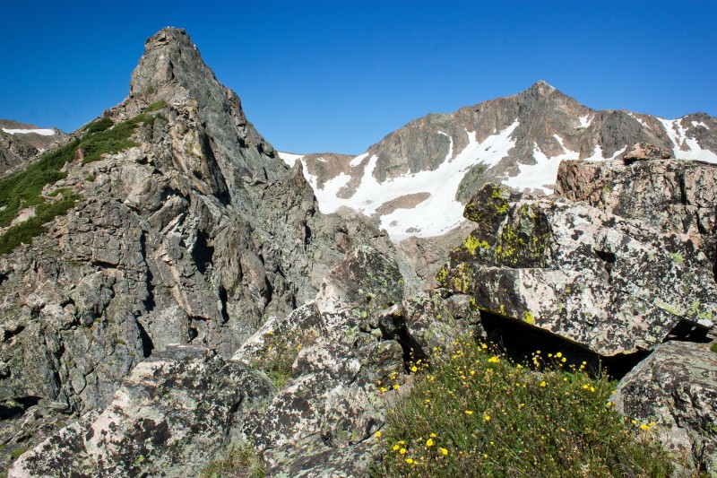
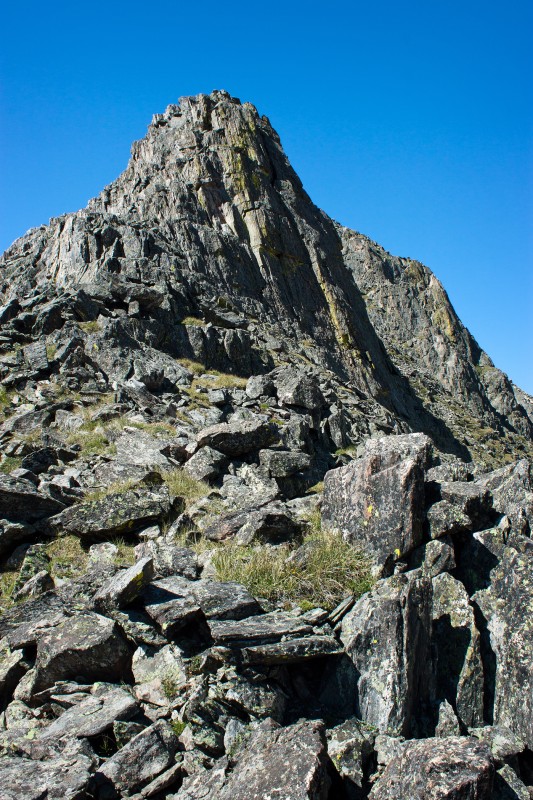
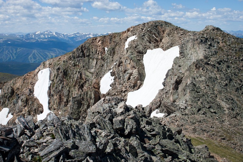
The ridge looks more difficult than it actually is. All of the towers can easily be skirted if you don't feel up to climbing them directly.
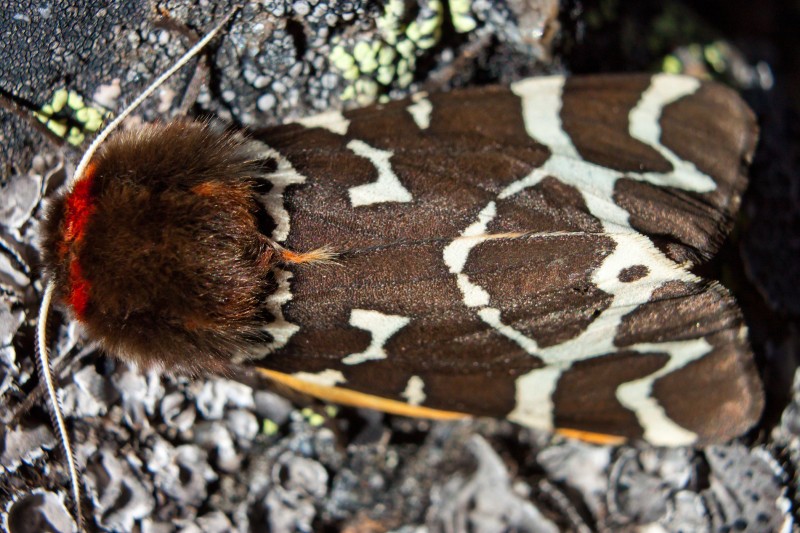
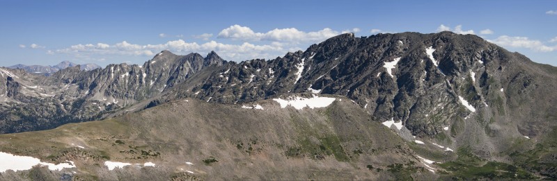
The first tower, Neva in background Another look up the ridge I skirted to the right of this tower Interesting moths on the ridge A look back at the ridge Mount Neva Indian Peaks Panorama
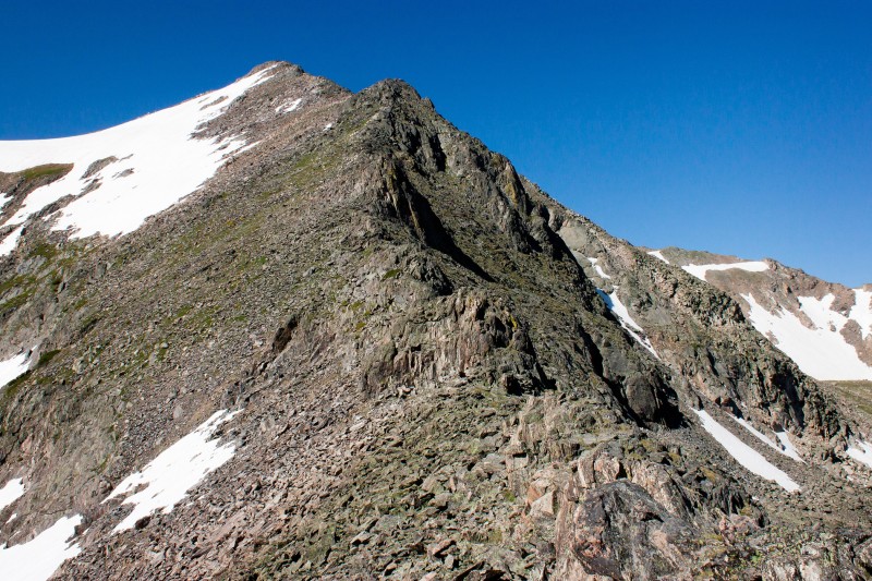
The summit you have been eyeing the entire time turns out to be a falsie, but don't lose heart, the true summit is not much further.
Jasper's summit from the false summit
From the summit, return over the false summit and then descend the northeast slopes back into the basin. This descent would make for a fun glissade earlier in the season.
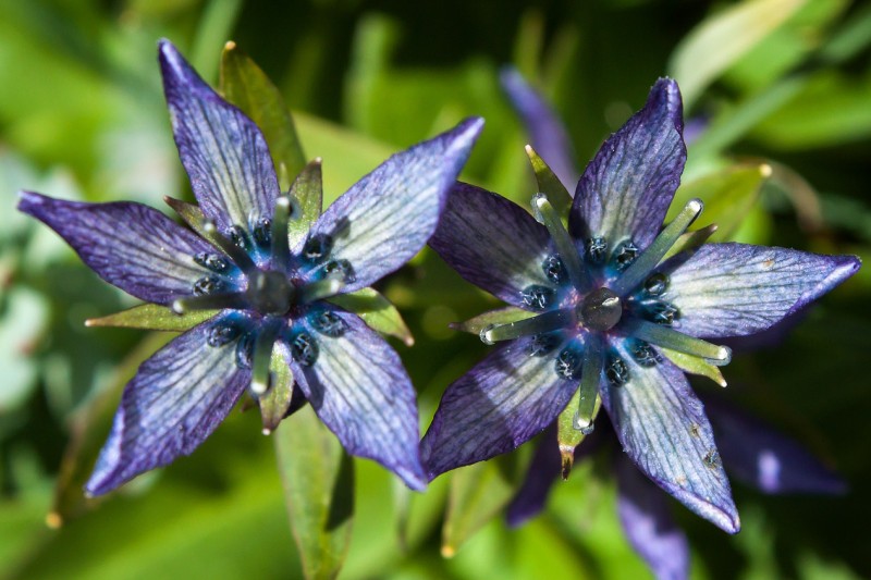
Descending the Northeast Slopes Route Star Gentian in the basin
Once back in the basin, you can make your way past the plane wreckage and 'Lake Xanadu', then retrace your route back to the Diamond Lake Trail.
Plane wreckage above 'Xanadu Lake'
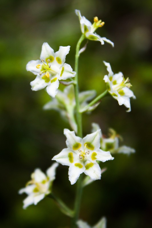
Along the trail back to the car I noticed these little flowers that my wildflower guide later identified as Death Camas. Death Camas Falls along the Arapaho Pass Trail
Thumbnails for uploaded photos (click to open slideshow):
Nice report. Love the panorama shot. Do you know what the very distinctive peak is that appears in the distant foreground right between Longs and Meeker in the photo? I want to say Sawtooth but I think that is wrong. Looks too tall for that.
Matt-yes, those were some funky moths. I'm sure PETA isn't happy about those chinchilla neck warmers they are wearing. Occasionally the wind would catch their wings Marilyn Monroe style, revealing crazy orange and black bodies. I've never seen anything like them in Colorado.
Miles-I'm pretty sure that peak is Iroquois, and it looks frightening. Must be tough, too. There are only 7 ascents listed among the many LoJ members out there, and it doesn't seem to exist on SummitPost.
vonmackle - Thanks. Yeah, I think you must be correct. I dropped a line in Google Earth from Japser's peak to The Loft and it passes right over Iroquois. I didn't think the ridge from Apache to there would look so long from Jasper, but I guess it does. Looks very interesting. Roach says the summit is mucho exposed. It looks it. :shock:
I did this yesterday and the beta for the approach was spot on and super helpful. Thanks much for the effort!
PS this is a friggen fantastic area and the situation and beauty more than makes up for the tedius talus.
Caution: The information contained in this report may not be accurate and should not be the only resource used in preparation for your climb. Failure to have the necessary experience, physical conditioning, supplies or equipment can result in injury or death. 14ers.com and the author(s) of this report provide no warranties, either express or implied, that the information provided is accurate or reliable. By using the information provided, you agree to indemnify and hold harmless 14ers.com and the report author(s) with respect to any claims and demands against them, including any attorney fees and expenses. Please read the 14ers.com Safety and Disclaimer pages for more information.
Please respect private property: 14ers.com supports the rights of private landowners to determine how and by whom their land will be used. In Colorado, it is your responsibility to determine if land is private and to obtain the appropriate permission before entering the property.