Download Agreement, Release, and Acknowledgement of Risk:
You (the person requesting this file download) fully understand mountain climbing ("Activity") involves risks and dangers of serious bodily injury, including permanent disability, paralysis, and death ("Risks") and you fully accept and assume all such risks and all responsibility for losses, costs, and damages you incur as a result of your participation in this Activity.
You acknowledge that information in the file you have chosen to download may not be accurate and may contain errors. You agree to assume all risks when using this information and agree to release and discharge 14ers.com, 14ers Inc. and the author(s) of such information (collectively, the "Released Parties").
You hereby discharge the Released Parties from all damages, actions, claims and liabilities of any nature, specifically including, but not limited to, damages, actions, claims and liabilities arising from or related to the negligence of the Released Parties. You further agree to indemnify, hold harmless and defend 14ers.com, 14ers Inc. and each of the other Released Parties from and against any loss, damage, liability and expense, including costs and attorney fees, incurred by 14ers.com, 14ers Inc. or any of the other Released Parties as a result of you using information provided on the 14ers.com or 14ers Inc. websites.
You have read this agreement, fully understand its terms and intend it to be a complete and unconditional release of all liability to the greatest extent allowed by law and agree that if any portion of this agreement is held to be invalid the balance, notwithstanding, shall continue in full force and effect.
By clicking "OK" you agree to these terms. If you DO NOT agree, click "Cancel"...
Summit Elevation: 10,778' is the generally accepted elevation, but it's also listed on some maps and in some books as 10,781' or 10,785' Date climbed: July 24, 2011 Trailhead / Basecamp / Route: Schriebers Meadow (also spelled Schreibers) / on "Railroad Grade" above Sandy Camp at 6,350' / Easton Glacier Total Round-trip Distance (approach and climb): about 14 miles Total Elevation Gain: about 7,500 feet (3,000' on approach and 4,500' on glacier) Rating: Grade II, Intermediate glacier travel Fun Facts: Mount Baker is the fifth-most-prominent mountain in the Lower 48, it's the third-highest mountain in Washington (if Mount Rainier's Little Tahoma is not counted), it's the second-most-glaciated mountain in the Lower 48, and it currently holds the world record for annual snowfall. Climb Times, for Reference: Trailhead to Basecamp: Over 3 hours / Basecamp to Summit: 5 hours / Summit to Basecamp: 2.5 hours / Basecamp to Trailhead: Over 2 hours The Team: Aubrey, Jen, Pavel (our friend from Vancouver, B.C., who we met while climbing in Ecuador) and Craig (our friend from L.A., who we met while climbing Mt. Rainier)
ABOUT MOUNT BAKER
Mount Baker is a stratovolcano in the North Cascades of northwest Washington, 31 miles due east of Bellingham and 15 miles south of Canada. It is the second-most-active volcano in the Cascade Range (Mount St. Helens is the most active).
Volume-wise, Mount Baker is the second-most-glaciated mountain in the Lower 48, second only to Mount Rainier. But according to "Climbing Washington's Mountains," by Jeff Smoot, Mount Baker has more surface ice, with 44 square miles of ice spread out among its 10 to 14 glaciers (sources vary on its number of glaciers), compared to Mount Rainier's 36 square miles of ice spread out among 26 glaciers. And, excluding Mount Rainier, the volume of snow and ice on Mount Baker is greater than all the other Cascades volcanoes combined.
Mount Baker's summit crater is covered with a 1,300-foot-deep mound of ice, and the mountain's highest point, named Grant Peak, is on the eastern edge of the summit. A sub-crater, which features steaming fumaroles that often belch sulfurous gases, is just below Grant Peak and adjacent to the 10,140-foot peak named Sherman Peak.
Because of its high elevation and geographic location, the mountain receives at least 50 feet of snow per year. And as mentioned above, it currently holds the world record for snowfall in one season. During the winter of 1998-1999, the Mount Baker Ski Area, which averages 600 inches or 50 feet of snow per year, received 1,140 inches or 95 feet of snow. What's even more amazing to think about is that the Mount Baker Ski Area is located at an elevation of just 4,200 feet (and it's nine miles northeast of Mount Baker's summit), so the actual mountain could have received even more snow, but it wasn't recorded.
Before being "discovered" in 1792 by Captain Vancouver's first mate and the mountain's namesake, Joseph Baker, the mountain was known as Koma Kulshan by the Native Indians. There are many translations, but Koma Kulshan is said to mean "Broken/Damaged/Wounded Mountain," "White Steep Mountain" and "Great White Watcher."
THE RECON
Recalling all the mountains Jen and I have had to turn back on over the last couple years, mostly because of nasty weather, high winds or horrible snow conditions, we're getting the feeling that the Mountain Gods have it out for us. And when we did a little reconnaissance of the approach to Mount Baker's basecamp last week, I was sure of it.
On a normal year around here, as I've read, by early July you can hike a snow-free trail to about 6,000 feet in elevation. But it wasn't the case this year, as just a week ago the snowline was still holding at just 3,400 feet, and almost the entire trail to the Easton basecamp was still buried. Long story short, we spent many hours bushwhacking through snowy forests, navigating across creeks and routefinding up snowy slopes. And while touring around up there, we encountered a few climbing groups doing the same thing.
THE APPROACH
The knowledge we gained from our recon was very helpful when it came time to climb. Even though some snow had melted off the lower trail, it was still a routefinding challenge.
Luckily for us, the weather could not have been better and the forecast for our two-day climb was looking mighty good. Perhaps the Mountain Gods decided it was finally our turn for some good fortune.
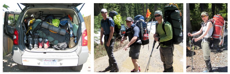
Loaded truck, Craig, me, Pavel and Jen:
The approach hike was like doing a tough climb right before an even tougher climb. With our heavy packs full of all our climbing gear, ropes, snow-camping gear, cold-weather clothes, tents, stoves, etc., we had to gain 3,000 feet of elevation over four miles. And most of that was on snow.
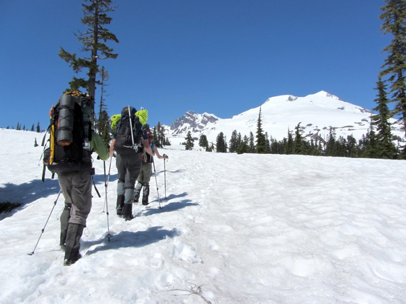
Pan of the Twin Sisters by Jen:
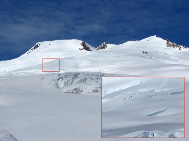
Climbers still on the mountain:
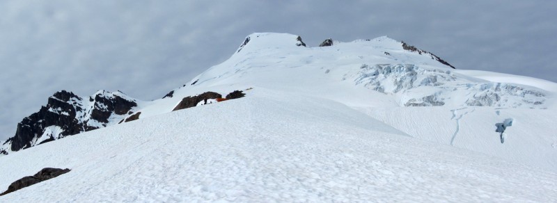
We wanted to climb as high as possible to make our summit climb shorter, but it was an exhausting trek, so we reluctantly stopped on the moraine ridge at 6,350 feet. Some people tented up as high as 6,800 feet, where the ridge finally dips into the Easton Glacier, but those people were crazy. And they must have steel backs.
As I began to unpack and help set up camp, I removed a snow picket from my pack and I plunged it into the snow. But I didn't plunge it how I normally do, like I'm throwing a dart. Instead, I plunged it from the top with my bare hand. When it hit the snow, one of my fingers slipped and the web of skin between my middle finger and ring finger sliced like a massive paper cut. At first I thought it was just a simple cut, but once the chunk of skin flapped open, blood oozed down my palm. It wasn't a good way to start the evening.
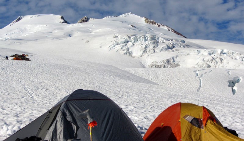
Our basecamp at 6,350':
Views from basecamp:
Aubrey, Jen and Pavel at camp (photo by Craig):
Late-afternoon sun on North Puget Sound and the San Juan Islands (Vancouver Island barely visible in the distance):
For some reason I decided one canister of fuel would be sufficient for melting snow for drinking water. Fortunately, I had the forethought to ask Pavel to bring a second stove and fuel, as a backup. Unfortunately, his stove started acting up, so we were only able to make enough water for each of us to have just two liters apiece for the climb, which is barely enough for a 4,500-foot climb.
Because we spent so much time trying to melt snow for our drinking water, we didn't get to bed until after 8 p.m., with the sun still shining brightly. But it didn't really matter because none of us slept much anyway.
THE CLIMB
To ensure good (i.e., solid and safe) snow for our climb, we decided to start at 1 a.m. Typically, the cold, nighttime air consolidates and hardens snow bridges and crevasse edges, making things a little safer. So I set my alarm for midnight.
At 11:55 p.m. my phone made a strange noise that woke me up. Turned out, it was the dead battery signal the phone makes just before shutting down.
Even though we all pretended to sleep, we each only got about an hour of sleep. But oftentimes that's how it goes on climbs like this.
While prepping the rope for our climb, Jen's brand-new headlamp with brand-new lithium batteries started to flicker and then it completely died. Because we've had headlamp problems before, which resulted in dire situations, I brought a backup headlamp, and I'm so glad I did. You always read that you should bring extra batteries for you headlamp, but I'm a firm believer in bringing an extra headlamp (with the "extra" batteries inside it).
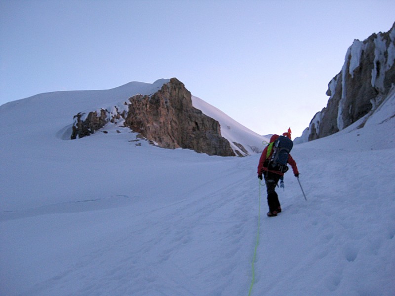
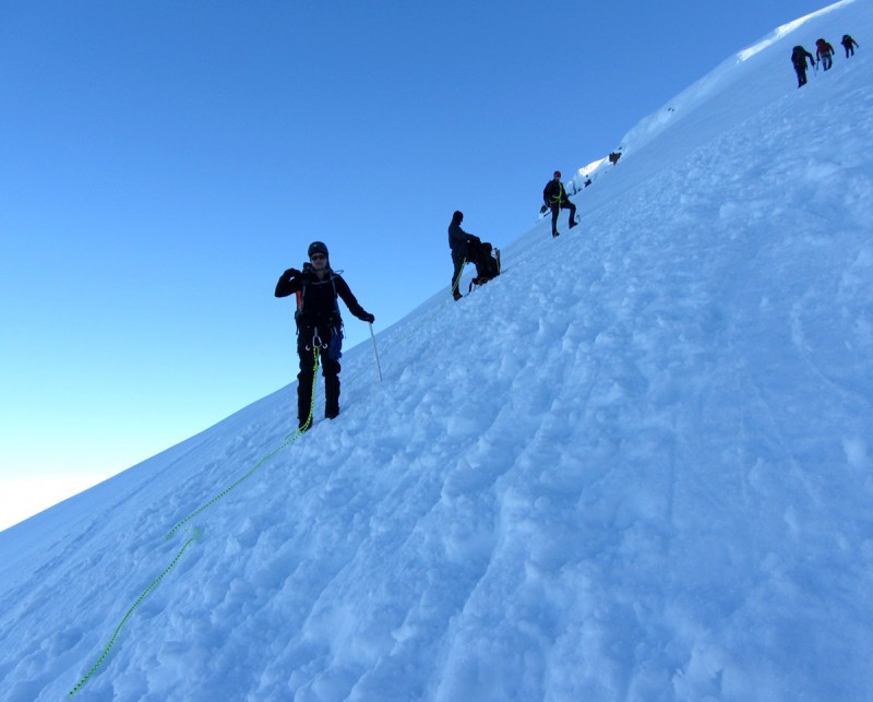
At 1:30 a.m. we were finally roped and ready. Because I spent the most time researching the mountain and coordinating the climb, I was assigned to lead.
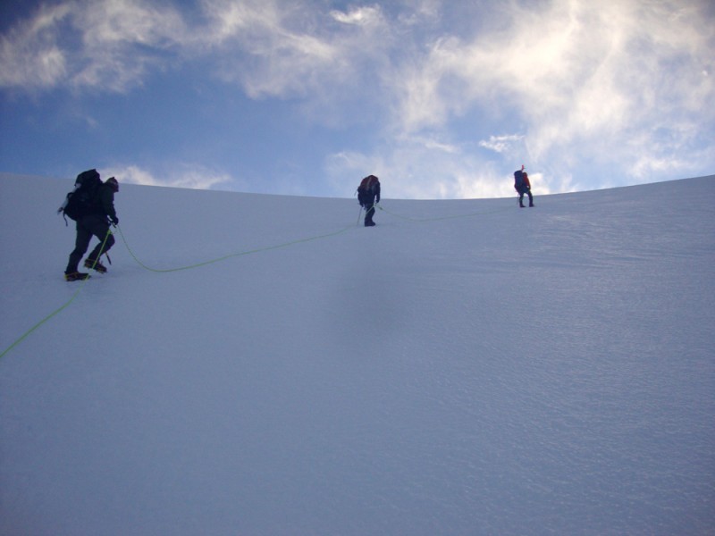
As we started up the dark, icy ridge, I kept a compass in my hand to stay on route. Originally, the plan was to head almost due north until hitting the Easton Glacier, and then head north-northeast in the hopes of finding a boot pack.
Instead, after seeing a couple teams hop directly onto the tongue of Easton Glacier, we decided to follow them. At that time no one else was on the glacier, so it seemed like a good idea to follow the other teams (for our sake and theirs).
Once we got into a slow, sustainable rhythm, I realized how thirsty I was. No matter how much I drank, I just couldn't quench my thirst. I really didn't want to have to add raw snow to my Nalgene, but at the rate I was drinking, there was no way I was going to make it up and down without running out of water. It's not like I'm a wuss or anything, but when we were harvesting snow the previous evening, I pulled a couple worm-like things out of the water. Snow worms?
"Just pretend it's a Tequila worm," Craig said, in an effort to make me feel better.
After stopping to pack snow into my Nalgene, the other teams had already zipped away and out of sight. Wow, they're pretty fast, I thought.
It was now just the four of us on top of a massive glacier under a dark sky. But it was exactly where I wanted to be. And as we continued to march up the mountain, with the sound of crampons crunching into ice, I found plenty of time to reflect on things.
Self reflection is just one of the many reasons why I love to climb. When you're so intently focused on what you're doing, with the realization that some mistakes might be your last, your mind becomes curiously clear. All the unimportant clutter of everyday life dissolves, and it's like your mind finally has time to breathe, focus on the task at hand and even ponder the truly important things in life (for me, it's Jen, my family, my friends and living life to the fullest).
Climbing in a rope team furthers your opportunity to self reflect. Even though you have a lifeline tied to your rope mates, it's like you're hiking alone because you're separated by many yards.
Of course, I couldn't get too deep in thought because I had to pay attention to where we were going.
When I encountered a gaping crevasse perpendicular to our path, it gave me pause. Jumping across crevasses is never a good idea, especially when you're tied to others and wearing crampons. The only way I could get across was to step from the very edge. Fortunately, it wasn't overhanging much, so it held my weight. But at just 5'4", it was a real stretch for Jen. Then Pavel and Craig stepped across without any problems.
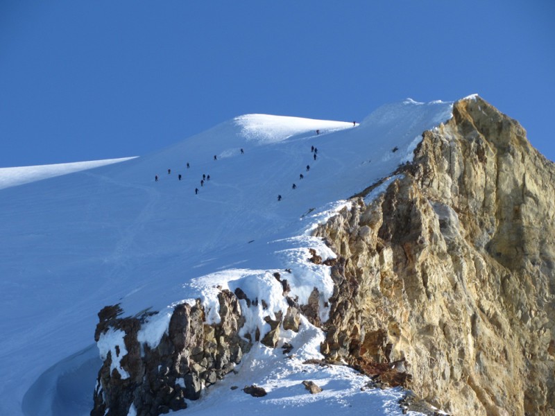
Just when I thought we'd be ascending the mountain all by our lonesome, we caught up with the other two teams. For a while I set a slow pace behind them, but they were too sporadic and they were making me nervous. The guy in the back would make a bunch of quick, choppy steps, and then he'd completely stop for a moment. And I saw another guy step on his rope a few times. So it was time to pass.
After slowly working past the second team, I noticed the first team passing through a narrow bridge between two open crevasses. There wasn't enough room for two rope teams, plus the upper team was heading to the left and I didn't want to have to climb below them (if someone fell from their team, they would fall on us). So I stopped. This is when the leader of the second team invited us to "cut in," which was very cool of him (I think he was a guide for AAI or Mountain Madness).
Meanwhile, the city lights of Bellingham and Seattle sparkled in the distance behind us.
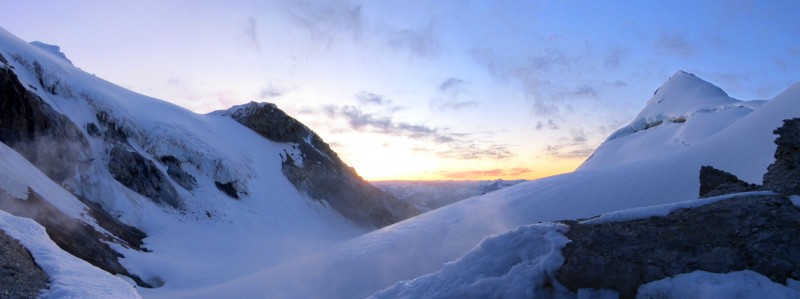
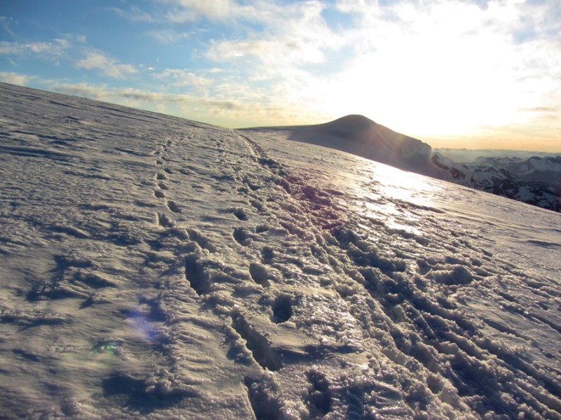
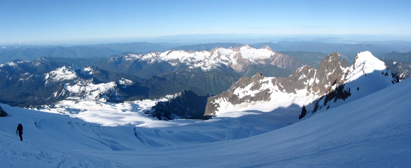
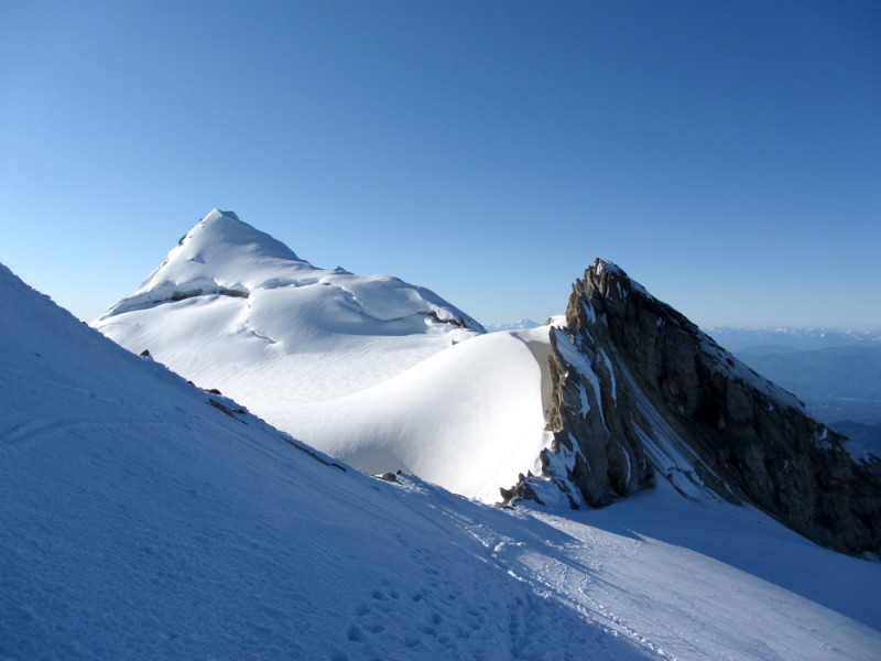
Soon thereafter, we gained the edge of the Sherman Crater, snapped a few photos of the sunrise, and then pushed on past the other rope team.
Photo of me nearing the crater (photo by Jen):
Sunrise and a pan of the Sherman Crater (Sherman Peak on the right):
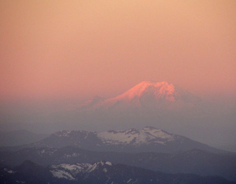
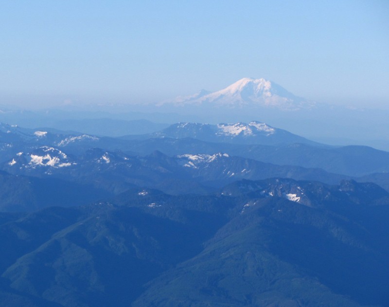
Zoomed-in shot of Mount Rainier, which was 135 miles to our south:
The Roman Wall, the crux of the climb, loomed before us.
It was a very steep section. At least 40 degrees - if not more - in some sections. And it was icy.
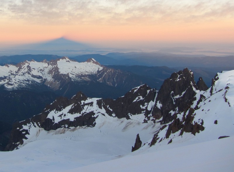
Climbing the Roman Wall with Mount Baker's shadow in the distance:
Firm spike plunges only resulted in an inch of purchase. Crampons, however, dug in like hot knives in butter. But it's always strange having to rely on just your feet to keep you attached to a steep, long and icy slope. A fall here wouldn't have been a good thing.
The Roman Wall seemed like it went on forever. I kept looking up, thinking we were nearing the lip, but it kept angling up.
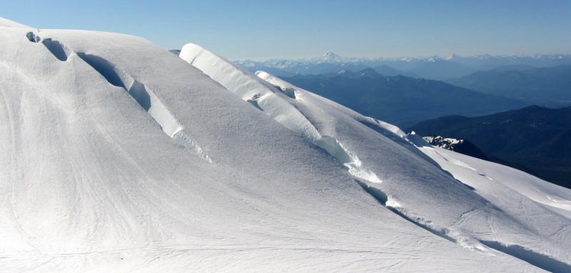
Then we hit a developing bergschrund, which made things even more interesting. It hadn't opened up yet, but you could tell it was trying to. It was cracked, blocky and steep, and it was the only section of the climb where I actually had to do some daggering with my ice axe.
Sometimes when I'm climbing I set little goals for myself. Something like, I'm not looking up until I get to that point. Or, When I get to that point, I'll reward myself with a sip of water or a quick break to catch my breath.
So I told myself: When I get to where the Coleman-Deming and Easton routes merge, which was about 50 yards above us, I'll look up again. But just three or four steps later, I couldn't resist and I looked up, in the hopes of being closer than expected. But we weren't.
So much for setting little goals.
Nearing the top of the Roman Wall (photo by Craig):
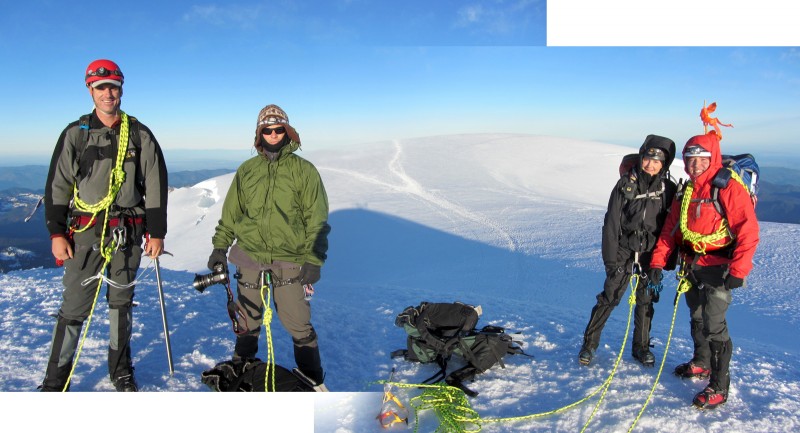
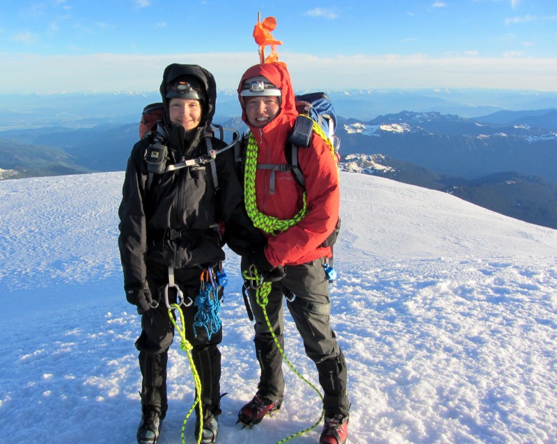
Eventually, we planed out on Mount Baker's broad summit. But the true summit, Grant Peak, was still a little hike away. "That looks really far away," Jen said. I was thinking the same thing.
It was a quick hike, though. And after passing the first team to gain the summit from the Coleman-Deming Route, we became the first team to summit from the Easton Route.
When the four of us finally made it to the top, my body felt a rush of excitement and relief. So many things can keep you from making it to the top of a mountain like Mount Baker, so I felt very fortunate.
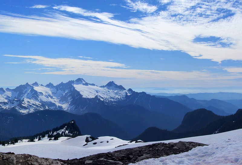
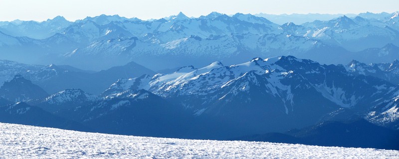
We were also very fortunate to have such incredible weather and an amazing, 360-degree view. We could see everything from Vancouver, B.C., to Seattle and beyond. Mount Rainier rose 135 miles away from the south and the jagged mountains of the North Cascades erupted all around us. It was truly one of the most scenic summits I have ever experienced.
Knowing that weather like this was a rare thing to experience on Mount Baker, we all drank it in and truly appreciated it. Even though we planned this climb months ago, we somehow hit the perfect weather window.
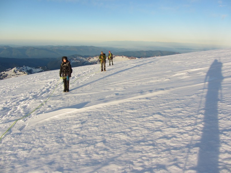
The descent back to basecamp was just as exciting as the ascent because we could finally see all the terrain we had just climbed. Naturally, we had to make many stops to take photographs.
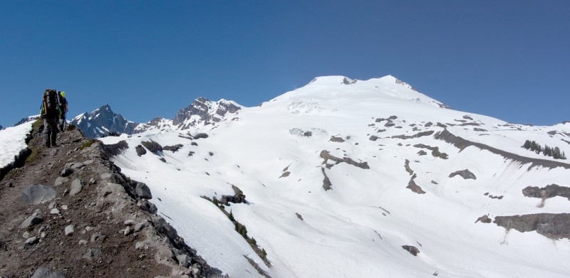
We just missed rush hour on the upper mountain:
Coleman-Deming Route climbers on the ridge:
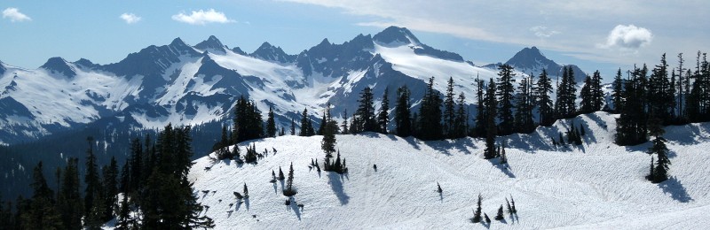
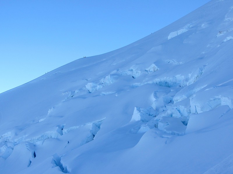
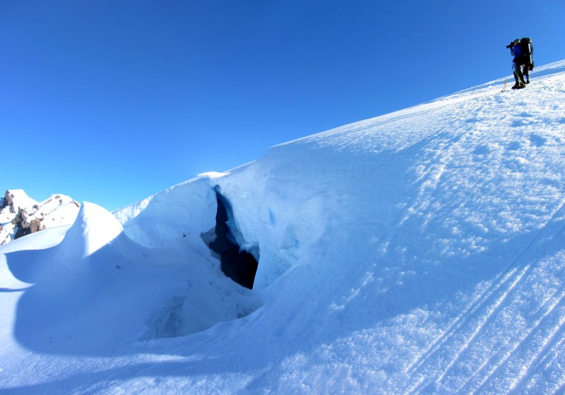
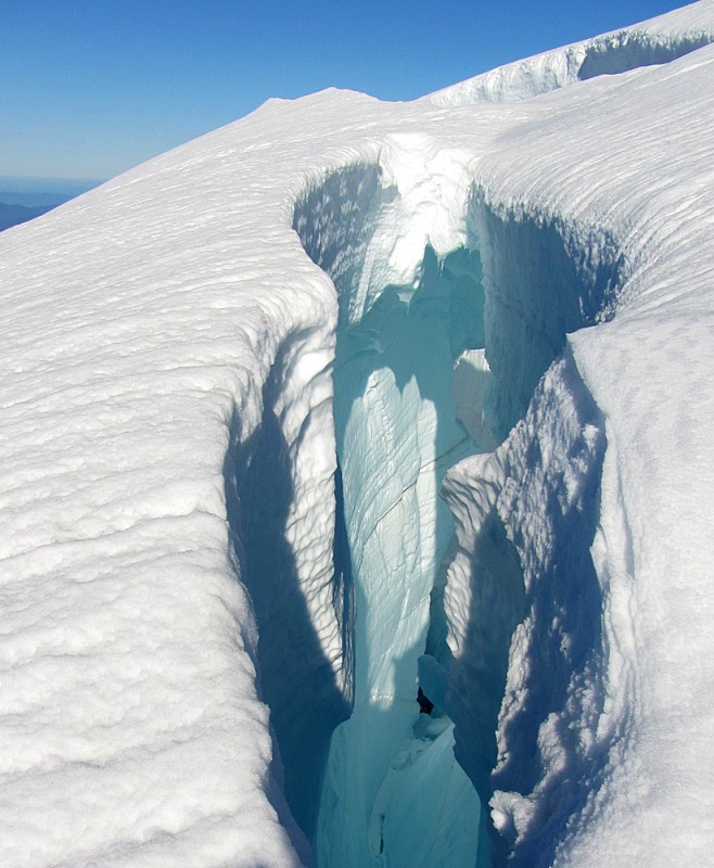
All the crevasses were mysteriously spectacular:
Back at our basecamp, exhaustion and lack of sleep finally started to set in. And the hike back to the trailhead through all that slushy snow made things even more brutal.
As we hiked back down like a bunch of zombies, Jen and I developed some severe cases of shin-bang from our boots; my arms began to burn but I was too tired to put on sunscreen; my pruned feet began to blister; I ran out of water; and it was so hot below treeline that I was on the verge of heat exhaustion. But we pushed through all the pain and made it.
"Awesome climb," I said, "but that hike back down ****ing sucked."
"In a couple days you'll look back on this climb and think it was the best thing ever," Pavel reassured me.
Funny thing is, he was right. After just two days, my mind has already started to dump those bad memories and polish the good ones.
Thumbnails for uploaded photos (click to open slideshow):
Looks like you are keeping busy up there Aubrey/Jen. Let me know if you ever try that Della Falls trip. Would love some first hand info before I take the family back there.
At least you had good weather and views! The day we did Baker, we did most of the climb from our camp in the fog ... :? . Nice photos, Aubrey and Jen. Thanks for posting. Looking forward to hearing of more of your adventures in the PNW. Happy trails! :D
Your reports are always such a pleasant surprise and so fun to read. Awesome photos, too... love the summit shot of you and Jen... you can see the happiness and sense of accomplishment on your faces. Thanks for posting!
Congrats Aubrey and Jen on what looks to be a great climb ! Glad to see you two had good weather for a change - it's been a long time coming. So happy you two are living the dream and making the most out of life. Wishing you many more safe adventures in the future.
On the 24th, I was sitting on Camano Island with my eyes fixed on Mt Baker all day. All I could think was ”damn, it would be an absolutely perfect day to climb that” Excellent report!
Thanks for all the nice words, everyone. This was an awesome climb, probably more scenic than Rainier, IMO. Tougher, too, but only because we went unguided, had to carry more gear, and didn't have a hut to sleep in. Floyd, Della Falls isn't in the cards for this year, maybe another. Vancouver Island is like a whole 'nother world to explore, and it's gonna have to get in line behind WA, OR and B.C.!
Caution: The information contained in this report may not be accurate and should not be the only resource used in preparation for your climb. Failure to have the necessary experience, physical conditioning, supplies or equipment can result in injury or death. 14ers.com and the author(s) of this report provide no warranties, either express or implied, that the information provided is accurate or reliable. By using the information provided, you agree to indemnify and hold harmless 14ers.com and the report author(s) with respect to any claims and demands against them, including any attorney fees and expenses. Please read the 14ers.com Safety and Disclaimer pages for more information.
Please respect private property: 14ers.com supports the rights of private landowners to determine how and by whom their land will be used. In Colorado, it is your responsibility to determine if land is private and to obtain the appropriate permission before entering the property.