| Report Type | Full |
| Peak(s) |
Tabeguache Peak - 14,158 feet |
| Date Posted | 07/25/2011 |
| Modified | 07/26/2011 |
| Date Climbed | 07/23/2011 |
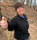
| Author | RiceSnob |
| Tab from Jennings Creek |
|---|
|
Since we already hiked Shavano, we decided upon the Jennings Creek route for Tabeguache - while staying away from the closed/eroded section. Thanks to all those who posted route details - your guidance was quite valuable. Another day on the top of mountain with exception we hike all the peaks in the Sawatch Range and this is my first trip report and for the first time we had a friend want to climb with us which is rare because we hike slow and we take lots of break...but we steady, and I would like to encourage more my friends get out there walk in the woods and explore the beauty of God's Creation and is good for your body, mind and spirit. I think that's enough for my introduction. We drove up from Denver Friday to get to the Jennings Creek TH, the road wasn't bad at all. We saw someone drive a Chrysler 300 get up there which i think (rental car or they don't know) we found few camp site along the road set up the tent, get ours pack ready for tomorrow and just relax by campfire. The road is accurately shown on map as high clearance, 4WD not needed! We all agree set alarm 5:30am but i couldn't sleep well, we get up around 6:00 am with triple shot of espresso starbuck's i think wake me up very quickly so we head up start at the trail about 7:00. I would like say THANK YOU to ALL write a great trip report it is help tremendous. The Jennings Creek trail head start exactly 7.6 mile from the turn off 50 on the CR 240 from that you can see a few big rock there they was seperate from each other, there wasn't any cairn so you have to pay attenion or you will miss it!! Look on the right side of the road, you see a few stumps of the small trees have been cut off that's where the trail starts (~10,520'). You keep follow the old but decent trail and you keep going until you see the tall old register on the left hand side and just follow you will cross many logs tree, the trail is steep as it climbs up into Jennings Creek drainage. We reach the first look at "The Valley" I'm telling you is it worth it. Go check out for your self if you don't believe picture can't describe. I have seen many valleys but this one is different than others so by this time don't let the beauty make you miss the small pond nestled in the brush at 11,250'. 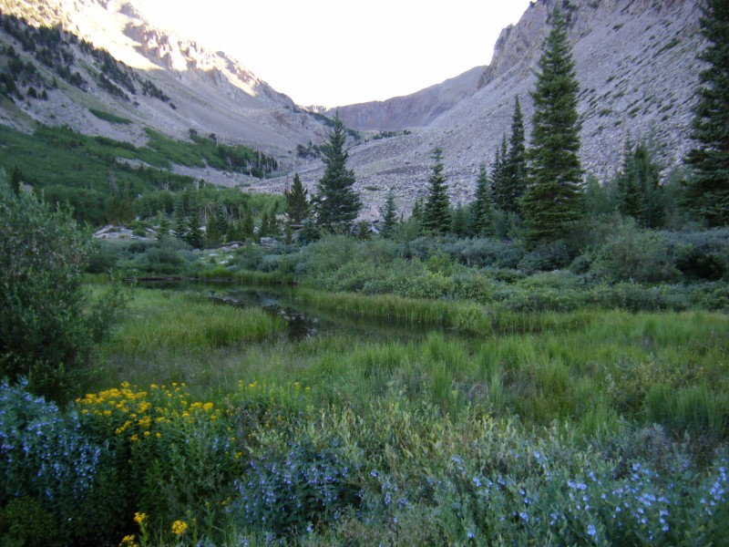 climber's right most of the way up). If you lose the trail, just keep working up the drainage and you'll find small trail segments all the way to the saddle (~12,600') east of Carbonate Mtn. The basin is not very wide and any "bushwhacking" is quite easy. There are lots of cool old trees in the basin. 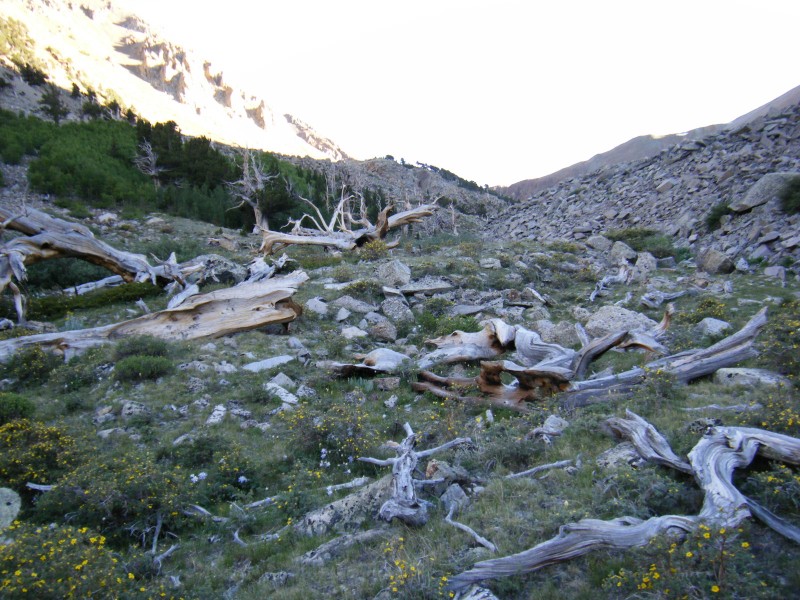 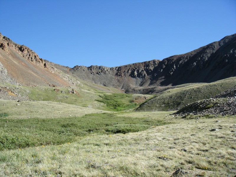  We turned right (East) and followed the small trail along (or just to the right/south of) the ridge around the first of many false summits. From here we got our first view of the remaining half mile to the summit. The final 300 yards before the summit you will encounter some easy class 3 but I think that adds more challenge and forced us to focus. Distance from TH to summit is 4.3 miles.  On our return we (meaning "I" the incompetent navigator) made the mistake of descending too low below the false summit south of 13,936'. Instead of traversing across the slope to return the way we came, we followed the "old" (closed) trail a few hundred yards and opted to descend the scree/rock slope about 1000' into the Jennings drainage where we picked up the trail. My wife and I are comfortable with steeper slopes (Sneffels, Snowmass from Lead King, ...), but many kudos (and apologies) to our friend Annie who patiently downclimbed the rock/scree without complaining. I owe you a hot bowl of pho and a new pair of pants, which were sacrificed on the rocks. Wonder if she'll ever hike with us again!? Thumbnails for uploaded photos (click to open slideshow):
|
| Comments or Questions | |||
|---|---|---|---|
|
Caution: The information contained in this report may not be accurate and should not be the only resource used in preparation for your climb. Failure to have the necessary experience, physical conditioning, supplies or equipment can result in injury or death. 14ers.com and the author(s) of this report provide no warranties, either express or implied, that the information provided is accurate or reliable. By using the information provided, you agree to indemnify and hold harmless 14ers.com and the report author(s) with respect to any claims and demands against them, including any attorney fees and expenses. Please read the 14ers.com Safety and Disclaimer pages for more information.
Please respect private property: 14ers.com supports the rights of private landowners to determine how and by whom their land will be used. In Colorado, it is your responsibility to determine if land is private and to obtain the appropriate permission before entering the property.