| Report Type | Full |
| Peak(s) |
Mt. Bierstadt - 14,066 feet |
| Date Posted | 07/16/2011 |
| Date Climbed | 07/14/2011 |
| Author | James Scott |
| Bierstadt & Evans via Abyss Lake |
|---|
|
I am hesitating to post this trip report. Roach writes about this (route 3.19), as does Dawson (3.4.9), but it still feels like a well kept secret. I first did this in 2007, and really enjoyed it. Last Thursday I repeated the day, and it is now one of my favorite routes. The Abyss Lake drainage is framed by big U, with the southern ridge of Bierstadt on the left, Bierstadt in the upper left, the Sawtooth to the north, and the northern ridge of Evans to the Evans summit frames the right side. In short, you drive to the first big switchback on the Mt Evans road, drop down into the Abyss Lake drainage, cross over and up to gain the southern ridge on Bierstadt, and cross back over the Sawtooth before hitting Evans and hopefully getting a ride back down to your car. It's close to Denver, there's a bit of excitement, beautiful views, and not as much simple walking as a normal day. This is a route I will return to over the years. I don't want it to become super popular. Ashley and I got to the parking spot at 6:15, and the clouds were so thick we couldn't see five feet off the road. It was a little nerve wracking driving up the shelf road with no visibility. I was glad I'd done the route before and had a clear idea about where to go, but it cleared very quickly and dramatically, showing blue skies. Starting at 6:20, we walked from the road to the Epaulet saddle, and dropped down the gully into the Abyss Lake drainage. This is easy to find and there is a broken path down the loose gully. It's strange to start a climb by dropping down several hundred feet. 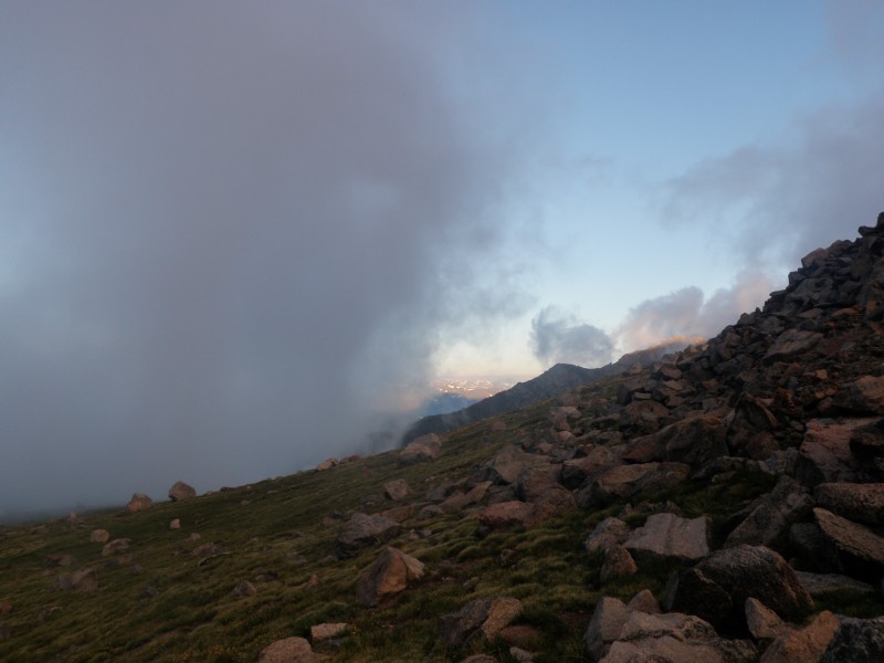 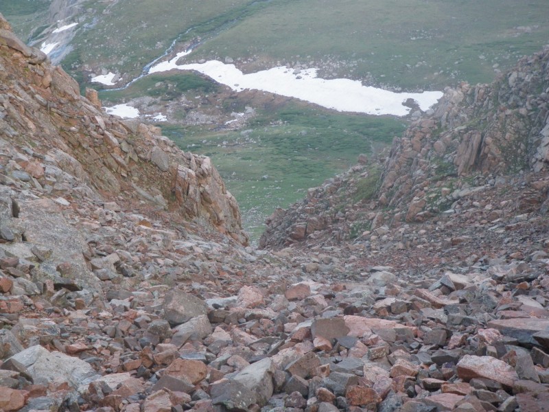 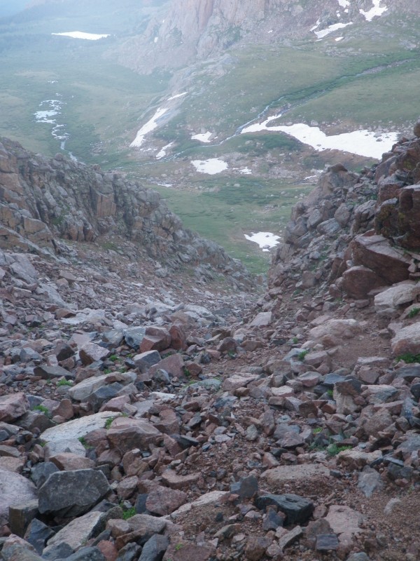 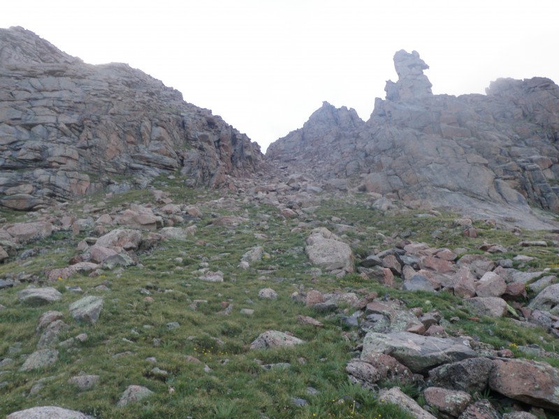 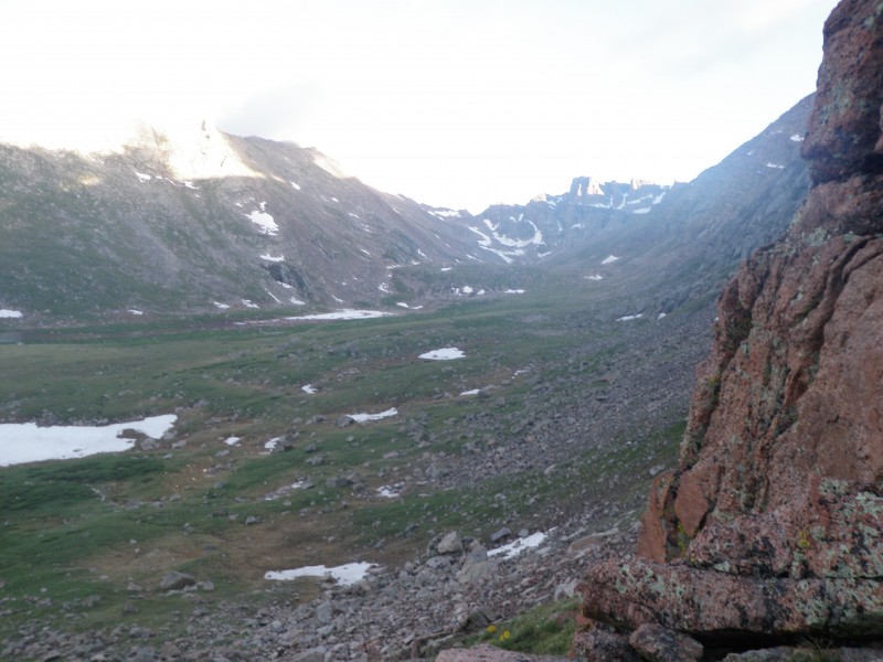 Once in the drainage, you can see a single track path winding toward the step-up at the top of the drainage, revealing Abyss Lake. This is a beautiful place to be, and it's easy to get that "where else would you rather be?" feeling. We laughed about the many cars making their way up the Mt Evans road on one side, and the line of ants coming up Bierstadt from the Guenella Pass side. We were right in the middle, with this valley all to ourselves. We made the lake quickly, crossed over, and picked our line up the slope toward the Bierstadt ridge. There is no trail going up, and it is mostly talus, but I wouldn't consider it scree. There are a lot of possible ways up, but we basically worked up toward the right of the rocky high point on the left side. This went fairly quickly as well. 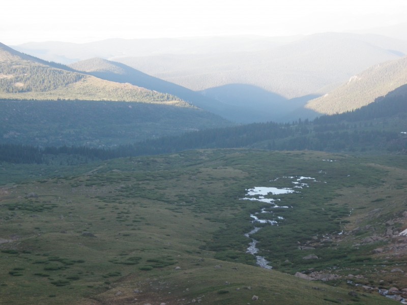 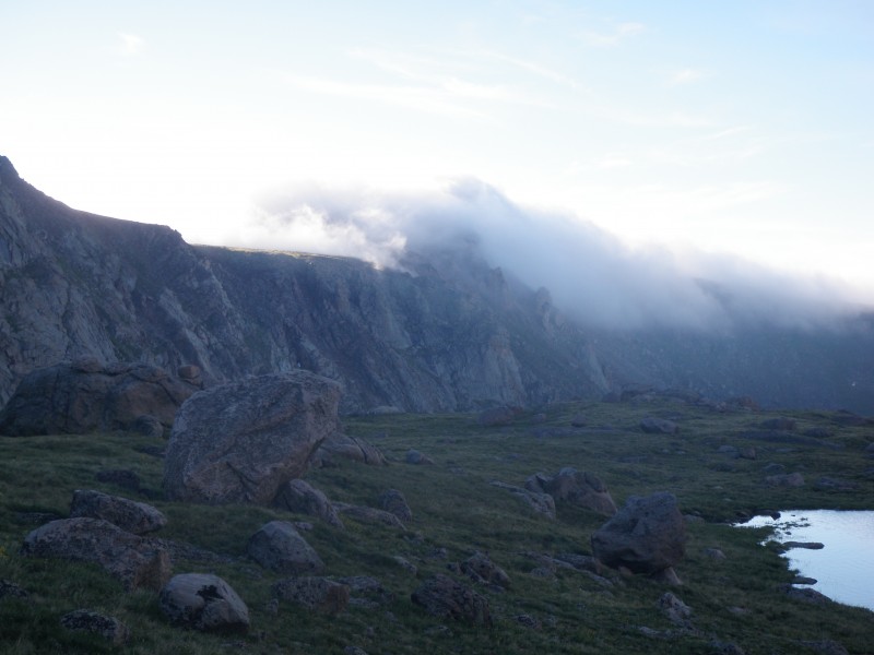 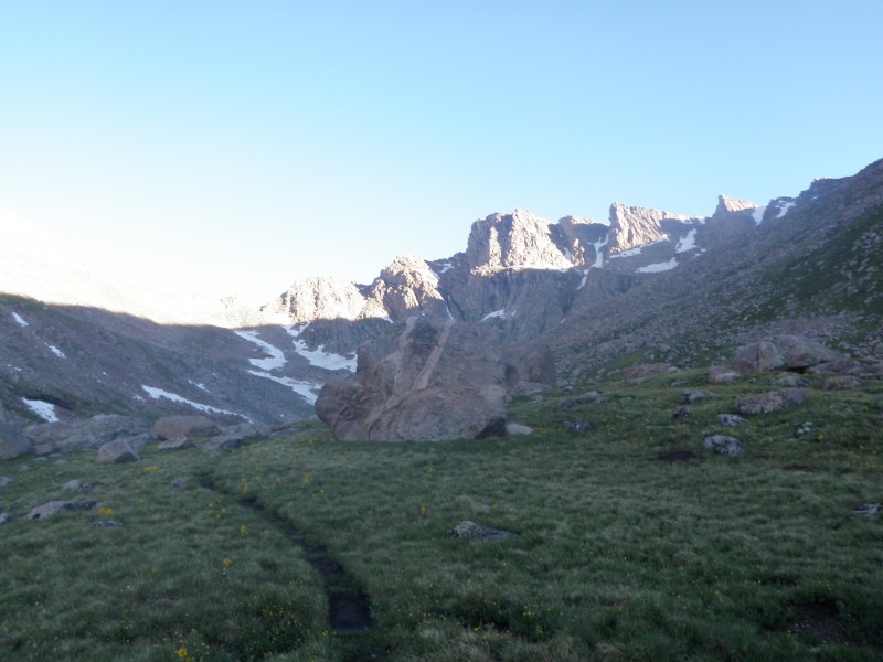 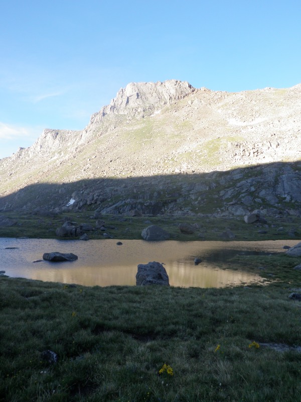 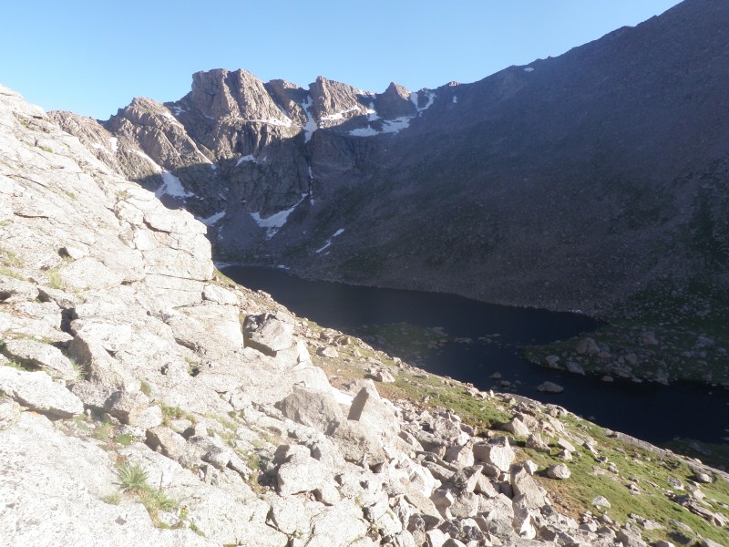 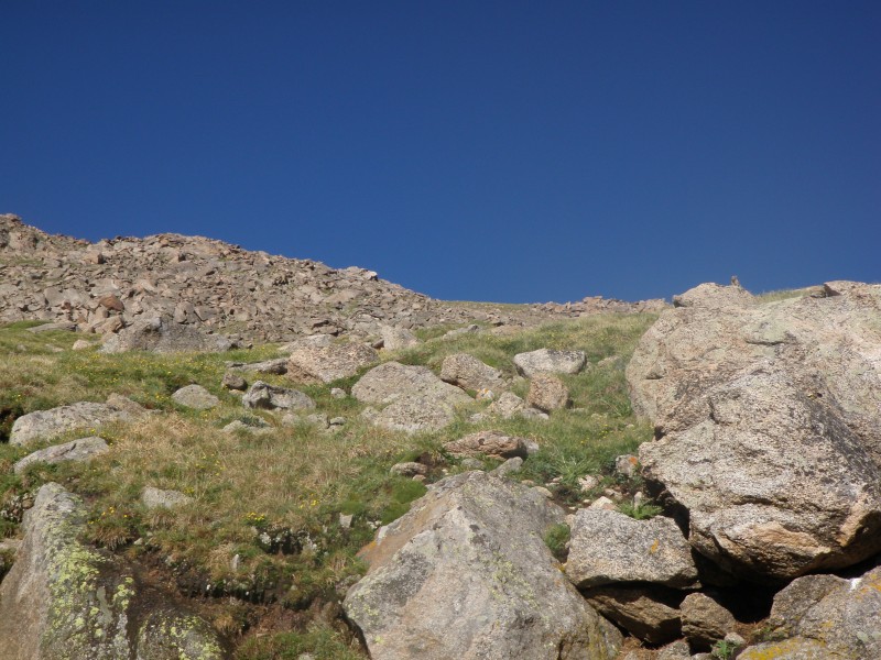 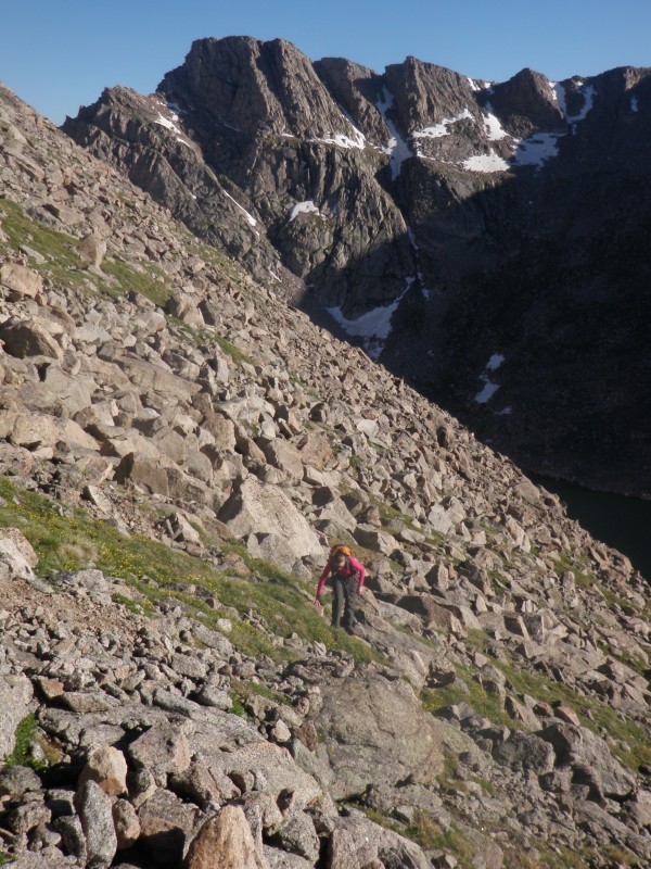 When we gained the ridge, the next basin over opened up below us, along with a pretty clear view of the ten mile/ mosquito range, and beyond. Turning around, Evans is directly across Abyss Lake, and the Sawtooth was showing it's muscle at the head of the valley. Bierstadt looked pretty close to us, and it was an easy class 2 scramble to get to the final push, when we started hearing voices above, telling us the crowds were waiting. When we arrived at 9:00, there were only four people, but another five quickly showed up. I don't mind the crowds- everyone seems to be friendly at 14,000 feet, and we did have the approach to ourselves. The clouds were nothing yet, but we opted to have a quick snack and get down to start the Sawtooth. It would be easier to relax and eat with the Sawtooth behind us, especially with the inclement weather expected to roll in again today. 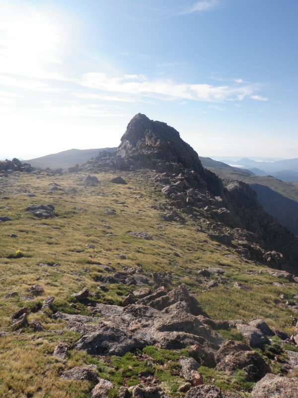 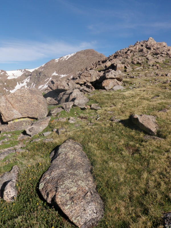 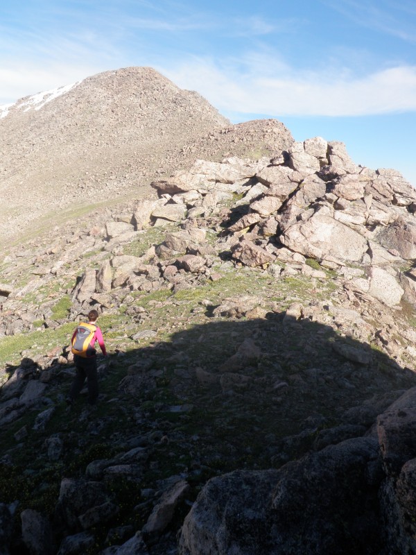 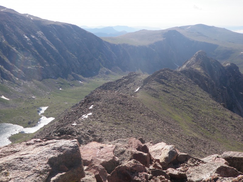 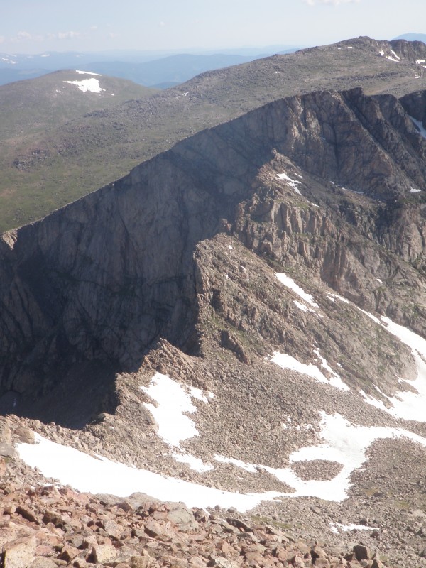 It's a tedious drop from Bierstadt down to the beginning of the Sawtooth, and with a couple snowfields that we wanted to avoid, we were unable to stay on the accepted path. I was getting excited for the scramble, and finally the first "tooth" appeared. This is a classic example of how "it's always easier than it looks from afar." The climbing was fun, with little exposure, and we chose to go directly over the crux. Just enough to get your pulse up a bit, but nothing too intimidating. Before long, we reached the saddle before the third "tooth" and turned left toward the ledges. Again, from afar they looked incredibly dangerous, but once on them, they are stable, wide, and allow a certain amount of comfort despite the dramatic exposure they offer. What made this crossing a bit more uncomfortable was how quickly the clouds- nonexistent only 30 minutes earlier- were building and creating the low black ceiling that can indicate thunder. We were happy to top out and find more solid ground on the Evans side. 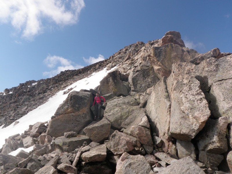 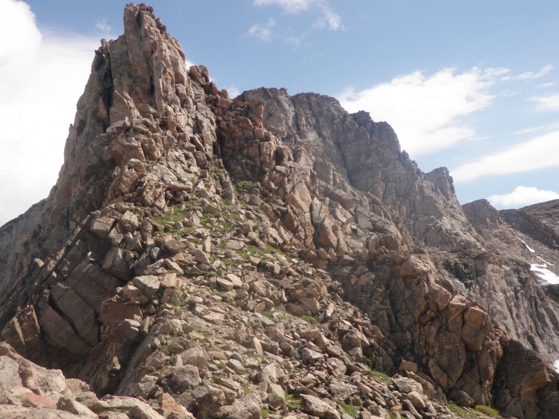 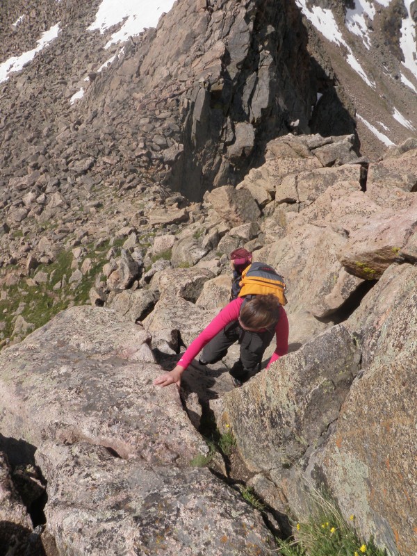 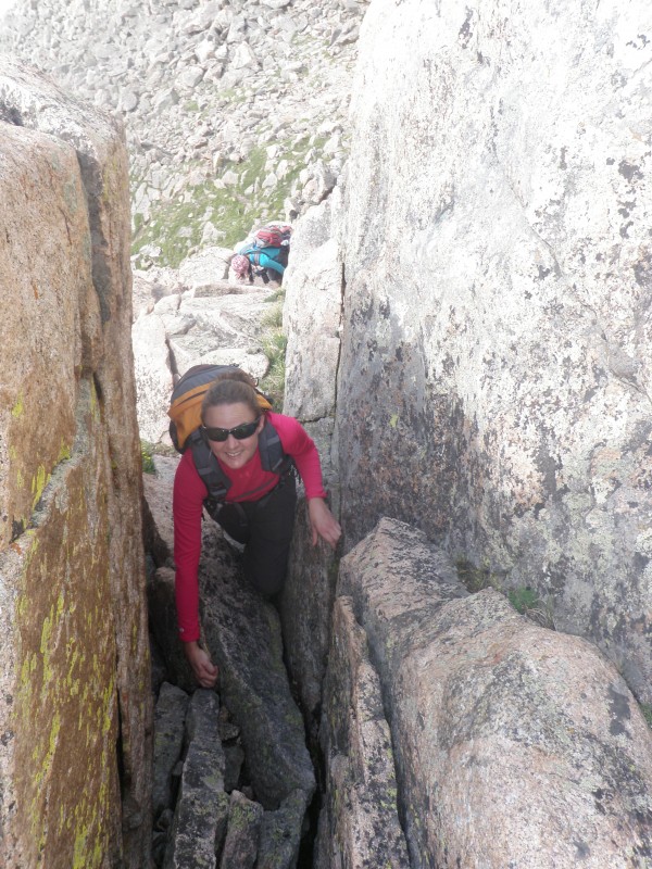 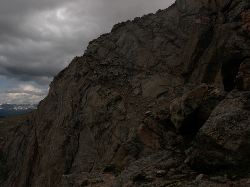  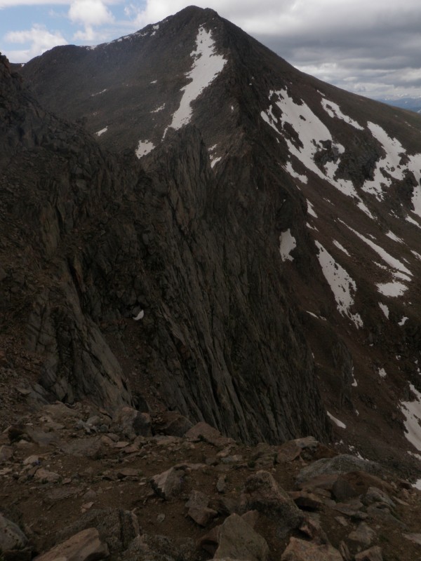 We had planned to eat at this point, but with 1.2 miles to go to gain Evans, all on an exposed ridge, we decided we could hold out until Tommyknockers in Idaho Spgs. We took off along the tundra, hoping to beat any weather, looking for cairns. At one point, we experienced some graupel, and we didn't trust the huge cairn far off to the right from a saddle, getting off route a bit, but we made the turn to see the cars and tourists, and stood on Evans at 12:20. A couple thunderclaps sounded from across the valley, and I was a bit frightened to see people on the summit laughing about how their hair was all sticking straight up from static electricity, and other people holding umbrellas. I considered a lecture on the relationship between static electricity and thunder, and on the wisdom of holding a metal pole on a mountain during a thunderstorm, but instead chose to get out of there quickly. It didn't take long to find a ride back to our car, and by 1:45 we were sitting at Tommyknockers enjoying lunch. 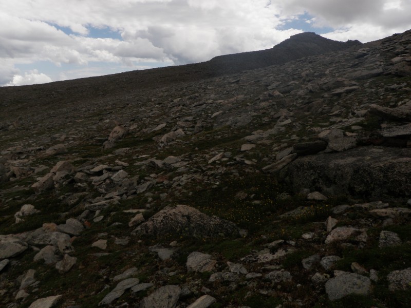 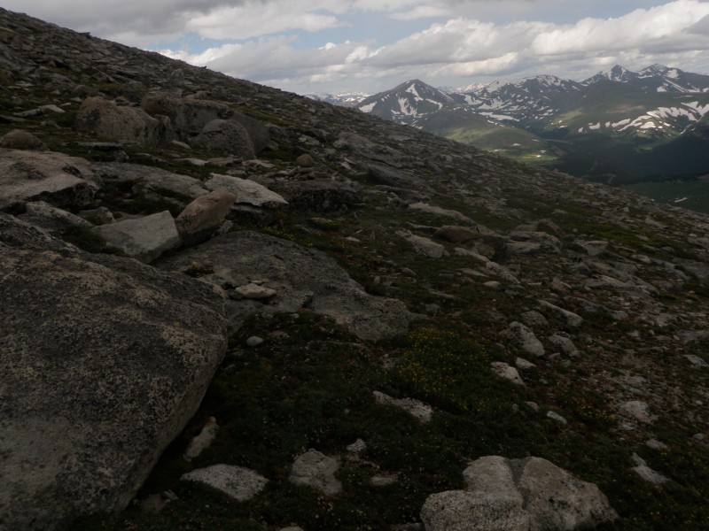 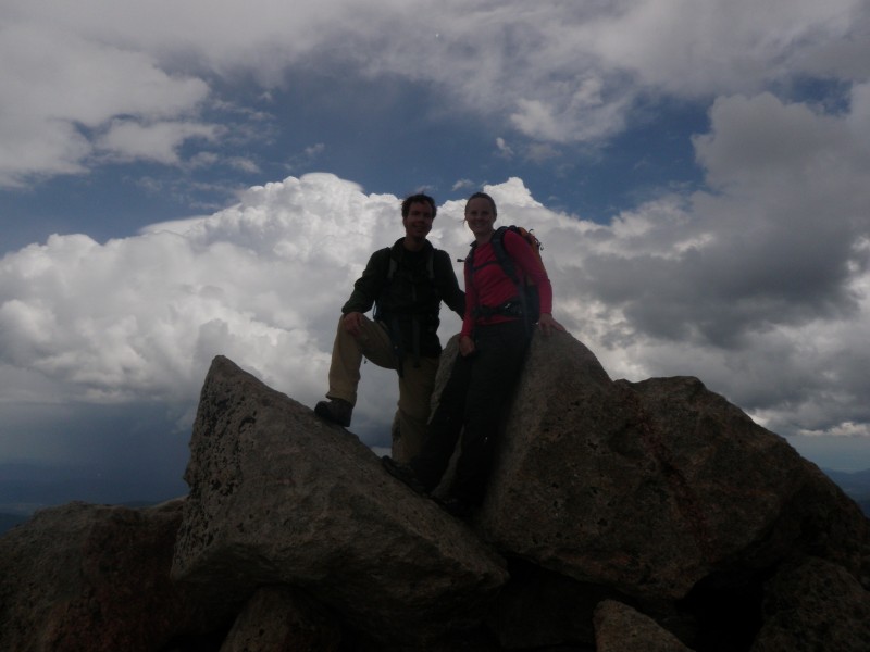  I could see myself doing this route once a summer, given the proximity to Denver and all it offers. Fantastic day, and now I can't wait for the next one! Thumbnails for uploaded photos (click to open slideshow):
|
| Comments or Questions | ||||||
|---|---|---|---|---|---|---|
|
Caution: The information contained in this report may not be accurate and should not be the only resource used in preparation for your climb. Failure to have the necessary experience, physical conditioning, supplies or equipment can result in injury or death. 14ers.com and the author(s) of this report provide no warranties, either express or implied, that the information provided is accurate or reliable. By using the information provided, you agree to indemnify and hold harmless 14ers.com and the report author(s) with respect to any claims and demands against them, including any attorney fees and expenses. Please read the 14ers.com Safety and Disclaimer pages for more information.
Please respect private property: 14ers.com supports the rights of private landowners to determine how and by whom their land will be used. In Colorado, it is your responsibility to determine if land is private and to obtain the appropriate permission before entering the property.


