Download Agreement, Release, and Acknowledgement of Risk:
You (the person requesting this file download) fully understand mountain climbing ("Activity") involves risks and dangers of serious bodily injury, including permanent disability, paralysis, and death ("Risks") and you fully accept and assume all such risks and all responsibility for losses, costs, and damages you incur as a result of your participation in this Activity.
You acknowledge that information in the file you have chosen to download may not be accurate and may contain errors. You agree to assume all risks when using this information and agree to release and discharge 14ers.com, 14ers Inc. and the author(s) of such information (collectively, the "Released Parties").
You hereby discharge the Released Parties from all damages, actions, claims and liabilities of any nature, specifically including, but not limited to, damages, actions, claims and liabilities arising from or related to the negligence of the Released Parties. You further agree to indemnify, hold harmless and defend 14ers.com, 14ers Inc. and each of the other Released Parties from and against any loss, damage, liability and expense, including costs and attorney fees, incurred by 14ers.com, 14ers Inc. or any of the other Released Parties as a result of you using information provided on the 14ers.com or 14ers Inc. websites.
You have read this agreement, fully understand its terms and intend it to be a complete and unconditional release of all liability to the greatest extent allowed by law and agree that if any portion of this agreement is held to be invalid the balance, notwithstanding, shall continue in full force and effect.
By clicking "OK" you agree to these terms. If you DO NOT agree, click "Cancel"...
Summit Elevation: 13,063 feet Trailhead / Route: Standard Northwest Ridge, easy Class 2 Date Climbed: July 3, 2011 Round-trip Distance: 9.6 miles Total Elevation Gain: about 3,000 feet
It was the best five hours of sleep I have had in a long time.
On the previous day, we got up at 3 a.m., drove a couple hours to Charleston Peak's trailhead, spent eight hours hiking almost 15 miles and 4,000 feet, and then we embarked on a five-hour drive to Great Basin National Park, which actually took more than 12 hours because we had to deal with a broken-down rental car, and then we helped some guy who had just hit an elk on the highway.
By the time we got to bed in our hotel in Baker, Nevada, we had been up for almost 23 exhausting hours.
But it was a new day. And things were looking brighter.
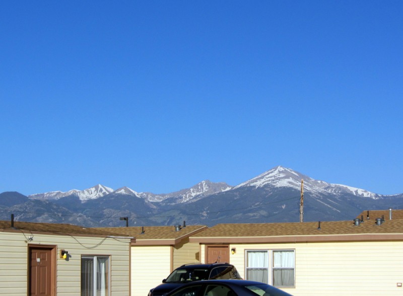
Our objective ... from the Border Inn:
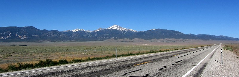
... and from the road:
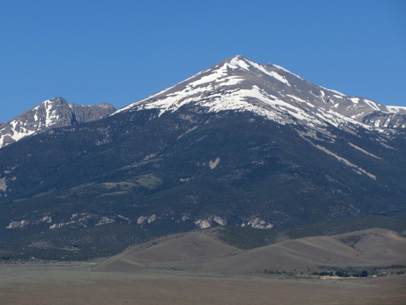
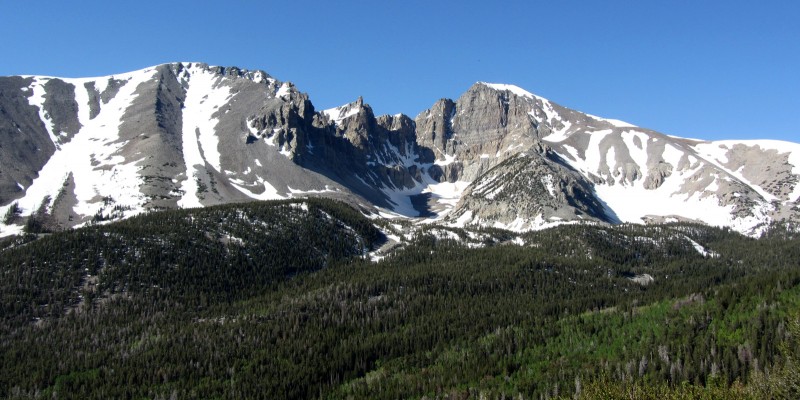
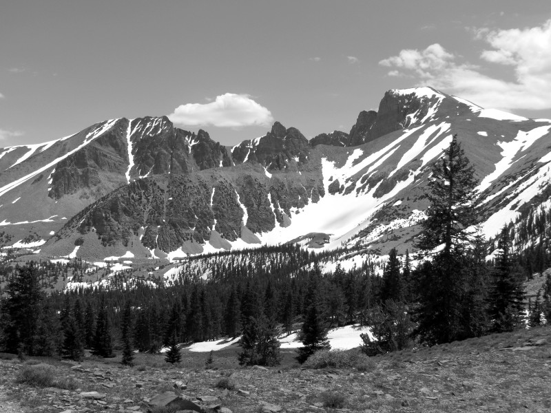
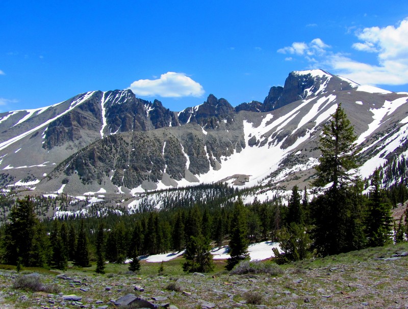
Jeff Davis Peak is in front; Wheeler Peak's summit is barely discernible behind Jeff Davis's right/north ridge:
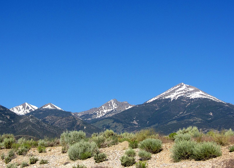
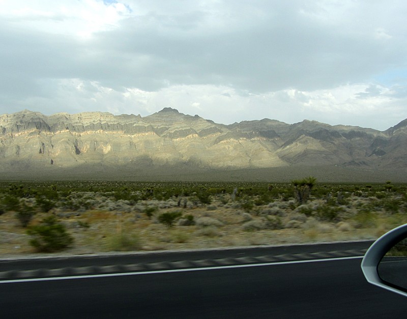
Other shots from the drive to the trailhead:
Jeff Davis on the left; Wheeler on the right:
Years ago we climbed Nevada's highest mountain, Boundary Peak. But after learning about the significance of the state's second-highest mountain, Wheeler Peak, we added it to our ever-growing list of mountains to climb. As a bonus, it's in a National Park.
Great Basin National Park is small (it's almost a fourth the size of Rocky Mountain National Park), it's isolated (the small town of Ely, NV is more than 60 miles away, and it's a four-hour-drive away from either Salt Lake City or Las Vegas), it's one of America's least-visited National Parks (in 2009 it only saw 60,000 visitors, compared to Yosemite's 3 to 4 million visitors per year) and at night it's one of the darkest and least light-polluted places in the country.
Wheeler Peak (not to be confused with New Mexico's Wheeler Peak) is a beautiful mountain in the heart of Great Basin National Park. It's also the highpoint of Great Basin and it's the 12th-most-prominent mountain in the Lower 48.
Unlike Nevada's highest mountain, Boundary Peak (13,140'), Wheeler Peak is the state's highest independent mountain, as Boundary Peak is considered a subsidiary summit of California's Montgomery Peak. Additionally, Boundary's prominence is only 253 feet, which falls short of the accepted 300 feet for it to be considered an independent peak.
The entire mountain massif in the middle of Great Basin N.P. used to be called Jeff Davis Peak, but the highest summit was eventually named Wheeler, after a USGS surveyor. The lower peak nearby retains the name Jeff Davis Peak (12,771'), and it's Nevada's third-highest mountain.
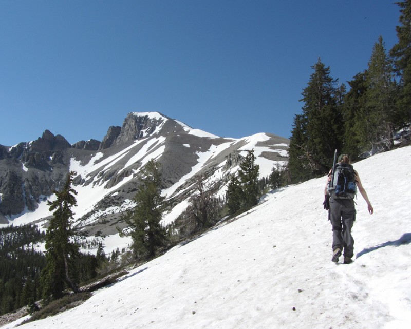
Because we started up the trail at the late hour of 8:30 a.m., we didn't think we would have time to do the Class 3 traverse to Jeff Davis as originally planned. But we were more than happy to just climb Wheeler, because after our rental car broke down on the previous day, we didn't know if we'd have the chance to climb anything.
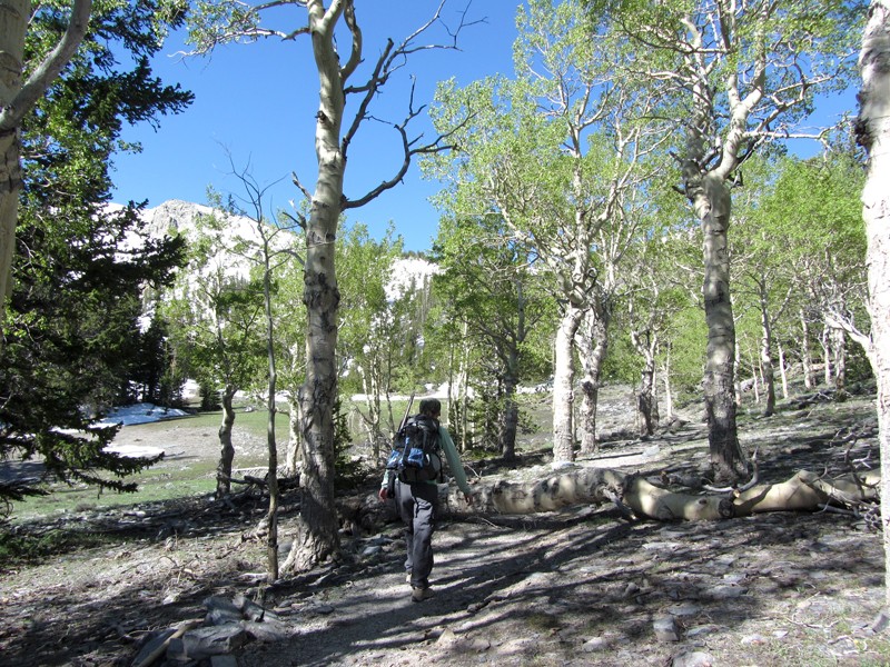
The trail was quite pleasant and easy to follow up to the ridge.
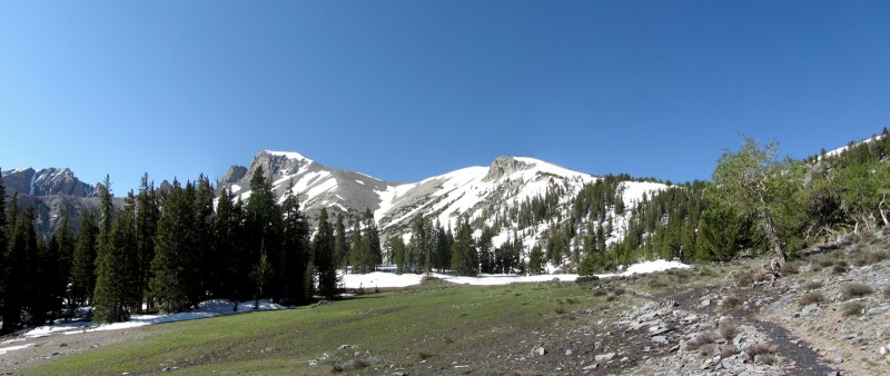
Earlier in the season, and with a little more snow, this gully from Stella Lake looks like it would be a good snow climb:
Once on the ridge, we encountered some sections of snow here and there, but none of it was an issue and some of it was completely avoidable.
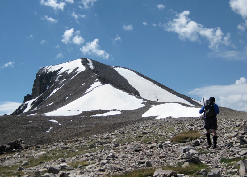
The talus on the ridge reminded me of Colorado's mountains. In fact, if you hypothetically plucked this mountain from Nevada and plopped it in Colorado, no one would ever question it being there.
Halfway up the ridge, the wind intensified, but it was nothing like the wind we dealt with on Humphreys Peak in Arizona just a few days earlier. Still, it was enough to turn one couple back.
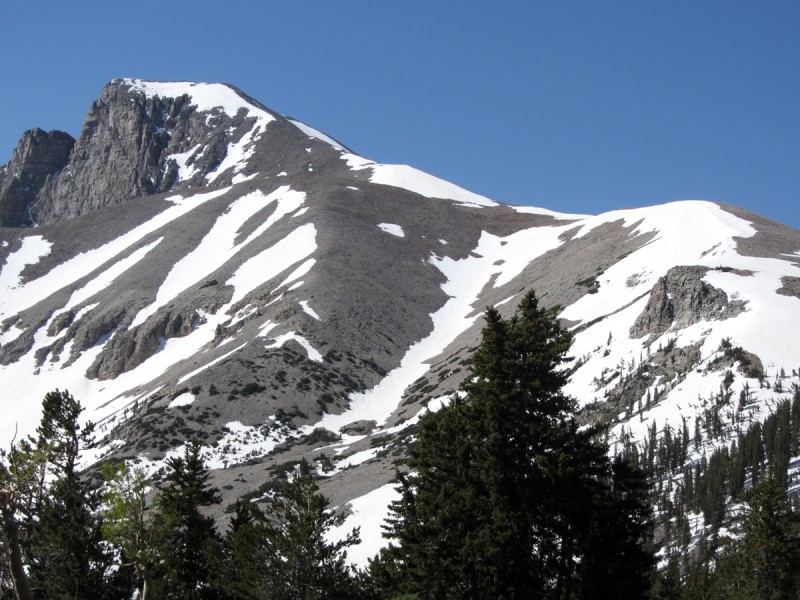
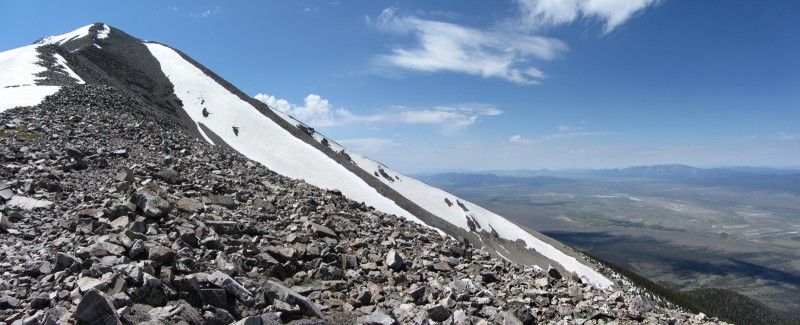
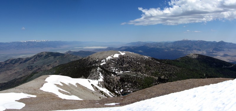
A shot of the mountain's upper reaches and the desert valley to the west:
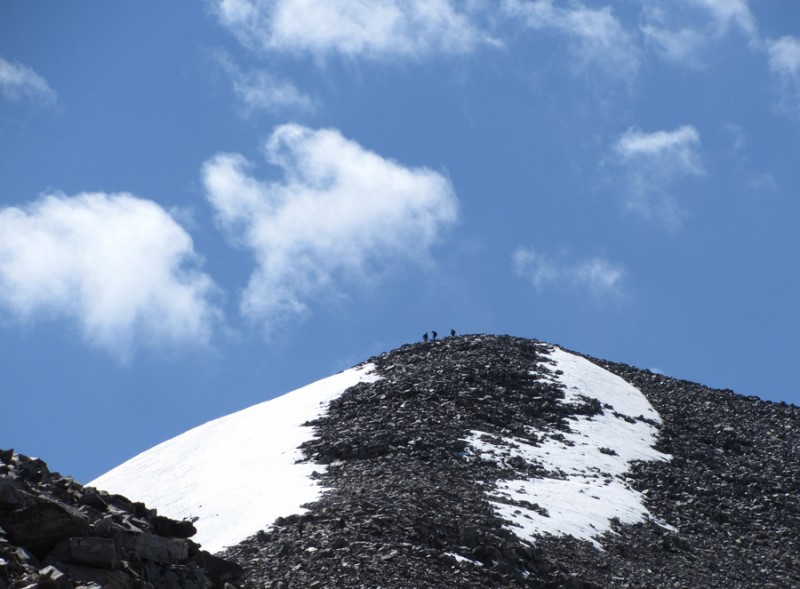
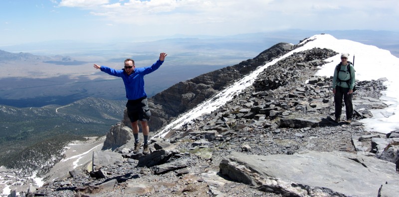
Climbers on the summit:
Looking to the north:
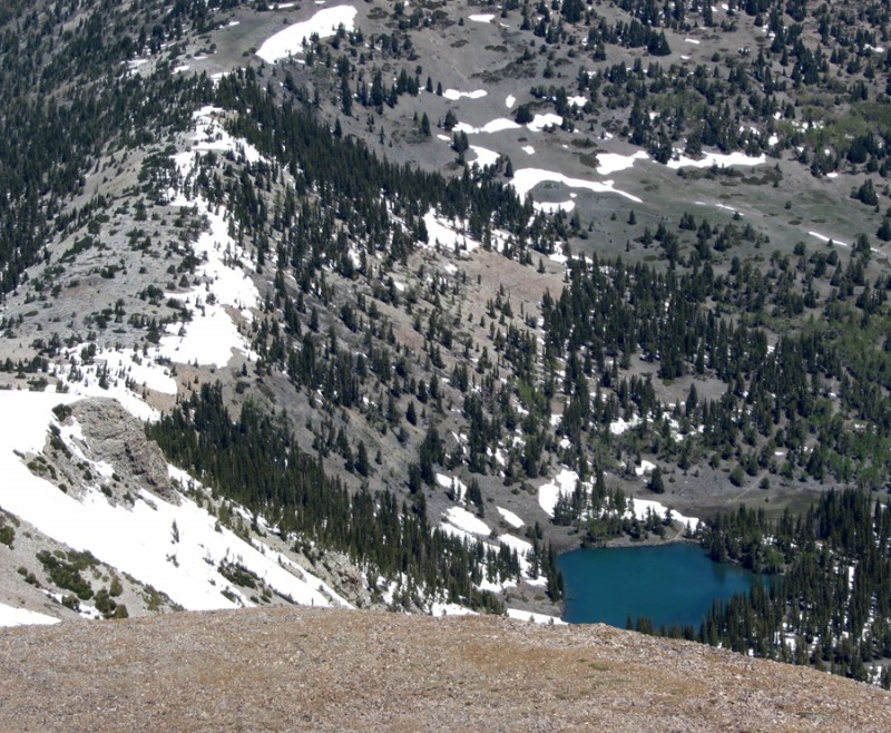
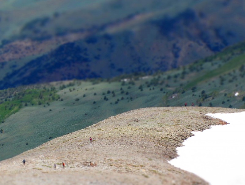
Stella Lake, thousands of feet below:
In less than a few hours of hiking, we finally gained the summit. It was the highest Jen and I have climbed since moving to Washington from Colorado.
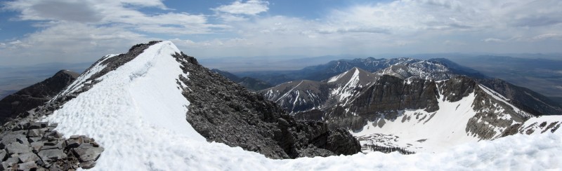
Summit view to the south:
A closer view to the south with Mt. Baker:
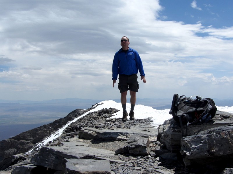
Playing around on top:
I tried to walk to the edge of the summit ridge to get a better view of Jeff Davis Peak, but I kept postholing up to my waist (and the snow was very wet), so I scrapped that idea.
After enjoying the serene views and saying hello to the other climber we met on top, we headed back down.
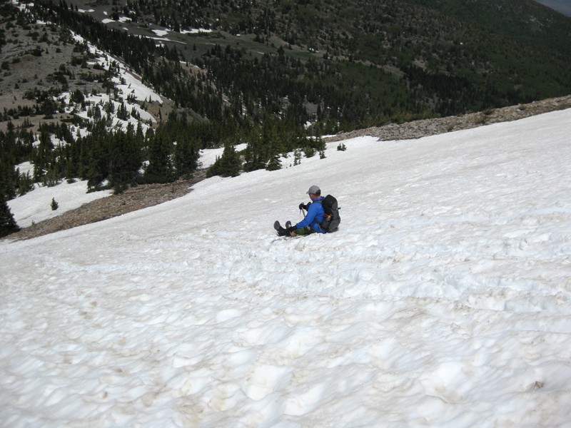
Made a couple short glissades on the descent:
Overall, Wheeler Peak was a fun climb and it's a beautiful mountain. I highly recommend it. Had we had more time (like RenoBob suggested), it would've been fun to do some other mountains in the area.
I leave you with some more photos I took ...
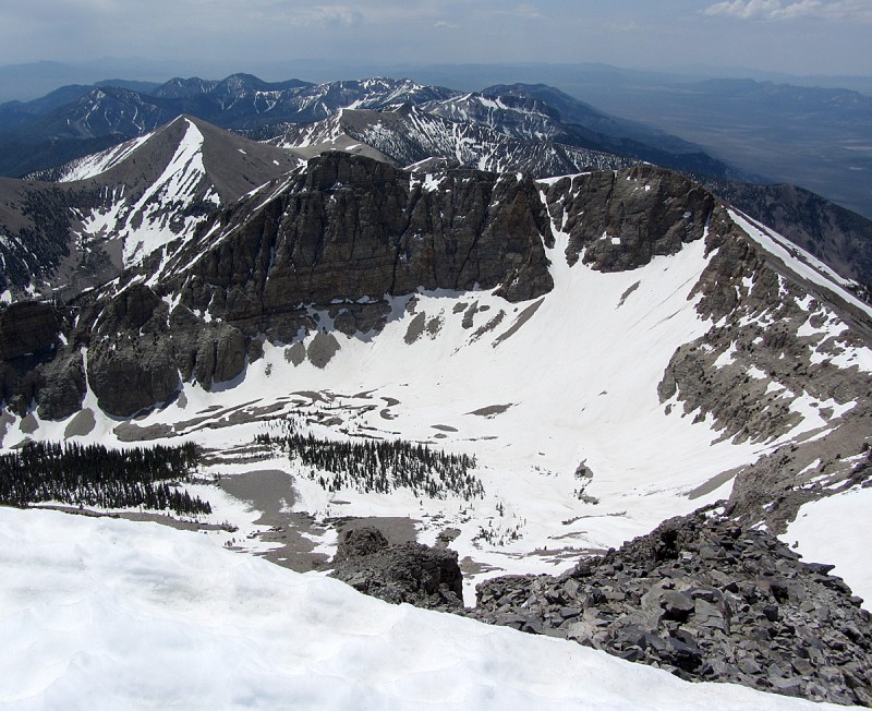
Jeff Davis and Wheeler:
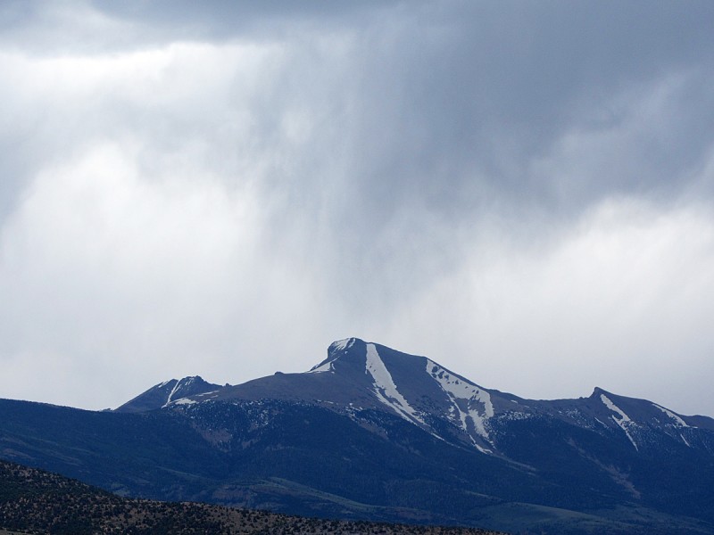
On the drive home, I took this pic of Wheeler's northwest side (rainstorm in full effect):
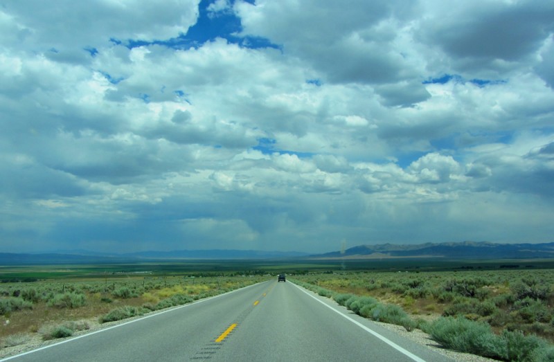
Driving back to Las Vegas:
Thumbnails for uploaded photos (click to open slideshow):
I've wanted to do this one for a long time, a huge prominent peak in the middle of nowhere. Great write-up as usual! Love the B&W photo 23!
Are you working on the most prominent peaks right now? Washington seems to be a pretty good home base for that.
Caution: The information contained in this report may not be accurate and should not be the only resource used in preparation for your climb. Failure to have the necessary experience, physical conditioning, supplies or equipment can result in injury or death. 14ers.com and the author(s) of this report provide no warranties, either express or implied, that the information provided is accurate or reliable. By using the information provided, you agree to indemnify and hold harmless 14ers.com and the report author(s) with respect to any claims and demands against them, including any attorney fees and expenses. Please read the 14ers.com Safety and Disclaimer pages for more information.
Please respect private property: 14ers.com supports the rights of private landowners to determine how and by whom their land will be used. In Colorado, it is your responsibility to determine if land is private and to obtain the appropriate permission before entering the property.