Download Agreement, Release, and Acknowledgement of Risk:
You (the person requesting this file download) fully understand mountain climbing ("Activity") involves risks and dangers of serious bodily injury, including permanent disability, paralysis, and death ("Risks") and you fully accept and assume all such risks and all responsibility for losses, costs, and damages you incur as a result of your participation in this Activity.
You acknowledge that information in the file you have chosen to download may not be accurate and may contain errors. You agree to assume all risks when using this information and agree to release and discharge 14ers.com, 14ers Inc. and the author(s) of such information (collectively, the "Released Parties").
You hereby discharge the Released Parties from all damages, actions, claims and liabilities of any nature, specifically including, but not limited to, damages, actions, claims and liabilities arising from or related to the negligence of the Released Parties. You further agree to indemnify, hold harmless and defend 14ers.com, 14ers Inc. and each of the other Released Parties from and against any loss, damage, liability and expense, including costs and attorney fees, incurred by 14ers.com, 14ers Inc. or any of the other Released Parties as a result of you using information provided on the 14ers.com or 14ers Inc. websites.
You have read this agreement, fully understand its terms and intend it to be a complete and unconditional release of all liability to the greatest extent allowed by law and agree that if any portion of this agreement is held to be invalid the balance, notwithstanding, shall continue in full force and effect.
By clicking "OK" you agree to these terms. If you DO NOT agree, click "Cancel"...
It has been an incredibly busy summer so far, and this was the first time I finally had chance to get out and hike/climb. I figured I should start out with something a bit easier, and since I see Bald Mtn all winter while skiing at the Stone, it seemed like a fun choice.
Left Denver at 4:30am and reached the top of Boreas Pass at 6:30. I had considered the North Ridge route as it is the standard on 13ers.com, but the road hiking and radio towers made it sound too 'civilized'.
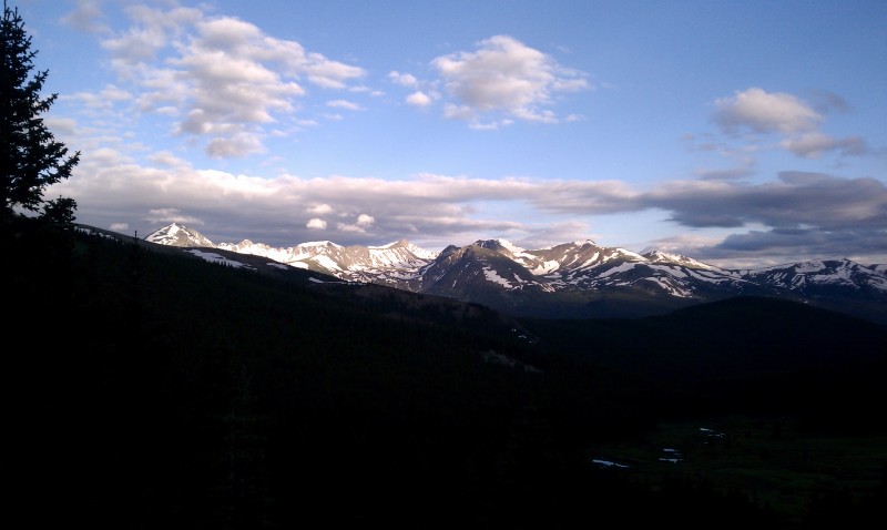
That is one of the false summits. Alpenglow on Quandary (left) and southern Tenmile Range
The trail heads to the left/north from the cabins at the trailhead and follows a stream/canal for a while. Once you reach the pond where the canal originates, look for the trail which heads up following the runoff stream. Do not continue left following the ditch. Follow the trail toward the obvious low point on the ridge - Black Powder Pass.
As I neared the pass, it appeared that the trail was just going to continue straight over, so I turned left to begin heading up the south slopes. You might be supposed to follow the trail all the way to the top before turning left, but I wasn't sure, and turning off where I did allowed me to skirt a few large snowfields. A couple shots along the way:
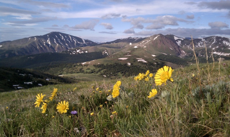
For being an 'easy' 14er, Quandary sure looks mean from this angle. Silverheels
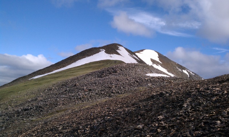
From there, it was straight up to the until you top out and can see a sub summit and what appears to be the real one just behind.
However, once you get there, you realize you still have a ways to go.
I continued up and over the next point (going around another large snowfield) and finally reached the summit around 9:00.
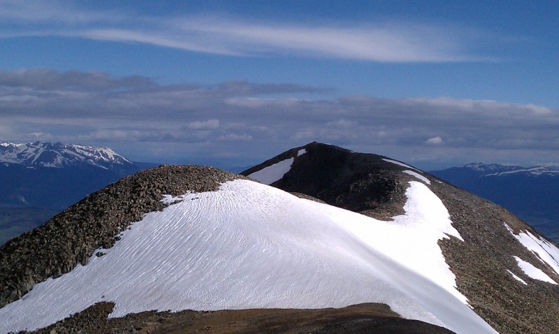
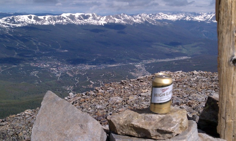
Breck I normally tap the Rockies but felt like living the high life on this occasion. Keystone
I hung out on the summit for about a half hour enjoying the views and basking in the lack of wind. The return trip forces you to cross back over all those sub and false summits, but it's still quick - made it back to the car at 11:00.
Considering its prime location above the tourist areas of Summit County, I was pleasantly surprised to only see one group of people on the way down near the trailhead - no one else the whole rest of the hike. Most of this was fairly easy ridge walking but a few of the steeper areas involved talus scrambling in the Class 2/2+ range. I think some of that could have been avoided had the snowfields not been there. Made it back to Denver just in time for more huge storms. Crazy monsoon weather the last couple weeks.
Thumbnails for uploaded photos (click to open slideshow):
I was thinking about this one and Boreas this coming weekend. Or Red/Hoosier/etc. which appear in your Silverheels pic. How did the ridge up Boreas look from Black Powder Pass? Nice pictures.
you old pole cat. You just keep on living.....The High Life.
Sorry, I found those Errol Morris commercials priceless. Thanks for the 13er beta, not much snow left up there.
Caution: The information contained in this report may not be accurate and should not be the only resource used in preparation for your climb. Failure to have the necessary experience, physical conditioning, supplies or equipment can result in injury or death. 14ers.com and the author(s) of this report provide no warranties, either express or implied, that the information provided is accurate or reliable. By using the information provided, you agree to indemnify and hold harmless 14ers.com and the report author(s) with respect to any claims and demands against them, including any attorney fees and expenses. Please read the 14ers.com Safety and Disclaimer pages for more information.
Please respect private property: 14ers.com supports the rights of private landowners to determine how and by whom their land will be used. In Colorado, it is your responsibility to determine if land is private and to obtain the appropriate permission before entering the property.