Download Agreement, Release, and Acknowledgement of Risk:
You (the person requesting this file download) fully understand mountain climbing ("Activity") involves risks and dangers of serious bodily injury, including permanent disability, paralysis, and death ("Risks") and you fully accept and assume all such risks and all responsibility for losses, costs, and damages you incur as a result of your participation in this Activity.
You acknowledge that information in the file you have chosen to download may not be accurate and may contain errors. You agree to assume all risks when using this information and agree to release and discharge 14ers.com, 14ers Inc. and the author(s) of such information (collectively, the "Released Parties").
You hereby discharge the Released Parties from all damages, actions, claims and liabilities of any nature, specifically including, but not limited to, damages, actions, claims and liabilities arising from or related to the negligence of the Released Parties. You further agree to indemnify, hold harmless and defend 14ers.com, 14ers Inc. and each of the other Released Parties from and against any loss, damage, liability and expense, including costs and attorney fees, incurred by 14ers.com, 14ers Inc. or any of the other Released Parties as a result of you using information provided on the 14ers.com or 14ers Inc. websites.
You have read this agreement, fully understand its terms and intend it to be a complete and unconditional release of all liability to the greatest extent allowed by law and agree that if any portion of this agreement is held to be invalid the balance, notwithstanding, shall continue in full force and effect.
By clicking "OK" you agree to these terms. If you DO NOT agree, click "Cancel"...
Trailhead: Matterhorn Creek, elevation 10,400
Starting elevation: 11,500
Start time: 6.15 am
Summit: 10.15 am
Back to camp: 1.30pm
We arrived at the 2WD parking on Friday afternoon, we hiked up the 0.7 mile up to the upper parking lot and were surprised there were no cars, it seemed very quiet for a holiday weekend. We started hiking up for about a mile and a half and found a very nice camp spot just below timberline.
This is the trail going up to timberline
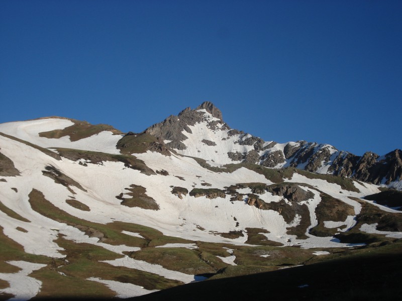
The next morning we started hiking at 6.15 towards Uncompahgre. This is a view of Wetterhorn peak.
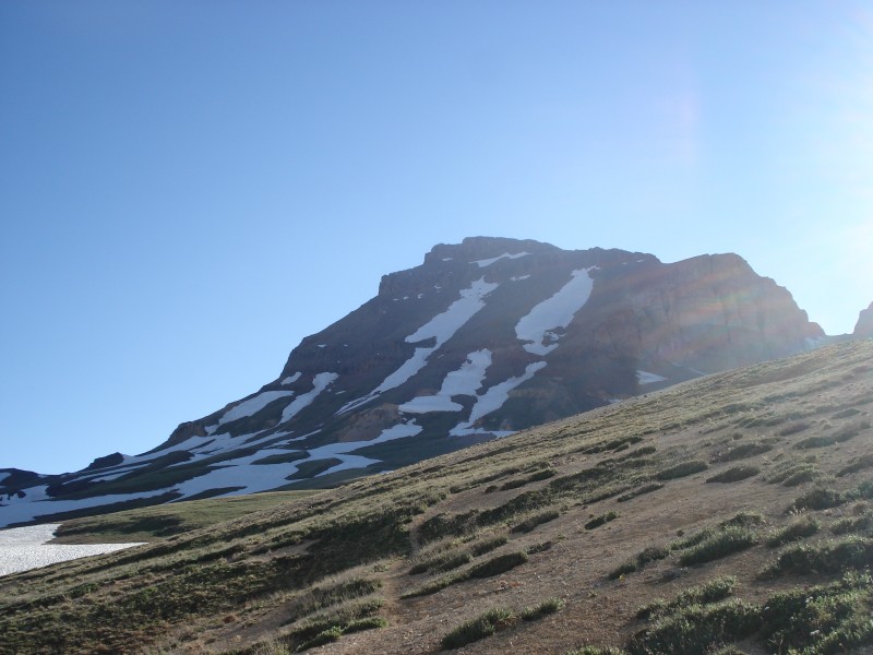
And this one of Uncompahgre
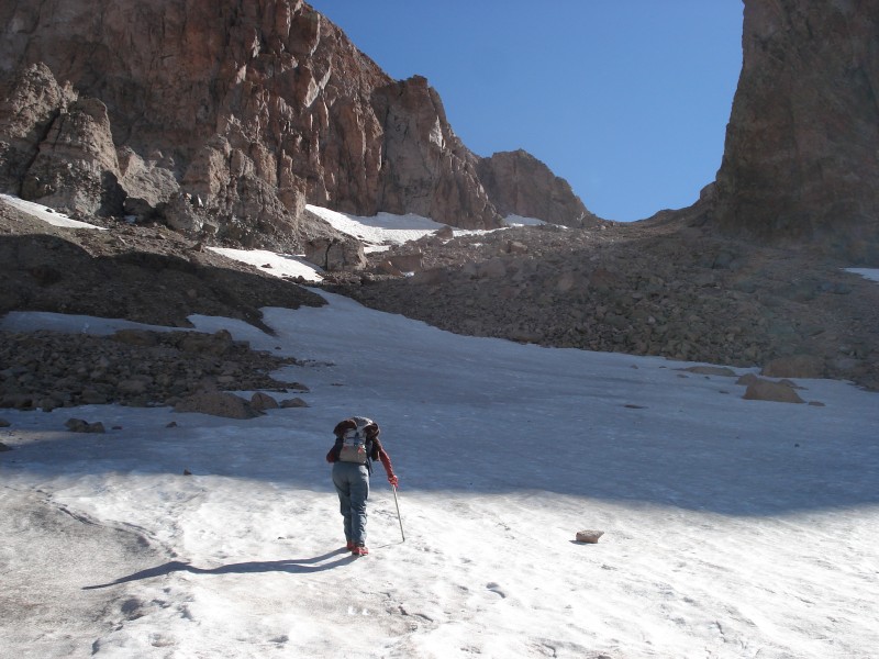
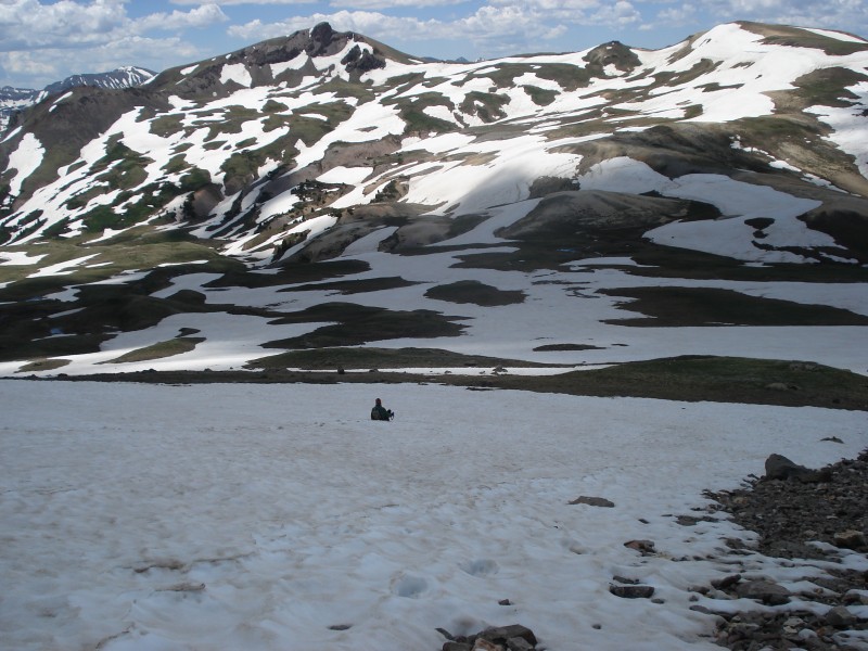
On the way up there are several snow fields to cross, here you can see Mike crossing one of them. The snow was hard at this hour of the day so it was easy to walk on.
We did not follow the standard route that goes around Unc. Instead we were trying to follow Roach's route number 3, but once we got there we were not sure which gully he refers to. We saw there was plenty of snow to make it to the notch seen in the next picture:
From the picture it does not look too steep, but once we were on it we realized it was pretty steep. We used our microspikes and ice axe to make the climb, the snow was still solid and good.
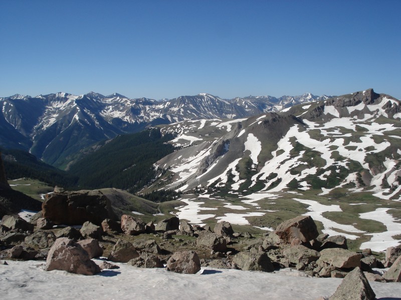
The views were amazing
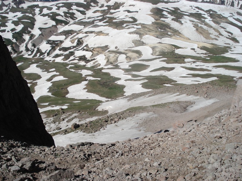
Looking down on the route:
There is still a lot of snow in the San Juans!
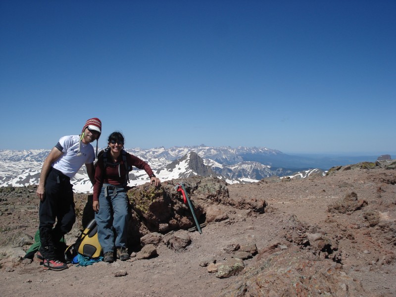
We finally made the summit, it took us probably longer than if we had stayed on the route around the peak, but hey it was fun. We had the summit to ourselves.
A pic of Wetterhorn (that would have to wait till the next day)
On the way down we were going to do the standard route back to camp, but when we reached 13,800 we looked down and though "wow, wouldn't it be faster to go this way?", this is probably the route number 3 that we had been looking for on our way up. And, in fact, we met a group of 3 climbers that had gone up this way. There was a patch of snow and it was pretty soft, but it was so steep that we decided it was not safe to glissade it. So, we just hiked down on the scree, which was not bad at all.
This is what it looked on the way down.
And, again, amazing views of Matterhorn and Wetterhorn.
The lower part of this gulley looked great for a fun glissade.
This is a pic on the way back that looks at the route we took coming down, through the snow field on the right side.
We had talked about doing Wetterhorn on the same day, and looking at the sky there were no threats of thunderstorms, but our legs made the decision of post-pone it for the next day. We had spent a lot of energy post-holing in the soft snow on the way back. "The mind says go but the feet say no..." Chuck Pyle.
Oh and we want to thank our camp site neighbors for the bleach! (sorry, we did not get your names). Our water filter broke down on the day before, so we had to drink from the snow melt.
Report on Wetterhorn coming briefly.
Thumbnails for uploaded photos (click to open slideshow):
It's always interesting to see routes I've done in a different season. Thanks for the report! :D
Caution: The information contained in this report may not be accurate and should not be the only resource used in preparation for your climb. Failure to have the necessary experience, physical conditioning, supplies or equipment can result in injury or death. 14ers.com and the author(s) of this report provide no warranties, either express or implied, that the information provided is accurate or reliable. By using the information provided, you agree to indemnify and hold harmless 14ers.com and the report author(s) with respect to any claims and demands against them, including any attorney fees and expenses. Please read the 14ers.com Safety and Disclaimer pages for more information.
Please respect private property: 14ers.com supports the rights of private landowners to determine how and by whom their land will be used. In Colorado, it is your responsibility to determine if land is private and to obtain the appropriate permission before entering the property.


")
")
")
")
")
")
")
")
")
")
")
")
")
")
")
")


