Download Agreement, Release, and Acknowledgement of Risk:
You (the person requesting this file download) fully understand mountain climbing ("Activity") involves risks and dangers of serious bodily injury, including permanent disability, paralysis, and death ("Risks") and you fully accept and assume all such risks and all responsibility for losses, costs, and damages you incur as a result of your participation in this Activity.
You acknowledge that information in the file you have chosen to download may not be accurate and may contain errors. You agree to assume all risks when using this information and agree to release and discharge 14ers.com, 14ers Inc. and the author(s) of such information (collectively, the "Released Parties").
You hereby discharge the Released Parties from all damages, actions, claims and liabilities of any nature, specifically including, but not limited to, damages, actions, claims and liabilities arising from or related to the negligence of the Released Parties. You further agree to indemnify, hold harmless and defend 14ers.com, 14ers Inc. and each of the other Released Parties from and against any loss, damage, liability and expense, including costs and attorney fees, incurred by 14ers.com, 14ers Inc. or any of the other Released Parties as a result of you using information provided on the 14ers.com or 14ers Inc. websites.
You have read this agreement, fully understand its terms and intend it to be a complete and unconditional release of all liability to the greatest extent allowed by law and agree that if any portion of this agreement is held to be invalid the balance, notwithstanding, shall continue in full force and effect.
By clicking "OK" you agree to these terms. If you DO NOT agree, click "Cancel"...
Camped at Winfield for few days hoping to knock off a couple climbs Huron and La Plata.
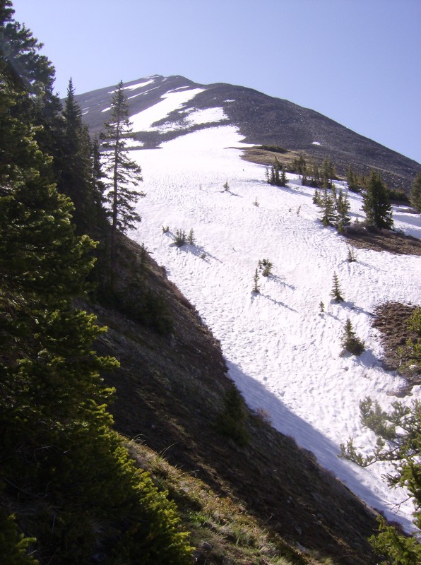
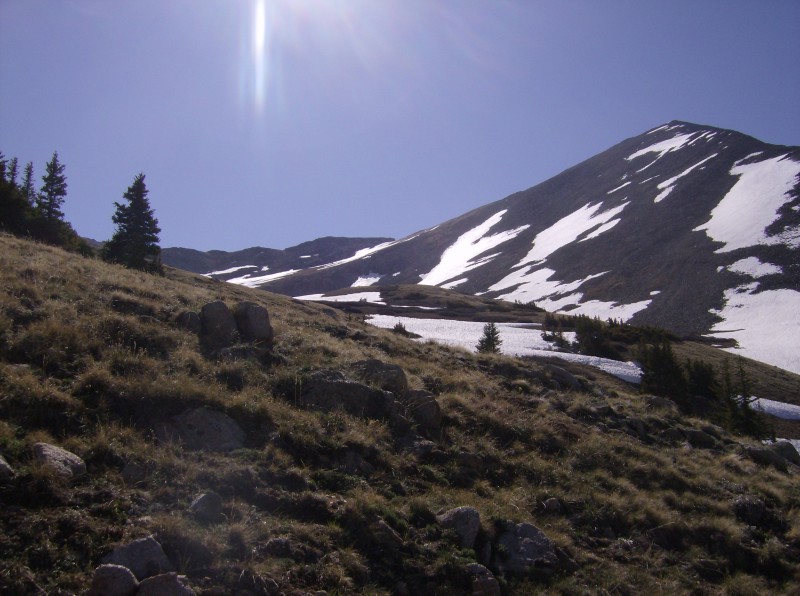
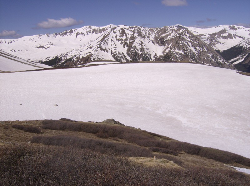
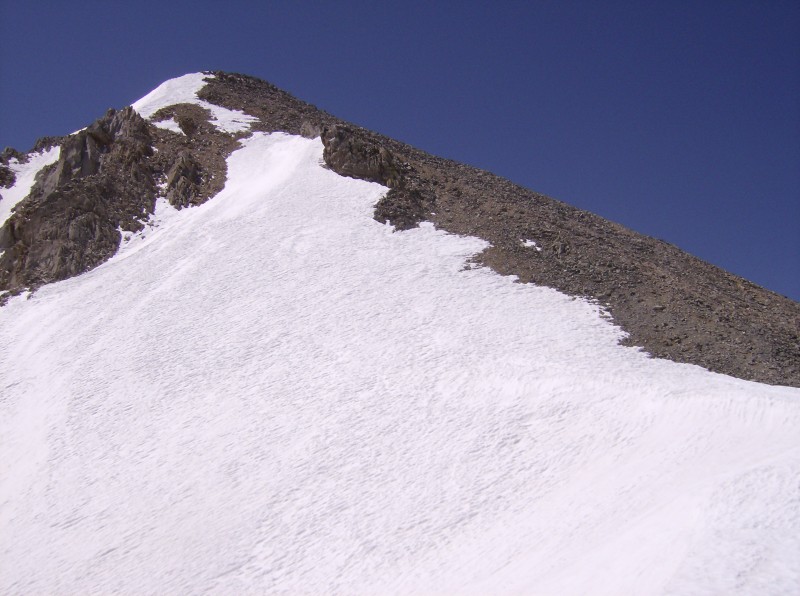
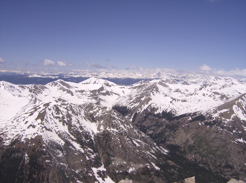
Set my alarm for 5:30am but it didn't go off. By the time I arrived at the trailhead it was 7:50am, a full 1 ½ hrs after I had planned. After reading reports of the snowfield in the basin, I knew this was going to be a problem. Hiked up through the forest, started hitting snow banks higher up in the trees. Some of the trail was hard to follow due to large snow banks covering large areas in the trees. As I came out of the trees into the lower part of the basin, I looked up was able spot a couple of climbers just below the summit heading up. Climber envy set in and I remember thinking "great, only 2000 more feet to go." The goal.Entering the lower basin. I followed the small ridge into the upper basin and came to the snowfield where a group of 4 climbers were having a difficult time crossing. I sat and watched as all were postholing on almost every step. One of the men was trying to help a woman free herself from one hole for what must have been 5 minutes. After which, she decided she'd had enough and crawled back to solid ground, pants and tennie's soaking wet. Snowfield. Struggling climbers off left edge of image.I took a lower line than that party reasoning that the slight angle away from the sun might allow the snow to stay firm a little longer. Luckily, I was right and did ok through most of the snowfield, only breaking through a few times. It was 9:15am and I knew coming back through was not going to be a pleasant experience. Looking back across snowfield from grassy slope. Once up on the grassy slope heading to the ridge, my pace slowed down. I'm able to pass the group going across the snowfield earlier and brielfly spoke to the guys glissading down from the summit. As I climbed up, I kept looking back to see the line they would take back across the snowfield, but never see them cross. I did spot them heading down the lower part of the basin past the snowfield. After topping out on the ridge, I took a small break. Great view of Missouri Mt. and the Lake Fork valley. Looking down valley towards Missouri Mt. and Belford. The group I passed earlier caught up and we climbed the last section together. I was thinking the grassy slope was steep, man that summit pitch really took a lot out of me! Steep summit pitch.Summit cornice. Needless to say, I was glad to reach the top so I could rest. The views from Huron are incredible! One of the many views from summit. Stayed on top for about half an hour, traded snapping photos with the other group and grabbing a bite before heading down.
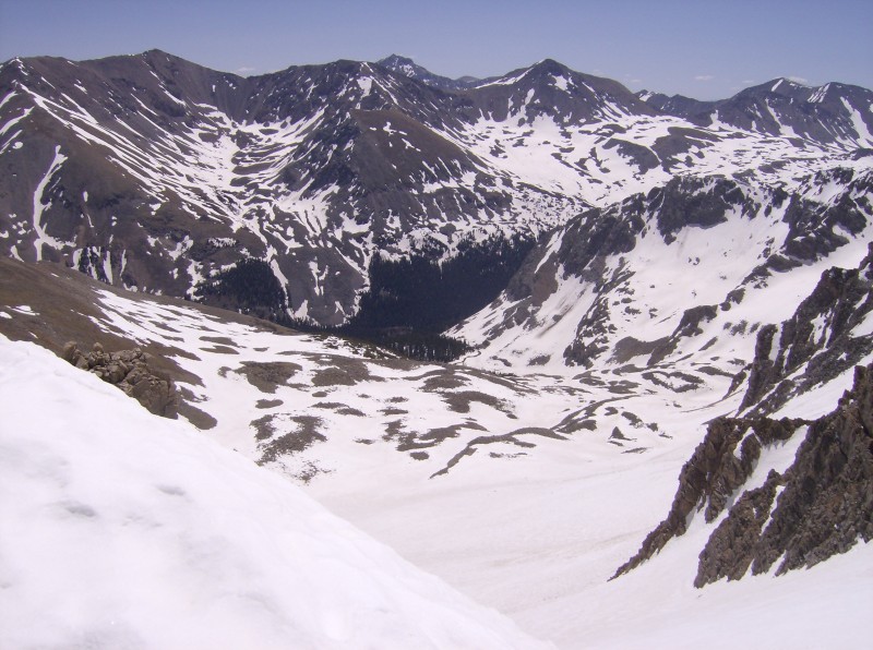
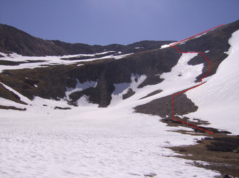
Knowing I didn't want to go back across the snowfield, I veered to the left at the top of the headwall and cut across, under one of the rock outcroppings to a steep but dry section leading into the basin. The slope was quite steep and a slip would have brought me to the middle of the snow covered basin (approx. 400 ft) quickly. Fortunately, the snow was quite firm and I was able kick step across the slope. A couple of class 3 moves and a small section of snow to cross and I was in the clear. My route down. Trail can be seen going up on left side of image. I'm still not sure if the risk/reward factor was on my side, but I was able to avoid crossing the snowfield in mid-afternoon and that can only be a good thing. The woman who reversed track in the middle of the snowfield was still waiting by a rock for the rest of her party come down. We exchanged pleasentries and I continued down. Remainder the hike out was uneventful and pleasant, although some of the snowbanks in the trees became really slushy and quite slippery reminding me that "I'm not out of the woods yet" (HA!). Huron was a great hike with absolutely stunning views from the summit.
Thumbnails for uploaded photos (click to open slideshow):
Comments or Questions
Caution: The information contained in this report may not be accurate and should not be the only resource used in preparation for your climb. Failure to have the necessary experience, physical conditioning, supplies or equipment can result in injury or death. 14ers.com and the author(s) of this report provide no warranties, either express or implied, that the information provided is accurate or reliable. By using the information provided, you agree to indemnify and hold harmless 14ers.com and the report author(s) with respect to any claims and demands against them, including any attorney fees and expenses. Please read the 14ers.com Safety and Disclaimer pages for more information.
Please respect private property: 14ers.com supports the rights of private landowners to determine how and by whom their land will be used. In Colorado, it is your responsibility to determine if land is private and to obtain the appropriate permission before entering the property.