June 22nd, 2011
Payne Benchmark (11,780')
"No Payne" (11,789')
Shawnee Peak (11,927')
"Platte Peak" (11,941')
Distance : Around 25 miles (19 on foot, 6 on bike)
Elevation Gain: 6,100' (5,800' on foot, 300' on bike)
Time: 11.5 Hours
From: Brookside/Payne Trailhead (8,020 ft)
All captions are listed below the photos.
The Platte River Mountain portion of the Lost Creek Wilderness isn't glamorous. The amazing rock formations of the Tarryall area are far to the south, and along with it much of the attention. Nevertheless, this area is a place that I have a lot of history with. Many days of wandering the area over the past few years has left me sometimes bruised and exhausted, sometimes turned around to the point that I don't believe my compass, but ALWAYS ready to come back for more. One would think that the little 10/11ers in the range would make easy pickens for your standard peak bagger. However as I have learned many times over, these peaks will put up quite a fight.
Some of my history from the area, specifically "Platte Peak":
1-20-2007 - "Platte Peak": Turned back after 3,300' due to solo trailbreaking.
2-28-2009 - "Platte Peak": Turned back after 3,000' due to solo trailbreaking and conditions.
2-17-2010 - "Platte Peak": Turned back after 3,000' due to trailbreaking and conditions with Greenhouseguy.
1-22-2011 - "Platte Peak": SUCCESS! Finally, with a large group and doable weather I was finally able to summit this elusive peak.
When I mentioned my struggles with Platte Peak to others, I was always asked "why not just try it without snow?" I'll admit that was a logical question, but for me it was beyond just wanting the summit. After having been defeated so many times in the snow, it made me want to finish in the same type of conditions. Now, having that long sought after summit completed, I could finally allow myself to have some summer fun in the area.
As is often the case when I am looking to repeat a summit, I wanted to try a different route than normal. Not only that, but I was starting to feel like I was a bit too familiar with the Ben Tyler Trail (I swear last time through a chipmunk referred to me by name) so I wanted to avoid an out-and-back route. I wanted to try a full loop from Brookside/Payne TH and collect the four peaks along the main ridge going clockwise. (The summit order would be Payne BM, "No Payne", Shawnee, and Platte.) In order to do this while solo (therefore without a shuttle) would take a bit of creativity.
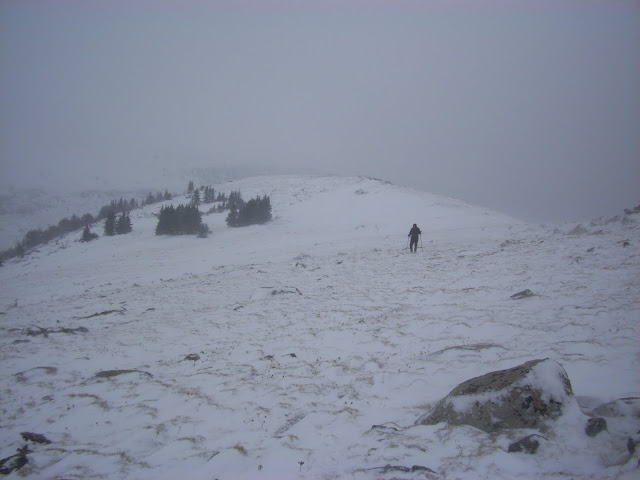
Knowing I would need many hours to do this trip (judging from the map the loop looked to be around 20 or so miles) I set my alarm for a 3:30 wake up. I awoke at 4:45. Already behind schedule. I loaded up my secret weapon for connecting the two trailheads in the loop (my bike) and headed off to the North Ben Tyler TH a couple miles west of Shawnee. I walked off trail about 75 yards and locked my bike up to a tree, hidden from view of anyone that might pass by. After this, I jumped back in the truck and made my way east to the Brookside/Payne Trailhead located SW of Bailey. By the time I was parked and ready to go it was already 6:45.
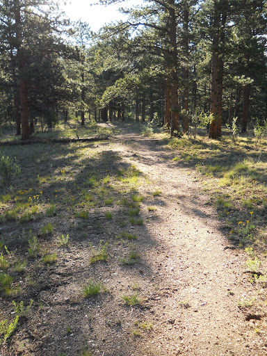
Starting up the Brookside/Payne Trail

Very nice trail just past the Brookside-McCurdy Junction

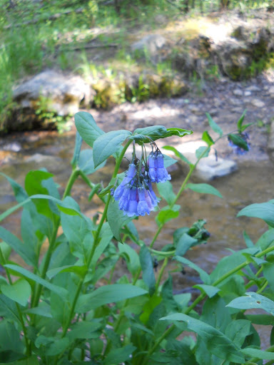
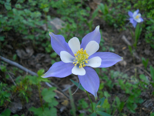
Flowers along the Brookside-McCurdy trail.
The first portion of my day involved following the standard route for Payne Benchmark (trail 607) which required around 6-7 miles of easy hiking up a VERY nice trail followed by a short .5 mile bushwhack to the summit. The route starts with the rerouted Brookside-Payne Trail for about 1.5 miles, then the Brookside-McCurdy Trail for the next 5 or so miles. I tried to take advantage of the mellowness of the trail by keeping up a good pace to make up for my late start. Thankfully, I decided to pack light and brought my water pump to use along the way instead of hauling water. That helped the legs tremendously in the end. As I am not usually in this area in the summer months, I was amazed at the variety of plant life and birds that I passed by. This made the 6-7 mile approach go quickly. I said goodbye to the trail at the saddle between Payne Benchmark and "No Payne" and headed south towards Payne BM first. The bushwhack towards the summit is relatively mellow and I was able to top out in short time. My approach for the day was over.

Passing into the LCW boundary on the Brookside-McCurdy trail.
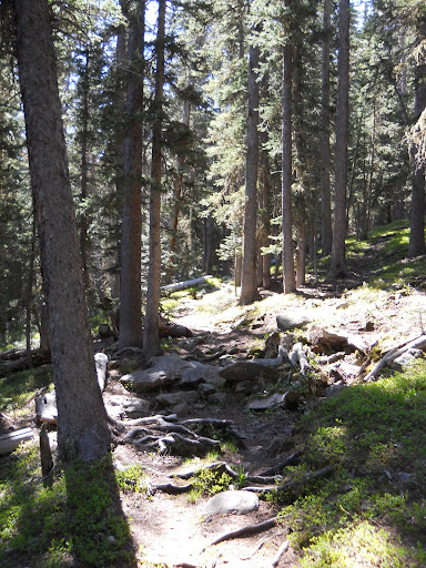
A mile or so below the Payne saddle.

Last big switchback before the saddle.

Last short distance to the summit of Payne BM.

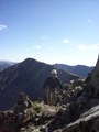
The long road ahead from the summit of Payne BM. (No Payne in the center, Craig Park on the left.)

Bison and McCurdy from the summit of Payne BM.

Peak Z, Peak Y, and Peak X.
I dropped the half mile back the saddle and continued north towards "No Payne". The summit is just over 1 mile from the saddle. I had been up "No Payne" (as well as Payne BM) last year, so much of this terrain was familiar. The first .5 miles towards "No Payne" is a tad rough, but once past the steeper initial portion it eases up. The views open up over the last quarter mile to the summit, and the final stroll to the top is pleasant.
I knew going into this hike that the area between No Payne and Shawnee would be the most difficult portion of the hike. There wasn't a lot of information on the area between, and from what there was it told of some annoying bushwhacking. Thankfully, I lucked out and came across a nicely traveled elk trail. This made the first mile and a half go by easily. Unfortunately, the trail disappeared just shy of a steep section about a quarter mile SE of Shawnee. It took a bit of picking around to make it up this area, but once through it I had a nice boulder hop to the summit. Shawnee was the only new summit of the group for me, so I took a bit of extra time on top to enjoy it. I realized while on the summit of Shawnee that I still hadn't stopped for lunch. Again, I was in a treeless area so I needed to continue on to escape the heat.

Easy stroll to the summit of "No Payne".

Peak X.

Connecting ridge between No Payne and Shawnee.

Views to the NW.

Looking back at the Payne group from Shawnee.
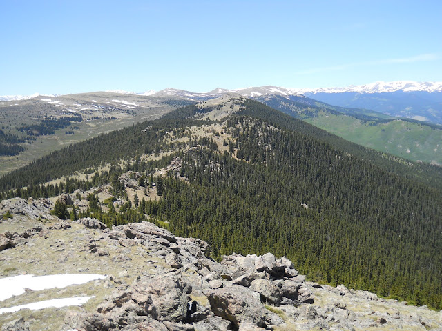
Looking ahead at Platte Peak from Shawnee.

Down into Bailey.
The distance between Shawnee and Platte Peak was probably the easiest connection between peaks all day. Very little elevation was lost and regained (probably only around 400 feet) and the trees that existed posed few problems. I chose a nice large tree to enjoy my sandwich and orange under and relaxed for a while. I took a quick cat nap (maybe 15 minutes or so) before heading on to the headliner of the day....Platte.
It was amazing. Where in the winter "Platte Peak" proved to be a formidable foe, now in the summer could barely force a whimper. A hop, skip and jump had me sitting on the summit just 5 months to the day after the last trip.

Easy stroll to Platte.

A picturesque tree near Platte Peak.

A view of the summit (and register) with the Evans Wilderness in the background.

Elk on the slopes of Platte with the Twin Cones in the background.
Same view from 5 months ago....only with zoomie83 on the slope instead of elk. What a difference a season makes.
I was still feeling good, but the warm temperatures and beating sun were really starting to get to me. (Probably my last LCW trip until the cooler weather of fall.) I toyed with continuing on to Foster Benchmark and/or Kenosha Peak, but the moat of willows separating me from their summits made me call it a day. I had to keep reminding myself that I had a bike ride back to my truck to keep energy for. From the summit of Platte I angled NW until I met up with the Ben Tyler Trail. At the first stream I came to I refilled water (I had run out on Shawnee) and mixed up some gatorade. The rest of the descent back to the North Ben Tyler TH went VERY slow. I stopped often for pictures and simply enjoyed the rest of my hike.
After countless breaks and photo ops, I finally reached the familiar trailhead.

Ben Tyler Trail.

Ben Tyler Trail.
Random Photos from the Ben Tyler Trail:


I found my bike right where I had left it early that morning (thankfully) and spent a couple minutes talking to someone heading out on a longer backpack. Nice to see other people enjoying the wonderful LCW area. Now for the most nerve-racking part of the day....the two mile ride down 285 to reach County Road 64. I rode as close to the edge as possible and actually pulled all the way off whenever a string of cars came up from behind. After two miles, I reached the town of Shawnee where I was able to cut through side streets all the way to 64. From here, I enjoyed nice dirt roads for the remaining few miles back to the Brookside/Payne Trailhead.
A nice day out. Lost Creek Wilderness: I'll see you next fall.

Fin.

Googleearth map of the day.
Cheers
My GPS Tracks on Google Maps (made from a .GPX file upload):
|